Utah Scenic Byway 24 RV Trip – Capitol Reef National Park

April 2018 – Utah Scenic Byway 24 between the towns of Loa and Hanksville goes through Capitol Reef National Park and is one of the most spectacular scenic drives in America. We have been fortunate to drive it several times in each direction, and every single time our jaws have hung open for the entire 64 miles as we’ve been utterly blown away by the dramatic scenery and wild rock formations passing by our windows.

Here’s a series of photos showing how it looked from the passenger seat of our truck as we towed our trailer across the magical wonderland of Capitol Reef Country from west to east.

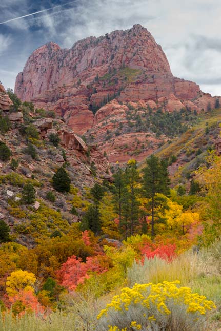
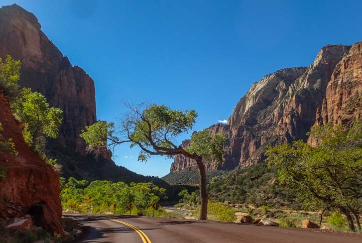
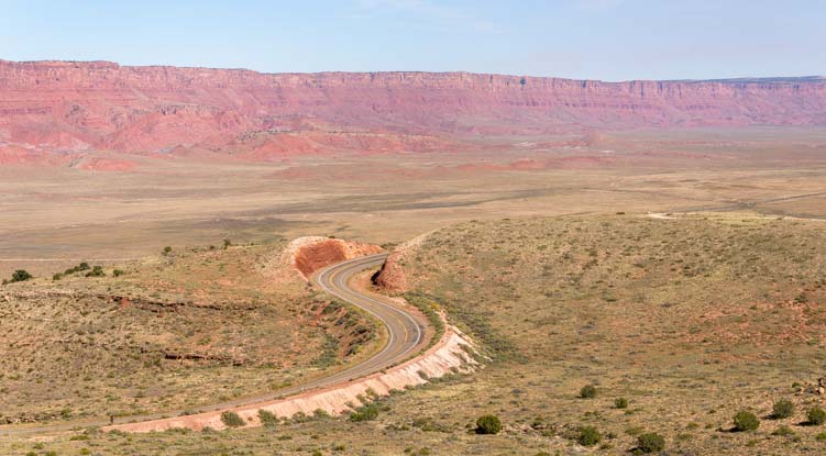
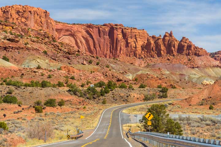
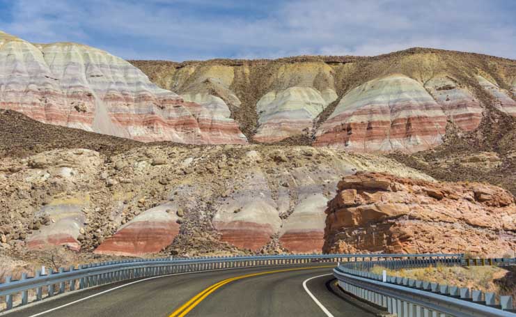
It started with a lovely view of red rocks as we rounded a bend.

Utah Byway 24 Capitol Reef National Park Scenic Drive-min

Our first big red rocks view begins to take shape on Utah’s Scenic Byway 24

Then our eyes popped open as the contours and texture of the land grew bigger and more complex.

Utah Highway 24 Capitol Reef National Park Scenic Drive RV trip-min

Wow!

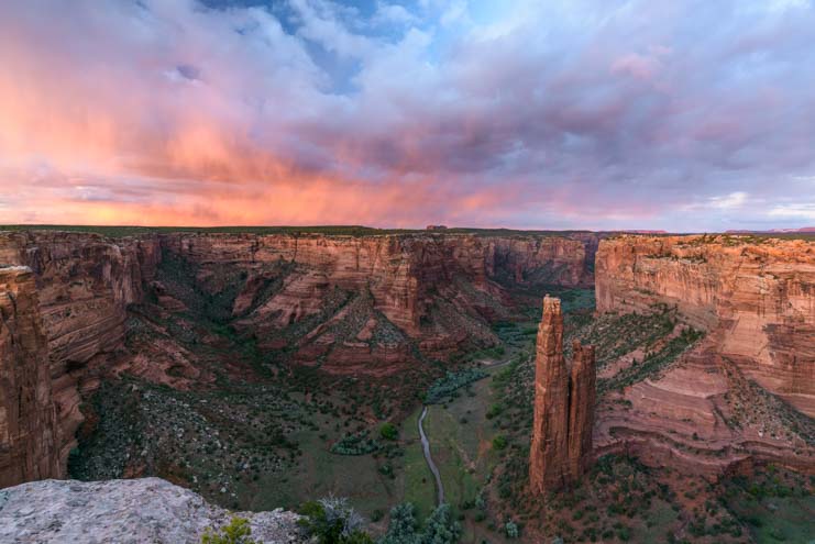
Suddenly, we started down a hill and the view exploded in front of us and became knock-your-socks-off stunning!

Utah 24 Capitol Reef National Park Scenic Drive-min

Wow, Wow, WOW!

A group of horses and cows live in this view all day every day, so they weren’t quite as impressed.

Horses on Utah Scenic Byway 24 Capitol Reef National Park RV trip-min

.

But we were loving every minute as we drove head on into that view.

Utah Byway 24 Capitol Reef National Park Scenic Drive RV trip-min

.

Views on Capitol Reef National Park Utah Highway 24 Scenic Drive-min

View out the side window.

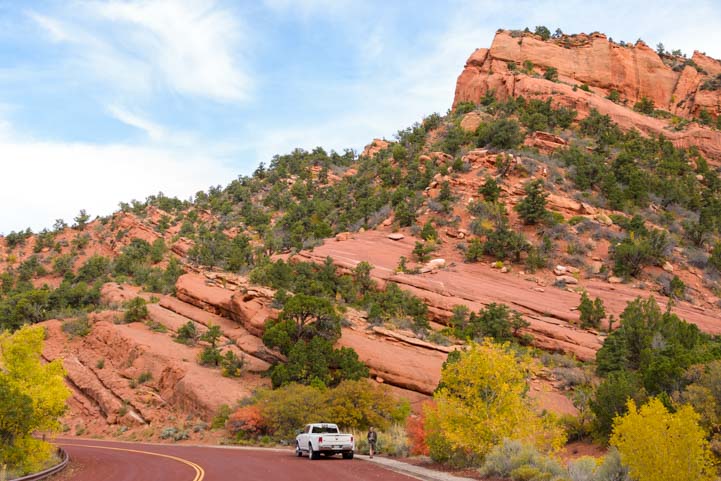
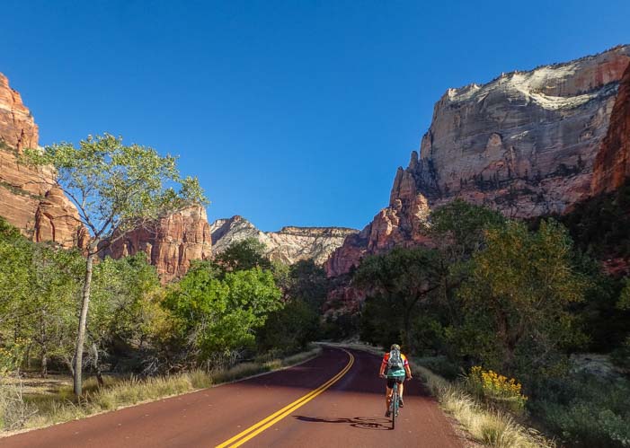
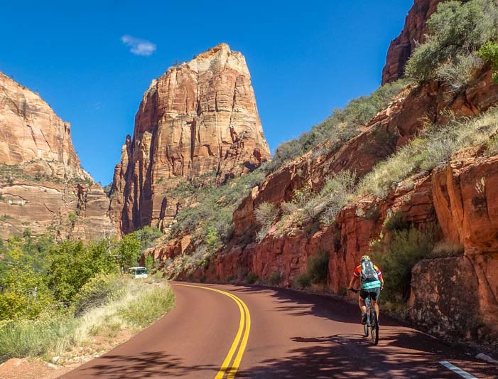
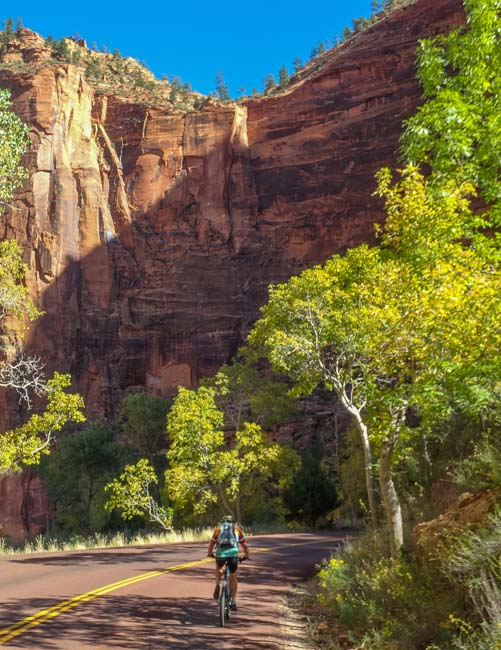
Utah Byway 24 is easily driven in an RV, even though there are lots of twists and turns and climbs and descents, and we saw plenty of RVs on the road.

RV on Capitol Reef National Park Utah Scenic Byway 24 Scenic Drive-min

There are lots of RVs on this route.

Capitol Reef National Park Utah Byway 24 Scenic Drive RV trip-min

The road curves, climbs and descends, but it’s easy driving.
Just don’t get too distracted by the sensational views and drive off the road!

Capitol Reef National Park Utah Route 24 Scenic Drive RV trip-min

.

RV on Utah Route 24 Capitol Reef National Park Scenic Drive-min

.

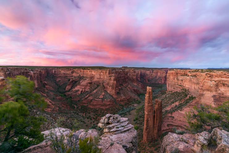
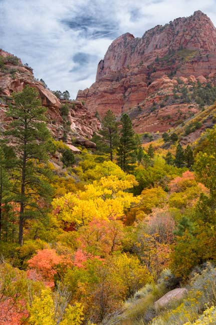
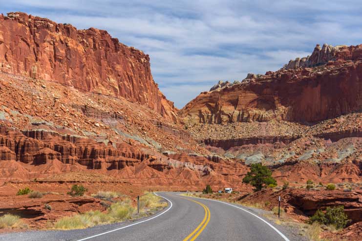
The red rock views just kept coming and coming and coming.

Capitol Reef National Park Utah Route 24 Scenic Drive RV trip-min

.

Red rocks Capitol Reef National Park Utah Route 24 Scenic Drive-min

.

Capitol Reef National Park Utah Route 24 Scenic Drive Red rocks RV trip-min

.

Exotic rock formations Capitol Reef National Park Utah Route 24 Scenic Drive-min

.

The heart of Capitol Reef National Park is an old Mormon farming community called Fruita. As we drove past the village on Utah Highway 24, we noticed that the trees were still showing off their nakedness for winter. However, on other spring and summer visits, we’ve seen these trees lit up in brilliant shades of green that are the perfect visual contrast to the red rocks and blue sky.

Trees and red rocks Fruita Utah Route 24 Scenic Drive Capitol Reef National Park RV trip-min

These trees turn vivid green in spring!

Trees and red rocks Fruita Utah Route 24 Scenic Drive Capitol Reef National Park RV trip-min

Trees line the road near Fruita.

Fruita is a beautiful and tranquil little community, and there are camping options, a fantastic scenic drive into the depths of the red rocks, and some terrific hikes to historic Mormon sites. We have a detailed blog post about some of the highlights of Capitol Reef National Park and the town of Fruita from our visit a few years back (blog post here).

However, on this trip we were just driving through on Utah Highway 24. So, on we went, reminiscing when we passed some favorite spots and then quickly becoming immersed in the majestic scenery of Utah Scenic Byway 24 once again.

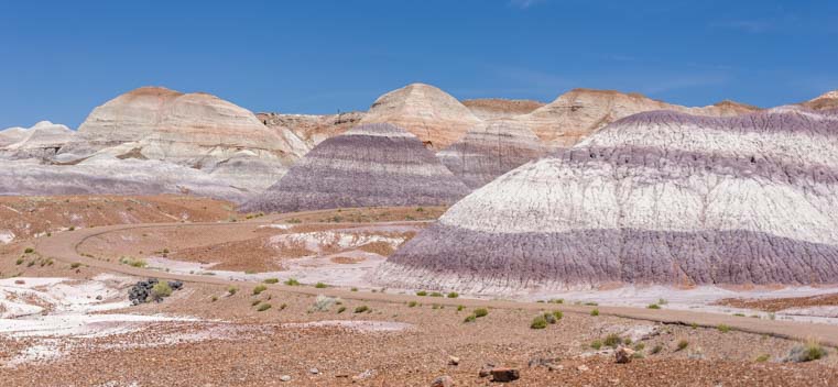
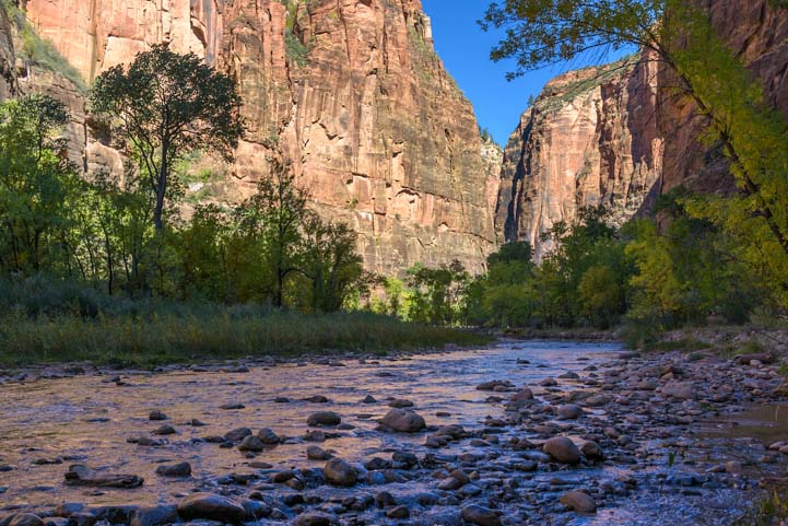
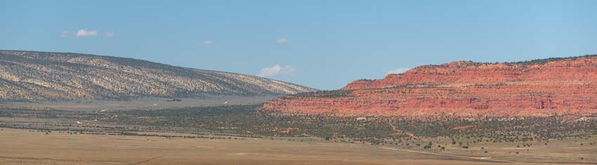
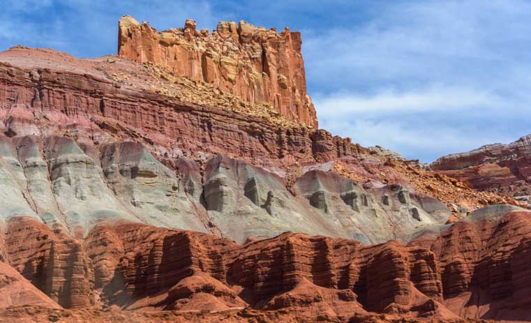
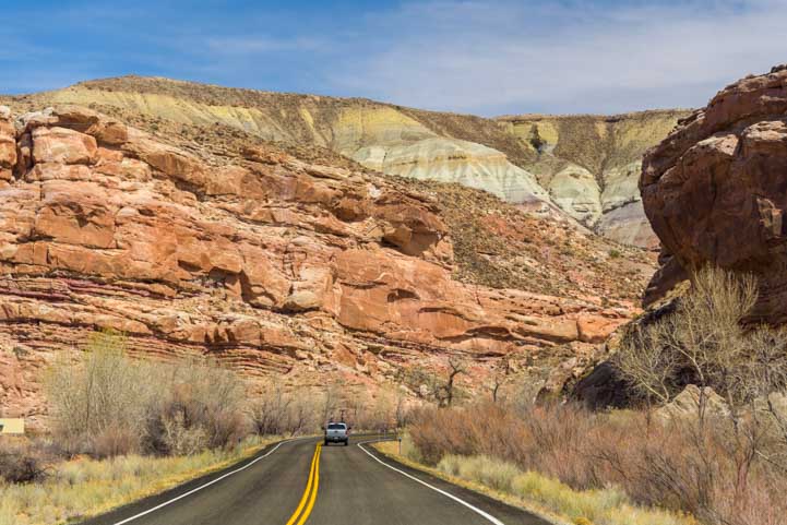
We had left red rock country behind and were now driving between rock walls that Mother Nature had painted in lighter shades.

Rock canyon Utah Byway 24 Scenic Drive Capitol Reef National Park RV trip_-min

We’d left the red rocks but were still surrounded by dramatic canyon walls.

Pinnacles Scenic

.

.

Views Utah Route 24 Scenic Drive Capitol Reef National Park RV trip-min

.

Sheer walls Capitol Reef National Park Utah Route Scenic Byway 24 RV truo

.

There were still some hints of red rocks here and there, and we were mesmerized as we drove. A UPS truck went by in the opposite direction and we had to laugh. Surely, that driver has the best UPS route in the country!

Canyon walls Capitol Reef National Park RV trip Utah Highway 24 Scenic Drive-min

Not bad scenery for the few lucky folks who have to drive this route for work every day!

Canyon walls Capitol Reef National Park RV trip Utah Byway 24 Scenic Drive-min

.

Scenic Drive Capitol Reef National Park RV trip Utah Scenic Byway 24

.

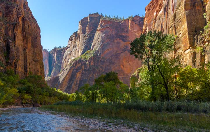
Gradually, the soaring rock walls on either side of us receded, and the land opened up, punctuated by occasional towers of stone.

Scenic Drive Capitol Reef National Park RV trip Utah Route 24-min

.


RV Scenic Drive Capitol Reef National Park Utah Route 24-min

.

Scenic Drive Capitol Reef National Park RV trip Utah Route 24-min

.

Scenic Drive Capitol Reef National Park RV trip Utah Route 24-min

.

Scenic Drive Capitol Reef National Park RV trip Utah Route 24-min

.

RV Scenic Drive Capitol Reef National Park Utah Byway 24-min

.

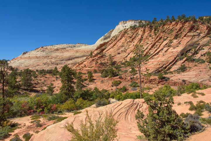
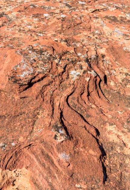
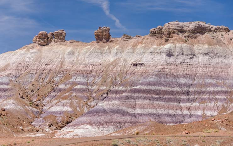
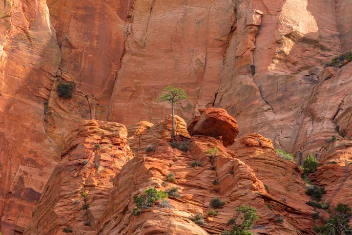
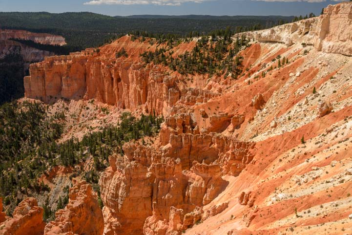
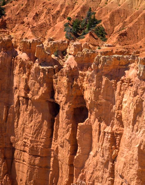
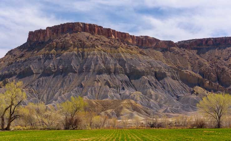
Then the rock formations changed shape and the rock walls were filled with steep and angular channels that were carved with Nature’s sharpest chisels.

Exotic landscape Capitol Reef National Park Utah Scenic Highway 24 RV trip-min

Fine chisel work…

We were no longer in Capitol Reef National Park, but the landscapes in Utah pay no attention to such artificial boundaries. Utah Scenic Byway 24 was still giving us a magic carpet ride through some of the most exotic scenery America has to offer.

Desert landscape Capitol Reef National Park Utah Scenic Byway 24 RV trip-min

.

Rock uplift Capitol Reef National Park Utah Route 24 Scenic Drive by RV-min

Massive rock uplifts make faces.

The chiseled walls returned, but the cows grazing underneath didn’t notice.
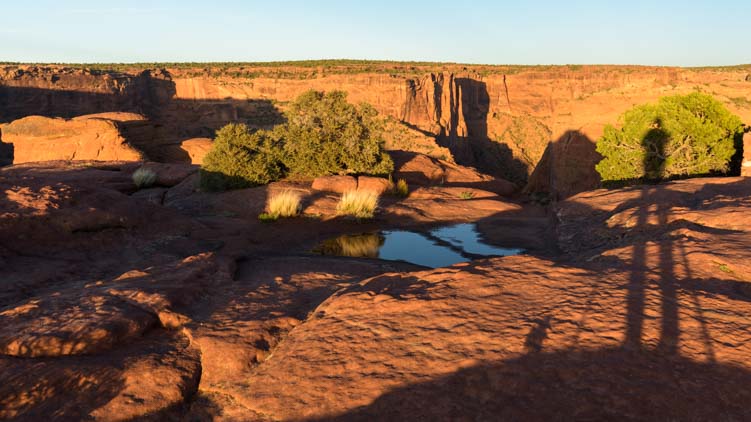
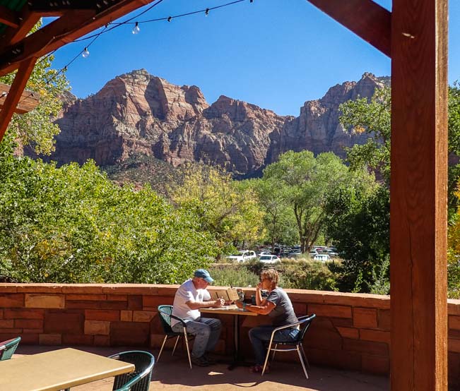
Spectacular landscape Capitol Reef National Park Utah Highway 24 Scenic Drive by RV

Dinner with a view!

Flowering tree Capitol Reef National Park Utah Highway 24 Scenic Drive by RV-min

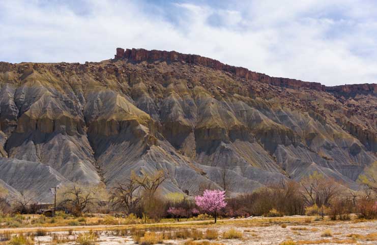
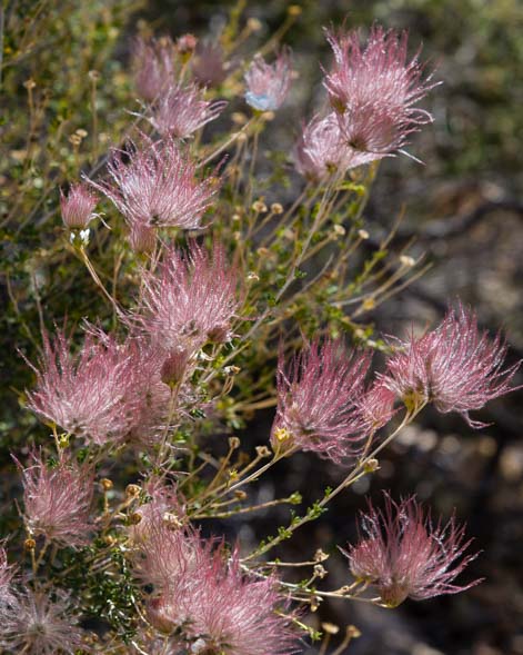
A pink tree shows off its springtime finest.

Farm field Capitol Reef National Park Utah Scenic Byway 24 by RV-min

.

As we neared the hamlet of Hanksville, the road took a few final sweeping turns past some walls of stone.

Stone canyon Capitol Reef National Park Utah Highway 24 Scenic Drive by RV-min

.

Towering rock formation Capitol Reef National Park Utah Scenic Byway 24-min

.

And then, in a final burst of glory, we passed a “mitten” rock formation that seemed to be advertising some of the other wonders of America’s southwest. “If you liked this road, you should check out Monument Valley!” it seemed to be saying.

Capitol Reef National Park Utah Route 24 Monument Valley lookalike-min

A mitten formation reminds us of Monument Valley.

What a glorious drive that was! I looked over at Mark to exchange happy glances and did a double take. Hey, who was doing the driving?

Puppy drives the truck and trailer

.

We will never tire of driving the many wondrous scenic drives in Utah, and Utah Scenic Byway 24 is well worth experiencing many times in both directions. It attaches to Scenic Byway 12 and the fabulous Bicentennial Highway and is close to the little known Burr Trail too.

Even if your itinerary doesn’t include visiting Capitol Reef National Park for its hikes and camping, if you happen to be in southern Utah, treat yourself to an east-west detour and spend a few hours driving Utah Scenic Byway 24!

Subscribe
Never miss a post — it’s free!

More info about Utah Byway 24 and Capitol Reef National Park:

Other “Do Not Miss” Scenic Byways we have loved:

Our most recent posts:

More of our Latest Posts are in the MENU.   New to this site? Visit RVers Start Here to find where we keep all the good stuff. Also check out our COOL NEW GEAR STORE!! *** CLICK HERE *** to see it!

<-Previous || Next->

Dolly Steamboat – Gliding Through the Arizona Desert on Canyon Lake

February 2018 – One of the most enjoyable ways to experience the beauty of the Sonoran Desert in Arizona is to take a boat ride on one of the lakes around Phoenix. Years ago we rode on the Desert Belle on Saguaro Lake and absolutely loved it. This past week we took a ride on the Dolly Steamboat on Canyon Lake.

Dolly Steamboat Canyon Lake Arizona RV trip

Dolly Steamboat floats through the Sonoran Desert on Canyon Lake in Arizona.

While we were camped in our RV on Canyon Lake, our new puppy Buddy loved going down on the beach, especially during our early morning photo sessions. He liked to show us how fast he could zip between the legs of our tripods.

Photography at Canyon Lake Arizona-min

Buddy shows us his slalom skills.

When he wasn’t busy doing that, he was sprinting across the lakeside lawn carrying his favorite pink rope toy.

Puppy Chow plays fetch at Canyon Lake RV Park-min

Canyon Lake Marina & Campground has a big open grassy area that’s great for playing fetch.

Late one afternoon while he was down on the beach playing with the waves, he noticed an inflatable boat that had been pulled up on the beach. Hmmmm… a boat ride might be pretty fun!

Boating at Canyon Lake Arizona-min

A little sailor dog is born.

While we were out walking the next morning I was busy snapping pics of our shadows on the ground when we looked up and noticed the Dolly Steamboat moored at the dock.

Walking with puppy at Canyon Lake Marina Arizona-min

.

The Dolly Steamboat was patiently waiting to take her first group of passengers out for a nature tour on Canyon Lake.

Docked Dolly Steamboat at Canyon Lake Arizona on an RV trip-min

Dolly Steamboat on Canyon Lake

Dolly Steamboat docked at Canyon Lake Arizona-min

Dolly Steamboat rests at dawn.

A steamboat ride definitely seemed like it would be a lot of fun to do together.

Dolly Steamboat Canyon Lake Arizona RV trip-min

What would the pup think of a boat ride?!

Canyon Lake is a beautiful big, blue lake in the middle of the desert, and we had been getting lots of photos of it from the shore as we drove up and down the Apache Trail. But seeing a lake from the shore isn’t the same as seeing it from the water.

Canyon Lake Arizona RV Trip-min

Canyon Lake is a big blue expanse of water in the middle of the desert.

We talked about doing a boat ride on the Dolly Steamboat over dinner.

Puppy enjoys dinner in the RV-min

.

And Buddy slept on the idea too.

Puppy relaxes in RV-min

.

He slept right through the enormous rising full moon!

Full moon Canyon Lake Arizona RV trip-min

.

He’s a very quiet little pooch, but he does know how to express himself and let us know what he wants.

Puppy Chow in our RV-min

“I’ve been really really good for days. Can I go on that boat ride now?”

The next day we went to stand in line at the Dolly Steamboat dock. A group of kids in front of us eagerly waited for Dolly to come in from her last excursion.

Kids wait for Dolly Steamboat ride at Canyon Lake Arizona-min

Kids wait for the Dolly Steamboat to arrive at the dock.

Finally, she appeared, and we made our way down the dock and onto the boat.

Dolly Steamboat Canyon Lake Arizona RV trip-min

There she is!

Walking down to the Dolly Steamboat ride on Canyon Lake Arizona-min

Mark and Buddy walk down the dock.

Captain Jason was very friendly.

Captain Jason Dolly Steamboat Canyon Lake Arizona RV trip-min

Captain Jason.

Seen from our truck window on the Apache Trail (Route 88), Canyon Lake doesn’t look all that big. But to our surprise, we traveled three miles into the hinterlands, winding our way through fabulous rock canyons that were studded with saguaro cactus.

Canyon Lake Arizona RV trip-min

Canyon Lake turns out to be a lot bigger than it seems from the Apache Trail.

Canyon Lake Dolly Steamboat ride in Arizona-min

The Dolly Steamboat heads into the canyon where it will disappear from view.

There is seating out on deck, and we found a seat at a table to take in the view.

Puppy on Dolly Steamboat Cruise Canyon Lake Arizona-min

There are wonderful seats on the deck that offer a great view.

While we marveled at the scenery, Buddy enjoyed the new smells.

Admiring views Canyon Lake Dolly Steamboat Arizona-min

Buddy tests the air with his nose.

We were startled at how rugged and dramatic the rock canyons were. As music by Enya played softly over the loudspeaker, we floated past exquisite desert landscapes.

The Captain was hoping to spot some big horn sheep, which are a fairly common sighting on this tour, but the herd was somewhere else that afternoon.

It didn’t matter, though, the scenery was so stunning.

Views on Dolly Steamboat Ride Canyon Lake Arizona-min

The rocky canyon is extremely craggy and rugged with saguaro cacti poking up all over the place.

Canyon Lake Scenery Dolly Steamboat Cruise Arizona-min

There were always more views around the next bend. There are two free boat-in campgrounds too!

The Dolly Steamboat has indoor seating down below, as well as snacks and goodies for sale.

Admiring the views Dolly Steamboat Canyon Lake Arizona-min

If it’s too hot on deck, there’s a cool spot in the cabin with big picture windows.

But Buddy’s favorite spot was a place in the shade up on deck where he got a dog’s eye view.

Puppy enjoys the view on Canyon Lake Dolly Steamboat Ride Arizona-min

Buddy found a cool spot of his own down a narrow passageway on deck.

Finally, after about an hour and a half of gliding through the desert on glassy water, it was time to head back in to shore.

Dolly Steamboat Canyon Lake Arizona RV trip-min

.

If you are traveling through the eastern side of Phoenix, Arizona, and have an afternoon or evening to spare, take a ride on the Dolly Steamboat. They have starlit dinner cruises too!

Dolly Steamboat Cruise with puppy Canyon Lake Arizona RV trip-min

This simple little boat ride is a definite “must do” if you like the desert and want a scenic outing.

Note: The Apache Trail (Route 88 from Apache Junction to the Roosevelt Dam) is one of the most famous and popular scenic drives in central Arizona. It is full of hairpin turns and sweeping views, and there are serious drop-offs too! If taking your rig, scout with your tow vehicle or toad first. As of February 2018, the 18 mile paved portion is under construction for it’s entire length, and the winter traffic is significant, so allow plenty of time for delays — or wait until next year!

Subscribe
Never miss a post — it’s free!

More info about boat rides and camping near Canyon Lake, Ariziona:

Other fun rides we’ve done:

Other blog posts from the east side of Phoenix (there’s a lot to see!):

Our most recent posts:

More of our Latest Posts are in the MENU.   New to this site? Visit RVers Start Here to find where we keep all the good stuff. Also check out our COOL NEW GEAR STORE!! *** CLICK HERE *** to see it!

<-Previous || Next->

Kanab – Hub for the National Parks + Gorgeous Canyons Nearby!

November 2017 – Southern Utah is loaded with eye-popping scenic drives. From the stunning and famous Scenic Highway 12 to the little known Burr Trail to the dramatic Bicentennial Highway (Utah Route 95) and Scenic Byway 24 through Capitol Reef Country, almost every road in southern Utah is impossible to drive without stopping every few miles to take a photo!

RV trip to Zion National Park Utah-min

There are loads of gorgeous scenic drives in southern Utah!

Driving through the red rocks near Kanab Utah-min

Whether it’s a freeway or a back country byway, almost every road in southern Utah is a stunner!

Scenic drive on the way to Zion National Park Utah-min

Typical southern Utah scenery at dusk.

Scenic road near Kanab Utah-min

Southern Utah inspires us every time we visit!

We’ve loved our travels in southern Utah so much that I’ve had to split our Utah travel page to list southwestern Utah and southeastern Utah blog posts separately. Looking them over, it’s impossible to say which area we love most!

But our travels this year focused on the area around Kanab, a little town that is within easy striking distance of the Grand Canyon, Zion Canyon and Bryce Canyon, three of America’s most popular and awe-inspiring National Parks.

Like many western towns, a hillside on the edge of town sports Kanab’s first initial.

Red rock mountain in Kanab Utah-min

The letter “K” for “Kanab” on a nearby hillside.

Kanab, Utah, has a long history of hosting Hollywood movie crews whenever they descended on the area to film scenes set in the dramatic landscapes nearby.

Not only are there movie sets to visit, both renovated and dilapidated, but there’s a historic motel in the center of town that has lots of photos of the various celebrities who have used their facilities as a home base while making their films.

Sign at Historic Parry Lodge in Kanab Utah-min

Historic Parry Lodge was the motel of choice for visiting Hollywood stars.

But our favorite aspect of Kanab is getting out into those landscapes and exploring. The amazing thing is that simply driving towards the big name destinations automatically becomes a trip through gorgeous scenery.

Taking Route 89 a few miles north of town in the direction of Best Friends Animal Sanctuary and Red Canyon and Bryce Canyon, we found a stunning red rock wall that was throwing fabulous reflections across the water.

We’ve driven this road dozens of times and barely noticed this gem passing by at 60 mph. This time we stopped to take photos!

Red rock reflections Kanab Utah RV trip-min

Just north of town on Route 89 thousands of people zip past this beautiful spot!

Red rock reflections Kanab Utah RV trip-min

.

Heading east of Kanab we drove into Johnson Canyon where, again, the views were breathtaking.

Johnson Canyon scenery Kanab Utah RV trip-min

Johnson Canyon offers some gorgeous views.

We spotted an exotic looking rig camping among the towering rocks. At first we thought it was an EarthRoamer, a very expensive go-anywhere type of ultra rugged motorhome. But it turned out to be a work truck front end with a small travel trailer perched in the bed! Now there’s a creative way to go…!!

Unusual RV near Kanab Utah-min

An EarthRoamer? No, a utility truck with a travel trailer on the back!

Johnson Canyon Road veers off onto various dirt roads that can take you on a very long back country adventure through Grand Staircase Escalante before returning you to one of the distant highways. There isn’t a whole lot back there, but we were thrilled when we spotted a roadrunner that wasn’t sprinting away as they usually do.

Roadrunner Kanab Utah-min

This roadrunner stopped running just long enough for a portrait.

This little guy wasn’t in a hurry to go anywhere.

Roadrunner Kanab Utah-min

He wasn’t too worried about ut.

He sat on his perch and looked this way and that, letting us get incredibly close.

Roadrunner in Kanab Utah_-2-min

“Here’s my better side.”

Roadrunner in Kanab Utah-min

Did you know roadrunners have that cool patch of bright orange behind their eyes?

Then he hopped to face the other way, and after showing off his tail, he took off.

Roadrunner's tail Kanab Utah-min

A final tail shot gave us a view of the color patches almost meeting in the back of his head.

This is ranching country, and cattle grazed peacefully in the fields. We noticed a crowd of cows and a huge flock of mockingbirds were grouped in one spot. We slowed to get a closer look and were floored to see a lone coyote standing over a dead deer in the middle of them all.

As we approached, all but a few mockingbirds (which look like flying saddle shoes) scattered to the winds. The cows swayed and turned their attention to us. But the coyote didn’t budge. He stood over his kill and even licked his chops.

Coyote protects deer kill Kanab Utah-min

Dinner.

We often hear coyotes yipping at night. They hunt in groups and let out a whoop and holler of excitement when they get a kill. But this guy appeared to have taken down the deer by himself, as there were no other coyotes around. It is astonishing that a coyote could take down a deer, but we did a little research later and found that it is not that unusual, although several friends think he was just an opportunist who came along at the right moment!

It was strange, though, to look at the big herd of cows standing around and realize that they had witnessed the whole thing. What did they think as they watched the coyote chasing that deer down?

Coyote and cow Kanab Utah RV trip-min

What did the cows think of the grisly slaughter that became a banquet feast for dozens of creatures?
Five days later we drove by again and only a few bare bones were left.

There are some red rock walls in Johnson Canyon that sport petroglyphs left by the ancients. Not far from the familiar rock art images of hundreds of years ago there are also some scratchings that were left more recently.

Kids from the class of 1941 made a few etchings, and a “Store and Garage” owned by Jensen and a partner which sold Eastman Kodak film had something of an advertisement pecked out on one rock wall.

We saw this funny kind of antique advertising at Montezuma’s Well in Arizona too. Those wily proprietors knew that tourists were out searching the landscape for petroglyphs. What better way to lure them to your store back in town than to put an ad right alongside?!

Old sign on red rocks near Kanab Utah-min

Petroglyphs from 1941

Kanab is quite a hub for RV travelers, especially international travelers, and rental RVs are as common as privately owned rigs. One year we saw several rental RVs with flags from the tourists’ home countries, and another year, while we were waiting to use the RV dump station in town, we met a couple from Germany who had taken their rig around the world.

South of town lie the mysterious sand dunes of Coral Pink Sand Dunes State Park.

Coral Pink Sand Dunes State Park Utah-min

Coral Pink Sand Dunes State Park.

But without doubt, the most popular destination for folks that swing through Kanab is Zion National Park. Before reaching the incredible scenery that lies in the main canyon or the stunning vistas that lie in the western section of the Park at Kolob Canyon, tourists coming into Zion from the east end up driving one of the most dramatic roads we’ve ever seen.

Welcome to Zion National Park Utah-min

Entering Zion National Park, a world of wonder!

Route 9 between Zion’s hometown of Springdale, Utah, and the intersection with Route 89 travels through a kaleidescope of color and a series of switchbacks that are mind boggling. I will never forget our first trip on this road with a minivan years ago. Unfortunately, part of the road goes through a low and narrow tunnel, and dually trucks and larger vehicles can’t go through the tunnel without paying a fee for a pilot because traffic must be shut down in the opposite direction.

Old truck Zion National Park east entrance Utah RV trip-min

Right next to the entrance sign there’s an old truck. Maybe the owner is waiting for the tunnel to be widened!

We weren’t traveling to the main part of Zion this year, so we didn’t go through the tunnel to the dramatic switchbacks on the other side, but we still enjoyed a glorious few hours exploring the scenic drive east of there.

Driving Route 9 to Zion National Park on Utah RV trip-min

It’s hard to keep your eyes on the road!

Airstream trailer drives scenic road to Zion National Park Utah-min

RVs drive this road but must pay a fee at the tunnel.

Since we had plenty of time and just a few miles of distance to cover, we made a point to get out of the truck a bunch of times and wander way back into the exotic landscape, far from the road.

This little excursion was well worth doing because everyone on the road was whipping past at high speeds on their way to the main part of the park, but there was nobody out in the red rocks.

Scenic route 9 to Zion National Park Utah-min

Just a few steps from Route 9 we were enveloped by some of Mother Nature’s best handiwork.

Exotic rock formations Route 9 Zion National Park Utah-min

Exotic swirling patterns in the rocks.

The Fall foliage season was in full swing, and quite a few trees were bursting with yellow, orange and red colors.

Fall foliage Zion National Park scenic drive Route 9-min

Fall color comes to Zion.

The peace and tranquility out on these unique rocks was delicious, and we just soaked it all in.

It was fascinating to run our hands on the exotic swirls of rock and imagine the days eons ago when these exotic mounds were sand dunes. The sand at Coral Pink Sand Dunes flies so freely in the wind…

Enjoying the view at Zion National Park-min

Back here, 100 yards from the road, you’d never know there was a road!

Stone dunes Zion National Park RV trip-min

These colorful, striated mounds were once sand dunes, not unlike the ones over at Coral Pink Sand Dunes State Park a few miles away.

Star burst and stone sand dunes Zion National Park Utah RV trip-min

Wow!

Looking at the rock patterns up close, it seemed very similar to wood grain. I love the way the different grains intersect and criss-cross each other.

Red rock veins look like wood-min

Up close the rock looks an awful lot like wood!

We made our way back to the road and the traffic had intensified. Zion National Park is extremely popular, and the road leading to it from the east was becoming non-stop cars and RVs.

RV on scenic Route 9 Zion National Park Utah-min

Scenic Route 9 heading into Zion.

if your RV travels take you through Kanab, there are wonders to see in all directions. But some of the greatest beauty and quietest spots can be found along the roads leading to the big name destinations, so take your time getting there!

RV camping under the Milky Way near Kanab Utah-min

I couldn’t resist posting another awesome Milky Way shot with our rig… 🙂

Subscribe
Never miss a post — it’s free!

More info:

Fun destinations we’ve visited that are closest to Kanab:

Our most recent posts:

More of our Latest Posts are in the MENU.   New to this site? Visit RVers Start Here to find where we keep all the good stuff. Also check out our COOL NEW GEAR STORE!! *** CLICK HERE *** to see it!

<-Previous || Next->

Canyon de Chelly – Breathtaking Views Under Vibrant Skies

April 2017 – We left the wondrous Petrified Forest National Park with its incredible hikes and nearby Route 66 nostalgia and headed due north from Holbrook, Arizona, on Route 77 towards Canyon de Chelly National Monument.

Route 77 in the Navajo Nation Arizona

Wide open lands on Route 77 in the Navajo Nation, Arizona

This interesting (although occasionally bumpy) rural road goes through the vast Navajo Nation. We were mesmerized by the classic southwestern vistas that filled our views for the first twenty miles or so. My long lens was in the trailer (sigh), so I didn’t get good shots of the amazing rock formations we passed.

A few years back we made a similar trek on the parallel Indian Route 12 and really enjoyed it. So, again, we decided to forego the more major highway (US Route 191) and take another scenic route instead.

Little did we know it was going to snow on us as we got into the higher elevations!

Snow on road Navajo Nation Arizona

When we climbed from 5,000′ to 6,500′ elevation, we got a spring snow storm!

This was our third trip to Canyon de Chelly (pronounced Canyon d’Shay), but like all of the National Parks and National Monuments, there always seems to be something new to see.

In past visits we explored the overlooks along the northern scenic rim road through the park and hiked to the jaw-dropping White House Ruin. So, this time we decided to explore a few spots along the southern rim road.

Tunnel Overlook Canyon de Chelly National Monument Arizona

Tunnel Overlook, Canyon de Chelly

Canyon de Chelly is a massive canyon formed by uplifts and the relentless flow of water, and today the sheer red rock canyon walls tower 700 feet above the lush green valley floor.

Far below us we saw trucks bashing through the water from recent rains.

Tsegi Overlook Canyon de Chelly National Monument Arizona

Tsegi Overlook.

The only way to see the valley of the canyon is to take a private guided tour offered by the Navajo who live on the reservation that surrounds Canyon de Chelly National Monument. However, the North and South Rim Drives are open to everyone to enjoy for free without a paid guide.

Car driving in wash at Tsegi Overlook Canyon de Chelly National Monument Arizona

The only way to get into Canyon de Chelly is on one hiking trail (White House Trail) or on a commercial tour.

As we zipped in and out of the overlooks, the skies began to brood…

Tsegi Overlook Canyon de Chelly National Monument RV trip Arizona

The clouds were moving fast at Tsegi overlook.

…and the red rock cliffs seemed to swirl around each other in fabulously exotic shapes.

Junction Overlook Canyon de Chelly South Rim Road Overlook Arizona

The rocks formed beautiful shapes that were so much fun to climb on.

Sliding House Ruin Overlook at Canyon de Chelly National Monument Arizona

Sliding House Ruin Overlook

Eventually, we made our way to Spider Rock Overlook, one of the iconic images of Canyon de Chelly. We reached the overlook right at the golden hour before sunset when the rock itself was lit in rich burnt orange hues.

Spider Rock overlook Canyon de Chelly National Monument Arizona

Spider Rock.

The day had been very cloudy and windy, but as if by magic, right as the sun began to set, we were blessed with the most astonishing display of colors in the sky.

Sunset spider rock Canyon de Chelly National Monument Arizona

As the golden light faded on Spider Rock and the red rock cliffs, the sky began a light show of its own.

We each ran back and forth on the rim, unsure where to get the best views and which part of the sky would light up next.

Sunset at Spider overlook Canyon de Chelly National Monument Arizona

Mark lines up his shot on the next rock outcropping (upper right corner).

Spider rock lost its glow but the fire in the heavens was just getting started.

Spider Rock sunset Canyon de Chelly National Monument Arizona RV trip

Sunset’s brilliant display begins at Spider Rock.

Once the drama had played itself out in shades of orange, the skies turned vivid pink.

Pink sunset Spider Rock Canyon de Chelly National Monument Arizona

.

The light show intensified and our two-way radios crackled as we called each other from opposite ends of the overlook.

“Did you see THAT??!!”

Colorful sunset Spider Rock overlook Canyon de Chelly National Monument Arizona

.

That sunset was breathtaking, but when morning came the next day and we ventured back out on the south rim drive, the drama in the sky was gone. We returned to Sliding House Ruin overlook because there is such a huge area to prowl around there, and looking down into Canyon de Chelly was as astonishing as ever.

Valley at Sliding House Ruin Overlook Canyon de Chelly National Monument Arizona

Sliding House Ruin Overlook.

At Sliding House Ruin overlook there are endless stretches of flat and undulating boulders that head out in all directions on a promontory. Before we knew it, we had been there for hours running around on the tops of these cliffs and peering down into the tree-filled valleys below.

Of course, if you get too close to the edge in a place like this, it’s all over. A sign near the rim was a good reminder!

Sheer cliff warning sign Canyon de Chelly National Monument Arizona

.

Red rock cliffs and green valley floor Sliding House Overlook Canyon de Chelly National Monument Arizona

It’s a long way down…but what a view!

When I finally had gotten my fill of staring at the immense views in front of me, I glanced down at my feet and was taken with the rich hues and artistic patterns of the colorful lichen that was growing in and around the creases in the rocks.

Nature's artwork Canyon de Chelly National Monument Arizona

Nature’s artwork on the rocks.

Standing back and surveying the vast flat lichen covered boulders that stretched in all directions around me, I felt like I was looking at a modern art painting. Perhaps this is where Jackson Pollack got his inspiration!

Lichen on red rocks Jackson Pollack painting Canyon de Chelly National Monument Arizona

Jackson Pollack — Or colorful lichen on red rocks?

A little movement in the corner of my eye caught my attention, and I turned to see a lizard scampering past. He stopped and stared at me as I snuck closer and clicked my camera’s shutter.

Lizard Canyon de Chelly National Monument Arizona

A lizard looks over at me as he runs by.

The spring wildflowers had started blooming, and Mark found a beautiful bouquet of Indian Paintbrush flowers.

Indian Paintbrush Canyon de Chelly National Monument Arizona

A dash of scarlet…

We stuck around and soon the sun was sinking low in the sky, and the shadows were growing long and deep.

Shadows at sunset Canyon de Chelly National Monument Arizona

Long shadows made for a surprise selfie at Sliding House Overlook.

The clear sky meant there were no colorful theatrics in the sky for our sunset at Sliding House overlook, but the sun gave me a coy wink for a split second before it slipped out of sight.

Starburst sunset Sliding House Ruin Canyon de Chelly National Monument Arizona

A fleeting starburst at sunset…

It was hard to set the alarm for a pre-dawn hour the next day, but we bundled into our truck with hot tea and coffee in hand and drove out to Sliding House overlook once again where Mark caught the sun giving us a wink on its way up.

Sunrise Sliding House Ruin Overlook Canyon de Chelly National Monument Arizona

…and another at dawn.

Canyon de Chelly is a special place deep in the heart of the immense Navajo reservation. There is a dry camping campground in the town of Chinle that is run by the Navajo, and a few sites are big enough for a big RV.

Subscribe
Never miss a post — it’s free!

More info about Canyon de Chelly:

Other blog posts from the beautiful red rock country of America’s southwest:

Our most recent posts:

More of our Latest Posts are in the MENU.
New to this site? Visit RVers Start Here to find where we keep all the good stuff!!

<-Previous || Next->

Blue Mesa Trail – Lavender Beauty in Petrified Forest National Park

April 2017 – When we visited Petrified Forest National Park a few weeks ago with our RV, we discovered two true jewels in the park: Jasper Forest and Blue Mesa Trail.

Ready to hike Blue Mesa Trail Petrified Forest National Park Arizona

Ready to hike Blue Mesa Trail in Petrified Forest National Park, Arizona

It is really easy to blast through Petrified Forest National Park at 50 mph and miss it all, and we’ve made that mistake in the past. We’ve also done the less spectacular hikes and later wondered where all the petrified wood was! How funny!

As seen in our last post about Jasper Forest, there are some breathtaking landscapes where petrified logs are in stunning abundance.

Blue Mesa is another fabulous region in the National Park where rolling hills are beautifully striped in shades of purple and lavender. There is a wonderful and very easy hike on a paved path at Blue Mesa that wanders through all these hills.

Blue Mesa Overlook Petrified Forest National Park Arizona

The overlook at Blue Mesa in Petrified Forest National Park

At the start of the hike, high up on a plateau overlooking a vast expanse of exotic beauty, we saw a pretty spray of yellow spring flowers and spent a few minutes admiring them.

Yellow wildflowers Blue Mesa Trail Petrified Forest National Park Arizona

A vibrant sign of spring greeted us right away.

Mark took advantage of the “Color sketch” option in his Nikon camera to get a very cool effect from this photo:

Color sketch Yellow wildflowers Blue Mesa Trail Petrified Forest National Park Arizona

The “color sketch” option is available in most Nikon DSLR’s. Fun!

The Blue Mesa trail begins with a wonderful plunge down to the valley floor, and we got a few shots of the spectacular purple/blue landscape as we descended.

Descending on the Blue Mesa Trail Petrified Forest National Park Arizona

Blue Mesa trail took us down to the valley floor right away.

As we made our way along the pretty, winding trail, the breathtaking views of these colorful hills surrounded us.

Blue and purple on Blue Mesa Trail Petrified Forest National Park Arizona

The purple stripes were magnificent!

Rock striations Blue Mesa Trail Petrified Forest National Park Arizona

Nature has a wonderful artistic flair!

But where was all the petrified wood? It didn’t take long for us to find the gorgeous rock logs spilling down the gullies between the hills.

Falling petrified logs Blue Mesa Trail Petrified Forest National Park Arizona

Did a woodsman just cut down a tree?
No! Nature did this over 200 million years ago!!

Every crevice between the hills was loaded with perfectly hewn petrified logs. Incredible!

Petrified log pile Blue Mesa Trail Petrified Forest National Park Arizona

Solid rock logs that look for all the world like they are wood!

Petrified logs Blue Mesa Trail Petrified Forest National Park Arizona

Every crevice between the hills was filled with stone logs.

We couldn’t help but scurry up a ways to get different perspectives on these logs. Suddenly, I lost my balance and slipped. I brushed myself off and looked around, a little embarrassed and wondering if anyone had seen me fall. Luckily I was the only witness.

That is, I was the only witness until I saw what my camera did when my finger hit the shutter button on my way down!

Falling on hiking trail at Blue Mesa Petrified Forest National Park Arizona

Oops!

I don’t think I could have staged that shot more perfectly!

Blue Mesa trail was largely surrounded with waves of gravelly hills that are horizontally striped in lavender hues. But a few of the hillsides and cracks were gray, and these were strewn with exquisite crystallized tree stumps too.

Tumbling petrified logs Blue Mesa Trail Petrified Forest National Park Arizona

.

Pile of petrified wood logs Blue Mesa Trail Petrified Forest National Park Arizona

.

Surprisingly, even though this was peak season for visiting Petrified Forest National Park, with absolutely perfect sunny, dry, warm weather, there were very few people on the Blue Mesa trail. Every so often, though, we caught sight of someone in the distance.

Tumbling logs Petrified Forest National Park Arizona Jasper Forest

We shared Blue Mesa with very few other hikers.

Petrified Forest National Park has several “Off the Beaten Path” hikes, and there is one that originates at Blue Mesa trail and heads out to the Tee Pees formations. I had hoped to hike at least some of that trail because we had enjoyed the Off the Beaten Path trail at Jasper Forest so much.

Hiking Blue Mesa Trail Petrified Forest National Park Arizona

.

But I was so caught up in admiring the awe-inspiring views surrounding us on all sides that I forgot to double check the page of notes the ranger had given us to see where the gravel trail intersected the paved trail we were on. I think I’d kind of expected it to be obvious when we got there.

Hikers and petrified logs on Blue Mesa Trail Petrified Forest National Park Arizona

.

The National Park Service is a little coy with these special Off the Beaten Path hikes.

First, I’d only learned about them when I asked a ranger to recommend some areas for photography and then watched wide-eyed as he pulled a huge 3-ring binder full of photocopied trail notes off a low shelf behind the counter. More importantly, though, the trail intersection itself isn’t marked with a sign!

Blue skies on the Blue Mesa Trail Petrified Forest National Park Arizona

Somewhere out here there’s a neat unpaved hiking trail!

I learned later that the intersection is to the right of the one plaque that is out on the paved trail at Blue Mesa, and unfortunately, we’d walked right by it. Argh!

Purple striations at Blue Mesa Trail Petrified Forest National Park Arizona

Lavender shades all around.

Oh well, it’s a good reason for us to come back to Petrified Forest National Park another time!

Hiker Blue Mesa Trail Petrified Forest National Park Arizona

Purple haze…

If you take your RV to Petrified Forest National Park, don’t miss the Blue Mesa trail, and keep an eye out for that plaque and head out on the adjoining “Off the Beaten Path” hike! I suspect there are some cool views back there.

RV at Blue Mesa Overlook Petrified Forest National Park Arizona

A cute teardrop trailer at the top of the Blue Mesa overlook.

Subscribe
Never miss a post — it’s free!

More info about Petrified Forest National Park:

Other blog posts from our travels in Northeastern Arizona:

National Parks and World Heritage Sites – by RV, sailboat, and airplane!

Our most recent posts:

More of our Latest Posts are in the MENU.
New to this site? Visit RVers Start Here to find where we keep all the good stuff!!

<-Previous || Next->

Petrified Forest National Park RV Trip – Magic in Jasper Forest

April 2017 – One of the highlights on Route 66 is the Petrified Forest National Park where the enormous trunks of 200 million year old trees have turned to stone.

Photography at Petrified Forest National Park Arizona Jasper Forest

The solid stone tree stumps at Petrified Forest National Park are truly impressive!

We have been to Petrified Forest National Park twice before, but it was on this trip that we finally found the true magic there.

Stumps Petrified Forest National Park Arizona Jasper Forest

Those tree stumps are solid rock, through and through!

We knew that the best way to see Petrified Forest National Park, like all the National Parks, is to get out on the hiking trails away from the crowds.

Jasper Forest petrified logs Petrified Forest National Park Arizona

We loved seeing how the logs split over millenia, due to the pressures of moisture and ice,
and revealing the tree rings — still perfectly intact — inside.

But it wasn’t until this visit that we discovered which hiking trails are the most stunning.

Logs Petrified Forest National Park Arizona Jasper Forest

Was the woodsman just here with his ax?

On our first foray into the Park on this trip we explored the area called Crystal Forest.

Logs Petrified Forest National Park Crystal Forest

The logs were scattered everywhere. But there wasn’t a living tree to be seen anywhere!

In every direction we saw the enormous trunks of trees that had been growing millions of years ago.

These trees had toppled over during torrential rains millenia ago, and had floated downstream only to end up in a deep and muddy logjam where they slowly and very gradually crystallized.

Over time, the pressure of moisture and ice within the logs broke them into segments.

Out on the vast treeless plain, we saw countless tree trunks that looked like a lumberjack had just sliced them up with a chainsaw in preparation for splitting them into firewood!

Petrified log Petrified Forest National Park Crystal Forest

We saw many 50+ foot long logs lying on the grass and split into sections.

Here and there, the stump of a tree trunk stuck up from the ground and looked for all the world like the tree had just been felled.

Wildflowers with petrified wood tree stump Petrified Forest National Park Arizona Jasper Forest

A rock and a wildflower.

All the tree rings were perfectly visible in a rainbow of crystalline colors.

Tree rings Petrified Forest National Park Jasper Forest

Brilliantly colored minerals have crystallized the tree rings in this ancient tree.

The logs lay scattered all over the place, and in between were beautiful shards of petrified wood.

Colorful agate Petrified Forest National Park Jasper Forest

There were exquisite shards of rock EVERYWHERE as far as the eye could see in all directions.


Some logs had been split so the tree rings were visible while others had been severed lengthwise showing vertical striations from the interior of the log.

Colorful agate Petrified Forest National Park Jasper Forest-2

.

In one area the shards that surrounded the logs look like woodchips. It was as if the lumberjack had just laid down his ax! These pale wood chips were very thin, just like ordinary wood chips, but these slivers of rock tinkled like a bell when dropped on each other!

Petrified wood chips at Petrified Forest National Park Jasper Forest

The light colored “wood chips” on the ground were brittle rock shards that sounded like bells
when they fell on each other.

We had wandered out at the “golden hour” about an hour before sunset, and as the sun sank below the horizon we were blessed with a beautiful sunset over these exotic rocks.

Sunset at Jasper Forest Petrified Forest National Park Arizona

Sunset in Petrified Forest National Park.

Even better than Crystal Forest, however, is Jasper Forest which is just a little further north. The overlook takes in a sweeping view.

Jasper Forest Overlook Petrified Forest National Park Arizon

Jasper Forest overlook has an incredible view — see the logs below? — and the trail to the plain below took us down among thousands of logs.

In the distance, far below the Jasper Forest overlook, boulders and petrified logs intermingled.

Overlook at Jasper Forest Petrified Forest National Park Arizona

Huge waves of eroded rock formations were littered with tumbled boulders and petrified logs.

When we stopped at the Visitors Center to find out where the best collections of petrified wood were in the Park, the ranger took out a large 3-ring binder labeled “Off The Beaten Path Trails.” He took out the trail directions, complete with photos, for a few trails and handed them to us. One set was for Jasper Forest.

Sitting on petrified logs Petrified Forest National Park Arizona Jasper Forest

Down among the petrified logs at Jasper Forest.

The trail directions were a bit confusing, but they are actually very easy:

  • Go to the north end of the Jasper Overlook parking lot and look for a narrow trail heading north from the last parking space in the lot.
  • Follow this trail north and then west onto the wide plain that stretches out below the Jasper Forest overlook.
Petrified logs Petrified Forest National Park Arizona Jasper Forest

Two faces from the same log reveal gorgeous tree rings.

From there you can go in any direction you want, and we quickly ran off in opposite directions!

Log with a knot Petrified Forest National Park Arizona Jasper Forest

The “bark” on this 200 million year old log even had a knot in it.

We were there in the harsh light of noon, so even though the rock logs were mind boggling, we knew they would be even more beautiful in the rich light of late afternoon.

Petrified logs Petrified Forest National Park Arizona Jasper Forest

.

Petrified wood logs Petrified Forest National Park Arizona Jasper Forest

.

So, we returned a little later with our cameras, and suddenly the logs came alive in vivid shades.

Petrified tree stump Petrified Forest National Park Arizona Jasper Forest

At the “golden hour” an hour before sunset,
all the logs began to glow.

The skies were darkly overcast but the sun snuck through underneath and cast a brilliant light on all the stone tree logs.

Storm clouds Petrified Forest National Park Arizona

Storm clouds darkened the skies while the sun peeked through.

Golden light at Jasper Forest Petrified Forest National Park Arizona

Looking at the tree root ends of the logs — in rich light.

As the sun sank towards the horizon, we were in awe of the beauty around us. We were also frantically running around trying to capture it as best we could while the sun teased us mercilessly!

At one moment the sun would pierce through the clouds and light everything up in bright orange and yellow, and at the next moment it would disappear all together behind the clouds!

Petrified logs at Jasper Forest Petrified Forest National Park Arizona

.

The clouds were flying across the sky, making an ideal opportunity to use long shutter speeds to make them blur dramatically just as the sun set in a starburst.

Sunset at Jasper Forest Petrified Forest National Park Arizona

Drama in the sky above an ancient world of stones.

Wild skies at Jasper Forest Petrified Forest National Park Arizona

.

Dramatic clouds at Jasper Forest Petrified Forest National Park Arizona 2

.

Petrified Forest National Park is a great place to go with an RV, and it is surrounded by many of the most spectacular natural wonders of America’s southwest.

RV motorhome in Petrified Forest National Park Crystal Forest

A motorhome passes the Crystal Forest turnoff.

Subscribe
Never miss a post — it’s free!

More info about Petrified Forest National Park:

Other blog posts from our travels in Northeastern Arizona:

National Parks and World Heritage Sites – by RV, sailboat, and airplane!

Our most recent posts:

More of our Latest Posts are in the MENU.
New to this site? Visit RVers Start Here to find where we keep all the good stuff!!

<-Previous || Next->

Zion National Park “West” RV Trip – Gorgeous Kolob Canyons!

October 2016 – Zion National Park in Utah is one of America’s most beautiful National Parks, and we were loving our RV trip to the main part of the park at Zion Canyon. A side trip to Kolob Canyons at Exit 40 on I-15 took us to a much less visited but equally dramatic area on the west side of the Park.

Kolob Canyons Road Scenic Drive Zion National Park Utah

Kolob Canyons Road is a spectacular scenic drive.

The stunning scenic drive through the Kolob Canyons region of the park is truly breathtaking.

We had been blown away by the fall foliage season on the San Juan Skyway in Colorado in late September where the aspen trees were cloaked in gold. Autumn comes four or five weeks later in Zion National Park, but the colors in the last days of October were wonderful.

Autumn Foliage Taylor Creek Trail Kolob Canyons Zion National Park Utah

The trees were vivid colors.

As we followed Kolob Canyons Road, Taylor Creek accompanied us. Hardwood trees along the edges of this thin trickle of water were resplendent in their fall colors.

Fall Foliage Taylor Creek Trail Kolob Canyons Zion National Park Utah

Fall foliage was at its peak in late October – Wow!

The red rock scenery was awe-inspiring too, with jagged cliffs towering in front of us and then surrounding us.

Fall Foliage Kolob Canyons Zion National Park Utah

Kolob Canyons

Autumn Leaves Kolob Canyons Zion National Park Utah

.

There is no shuttle bus on Kolob Canyons Road, and there is very little traffic, especially in the early morning. We stopped at several pullouts to take a deep breath and savor the incredible views.

Scenic Drive Kolob Canyons Road Zion National Park Utah RV trip

.

Kolob Canyons Visitor Center at the beginning of the scenic drive is at about 5,000′ elevation, and Kolob Canyons Road climbs about 1,000 feet to the Kolob Viewpoint at the end, about 5 miles down the road.

In comparison, Zion Canyon is at 4,000′ elevation.

So, there was a delicious mix of evergreens and deciduous hardwood trees that stand out against the red rock backdrop.

Kolob Canyons Red Rock Fall Foliage Zion National Park Utah

Fall foliage and red rocks – yum!

Red Rock Kolob Canyons Zion National Park Utah

Trees perched on outcroppings of the red rock cliffs.

Kolob Canyons is an awesome area for photography, and our cameras were going wild.

Photography Kolob Canyon Road Zion Canyon National Park RV Trip

.

Some of the best fall colors seemed to be down along Taylor Creek, so we decided to hike the Taylor Creek Trail to see if we could immerse ourselves a little deeper in the fall foliage.

Taylor Creek Trail Kolob Canyons Zion National Park Utah RV trip

The Taylor Creek Trail headed right into the fall color.

Taylor Creek Trail was an easy hike that took us under lovely archways of colorful leaves.

 Fall Color Taylor Creek Hike Zion National Park Kolob Canyons

We walked under an arch of autumn color.

We had the trail almost entirely to ourselves as we walked into a wonderland of fall color.

Taylor Creek Trail hike Zion National Park Kolob Canyons

.

Because the elevation in Kolob Canyons is slightly higher than in Zion Canyon, late October was the ideal time to see the autumn colors along this creek.

Autumn color Taylor Creek Hike Zion National Park Utah

.

Red rocks autumn leaves Zion National Park Kolob Canyons

.

Being there at the right time for beautiful colors was a nice surprise, because, over in Zion Canyon we had found we were just a little bit early. The best time for that part of the park is the first week of November.

Fall Color Taylor Creek Trail Kolob Canyons Zion National Park Utah

.

Fall Foliage Kolob Canyons Zion National Park Utah

.

The red rocks of the surrounding peaks of Kolob Canyons jutted into the brooding sky, adding a wonderful burnt orange to the brilliant shades of the trees around us.

Taylor Creek Hike Zion National Park Kolob Canyons

.

We were just having too much fun with our cameras here!

Photography in Fall Colors Zion National Park Utah

.

As is always the way when we go on a gorgeous hike with our cameras, we soon got separated as we each scrambled off the trail here and there to explore inviting and hidden spots. Mark found himeself surrounded by maple trees and had fun with their bright red leaves.

Maple Leaf and acorn from Zion Canyon

Fall comes to Zion National Park.

Who knew there were maple leaves in the red rock desert canyons of Southern Utah?!

Colorful autumn leaves Zion National Park Utah

.

We spent many hours on Taylor Creek Trail and didn’t even make it to the end of the hike!

Autumn colors Taylor Creek Trail Hike Zion National Park Utah

.

Keeping tabs with each with our two-way radios, we finally made our way back to our truck. When I got there I found Mark had put pretty fall leaves all over my seat!

Autumn leaves in a truck

I came back to our truck to find my seat covered with fall leaves — fun!

It is days like this that make our crazy lives in our trailer so special.

Zion National Park RV Trip Kolob Canyons

.

For RVers heading to Zion National Park, the one hour drive from Zion Canyon around to the west entrance at Kolob Canyons is really worthwhile. There is a campground on the west side of the park that is designed for tent camping and is suitable for truck campers and very short Class C’s.

Camping Zion National Park Utah

A full moon rises at Zion.

There are links with more info and big rig RV parking ideas below.

Subscribe
Never miss a post — it’s free!

More info about Kolob Canyons in Zion National Park:

Blog posts from our RV trips to Zion National Park:

Blog posts from the area near Zion National Park:

Our most recent posts:

More of our Latest Posts are in the MENU.
New to this site? Visit RVers Start Here to find where we keep all the good stuff!!

<-Previous || Next->

Zion National Park RV Trip – One AWESOME Canyon!

October 2016 – Zion National Park in Utah is filled with towering rock formations that rise up alongside the Virgin River. It’s located in the heart of National Parks country, just 70 miles from Bryce Canyon National Park, 70 miles from Cedar Breaks National Monument and 110 miles from the North Rim of the Grand Canyon.

RV Camping on an RV trip to Zion National Park in Utah

Zion National Park is a fantastic destination for an RV trip

The views in Zion Canyon are utterly breathtaking.

View of Zion Canyon Zion National Park Utah RV trip

Zion Canyon view – spectacular!

We had visited Zion National Park before, both in a tent and also with our first full-time RV. But each of those visits had been more of a survey trip than an in depth immersion. This time we took our time exploring.

The Watchman Zion National Park Utah

The Watchman at sunset

There are many ways to enjoy Zion National Park. One of the most fun ways to get an introduction is to walk along the Pa’rus Trail that goes alongside the Virgin River right from the Visitors Center.

Hiking Pa'rus Trail Zion National Park Utah

We walked the Pa’rus Trail and crossed several bridges over the Virgin River

This is a popular trail both for walking (including dog walking) and for riding bikes as well.

Bike Pa'rus Trail Zion National Park Utah

Biking is a great way to get an overview of Zion National Park, especially on the Pa’rus Trail

We took our bikes on it one day and saw some fabulous views.

Bicycling Pa'rus Trail Zion National Park Utah

Cycling the Pa’rus Trail

Biking in Zion Canyon Zion National Park Utah

Pa’rus Trail – What a ride!

Rock pinnacles thrust up from the earth on all sides, and the trees were changing colors here and there in the cool October air.

The Watchman Zion National Park Utah

The Watchman in fall color.

We saw some little critters. A bird flitted between the branches of a tree and a ground squirrel paused to have a look at us.

Bird at Zion National Park Utah

.

Ground Squirrel Zion National Park Utah

.

The main road through the park is the 9 mile long Zion Canyon Scenic Drive which dead ends in the heart of the main canyon. Cars are restricted on much of this road and are forbidden for the last half of it from Spring to Fall, making it absolutely fabulous for a bike ride.

Bike Zion Canyon Scenic Drive Zion National Park Utah

Cycling Zion Canyon Scenic Drive into the heart of Zion’s main canyon: Zion Canyon

Cyclists share this road with both chartered tour buses and the Park’s free shuttle buses, but the buses are infrequent enough that for most of the ride we had the entire road to ourselves. Awesome!

Cycling Zion Canyon Scenic Drive Zion National Park Utah

We LOVED riding our bikes on Zion Canyon Scenic Drive

The erosive power of the Virgin River is responsible for Zion Canyon, and the stunning scenic drive runs alongside it.

Virgin River Zion Canyon Zion National Park Utah

The Virgin River cuts between the rock walls.

The Virgin River is shallow and filled with small rocks in some places.

Virgin River Zion National Park Utah

.

As we got deeper and deeper into Zion Canyon, the towering rock walls closed in all around us.

Virgin River Zion Canyon Zion National Park Utah RV trip

Tall cliffs and magical light in Zion Canyon

The canyon walls grew steeper and steeper, rising up around us on all sides as we approached the end of the road.

Bike Zion Canyon Scenic Drive Zion National Park Utah

Views everywhere

Early in the morning, much of Zion Canyon was in shade because the rock walls are so high.

Zion Canyon RV trip Zion National Park Utah

Light and shadow change all day long on Zion’s cliffs.

But later in the day the sun rose high enough to light it up. As the sun traversed the sky, the walls on one side of the canyon were lit first. Then they became shaded and the walls on the other side lit up.

Zion Canyon Scenic Drive Zion National Park Utah

A gorgeous view from Zion Canyon Scenic Drive.

Amazingly, Zion Canyon National Park has a brewpub right outside the park. After a day of sightseeing, no one had to twist our arms to join the other happy tourists and find a table with a view to quaff a pint!

Zion Brewery Zion National Park Utah

What a great way to unwind after a day of sightseeing.

Zion Canyon Brewing Company Zion National Park Utah

A brew with a view!

In the late afternoon we watched the full moon rise through the sunset.

Full moon Zion National Park Utah

.

Full moon Zion National Park Utah

.

Zion Canyon is essentially an enormous (and enormously beautiful) box canyon, i.e., a dead end. And Zion National Park is immensely popular. A ranger told me 4 million people had already visited the Park in 2016 when we got there in October.

So, getting all these people in and out of the box canyon is no small trick. Zion National Park has done an amazing job of handling the traffic and the crowds.

For starters, car traffic is highly restricted for all but the Winter season. The parking lot at the Visitor Center fills as early as 8:00 a.m. during the peak season between Spring and Fall.

RV Parking Zion National Park Utah

Forget about parking at the Visitors Center after 8:00 a.m.
Luckily, there is parking in the town of Springdale, especially at the south end of town.

There are two excellent free shuttle systems to ferry people around both the town of Springdale and Zion National Park.

The Springdale Shuttle takes visitors through town and runs all the way to the Zion National Park entrance and visitors center.

The Zion Canyon Shuttle takes visitors from there all the way through the National Park to the end of the box canyon (which is also the start of the very popular Narrows hike).

Shuttle Bus Zion Canyon Scenic Drive Zion National Park Utah

Free Shuttle Buses
The Zion Canyon shuttle (at bus stop #3 above) is efficient and easy to use.
A different shuttle — the Springdale Shuttle — serves the town of Springdale where you can park.
So… Park in town, take the Springdale Line to the Canyon Line which goes into the Park

There are about 9 stops on each route, and each one takes about 40-45 minutes end to end.

Passengers on the Zion Canyon Shuttle get to hear an interesting recording that tells all about the park, both its natural history and its human history. We took both shuttles quite a few times during our stay, visiting various overlooks and doing various hikes, and we found it easy and convenient.

Cars can drive into the park as far as the turn-off onto Route 9 East that goes through the Zion-Mt. Carmel Tunnel. People staying at Zion Canyon Lodge, which is beyond that point, can get a pass to drive as far as the lodge and park their cars there. However, during the peak season when the shuttle runs (Spring to Fall), all cars are forbidden beyond the Lodge. During the Winter, the shuttle runs only on holidays, and at that time cars are allowed to drive the full length of Zion Canyon Scenic Drive.

Anyone entering the canyon with a big dually truck like ours, or towing a trailer or driving a motorhome, will be informed that their vehicle will require a pilot to go through the Zion-Mount Carmel Tunnel on Route 9. There is a fee for this, as traffic in both directions has to be stopped. Years ago, we went through the Zion-Mt Carmel tunnel and drove the wild switchbacks of Route 9 in a minivan, and the drive is out of this world. So, if you have a car, do it!!

South Campground camping Zion National Park Utah

South Campground is right next to the Pa’rus Trail

There are two campgrounds that can accommodate small to mid-size RVs. Both are close to the Park entrance. South Campground is, ironically, the more northerly of the two. Watchman Campground is the more southerly one!

During our stay in October, the leaves were just beginning to change into their autumn colors. The peak for fall color is generally around the first week of November.

Fall color The Watchman Zion National Park Utah

Fall colors peak at Zion in the first week of November (this photo is late October)

RV trip Zion National Park Utah

.

Zion National Park is a world class destination and we absolutely loved our stay this year! We’ll have more blog posts from our time there. In the meantime, we’ve got lots of links below to help you plan your visit.

Zion Canyon RV camping Zion National Park Utah

Zion National Park is an incredible destination

Subscribe
Never miss a post — it’s free!

More info about Zion National Park:

Blog posts from our RV trips to Zion National Park:

Blog posts from the area near Zion National Park:

Blog posts from all our travels to National Parks and UNESCO World Heritage Sites in North America

Our most recent posts:

More of our Latest Posts are in the MENU.
New to this site? Visit RVers Start Here to find where we keep all the good stuff!!

<-Previous || Next->

“Cliff Dwellers” on Arizona’s Vermillion Cliffs Scenic Drive – A Fun Stop!

October 2016 – Cutting across the northern part of Arizona from east to west in an RV is a total treat.

RV trip Vermillion Cliffs National Monument Arizona

An RV trip through the Vermillion Cliffs area in northern Arizona is a fabulous scenic drive.

We took US-95 south from Page to US-89A, and then followed US-89A northbound towards Marble Canyon, passing through the stunning red rock scenery of Vermillion Cliffs National Monument.

Driving through Vermillion Cliffs National Monument Arizona

Classic scenery in the Vermillion Cliffs of Arizona

The most spectacular section of this drive does a 180 degree turn on US-89A near Lees Ferry and Marble Canyon.

RV trip in Vermillion Cliffs National Monument Arizona

My camera never stops when we drive this part of US-89A!

Every time we pass through this region we are blown away by the scenery once again.

02 761 RV travel Vermillion Cliffs National Monument Arizona

.

As I was going through our photos this morning, choosing which ones to include in this post, I was amused to discover that a lot of the photos were essentially the sames ones I had taken from the passenger seat of our truck on previous trips through this area on our way to Kanab and Bryce Canyon years ago, and again this past spring of 2016 on our way towards the Canadian Rockies.

It is just that beautiful: even though I have the photos already, I’ve gotta take them again!

Motorhome RV in Vermillion Cliffs National Monument Arizona

RVing through the Vermillion Cliffs. Wow!

A stop at Marble Canyon and Lees Ferry is an absolute must. We loved visiting that area last spring.

This time, however, we wanted to see something new, and a small roadside stop called Cliff Dwellers was just the ticket. This is essentially a pullout located about 9 miles west of Navajo Bridge at Marble Canyon.

Pullout at Cliff Dwellers Vermillion Cliffs National Monument Arizona

The pullout at “Cliff Dwellers” on US-89A.

Boulders at Cliff Dwellers Vermillion Cliffs Arizona

The boulders at Cliff Dwellers are huge!

RV at Cliff Dwellers Vermillion Cliffs National Monument Arizona

.

We had no idea what we would find at this roadside stop in the middle of nowhere, but the first thing we saw was a towering mushroom red rock formation.

Rock formation Cliff Dwellers Vermillion Cliffs National Monument Arizona

A huge mushroom rock formation towers above me!

Red rocks at Cliff Dwellings Vermillion Cliffs Arizona

.

In the distance there was a rock structure.

Rock formation and rock house Cliff Dwellers Vermillion Cliffs Arizona

.

Whoever built this structure had placed red rocks on top of each other to form walls that fit under a huge overhanging mushroom type of boulder which formed part of the roof.

Cliff Dwellers Vermillion Cliffs National Monument Arizona

The rock building at Cliff Dwellers isn’t on a cliff, but it probably was a dwelling!

Rock house built into boulder Cliff Dwellers Vermillion Cliffs Arizona

The building is tucked under and overhanging boulder which provides part of the roof.

We prowled around the outside and inside of the building, peering through the windows and door.

Photography at Cliff Dwellers Vermillion Cliffs National Monument Arizona

View from the rock dwelling.

Windows at Cliff Dwellers Vermillion Cliffs National Monument Arizona

.

There were some beams that had once formed a ceiling over part of the structure.

Interior Cliff Dwellers Vermillion Cliffs National Monument Arizona

Simple living!

Off in the distance, we found a plaque that probably used to describe the history of the structures and the area, but the plaque was empty. So, we just enjoyed roaming around this odd structure.

Cliff Dwellers rock house Vermillion Cliffs Arizona

The rock house looks small compared to the huge red rock hill behind.

Behind it there was a fantastic red rock hill that had all kinds of striations and textures. Huge white boulders had come crashing down from one of the layers over the years, and they were strewn around the base.

Red rock cliff at Cliff Dwellers Vermillion Cliffs Arizona

Enormous rock boulders had fallen down the sides of this hill and lay around the bottom.

A Navajo woman had set up a folding table to sell jewelry to tourists who stopped by.

Navajo trinkets Cliff Dwellers Vermillion Cliffs National Monument Arizona

.

This little stopover at Cliff Dwellers was a fun way to spend an hour or two.

Cliff Dwellers red rocks Vermillion Cliffs National Monument Arizona

What a great little spot to take a breather in the middle of a truly gorgeous drive!

Motorhome Navajo trinkets Cliff Dwellers Vermillion Cliffs National Monument Arizona

Cliff Dwellers Roadside Stop on US-89A.

Continuing our drive west along US-89A, we came to the end of the red rock region where the red rocks of Vermillion Cliffs abruptly give way to the evergreens of the Kaibab Plateau.

RV at Vermillion Cliffs National Monument Arizona

.

Climbing up a series of tight switchbacks and steep grades, we arrived at a pullout near the top where we could take in the view in all directions and see this incredible transition in the landscape from red desert to green forest.

On one side there were beautiful yellow wildflowers that set off the red rock cliffs in the distance.

Wildflowers Vermillion Cliffs National Monument Arizona

.

There were also some beautiful pink fairy dusters in bloom.

Fairy Duster wildflowers Vermillion Cliffs Arizona

Pink fairy dusters.

Looking east back down the way we came, the road cut a cool s-turn through the desert.

Road in Vermillion Cliffs National Monument Arizona

Looking back towards the red rock cliffs.

And looking to the north, we saw the very cool divide between the red rocks of the desert and the green hills leading up to the very dense Kaibab forest that surrounds the Grand Canyon.

Red rocks and juniper hills Vermillion Cliffs Arizona

The red rocks of the desert give way to the greenery of the forested Kaibab Plateau which surrounds the Grand Canyon.

More about the Grand Canyon in our next post!! In the meantime, there are links for Vermillion Cliffs below.

Subscribe
Never miss a post — it’s free!

Info about the Vermillion Cliffs:

Other posts from our RV travels in Northeastern Arizona:

Other roadside attractions we’ve bumped into:

Our most recent posts:

More of our Latest Posts are in the MENU.
New to this site? Visit RVers Start Here to find where we keep all the good stuff!!

<-Previous || Next->

Bryce Canyon – Rainbow Point – Bristlecone Pines and Sweeping Vistas

September 2016 – Our stay in Bryce Canyon National Park had been a wonderful immersion in orange and pink spires along the Rim Trail and on the new bike path that runs between Red Canyon and Inspiration Point. We’d even found a waterfall at Mossy Cave.

Shelter at Rainbow Point Bryce Canyon National Park Utah

Visitors’ shelter at Rainbow Point in Bryce Canyon National Park

At the far south end of the Bryce Canyon National Park, we hiked the Bristlecone Loop around Rainbow Point. We didn’t see a rainbow over the canyon, as we had at Fairyland Point, but the views were sensational.

Hiking Rainbow Point Bryce Canyon National Park Utah

What a view! Rainbow Point at Bryce Canyon National Park in Utah

Rainbow Point View Bryce Canyon National Park Utah

Rainbow Point, Bryce Canyon National Park.

The orange and red rock cliffs had interesting windows and holes carved in their sides. Mark nudged me as we stared across the canyon and said, “See the Alice Cooper eyes over there?” Sure enough!

Alice Cooper eyes at Rainbow Point Bryce Canyon National Park Utah

Alice Cooper eyes…

This end of Bryce Canyon is the highest point in the whole National Park, about 9,100 feet in elevation, and it is just the kind of wind blown, rocky place that ancient bristlecone pines love to make home.

Brislecone Pine Rainbow Point Bryce Canyon National Park Utah

A bristlecone pine at Rainbow Point in Bryce Canyon

As we walked out on a bluff, we came across a large stand of bristlecone pine trees that had finally given up the ghost. Unlike the living 1,600 year old bristlecone pine we’d seen a month earlier at Cedar Breaks National Monument whose gnarled branches were vibrantly alive and covered with soft pine needles and pine cones tucked into its craggy skeleton, these trees were totally bare.

Three bristlecone pine trees Rainbow Point Bryce Canyon National Park Utah

Ghosts of bristlecone pine trees

They stood together, as if continuing an ageless conversation that had begun long ago, and their wood was bleached by the sun.

Bristlecone Pine Rainbow Point Bryce Canyon National Park Utah

.

When I touched their branches and knocked on the trunks with my knuckles, their wood was as hard as rock and felt very dense.’

Bristlecone Pines Rainbow Point Bryce Canyon National Park Utah

.

The stand of bristlecone pines numbers just a few dozen trees, but each raised its branches to the heavens in its own graceful way.

Bristlecone Pine Rainbow Point Bryce Canyon National Park Utah

.

At our feet, the trees cast beautiful shadows across the ground.

Bristlecone Pine Shadow Rainbow Point Bryce Canyon National Park Utah

A bristlecone plays with its shadow

The trees stand near the edge of a sheer cliff, and as we walked along the rim and looked back, we got an eye-popping view of the scale of people standing on the cliff, the tree skeletons, and the huge drop down.

Cliffs Rainbow Point Bryce Canyon National Park Utah

People get a selfie by the bristlecone pines and cliffs at Rainbow Point

The National Park Service wisely warns people not to go too close to the edge, but it’s hard to resist…

Overlook Rainbow Point Bryce Canyon National Park Utah

.

Back near the start of the trail we came across a group of people staring intently into the woods, their cameras and cell phones held high.

People photography a buck deer at Rainbow Point Bryce Canyon National Park Utah

Nature’s paparazzi

Tip-toeing over to join them and see what they were looking at, we saw a beautiful buck nibbling on leaves in the bushes. He paused to stare at us all and then went back to munching the tender leaves.

Buck deer at Rainbow Point Bryce Canyon National Park Utah

A buck becomes the star of the show at Rainbow Point

We wrapped up our hike around the Bristlecone Loop and began to say our sad goodbyes to Bryce Canyon National Park.

We’d had an extraordinary visit this year, and we’d had a chance to take in some of the most beautiful spots in the Park. But we still haven’t seen it all, and we’ve made notes of the places we want to visit next time…

Posing Rainbow Point Bryce Canyon National Park Utah

Bryce Canyon’s siren song will lure us back again and again.

If you are planning an RV trip to Bryce Canyon National Park, there is an awful lot to see and experience. Below are some links to help you plan your adventure:

Subscribe
Never miss a post — it’s free!

Here are some more links for planning a visit to Bryce Canyon National Park and doing the Mossy Cave hike:

More blog posts from our RV trips to Bryce Canyon

Related posts from our RV travels:

Our most recent posts:

More of our Latest Posts are in the MENU.
New to this site? Visit RVers Start Here to find where we keep all the good stuff!!

<-Previous || Next->