Exploring the Lower Salt River and Apache Trail in Arizona!

March 2024 – The Salt River in eastern Arizona boasts some of the finest Sonoran Desert scenery in the state, and it’s one of our favorite places for exploring, hiking, biking, photography and relaxing in the lush desert!.

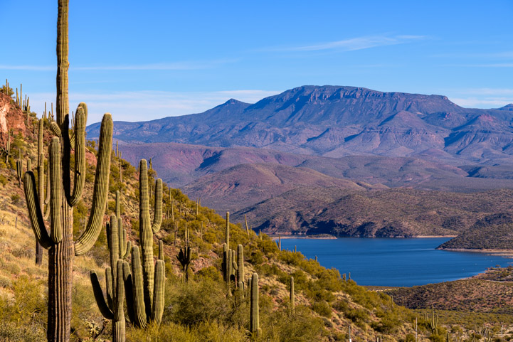
The river flows westward from Arizona’s White Mountains, and as it approaches Phoenix, a portion of it known as the Lower Salt River flows through a series of dams, creating Roosevelt Lake, Apache Lake, Canyon Lake and Saguaro Lake. The Apache Trail parallels the river on an impossibly winding and gorgeous route.

The contrast between the dry desert and these lakes makes for a unique landscape, and in the springtime it is bursting with flowers and wildlife.

Sitting in the Lower Salt River Arizona poppies

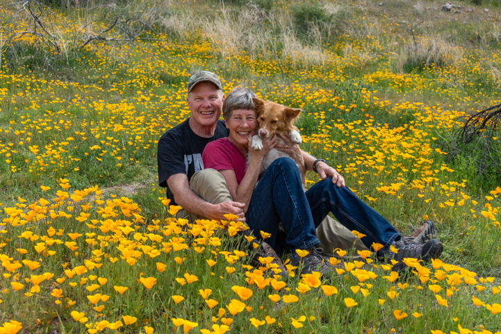
A little wildlife amid a lot of flowers!.

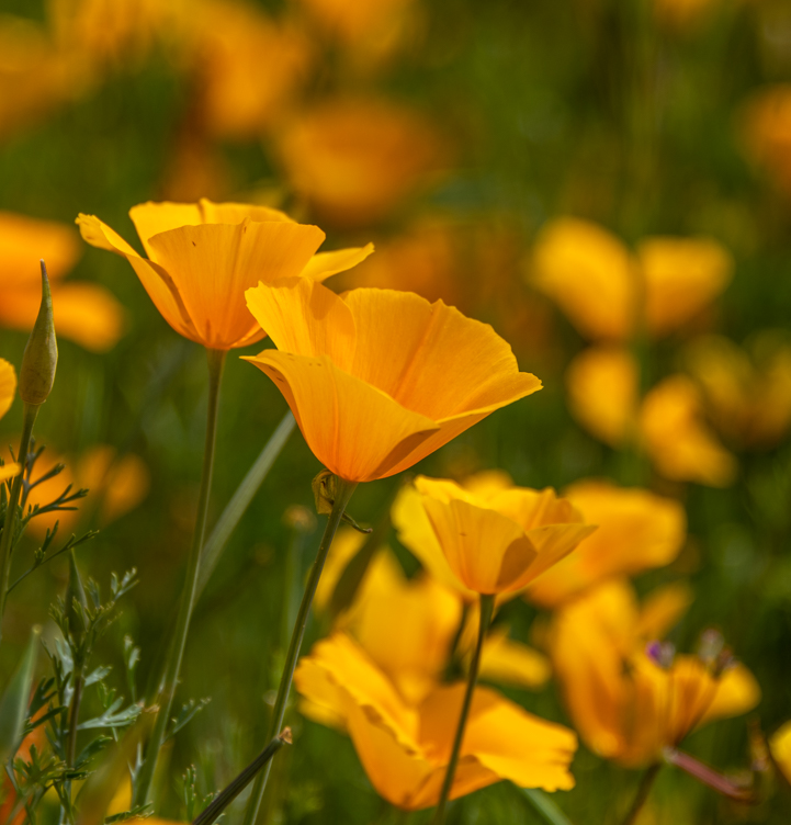
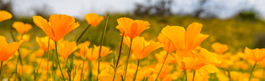
We had so much fun photographing the Arizona poppies along the Bush Highway last March that we just had to return this year.

Last year the poppies exploded in a fabulous super bloom. This year the fields of gold weren’t as extensive as before. However, it was still a magical experience to see the pretty flowers and walk between the thick patches of yellow and orange.

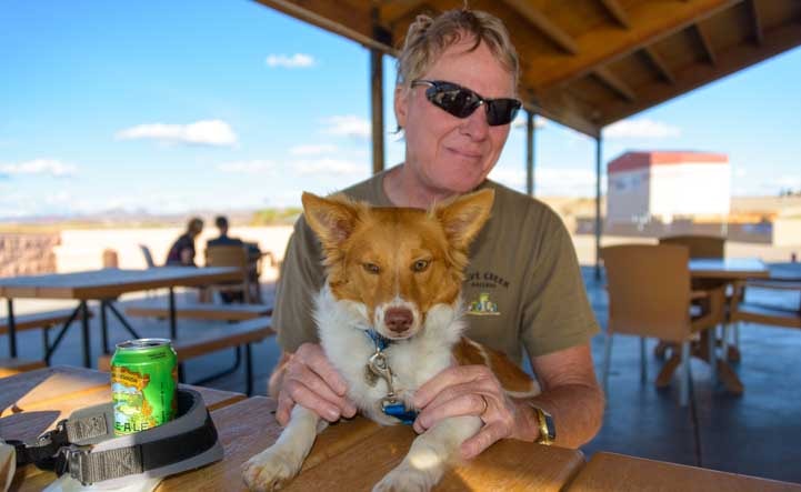
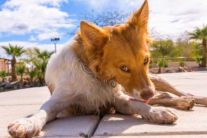
Buddy made himself at home and promptly laid down in a thicket of poppies.

Puppy in the poppies on the Lower Salt River in Arizona

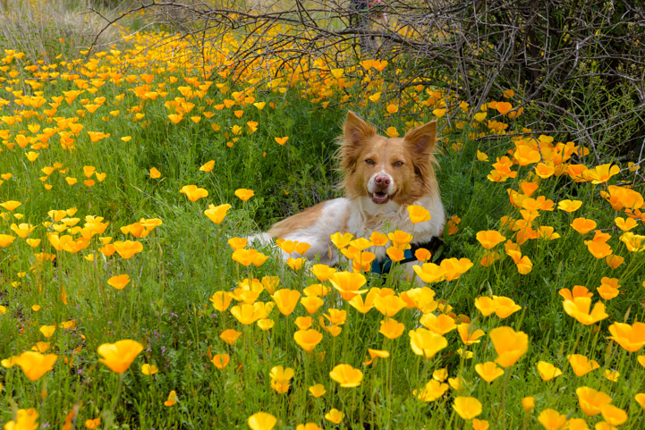
“This is nice here!”

People all around us strolled slowly in wonder, stopping now and then to get selfies amid the flowers. We were no exception!

Happy photographing the poppies along the Lower Salt River Recreation Area in Arizona

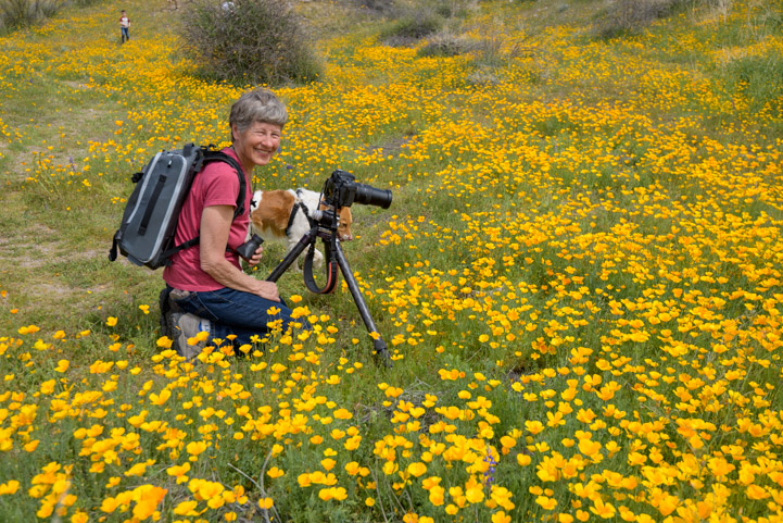
Right in the thick of it…

Photography in the Lower Salt River Arizona poppies

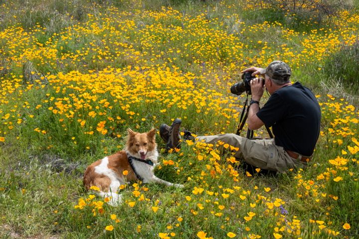
Getting down to business!


We use these two-way radios EVERYWHERE!. Hiking, biking, shopping and parking the rig! For more of our RVing tips, visit this page: RVing Tips & Tricks


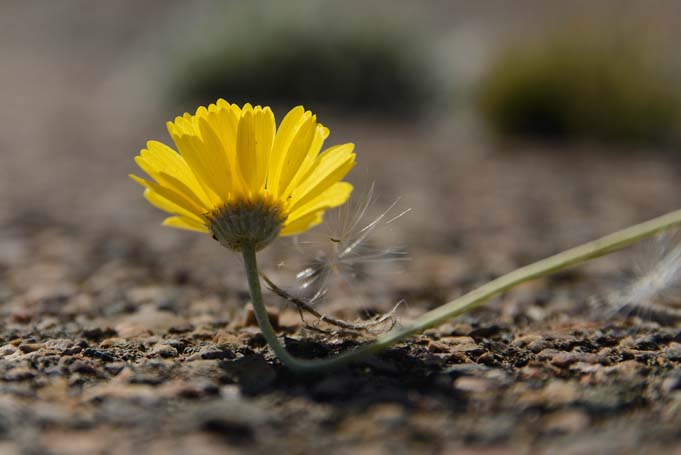
These joyful flowers grow in abundance all around the Phoenix area. For some people whose yards are overrun with them each spring, they can actually be something of a nuisance. But to us, their happy faces smiling up at the sun are the very essence of Spring.

Lower Salt River Arizona poppies with a lupine

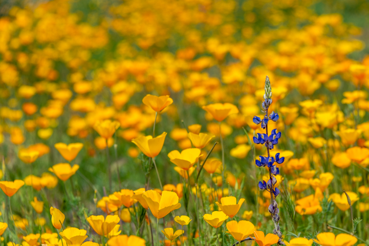
Poppies herald the arrival of Spring in the Sonoran Desert.

Lower Salt River Arizona poppies on the Bush Highway in the Lower Salt River Recreation Area

Smiling faces.

Arizona Poppies blooming on the Bush Highway in the Lower Salt River Recreation Area in Arizona

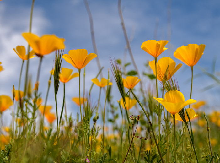
Poppies’ eye view of the sky!

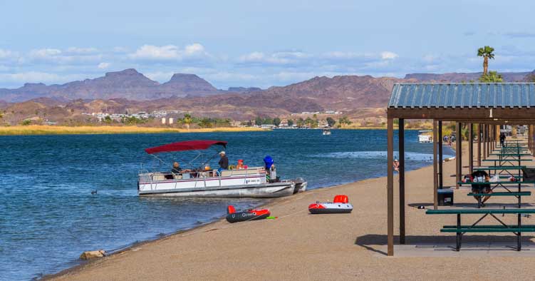
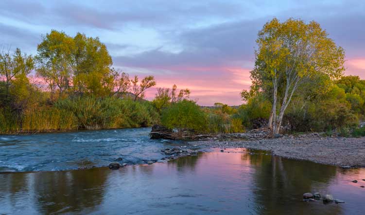
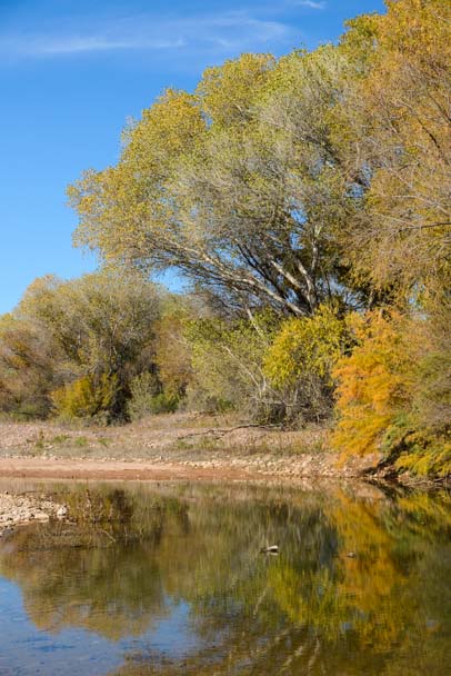
A little further down the Bush Highway, we stopped at the Water User’s Recreation Area. This is a huge parking lot and river frontage area where people launch kayaks, standup paddle boards and let their dogs and kids play in the water. There’s a fantastic view of the Salt River from the edge of the parking lot.

Water Users Recreation Area Lower Salt River on the Bush Highway

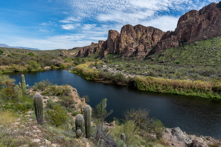
A natural river flows through the desert.

Water Users Recreation Area Lower Salt River on the Bush Highway

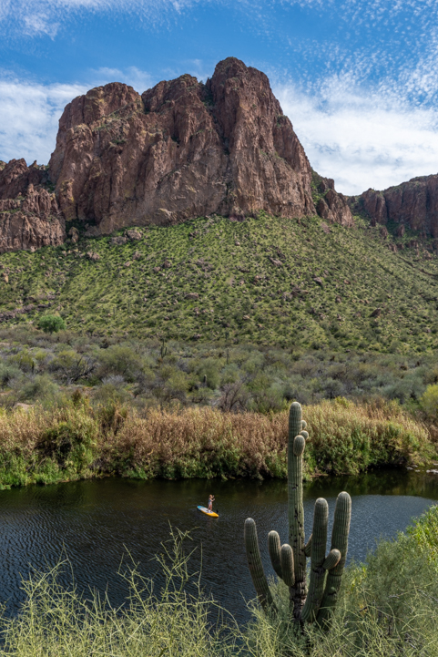
This is a great place to play in the water on a hot day.

Lower Salt River on the Bush Highway Water Users Recreation Area

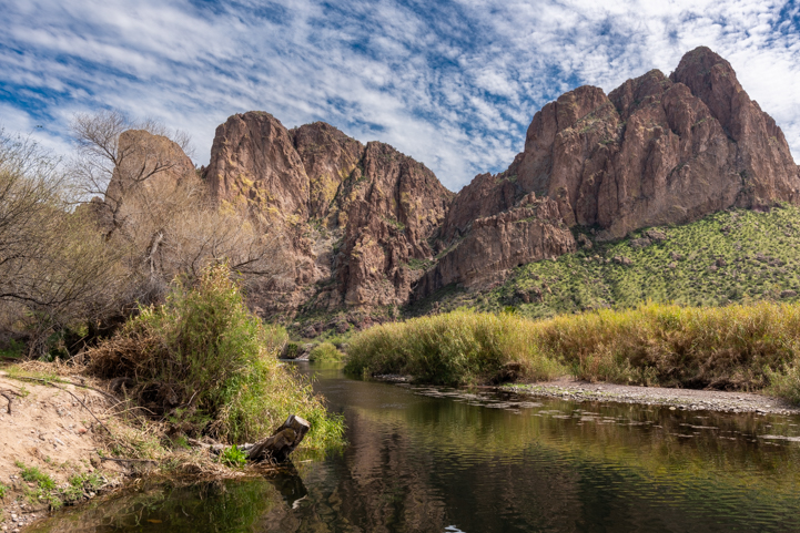
Just love those cliffs!

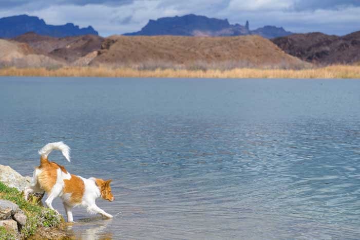
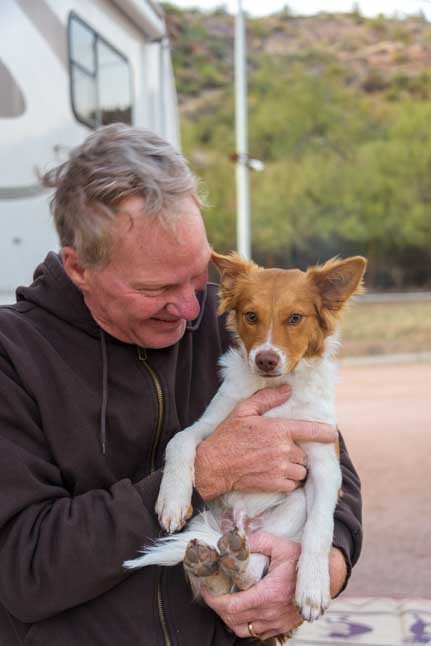
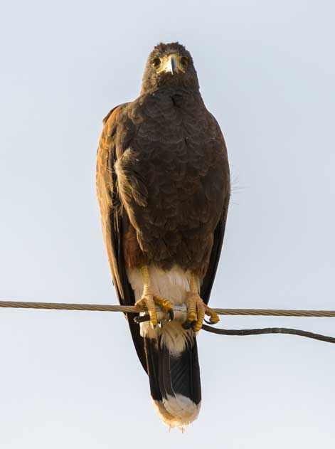
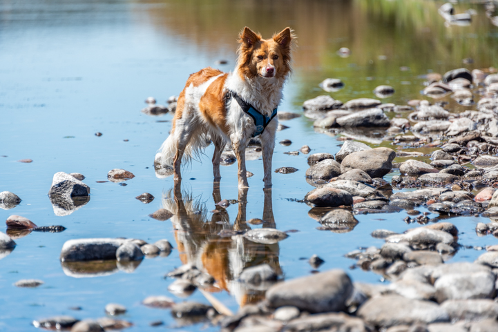
Sometimes when we’ve stopped at this spot we’ve seen the wild horses that are residents of the area. They come down to the water here for a drink. None were out on this particular day. However, Buddy waded in the water and took a long drink.

Dog in the Salt River on the Bush Highway at Water Users Recreation Area

.

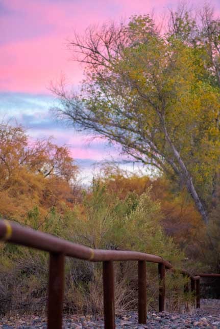
There are a lot of recreation areas along the Bush Highway, and each is a little different. There are cliffs and beaches and even some mesquite woods at the Coon Bluff Recreation Area.

We hiked on the short trail that parallels the Salt River and wanders between the lush green grass and mesquite trees.

Coon Bluff Trail in the Lower Salt River Recreation Area in Arizona

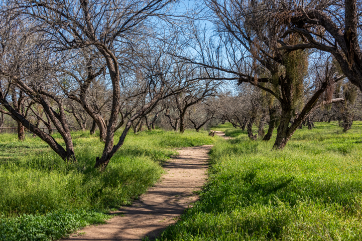
We watched a wedding shoot in this grove of trees a few years back!

Down on the riverbank we suddenly heard a loud chirping coming from a pile of boulders. Buddy quickly ran over and stared into a hole between the rocks, sniffing continuously. Sure enough, there was a ground squirrel in the hole. He came out into the sunshine for a split second and chirped for us and then darted back in the hole.
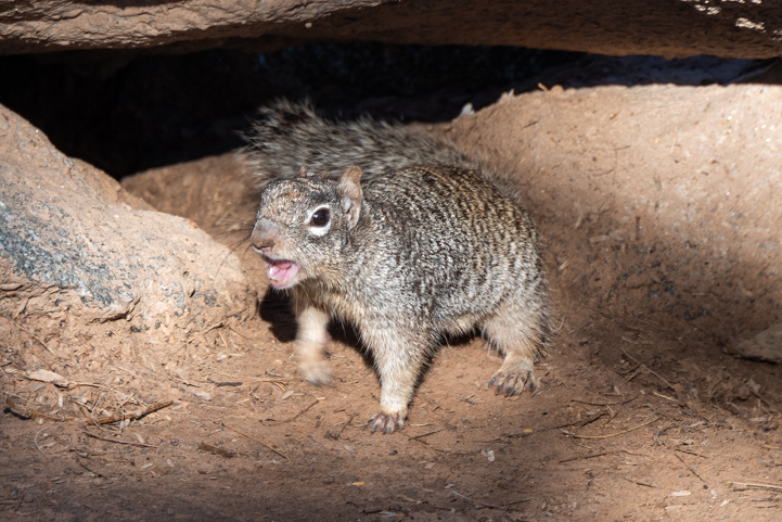
Squirrel at Coon Bluff Trail in the Lower Salt River Recreation Area in Arizona

“Watcha doin’ ?”

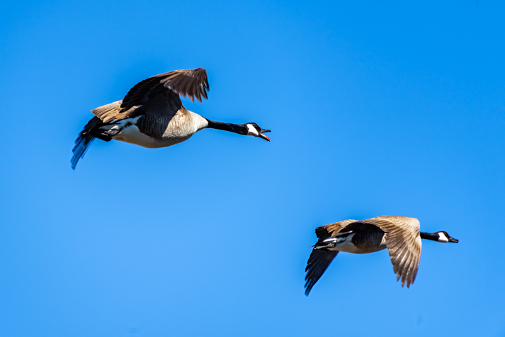
Up in the sky, a pair of geese flew by. One was honking loudly. The wildlife around here had a lot to say!

Geese flying at Coon Bluff Trail in the Lower Salt River Recreation Area in Arizona

“Take a left!”

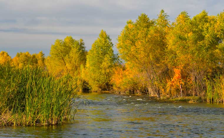
We drove on a short distance and stopped at the Phon D Sutton Recreation Area. This spot is at the confluence of the Salt River and the Verde River, and there’s not only wildlife all around but lots of human activity too. it’s a beautiful place to spend an afternoon.

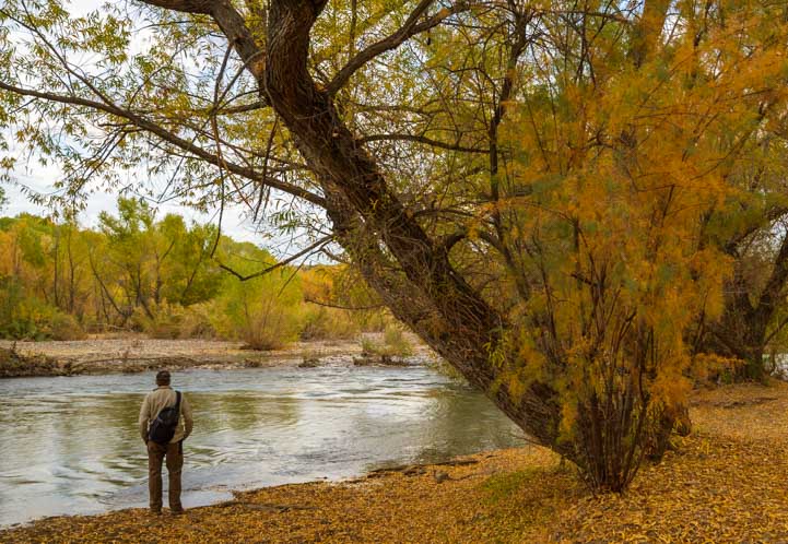
We hiked a short trail that goes along the river’s edge, and Buddy suddenly stopped and laid down for a brief rest while he surveyed the pretty landscape from a nice spot in the shade.

Dog relaxes at Phon D Sutton in the Lower Salt River Recreation Area in Arizona

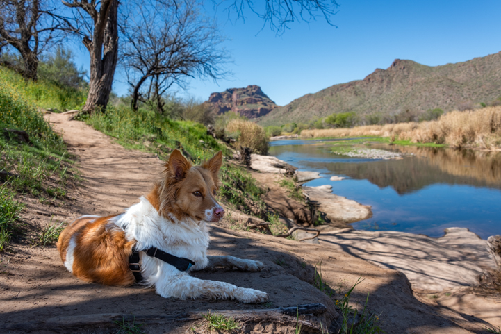
Buddy takes a breather in the shade by the Salt River.

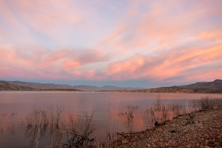
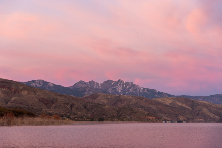
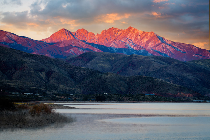
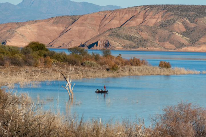
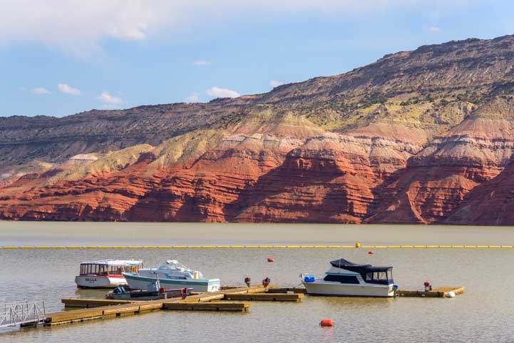
Four Peaks appeared far out on the horizon. From this vantage point we were seeing the “front” of Four Peaks while when we RV camped at Roosevelt Lake further upstream on the Salt River a few weeks ago, we were looking at the “back” of Four Peaks.

Salt River at Phon D Sutton in the Lower Salt River Recreation Area in Arizona

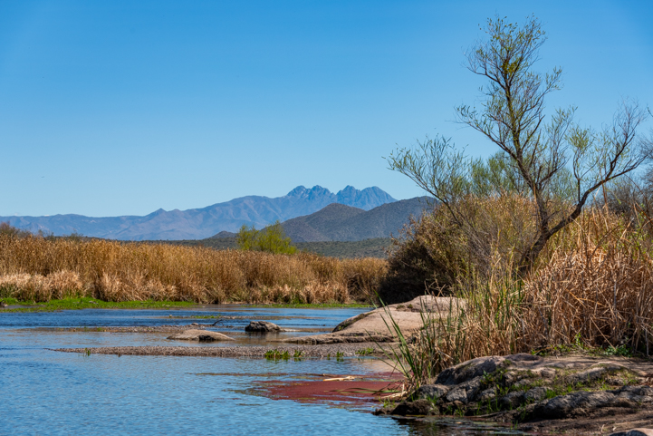
View of Four Peaks from Phon D Sutton Recreation Area.

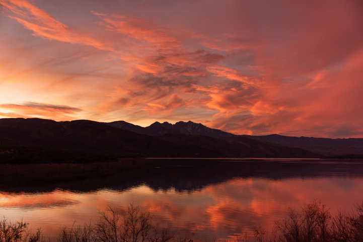
In the opposite direction, Red Mountain cast a reflection in the glassy water.

Red Mountain Lower Salt River Arizona

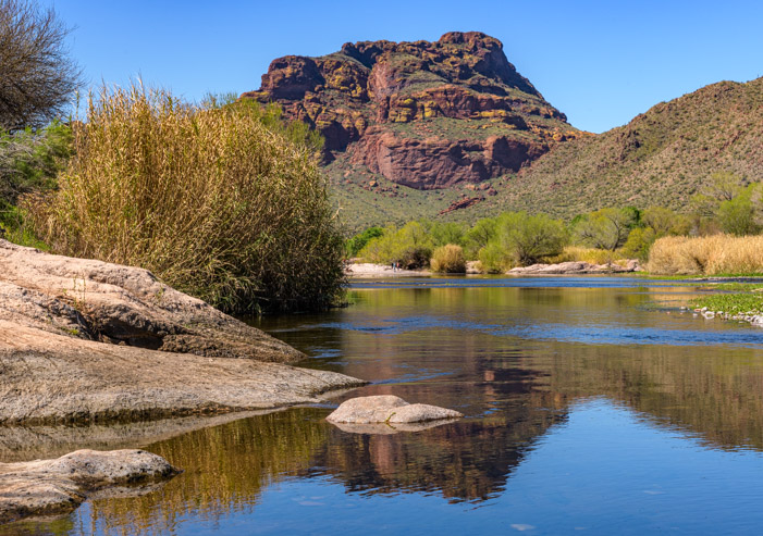
Red Mountain checks its reflection in the water.

As I mentioned, Phon D Sutton (along with all the other Recreation Areas on the Salt River) is a popular place for all kinds of outdoor activities. While we were there, a group of people began bringing inflatable kayaks down to the water’s edge. First it was two yellow kayaks. Then two yellows and a red. Then two yellows, a red and a green. In no time the shoreline was filled with a rainbow of kayaks.

Rafting in the Lower Salt River Arizona

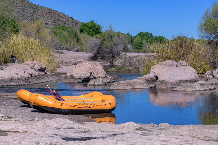
A group of kayakers brought a kaleidescope of kayaks to the shores of the Salt River.

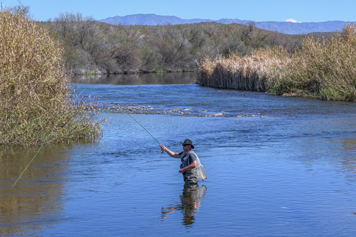
A fly fisherman stood in the water casting his line, and a photographer grinned happily between shots.

Fishing in the Lower Salt River Arizona

The Lower Salt River recreation areas along the Bush Highway are all about having fun in and near the water.


The Reese Goose Box was a GAME CHANGER for us. We got the bed of our truck back (yay!) and hitching/unhitching is easy.

Check out our review: HERE!


Photography in the Lower Salt River Arizona at Phon D Sutton

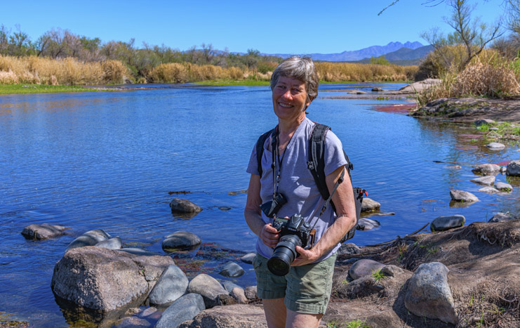
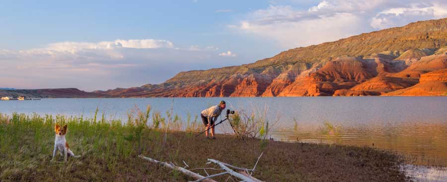
This is a great area to bring a camera.

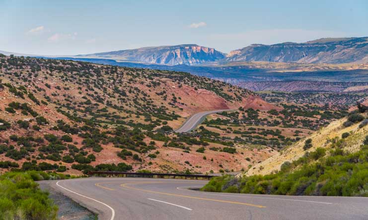
The Bush Highway, Coon Bluff and Phon D Sutton are all near the city of Mesa. Further upstream on the Salt River, on the northeastern edge of the city of Apache Junction, lies one of Arizona’s most spectacular scenic drives: the Apache Trail (State Route 88).

This incredible winding road goes through some of the finest Sonoran Desert scenery in the state on a road that began as a trail used by the Apache Indians before the settlers arrived.

In 1903 road construction began to link the city of Mesa with the construction site for the Roosevelt Dam. In just a year, the first 64 miles of the road from Mesa to the Roosevelt Dam (which created Roosevelt Lake) was completed for a cost of $200,000. Two years later, in 1905, the entire 112 mile long road through this very treacherous terrain was completed for a total cost of $500,000.

The road builders were predominantly Apache Indians, and they built the road using pick axes and shovels along with dynamite. What an impressive feat!

Apache Indian road building crew on the Apache Trail, courtesy Bureau of Reclamation

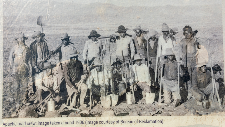
These guys built 112 miles of road through perilous terrain in 3 short years!

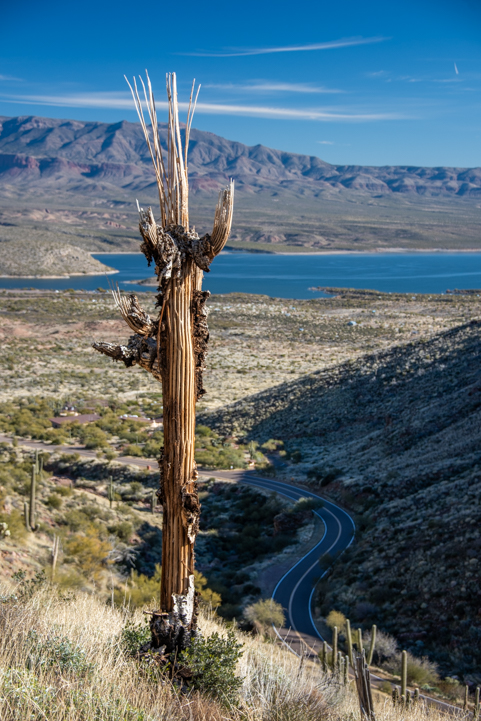
Today, the 37 miles of road through the most treacherous part of the original 112 mile long Apache Trail goes from Apache Junction to Roosevelt Lake and takes dozens of sweeping turns on a hilly run out towards the dam.

Only the first 15 miles are paved, however. And the 22 mile long dirt portion, which used to make for a very exciting ride, is currently washed out in a few places due to flooding in 2019, so it’s closed.

As we drove this beloved road, we reminisced about racing our bicycles on the paved portion after work on hot summer Wednesday evenings back in the day! It was a crazy race, but so much fun. It was typically 115 degrees, and we’d both put in a full work day already, but all our cares slipped away as we rode at top speed on this scenic route.

The Apache Trail in Arizona is a winding road

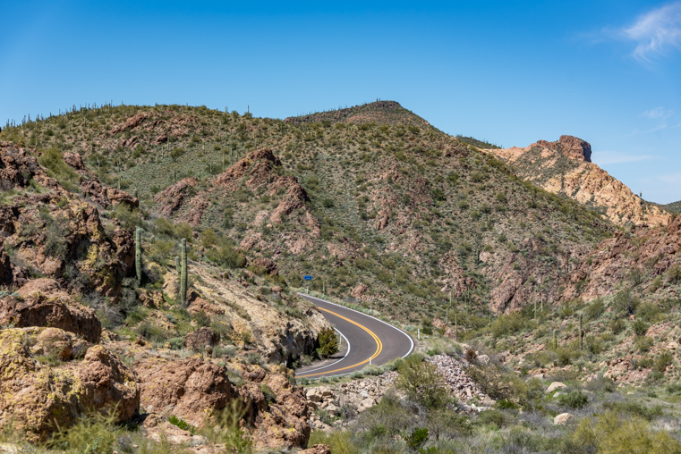
One of dozens of tight turns on the Apache Trail.

On our drive last week, we were alarmed when we saw a sheriff’s car and an ambulance parked by the side of a particularly tight turn, lights flashing.

People routinely drive this road way too fast, and a surprising number go over the edge. Seeing the car at the bottom of the cliff was a great reminder to take our time and drive slowly. After all, why rush on such a beautiful drive?!

Saguaro cacti in the Lower Salt River area in Arizona

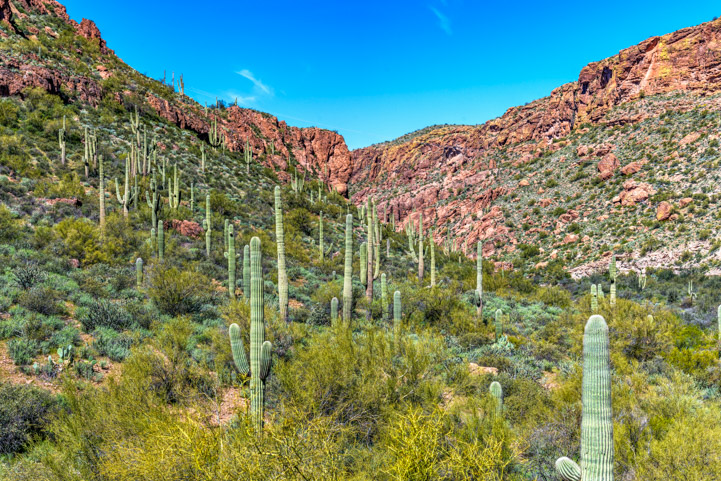
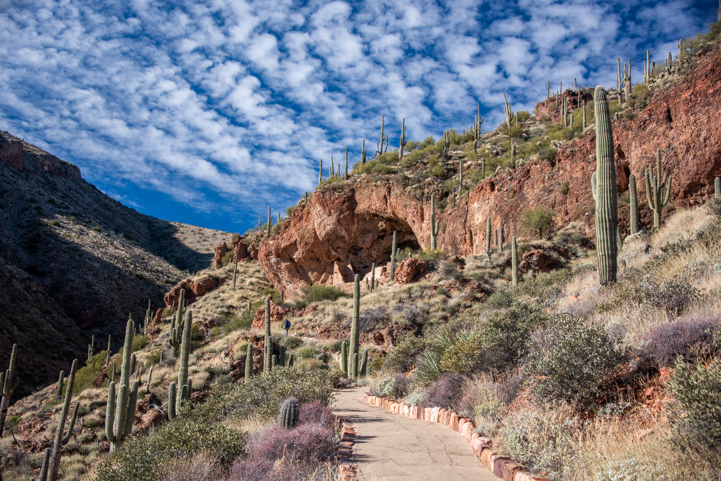
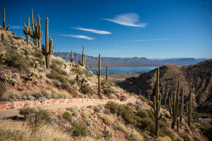
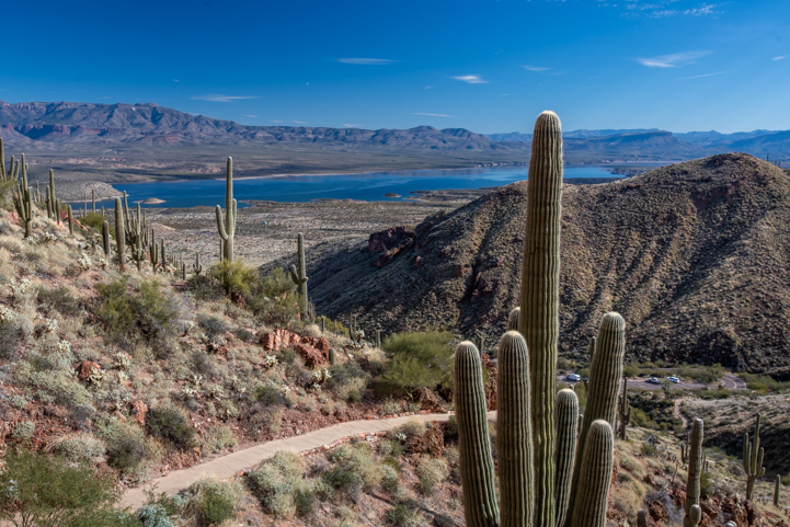
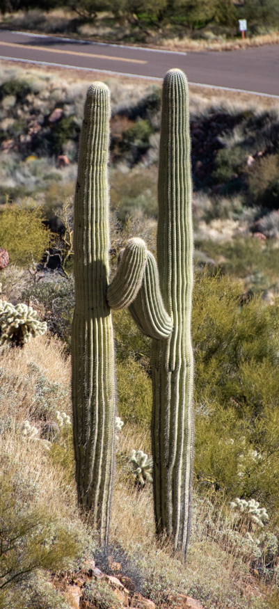
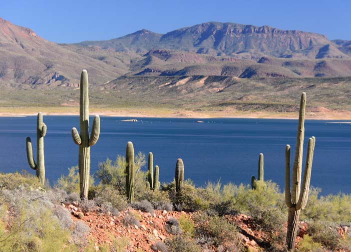
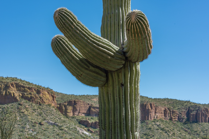
The Apache Trail is one of the best places to see gorgeous saguaro cactus stands.

721 Saguaro Cactus on the Apache Trail in Arizona

.

Along the way, two trestle bridges cross tributary streams that flow into the river.

Bridge on the Apache Trail in Arizona

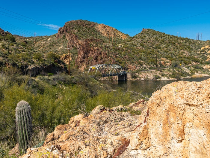
There are two trestle bridges on the Apache Trail.

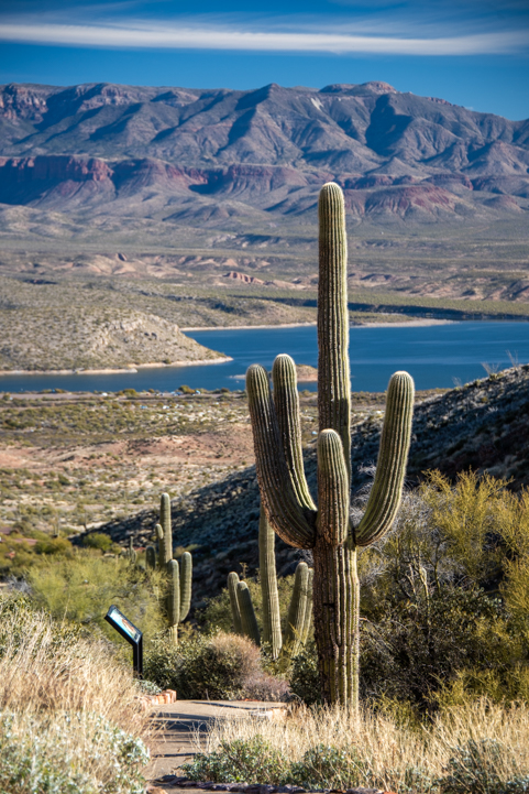
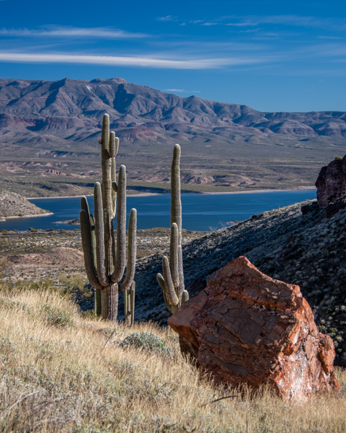
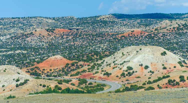
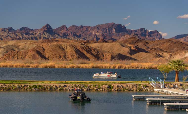
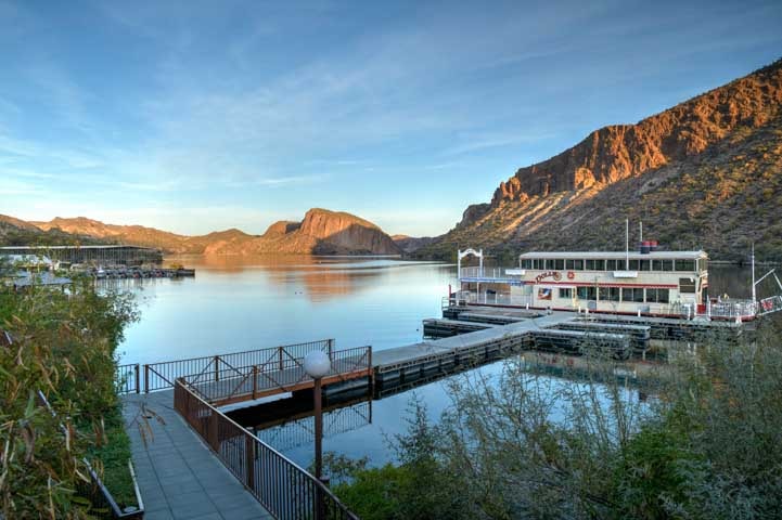
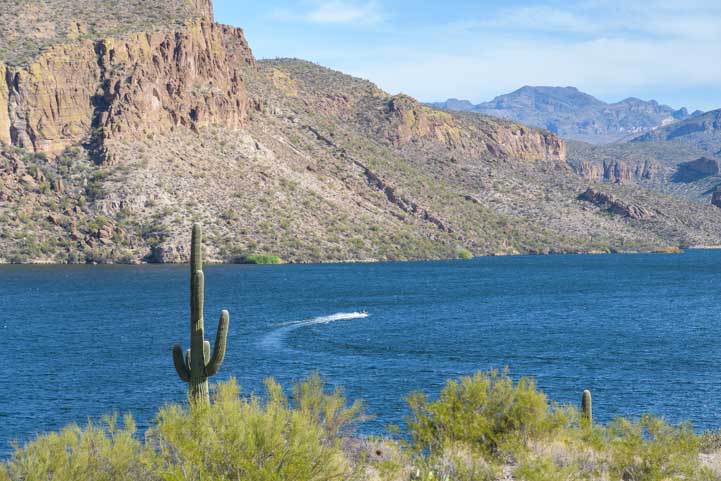
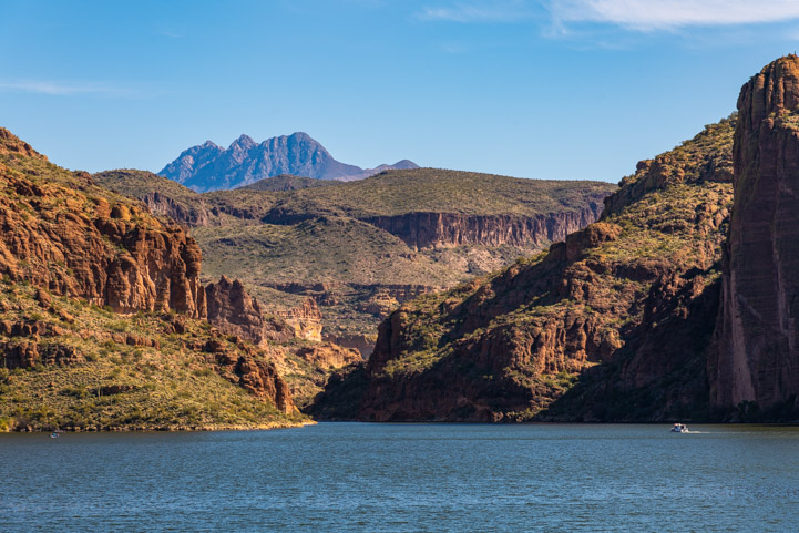
The Apache Trail follows a portion of the Salt River that is dammed to form a series of lakes: Roosevelt Lake, Apache Lake, Canyon Lake and Saguaro Lake. As we turned a corner, we could see Canyon Lake in the distance.

View of Canyon Lake on the Apache Trail in Arizona

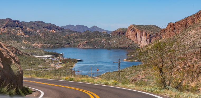
Canyon Lake appears in the distance.

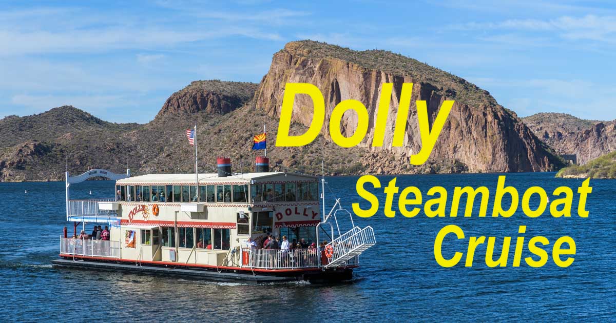
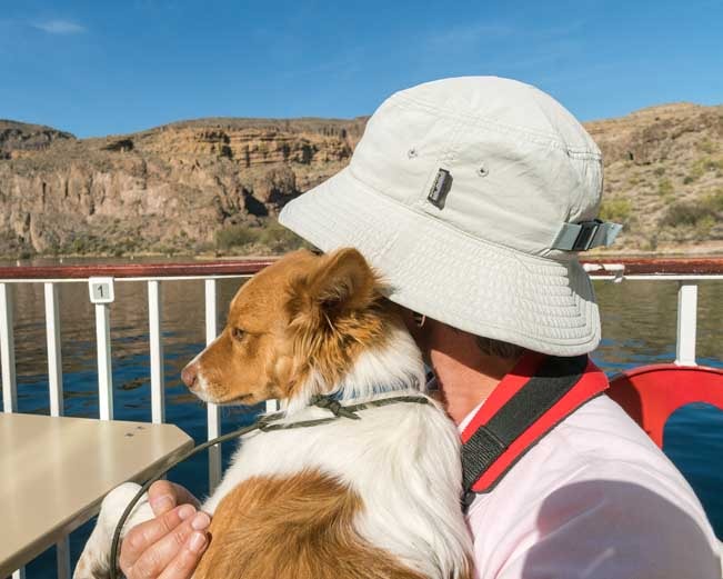
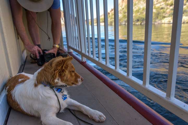
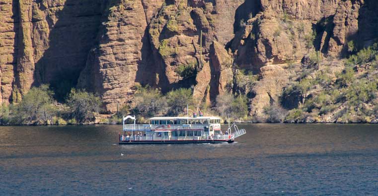
A delightful way to see Canyon Lake is to take a ride on the Dolly Steamboat. We enjoyed that wonderful boat ride a few years ago when a crew from Camping World was filming us for a promotional video. It was a lot of fun to float through a Sonoran Desert canyon!

We’ve also taken the boat ride on Saguaro Lake aboard the Desert Belle. If you have a chance, either boat ride (or both) is well worth doing. Drifting through spectacular Sonoran Desert scenery is a captivating way to spend a few hours.

Dolly Steamboat ride on Canyon Lake Arizona

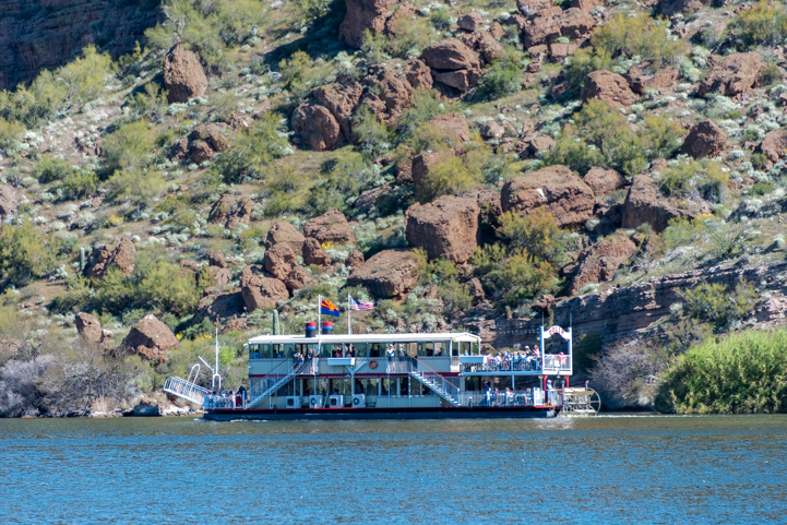
Dolly Steamboat cruises down Canyon Lake.

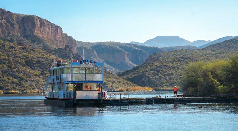
There are also several recreation areas near the Dolly Steamboat dock, and we stopped at Acacia Recreation Area to explore. This is a gorgeous spot with a beach, picnic tables, shade trees and stunning views of the canyon walls across the water.

A young family was enjoying a picnic on a blanket while a little girl and her dad fished at the water’s edge.

Acacia Recreation Area on the Apache Trail Arizona

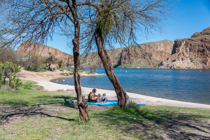
What a beautiful place to bring the family on a hot day.


We used two of these solar panels to upgrade our toy hauler's factory-installed 200 watt system to a 600 watt system.

See our DIY installation details here:
RV Solar Power Upgrade

Canyon Lake on the Apache Trail in Arizona

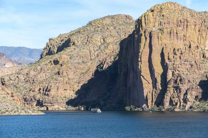
Far in the distance, the Dolly Steamboat is dwarfed by the canyon walls.

The paved portion of the Apache Trail ends just beyond Tortilla Flat, a small complex of historic buildings with a restaurant. This place is a magnet for convertible drivers and motorcyclists who love to ride the sweeping turns of the Apache Trail and then stop for lunch.

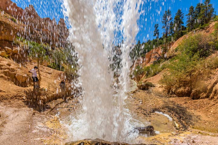
On our way back we saw an opening for a small trail that went down to a stream. Buddy cooled his paws in the water and Mark did too when he accidentally stepped into deep water that came in over the tops of his boots!

Fun in the water on the Apache Trail in Arizona

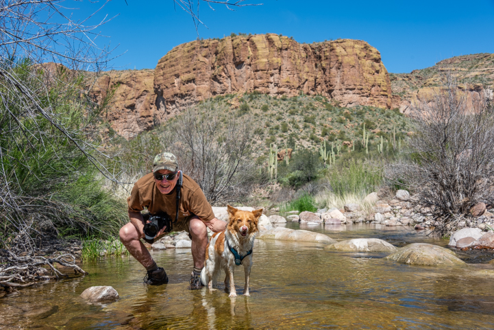
Buddy and Mark cool their paws in the water.

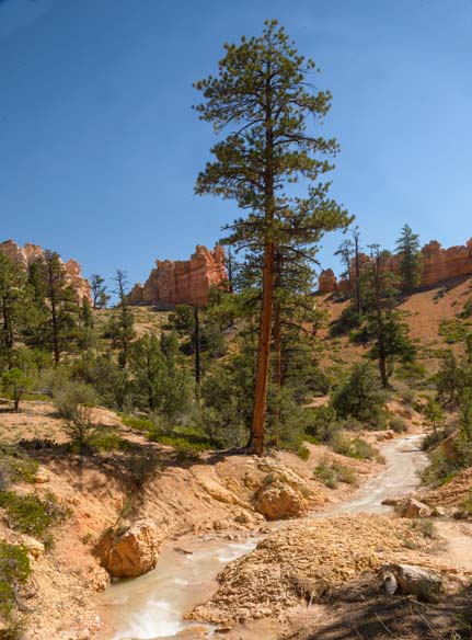
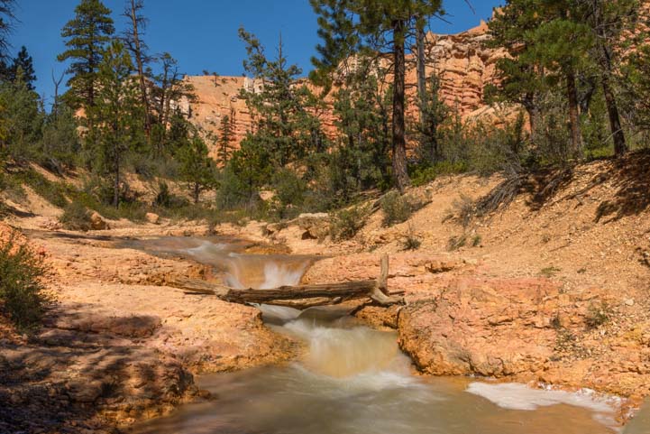
The whole Lower Salt River area from Roosevelt Lake to the Apache Trail to the river access points on the Bush Highway is a rich playground for outdoor lovers, and we keep going back and back again!

Camping in Arizona

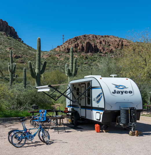
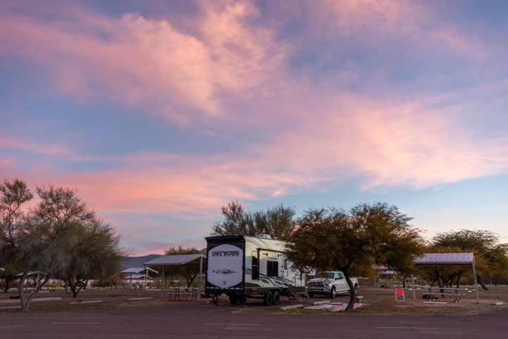
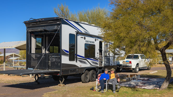
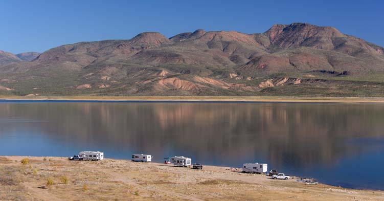
RV camping in the Sonoran Desert – fun fun fun!

Arizona poppies blooming on the Bush Highway in the Lower Salt River Canyon Recreation Area

Poppies, poppies, poppies!

If you liked this post, please do us a big favor and share it with a friend!

Subscribe
Never miss a post — it’s free!

Check out all the goodies in our GEAR STORE:
RLT Gear Store Categories

More info about the Lower Salt River recreation areas and the Apache Trail:

Other blog posts from our visits to the Salt River and Apache Trail:

More blog posts from our trips to central Arizona:

Our most recent posts:

More of our Latest Posts are in the MENU.   New to this site? Visit RVers Start Here to find where we keep all the good stuff. Also check out our COOL NEW GEAR STORE!! *** CLICK HERE *** to see it!

<-Previous || Next->

Windy Hill Campground + Tonto National Monument

January 2024 – Roosevelt Lake is a beautiful lake in Central Arizona that was created by damming up the Salt River, and it is one of our favorite places to go winter RV camping in Arizona. When a warm “January thaw” swept through the state, we took advantage of the spring-like weather and spent a few days at Windy Hill Campground.

Four Peaks seen from Windy Hill Campground Roosevelt Lake Arizona

Mist rises from Arizona’s Roosevelt Lake in view of Four Peaks at dawn.

There are several campgrounds around Roosevelt Lake, but our favorite is Windy Hill Campground. There are quite a few campground loops at Windy Hill, and each is lovely. Some campsites can be reserved, but we always take our chances with first-come-first-serve because there are usually dozens and dozens of empty sites.

This year we had an entire campground loop to ourselves. What luck!

RV camping at Windy Hill Campground at Roosevelt Lake Arizona

We had an entire campground loop to ourselves at Windy Hill Campground.

Many of the campsites are near the water’s edge. This year the lake level was quite high, so it was just a few steps down a short trail to get to the water from our campsite.

At sunrise the world was very quiet as wispy clouds painted pastel shades of pink and orange across the heavens. Reflections appeared in the water below.

Sunrise Windy Hill Campground at Roosevelt Lake Arizona

Sunrise at Roosevelt Lake, Arizona.

In the distance, we could see the winter snow on Four Peaks in the early morning glow.

Four Peaks at sunrise Windy Hill Campground at Roosevelt Lake Arizona

Pink everywhere.

The light was constantly changing and once the mist cleared, the mountains took on a fiery hue for a few moments.

Four Peaks over Roosevelt Lake seen from Windy Hill Campground

“Morning has broken…”

Roosevelt Lake is especially loved by fishermen, and there are fishing tournaments year round. There weren’t any fishing tournaments going on during our stay this year, but there were plenty of anglers out on the water.

Fishing on Roosevelt Lake at Windy Hill Campground in Arizona

What a place to fish!

Hiking trails hug the water’s edge around several of the peninsulas just below the campsites, and we happily hit the trails each morning and evening. The campground hosts had done a great job of keeping these trails clear.

All the campground loops are paved while the campsites themselves are gravel.

One day while returning to our campsite, the shadow of Buddy’s inner wolf suddenly appeared in the road.

Inner Wolf

On a late afternoon walk, Buddy was stalked by his inner wolf.

Despite the shadow monsters out there, we felt a wonderful peace in the air and just hung out and relaxed.

RV Camping at the Windy Hill Campground at Roosevelt Lake in Arizona

Soaking up some winter sunshine in our campsite.

Just chilling in the RV

Just chillin’ on the sofa.

Sunsets are just as dramatic as the sunrises at Roosevelt Lake, and they were a bit easier to enjoy since we were already up and out of bed!

Sunset reflection at Roosevelt Lake in Arizona.jpg

Sunset!

Sunset view of Four Peaks from Roosevelt Lake Arizona.jpg

Wow!

For such a beautiful RV camping area in such a scenic setting, it has always bewildered us that very few of Arizona’s thousands of winter RV snow birds ever go there. Oddly, even fewer locals have ever heard of it!

The US Forest Service recreation areas around Roosevelt Lake were built decades ago with great anticipation that hordes of campers and boaters would flock to the lake from both Phoenix and Tucson, each about 100 miles away. There were hundreds of campsites built on both sides of the lake in all kinds of pretty settings.

Although the campgrounds at Roosevelt Lake, including Windy Hill Campground, are dry camping only, the loops are paved, the campsites are spacious, each one has a shaded picnic ramada and campfire ring, there are ample water spigots around each loop and there are bathroom buildings with flush toilets and showers.

But the expected crowds never came.

Roosevelt Lake is 2 hours from both Phoenix and Tucson, and it is just too far for a family to go for a Saturday night camping trip. Lots of people come for longer stays like Spring Break and the big three-day weekends, but not at any other time. As for winter RV snowbirds, most want hookups, and who can blame them in January when the onshore lake winds pipe up and temps turn chilly?

But if you choose a campsite that isn’t waterfront property (I know, it’s hard to do that!), then there’s little wind and it’s a lot warmer.

The USFS has allowed the Roosevelt Lake campgrounds to fall into decay, and they are deliberately letting several loops at Windy Hill Campground sites “return to nature” as one camp host put it. The picnic tables and campfire rings have been removed and the campsite pads are disappearing under the weeds.

Yet, at the same time, they installed a major upgrade this past year: a new RV dump station! They rerouted the road on one of the closed campground loops, and although it’s not the best dump station layout we’ve ever seen, it’s there and it’s open and it’s a lot more convenient than going to the other RV dump station at Roosevelt Lake located 10 miles away at Cholla Bay Campground.

In 2024, campsites at Windy Hill Campground cost $25/night ($12.50/night for seniors with the Federal Interagency Pass).

Roads Less Traveled Amazon Store

⬆⬆⬆ Check out our GEAR STORE where we've gathered together the things we love and depend on! ⬆⬆⬆

One big surprise this year was that they now allow winter RV snowbirds to stay at Roosevelt Lake for as long as they wish. In the past, they wanted RVers to leave after the standard 14 days. During our stay we met several RVers who had been there for a few months and were planning to stay for a few months more. For seniors, at $12.50/night or ~$375/month, it’s a great deal for monthly rent in a scenic spot with paved loops and good sized campsites.

Roosevelt Lake isn’t near anything, and that may be part of the reason that most Snowbird RVers don’t flock there. The bustling town of Payson, Arizona, is 50 miles away to the north and the mining town of Globe, Arizona, is 80 miles to the east.

However, right across the street from Windy Hill Campground is a wonderful ancient Indian cliff dwelling ruin, Tonto National Monument. Even though we have visited several times before, we decided to go there once again during our stay this year.

Tonto National Monument trail to Lower Ruins

A paved path heads up to the Lower Cliff Dwellings cave at Tonto National Monument.
This is across the street from Windy Hill Campground.

The fun thing about these ruins is that you can go right inside the pueblo and get a feeling for what life might have been like for the ancients living high up on this mountainside.

There are two sets of ruins, the Lower Cliff Dwelling and the Upper Cliff Dwelling. Each set of ruins was found very much intact by the settlers in the 1800s, and there were fabulous artifacts strewn about as if the former inhabitants had just moved out last week.

In the 1940s, the Civilian Conservation Corps (CCC) built a hiking trail to each ruin, and the Navajo Mobile Unit that had worked on stabilizing the massive ruins at Chaco Canyon in New Mexico were brought in to stabilize these ruins.

The paved half-mile trail to the Lower Cliff Dwelling is very steep and has lots of switchbacks. But between our huffs and puffs as we tackled this vertical hike, we paused to soak in the fantastic views of Roosevelt Lake behind us.

View from Tonto National Monument trail to Lower Ruins

We enjoyed sensational views as we ascended and descended the trail to Tonto National Monument’s Lower Cliff Dwellings.

View from Tonto National Monument trail to Lower Ruins

It’s worth it to hike up to the cliff dwellings just to see the views!

Roosevelt Lake didn’t exist 700 years ago when these cliff dwellings were built, but it sure is pretty today. Back then, the Salt River meandered through the valley below but its flow was temperamental during droughts and floods.

Roosevelt Lake seen from the trail to the Lower Cliff Dwellings at Tonto National Monument

The ancient Indians didn’t have these mesmerizing lake views…

Saguaro skeleton Tonto National Monument trail to Lower Ruins

Saguaro cacti leave exotic skeletons behind when they die.

The hike to the Upper Cliff Dwelling is 3 miles long and you can only do it on a ranger guided tour (the tours are free).

When we did that hike a few years back, the ranger explained that current theories about the Salado People who lived on these hillsides and in the valley 700 years ago were that the valley dwellers arrived and built homes before the cliff dwellers did. They farmed the flat lands by the riverbanks and in the river’s flood plains.

View from Tonto National Monument trail to Lower Ruins

Ancient farmers raised crops in the valley before the cliff dwelling builders arrived.

Tonto National Monument trail to Lower Ruins view of Roosevelt Lake

.

As this modern theory goes, the cliff dwellers arrived at a later date, and because there was no room to set up housekeeping on the valley floor, they built their homes into the cliffs. It is also thought that the cliff dwellers were tradesmen and made pots and other things for trade with other peoples elsewhere (macaw feathers from Costa Rica have been found in this area, perhaps traded for a pot or two!).

So, you had two groups of people living here, farmers in the valley and artisans on the mountainsides.

Tonto National Monument Cliff Dwellings Roosevelt Lake Arizona

Today’s theory is that these cliff dwellings in the mountainside caves were inhabited by artisans while farmers lived on the valley floor.

Tonto National Monument cliff dwellings Arizona 2

There is even a theory that the Salado People manufactured clay pots specifically for trade and the pots were warehoused in structures built just to store them.

Dogs are allowed on the Lower Cliff Dwelling trail, but only up to a certain point which is marked by a trash can. That is the holding area where you can either tie up your pooch and take a quick peek at the Cliff Dwelling or leave him with another member of your party and take turns roaming through the ruins.

We took turns, and Buddy patiently — but a bit nervously — waited for each of us to go up to the ruins and have a look around. He wasn’t keen on having his pack separated!

Other dogs arrived and had to wait too, so we all chatted together. The wonderful thing is that we could take our dogs on the trail at all and enjoy the hike together. It is understandable that they don’t want any peeing or pooping mishaps inside the ruins because that would attract wild animals into the ruins when no one is there.

Tonto National Monument cliff dwellings Arizona

The front of the cave was originally walled in.

Tonto National Monumnet Lower Cliff Dwellings Arizona

Photos from over a century ago show these walls extending much higher.

For me, one of the most interesting tales related to these ruins is that of Angeline Mitchell who rode her horse five miles through the brush, tied him to a tree and then scrambled up the mountainside to “the caves” with five friends, Melinda, Clara, Tom, Frank and Bud, in December, 1880.

She describes the mountainside as being covered with debris from the ruined walls and says she and her friend found traces of 33 rooms, 18 of them in “fair preservation.”

She describes the ruin as seven or eight stories high, or more, and says there was originally no opening in the outer wall and that the people got into the pueblo via the second story.

Tonto National Monument cliff dwellings Arizona

This cave is not seven or eight stories high, so perhaps Angeline Mitchell was writing about a different cave nearby (there are other ruins in the area that are inaccessible).

She mentions that another person who explored the ruins found the skeleton of an infant and that the fingerprints of the builders were as “perfect as the day ages ago when the hands were pressed into the plastic clay.”

Tonto National Monument cliff dwellings Arizona

A metate for grinding grain sits on the ground today. Angeline Mitchell wrote in 1880, “The floor is formed partly by a big rock…and in this rock were 1/2 a dozen metates hollowed out of it and varying in size, depth & shape.” Again, I’m not sure she’s writing about the Lower Cliff Dwellsing or about another cave in the vicinity.

In another cliff house, she and her friend found 22 rooms of which 16 were in “fair order, three of them and a hall…as perfect as the day they were finished.” That might be the Lower Cliff Dwellings as there appears to have been a hall at the front of the cave.

While marveling at the “fine state of preservation” of these rooms, her friend Clara suddenly fell through an opening to a lower level and landed in a pile of cholla cactus. Ouch! Removing just one barbed cholla cactus thorn will pull out a hunk of flesh with it. I can’t even imagine falling into a pile of chollas!

Nonetheless, Clara was eventually freed from the chollas and the group reconvened in another room.

Tonto National Monument Arizona cliff dwellings

It seems many of the rooms were fully intact when the ruins were first explored. Here there’s a hint of a roof.

Angeline later writes of the reactions they all had to this unbelievable adventure:

“It seemed so strange to be chatting and laughing so gaily in a house built unknown centuries ago by people unlike us in appearance but who had known joy and grief, pleasure and pain same as our race of today knows them, and who had laughed, cried, sung, danced, married & died, mourned or rejoiced their lives away in this once populous town, or castle, or whatever one would call it! It made an uncanny feeling come over us as we rested till moon rise and talked of this long dead people and told the little we knew concerning them.”

Juniper roof structure Tonto National Monument Arizona cliff dwellings

A few relics lie on the floor today. Whole pots and other treasures were in abundance when the dwellings were first explored.

Even though the ruins and the experience of seeing them today is nothing like what it was for Angeline and her friends in 1880, those sentiments of wonder about the people who “had laughed, cried, sung, danced, married & died, mourned or rejoiced their lives away” are still very much alive today.

We heard exclamations of “This is incredible” “Wow” and “I had no idea…” from everyone who came up into the ruins from the steep path.

We’d had a great adventure too, and as we left, I spotted two saguaro cacti waving goodbye to us.

Happy Trails to You

“Happy Trails to you, until we meet again…”

For some reason, I instantly thought of the song sung by Roy Rogers and his wife Dale Evans at the end of every episode of the Roy Rogers TV Show, “Happy Trails to You!”

I didn’t see the TV show when it aired 60-70 years ago, but I heard this song when we were at an Escapees RV park a few years back and some folks were watching the Roy Rogers Show on TV in the common room.

Its simplicity and sincerity touched me, and as you can see by the YouTube comments, it is beloved by thousands who grew up watching the Roy Rogers show:

Lyrics to the song “Happy Trails to You” (here) — There’s a cool surprise in the last verse!

Subscribe
Never miss a post — it’s free!

More info about Roosevelt Lake, Windy Hill Campground and Tonto National Monument:

More from our travels to Roosevelt Lake and Tonto:

Other blog posts about ancient ruins:

Other special campgrounds we’ve enjoyed:

Our most recent posts:

More of our Latest Posts are in the MENU.   New to this site? Visit RVers Start Here to find where we keep all the good stuff. Also check out our COOL NEW GEAR STORE!! *** CLICK HERE *** to see it!

<-Previous || Next->

Bighorn Canyon – A River Runs Through It in Montana!

July 2018 – The Bighorn Mountains of Wyoming have given us many special moments recently. We traversed the beautiful Bighorn Scenic Byway this past spring and spent part of last summer nestled alongside the Bighorn Mountains in the charming town of Buffalo, Wyoming.

In Buffalo we not only enjoyed a festival for the Longmire TV show but also took part in an unusual celebration of the Basque sheep herders who settled the area over a century ago.

During our time in this area the word “Bighorns,” in our minds, had become synonymous with “Mountains in Wyoming.” So, it was a huge surprise when I opened a Montana travel magazine a few weeks ago and saw a stunning photo of sheer canyon walls plunging down to a winding river with the caption: Bighorn Canyon. This we had to see!

Devil's Overlook Horseshoe Bend Bighorn Canyon Montana and Wyoming

Bighorn Canyon.

Bighorn Canyon National Recreation Area is managed by the National Park Service, and there are two districts, the South District which is accessed from Lovell, Wyoming, and the North District which is accessed near St. Xavier, Montana.

Bighorn Canyon National Recreation Area RV trip in Montana and Wyoming

The drive into Bighorn Canyon National Recreation Area from Lovell, Wyoming, is very scenic.

The two districts are connected by the wonderfully twisting Bighorn River that snakes its way between the canyon walls for miles and miles in both Montana and Wyoming.

However, the Bighorn National Recreation Area is not contiguous for visitors unless you travel on the Bighorn River by boat. The dirt road connecting the South and North Districts crosses through the Crow Indian Reservation which is private property.

So, we decided we would check out the South District of Bighorn Canyon National Recreation Area since it is not too far from Cody, Wyoming, and then loop around to the North District and see the canyon from that angle.

Bighorn Canyon National Rec Area Scenic Drive Montana and Wyoming RV trip-min

Bighorn Canyon Scenic Drive.

The shock to our senses after spending several weeks in the high elevations of the Beartooth Highway and Chief Joseph Highway just outside Yellowstone National Park was incredible. Not only did we descend from cool summertime mountain temps in the low 70s to the baking heat of the desert in the mid-90s, but we went from lush greenery with wildflowers to a dusty crusty land full of red rocks.

Bighorn Canyon scenic drive Montana and Wyoming RV trip-min

.

Bighorn Canyon National Recreation Area Scenic drive by RV-min

Red rocks!

The most famous view on the southwest end of Bighorn Canyon is Devil’s Canyon Overlook just over the border on the Montana side. As we turned onto the road that heads out to this overlook we noticed a female bighorn sheep standing by the side of the road.

Bighorn sheep ewe Bighorn Canyon National Recreation Area RV trip in Montana and Wyoming

A bighorn sheep stops grazing to look at us.

BIghorn sheep ewe Bighorn Canyon National Recreation Area RV trip in Montana and Wyoming

.

After taking a few pics we noticed that there were several more bighorn sheep munching the grass by the side of the road. A mama and her sweet little lamb caught our eye.

Bighorn sheep at Bighorn Canyon National Recreation Area RV trip Montana and Wyoming

Mama Bighorn (shedding her winter coat) and her baby.

We got out of the truck to have a closer look.

Bighorn sheep lamb Bighorn Canyon National Recreation Area Montana and Wyoming

So cute!

We noticed two other little lambs close by. They were adorable!

Bighorn sheep lambs Bighorn Canyon National Recreation Area RV trip in Montana and Wyoming

Twice as cute!

Bighorn sheep lambs Bighorn Canyon National Recreation Area RV trip in Montana and Wyoming

.

What a treat it was to see all these bighorn lambs right by the road!

Bighorn sheep lamb Bighorn Canyon National Recreation Area RV trip in Montana and Wyoming

.

Just a little ways further on the view suddenly opened up and we were looking at the fabulous sheer walls of the Devil’s Canyon Overlook. Wow!

Devil's Overlook Horseshoe Bend Bighorn Canyon National Recreation Area RV trip Montana and Wyoming RV trip-min

The view at Devil’s Canyon Overlook is very dramatic.

Devil's Overlook Bighorn Canyon National Recreation Area Horseshoe Bend RV trip in Montana and Wyoming

.

The towering canyon walls and the thin ribbon of water snaking between them reminded us a little of both Goosenecks State Park in Utah and Horseshoe Bend in Arizona.

We had the place to ourselves and we ran around taking pics like mad.

Photographer Devil's Overlook Horseshoe Bend Overlook Bighorn Canyon National Recreation Area Montana and Wyoming RV trip-min

What a spot to take some pics!

Buddy trotted along the fence line, and he seemed to be enjoying the views too, although maybe he was just keeping an eye on the mice and other varmints that were scampering near the edge!

Puppy checks out view Devil's Overlook Horseshoe Bend Overlook Bighorn Canyon National Recreation Area RV trip-min

Puppy Chow checks out the view and the varmints!

The Devil’s Canyon Overlook is a big area and we walked along the edge peering into the canyon for a ways.

Horseshe Bend Bighorn Canyon National Recreation Area RV trip in Montana and Wyoming

.

Backtracking a little into the Wyoming side of the Bighorn Canyon National Recreation Area, we found the Horseshoe Bend Marina and Campground. We loved seeing the boats tied up to the docks with the rich colors of the red rocks behind them.

Horseshoe Bend Marina Bighorn Canyon Montana and Wyoming RV trip-min

Horseshoe Bend Marina.

At dawn we ran down to the beach to catch the sunrise.

Horseshoe Bend beach Bighorn Canyon National Recreation Area RV trip in Montana and Wyoming

Sunrise on the Bighorn River.

Wild yellow daisies swayed to and fro by the water’s edge.

Daisies at sunrise Horseshoe Bend beach Bighorn Canyon National Recreation Area RV trip in Montana and Wyoming

Daisies dancing at dawn.

The water in the Bighorn River reflected the sunrise beautifully.

Sunrise Horseshoe Bend beach Bighorn Canyon National Recreation Area RV trip in Montana and Wyoming

.

Sunrise Horseshoe Bend beach Bighorn Canyon National Recreation Area RV trip in Montana and Wyoming

.

Red rocks at sunrise Horseshoe Bend beach Bighorn Canyon National Recreation Area RV trip in Montana and Wyoming

.

The red rocks on the far shore took on a rich shade of burnt orange.

Sunrise Red rocks Horseshoe Bend beach Bighorn Canyon National Recreation Area RV trip in Montana and Wyoming-min

.

The beach and shoreline were deserted except for the three of us, and we had a wonderful time together playing by the edge of the water and watching the day wake up.

Photographer and puppy Bighorn Canyon National Recreation Area RV trip in Montana and Wyoming

Happily busy on the beach at sunrise!

Bighorn Canyon National Recreation Area is most popular during the spring and fall when the temperatures are cool. But for visitors who stop by mid-summer, there are electric hookups at the marina campground at Horseshoe Bend, and the air conditioners of a handful of campers were happily purring away 24/7!

Horseshoe Bend Campground Bighorn Canyon National Recreation Area RV trip in Montana and Wyoming

Camping at Horseshoe Bend Marina and campground.

We will be back again at a more comfortable time of year, and we plan to visit the North District of Bighorn Canyon National Recreation Area when it’s cool too. Our visit this time was a brief but wonderful detour that took us out of the snow capped mountains and into red rock country, and it whetted our appetites for a return trip!

Subscribe
Never miss a post — it’s free!

More info about Bighorn Canyon National Recreation Area in Montana:

More blog posts about curvy rivers carving fabulous canyon walls:

Other blog posts with bighorn sheep:

Special places where desert meets water:

Our most recent posts:

More of our Latest Posts are in the MENU.   New to this site? Visit RVers Start Here to find where we keep all the good stuff. Also check out our COOL NEW GEAR STORE!! *** CLICK HERE *** to see it!

<-Previous || Next->

Waterfront Dining in Arizona – Scorpion Bay & River’s Edge Cantina

March 2018 – The places where the Arizona desert meets the many waterways that flow through the state are very beautiful. We’ve hiked the shorelines and taken boat rides out onto some of Arizona’s desert lakes to see them up close. We’ve also recently discovered two fun places to dine on the waterfront right in the middle of the desert.

Scorpion Bay Marina Lake Pleasant Arizona-min

Scorpion Bay Marina at Lake Pleasant, Arizona

Lake Pleasant – Scorpion Bay Grill

The first is the Scorpion Bay Grill at Scorpion Bay Marina on Lake Pleasant on the northwest edge of Phoenix. Lake Pleasant is large enough to have two marinas, one on the east side which is privately owned and another — Scorpion Bay — on the west side which is part of the Maricopa County Parks system.

Friends of ours told us about the Scorpion Bay Grill and suggested we have dinner with them there. Despite having the word “scorpion” in the name, we were totally charmed by this special spot.

The first thing that struck us as unusual and kinda neat about Scorpion Bay Marina was the funicular ride that takes you from the parking lot down to the water. A “funicular” is a kind of enclosed cross between an escalator and an elevator that gets people up and down a steep slope without having to climb a million stairs. We first rode one in the colorful town of Guanajuato, Mexico, which is built on a steep hillside.

Funcular at Scorpion Bay Marina Lake Pleasant Arizona-min

The steep climb down to the marina is easier if you take the funky funicular ride!

You can take the stairs at Scorpion Bay, but we went for the ride. Mark opened the door to the funicular and down we went!

Calling the funcular at Scorpion Bay Marina Lake Pleasant Arizona-min

Mark and Buddy head on into the funicular car.

The Scorpion Bay Grill is built on a huge floating dock so the water is all around you. The fabulous outdoor patio has a view of the lake and is a great place to watch the sunset. The fish and chips dinner was outstanding!

There’s special seating for people with dogs, and now that we count ourselves as “people with dogs” we sat there. Each dog is given his own mat next to the table! The dog area is on the shady side of the patio, which is great in the hotter months, but the view is not as dramatic as the people-only area out front, but Buddy loved it.

We had such a great time eating dinner with this up-close lake view that we forgot to take any pics (oops!). But here is a sunset shot on a different night at Lake Pleasant to give you an idea of what’s possible when you enjoy a sundowner at the Scorpion Bay Grill.

Sunset at Lake Pleasant Arizona-min

Sunset reflections on Lake Pleasant.

Colorado River – River’s Edge Cantina

The other place we discovered is up in the northwest corner of Arizona on the Colorado River in the town of Parker. The Colorado River is a popular spot for boaters and RVers, and there is a VW & Microbus rally and a balloon festival there every winter.

Welcome to Parker Arizona-min

Parker, Arizona, loves visitors and has plenty water sports and RV parks and lots of fun events.

RV park on Colorado River Parker Arizona-min

Lots of RV parks along the Colorado River have campsites right on the water.

There are many places to access the Colorado River around Parker, some with palm trees and others with beaches and picnic ramamdas.

View from River's Edge Cantina Bluewater Casino Parker Arizona-min

Mexican Palm trees along the Colorado River make the scenery reminiscent of their namesake country.

Party boat on the Colorado River Arizona-min

A party boat lands on the beach.

The Bluewater Casino and Marina Resort just east of downtown Parker has a big marina.

Docks at Bluewater Casino Parker Arizona-min

The docks at the Bluewater Casino and Marina Resort

And there’s a little outdoor bar next to the boat docks called the River’s Edge Cantina.

River's Edge Cantina Colorado River Parker Arizona-min

River’s Edge Cantina

Some folks arrive at the River’s Edge Cantina by boat!

Party boat at dock River's Lodge Cantina Parker Arizona RV trip-min

The River’s Edge Cantina is a popular stop for boats going up and down the Colorado River.

The setting gives you a waterfront view and is very casual. It’s a pretty spot for a beer as the sun goes down.

Enjoying a sundowner at River's Edge Cantina Parker Arizona-min

It’s simple but scenic…and dog friendly!

This outdoor patio is dog-friendly too, and we brought our little pooch along. Buddy even tried to order a beer (he wanted a Bud), but they don’t serve beer to people who walk on four legs.

Having a beer at River's Edge Cantina Parker Arizona RV trip-min

Buddy was hoping for a Bud.

Nearby there was a little grassy area to play. When Buddy heard that, he ran down to the docks and jumped for joy!

Puppy running on the docks River's Edge Cantina Parker Arizona-min

“Did someone say it’s time to play?”
All four feet off the ground — pure joy!

This is a great spot to romp with a favorite toy.

Puppy running with pink rope toy-min

Playtime!

Down by the water’s edge you can put a toe — or paw — in the water.

Testing the water on the Colorado River in Parker Arizona-min

How’s the water?

Buddy was quite parched, since his request for a beer had been turned down, so he reached down and put two paws in the water for a drink.

Water tasting Colorado River Parker Arizona-min

The water’s good enough to drink!

He leaned out a little too far and suddenly he fell in. Oops! Well, we all found out he knows how to dog paddle! He got a great bath and came out of the water sparkling clean.

Puppy swims at Bluewater Casino Parker Arizona-min

Oops!

But Cleanliness is not next to Dogliness, he told us. So, he made a beeline for a dirt patch under a bush, plopped himself down in the dirt and started digging holes as fast as his paws could go.

Puppy lies in dirt after swimming-min

What better to do when you’re soaked than start digging in the dirt?!

When he stood up he was shocked to discover he was a muddy mess!

Puppy covered in mud after swimming-min

Wild eyes!

He ran around in circles a few times and then settled down on the dock to lick himself clean.

Muddy dog River's Edge Cantina Colorado River Parker Arizona-min

How many licks will it take to clean up?

He was too cute for words, so our cameras were clicking away.

Taking photo of a muddy puppy-min

Mark gets a close-up.

Muddy puppy cleans up after swimming-min

Nice shot!

With two owners constantly following him around taking his photo, Buddy is now a much photographed dog. And he’s becoming quite aware of his status as a model.

When I crouched down to get a shot of him showing off his backside for Mark’s camera, he squinted his eyes and gave me a sly look and muttered under his breath, “Talk to my agent!”

Puppy photography model River's Edge Casino Parker Arizona

“Talk to my agent…”

Even without a puppy, the boat docks and area around River’s Edge Cantina are a lovely place for a stroll in the late afternoon.

Docks at Bluewater Casino Parker Arizona-min

The docks at River’s Edge Cantina.

Boating on the Colorado River near Parker Arizona-min

Life on the Colorado River in the late afternoon — beautiful!

And at either the Scorpion Bay Grill on Lake Pleasant or the River’s Edge Cantina on the Colorado River, there’s always the chance you’ll get a classic Arizona sunset as you enjoy your lakeside sundowners!!

Sunset at Lake Pleasant Arizona-min

Sunset at Lake Pleasant

Subscribe
Never miss a post — it’s free!

More info about Scorpion Bay Grill and River’s Edge Cantina:

Other blog posts from where the Desert meets the Water:

Our most recent posts:

More of our Latest Posts are in the MENU.   New to this site? Visit RVers Start Here to find where we keep all the good stuff. Also check out our COOL NEW GEAR STORE!! *** CLICK HERE *** to see it!

<-Previous || Next->

Dolly Steamboat – Gliding Through the Arizona Desert on Canyon Lake

February 2018 – One of the most enjoyable ways to experience the beauty of the Sonoran Desert in Arizona is to take a boat ride on one of the lakes around Phoenix. Years ago we rode on the Desert Belle on Saguaro Lake and absolutely loved it. This past week we took a ride on the Dolly Steamboat on Canyon Lake.

Dolly Steamboat Canyon Lake Arizona RV trip

Dolly Steamboat floats through the Sonoran Desert on Canyon Lake in Arizona.

While we were camped in our RV on Canyon Lake, our new puppy Buddy loved going down on the beach, especially during our early morning photo sessions. He liked to show us how fast he could zip between the legs of our tripods.

Photography at Canyon Lake Arizona-min

Buddy shows us his slalom skills.

When he wasn’t busy doing that, he was sprinting across the lakeside lawn carrying his favorite pink rope toy.

Puppy Chow plays fetch at Canyon Lake RV Park-min

Canyon Lake Marina & Campground has a big open grassy area that’s great for playing fetch.

Late one afternoon while he was down on the beach playing with the waves, he noticed an inflatable boat that had been pulled up on the beach. Hmmmm… a boat ride might be pretty fun!

Boating at Canyon Lake Arizona-min

A little sailor dog is born.

While we were out walking the next morning I was busy snapping pics of our shadows on the ground when we looked up and noticed the Dolly Steamboat moored at the dock.

Walking with puppy at Canyon Lake Marina Arizona-min

.

The Dolly Steamboat was patiently waiting to take her first group of passengers out for a nature tour on Canyon Lake.

Docked Dolly Steamboat at Canyon Lake Arizona on an RV trip-min

Dolly Steamboat on Canyon Lake

Dolly Steamboat docked at Canyon Lake Arizona-min

Dolly Steamboat rests at dawn.

A steamboat ride definitely seemed like it would be a lot of fun to do together.

Dolly Steamboat Canyon Lake Arizona RV trip-min

What would the pup think of a boat ride?!

Canyon Lake is a beautiful big, blue lake in the middle of the desert, and we had been getting lots of photos of it from the shore as we drove up and down the Apache Trail. But seeing a lake from the shore isn’t the same as seeing it from the water.

Canyon Lake Arizona RV Trip-min

Canyon Lake is a big blue expanse of water in the middle of the desert.

We talked about doing a boat ride on the Dolly Steamboat over dinner.

Puppy enjoys dinner in the RV-min

.

And Buddy slept on the idea too.

Puppy relaxes in RV-min

.

He slept right through the enormous rising full moon!

Full moon Canyon Lake Arizona RV trip-min

.

He’s a very quiet little pooch, but he does know how to express himself and let us know what he wants.

Puppy Chow in our RV-min

“I’ve been really really good for days. Can I go on that boat ride now?”

The next day we went to stand in line at the Dolly Steamboat dock. A group of kids in front of us eagerly waited for Dolly to come in from her last excursion.

Kids wait for Dolly Steamboat ride at Canyon Lake Arizona-min

Kids wait for the Dolly Steamboat to arrive at the dock.

Finally, she appeared, and we made our way down the dock and onto the boat.

Dolly Steamboat Canyon Lake Arizona RV trip-min

There she is!

Walking down to the Dolly Steamboat ride on Canyon Lake Arizona-min

Mark and Buddy walk down the dock.

Captain Jason was very friendly.

Captain Jason Dolly Steamboat Canyon Lake Arizona RV trip-min

Captain Jason.

Seen from our truck window on the Apache Trail (Route 88), Canyon Lake doesn’t look all that big. But to our surprise, we traveled three miles into the hinterlands, winding our way through fabulous rock canyons that were studded with saguaro cactus.

Canyon Lake Arizona RV trip-min

Canyon Lake turns out to be a lot bigger than it seems from the Apache Trail.

Canyon Lake Dolly Steamboat ride in Arizona-min

The Dolly Steamboat heads into the canyon where it will disappear from view.

There is seating out on deck, and we found a seat at a table to take in the view.

Puppy on Dolly Steamboat Cruise Canyon Lake Arizona-min

There are wonderful seats on the deck that offer a great view.

While we marveled at the scenery, Buddy enjoyed the new smells.

Admiring views Canyon Lake Dolly Steamboat Arizona-min

Buddy tests the air with his nose.

We were startled at how rugged and dramatic the rock canyons were. As music by Enya played softly over the loudspeaker, we floated past exquisite desert landscapes.

The Captain was hoping to spot some big horn sheep, which are a fairly common sighting on this tour, but the herd was somewhere else that afternoon.

It didn’t matter, though, the scenery was so stunning.

Views on Dolly Steamboat Ride Canyon Lake Arizona-min

The rocky canyon is extremely craggy and rugged with saguaro cacti poking up all over the place.

Canyon Lake Scenery Dolly Steamboat Cruise Arizona-min

There were always more views around the next bend. There are two free boat-in campgrounds too!

The Dolly Steamboat has indoor seating down below, as well as snacks and goodies for sale.

Admiring the views Dolly Steamboat Canyon Lake Arizona-min

If it’s too hot on deck, there’s a cool spot in the cabin with big picture windows.

But Buddy’s favorite spot was a place in the shade up on deck where he got a dog’s eye view.

Puppy enjoys the view on Canyon Lake Dolly Steamboat Ride Arizona-min

Buddy found a cool spot of his own down a narrow passageway on deck.

Finally, after about an hour and a half of gliding through the desert on glassy water, it was time to head back in to shore.

Dolly Steamboat Canyon Lake Arizona RV trip-min

.

If you are traveling through the eastern side of Phoenix, Arizona, and have an afternoon or evening to spare, take a ride on the Dolly Steamboat. They have starlit dinner cruises too!

Dolly Steamboat Cruise with puppy Canyon Lake Arizona RV trip-min

This simple little boat ride is a definite “must do” if you like the desert and want a scenic outing.

Note: The Apache Trail (Route 88 from Apache Junction to the Roosevelt Dam) is one of the most famous and popular scenic drives in central Arizona. It is full of hairpin turns and sweeping views, and there are serious drop-offs too! If taking your rig, scout with your tow vehicle or toad first. As of February 2018, the 18 mile paved portion is under construction for it’s entire length, and the winter traffic is significant, so allow plenty of time for delays — or wait until next year!

Subscribe
Never miss a post — it’s free!

More info about boat rides and camping near Canyon Lake, Ariziona:

Other fun rides we’ve done:

Other blog posts from the east side of Phoenix (there’s a lot to see!):

Our most recent posts:

More of our Latest Posts are in the MENU.   New to this site? Visit RVers Start Here to find where we keep all the good stuff. Also check out our COOL NEW GEAR STORE!! *** CLICK HERE *** to see it!

<-Previous || Next->

Lake Pleasant & Canyon Lake – Waterfront Camping in Arizona’s Sonoran Desert

January 2018 – One of our favorite things in Arizona’s Sonoran Desert is the places where the arid prickly land embraces water. The city of Phoenix was first settled by the ancient Hohokam people who used the rivers to irrigate their crops. The city was named “Phoenix” because the new modern community rose from the ashes of that ancient city like the mythical phoenix bird. Those same rivers still flow today and in places they have been dammed to become lakes.

Lake Pleasant Arizona-min

Lake Pleasant, Arizona.

Lake Pleasant is on the northwest side of Phoenix, and it is big enough to house a marina, several boat launches, a few campgrounds and an RV park.

Golden hour cactus at Lake Pleasant Arizona-min

Arizona’s iconic saguaro cacti light up in the late afternoon sun at Lake Pleasant.

The air glistens with a special light at dawn and dusk, and we made a point to get out at sunrise and sunset to see what we could see.

Lake Pleasant Arizona at sunset with saguaro cactus-min

Sunset at Lake Pleasant.

There is something about the stately saguaro cactus standing watch over a beautiful calm lake in pink and blue light that stirs my soul.

Saguaro cactus at Lake Pleasant Arizona-min

.

Saguaro cactus at sunset at Lake Pleasant Arizona-min

Sunset over Lake Pleasant.

Sunset steals over the water gradually, changing the sky and water from shades of peach to orange to pink.

Sunset saguaro cactus at Lake Pleasant Arizona RV trip-min

.

Sunset at Lake Pleasant RV campground with saguaro cactus-min

.

Sunrise at Lake Pleasant Arizona-min

Our favorite thing about lakeside sunrises and sunsets is the reflections!

The campgrounds at Lake Pleasant are lovely and offer campsites of all kinds, from up on a hill with a view of the whole lake to down on the shores of a narrow cove. Like all the public campgrounds in Arizona, reservations are highly recommended in the peak winter season.

Travel trailer RV at Lake Pleasant Arizona-min

.

Sunset at Lake Pleasant Arizona-min

Lake Pleasant.

One day the skies turned threatening, and heavy clouds dripping with moisture reached down to the desert floor.

Saguaro cactus in mystical light-min

Heavy storm clouds hovered over the cactus.

Saguaro cactus at sunset in Arizona-min

A while late they turned pink.

The only caveat about camping at Lake Pleasant is that when the wind picks up it really howls. One night our trailer shook and rattled and bounced on its wheels all night long as the lake seethed with whitecaps and wind-whipped waves. It felt like we were back in the Sea of Cortez on our sailboat where the infamous Corumuel winds catch sailors off guard every year!!

After we had been camping at Lake Pleasant for a while, we packed up and moved to Canyon Lake on the other side of Phoenix.

Of course, nowadays “we” means not just the two of us but our new furry companion, Buddy, too.

Buddy the RV camping dog in our truck-min

My boys — the Pilot and Co-Pilot!

Canyon Lake is one of several man-made lakes on the Salt River. Gorgeous Roosevelt Lake is another lake on the Salt River that we have enjoyed most winters we’ve been in Arizona in our RV. This was our first time camping on Canyon Lake, however.

Canyon Lake Arizona speedboat and cactus-min

Canyon Lake is another beautiful desert lake on the eastern edge of Phoenix.

Down on the shores of the lake Buddy discovered a few new duck friends.

A puppy meets a group of ducks at Canyon Lake Arizona-min

The local duck welcoming committee.

One of the ducks was so curious about us he climbed out of the water and waddled up to say hello.

A duck waddles up to say hi at Canyon Lake Arizona-min

Why, hello there!

There is a lot of bird life along the Salt River, from snowy egrets to bald eagles. At Canyon Lake there was a resident flock of coots that spent their days wandering between the grassy shore and the water.

Canyon Lake RV campground on an early Arizona morning-min

Canyon Lake.

Early one morning Buddy ran down to the shore to admire the sunrise.

Sunrise at Canyon Lake on an Arizona RV trip-min

Sunrise at Canyon Lake.

Mark and I followed, cameras and tripods in hand. As Mark set up his shot, Buddy gave him pointers on composition and camera settings.

Photographing-sunrise-at-Canyon-Lake-Arizona-on-an-RV-trip-min

Mark gets a few photography tips from our new companion.

Buddy checked the back of the camera and gave his approval.

Sunrise photography at Canyon Lake RV Campground Arizona-min

.

We walked along the water until the sun was all the way up. Down by the water’s edge there were some fabulous gnarly trees, and Mark paused on a lower branch for a cuddle and portrait with the pup.

RV camping with a dog at Canyon Lake Arizona'-min

.

Buddy seems to weasel his way into most of our pics these days. We just can’t help it!

Buddy the camping dog at our RV-min

.

Whether he’s patiently sitting outside waiting to be let in.

Little RV puppy Buddy waits at our fifth wheel trailer door-min

Surveying the scene from the top step while waiting for the door to open.

Or patiently sitting inside waiting be let out!

The dog Buddy welcomes us home to our RV-min

“C’mon out, Buddy!”

If you are visiting Arizona with your RV this winter and looking for a different view of Arizona’s Sonoran Desert, try camping at one of the many beautiful lakes!

Subscribe
Never miss a post — it’s free!

More info about RV camping at Lake Pleasant and Canyon Lake:

Other blog posts from places we’ve visited where the Desert and Water meet:

More special campgrounds we’ve enjoyed:

Our most recent posts:

More of our Latest Posts are in the MENU.   New to this site? Visit RVers Start Here to find where we keep all the good stuff. Also check out our COOL NEW GEAR STORE!! *** CLICK HERE *** to see it!

<-Previous || Next->

Fall Colors and Wildlife on the Sonoran Desert Rivers in Arizona

December 2017 – The Sonoran Desert in Arizona is known for its cactus and warm dry climate, but one of our favorite things in the Sonoran Desert is the waterways – the rivers and lakes that flow through the arid land.

Sunset on Verde River Arizona RV camping-min

Sunset on the Verde River

While Spring is an awesome time to see wildflowers in the Sonoran Desert, the months of Fall are a beautiful time to explore the central Arizona waterways because the cottonwood trees and other riverside deciduous trees begin to change color.

RV camping on Arizona Verde River-min

The many waterways in Arizona are wonderful to explore.

Autumn comes later to the Sonoran Desert than most places, peaking sometime in November. Some of our favorite Arizona fall foliage images are in this article about Tonto National Forest here. They are from the eastern side of Phoenix just beyond the edges of the city of Mesa along the Salt River and the Verde River (“Green River”).

This year we returned to the banks of the Verde River once again to witness the colorful display.

Verde River Arizona RV camping-min

A thick bed of fallen leaves leads to the river.

The Verde River rises and falls depending on rainfall and water releases at the dam upstream. In some places the water had seeped up between the trees and made wonderful reflections surrounded by fallen leaves.

Verde River Reflections in Arizona-min

Reflections.

Big cottonwood trees reached out across the Verde River.

Verde River Camping in Arizona-min

.

Suddenly a group of wild horses appeared on the far shore.

Wild horses on the Verde River in Arizona-min

Wild horses come for a drink on the opposite shore.

Central Arizona’s wild horses live in small family groups all along both the Salt River and the Verde River. We have seen them many times over in areas east of Mesa along the beautiful Bush Highway which parallels the Salt River.

Suddenly one of the horses crossed the river and approached quite close.

Wild horse Verde River Arizona camping trip-min

The wild horses of the Salt and Verde Rivers are much loved by Phoenix residents and visitors.

His tail and his mane were filled with burrs from running around in the prickly desert. It gave him a bit of a rastafarian look!

Wild horse in Verde River Arizona burrs in its tail-min

This guy’s tail and mane were thick with burrs.

Arizona wild horse with burrs in its mane-min

Quite a hairdo!

We wandered away from the river after the horses left and found some stately saguaro cacti with their arms outstretched toward the heavens.

Saguaro cactus near Four Peaks Arizona-min

Arizona is the only state where saguaro cactus grows, and they bring a lot of personality to every landscape.

A yucca plant erupted in a spray of gold along its spikey leaves as the sun lit it from behind.

Yucca plant in Arizona-min

A sunlit yucca.

Up on a wire we noticed a regal Harris Hawk surveying the scene below him.

Harris Hawk Lake Meade Utah RV trip-min

High wire act — a Harris hawk surveys his domain.

He moved very slowly, first staring in one direction and then staring in another, surveying the ground for any signs of scurrying feet that might make a good snack.

Harris

.

Harris Hawk on an RV trip to Lake Meade Utah-min

.

We have gotten a kick out of seeing various animals in our travels, including wild burros, buffalo, prairie dogs, mountain blue birds and herds of cows in the Black Hills of South Dakota this past summer (blog posts here and here).

Arizona’s most scenic spots off the beaten path offers the opportunity for some particularly special wildlife encounters too, and I wrote an article in the December issue of Motorhome Magazine describing the wide variety of animals we’ve seen in our Arizona RV travels.

Motorhome Magazine Feature Arizona Animals by Emily Fagan December 2017-min

Motorhome Magazine December 2017 issue
Article by Emily Fagan – Photos by Emily and Mark Fagan

Motorhome Magazine has posted the article online at this link: Animal Encounters in Arizona.

Dead tree in Arizona-min

.

From snowy egrets to burrowing owls to peach faced lovebirds to sandhill cranes to hummingbirds and a whole host of four legged critters like big horn sheep and mountain lions (not to mention the wild horses), there are all kinds of animals to be seen all around Arizona!

Arizona is also famous for its beautiful sunrises and sunsets, and we caught a few along the Verde River.

Pink sky at sunset in Arizona-min

Sunsets in Arizona are stunning and surprisingly reliable!

Sunset on the Verde River on an Arizona RV trip-min

Twice the color!

Arizona sunset-min

.

Sunset on the Verde River in Arizona-min

.

Lots of snowbird RVers are headed to Arizona now and in the coming weeks, and we hope you all take a drive on the beautiful Bush Highway and catch a glimpse of the wild horses and perhaps a Harris hawk or two!

Happy days on an Arizona RV trip-min

.

MERRY CHRISTMAS!!

Subscribe
Never miss a post — it’s free!

More info about the Sonoran Desert and its rivers:

Other blog posts with wildlife sightings in Arizona:

All of our blog posts from central Arizona – Places to camp, scenic drives, hikes and wildlife

A sampling of our Motorhome Magazine articles:

Our most recent posts:

More of our Latest Posts are in the MENU.   New to this site? Visit RVers Start Here to find where we keep all the good stuff. Also check out our COOL NEW GEAR STORE!! *** CLICK HERE *** to see it!

<-Previous || Next->

Sand Hollow State Park, Utah – An Oasis in the Desert!

November 2017 – Sand Hollow State Park is another jewel in southwestern Utah‘s stunningly beautiful crown of red rock scenery. Situated just 30 miles from Zion National Park, it is a newer state park that opened in 2003, and it boasts a beautiful blue reservoir, vivid orange beaches and a spectacular mountain backdrop.

RV camping Sand Hollow State Park Utah-min

Sand Hollow State Park in Utah

Just like nearby Coral Pink Sand Dunes State Park, Sand Hollow is a lesser known gem in an area that is overflowing with beautiful National Parks.

As we noted in our post about Kanab, Utah, with Zion, Bryce and the Grand Canyon so close by, many RVers and other travelers have no idea there is even more to see in the area.

Boating at Sand Hollow State Park Utah-min

A beautiful reservoir is at the heart of Sand Hollow State Park.

The man-made lake is bordered at one end by a dam which captures the flow of the Virgin River. At the other end there’s an inviting collection of red rocks. The beaches surrounding the reservoir are filled with vivid orange sand. The overall effect of blue sky, blue water, red rocks and sand is very dramatic and makes for a fun time wandering around with a camera.

Photography at Sand Hollow State Park Utah-min

Bright orange beaches and rocks – a great spot for photography!

The lake at Sand Hollow State Park Utah-min

.

The reservoir at Sand Hollow State Park is beloved by people who like to play outside in nature. Out on the water in the distance, we saw some folks in a canoe making their way from shore to shore. The mountains rose behind them in awesome colors as the sun played hide and seek, casting shadows across the hilly contours.

Kayaking Sand Hollow State Park Utah-min

What a backdrop for canoeing!

We no longer have our inflatable Hobie kayak, but being here on the water’s edge watching kayakers out on the reservoir got our minds turning. It sure looked like fun out there!

Kayaking Sand Hollow State Park Utah-min

.

Down at our feet, the water was extremely clear. Tiny wavelets lapped the shore, and we could see every detail of the rocks under the water.

Clear water Sand Hollow State Park Utah-min

The water is extremely clear.

Sunlight in water Sand Hollow State Park Utah-min

.

There are several RV campgrounds and camping options within Sand Hollow State Park. Westside Campground has full hookups, paved loops, big sites and wonderful views.

RV camping Westside Campground Sand Hollow State Park Utah-min

Westside Campground.

RV camping Westside Campground Sand Hollow State Park Utah-min

.

What we loved, though, was being down by the water where the reeds grow thick and tall.

Dramatic light Sand Hollow State Park Utah-min

Tall reeds hug the lake along the shore.

Wonderfully dark storm clouds hung over the mountains late one afternoon, but just as the sun started its final descent into the horizon behind us, it lit up the red rocks on the far shore as if pointing them out with a spot light.

Reeds and light at dusk Sand Hollow State Park Utah-min

.

Light and shadow Sand Hollow State Park Utah-min

.

At dawn pastel pinks filled the sky and water.

Pink reflections Sand Hollow State Park Utah-min

Soft light at dawn.

The orange sand beaches set aside for day use and picnics are endless. Deep soft sand dunes run down to the lake, and big groups of seagulls pierce the air with their haunting calls.

In one spot I caught a reflection of the distant mountains in a mirror-like pool in front of me.

Dramatic Light Sand Hollow State Park Utah-min

Reflections.

We were blessed to have been able to live on the water in our sailboat for a few years, and I’ve been lucky enough to live on the water in other boats and in a beach house for a few years in previous lives before that.

There is something about a large expanse of water filling a landscape that makes it come alive. It is ever changing, going from placid to fierce, from white to dark blue, and at Sand Hollow it even turns shades of pink, red and orange by the shore.

Rippling waves at RV campsite Sand Hollow State Park Utah-min

Small waves ripple across the reservoir’s red sand bottom.

Sand Hollow State Park has a second campground with paved loops, gravel campsites and hookup options ranging from dry camping to water/electric. There’s also a spiffy toilet and shower building. It’s called Sand Pit Campground, which is a little unfair, because it isn’t a pit and it isn’t any sandier than anywhere else in the park.

I mean, if you go to Sand Hollow, you go to play in the sand and on the beach, right?!

There is also open boondocking (“primitive camping”) too, but you’ve got to scout it out very carefully and evaluate whether your RV can make it down and back on the soft sand trails that lead there. We gave it a shot with our buggy and were glad we have our new truck with its limited slip differential and rock solid four wheel drive.

RV campsite Sand Hollow State Park Utah-min

Home Sweet Home.

The view out our door was breathtaking. And what we loved was the way the view was constantly changing.

View out RV door Sand Hollow State Park Utah-min

A beautiful sunny view right out our door.

View out RV door Sand Hollow State Park Utah-min

A beautiful cloudy view right out the door!

Claude Monet is famous for his series of impressionist paintings of haystacks. Each painting is unique, and the series shows how the light playing on the haystacks totally changed their look and feel, morning, noon and night.

For the same reasons, we became enraptured by the picnic table at our campsite.

Following Monet’s infinite simplicity in choosing the name “Haystacks,” we call our series of photos “Picnic Table.”

RV campsite Sand Hollow State Park Utah-min

A photo series called “Picnic Table” 🙂

RV campsite Sand Hollow State Park Utah-min

.

RV campsite Sand Hollow State Park Utah-min

.

RV campsite Sand Hollow State Park Utah-min

.

During our stay, not only did the sun and clouds chase each other around the sky, leaving a continuous trail of beautiful artwork behind, but the moon played her part too. During sunset one evening, we caught her silent ascent as she peeked between the clouds and winked at us over the mountains.

Full moon rising Sand Hollow State Park Utah-min

A rising full moon smiles down on Sand Hollow State Park.

If your RV travels take you to the southwestern part of Utah, drop by Sand Hollow State Park and dig your toes in the sand!

Subscribe
Never miss a post — it’s free!

More info about Sand Hollow State Park:

The beach and sand are wonderful to play in at Sand Hollow, but we did see notices posted about what to do if you go swimming and end up with “Swimmer’s Itch.” Read up a bit on this before you jump in for a dip!

Other blog posts from Utah’s Red Rock Country:

Other special campgrounds we’ve enjoyed:

Our most recent posts:

More of our Latest Posts are in the MENU.   New to this site? Visit RVers Start Here to find where we keep all the good stuff. Also check out our COOL NEW GEAR STORE!! *** CLICK HERE *** to see it!

<-Previous || Next->

Bryce Canyon National Park – “Mossy Cave” – Mystery Waterfall!

September 2016 – Just as headlines sell news stories, the same thing is true with hiking trails at the National Parks.

Red rock pinnacles Mossy Cave Bryce Canyon National Park Utah

Bryce Canyon has beautiful red rock hoodoos everywhere, even on the less visited trails.

At Bryce Canyon National Park there are lots of great hiking trails and overlooks with fabulously inviting names like: Fairyland Trail, Inspiration Point, Sunrise and Sunset Points and Peek-a-boo Trail to name a few.

Colorful trees and red rocks Mossy Cave Trail Bryce Canyon National Park Utah

Wonderful colors on the Mossy Cave hike.

But up in the northeast corner of Bryce Canyon National Park, well off the beaten path, and not even on the main drive through the Park, there’s a hiking trail called Mossy Cave. This is an interesting name, perhaps, but it sure didn’t jump out at us and beg us to come check it out!

Bridge at Mossy Cave Trail Mossy Cave Trail Bryce Canyon National Park Utah

The Mossy Cave trail crosses a cool bridge at the beginning of the hike.

I wonder if because of this rather drab sounding name, other visitors respond like we do and don’t bother to drive outside the Park and around to its far northeastern edge to find out what Mossy Cave is all about.

Whatever the cause, this hiking trail is very lightly used compared to the other more popular trails at Bryce Canyon National Park.

Red rock windows Mossy Cave Trail Bryce Canyon National Park Utah

“Windows” appeared high above us among the red rock formations.

My suspicion is that if this trail bore the name “Waterfall Cascades” or “Glittering Pools,” both of which is has, the trail would be overrun with visitors!

How fortunate that the feature this trail is named after is the other thing you’ll see on the hike — a shallow overhang that seeps water and is covered with various types of moss — instead of the beautiful waterfall!

Mossy Cave Trail Bryce Canyon National Park Utah

The waterfall on the Mossy Cave hike takes a lot of people by surprise!

Mossy Cave Trail Waterfall Bryce Canyon National Park Utah

A beautiful waterfall in the desert!

To a naturalist or biology expert, the mossy cave is probably the more fascinating feature on this trail. And photos we’ve seen of icicles in the cave during the winter are beautiful.

However, to everyday hikers and tourists, it is the waterfall and cascades upstream from it that are the real draw!

Mossy Cave Trail Bryce Canyon National Park Utah Waterfall

Who knew Bryce Canyon had a waterfall?!

The branch canyon that Mossy Cave is in is called Water Canyon, and rightfully so. In the early 1890’s, mormon pioneers diverted some of the East Fork of the Sevier River to flow through here so they could use the water for irrigation purposes. With picks and shovels they carved a ditch and let the water flow.

Mossy Cave Trail Waterfall Mossy Cave Trail Bryce Canyon National Park Utah

Silky falls and pools.

So, it is not a natural water course. But the waterfall itself is totally natural, and the water drops down over a red rock overhang as if this year-round stream were meant to be here and had been here all along!

Mossy Cave Waterfall Mossy Cave Trail Bryce Canyon National Park Utah

A rush of water over the desert rocks.

The overhang is fairly large, so Mark slipped in behind it to get some very cool images.

Hiking under the waterfall Mossy Cave Trail Mossy Cave Trail Bryce Canyon National Park Utah

The overhang makes it easy to walk under this waterfall.

Under waterfall Mossy Cave Trail Mossy Cave Trail Bryce Canyon National Park Utah

View from under the waterfall on the Mossy Cave hike.

View under waterfall Mossy Cave Trail Mossy Cave Trail Bryce Canyon National Park Utah

How refreshing on a hot day!

We walked upstream from the main waterfall and found that the stream is a babbling brook for quite a distance, tripping over stones and rocks along the way.

Stream Mossy Cave Trail Bryce Canyon National Park Utah

We turned the corner at the waterfall and found the hike continues upstream.

There are other smaller waterfalls too.

Waterfall Mossy Cave Trail Bryce Canyon National Park Utah

Looking upstream.

Mossy Cave Waterfall Bryce Canyon National Park Utah

We discovered another smaller waterfall too.

We wandered back down the trail to a fork and took the path leading to the Mossy Cave. A short distance down the trail we came to the cave. The water was seeping through the rocks in such quantities that it was dripping from the roof of the cave onto the gravel floor below. Patches of moss covered the rocks, and the air was cool. The trail didn’t go inside the cave, but we could stand on one side and peer in.

Water seeps through rock and drips down moss in Mossy Cave Bryce Canyon National Park Utah

Water seeps through the rocks and drips from the moss at Mossy Cave.

We ended up doing the Mossy Cave hike several times during our stay in Bryce Canyon. It is a short and easy trail that is lovely in both morning and afternoon light. And there are some wonderful hoodoos high up on the ridges.

Red rock window Mossy Cave Trail Bryce Canyon National Park Utah

.

One morning, as the sun was rising, Mark caught a fantastic starburst in one of the red rock windows.

Starburst Mossy Cave Trail Bryce Canyon National Park Utah

.

If you have already enjoyed some of the major hikes and overlooks at Bryce Canyon National Park, the Mossy Cave trail makes for a very pleasant trek. And on a hot day, what could be better than hanging around a waterfall!

Subscribe
Never miss a post — it’s free!

Here are some more links for planning a visit to Bryce Canyon National Park and doing the Mossy Cave hike:

More blog posts from our RV trips to Bryce Canyon

Related posts from our RV travels:

Our most recent posts:

More of our Latest Posts are in the MENU.
New to this site? Visit RVers Start Here to find where we keep all the good stuff!!

<-Previous || Next->

Fall Color in Arizona’s Sonoran Desert near Roosevelt Lake

November 2015 – The climb up lofty Mt. Graham in southeastern Arizona had given us some beautiful autumn colors, and we were treated to even more as we drove our RV into central Arizona.

Autumn leaves Sonoran Desert riparian area Roosevelt Lake Arizona

Autumn splendor in Arizona’s Sonoran Desert

Fall color Sonoran Desert Riparian area Arizona

Colorful trees stood alongside the rivers, streams and washes.

We scooted along Route 88 to Roosevelt Lake and did some exploring along the shores of this beautiful body of water, the largest lake in the middle of the state. We had arrived at the peak of the Sonoran Desert’s fall foliage season.

Autumn colors Roosevelt Lake Arizona

One of many gorgeous views across Roosevelt Lake

It may not seem possible that a desert would have a fall foliage season, but the Sonoran Desert’s wetland areas along streams and washes (called “riparian” habitats) are loaded with wonderful sycamores and cottonwoods that turn vivid yellow and orange come fall.

Roosevelt Lake was created in 1911 by damming up the Salt River, and the water level rises and falls. Right now it was very low — the lake was just 40% full — and yellow trees filled an area that at times has been filled with water.

Autumn color Roosevelt Lake Arizona

Golden trees fill the void while the lake is down.

We found lots of rounded, smooth rocks along one part of the lake.

Roosevelt Lake Arizona pebble beach

A rocky shore

Even where the colors were muted, little bits of autumn flame peeked through, and the colors in late afternoon were just gorgeous.

Fall leaves sycamore trees Arizona desert

Fall colors reflected in the water.

Four Peaks Arizona Roosevelt Lake

A view of Four Peaks across the lake and desert

Roosevelt Lake autumn color Arizona

Compare this to the previous pic – Lighting is everything!

In one spot, Mark discovered a lone yellow wildflower looking up and opening its petals to the sun.

Wildflower Arizona desert

A tiny wildflower looks up from the ground.

Roosevelt Lake is an enormous lake whose southern shore runs for some 50 miles. In many places the saguaros were all standing around in groups. They seemed to be conversing in the morning sun. I wonder if they were sharing memories of a time when this lake was just an unpredictable river.

Sonoran Desert saguaro cactus Roosevelt Lake Arizona

Saguaro cactus commune in the morning sun by the lake.

On the far shore of the lake there were rolling hills of red sand. What a beautiful sight!

Roosevelt Lake Arizona Saguaro Cactus

Colors of the desert.

Saguaros are the sentinels of the desert, and they seemed to be keeping an eye on things at the lake.

Saguaro cactus Roosevelt Lake Arizona

.

Meanwhile, down by the water’s edge, campers had set up their RVs right on the beach.

Lakeside RV boondocking Roosevelt Lake Arizona

Lakeside camping.

What a fantastic place to camp! Unfortunately, several of the boondocking areas along Roosevelt Lake were closed. We were told the closure was temporary, from mid-November to mid-February, and it was to protect the Canada geese.

Apparently the powers that be have never been to the green grassy areas in nearby Scottsdale where the Canada geese are thriving! Needless to say, there wasn’t a goose to be found.

RV boondocking Popup tent trailer Roosevelt Lake Arizona

Room with a view.

But there were two spots open, and RVers were enjoying beautiful waterfront campsites with views to die for.

RV boondocking Roosevelt Lake Arizona

Not a bad place to be!

And of course the sunsets were spectacular…

Roosevelt Lake sunset Arizona

An Arizona sunset at the lake.

For RV travelers who want to experience the Sonoran Desert in the peak of autumn glory, the season is the last two weeks of November, and the colors can be found anywhere there’s water.

RV Arizona sunset fifth wheel trailer

What a place!

Roosevelt Lake has hundreds of dry camping campsites in several different formal campgrounds as well as boondocking available along the lake. You need to get a Tonto Pass ($6 per night ($3 for seniors)), and they are sold at the convenience stores in the communities that lie at the eastern and western ends of the lake. Beginning in January, 2016, the rates will increase to $8 per night ($4 for seniors). There are flush toilets and hot showers at the Windy Hill and Choilla campgrounds.

Subscribe
Never miss a post — it’s free!

Our most recent posts:

More of our Latest Posts are in the top MENU above.

A few more of our blog posts from our RV travels in central Arizona:

More about Roosevelt Lake:

<-Previous || Next->