May 2024 – Spectacular Glen Canyon on the Arizona/Utah border was transformed into Lake Powell when the Colorado River was blocked by a big dam in 1963, creating one of the largest manmade lakes in the US. Today, Glen Canyon Recreation Area is a fabulous place to enjoy the outdoors, and we went there last week to do a little exploring.
The beauty of the Lake Powell as it snakes through the Glen Canyon on the approach to the dam is truly awe-inspiring.

A boat weaves between the walls of Glen Canyon on Lake Powell.
The views change throughout the day as the light changes. Although the most magical times are at the beginning and end of the day, we thoroughly enjoyed driving the scenic road to Wahwheap that goes past several overlooks. The water was a rich dark blue, making a wonderful contrast to the whites and browns of the cliff walls.

Glen Canyon Dam was responsible for creating gorgeous Lake Powell.

These are the tops of Glen Canyon’s very steep cliff walls.
We could see boats far below cruising the twisting path through Glen Canyon. What a fun way to see it!

What a unique boat ride this would be!

Coming and going…
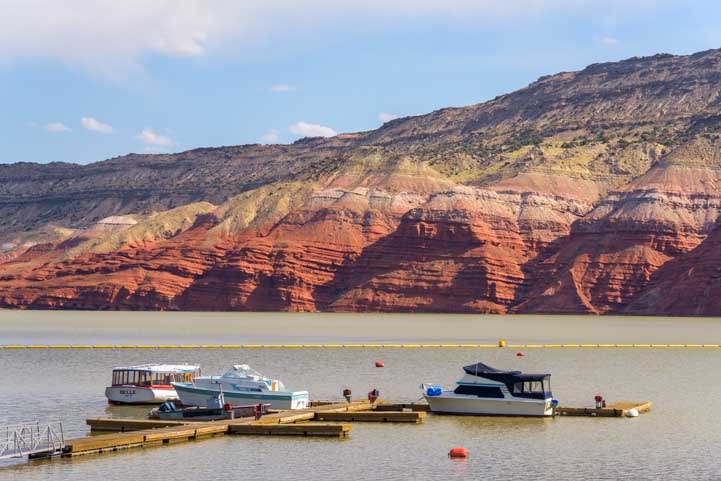
In the distance we could see Wahwheap Marina which is loaded with houseboats and big cruising boats along with smaller power boats. Many are available for rent, and we made a mental note to return someday to get out on the water. It wasn’t in the cards for this trip, though.

Wahwheap Marina is set against a jaw-dropping backdrop!

Not a bad place to have a boat — and some of them are huge!
The size and scale of the Glen Canyon Dam hydroelectric project is staggering. Lake Powell began filling with water on March 13, 1963. It didn’t finish filling up until seventeen years later on June 22, 1980!
On a plaque by the dam there are photos of Sentinel Rock which towered 200 feet in the air from the banks of the Colorado River at the bottom of the canyon before the dam was built. Once the lake was full, Sentinel Rock was submerged under 300 feet of water!
The lake is not a big round lake. Instead it consists of a long arm of the Colorado River with 90 water filled side canyons coming off of it on either side like tentacles. One of the best spots to see these bright blue tentacles is at Glen Canyon dam.

.

.
Over 5 million people visit the Glen Canyon Recreation Area which each year. They come for all kinds of outdoor fun from boating to hiking, camping, taking photos and playing in the water. Spring and Fall are great because the weather is warm but not too hot. All summer long, the lake teems with people and boats.
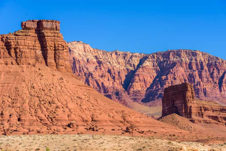
The whole area is rich with breathtaking sights, and a drive along US-89 is a journey past towering red rock drama. Now-famous Horseshoe Bend is just a few miles south of Glen Canyon Dam. Amazingly, it was unknown to residents of Page just 60 years ago.
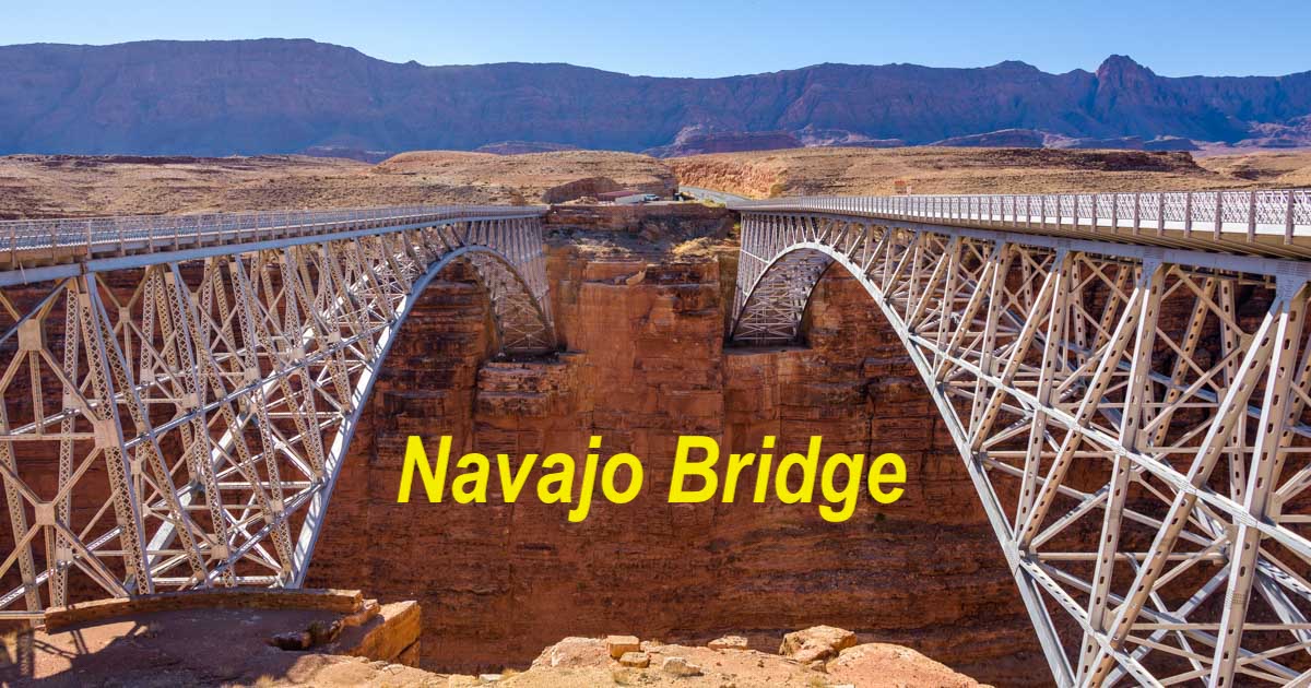
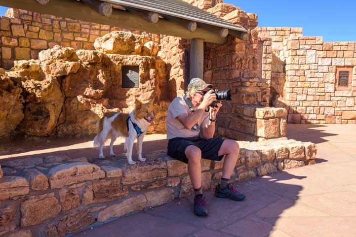
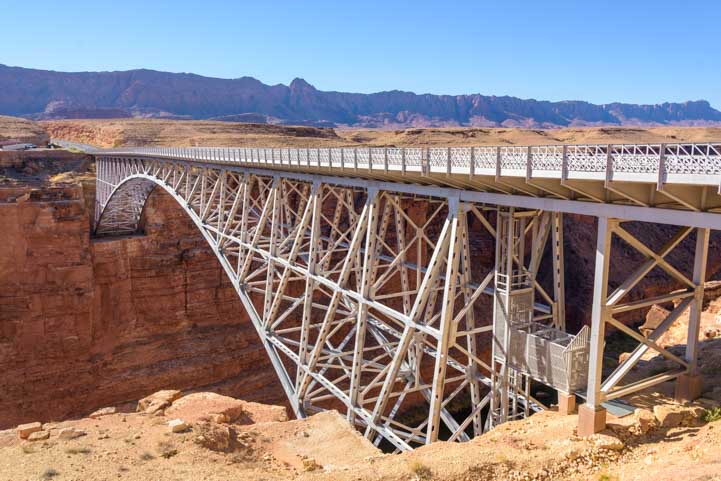
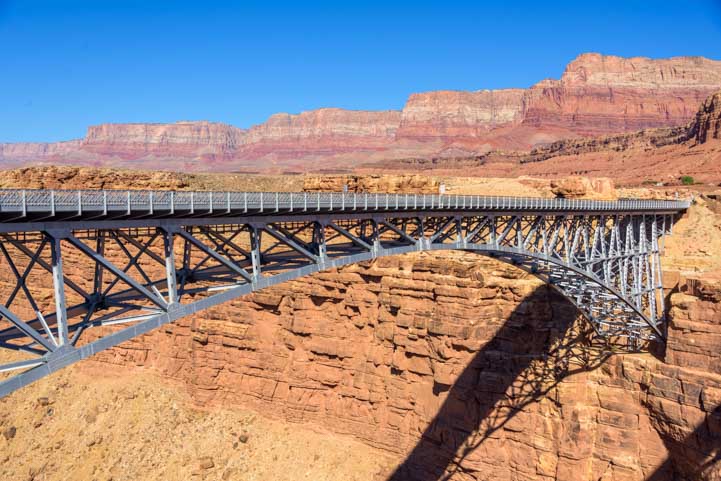
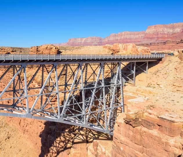
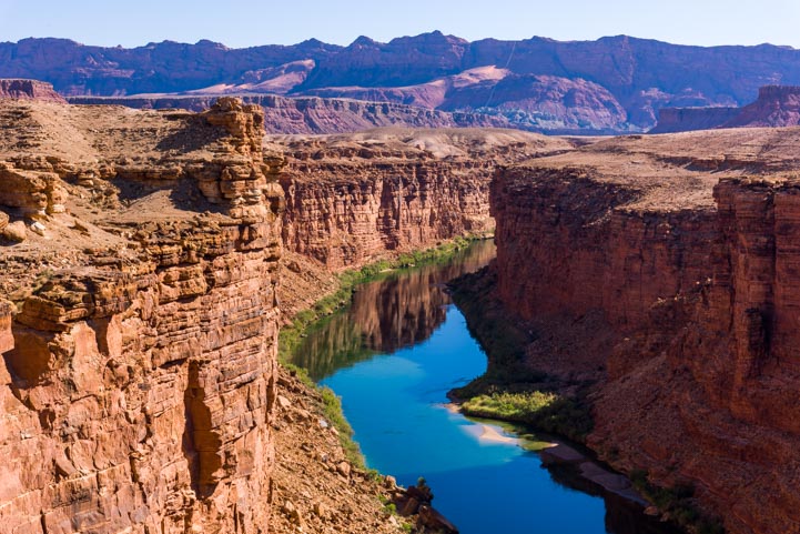
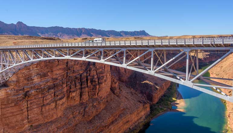
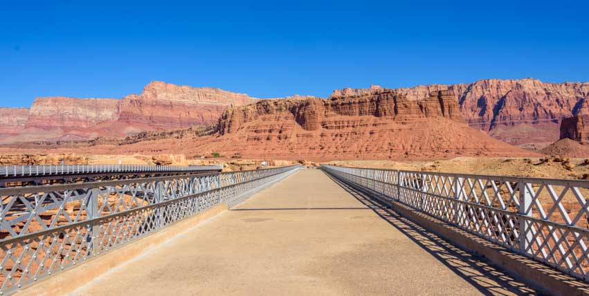
Just a few miles southwest of Glen Canyon dam as the condor flies, US-89 meets up with US-89A at a sharp turn and then reveals the wonders of Navajo Bridge, Lees Ferry and Marble Canyon and “Cliff Dwellers” as you head west. This is Canyon Country, and for travelers coming up into Utah from Arizona, it is the beginning of some of the most majestic scenery America has to offer.

Looking at the far shore of Lake Powell from Wahwheap Overlook.
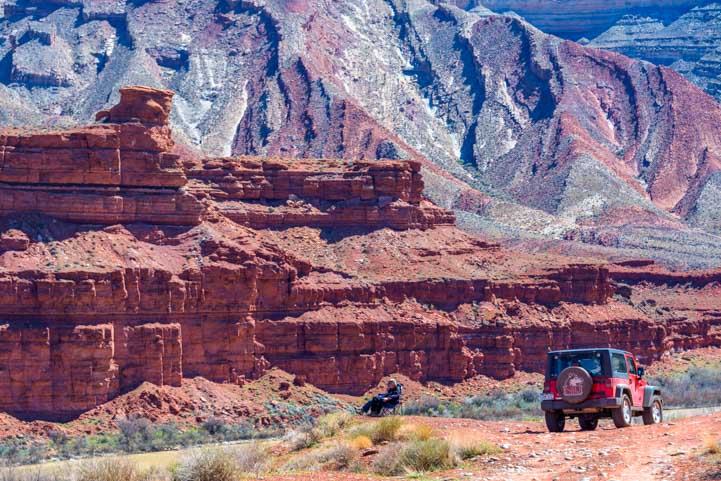
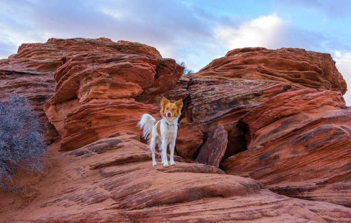
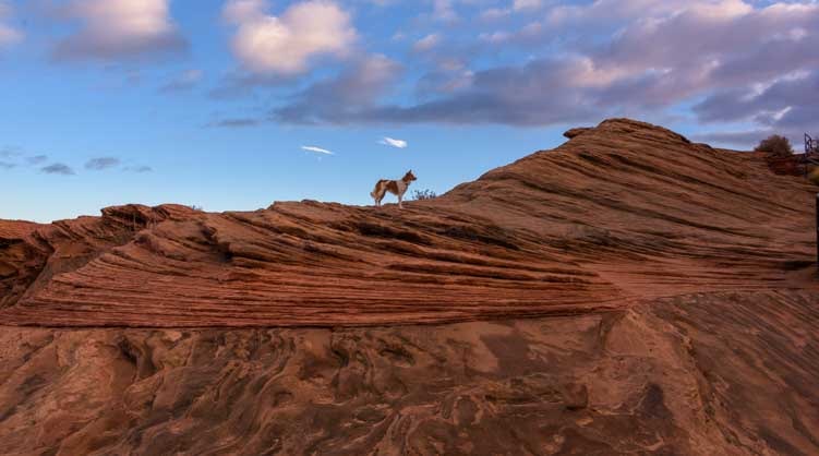
Glen Canyon Dam has large parking areas on either side of it, and you can walk all over the huge boulders that line the sides of the canyon. Buddy and I dashed off to explore the boulders — it was just so inviting!
We could hear Mark yelling, “Be CAREFUL!” far behind us. The wind was whipping, and he was afraid we’d go over the edge into the water far below. However, even though it looked like we were on a dangerous precipice, we were actually quite safe with several shelves of boulders stair-stepping down a ways before we’d be anywhere toppling over into the fast flowing water.

What a place for photography!

We used two of these solar panels to upgrade our toy hauler's factory-installed 200 watt system to a 600 watt system.
See our DIY installation here:
RV Solar Power Upgrade

Buddy’s fur was flying.
The rocks had wonderful lines and shapes. Buddy disappeared into a small slot canyon and then reappeared, trotting happily towards me.

Dog heaven.
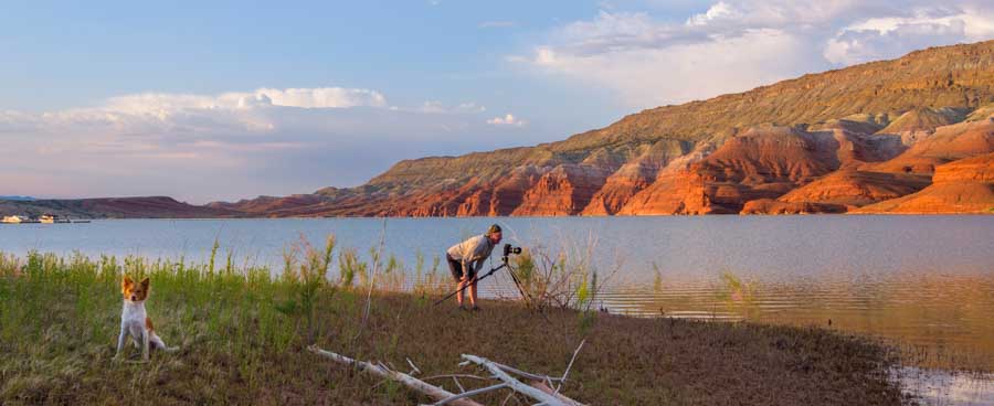
As I said, Glen Canyon and Lake Powell are stunning at any time of day, but some of the coolest scenes happen early. We returned to the Wahwheap Overlook scenic drive at dawn and waited for the first wink of sunlight to appear across the lake.

Good morning, Lake Powell!

.
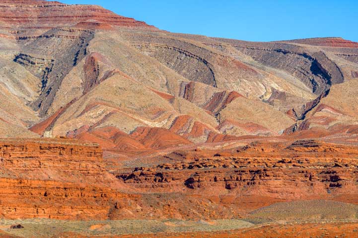
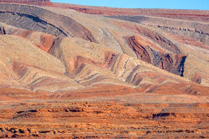
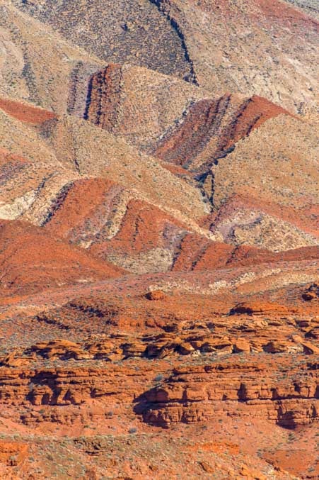
The far side of the lake backs up to some wonderful mesas and rock pinnacles. I loved the layers and shapes of the mesas and stone pinnacles in the misty distance.

Layers upon layers…
As the sun rose, highlights appeared on the rocks and cliff faces. This was a truly magical time of day. No one was around and the air was still.

Sunny highlights appeared as the land woke up.
A car drove on the road by behind me and then two more followed. I could hear them drive all the way to the boat ramp, and then I heard the rev of their boat engines as they took off. Suddenly a series of boats snaked through the canyon and disappeared into the deeper water beyond. Hopefully the fish were biting!

Fishermen make their way out to the best fishing grounds.
Glen Canyon Dam was controversial when it was built because many historical treasures and magnificent landscapes were lost forever beneath the Colorado River water that filled the lake. Before the dam was built, some folks thought the area deserved to be a National Park. Many felt it was unwise to build the dam.
Interestingly, most of America’s major dams were constructed at a time that followed decades of plentiful rain and snowmelt. The data the engineers were working from was biased towards wetter than normal conditions. However, at that time and even today, no one knows what the Colorado River was like in the 13th and 14th centuries when the ancient Indians abandoned their pueblos all across the southwest and Mexico due to intense and persistent drought. If that data could have been taken into account, Glen Canyon Dam and others might not have been built!

Lake Powell hovers around 50% of water capacity these days..
Oh well, that’s all water over the dam now. Lake Powell is gorgeous and we’ve just scratched the surface of all there is to see in Glen Canyon National Recreation Area.
Before you pack up and go, here are some notes about the seasons: Spring is a great time to visit Lake Powell, however it can be exceedingly windy. Like 40 mph gusts and dust devils. Summer has much less wind but is very hot. Fall is cooler than Summer and less windy than Spring. Our visit one January was exceptional because there were few tourists and the air was very clear after some winter rains. It’s chilly at that time of year, but it’s a great time to go!

Happy campers at Lake Powell
This little portrait of us was captured by a gal named Beth that we met on the trail. We were lamenting that for once we didn’t have our cameras, and the view was out of this world. She said, “I’ll get a pic of you three!” and she got it on her phone and emailed it to me. What a kind gesture that was, and what a great memento of that beautiful hike and view!


Never miss a post -- it's free!
More info about Glen Canyon Recreation Area and Lake Powell:
- Glen Canyon Recreation Area – Official Website
- Detailed History of the Dam – US Bureau of Reclamation
- Glen Canyon Dam Specs – Bureau of Land Management
- Glen Canyon Dam Controversy / – Glen Canyon Institute
- Rediscovering Lake Powell’s lost natural treasures – A modern day expedition plus tons of photos of the dams’s construction and dedication in the 1960s.
- Locations of Glen Canyon, Lake Powell and Wahwheap – Google Maps
Other blog posts from Canyon Country:
- “Cliff Dwellers” on Arizona’s Vermillion Cliffs Scenic Drive – A Fun Stop!
- A Glimpse of the Navajo (or “Diné” as they call themselves)
- Bighorn Canyon – A River Runs Through It in Montana!
- Black Canyon of the Gunnison National Park, CO – Steep and Deep!
- Blue Mesa Trail – Lavender Beauty in Petrified Forest National Park
- Bryce Canyon – Hiking The Rim & Navajo Loop + A Tourist Time-lapse!
- Bryce Canyon – Rainbow Point – Bristlecone Pines and Sweeping Vistas
- Bryce Canyon in Winter – Snow and Lace on the Red Rock Spires!
- Bryce Canyon National Park – Fairyland Trail – A Beautiful Hike!
- Canyon Country Highlights – Lake Powell, Horseshoe Bend & More!
- Canyon de Chelly – Breathtaking Views Under Vibrant Skies
- Canyon de Chelly, AZ – A Canyon of Indian Cliff Dwellings
- Canyonlands National Park UT – Island in the Sky (and Night Skies!)
- Canyonlands National Park Utah – Hiking in the Needles District!
- Dead Horse Point State Park, Utah – Magical Sunrises!
- Dolly Steamboat – Gliding Through the Arizona Desert on Canyon Lake
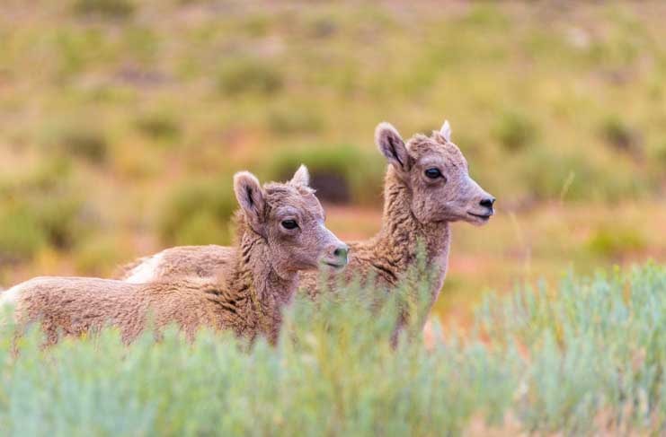
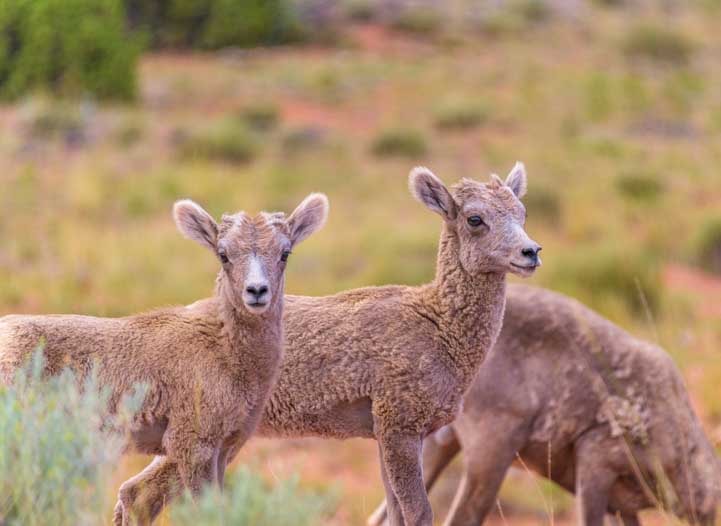
- Flaming Gorge Utah – Fiery canyons, a cool river, and nearly tame bighorn sheep
- From Salt to Snow in Nevada – Bonneville to Lamoille Canyon
- Grand Canyon – A Winter Wonderland with Snow!
- Hell’s Canyon – A Gorgeous Gorge!
- Horseshoe Bend Overlook – Page, Arizona – Stunning!
- Kanab – Hub for the National Parks + Gorgeous Canyons Nearby!
- Lake Powell – Heart of Glen Canyon National Recreation Area
- Lees Ferry & Marble Canyon AZ + Pretty Paria River Hike
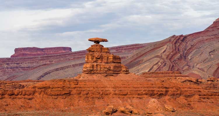
- Mexican Hat, Utah – A Special Hoodoo in the Red Rocks
- Monument Valley & Hite Scenic Overlook – Stone Towers from Below & Above!
- Mysteries in the Navajo Nation, Arizona
- Navajo Bridge, Arizona — A Scenic Roadside Attraction in Red Rock Country
- Navajo National Monument, Monument Valley and Bears Ears
- Newspaper Rock Utah – Petroglyphs and Rock Art from the Ancients
- Paria Rimrocks “Toadstools” Hike to A Hidden Canyon!
- Petrified Forest National Park RV Trip – Magic in Jasper Forest
- Point Sublime – A Wild Ride to a Stunning Overlook in Grand Canyon!
- Red Canyon Utah and the Bryce Canyon Bike Trail!
- Timp Point – A Private View of Grand Canyon’s Majesty
- Utah Scenic Byway 24 RV Trip – Capitol Reef National Park
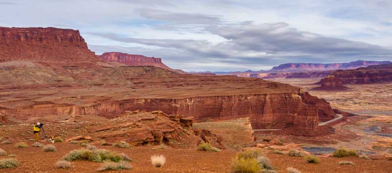
- Valley of the Gods & Goosenecks State Park, Utah – Beautiful!
- Wire Pass Trail – Slot Canyon Hiking!
- Zion National Park “West” RV Trip – Gorgeous Kolob Canyons!
- Zion National Park RV Trip – One AWESOME Canyon!
Our most recent posts:
- Buckskin Mountain State Park – Fun on the Colorado River! 01/31/26
- How to Install Starlink Gen 3 in an RV? Use the Speedmount! 08/07/25
- Escape to Paradise – Rocky Mountain Magic! 08/01/25
- Is Forest River a Good RV? Well Built? Here’s Our Experience 06/20/25
- Sunset Crater Nat’l Monument – Lava & Camels at Bonito CG! 06/06/25
More of our Latest Posts are in the MENU.
New to this site?
Visit RVers Start Here to find where we keep all the good stuff. Also check out our COOL NEW GEAR STORE!! *** CLICK HERE *** to see it!
<-Previous || Next->