Capitol Reef NP – Cathedral Valley – A Stunning Backcountry Drive in Utah!

September 2019 – One day, while enjoying the beautiful lakes and woods of central Utah, we took our RZR up and over a mountain and found ourselves staring down into a world of stunning red rocks: Capitol Reef National Park’s spectacular Cathedral Valley.

Cathedral Valley Capitol Reef National Park Utah

We took our RZR for a ride in sensational Cathedral Valley — WOW!

The road wound around through the mountain woods and passed a few small ponds and meadows and then branched off on a spur to an overlook. What a fabulous view!

View from a RZR Cathedral Valley Capitol Reef National Park Utah-min

The red rock towers of Cathedral Valley beckoned from a distance.

Lookout at Cathedral Valley Capitol Reef National Park Utah-min

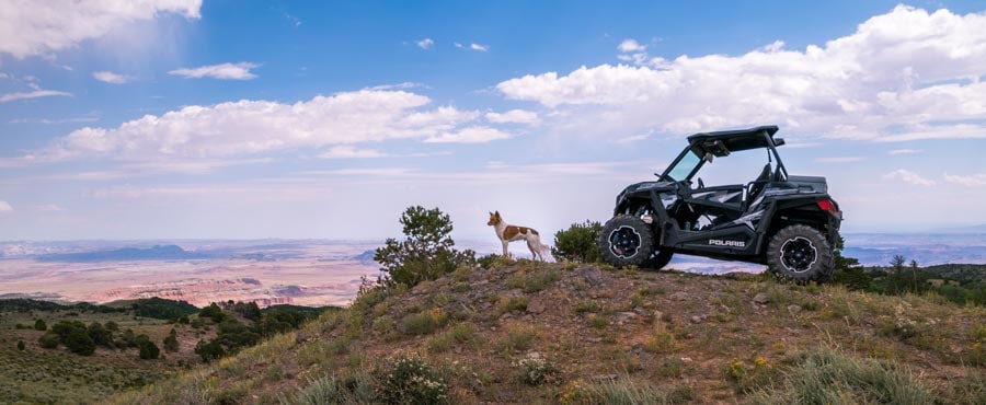
Buddy looks out at the astonishing view.

Cathedral Valley Capitol Reef National Park Utah-min

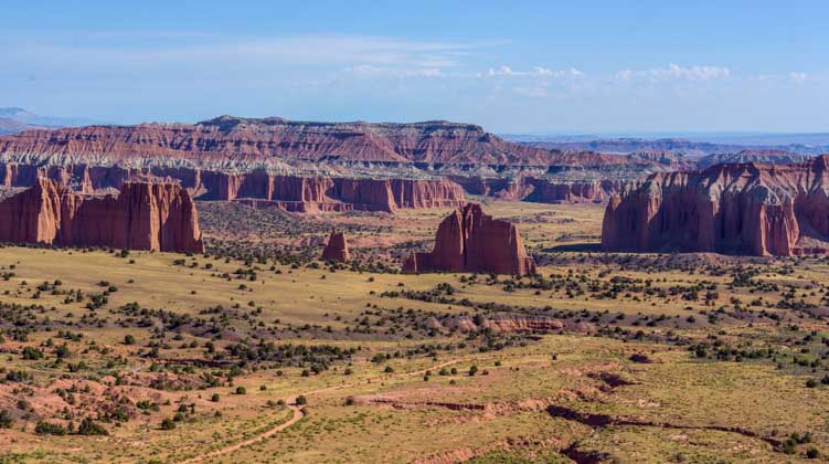
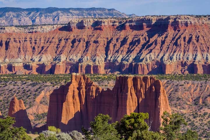
Cathedral Valley lay far below us.

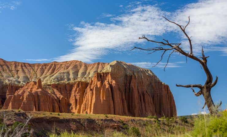
In the distance we could see a dirt road crossing the valley floor heading off towards the towering red rock cathedrals.

Road to Cathedral Valley Capitol Reef National Park Utah-min

A road through Cathedral Valley wound towards the pinnacles.

Towers in Cathedral Valley Capitol Reef National Park Utah-min

.

The road descended quickly and made some sharp switch-back turns.

First glimpse Cathedral Valley Capitol Reef National Park Utah-min

We got down towards the level of the valley floor.

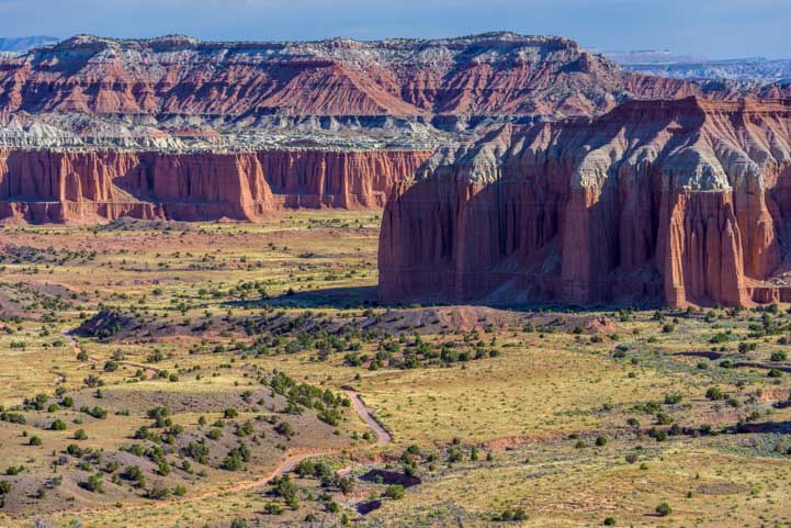
We stopped on a little promontory and wandered around on a narrow sandy trail. Such views!

View of Cathedral Valley Capitol Reef National Park Utah-min

Exotic stone towers seemed to jut up from the desert floor.

Cathedral Valley Capitol Reef National Park Utah views-min

.

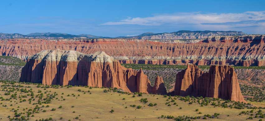
We rounded one final hairpin switchback turn and then the view widened. The towering cathedral pinnacles seemed within arm’s reach.

Cathedral Valley Capitol Reef National Park Utah view-min

“Cathedral Valley” is the perfect name for this place.

Cathedral Valley Capitol Reef National Park Utah pinnacle framed by tree-min

View through the branches of an old dead tree.

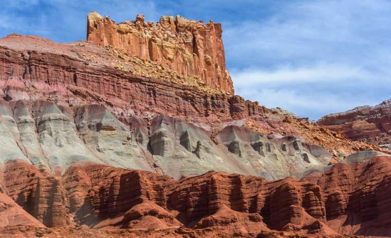
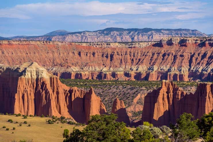
Some of the rock formations were sharp and jagged, while others had a more rounded and softer appearance.

Sandstone towers Cathedral Valley Capitol Reef National Park Utah-min

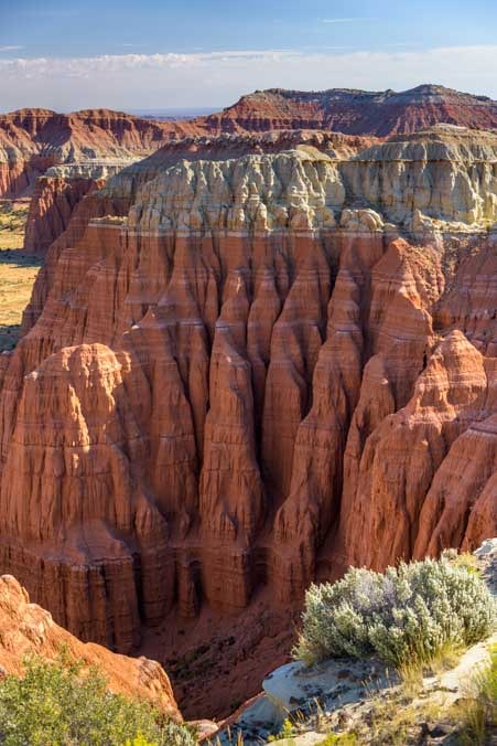
Some rock towers had knife-like edges. Others were softly rounded.

Striped sandstone formations Cathedral Valley Capitol Reef National Park Utah-min

Horizontal stripes and undulations

Pinnacles Cathedral Valley Capitol Reef National Park Utah-min

Varying shapes and layers.

Once we got down to the valley floor, our little canine trail scout, Buddy, insisted on showing us the way.

Puppy runs in Cathedral Valley Capitol Reef National Park Utah-min

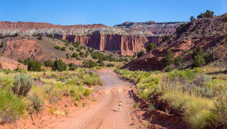
The views made Buddy want to run run run!

Puppy runs in Cathedral Valley Capitol Reef National Park Utah-min

What a place!

We were all alone in a fantastic and desolate land. The sun was warm on our skin and there were exotic red rock cliffs and pinnacles in every direction around us.

RZR side-by-side ride in Cathedral Valley Capitol Reef National Park Utah-min

Moon unit in a moonscape!

We hopped out of the RZR onto the sandy trail, and down at our feet we noticed that even though we felt like we were alone, there were lots of other creatures enjoying this beautiful place along with us.

Footprints in the desert sand-min

We were not alone out here!

Further down the road a thin wall of pinnacles rose up on one side of us.

Cathedral Valley Capitol Reef National Park Utah-min

Some pinnacle walls were very sheer.

Cathedral Valley Capitol Reef National Park Utah-min

.

At one spot there was a a U-shaped window in the thin wall.

Cathedral Valley Capitol Reef National Park Utah-min

The razor’s edge of the cliff wall can be seen in this unique window

Window Cathedral Valley Capitol Reef National Park Utah-min

.

A little further down the road we saw an old dead tree permanently arched as if blown by a persistent wind.

Old tree in Cathedral Valley Capitol Reef National Park Utah-min

.

As we progressed down the road we had to stop every 100 yards or so to get a closer look. Such beauty absolutely everywhere — it was breathtaking!

RZR side-by-side ride in Cathedral Valley Capitol Reef National Park Utah-min

We hopped in and out of the RZR a lot. There was just so much to see up close on foot!

Pinnacle peaks Cathedral Valley Capitol Reef National Park Utah-min

.

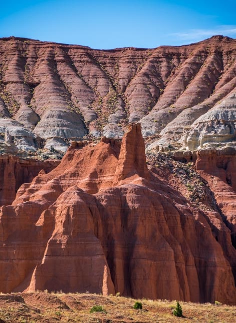
The name “Cathedral Valley” is perfect for this area. One formation in particular seemed to have buttresses along the flanks of the cathedral and a steeply pitched roof.

Cathedral buttresses and roofline Cathedral Valley Capitol Reef National Park Utah-min

All it needed was a tall steeple at the far left end!

While Nature has created these fabulous rock formations, ranchers have put their imprint on the land as well. We came across a small wooden building that was used by the cowboys of yesteryear when they brought their cattle to this valley for summer grazing.

There was a hitching post out front and a small corral for their horses off to the side. Inside was a table and set of shelves that held many of the relics that have been found around the property: rusty cans and utensils, bits of pottery, cookware and some leather straps and buckles.

There was a row of hooks on the wall for coats and cowboy hats.

Old cabin and hitching post Cathedral Valley Capitol Reef National Park Utah-min

We found an old cabin cowboys used to use in the summertime.

Window view old cabin Cathedral Valley Capitol Reef National Park Utah-min

It was ultra-simple living out here in this remote land, but I’m sure the cowboys loved it.

Back on the road we savored the views in every direction. While we snapped endless photos, Buddy pranced along on his own four paws.

Pinnacle in Cathedral Valley Capitol Reef National Park Utah-min

.

Puppy runs in Cathedral Valley Capitol Reef National Park Utah-min

These glorious open spaces make some people want to grab their cameras and other people want to run!

Cathedral Valley Capitol Reef National Park Utah puppy on the trail-min

Working up a thirst!

Water break

Ahhh! A cool water break in the shade!

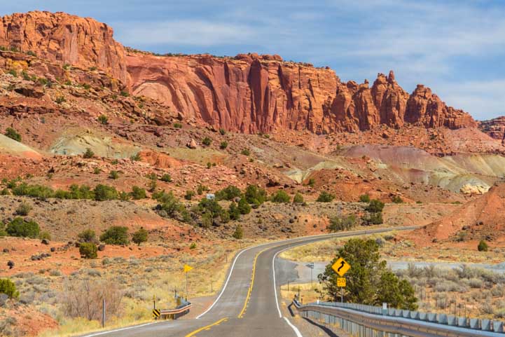
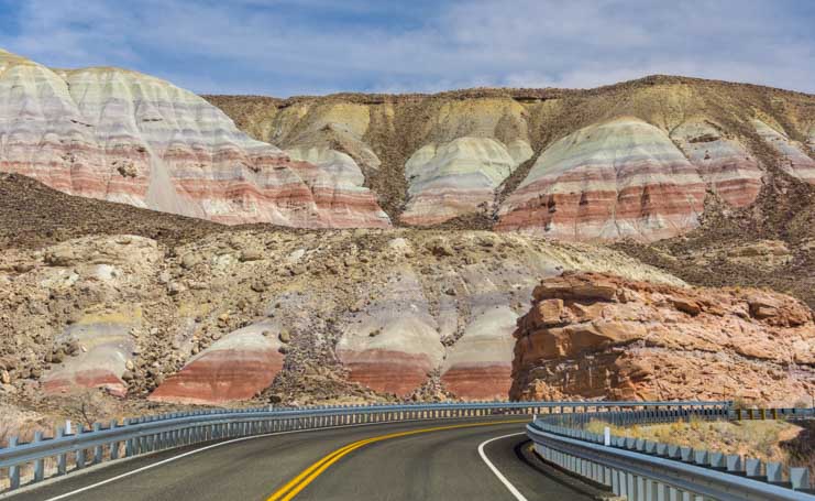
The back roads through Capitol Reef National Park are open to highway licensed vehicles, bikes, horses and hikers, and they are drivable with a 4×4 passenger vehicle if you take it slowly.

Some parts are narrow, steep, twisty and washboarded, and in a few places the road was covered with fairly deep sand, but we did see a pickup go by. We loved driving in our “little tank” because it is open air, it floats over the bumps and is so easy to hop in and out of.

Side-by-side RZR ride Cathedral Valley Capitol Reef National Park Utah

.

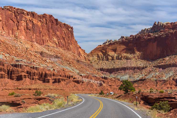
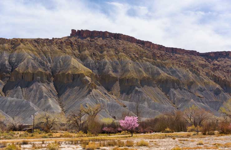
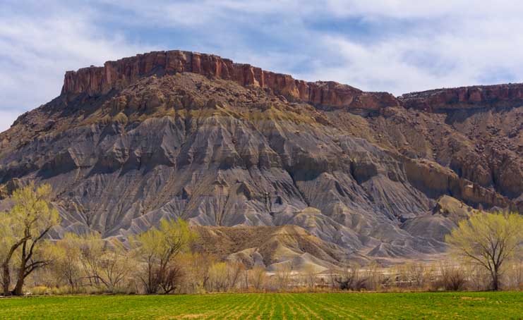
This remote back side of Capitol Reef National Park is gorgeous. As with all the National Parks, though, we recommend that first time visitors check out the sights by the front door of the Park at the outset.

After all, visitors centers and major overlooks are always located at the most spectacular spots, and there is much to see along the truly eye-popping Highway 24 “All American Scenic Drive” as it goes through the main part of Capitol Reef National Park before venturing into the Park via this more rough hewn back door!

Subscribe
Never miss a post — it’s free!

More info about Capitol Reef National Park:

More from Capitol Reef National Park:

Related articles from our RV travels:

Our most recent posts:

More of our Latest Posts are in the MENU.   New to this site? Visit RVers Start Here to find where we keep all the good stuff. Also check out our COOL NEW GEAR STORE!! *** CLICK HERE *** to see it!

<-Previous || Next->

Utah Scenic Byway 24 RV Trip – Capitol Reef National Park

April 2018 – Utah Scenic Byway 24 between the towns of Loa and Hanksville goes through Capitol Reef National Park and is one of the most spectacular scenic drives in America. We have been fortunate to drive it several times in each direction, and every single time our jaws have hung open for the entire 64 miles as we’ve been utterly blown away by the dramatic scenery and wild rock formations passing by our windows.

Here’s a series of photos showing how it looked from the passenger seat of our truck as we towed our trailer across the magical wonderland of Capitol Reef Country from west to east.

It started with a lovely view of red rocks as we rounded a bend.

Utah Byway 24 Capitol Reef National Park Scenic Drive-min

Our first big red rocks view begins to take shape on Utah’s Scenic Byway 24

Then our eyes popped open as the contours and texture of the land grew bigger and more complex.

Utah Highway 24 Capitol Reef National Park Scenic Drive RV trip-min

Wow!

Suddenly, we started down a hill and the view exploded in front of us and became knock-your-socks-off stunning!

Utah 24 Capitol Reef National Park Scenic Drive-min

Wow, Wow, WOW!

A group of horses and cows live in this view all day every day, so they weren’t quite as impressed.

Horses on Utah Scenic Byway 24 Capitol Reef National Park RV trip-min

.

But we were loving every minute as we drove head on into that view.

Utah Byway 24 Capitol Reef National Park Scenic Drive RV trip-min

.

Views on Capitol Reef National Park Utah Highway 24 Scenic Drive-min

View out the side window.

Utah Byway 24 is easily driven in an RV, even though there are lots of twists and turns and climbs and descents, and we saw plenty of RVs on the road.

RV on Capitol Reef National Park Utah Scenic Byway 24 Scenic Drive-min

There are lots of RVs on this route.

Capitol Reef National Park Utah Byway 24 Scenic Drive RV trip-min

The road curves, climbs and descends, but it’s easy driving.
Just don’t get too distracted by the sensational views and drive off the road!

Capitol Reef National Park Utah Route 24 Scenic Drive RV trip-min

.

RV on Utah Route 24 Capitol Reef National Park Scenic Drive-min

.

The red rock views just kept coming and coming and coming.

Capitol Reef National Park Utah Route 24 Scenic Drive RV trip-min

.

Red rocks Capitol Reef National Park Utah Route 24 Scenic Drive-min

.

Capitol Reef National Park Utah Route 24 Scenic Drive Red rocks RV trip-min

.

Exotic rock formations Capitol Reef National Park Utah Route 24 Scenic Drive-min

.

The heart of Capitol Reef National Park is an old Mormon farming community called Fruita. As we drove past the village on Utah Highway 24, we noticed that the trees were still showing off their nakedness for winter. However, on other spring and summer visits, we’ve seen these trees lit up in brilliant shades of green that are the perfect visual contrast to the red rocks and blue sky.

Trees and red rocks Fruita Utah Route 24 Scenic Drive Capitol Reef National Park RV trip-min

These trees turn vivid green in spring!

Trees and red rocks Fruita Utah Route 24 Scenic Drive Capitol Reef National Park RV trip-min

Trees line the road near Fruita.

Fruita is a beautiful and tranquil little community, and there are camping options, a fantastic scenic drive into the depths of the red rocks, and some terrific hikes to historic Mormon sites. We have a detailed blog post about some of the highlights of Capitol Reef National Park and the town of Fruita from our visit a few years back (blog post here).

However, on this trip we were just driving through on Utah Highway 24. So, on we went, reminiscing when we passed some favorite spots and then quickly becoming immersed in the majestic scenery of Utah Scenic Byway 24 once again.

We had left red rock country behind and were now driving between rock walls that Mother Nature had painted in lighter shades.

Rock canyon Utah Byway 24 Scenic Drive Capitol Reef National Park RV trip_-min

We’d left the red rocks but were still surrounded by dramatic canyon walls.

Pinnacles Scenic

.

.

Views Utah Route 24 Scenic Drive Capitol Reef National Park RV trip-min

.

Sheer walls Capitol Reef National Park Utah Route Scenic Byway 24 RV truo

.

There were still some hints of red rocks here and there, and we were mesmerized as we drove. A UPS truck went by in the opposite direction and we had to laugh. Surely, that driver has the best UPS route in the country!

Canyon walls Capitol Reef National Park RV trip Utah Highway 24 Scenic Drive-min

Not bad scenery for the few lucky folks who have to drive this route for work every day!

Canyon walls Capitol Reef National Park RV trip Utah Byway 24 Scenic Drive-min

.

Scenic Drive Capitol Reef National Park RV trip Utah Scenic Byway 24

.

Gradually, the soaring rock walls on either side of us receded, and the land opened up, punctuated by occasional towers of stone.

Scenic Drive Capitol Reef National Park RV trip Utah Route 24-min

.


RV Scenic Drive Capitol Reef National Park Utah Route 24-min

.

Scenic Drive Capitol Reef National Park RV trip Utah Route 24-min

.

Scenic Drive Capitol Reef National Park RV trip Utah Route 24-min

.

Scenic Drive Capitol Reef National Park RV trip Utah Route 24-min

.

RV Scenic Drive Capitol Reef National Park Utah Byway 24-min

.

Then the rock formations changed shape and the rock walls were filled with steep and angular channels that were carved with Nature’s sharpest chisels.

Exotic landscape Capitol Reef National Park Utah Scenic Highway 24 RV trip-min

Fine chisel work…

We were no longer in Capitol Reef National Park, but the landscapes in Utah pay no attention to such artificial boundaries. Utah Scenic Byway 24 was still giving us a magic carpet ride through some of the most exotic scenery America has to offer.

Desert landscape Capitol Reef National Park Utah Scenic Byway 24 RV trip-min

.

Rock uplift Capitol Reef National Park Utah Route 24 Scenic Drive by RV-min

Massive rock uplifts make faces.

The chiseled walls returned, but the cows grazing underneath didn’t notice.

Spectacular landscape Capitol Reef National Park Utah Highway 24 Scenic Drive by RV

Dinner with a view!

Flowering tree Capitol Reef National Park Utah Highway 24 Scenic Drive by RV-min

A pink tree shows off its springtime finest.

Farm field Capitol Reef National Park Utah Scenic Byway 24 by RV-min

.

As we neared the hamlet of Hanksville, the road took a few final sweeping turns past some walls of stone.

Stone canyon Capitol Reef National Park Utah Highway 24 Scenic Drive by RV-min

.

Towering rock formation Capitol Reef National Park Utah Scenic Byway 24-min

.

And then, in a final burst of glory, we passed a “mitten” rock formation that seemed to be advertising some of the other wonders of America’s southwest. “If you liked this road, you should check out Monument Valley!” it seemed to be saying.

Capitol Reef National Park Utah Route 24 Monument Valley lookalike-min

A mitten formation reminds us of Monument Valley.

What a glorious drive that was! I looked over at Mark to exchange happy glances and did a double take. Hey, who was doing the driving?

Puppy drives the truck and trailer

.

We will never tire of driving the many wondrous scenic drives in Utah, and Utah Scenic Byway 24 is well worth experiencing many times in both directions. It attaches to Scenic Byway 12 and the fabulous Bicentennial Highway and is close to the little known Burr Trail too.

Even if your itinerary doesn’t include visiting Capitol Reef National Park for its hikes and camping, if you happen to be in southern Utah, treat yourself to an east-west detour and spend a few hours driving Utah Scenic Byway 24!

Subscribe
Never miss a post — it’s free!

More info about Utah Byway 24 and Capitol Reef National Park:

Other “Do Not Miss” Scenic Byways we have loved:

Our most recent posts:

More of our Latest Posts are in the MENU.   New to this site? Visit RVers Start Here to find where we keep all the good stuff. Also check out our COOL NEW GEAR STORE!! *** CLICK HERE *** to see it!

<-Previous || Next->

Capitol Reef National Park Utah – Awe-inspiring!

Capitol Reef National Park captivated us with its natural afternoon light show at Sunset Point, its Mormon history at the Pioneer Register and the natural rock Hickman Bridge. Capitol Reef National Park: Sunset Point. Vivid colors come to life at Capitol Reef National Park: Sunset Point.

Vivid colors come to life.

Capitol Reef's Sunset Point is a romantic spot for taking photos. Sunset Point at Capitol Reef National Park.

Mark disappears in the vast landscape.

Evening shadows at Sunset Point Trail, Capitol Reef Nat'l Monument.

Late afternoon shadow-play at Sunset Point.

Evening shadows at Sunset Point Trail, Capitol Reef Nat'l Monument. Twisted trees resemble driftwood on an inlad vermillion sea.

Twisted trees resemble driftwood on

an inlad vermillion sea.

We were way too excited to sit down!

Utah wildfire smolders int the distance.

A wildfire puffs smoke in the distance.

Spectacular views along Capitol Reef's

Views along the park's "Scenic Drive"

An antique plough sits out in a field.

An antique plough sits out in a field.

Pioneer Schoolhouse at Capitol Reef.

Pioneer Schoolhouse

The Capitol Gorge wash where pioneers arrived by car.

...and now.

Capitol Gorge Wash then...

It must have been exciting to

arrive here.

Pioneer Register, Capitol Reef National Park.

Hiking to the Pioneer Register.

Pioneer Register, Capitol Reef National Park.

Pioneer names from September

24th, 1910.

M. Larson, Nov. 20th, 1888

M. Larson, Nov. 20th, 1888

Wildflowers soften the canyon walls.

Views from the Golden Throne Hike at Capitol Reef Nat'l Park

Looking down from our hike to

the Golden Throne

Gnarled trees on the Golden Throne hike.

Gnarled trees on the Golden

Throne hike.

End of Trail.  And there's the Golden Throne.

End of Trail.  And there's the Golden Throne.

Views from Capitol Reef's

Views from the park's "Scenic Drive"

The setting sun plays with light and shadow on the rocks at Capitol Reef, Utah.

The setting sun plays with light and shadow on the rocks.

Gifford Homestead Barn, Fruita, Utah.

Gifford Homestead Barn

Horse grazing at Gifford Homestead.

Not a bad spot to graze.

Hickman Bridge at Capitol Reef NP

Hickman Bridge

Mark admires the view of Hickman Bridge.

Admiring the view.

Capitol Reef National Park & Fruita, Utah

Mid-June, 2012 - After our energetic hikes in Natural Bridges National

Monument and our awe-inspiring drive along the Bicentennial Highway

(Route 95), we were geared up to for more immersion in Utah's red rocks.

We found exactly that at Capitol Reef National Park in Utah.

On our first afternoon

in the area we visited

Sunset Point, a perfect

spot to watch the sun

fall lower and lower in

the sky.  The vivid

colors came to life in

the late afternoon.

It is a dramatic

setting - a

wonderful place

to get a photo of a

loved one with a

soaring backdrop.

There were clouds

in the sky, and

they wafted past

us overhead,

casting shadows

and playing with

the sunlight as

they passed.

Dead tree stumps were twisted into exotic shapes here and

there, looking a bit like driftwood that had been washed ashore

somehow in this burnt orange desert land.

Park benches invited us to take

a load off, but we were way too

busy running up and down the

hiking trails -- trying to see

everything at once -- to even

think about sitting down.

Off in the distance a

new wildfire smoldered.  A nearby plaque stated that this part

of Utah boasts some of the cleanest air in the continental US,

but the smattering of wildfires that were burning at the time

weren't helping that claim.

We wandered among the red rocks until the disappearing

sun had quietly stolen all their colors away.

Capitol Reef National Park is a

long skinny park (~5 miles wide

by ~50 miles long) that runs on a

north-south axis along the

Waterpocket Fold which is a

huge buckle in the earth's crust.

There are loads of backcountry

roads and trails leading to wild

and remote places, but on this

visit we stuck to the easy-to-

reach hikes.

The tiny community of Fruita is at the heart of this area, and Mormons settled there in the late

1800's.  By 1917 they had a bustling village filled with orchards.  Cherries, apricots, peaches,

pears and apples are still grown here, but we were just a little too early to take advantage of any of the harvests.

Remnants of Fruita's past still remain

along the edges of the scenic drive

through the park.  An old plow and a

pioneer schoolhouse were reminders of

a bygone era.

This area was extremely difficult to

reach for those pioneers, due to the

rugged terrain of the Waterpocket Fold,

but a route coming in did exist along the

bottom of a wash through Capitol

Gorge.  Between 1871 and the early

1940's Mormons arrived via this route,

first by horse and buggy and then by

car.  Looking at my photos afterwards I

noticed that Mark had been standing

pretty close to the spot where a photo

from the National Park Service showed

an antique car going through.

It took a group of men eight days to move all the boulders out of a 3.5 mile

stretch of the Capitol Gorge wash so it could be traversed by vehicles.  Then two

cars could just barely pass side by side.  Today the wash is regaining its natural

state and there are boulders and thickets of plants growing where it once must

have been smooth enough for a car to make it through.

As the arriving pioneers passed the towering cliffs, a lot of them stopped to

carve their names in the flat parts of the stone walls.  Today it's called the

Pioneer Register, and we saw names and dates from the late 1800's all the way

to 1942.  It is hard to imagine what those determined, rugged and travel-weary

people must have felt as they passed through this gorge to a new life.  Little kids

with grubby hands must have peered out the windows of the cars, while

flustered moms tried to keep all their kids in tow.  I can't imagine the exhaustion

and exhilaration they must have felt.  Yet the town where they were arriving

didn't even have the paved campground loops, the gift shop full of coffee table

books or the flush toilets that it does today.

In my excitement of spotting

a list of names high up on

one wall, I hastily took a

photo without looking

closely enough at what I

was shooting.  I managed

to get all the names in the

list but cut off the date -- it

was September 24th 1910.

Still mulling over the

immense changes that

have taken place in the

world since the last signatures from the 1940's were pecked out on these

walls, we started up the initial ascents of the Golden

Throne hike.  This hike took us to the tops of the rock

cliffs where we had magnificent views looking down on

the road far below.

Gnarled trees greeted us as we climbed higher and

higher, until finally -- and rather abruptly -- we came to a

sign that said "End of trail."  Behind it was the trail's

namesake Golden Throne, a huge round yellow rock.

Making our way back along the park's

simply named "Scenic Drive," the late

afternoon light was playing with the

rocks again, a game of hide-and-seek

that involved brights and shadows

on the burgundy rocks.

A lone barn belonging to the historic

Gifford Homestead and a horse

munching the grass in the pasture

across the street spoke of the

immense peace of this place.  The

trees rustle so softly and the birds

chirp so quietly.  The bustle of the

campground and the arriving cars of

tourists seemed to suddenly hush,

as if everyone knew to act as if the

were in a library in honor of the calm

that resides here.

If the pioneers had a tortuous trip getting

here, once they arrived and got settled they

must have paused for a moment on many a

luscious afternoon and murmured "This is

God's country," because it is, even today.

We fell under the area's spell and decided to do one more hike

before moving on down the road.  Hickman Bridge is a rock

bridge that is a cousin to the three bridges we had seen at

Natural Bridges National Monument.  It is an easy hike in to see

it, but once there we found it hard to get it lined up in such a way

as to prove that it was indeed a bridge.  The other rocks and cliffs

all crowd around it, like a city swarming around a man-made

bridge, and only when you get

underneath can you get it

framed against the sky.

Mark gave up trying to capture

it on camera and simply sat

across the way admiring it, legs

folded and very content.

As has been the theme for us

this season, the heat of summer

began to catch up with us and soon we were pushed a little further

north in Utah to Koosharem Reservoir and Fish Lake where the

fiery red rocks gave way to cool green mountains and seagulls

flying over the water.