Chief Joseph Scenic Byway – Mountain Majesty Near Yellowstone NP

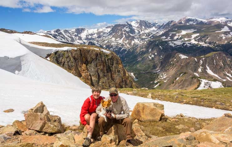
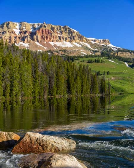
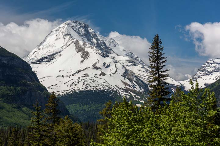
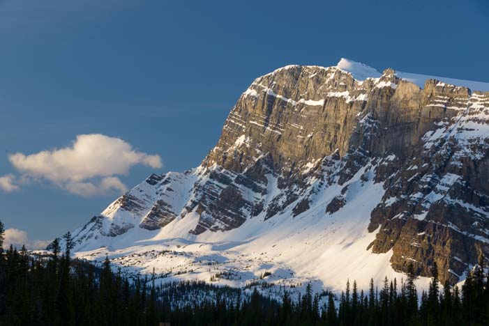
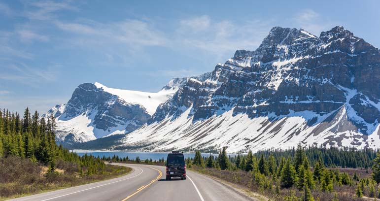
July 2018 — The Chief Joseph Scenic Byway is a gorgeous scenic drive that forks off of the Beartooth Highway in Wyoming. It’s not as well known as the Beartooth Highway, but the views are jaw-dropping.

Mountain scenery Chief Joseph Highway Wyoming RV Trip

Views on the Chief Joseph Scenic Byway near Yellowstone in Wyoming

We had driven the Beartooth Highway several times as an out-and-back trip from Red Lodge, Montana, our mouths forming a permanent “Wow!” every time we drove it.

And each time we passed the turn-off from the Beartooth Highway onto the Chief Joseph Scenic Highway we craned our necks, wondering what that other scenic drive was like.

Chief Joseph Scenic Highway Wyoming RV Trip-min

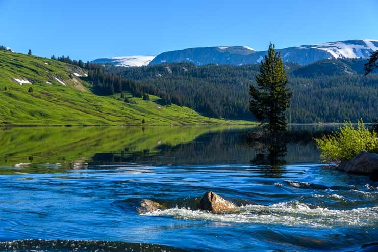
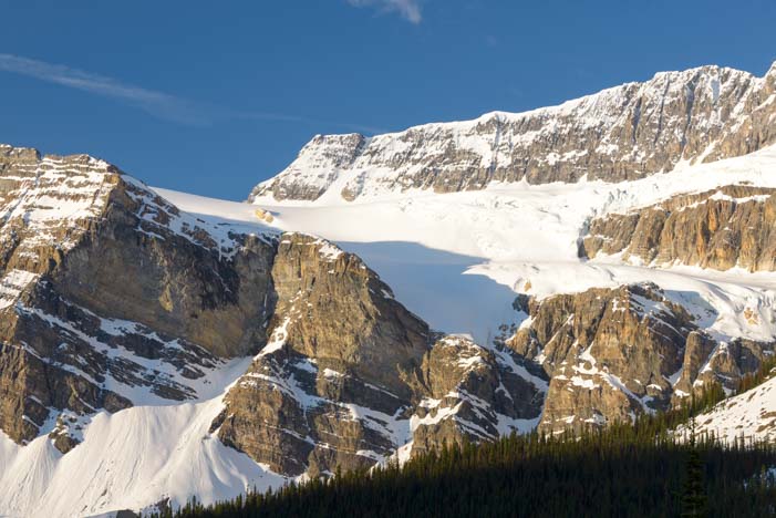
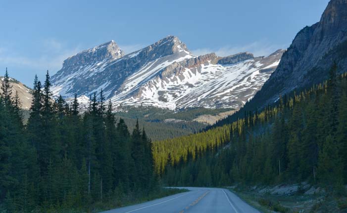
The Chief Joseph Scenic Highway wanders through the mountains.

After spending a very special 4th of July in Cody, Wyoming, we used that town as a home base to drive the gorgeous Chief Joseph Scenic Byway out to where it interesects with the Beartooth Highway and back again.

We loved it so much we drove it a few more times, catching it in a different light on each drive.

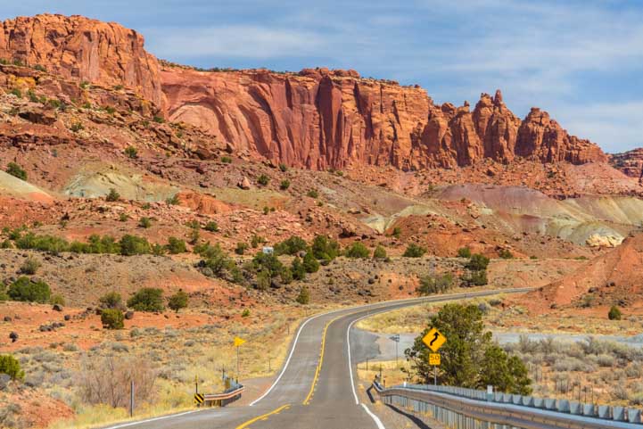
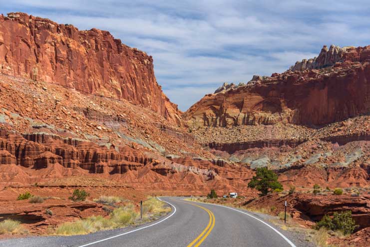
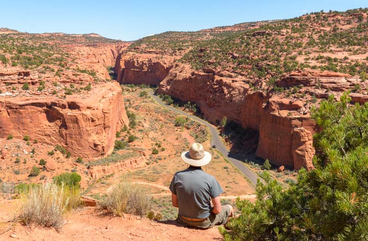
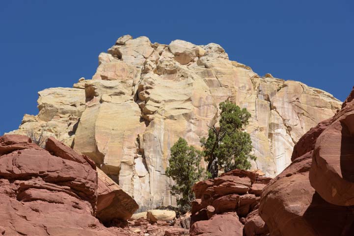
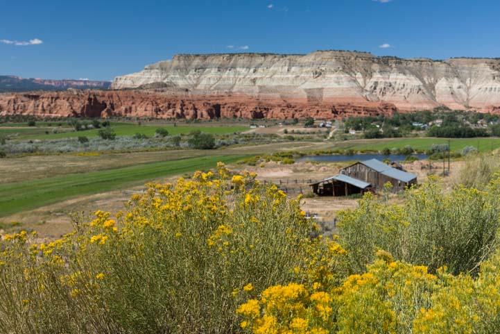
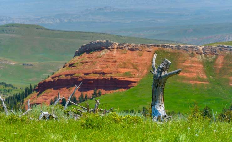
Not far from the start of the Chief Joseph Scenic Byway (which is about 17 miles northwest of Cody), we rounded a bend and were shocked to see some huge outcroppings of red rocks. It was a little touch of Utah right there in Wyoming!

Chief Joseph Scenic Byway Wyoming Red rocks and green grass-min

Turning a big sweeping corner we came across some red rocks peeking out of the greenery.

We think of Wyoming as being home to tall craggy mountains and woods and open grasslands. What a beautiful surprise to see red rocks glowing orange in the late afternoon sun.

Red rocks on Chief Joseph Scenic Highway Wyoming RV trip-min

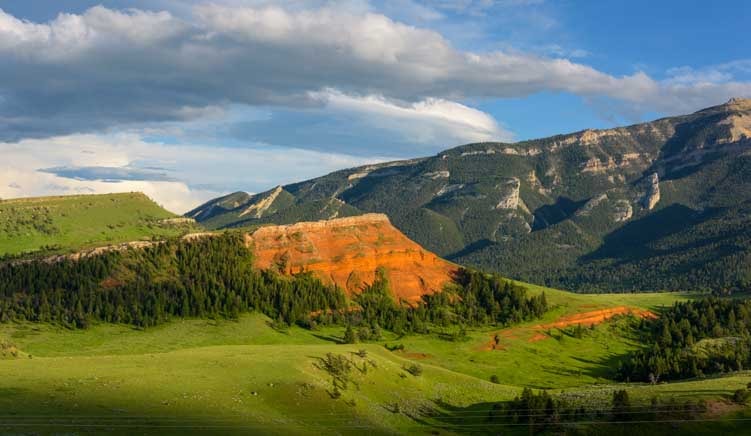
At the golden hour just before sunset the red rocks lit up in vivid shades of orange.

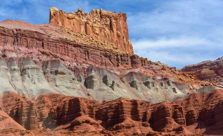
The rain had fallen so consistently for so many weeks during the spring that everything in Wyoming was green and lush. The red rock hillsides were partially covered in a thick layer of tall grasses and green trees. From a distance it almost looked like moss.

Green grass and red rocks Chief Joseph Highway Wyoming RV trip

Intense rains had made the grass surrounding and growing on the red rocks very lush.

Green grass and red rocks Chief Joseph Highway Wyoming RV trip-min

From a distance the greenery may have resembled moss, but these red cliffs are immense and you can see evergreen trees growing on the hillsides.

We got out of the truck and wandered around on the hillsides for a while. An old, bleached tree trunk looked like it had it’s arms outstretched to the heavens!

The Hills Are Alive with the Sound of Music in Wyoming-min

It’s Julie Andrews singing “The hills are alive with the sound of music!”

Dead tree and red rocks Chief Joseph Scenic Byway Wyoming RV Trip-min

Another bare tree trunk finds new life among the red rocks.

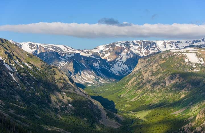
A little further on we came to a fabulous overlook at the Dead Indian Summit. There is a big viewing platform and the view is out of this world.

Afternoon storm clouds Chief Joseph Scenic Highway Wyoming Dead Indian Summit-min

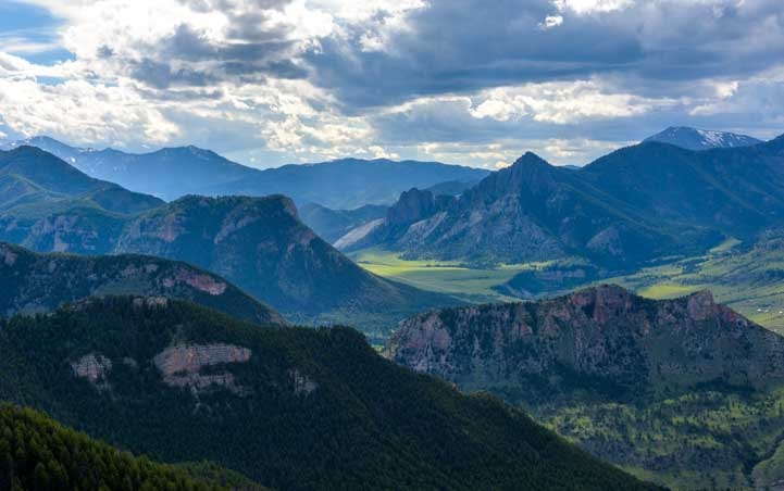
At Dead Indian Summit the views went on forever.

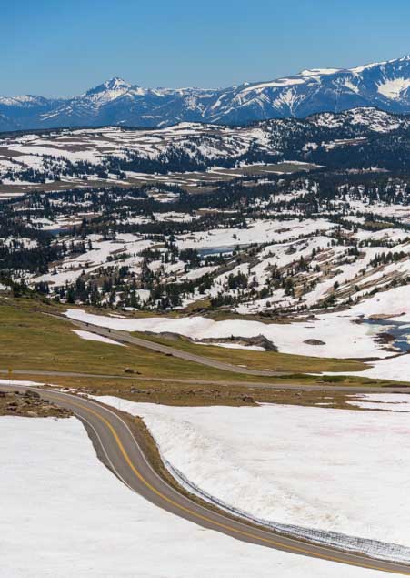
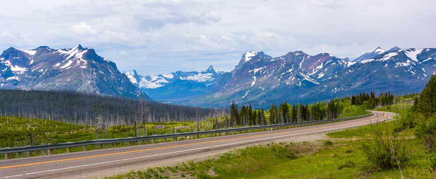
We could see the Chief Joseph Scenic Byway snaking through switchbacks into the valley below.

Chief Joseph Scenic Highway Wyoming Dead Indian Summit RV trip-min

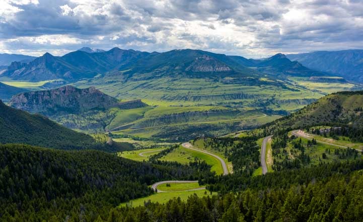
The Chief Joseph Scenic Byway wanders down into the valley with lots of switchbacks.

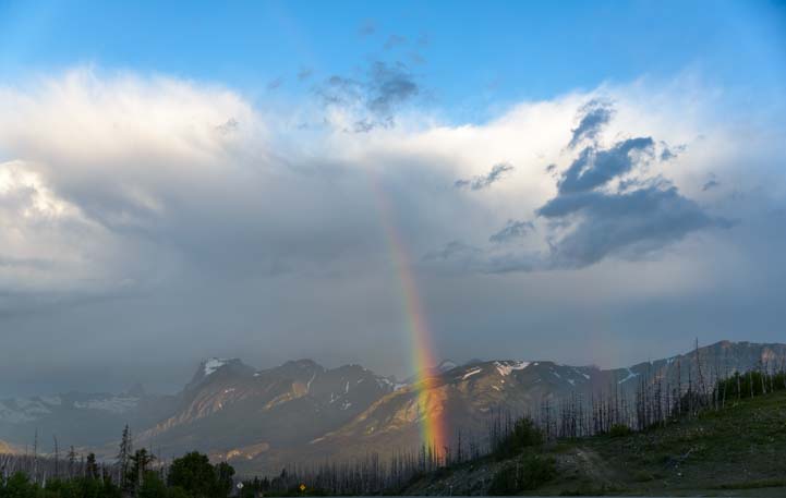
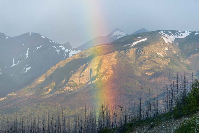
We had arrived in late afternoon, and the view was backlit by the sun. We thought this overlook might look best in the morning with the early morning light filling all the nooks and crannies, so we got out of bed before dawn one morning to catch the sunrise at the summit overlook.

We needed cloud cover in the west that would pick up the beautiful colors of sunrise slightly after the sun rose in the east. But we wondered if we’d done the right thing as an incredible sunrise developed behind our backs, mostly blocked by a large berm. Arghh!!

However, just as we were giving up and figuring we’d blown it and the sunrise was going to be a one-part-of-the-sky-only event, suddenly the clouds to the west in front of us began to turn a soft pink.

Sunrise Chief Joseph Scenic Highway Wyoming RV Trip Dead Indian Summit-min

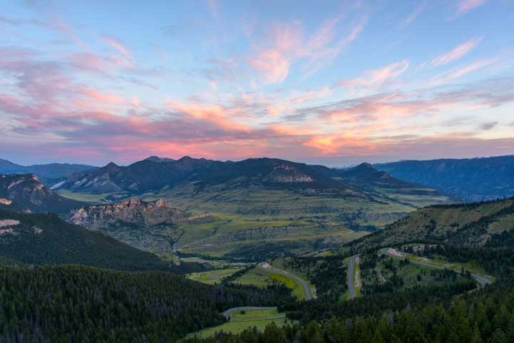
Same Dead Indian Summit view at sunrise!

It turned out to be well worth the pre-coffee driving adventure to get there in time for this celestial show, and we were so glad we hadn’t given up and had stuck around long enough to let the sunrise creep across the sky from east to west.

Sunrise Chief Joseph Scenic Byway Wyoming RV Trip Dead Indian Summit-min

It was soooo worth getting out of a warm bed to come witness this sunrise!

Photographer at sunrise Chief Joseph Scenic Highway Wyoming RV Trip Dead Indiand Summit-min

Mark hung out on a cliff getting great pics.

As the sun rose higher, the mountaintops lit up and wild daisies began to slow dance in the soft breeze.

Wildflowers Chief Joseph Scenic Byway Wyoming RV Trip-min

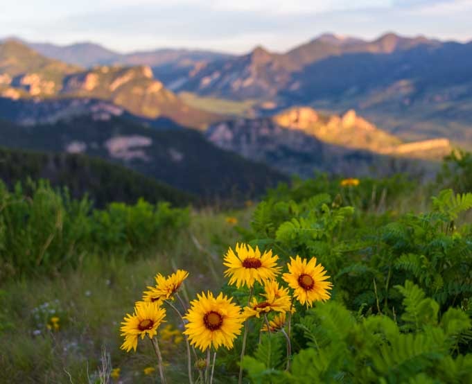
Once the sun crested the horizon the distance peaks lit up in delightful contrast to the big yellow daisies at my feet.

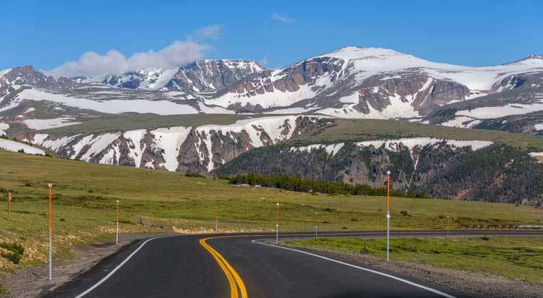
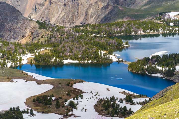
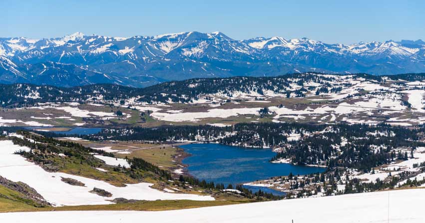
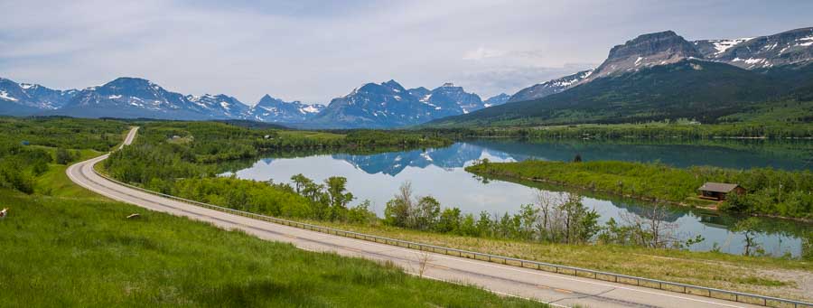
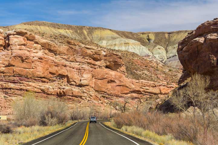
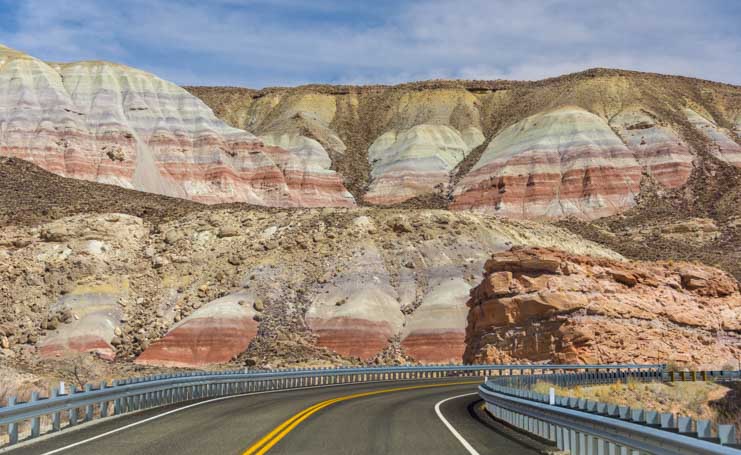
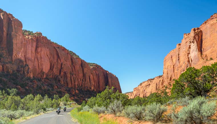
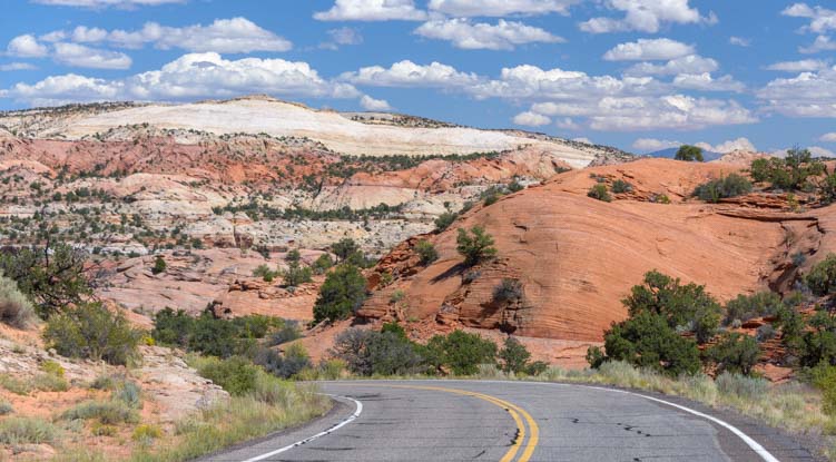
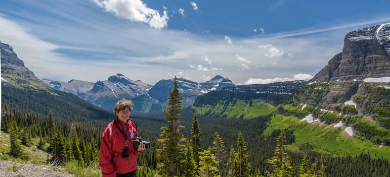
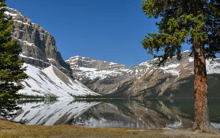
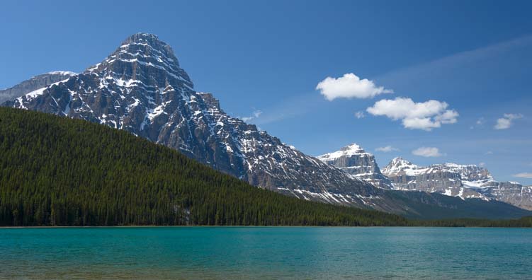
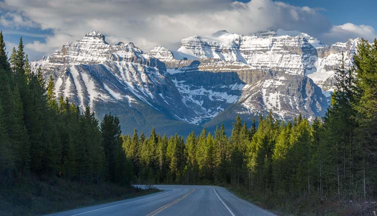
The Chief Joseph Scenic Highway is a dramatic drive through the mountains, and we savored every view. Fortunately there are lots of pullouts where you can stop to take pics!

Mountain views Chief Joseph Scenic Highway Wyoming RV Trip-min

The Chief Joseph Scenic Highway offers many glorious vistas.

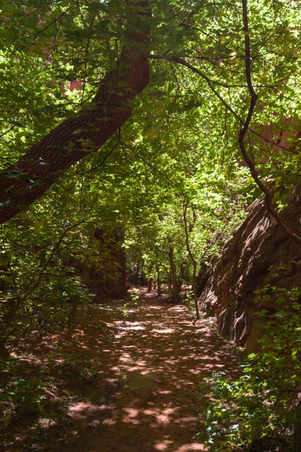
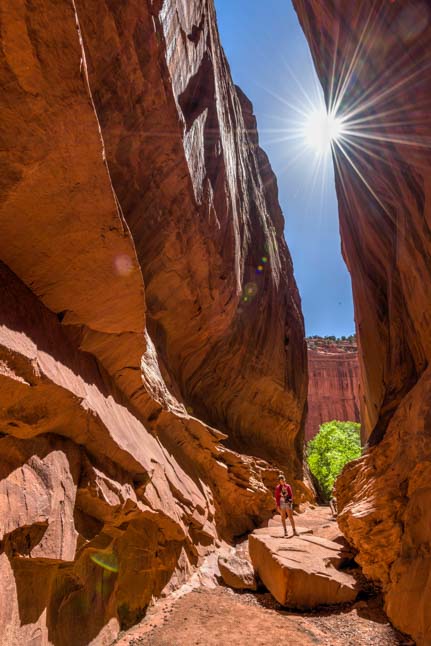
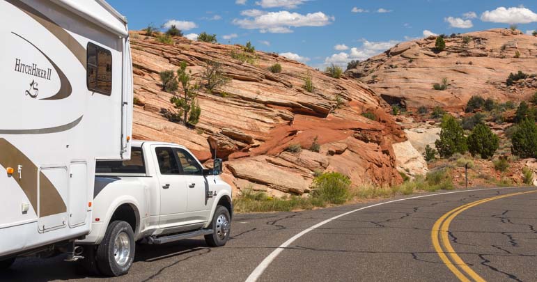
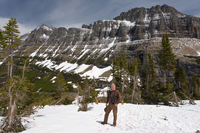
But some of the best experiences were down the dirt roads and hiking trails that wander away from the main drag.

Trotting puppy on a hike in Wyoming-min

We enjoyed hiking a few of the trails and dirt roads.

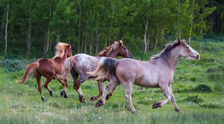
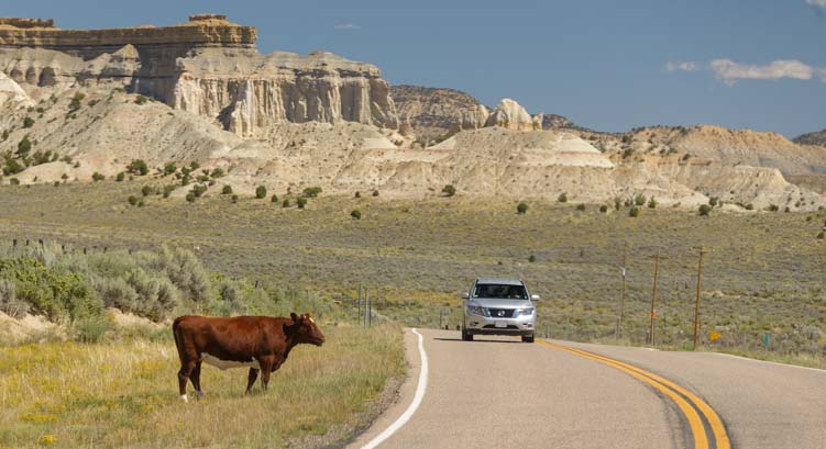
While we preferred hiking on our own two feet (or four paws), others were out on horseback. We bumped into a group of cowboys who had just done a cattle roundup on the other side of the mountain.

Horseback riders Chief Joseph Scenic Byway Wyoming RV Trip-min

These cattle ranchers had just finished rounding up a herd of cows!

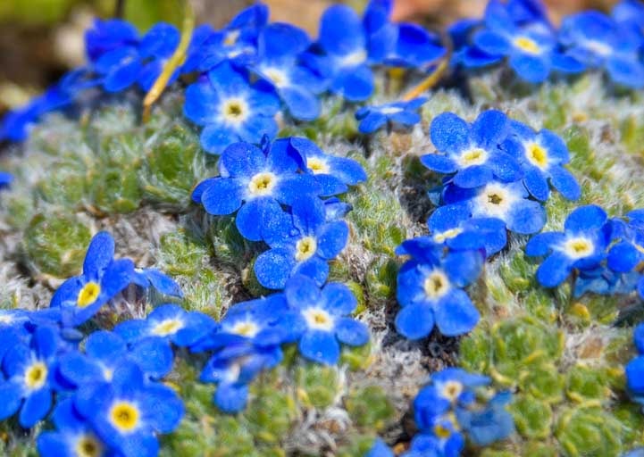
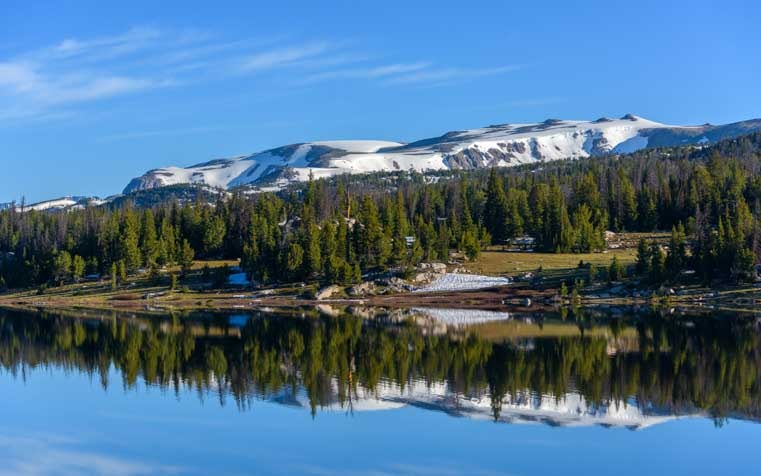
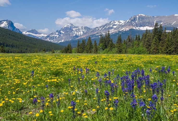
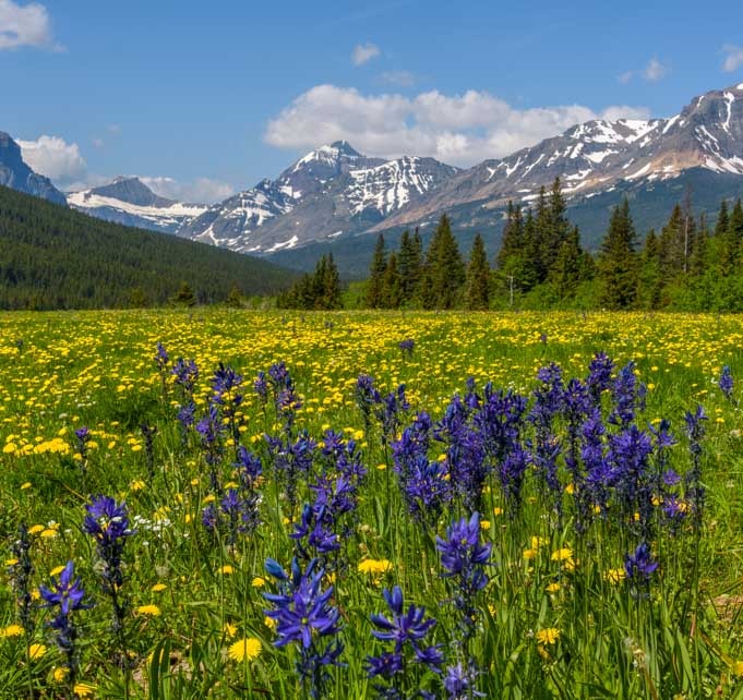
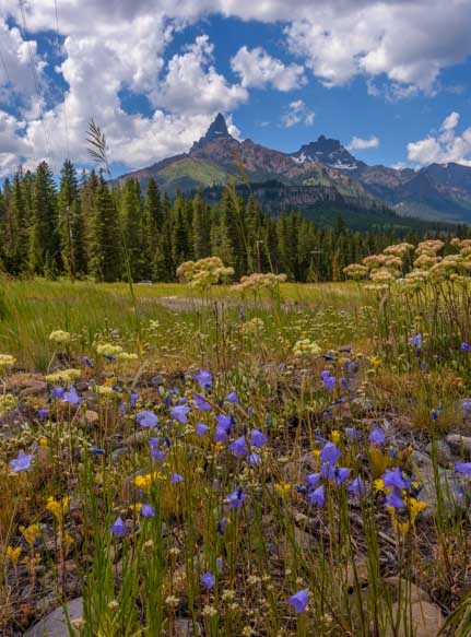
Everywhere we went along the Chief Joseph Scenic Byway the wildflowers were out sunning themselves, giving the landscape a colorful and cheery air.

Wildflowers Chief Joseph Scenic Byway Wyoming-min

Colorful bouquets created by a divine hand.

We took a gazillion photos, and couldn’t fit them all into one blog post. So here are a few more!

Photographing wildflowers in Wyoming-min

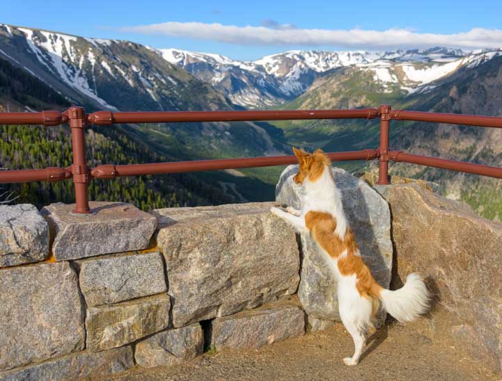
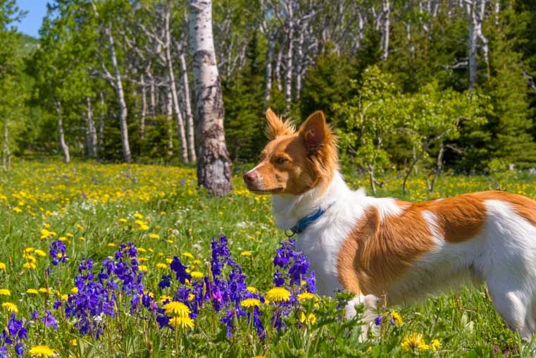
Buddy and I wandered into the flowers to get a closer look (and take pics!).

Puppy playing in the wildflowers-min

Buddy gives Mark a sly look as he takes his pic!

Wildflowers in the Wyoming woods-min

.

Wild yellow daisy-min

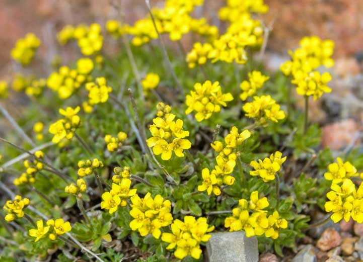
There were yellow daisies with yellow centers and with brown centers — all kinds of yellow daisies!

Indian paintbrush wildflowers in Wyoming-min

Such cool patterns.

Wildflowers Chief Joseph Scenic Highway Wyoming RV Trip-min

I couldn’t have planted such a beautiful garden if I tried!

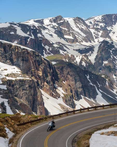
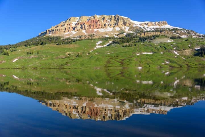
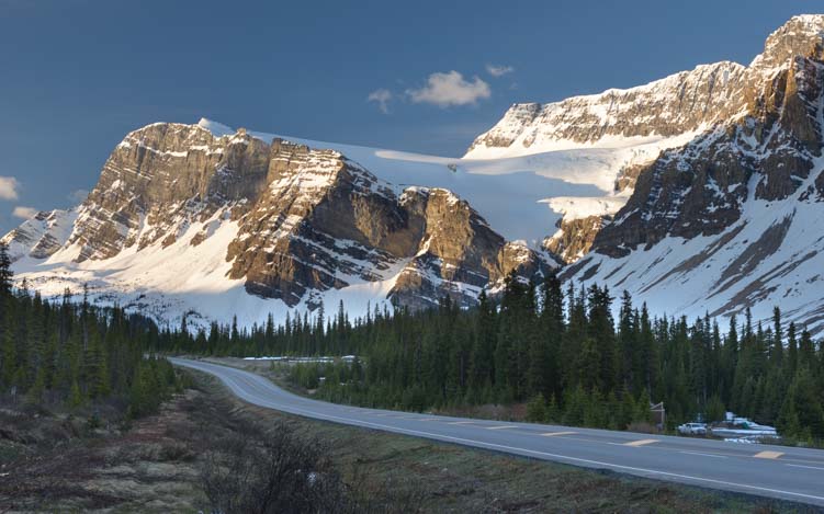
The Chief Joseph Scenic Highway eventually connects to the Beartooth Highway, and we couldn’t resist driving a little of that majestic scenic drive once again. Such gorgeous vistas!

Beartooth Highway Wyoming RV trip-min

An incredible view on the Beartooth Highway!

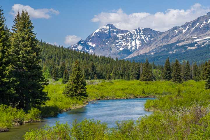
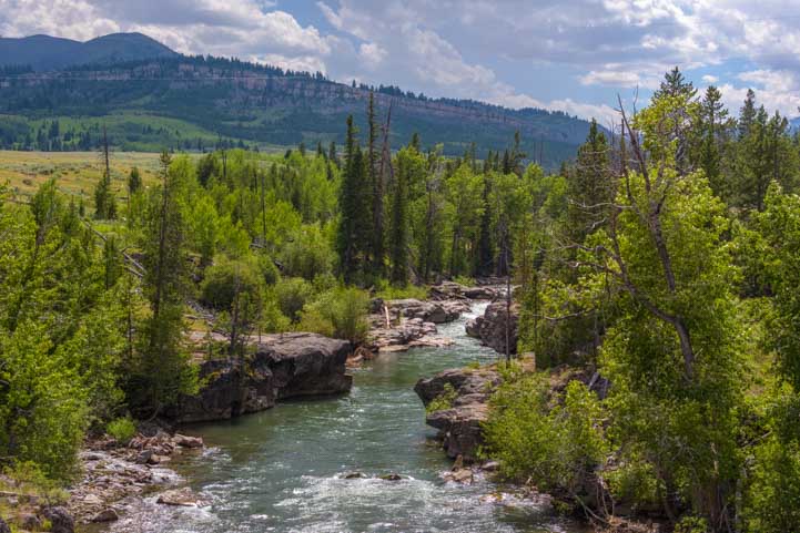
The Clarks Fork of the Yellowstone River was running fast and free.

Chief Joseph Scenic Highway Wyoming RV Trip-min

Right out of a brochure.

Waterfall Chief Joseph Scenic Byway Wyoming RV Trip-min

A waterfall cascade caught our eye as we drove over a bridge.

Backlit Waterfall Chief Joseph Scenic Highway Wyoming RV Trip-min

.

Wildflowers Chief Joseph Scenic Byway Wyoming RV Trip-min

Wildflowers were in bloom everywhere on the Beartooth Highway. What luck!

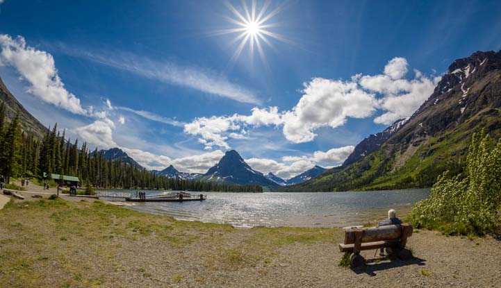
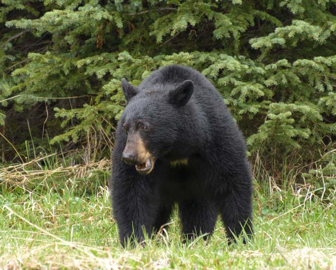
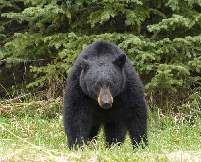
At the tiny village of Cooke City we stopped to stroll around. There are a few boutique shops and cute eateries. Buddy saw his first grizzly bear up close outside one store. Luckily it was stuffed!

Puppy meets stuffed grizzly Cooke City Wyoming-min

“My, what big teeth you have!”

If you are traveling to Yellowstone National Park, save a few days to drive the Chief Joseph Scenic Highway out of Cody, Wyoming, and/or the Beartooth Highway out of Red Lodge, Montana.

Or, if you want to do it all in one day, do a circle loop that includes both scenic drives (map link below) using Red Lodge, Cody or Cooke-City as a starting and ending point.

Sunrays on Chief Joseph Scenic Byway Wyomng-min

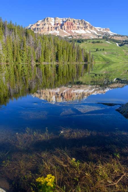
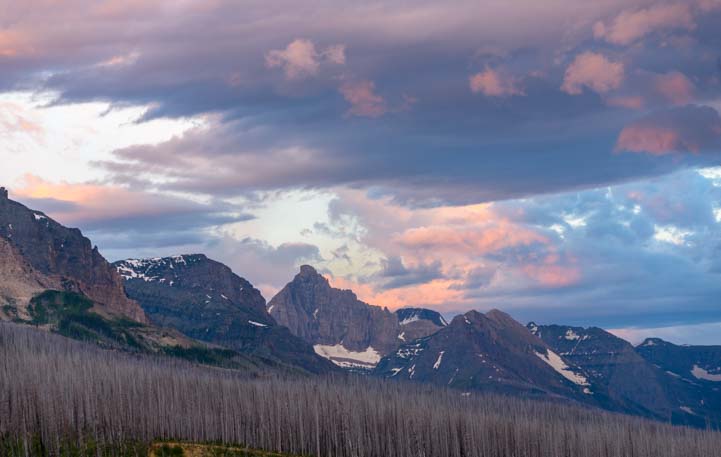
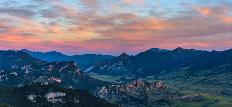
Sunset on the Chief Joseph Scenic Byway

Subscribe
Never miss a post — it’s free!

More info about the Chief Joseph Highway:

Other blog posts from Wyoming:

Our most recent posts:

More of our Latest Posts are in the MENU.   New to this site? Visit RVers Start Here to find where we keep all the good stuff and check out our GEAR STORE!!

<-Previous || Next->

Beartooth Highway Scenic Drive – Dazzling All American Road – WOW!!

June 2018 – The Beartooth Highway is a spectacular scenic drive in Montana and Wyoming that is so awe inspiring it has been given the well deserved designation of “All American Road.” Few roads in America have been singled out for this distinction, and the others we have driven knocked our socks off.

So, it was with great anticipation that we set out from Red Lodge, Montana, to drive the 69 miles of steep and arduous switchbacks into the heavens, passing endless sweeping vistas and stunning alpine lakes as we made our way towards the northeastern entrance of Yellowstone National Park in Wyoming.

Entrance to the Beartooth Highway Montana RV trip-min

A glimpse of things to come on the Beartooth Highway scenic drive.

The first snow capped mountain peaks crept into view between towering rock walls on either side of the highway shortly after we left Red Lodge, and then we drove straight into the sky until we had a fabulous view of it all at the Rock Creek Vista overlook.

Views on the Beartooth Highway Montana RV trip-min

Magnificent views of the Beartooth Mountains from Rock Creek Vista overlook.

This first formal lookout has a big parking area and a low rock wall to keep people and puppies from falling over the edge.

Puppy at Rock Creek Vista on Beartooth Highway Montana RV trip-min

Buddy liked the view too!

After the long grind going up the mountainside, our sweet pup Buddy loved seeing the view from the top! But he was most interested in the chipmunks that were scampering around on the ground!

Puppy on Beartooth Highway Montana RV camping-min

.

Rock Creek Vista overlook is just the first big viewing area on the incredible Beartooth scenic drive, and from that point on we were on top of the world with jaw-dropping views out our windows in every direction.

Beartooth Highway Wyoming scenic drive RV trip-min

With every bend in the road the views got better and better!

Snowcapped views on Beartooth Scenic Highway Wyoming RV trip-min

Light clouds teased the mountain tops.

Snowcapped mountains with clouds Beartooth Highway Wyoming RV trip-min

A recent snowstorm showed the mountains off in their Sunday best!

RV trip on Beartooth Highway scenic drive Wyoming-min

.

My camera shutter was clicking as fast as my fingers could go. When I turned to look at Buddy, his eyes were glued to the view too!

Puppy's eyes like saucers driving the Beartooth Highway in Wyoming-min

Buddy’s eyes were like saucers as we drove!

There are pullouts and overlooks all along the Beartooth Highway, and we had lots of chances to get out and stretch our legs and soak in the view.

Mountain views Beartooth Highway Wyoming RV trip-min

A view even a puppy can love!

The Beartooth Highway is closed during the winter months, and it opens over Beartooth Pass only when the road is fully cleared and safe to drive. It had been open for a few weeks when we drove it in late June, but a cold snap had drenched us with rain for a few days down in the valleys, and that same rain had buried Beartooth Pass in snow once again and had even closed it for a day or two right before our drive.

This divine intervention meant that we were treated to lots of snowy vistas and the views were just magnificent.

Beartooth Highway Scenic Drive Wyoming RV trip to the mountains-min

Wow!!!

Signs of spring were everywhere, though, and as we climbed through elevations between 7,000 and nearly 11,000 feet we saw a wide variety of wildflowers in bloom at each altitude.

Wildflowers Beartooth Scenic Highway in Wyoming-min

There were wildflowers blooming everywhere.

Snow and wildflowers Beartooth Highway scenic drive Wyoming RV trip-min

.

Some of these wildflowers are extremely tiny and delicate and not more than a pencil eraser in size!

Pink wildflowers Beartooth Highway scenic drive on a Wyoming RV trip-min

Pink jewels in the meadows.

Blue wildflowers on Beartooth Highway scenic drive in Wyoming-min

Tiny tiny sapphire blue flowers.

The flowers were blooming in every possible shade, and some meadows were filled with mixtures of yellow and blue and pink.

Tiny yellow wildflowers Beartooth Highway Scenic Drive Wyoming-min

A spray of yellow.

Magenta wildflowers Beartooth Scenic Highway Wyoming RV travels-min

Magenta delights.

Familiar wild lavender colored lupine bloomed in thickets here and there as well.

Wild lupines Beartooth Scenic Highway Wyoming-min

Familiar wild lupines stand tall.

One of the most dazzling images we found were the bright blue alpine lakes that shimmered in the sun between snowy banks.

Alpine lake Beartooth Highway RV scenic drive in Wyoming-min

What a view!

And patterns appeared on the hillsides showing a special kind of asymmetry that only the finest artist could render.

Gorgeous patterns Beartooth Highway Wyoming RV scenic drive-min

The snow made patterns on the mountainsides.

The Beartooth Highway is beloved by motorcyclists because it is truly the Ideal Ride. Groups of motorcycles and individuals were riding in both directions and loving the scenery with fresh air and no windows.

Motorcycle on Beartooth Highway scenic drive Wyoming-min

What a place to ride!!

At last we reached the actual Bear’s Tooth Pass.

The Bear's Tooth on Beartooth Highway scenic drive on Wyoming RV trip-min

.

Before we did this drive, back when we were down in Red Lodge, we had stopped into a cool metal works shop and started chatting with a gal who worked there. She had moved to Red Lodge so she could ski as much as her heart desired, and she spoke warmly of the spring skiing around the Beartooth Highway that begins on Memorial Day and continues through June.

We saw skiiers hitting the slopes, and gingerly walked out onto the thick snow ourselves. Much of the rest of America was experiencing a massive heatwave at that very moment, but up here on the Beartooth Highway life was cool.

Snow and puppy on Beartooth Highway scenic drive Wyoming RV trip-min

Buddy loved playing in the snow.

Photographer and puppy in snow on Beartooth Highway scenic drive in Wyoming-min

Truly awe inspiring!!

Our cameras were going full speed ahead, and so were everyone else’s too. This is a place where digital photography is a true blessing. I can’t imagine how many dozens of rolls of film we would have both gone through if we’d been using film cameras!

Puppy portrait Beartooth Highway scenic drive Wyoming-min

We got portraits and selfies…like everyone was doing…who could resist?

Selfie Beartooth Highway scenic drive Wyoming RV trip-min

.

In some places the snow banks along the highway were still 12′ high, and people were decorating the drifts with all kinds of graffiti. We had to add ourse too!

Love in the snow Beartooth Scenic Highway RV trip in Wyoming-min

We put our own graffiti on the snowbanks too.

And then, after cresting the top, we came upon the most incredible view that stretched for miles and miles out to the horizon. Just glorious!

Majestic views Beartooth Highway scenic drive Wyoming by RV-min

The view after cresting the summit took our breath away.

Majestic vista Beartooth Highway near summit on Wyoming RV trip-min

.

The Beartooth Highway deserves more than one cursory drive-through, and we ended up driving all of it or part of it on three separate occasions. This gave us a day with fabulous storm clouds and a day with perfect blue skies and lots of time to savor the various overlooks until we reached saturation and returned home, satisfied in our hearts that even if we “left early” we’d be back in a day or two to take in a little more.

It is best to hit the Beartooth Highway early in the day, and on our first trip we discovered that starting from Red Lodge at 7:00 a.m. wasn’t quite early enough! Lots of people have the same bright idea of starting early, so there was a surprising amount of traffic on the mountain.

We started out another day shortly after 6:00 a.m. and when we arrived at Beartooth Lake, which is easily seen from the road about 53 miles into the drive, the water was as still as glass and held reflections of the mountains like a mirror.

Beartooth Lake reflections Beartooth Highway scenic drive by RV in Wyoming-min

Beartooth Lake was perfectly calm in the early morning hours.

Reflections at Beartooth Lake on Beartooth Highway scenic drive by RV in Wyoming-min

.

We stopped at the overlook and then wandered down to the boat launch to see these wondrous reflections a little closer.

Mountain reflections Beartooth Lake on Beartooth Highway Wyoming RV scenic drive-min

.

A short stretch of rapids broke up the reflecting images in the most beautiful way.

Reflections at Beartooth Lake on Wyoming RV scenic drive Beartooth Highway-min

The mirror reflections were disturbed by some silky rapids.

Reflections and rapids Beartooth Lake on Beartooth Highway Wyoming-min

.

Reflections and rapids Beartooth Lake Beartooth Scenic Drive Wyoming-min

.

Where the water was still, the air was even more still. It was a crystalline moment in a world apart. As we stared at the view we were alone in the universe save for a few chirping birds in the trees.

Morning calm Beartooth Lake on Beartooth Scenic Highway Wyoming-min

On our return trip past the lake the wind was whipping.
How fortunate we were to see the water like this earlier on!

Like much of Montana and Wyoming, this area was deluged with snow and rain this year and the lakes and rivers were overflowing. As I looked into the water from the shore I was amazed to see a beautiful clump of yellow wildflowers happily blooming under a few inches of water!

Submerged flowers Beartooth Lake on Beartooth Scenic Highway Wyoming-min

Overflowing water submerged a bouquet of yellow wildflowers!

A little further on we came across the Crazy Creek waterfall. Here we could see and feel the extraordinary power of the waters that had been elevated and swollen by unusual amounts of snow and rain.

Crazy Creek Falls Beartooth Highway Wyoming RV trip-min

Wildly frothing Crazy Creek Falls.

The sound was deafening and the water was leaping and spraying across the path above the rapids.

Wild Crazy Creek Falls Beartooth Highway Wyoming RV trip-min

The water pranced and sprayed and exploded everywhere.

The Beartooth Highway ranks among the most stunning scenic drives we have ever done. How wonderful it is to find that even after eleven years on the road we are still making fabulous discoveries, and what a thrill it is to witness such an astonishing place.

Stunning vista Beartooth Highway Wyoming RV scenic drive-min

We’d never get tired of these views!

If you are taking an RV trip towards Montana or Wyoming, the Beartooth Highway is well worth a big detour to see.

Bigger RVs are not recommended on this road. There are signs suggesting that rigs longer than 40′ not drive it at all, and we saw less than a handful of Class C and smaller RVs. However, Mark felt fully confident that he could easily take our trailer on the drive if we wanted or needed to. We just wouldn’t have been able to stop so often or so easily, and it would have taken a lot of concentration on his part.

Beautiful scenic drive Beartooth Highway Wyoming RV trip

Beartooth Highway rates among the most spectacular drives we have done anywhere. Do it!!

POSTSCRIPT

A little while after we drove the Beartooth Highway, we met a trucker who has been in the road construction and trucking business for many decades. He told us that he had been hired to help film an Ice Road Truckers commercial on the Beartooth Highway a few winters back. Rather than fly the film crew to Alaska where the TV series takes place, it was much cheaper to film the ad here in Montana and Wyoming. So, they did it on the first switchbacks of the Beartooth Highway on the Montana side.

His stories were fantastic as he described the week-long creation of this video which was, in many ways, quite similar to the three days of filming we participated in as part of an ad campaign for Camping World last winter.

The film crew needed four inches of snow on the Beartooth Highway, so it was plowed to leave four inches of snow behind, and when that melted more snow was piled on to bring it up to four inches. A frightening sequence where the truck skids backwards down the mountain was actually filmed on level ground while he and his fellow workers pulled the truck backwards with chains attached to another truck.

The film director wanted to stage a horrific rollover accident, and he had some fancy and expensive equipment made to help simulate the rollover. However, the equipment was designed and built on the California coast, and the difference in altitude between there and the Montana Rockies wasn’t taken into account in the design and the equipment failed.

In classic down home fashion, the Montana boys on the film set said, “Hold my beer,” and huddled together to come up with a solution. Using a truck with chains again, they put chains under the semi and jerked back on them with to flip the truck on its side (with no one in it, of course). The film director was delighted with the perfect shot and said, “I didn’t need anything from California. All I needed were some good Montana boys!”

I’m not 100% sure that the following video is the actual ad or is perhaps just a bit of footage from it, but it is definitely an ice road trucker on the first switchbacks of the Beartooth Highway in Montana, and the various sequences appear just as described. Enjoy!

Subscribe
Never miss a post — it’s free!

More info about the Beartooth Highway and camping in nearby Red Lodge, MT:

Other blog posts featuring Top Scenic Drives:
(Check out the Utah Byway 12 “All American Road” in this list!)

Some pretty back roads drives in Montana and Wyoming

Our most recent posts:

More of our Latest Posts are in the MENU.   New to this site? Visit RVers Start Here to find where we keep all the good stuff and check out our GEAR STORE!!

<-Previous || Next->

East Glacier Scenic Drive – Treasures OUTSIDE Glacier National Park

June 2018 – America’s stunning National Parks get all the press, but sometimes the drive towards them is almost as beautiful. As we made our way to the eastern side of Glacier National Park in Montana via US-2, the image of a mountain reflecting in a pond caught our eye.

Mountain reflections in a lake at Glacier National Park Montana-min

US-2 is a beautiful drive. These pretty reflections made us stop.

We just had to pull over for a closer look. The day was a big gloomy but the landscape was lovely.

RV trip to the east side of Glacier National Park in Montana-min

.

The wildflowers were beginning to bloom, a perfect foreground for these snow capped peaks.

Wildflowers and mountains Glacier National Park Montana RV trip-min

Pretty wildflowers were in bloom!

Huge snows last winter and a bunch of rain this spring has made all of the rivers and streams in Montana swell almost beyond the riverbanks, and there are waterfalls, big and small, everywhere.

Waterfall Glacier National Park Montana RV trip-min

.

Hopping back in our rig, we drove alongside the eastern side of Glacier National Park on US-89, and the scenery got better and better.

Mountain views east Glacier National Park scenic drive in an RV-min

Spectacular views east of Glacier National Park.

Big rigs can’t drive the narrow and twisting Route 49 that goes to the Two Medicine entrance of Glacier National Park. Instead, we had to route through the town of Browning, but the views we saw as we headed north towards Saint Mary were fabulous.

Scenic Drive east Glacier National Park Montana RV trip-min

.

Scenic drive East Glacier National Park Montana RV trip-min

.

Suddenly the U-shaped valleys of Glacier National Park that were carved by glaciers eons ago came into view. Again, we had to pull over, if only to get a shot of our rig in such a setting!

Snowy mountains east Glacier National Park scenic drive in an RV-min

Rounded valleys carved by glaciers come into view.

RV trip east Glacier National Park Montana-min

.

Upper St. Mary Lake is located inside Glacier National Park, and we loved exploring it two years ago, but Lower St. Mary Lake is located outside of the Park, and pullouts along the road offered some fabulous views too.

Lower St Mary Lake Glacier National Park Montana RV trip-min

Lower St. Mary Lake outside Glacier National Park

When the sun is out, St. Mary Lake is a rich and luscious shade of blue, but on this overcast day the air was perfectly still and the mountains were able to check out their reflections in the silvery water.

Lupines blooming at St Mary Lake Montana-min

Lupines were blooming on the hillsides.

Reflections St. Mary Lake Glacier National Park Montana-min

St. Mary Lake can be a vivid blue with waves twinkling in the sun, but we caught it on a pensive, reflective day.

Lower St Mary Lake reflections near Glacier National Park on RV trip-min

The water was like glass.

The most famous part of Glacier National Park is the Going to the Sun Road that traverses the park via Logan Pass between the east and west sides. This road is so high that it is buried in snow well into the Spring, and the risk of avalanches keeps the road closed until mid to late June (or even early July!).

Mountain reflections Lower St Mary Lake near Glacier National Park on RV trip-min

The east side of Glacier National Park may be its more beautiful side.

For Park visitors that arrive early in the season, like we did, the views outside the Park are almost as stunning as the Going to the Sun Road, and there’s very little traffic.

Lower St Mary Lake reflections near Glacier National Park Montana-min

.

US-89 runs through the Blackfeet Indian Reservation, and some lucky souls have homes overlooking the lake. We spotted one on the far shore. How cool!

Reflections Lower St Mary Lake Glacier National Park Montana-min

.

Out in the pastures we saw some horses romping around too. Beautiful!

Horses running near Glacier National Park Montana-min

Horses ran free in a nearby pasture.

Our goal this year was to visit Many Glacier, one of the most spectacular spots in Glacier National Park and a place we had never visited before. As we anticipated, our photos from there will fill an entire upcoming blog post! Once we finished our visit, we were back out on glorious US-89 once again heading south, this time with sunshine.

Mountain views east of Glacier National Park Montana on an RV trip-min

.

At one pullout a dirt road beckoned us to take a walk towards the mountains.

Trekking down a road towards Glacier National Park Montana-min

Buddy leads us into the mountain views.

Stream and mountain views Glacier National Park Montana-min

A river runs through it.

The wildflowers were blossoming in all their glory.

In the past, we have searched high and low for fields of wildflowers to photograph, often with little success. But it seems that the best way to find anything super special in this life is not to go looking for it! Here we were soaking in the awe-inspiring mountain views when we discovered we were surrounded by fields of wildflowers.

Glacier National Park mountains with wildflowers-min

Mountains and wildflowers.

Wildflowers in northern Montana-min

.

Buddy posed by some flowers for a pic.

Puppy in wildflowers in Montana-min

.

The flowers inside Glacier National Park might be more plentiful and the mountains might be taller and craggier than what we saw on this special scenic drive outside the Park, but it was pretty darn gorgeous.

Glacier National Park mountains with wildflowers-min

.

Wildflowers and views of Glacier National Park Montana-min

.

Wildflowers east of Glacier National Park on Montana RV trip-min

.

For RVers heading to Glacier National Park, the trek from the more heavily visited west side to the less visited east side is a 100 mile trip. But despite the extra miles it is well worth doing, not just for the majestic scenery inside the Park at Two Medicine, St. Mary and Many Glacier, but for the eye-popping views you’ll see on the way there and back!

RV trip to the east side of Glacier National Park Montana at St Mary Lake-min

US-89 is easy to drive with a big rig and there are lots of large pullouts where you can stop and savor the view.

Please note that there was construction on US-89 when we drove it in June 2018. We experienced long delays as a pilot car led groups of vehicles through the lengthy construction zone. Hopefully next year the road improvements will be finished and it will be a breeze to drive!

Subscribe
Never miss a post — it’s free!

Glacier National Park Entrances on the East Side:

More info about the eastern side of Glacier National Park:

Other blog posts from Waterton-Glacier National Park:

PLUS – All of our blog posts from Montana
PLUS – Links to all our visits to the National Parks

Our most recent posts:

More of our Latest Posts are in the MENU.   New to this site? Visit RVers Start Here to find where we keep all the good stuff and check out our GEAR STORE!!

<-Previous || Next->

Utah Scenic Byway 24 RV Trip – Capitol Reef National Park

April 2018 – Utah Scenic Byway 24 between the towns of Loa and Hanksville goes through Capitol Reef National Park and is one of the most spectacular scenic drives in America. We have been fortunate to drive it several times in each direction, and every single time our jaws have hung open for the entire 64 miles as we’ve been utterly blown away by the dramatic scenery and wild rock formations passing by our windows.

Here’s a series of photos showing how it looked from the passenger seat of our truck as we towed our trailer across the magical wonderland of Capitol Reef Country from west to east.

It started with a lovely view of red rocks as we rounded a bend.

Utah Byway 24 Capitol Reef National Park Scenic Drive-min

Our first big red rocks view begins to take shape on Utah’s Scenic Byway 24

Then our eyes popped open as the contours and texture of the land grew bigger and more complex.

Utah Highway 24 Capitol Reef National Park Scenic Drive RV trip-min

Wow!

Suddenly, we started down a hill and the view exploded in front of us and became knock-your-socks-off stunning!

Utah 24 Capitol Reef National Park Scenic Drive-min

Wow, Wow, WOW!

A group of horses and cows live in this view all day every day, so they weren’t quite as impressed.

Horses on Utah Scenic Byway 24 Capitol Reef National Park RV trip-min

.

But we were loving every minute as we drove head on into that view.

Utah Byway 24 Capitol Reef National Park Scenic Drive RV trip-min

.

Views on Capitol Reef National Park Utah Highway 24 Scenic Drive-min

View out the side window.

Utah Byway 24 is easily driven in an RV, even though there are lots of twists and turns and climbs and descents, and we saw plenty of RVs on the road.

RV on Capitol Reef National Park Utah Scenic Byway 24 Scenic Drive-min

There are lots of RVs on this route.

Capitol Reef National Park Utah Byway 24 Scenic Drive RV trip-min

The road curves, climbs and descends, but it’s easy driving.
Just don’t get too distracted by the sensational views and drive off the road!

Capitol Reef National Park Utah Route 24 Scenic Drive RV trip-min

.

RV on Utah Route 24 Capitol Reef National Park Scenic Drive-min

.

The red rock views just kept coming and coming and coming.

Capitol Reef National Park Utah Route 24 Scenic Drive RV trip-min

.

Red rocks Capitol Reef National Park Utah Route 24 Scenic Drive-min

.

Capitol Reef National Park Utah Route 24 Scenic Drive Red rocks RV trip-min

.

Exotic rock formations Capitol Reef National Park Utah Route 24 Scenic Drive-min

.

The heart of Capitol Reef National Park is an old Mormon farming community called Fruita. As we drove past the village on Utah Highway 24, we noticed that the trees were still showing off their nakedness for winter. However, on other spring and summer visits, we’ve seen these trees lit up in brilliant shades of green that are the perfect visual contrast to the red rocks and blue sky.

Trees and red rocks Fruita Utah Route 24 Scenic Drive Capitol Reef National Park RV trip-min

These trees turn vivid green in spring!

Trees and red rocks Fruita Utah Route 24 Scenic Drive Capitol Reef National Park RV trip-min

Trees line the road near Fruita.

Fruita is a beautiful and tranquil little community, and there are camping options, a fantastic scenic drive into the depths of the red rocks, and some terrific hikes to historic Mormon sites. We have a detailed blog post about some of the highlights of Capitol Reef National Park and the town of Fruita from our visit a few years back (blog post here).

However, on this trip we were just driving through on Utah Highway 24. So, on we went, reminiscing when we passed some favorite spots and then quickly becoming immersed in the majestic scenery of Utah Scenic Byway 24 once again.

We had left red rock country behind and were now driving between rock walls that Mother Nature had painted in lighter shades.

Rock canyon Utah Byway 24 Scenic Drive Capitol Reef National Park RV trip_-min

We’d left the red rocks but were still surrounded by dramatic canyon walls.

Pinnacles Scenic

.

.

Views Utah Route 24 Scenic Drive Capitol Reef National Park RV trip-min

.

Sheer walls Capitol Reef National Park Utah Route Scenic Byway 24 RV truo

.

There were still some hints of red rocks here and there, and we were mesmerized as we drove. A UPS truck went by in the opposite direction and we had to laugh. Surely, that driver has the best UPS route in the country!

Canyon walls Capitol Reef National Park RV trip Utah Highway 24 Scenic Drive-min

Not bad scenery for the few lucky folks who have to drive this route for work every day!

Canyon walls Capitol Reef National Park RV trip Utah Byway 24 Scenic Drive-min

.

Scenic Drive Capitol Reef National Park RV trip Utah Scenic Byway 24

.

Gradually, the soaring rock walls on either side of us receded, and the land opened up, punctuated by occasional towers of stone.

Scenic Drive Capitol Reef National Park RV trip Utah Route 24-min

.


RV Scenic Drive Capitol Reef National Park Utah Route 24-min

.

Scenic Drive Capitol Reef National Park RV trip Utah Route 24-min

.

Scenic Drive Capitol Reef National Park RV trip Utah Route 24-min

.

Scenic Drive Capitol Reef National Park RV trip Utah Route 24-min

.

RV Scenic Drive Capitol Reef National Park Utah Byway 24-min

.

Then the rock formations changed shape and the rock walls were filled with steep and angular channels that were carved with Nature’s sharpest chisels.

Exotic landscape Capitol Reef National Park Utah Scenic Highway 24 RV trip-min

Fine chisel work…

We were no longer in Capitol Reef National Park, but the landscapes in Utah pay no attention to such artificial boundaries. Utah Scenic Byway 24 was still giving us a magic carpet ride through some of the most exotic scenery America has to offer.

Desert landscape Capitol Reef National Park Utah Scenic Byway 24 RV trip-min

.

Rock uplift Capitol Reef National Park Utah Route 24 Scenic Drive by RV-min

Massive rock uplifts make faces.

The chiseled walls returned, but the cows grazing underneath didn’t notice.

Spectacular landscape Capitol Reef National Park Utah Highway 24 Scenic Drive by RV

Dinner with a view!

Flowering tree Capitol Reef National Park Utah Highway 24 Scenic Drive by RV-min

A pink tree shows off its springtime finest.

Farm field Capitol Reef National Park Utah Scenic Byway 24 by RV-min

.

As we neared the hamlet of Hanksville, the road took a few final sweeping turns past some walls of stone.

Stone canyon Capitol Reef National Park Utah Highway 24 Scenic Drive by RV-min

.

Towering rock formation Capitol Reef National Park Utah Scenic Byway 24-min

.

And then, in a final burst of glory, we passed a “mitten” rock formation that seemed to be advertising some of the other wonders of America’s southwest. “If you liked this road, you should check out Monument Valley!” it seemed to be saying.

Capitol Reef National Park Utah Route 24 Monument Valley lookalike-min

A mitten formation reminds us of Monument Valley.

What a glorious drive that was! I looked over at Mark to exchange happy glances and did a double take. Hey, who was doing the driving?

Puppy drives the truck and trailer

.

We will never tire of driving the many wondrous scenic drives in Utah, and Utah Scenic Byway 24 is well worth experiencing many times in both directions. It attaches to Scenic Byway 12 and the fabulous Bicentennial Highway and is close to the little known Burr Trail too.

Even if your itinerary doesn’t include visiting Capitol Reef National Park for its hikes and camping, if you happen to be in southern Utah, treat yourself to an east-west detour and spend a few hours driving Utah Scenic Byway 24!

Subscribe
Never miss a post — it’s free!

More info about Utah Byway 24 and Capitol Reef National Park:

Other “Do Not Miss” Scenic Byways we have loved:

Our most recent posts:

More of our Latest Posts are in the MENU.   New to this site? Visit RVers Start Here to find where we keep all the good stuff and check out our GEAR STORE!!

<-Previous || Next->

Colorado’s Stunning Scenic Drives…by Porsche!

Back in June 2017, we took our RV into the Colorado Rockies and unexpectedly met up with a special friend of mine from high school the day she was hosting a rally for the Rocky Mountain Porsche 356 Club. Before we knew it, Mark and I had each hopped into a cute little roadster.

Heading out in a Porsche 356

We arrived in Colorado just in time to participate in a Porsche 356 rally.

We started in Georgetown, Colorado, and once the group of twelve colorful vintage sports cars had gathered, we were off on a beautiful day of driving west of Denver through some of Colorado’s best mountain scenery.

Rally for the Colorado Rocky Mountains Porsche 356 Club

Colorful little roadsters ready for a ride!

Porsche rally in Georgetown Colorado

We did a big loop through some of Colorado’s most breathtaking scenery, starting in Georgetown.

Our planned route would take us over four of Colorado’s big mountain passes: Loveland Pass, Vail Pass, Tennessee Pass and Fremont Pass. Almost as soon as we hit the highway, the snowcapped mountain peaks began to frame every view.

Rocky Mountain 356 Porsche rally in Colorado

Happy drivers take their vintage Porsches for a ride.

Rocky Mountain Porsche 356 Rally in Colorado

.

Rocky Mountain Porsche 356 rally in Colorado

Beautiful scenery!

The Porsche 356 is a sweet little car that was made from 1948 to 1965. It has two seats up front and a tiny seat in the back. We switched our seating around a few times, and my favorite spot was that little back seat where I had a view of the mountains in every direction.

View from back seat of Porsche 356 convertible in Colorado

I had a great view in all directions from the back seat.

Rocky Mountain 356 Porsche rally in Colorado

In June the mountains were still covered in snow.

The best view was out the back, and I just snapped away with the camera while Mark rode in another car and talked with the driver about all things Porsche for a very happy few hours.

Rocky Mountain Porsche 356 Rally in the Colorado Rockies

What a place for a Saturday drive!

It was a glorious late June day and the snow glistened in the bright, warm sun. We weren’t the only ones out enjoying the gorgeous roads and mountains scenery. A cyclist crested Loveland Pass just as we did.

Cyclist on the top of Loveland Pass Colorado

It was a lot easier to get to the top of this pass in a Porsche!

The snow was still surprisingly thick on the mountains, and at one point we even saw skiers zooming downhill at a ski resort. It was a blast to sit in the back seat and watch the line of Porsches snaking around all the curves behind us.

Scenic drive Rocky Mountain Porsche 356 Rally in Colorado

.

Rocky Mountain Porsche 356 Rally in Colorado

.

At one point we all parked and got out to stretch our legs and enjoy the views. The mountains were lovely, but I got a kick out of seeing the back sides of all the Porshce 356s lined up in the parking area!!

Colorado Porsche 356 Rally

.

Colorado Porsche 356 Rally

.

When we got back out on the road again, I was reminded of some of the really fun experiences we’ve had with sports cars out on the open road during our RV travels.

One of the best was the Idaho’s Sun Valley Road Rally, which takes place around the third weekend in July each year. We were fortunate to see the second edition of the Sun Valley Road Rally in 2009 when four members of a family each raced the family Porsche down a straight stretch of the Sawtooth Scenic Byway, achieving higher and higher speeds. The son won the day with a top speed of 188 mph.

We saw it again in 2014 when a fleet of Bugatti Veyrons entered the race. One hit a top speed of 246 mph! A cute 81 year old woman raced her Corvette too, reaching a peak speed of 166 while the loudspeakers played “Little Old Lady of Pasadena.” When she hopped out of her Corvette after she finished, she turned around and her T-shirt said, “Go Granny Go!”

Rally for Porsche 356 Club in Colorado

This fun Porsche rally brought back memories of other exotic car events on the open road.

Porsche roadsters in the Rocky Mountain Porsche 356 Rally in Colorado

.

At one point our group of Porsche 356s had to stop and refuel.

Gas stop on Colorado Porsche 356 rally

How fun to see all the Porsches taking turns at the gas station.

But soon we were out on the road again, winding our way through majestic mountain views.

Yellow Porsche Rocky Mountain 356 Porsche rally in Colorado

.

A few years ago, we saw the amazing Nevada Open Road Challenge which is held each May. Sports car enthusiasts from all over brought some of the most exotic looking racing cars to Ely, Nevada, to race against the clock on 90 miles of back roads to Las Vegas.

Rally for Porsche 356 roadsters in Colorado

Big mountains. Little Porsche!

Just like the Sun Valley Road Rally, spectators are allowed to mingle with the drivers in the Nevada Open Road Challenge. What a thrill it was to see the drivers get suited up and take off in that race.

It turned out that there are lots of opportunities for people to volunteer and help with the Nevada Open Road Challenge, and we talked with some of the folks about what a good time they had being a part of such an unusual car race.

Rally for Porsche 356 roadsters

.

Near the end of our beautiful ride through Colorado’s Rocky Mountains, all the Porsches parked in a line for some photo ops. We were delighted to capture these colorful cars all in a row, and the owners proudly posed next to their cars for another round of pics.

Rally for Porsche 356 roadsters in Colorado Rockies

A rainbow of pretty Porsches.

Pretty Porsche 356 roadsters lined up in Colorado

More Porsches join them.

Rocky Mountains Porsche 356 Club Rally

Classy class photo!

I can’t think of a better way to get an overview of the magnificence of Colorado’s mountain scenery than to hop in the back of a friend’s convertible Porsche 356 and drive all around the state for a day. What luck!

Driving a Porsche in the Colorado Rocky Mountains

.

But even if you don’t have a friend who has restored a vintage Porsche to take you on an exquisite ride, this part of Colorado is stunning no matter what vehicle you’re in. A map of the route is below in the reference links.

RV camping at sunset in Colorado

We never know where our travels will take us!

Subscribe
Never miss a post — it’s free!

The Porsche 356 Rally Route:

Other cool car rallies & races – Model A’s in Maine, sports car races in Sun Valley & Nevada, and Porsches in San Diego:

More stories from our RV trips to Colorado:

Our most recent posts:

More of our Latest Posts are in the MENU.
New to this site? Visit RVers Start Here to find where we keep all the good stuff!!

<-Previous || Next->

The Burr Trail – A Fabulous Side Trip on Utah’s Scenic Byway 12

September 2016 – One of the most beautiful side trips along Utah’s Scenic Byway 12 is another scenic drive that branches off of Route 12 at the small hamlet of Boulder, Utah. Its called the Burr Trail.

Overlook Burr Trail Scenic Byway 12 Utah

Looking out across the beginning of the Burr Trail

We first heard of this scenic back road from an old rancher who was a retired high school teacher and former football coach in Tropic, Utah, just outside of Bryce Canyon National Park.

As we leaned up against a fence with him, admiring his cows grazing in the distance, and listening to his tales of teaching and coaching back in the 70’s, he suddenly asked us if we’d ever driven the Burr Trail.

Boulder utah Post Office Burr Trail Scenic Byway 12

The post office in Boulder, Utah, where the Burr Trail begins.

We’d never even heard of it! But the more he talked about it, the more we knew we needed to check it out!

The little village of Boulder, Utah, has just a few buildings in it, so it is easy to drive right through it while barreling along on Scenic Byway 12.

But there’s a little store and an RV park, and there’s a post office that puts the town on the map. The turnoff to the Burr Trail is at the big 90 degree bend in Route 12 right by the Burr Trail Grill.

Boulder Utah RV Park  Burr Trail Scenic Byway 12

The Shopping District in Boulder, Utah

As soon as we drove onto the Burr Trail, the scenery went from ordinary to extraordinary in a matter of minutes.

Burr Trail Scenic Byway 12 Utah

Heading down the Burr Trail

The road is narrow. It’s fine for passenger vehicles but is not recommended for RVs. We drove it with our truck on a weekday, and during the morning to midday hours we were on our own and didn’t see any other travelers.

Scenery Burr Trail Scenic Byway 12 Utah

Views along the Burr Trail.

The rock formations became more and more dramatic with each mile that we drove.

Rock formations Burr Trail Scenic Byway 12 Utah

Gorgeous views at every turn!

Dead tree Burr Trail Scenic Byway 12 Utah

.

And then the canyon walls began to get very steep on either side of us as we drove down the middle of Long Canyon.

Canyon Walls Burr Trail Scenic Byway 12 Utah

.

The entire Burr Trail is 69 miles from end to end, but only the first 30 miles are paved. So, we drove until the pavement ended and then turned around and came back.

Cliffs Burr Trail Scenic Byway 12 Utah

Long Canyon has towering rock cliffs on both sides of the road.

On our way out on the Burr Trail, we had noticed a few cars parked on the side of the road at one spot. On our return trip, we stopped there to see what was going on.

It turned out to be a lovely but very short slot canyon!

Trees Long Canyon Slot Burr Trail Utah Scenicy Byway 12

Beautiful shade trees lead to a slot canyon

The first hundred feet or so of the slot canyon had a fantastic canopy of trees covering the trail, providing wonderfully cool shade at midday.

Slot Burr Trail Scenic Byway 12 Utah

These trees are actually very tall!

Then, after another few paces and a slight turn in the trail, the slot canyon suddenly ended.

Long Canyon Slot Burr Trail Utah Scenicy Byway 12

End of the trail.

Sometimes this canyon is called the Singing Canyon, and we quickly found out why.

A group of hikers was just coming out of the slot canyon as we approached, and they passed by us on the way to their cars out on the road. When we got to the far back end of the slot, out of sight of the road, the hikers had made it to their cars and were standing around in the road talking with each other.

Starburst Long Canyon Slot Burr Trail Utah Scenic Byway 12

The sun shines through the slot.

Amazingly, we could hear everything they were saying, as if they were on the opposite side of us, beyond the impenetrable back end of the canyon!

I didn’t believe the sound could bounce around like that at first, but as soon as they drove off in their cars, the echoes of conversation at the back of the canyon fell silent.

Singing indeed. You’ve gotta be careful what you say out loud by the road when your friends head into this slot!

The Long Canyon Slot Burr Trail Utah Scenicy Byway 12

This canyon has incredible echoes!
Here a starburst from the sun dwarfs me… cool!

At the mouth of the sot canyon there are some beautiful red rock formations that beg to be climbed. We obliged, of course!

Red rock formations Long Canyon Slot Burr Trail Utah Scenicy Byway 12

.

As we were leaving, we spotted the first signs of fall down on the ground. Yellow leaves were lying at the base of the tree trunks here and there.

Fall leaves and tree trunk

A golden harbinger of fall.

Back out on the Burr Trail, the rock formations were bright white and a rich burgundy red set off by dark green trees.

Red rocks and trees Burr Trail Utah Scenicy Byway 12

.

We drove back through Long Canyon and watched in awe as the canyon walls rose up around us once again.

Red rocks Burr Trail Scenic Byway 12 Utah

.

Motorcycles Burr Trail Scenic Byway 12 Utah

A pair of motorcycles takes in the view.

And then we were back in the open, sweeping vistas of the beginning of the Burr Trail.

What a drive!!

Wide vistas Burr Trail Scenic Byway 12 Utah

The Burr Trail is a wonderful excursion off of Scenic Byway 12 in Utah.

The Burr Trail is a really easy sidetrip for RVers traveling along Utah’s Scenic Byway 12, and is well worth taking a few hours to do.

Jewels like this are so easy to miss in this part of the world because the bigger, more famous stuff gets all the attention.

Thank goodness we met that old rancher in Bryce Canyon and hung out with him for a while by his fence, chatting about his cows, his former students and his football team, or we never would have learned about this beautiful place!

RV on Utah Scenic Byway 12

There are lots of gems for RVers on Utah’s Scenic Byway 12!

Subscribe
Never miss a post — it’s free!

More info about the Burr Trail :

Other posts from our RV trips on Utah’s Scenic Byway 12:

Blog posts from nearby Bryce Canyon National Park:

Our most recent posts:

More of our Latest Posts are in the MENU.
New to this site? Visit RVers Start Here to find where we keep all the good stuff!!

<-Previous || Next->

Utah Scenic Byway 12 RV Trip – Driving An All American Road!

September 2016 – One of America’s most dramatic and beautiful scenic drives goes between Bryce Canyon National Park and Capitol Reef National Park in Utah.

Scenic Byway 12 Utah RV trip

Utah’s Scenic Byway 12 is an All American Road

Classified as an All American Road by the (now defunct) National Scenic Byways Program, this drive is an awe-inspring drive through 123 miles of the most spectacular scenery anywhere.

RV trip Scenic Byway 12 Utah

.

We began our drive just outside Bryce Canyon National Park and drove between towering sandstone walls that rippled in whites, greys, and pinks.

RV Utah Scenic Byway 12

.

At the beginning of the drive we passed farmland and ranches that stretched across the vast landscape to cliffs in the distance.

Farmhouse on Scenic Byway 12 Utah

.

Occasionally a cow standing by the side of the road watched us pass.

Cow on Scenic Byway 12 Utah

.

Soon, the ranch land gave way to exotic red rock formations that rose up on either side of us.

Red rocks on Scenic Byway 12 Utah RV trip

.

The road climbed and fell and swooped this way and that in big wide bends and tight hairpin turns.

Red rocks RV trip Scenic Byway 12 Utah

.

There wasn’t a lot of traffic, as this road goes between tiny communities in a vast area. Many of the vehicles on the road were RVs.

RV motorhome on Utah Scenic Byway 12

.

But this drive isn’t for the faint of heart or for RVs that are underpowered. One of the climbs we did was a 14% grade! We stopped at the top to get a photo of the sign for cars and trucks that were starting the descent.

14 percent grade Utah Scenic Byway 12

Utah Scenic Byway 12 is not for the faint of heart or for underpowered RVs.

Last year, we upgraded to a more powerful truck just so we could tow our 14,100 lb. trailer on roads like this and climb double digit grades without worrying about whether the truck could handle it.

RVing Utah Scenic Byway 12 in the red rocks

.

As we had hoped, the truck didn’t even flinch even once on this stunning scenic drive. Lighter on their feet, lots of motorcycles were having a blast!

Motorcycle Utah Scenic Byway 12 RV trip

Scenic Byway 12 in Utah.

This would also be a stunning road for riding a bicycle, and we saw a van from Trek Tours providing sag support to their riders.

Trek Bike Tour Scenic Byway 12 Utah

.

The patterns of colors on the red rocks were just gorgeous, and we stopped many times to look out across the incredible landscape and soak it all in.

RV motorhome Utah Scenic Byway 12 red rocks

.

RVing Scenic Byway 12

.

We had driven this route years ago with our popup tent trailer, but this is a road that is worth driving many times. Such views!!

RVing Utah Scenic Byway 12

.

Red rocks Motorhome RV trip Utah Scenic Byway 12

.

There are many things to see and do along the way on Utah’s Scenic Byway 12. Kodachrome Basin State Park, which was named for the film because the colors are so magnificent, is a true highlight.

RV motorhome Utah Scenic Byway 12

.

We didn’t stop at Kodachrome Basin State Park this time, but we did the jaw-dropping Burr Trail drive, which we’ll share in an upcoming blog post.

Motorhome Scenic Byway 12 Utah RV trip

Don’t miss Utah’s Scenic Byway 12 in your RV travels!!

We also hiked to the majestic Lower Calf Creek Falls, which we’ll share soon too (smile).

RV motorhome Utah Scenic Byway 12 road trip

.

But for RVers who don’t have the time to make any stops on Utah’s Scenic Byway 12, the road itself is so breathtaking that it is well worth a detour to experience.

To help you plan an RV trip on Scenic Byway 12 in Utah, there are some links below.

Subscribe
Never miss a post — it’s free!

More info about taking an RV trip on Scenic Byway 12 in Utah:

More blog posts from our RV trips on Utah’s Scenic Byway 12:

Other blog posts from our RV travels about magical and historic scenic drives:

Our most recent posts:

More of our Latest Posts are in the MENU.
New to this site? Visit RVers Start Here to find where we keep all the good stuff!!

<-Previous || Next->

“Going to the Sun” from Glacier National Park’s East Side – Breathtaking!

June 2016 – During our visit to the east side of Montana’s Glacier National Park, we saw lots of storm clouds roll in and out, and at dawn and dusk the sky lit up in astonishing patterns and colors.

RV at sunset Glacier National Park Montana

We saw some amazing light shows in the sky.

The Going to the Sun Road is the famous and extraordinarily scenic drive that cuts through the center of the park from west to east, and one great way to do it is on one of the Red Bus Tours. Many of these buses were built by the White Motor Company in the early 1900’s but have been converted to run on propane and gasoline. Some have been in service since the 1930’s!

Glacier National Park Red Bus Tour

Here’s a fun way to tour Glacier National Park – with a Red Bus Tour!

We saw the red buses all over the place. They have tours of the west side of the park and tours of the east side of the park.

Red Bus Tour Glacier National Park Montana

What a classy ride!

Sometimes we saw them in groups of two or three. With the top of the bus rolled back, folks could stand up inside to take pics of the mountains with a totally unobstructed view. This seemed like the best way to enjoy this incredible drive, as the traffic can be pretty intense. Why not leave the driving to someone else?

Three Red Bus Tours Glacier National Park Montana

We saw the red buses everywhere!

Of course, there are many ways to enjoy the Going to the Sun Road, and driving it in a Led Zeppelin van looked pretty cool too.

Stairway to Heaven on the Going to the Sun Road

Take a drive up the Stairway to Heaven on the Going to the Sun Raod!

The views of Saint Mary Lake on the east side are just gorgeous, and we marveled at the ever changing colors of the water and the sky as the storms rolled in and out.

Saint Mary Lake Glacier National Park Montana

Saint Mary Lake – teal blue water under misty gray skies.

One of the nice things about driving your own vehicle (especially if you have a sweet hubby who chauffeurs you around) is that you can stop in every single pullout and see what’s there. We found wildflowers blooming on the banks of Saint Mary Lake.

Wildflowers Saint Mary Lake Glacier National Park Montana

Pretty flowers throw a splash of color in the greenery.

At the beginning of the Going to the Sun Road, we were greeted by tall, craggy, gray mountains that didn’t have a whole lot of snow on their peaks.

Going to the Sun Road Glacier National Park Montana

Going to the Sun!!

As the road twisted and turned and rose higher, the mountains grew taller too, and they were dressed in their snowy white best. The road snuck right through a mountain at one point too!

Tunnel Going to the Sun Road Glacier National Park Montana

The Going to the Sun Road has snowy peaks and cool tunnels!

The temperatures quickly cooled as we climbed higher, and the snow on the highest peaks got thicker.

Snowcapped mountains Glacier National Park Montana

Mid-June in Glacier National Park!

Near the top, we found ourselves rounding a tight curve that took in an incredible view of the vivd green valley floor. What a setting!

Happy camper Glacier National Park Montana

The views down into the valleys from the Going to the Sun Road are stunning.

There were patches of snow on the ground in the valley, and the tall evergreens seemed miniscule so far below us.

Snow and trees Going to the Sun Road Glacier National Park Montana

Patches of snow were tucked between the trees in the valley.

In 1995, Waterton-Glacier National Park was named a World Heritage Site.

A century earlier, America and Canada joined hands across the border to to unite their adjacent National Parks, Waterton Lakes National Park in Alberta, Canada, and Glacier National Park in Montana, USA.

12,000 years ago, thick, moving slabs of ice and snow — glaciers – carved the valleys between these towering mountains, giving them a distinctive U-shape.

Glacier valleys Glacier National Park Montana

Eons ago, glaciers carved wonderful U-shaped valleys.

Waterton-Glacier National Park is referred to as the “Crown of the Continent,” and no wonder. The spiky mountains that encircle the valleys and lakes look like a crown.

This area also straddles the Continental Divide, the ridge that runs north-south down the continent and separates the water flow through the eastern states provinces from that going through the western ones. The water that spills down the mountains from the Continental Divide in streams and rivers heads towards the two opposite and very distant oceans, the Atlantic and the Pacific.

Happy Campers Glacier National Park Montana

Happy campers on the Crown of the Continent.

Far below us, tucked between the cliffs and grassy slopes and pine trees, we spotted a waterfall that was about a quarter inch tall from our vantage point. No doubt this is a tall cascade that plunges down with a thunderous roar.

Waterfall Glacier National Park Montana

Far below us we saw a tiny waterfall.
A zoom lens brings it in close!

We found another waterfall right alongside the Going to the Sun road near the top of the continent’s crown. This one was wide and shallow, and it scurried this way and that as it rushed downhill between the rocks.

Waterfall Going to the Sun Road Glacier National Park Montana

We explored a beautiful wide waterfall right by the road.

Up near the visitors center at Logan Pass, the snow was still very deep in places.

Thick Snow Glacier National Park Montana

Mark stands by a wall of snow at the visitors center.

Snow covered much of the ground, and it was really fun to follow the little animal tracks in the snow until they disappeared into round and deep holes. We didn’t see anyone peeking out of their burrows, but we knew they were under there. We threw a few snowballs at each other too!

Snow Glacier National Park Montana

The Going to the Sun Road had just opened at Logan Pass when we were there in mid-June!

There are three entrances to Glacier National Park on the east side. The Going to the Sun Road starts/ends in Saint Mary, but 37 miles south of there is the entrance at Two Medicine, near the town of East Glacier Park Village.

Two Medicine is home to a fabulous historic log building that was once part of the Two Medicine Chalet rustic vacation destination built by the Great Northern Railway in the early 1900’s. Today it is just the Two Medicine Store, but it offers a little bit of everything to visitors.

From souvenirs to guidebooks, hiking gear and tourist info, they also serve fancy fluffy lattes and yummy lunch fare and bottled microbrew beer. This cute cabin in the middle of nowhere has everything the modern hiker needs!

The Lodge at Two Medicine Glacier National Park Montana

This simple log building serves up cheap beer and lattes as well as yummy lunches and souvenirs.

We were shocked at how reasonable the prices were too, especially after visiting the village of Waterton in the heart of Waterton Lakes National Park where the prices of certain essential food items (beer) were more than double the norm.

We were also very intrigued to chat with our latte barista and find out she was a college student from Colorado who was working at the store as a summer job. Her boyfriend was also working a summer job nearby at Amtrak’s East Glacier Park station.

People often wonder how to make a living while RVing full-time. One option is to get fun seasonal jobs at popular tourist destinations. You just have to be as much of a go-getter as a college kid and be willing to do things like make espresso drinks or work at a train depot!

Inside the lodge at Two Medicine Glacier National Park Montana

Inside the historic Two Medicine Store.

Mark had just purchased a Rokinon 12 mm lens for his camera, and he was absolutely loving the very wide angles that it could capture. He also found it made fantastic starbursts, so he had a wide-angle-starburst theme going for a lot of his photos at Two Medicine.

Starburst Two Medicine Glacier National Park Montana

A fiery sun shines on Two Medicine Lake.

Two Medicine Lake is a beauty. We wanted to get out on it for the little boat ride that goes across, but we ended up saving that treat for our next visit!

Beach Two Medicine Glacier National Park Montana

Two Medicine offers Glacier National Park beauty with a bit of peace and solitude to go with.

There are lots of canoe rentals, and this lake would be a great place for a kayak too, especially in the mornings before the wind picks up.

Canoes Two Medicine Glacier National Park Montana

Rental canoes wait for a ride at Two Medicine.

Besides camera-created starbursts in the sky, we also loved seeing the stunning crepuscular rays at sunset when the sun lit the sky on fire.

RV in sunset Glacier National Park Montana

The changeable weather at Glacier National Park created some wonderful sunrises and sunsets.

On the morning we left Glacier National Park, the gods treated us to some unbelievable theatrics in the heavens. It began innocently enough with a beautiful pastel sunrise over the mountains. The thick forest of dead trees below seemed to mirror the shades of gray in the heavy moisture-laden clouds.

Sunrise over dead trees Glacier National Park Montana

Storm clouds mirror the dead gray forest while pink shades dance in the sky.

As we drove, the sky began to turn wild shades of yellow and orange, and heavy rain fell from the clouds in the distance. We pulled over the enjoy the spectacle and were stunned by the light show that followed.

RV in dawn stormy skies Glacier National Park Montana

As we were leaving, the sky went wild.

The rising sun cut across the valley and lit the mountains in the distance with soft orange hues while rain fell from black clouds. Suddenly a brilliant rainbow appeared.

RV in rainbow stormy skies Glacier National Park Montana

Wow.

We ran around like mad snapping photos, and as if in joyful response to our excitement, the rainbow got brighter and brighter.

RV under rainbow Glacier National Park Montana

The rainbow seemed to jump out of the clouds!

Then a second rainbow appeared outside the first one. This surely meant double good luck — but which one led to the pot of gold??

RV in a double rainbow Montana

And then there were two rainbows, one inside the other.

The outer rainbow eventually faded, so we knew it wasn’t that one! Off in the distance the remaining rainbow seemed to fall right into the heart of the valley below.

Rainbow Glacier National Park Montana

The rainbow ultimately aims right at the pot of gold down in the valley at Glacier National Park.

As clouds slowly parted and we made our way back to our buggy, we were breathless with excitement. What a sensational light show that had been.

Rainbow Glacier National Park Montana

The rainbow lands in the middle of the forest of dead trees, promising a new beginning.

We loved our visits to Glacier National Park this year, both the west side and on the east side. If you have a hankering to take an RV trip there too, there are more links for planning your adventure below.

Subscribe
Never miss a post — it’s free!

More info about the east side of Glacier National Park:

Other blog posts from our RV travels to Glacier National Park:

Other blog posts from our travels where the Sky went Wild

Our most recent posts:

More of our Latest Posts are in the MENU.
New to this site? Visit RVers Start Here to find where we keep all the good stuff!!

<-Previous || Next->

Icefields Parkway – True Blue Lakes, Avalanches & Grouse!

May 2016 – The Icefields Parkway weaves between towering mountain peaks through the Canadian Rockies in Banff and Jasper National Parks, offering up a new and utterly astonishing vista at every turn.

RV travel Icefields Parkway Banff National Park Canadian Rocky Mountains

The Icefields Parkway takes you from one jaw-dropping view to another..for 150 miles!

We wanted to catch the magic of Canada’s Rocky Mountains at dawn, and on a few mornings we hopped on the Icefields Parkway at the break of day to chase down down that magical moment.

Bow Lake Icefields Parkway Banff National Park Canadian Rockies

Dawn at Bow Lake on the Icefields Parkway

But it is hard to capture the soft pinks that fill the sky a half hour before sunrise when the sun crests the horizon at 5:30 a.m., as it does in this part of the world in late May, especially since it wasn’t getting totally dark until nearly 11 p.m. So much for sleeping!

Bow Lake Icefields Parkway Banff Canada

Morning on the Icefields Parkway.

So, we didn’t quite make it before sunrise, but we still got the beautiful golden glow that spreads across the mountains as they wake up.

Rocky Mountains Banff National Park Icefields Parkway

Soft light radiates across the peaks of the Rocky Mountains

Banff National Park Rocky Mountains Icefields Parkway_

.

The snow was thick in certain spots up on the mountain peaks, and we loved the patterns the rock and snow made high above us.

Canadian Rocky Mountains Icefields Parkway Banff

.

Patterns on the Rocky Mountains Banff National Park Canada

Beautiful patterns on the crests of the Rockies

The tourist literature for the Icefields Parkway doesn’t wax poetic about any particular location. Their implied suggestion is simply that you should explore on your own and discover the most exquisite spots for yourself.

Bow Lake Icefields Parkway Banff National Park Alberta Canada

Looking across Bow Lake.

Luckily, a friend had told us to make sure we didn’t miss Peyto Lake. He hadn’t elaborated about why Peyto Lake was a “must see,” but as soon as we emerged from the short hiking trail to the viewing area that overlooks the lake, we knew exactly why he wanted us to go there.

Peyto Lake Banff National Park Icefields Parkway Alberta Canada

Peyto Lake comes into view.

“Oh, Wow!” I blurted, my eyes like saucers. “Who spilled the can of blue paint?”

Peyto Lake Icefields Parkway Canadian Rocky Mountains Banff National Park

Is Peyto Lake really that blue? Yes!

The small crowd on the viewing platform laughed. Every hiker that arrived had the same shocked look on their face as I did when they came upon the stunningly gorgeous view in front of them. The color of Peyto Lake was extraordinary.

A group lined up for a selfie, and who wouldn’t?

Selfie at Peyto Lake Icefields Parkway Banff National Park Canada

Selfie time!

A dad took his son below the deck and sat with him for little while enjoying the view. What an unforgettable moment and priceless memory.

Peyto Lake Icefields Parkway Banff National Park Alberta Canada

A father and son take a moment to enjoy the view together.

His wife was standing next to me at the overlook, and we chatted for a few moments. I discovered they were from Germany and they had visited Peyto Lake a week earlier when the mountains had been blanketed in snow. “It was all white — except for that blue,” she said, her hand sweeping across the painted landscape as she described what she had seen.

All of the rivers and lakes in the Canadian Rockies turn vivid green and blue in the sunlight, as long as the water isn’t too stirred up. The water is full of “glacial flour” which is crushed rock that the glaciers have ground down to a fine powder as they move. This crushed rock becomes suspended in the water and creates vivid blues and greens in the sunlight.

Another beautiful pair of lakes on the Icefields Parkway is the Waterfowl Lakes (Upper and Lower). Rather than royal blue, these lakes are turquoise colored like Lake Louise.

Waterfowl Lake Banff National Park Icefields Parkway

Unlike the true blue of Peyto Lake, the Waterfowl Lakes are turquoise!

We didn’t see any waterfowl there, but as we were wandering around the shore, we came across a grouse.

Grouse on the Icefileds Parkway Banff National Park

Down at our feet, Mark spotted a grouse!

This bird noticed us, but she wasn’t too concerned. She was preoccupied with brushing off the amorous attentions of a her suitor who was walking around her in circles.

Male grouse on the Icefileds Parkway Banff National Park

“Hey, baby, are you free tonight?”

This guy was pulling out all the stops for her.

Male grouse strutting Banff National Park Canada

Do you think I’m sexy?

She wasn’t all that impressed, even though he was strutting his stuff for all he was worth, but I sure was!

Male grouse struts Banff National Park Canada

She was having none of it, but I thought his display was great!

Back out on the Icefields Parkway, we continued to be blown away by the towering mountains and their snowy peaks.

Icefields Parkway scenic drive Banff National Park Canada

The scenery on the Icefields Parkway never gets boring!

Occasionally, when we pulled over to admire the views, we could hear the thunderous sound of an avalanche high up in the mountains.

Rocky Mountains Peyto Lake Icefields Parkway Banff National Park

.

Then we’d see the snow pouring down the crevices in the side of the mountain.

Avalanches Icefields Parkway Banff National Park Alberta Canada

Avalanches are common as the snow melts in the spring.

It was incredible just how loud these avalanches were, and equally incredible just how hard it was to spot where the avalanche was happening. They were way far up in the peaks, and they didn’t seem all that big from our vantage point on the ground.

Canadian Rocky Mountains Icefields Parkway Banff NP

Triangles in the sky.

The loftiness of the mountains was awe-inspiring.

Canadian Rockies Icefield Parkway Banff National Park

.

And the clarity of lakes was too.

Herbert Lake Icefields Parkway Banff National Park Canada

Herbert Lake

The Icefields Parkway is a fast moving thoroughfare between Lake Louise and Jasper, but we never got tired of driving it!

RV at Bow Lake Banff National Park Icefields Parkway

Now THAT’s a scenic drive!

The village at the southern end of the Icefields Parkway, Lake Louise, makes a great “home base” for exploring the southern half of the Icefields Parkway. For more info, see this post: Lake Lousise – Heart of Banff National Park. At the end of that post (and in the following link) there is info about RV camping at Lake Louise.

Subscribe
Never miss a post — it’s free!

More info about the Icefields Parkway:

Other blog posts from our RV travels in the Canadian Rockies:

<-Previous || Next->

Places we’ve traveled where there is vivid blue or turquoise water:

Our most recent posts:

More of our Latest Posts are in the MENU above.

Icefields Parkway – Canadian Rockies Scenic Drive – WOW!

May 2016 – The Icefields Parkway is the quintessential “Canaadian Rockies Scenic Drive,” 150 miles of Canada’s most dramatic Rocky Mountain scenery. It goes between Lake Louise in Banff National Park at the south end and the town of Jasper in Jasper National Park at the north end.

It is touted to be one of the world’s top scenic drives. And they aren’t kidding!

Icefields Parkway Banff National Park Alberta Canada

The Icefields Parkway is one of the world’s most spectacular scenic drives.

We drove the southern half of this eye-poppoing scenic drive several times during our stay in Lake Louise. We were blown away by the thrilling views every single time.

Icefields Parkway Banff National Park Alberta Canada

The dramatic views never quit!

The Canadian Rockies were right there all around us, nearly close enough to reach out and touch.

RV on Icefields Parkway Banff National Park Canada Rocky Mountains

RVs are the most common vehicles on the Icefields Parkway.

The mountains towered in front of us and behind us, and we kept jumping around in our seats looking in every direction out the windows, our jaws hanging open in amazement.

Icefields Parkway Canadian Rocky Mountains Banff National Park

.

The mountains changed shape and color constantly as we drove in the varying light of early morning, midday and late afternoon.

RV in Rocky Mountains on Icefields Parkway

.

The magnificent Icefields Parkway provides a feast for the eyes while driving but, for its length, it has suprisingly few scenic overlooks and pullouts where drivers can stop to admire the breathtaking vistas.

One of the best scenic viewpoints is at Herbert Lake. It is the very first pullout at the south end of the Icefields Parkway, and loads of drivers who start their drive at Lake Louise zoom right by.

Herbert Lake Icefields Parkway Canada Rocky Mountains Banff National Park

Herbert Lake – A gorgeous spot on the Icefields Parkway that many northbound tourists skip past!

The temptation when you round the bend and pass Herbert Lake and first catch a glimpse of the mountains reflecting in the water is to think, “Oh, we’ll have lots of scenic viewpoints on this drive, and the Icefields Parkway is 150 miles long, so let’s keep going for a while and stop a little further down the road.” After all, you’ve been on the Icefields Parkway for all of about three minutes at this point! We zipped by the first time but made a point to stop there on several return visits.

As I stared at the mirrored reflections in the lake one morning, I noticed the clouds were flying across the sky. So I set up a timelapse on my camera to capture the swift movement and variable light. What a cool result!!

One day as we drove along the Icefields Parkway, we were craning our necks looking up at the mountains when we noticed a cluster of cars pulled over on the shoulder of the road. Everyone was pointing their cameras towards the woods. It turned out there was a black bear just in front of the trees.

Getting a photo of a bear Banff National Park Canada

People stopped their cars to snap pics of a bear.

What a beauty he was!! We were tickled to see a bear so effortlessly for a second time here in the Canadian Rockies.

Black bear Icefields Parkway Banff National Park Canada

Another wonderful black bear sighting!

He stood still for a long time, chowing down on the grass, and our cameras clicked furiously.

Black Bear Banff National Park Icefields Parkway

.

Black Bear Icefields Parkway Banff National Park_

.

He stayed so long that his audience cycled in and out. Some folks got back in their cars and drove off and newcomers pulled over to park and stare in awe. Finally, the bear lumbered off into the woods.

Black bear Banff National Park Icefields Parkway Canada

.

There are a number of dry camping campgrounds on the Icefields Parkway but most were closed, even in late May. We wandered through a few — what great spots to camp during the summertime! — and we discovered a lovely view of the Rockies reflecting quietly in a large puddle on the ground near Mosquito Creek Campground.

Reflections Canadian Rocky Mountains Icefields Parkway Banff

Canadian Rockies reflections…

Lots of RVs travel this highway, and we saw more rental RVs than any other kind of vehicle on the road. The Icefields Parkway was under construction in spots, so there were loads of big construction trucks driving very fast on a mission to get where they were going. In the early mornings, though, we had the road to ourselves.

Rental RV Icefields Parkway Banff National Park Canada Rocky Mountains

The Icefields Parkway is a popular spot to take an RV!

One of the biggest and most popular scenic pullouts is at Bow Lake. This is a stunning lake, and we caught it in a mild mood one morning when it was as still as glass.

Bow Lake Icefields Parkway Banff National Park Canadian Rockies

Serenity on Bow Lake.

The patterns of the snow on the mountains reflected beautifully in the green depths of the water.

Bow Lake Icefields Parkway Banff National Park Canadian Rocky Mountains

We loved the images the mountains created in the green water of Bow Lake.

The pullout at Bow Lake is very large, and we hung out for an hour or so watching the tourists come and go. First there was one RV.

RV driving on Icefields Parkway to Jasper Banff National Park Canada Rockies

An RV slows down to pull over at Bow Lake

Then two.

RV parking on Icefields Parkway to Jasper Banff National Park Canada Rockies

.

Then the tour buses began to show up and park alongside the cars and RVs. There was a constant shuffle of vehicles coming and going and people running around the overlook admiring the exquisite view.

RV and tour bus sightseeing Icefields Parkway Banff National Park Canada Rocky Mountains

Bow Lake is the most popular pullout in the southern half of the Icefields Parkway. It was busy in the off season!

Everyone wanted a selfie. Well, if you can’t lick ’em, join ’em! So, we got one too!

Happy hikers Banff National Park Icefields Parkway

.

Our original plan had been to drive the Icefields Parkway with our rig, going slowly from south to north, and possibly camping midway at the Columbia Icefields.

Canadian Rocky Mountains Icefields Parkway Banff National Park Canada

We never got tired of views like these!

But we soon found out that being 55′ long from end to end, we would have struggled to fit in most of the pullouts and in almost all the trailhead parking areas.

Rocky Mountains Icefields Parkway Canada

Icefields Parkway scenery – beautiful!

So, we drove the Icefields Parkway at leisure in our truck, stopping in different places each time we drove it, and never having to fight to squeeze a big rig into a tiny parking area.

Eventually, when we were finally ready to go all the way to Jasper, we took our rig straight through without stopping. But there was a lot to see around Lake Louise and Banff first, so that story will have to wait!

Fifth wheel RV on the Icefields Parkway Banff National Park Canada

.

The Icefields Parkway is a glorious road, and it is an easy drive that doesn’t involve any hairpin turns or steep climbs. So it is very manageable for a big RV and tow vehicle/toad as long as you don’t plan to pull over too often. And the views… oh my, the views!!

Canadian Rockies Banff National Park Icefields Parkway Canada

We saw sensational Canadian Rockies scenery at every turn on the Icefields Parkway

Subscribe
Never miss a post — it’s free!

More info about the Icefields Parkway:

Other blog posts from our RV travels in Canada and the Canadian Rockies:

Canada RV travel tips – Border crossing, currency exchange, gas prices, etc.
Our RV adventures in Canada – All the places we have enjoyed in Canada

<-Previous || Next->

Our most recent posts:

More of our Latest Posts are in the MENU above.