Solar Eclipse 2017: Time-Lapse Videos from the South Dakota Badlands

August 21, 2017 – We first noticed the mania about the 2017 solar eclipse when we took our RV through the cute towns of Chugwater and Douglas, Wyoming, a few weeks ago. There were solar eclipse glasses for sale at checkout counters and all kinds of tourist pamphlets advertising the event.

We watched it in the Badlands of South Dakota where the eclipse would 95.7% of maximum — pretty close to total.

Timelaps video setup for Solar eclipse 2017 Badlands National Park South Dakota August 21 2017

Timelapse video setup for Solar eclipse 2017 in the South Dakota Badlands!!

We set up three tripods with our cameras facing the rugged Badlands landscape to capture time-lapse video sequences of the two and a half hour progression from normal daylight through the dark skies of the eclipse and back to normal daylight again. We started the time-lapse videos a little more than an hour before the max eclipse time, and set the cameras to take images every four seconds. Then we got busy doing other things.

Solar eclipse 2017 Badlands National Park South Dakota tripod set up for timelapse video time-lapse August 21 2017.

We set the time-lapses to take a shot every 4 seconds.
It was cloudy at the start, and we had no idea how dark it would get, so the exposure settings were a wild guess!

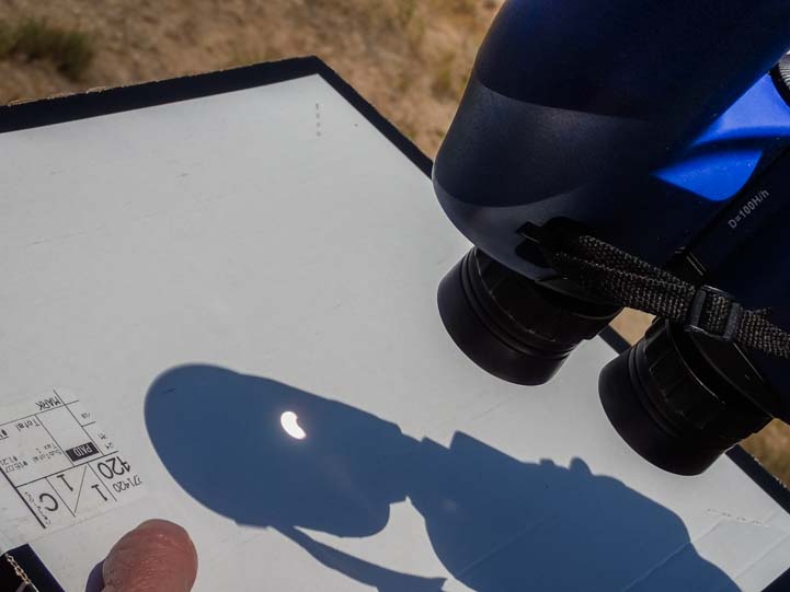
Because of the clouds, it was a little hard to tell that anything was happening. However, the sun eventually came out and it was a little dimmer than normal. Using a technique similar to the pin-hole boxes we had both made during solar eclipses as kids, Mark flipped a pair of binoculars upside down to show the image of the moon crossing the sun on the back of a white pizza box.

He thought of this technique at the last minute, and impressed the heck out of me. What a creative mind he has!! I asked him how he came up with the idea, and he just said, “Well, I needed something with a round hole.” Oh. Right. But of course!

Solar Eclipse 2017 Badlands National Park South Dakota viewing through binoculars August 21 2017.

It’s started!

We were in a quiet area, but as the eclipse progressed we noticed a fire engine pulled up to park a bluff. One firefighter climbed up on the roof of the truck to look at the changing landscape and the other stood out front. Cool!

Solar eclipse 2017 Badlands National Park South Dakota fire truck on hill August 21 2017.

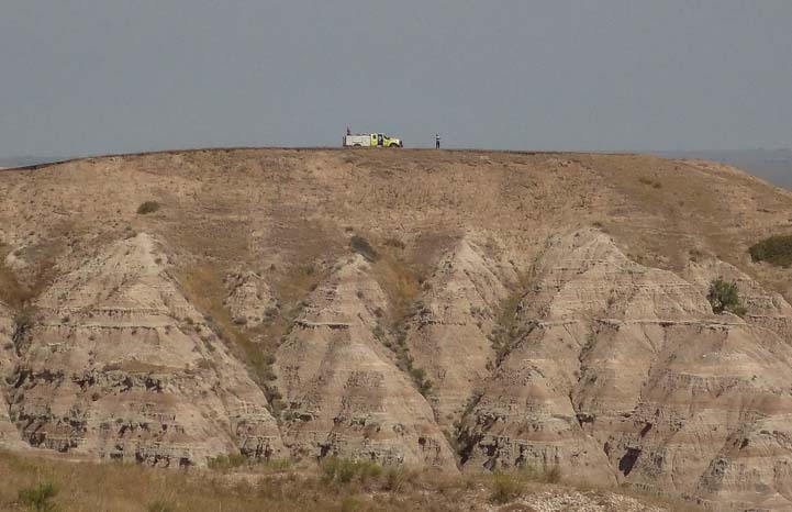
A fire truck showed up on a bluff.

I remember when I was child there was a solar eclipse visible across North America (in March, 1970), and my great-uncle, who was 85 at the time, began telling stories of a solar eclipse he had lived through as a kid in the last years of the 1800’s. He said the animals had gotten confused and had settled in to go to sleep. The chickens all roosted, the dogs curled up on the ground, and all the critters thought it was time to go to bed.

I don’t know if he was pulling my leg or not, but all of a sudden we saw a pair of big horn sheep babies playing out in the grasslands. They were romping around together bounding over the tall grasses when all of a sudden they stopped dead in their tracks and turned around to look at something behind them.

Baby Big horn sheep solar eclipse 2017 Badlands National Park South Dakota

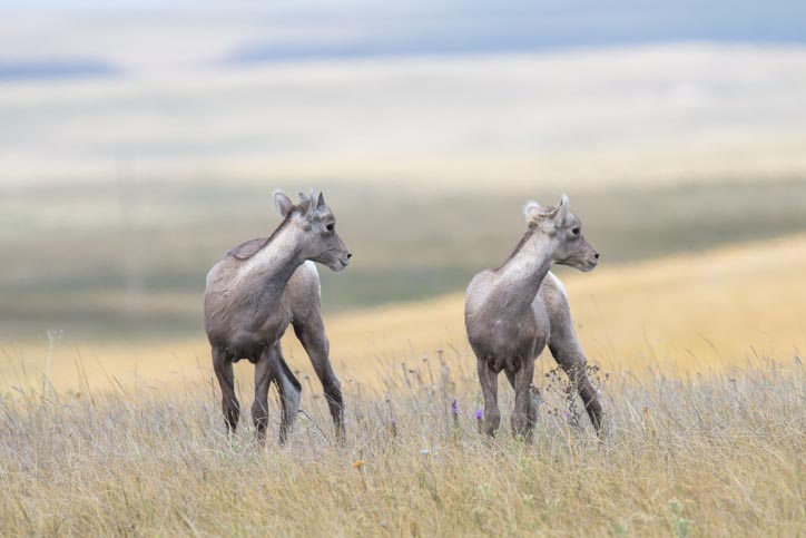
A pair of baby big horn sheep pause in the grasslands to look over their shoulders.

Mark grabbed his Nikon D500 camera and very long lens and snapped a few priceless pics. As we watched this sweet pair, we were both amazed when they suddenly laid down right there on the ground.

Resting big horn sheep solar eclipse 2017 Badlands National Park South Dakota

Time for a little rest.

Baby Big horn sheep solar eclipse 2017 Badlands National Park South Dakota-2

.

I’m not sure if they thought nighttime was coming, but one of them dozed off for a moment!
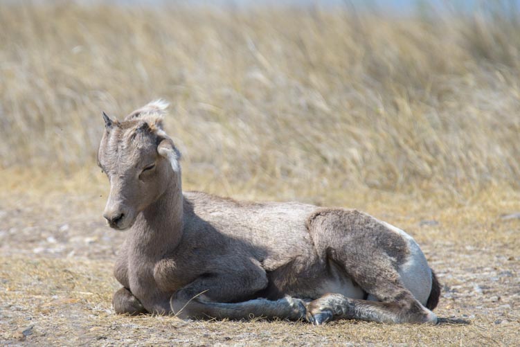
Sleeping Baby Big horn sheep solar eclipse 2017 Badlands National Park South Dakota

Nighty-night!

And then the magic moment arrived. 11:51:36 am was maximum eclipse time for us, and for the next two minutes we were at maximum moon-over-sun darkness of 95.7%.

Mark put his 16-80 mm lens on his camera, attached two 10-stop neutral density filters, popped out the live view display, and took a few shots.

Solar eclipse 2017 Badlands National Park South Dakota photographing 95.7% eclipse August 21 2017.

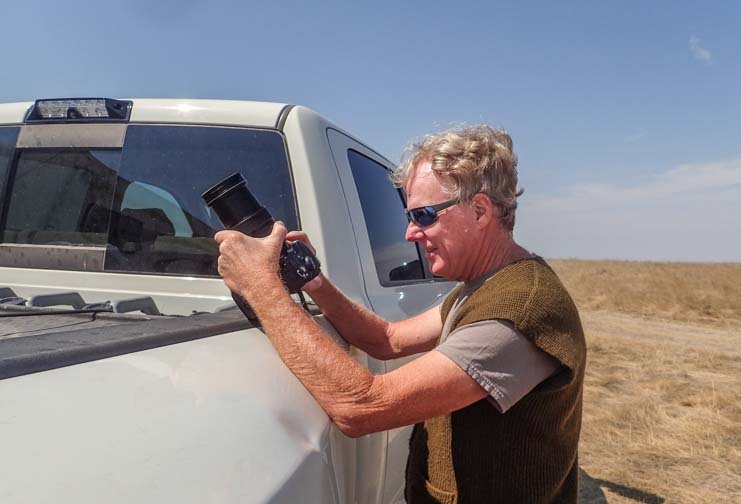
Mark sets up to see what he can get at the moment of maximum eclipse.

I sneaked behind him to see what he was getting. Very cool!!

Solar eclipse 2017 Badlands National Park South Dakota photographing 95.7% eclipse August 21 2017

There it is!

solar eclipse 2017 Badlands National Park South Dakota 95.7% eclipse at maximum August 21 2017 11-51 am

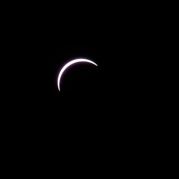
95.7% of total eclipse.

I wandered around with my pocket camera and got some images of the Badlands. Frankly, it wasn’t really that dark. At least it didn’t seem to be to me.

Solar eclipse 2017 Badlands National Park South Dakota 95.7% maximum eclipse August 21 2017 August 21 2017.

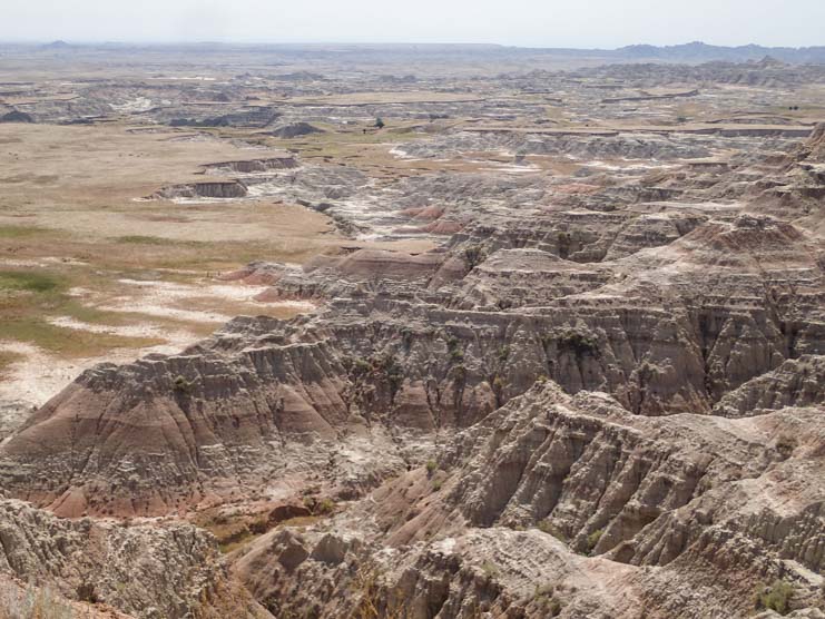
It didn’t seem all that dark during the maximum solar eclipse.

The sun was definitely still shining and there were distinct shadows on the ground. I took a shot of my shadow.

My shadow Solar eclipse 2017 Badlands National Park South Dakota

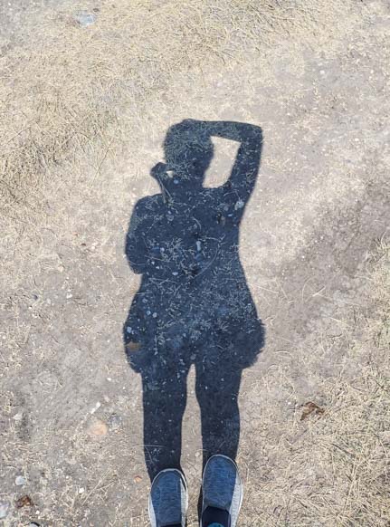
I could see my shadow plain as day at max eclipse time.
Friends of ours in Idaho said the true total eclipse was as black as night. They even saw stars for a few minutes!

But when we looked at the time-lapse videos later, we discovered the cameras had picked up the darkening light very well. I had a polarizing filter on my Nikon D810 with an 18-35mm lens set to about 20mm with a shutter speed of 1/50 and aperture of f8. Mark didn’t have a polarizer and used a 24-120mm lens with a shutter speed of 1/200 at f5.6.

Here are the three time-lapse videos, the first two from our Nikon D810 cameras and the third from the Nikon Coolpix A. Each one is about 30 seconds long:

Subscribe
Never miss a post — it’s free!

The solar eclipse I remember from childhood was on March 7, 1970, and occurred in the middle of my weekly piano lesson. My wonderful piano teacher and I kept peeking out the window and looking into my pin hole box between recitations of Bach’s sonatas. Very fun! Here’s some info about that eclipse.

More On Photography: Photography Gear, Tips and Resources – What we use and how we learned photography

Other blog posts from our travels featuring time-lapse videos:

Our most recent posts:

More of our Latest Posts are in the MENU.
New to this site? Visit RVers Start Here to find where we keep all the good stuff!!

<-Previous || Next->

Bryce Canyon – Hiking The Rim & Navajo Loop + A Tourist Time-lapse!

August 2016 – The views in Bryce Canyon National Park are absolutely breathtaking from the Rim Trail. This easy walking path extends for 5.5 miles along the edge of the canyon, going from Fairyland Point in the north and taking in the all the major overlooks until it arrives at Bryce Point in the south.

Sunrise Bryce Canyon National Park Utah View of Amphitheater

Bryce Canyon National Park at sunrise.

During our stay, we wandered up and down the Rim Trail many times, and we were stunned by the beauty every single time.

View from the Rim Trail 01 721 Sunset Point Bryce Canyon National Park Utah

Good Morning from the Rim Trail

View of hoodoos from Rim Trail at Bryce Canyon National Park Utah

Huge orange pinnacles dwarf the evergreens – Fantastic!

But the magic of Bryce Canyon is to get down in among all those hoodoos.

Sunset Point Bryce Canyon National Park Utah View from Rim Trail

A hiker snags a photo of this incredible view.

There are lots of hiking trails that wander between the peaks like thin pink ribbons strung all though the park. The tricky part is choosing which one to do!

Hikers Navajo Loop Trail Bryce Canyon National Park Utah

A ribbon of trail leads down into the hoodoos.

As we descended down the Navajo Loop trail from Sunset Point, the rock walls and pinnacles rose higher and higher around us.

Navajo Loop Trail Bryce Canyon National Park Utah

Hiking down into the hoodoos.

Navajo Loop Trail Bryce Canyon National Park Utah

Hikers pause on the trail to take in the magnificent views.

The spires soared into the sky like turrets on a fairy tale castle.

Hoodoos Rim Trail Bryce Canyon National Park Utah

This is a fairy tale landscape.

We hiked through this wonderland of rock formations utterly mesmerized.

Hiking the Rim Trail Bryce Canyon National Park Utah

.

Here and there, the rocks would open up, offering a view through a window to the canyon beyond.

Window Rim Trail Bryce Canyon National Park Utah

.

The rock formations seemed to grow up from the depths of the desert floor.

View from Rim Trail Bryce Canyon National Park Utah

.

Some rocks formed thin walls, creating craggy partitions within the canyon.

Windows Rim Trail Bryce Canyon National Park Utah

A tree perched on top of a rock wall showed us just how big the wall is — Immense!

The trail heads down many steep switchbacks, offering peeks into enticing nooks and crannies on its way to the canyon floor far below.

Navajo Loop Trail Bryce Canyon National Park Utah

A glimpse down into the depths…

These hiking trails are extremely popular, especially in the summer months when families from around the world are on vacation. It doesn’t make the trails any less appealing, but it is truly astonishing to watch the throngs of people climbing up and down these trails.

One afternoon I got chatting with a traveler from Germany, and as we talked idly about his travels in Patagonia, I set up my camera to do a time-lapse video of the hikers walking up and down the top few switchbacks of the Navajo Loop Trail at Sunset Point in front of us.

The result was fabulous. Check out the action not just at the top of the trail on the right but in the lower parts of the trail on the left. This is one of Bryce Canyon’s most popular hiking trails at its peak in August – Yikes!!

To replay, click the circular arrow in the bottom left corner

Of course, not all of Bryce Canyon National Park is crowded, and it doesn’t take much to get away from the masses. But these popular trails are a total thrill, and they are well worth doing, even if you’re sharing the experience with a busload of tourists and all their Facebook friends!

For a more solitary hike, we set out on the much less visited Fairyland Loop Trail one morning at dawn. That was an exquisitely serene experience which I’ll share in the next post.

If you are planning an RV trip to Bryce Canyon, there are links with more info below.

Subscribe
Never miss a post — it’s free!

More info about Bryce Canyon National Park:

More blog posts from our RV trips to Bryce Canyon

Related posts from our RV travels:

Our most recent posts:

More of our Latest Posts are in the MENU.
New to this site? Visit RVers Start Here to find where we keep all the good stuff!!

<-Previous || Next->

Waterton Lakes Nat’l Park – Starry Skies, the Milky Way & Wildflowers

June 2016 – Waterton Lakes National Park enchanted us. After all the grand and imposing majesty of the Canadian Rocky Mountains that we had seen in our RV trip on the other side of this mountain range at Banff and Jasper National Parks, there was an intimacy, charm and quiet elegance to Waterton Lakes that was very refreshing.

Prince of Wales Hotel Waterton Lakes National Parks Canada

Waterton Lakes National Park… Stunning!

The Prince of Wales Hotel really sets the stage for this special feeling at Waterton Lakes. We snuck down to the water’s edge one evening to get some photos of it reflecting its inviting warmth onto the lake.

Prince of Wales Hotel at night Waterton Lakes National Park Canada

The Prince of Wales Hotel has an inviting glow at night.

How rare it is to find this unique combination of natural beauty juxtaposed with man-made beauty in a National Park.

Prince of Wales Hotel Waterton Lakes National Park Canada

Prince of Wales Hotel, Waterton Lakes National Park

There was something about that hotel glowing across the water that just looked so appealing. It must be quite a place to stay!

Prince of Wales Hotel at night Waterton Lakes National Parks Canada

.

One thing we discovered quickly is that the night skies in Waterton Lakes National Park are extremely dark and absolutely jam packed with stars. The park is 35 miles away from the nearest “big” town, and by “big” I mean 3,700 people. So there aren’t any city lights to block out the view of the stars.

We crept out in the wee hours of the morning one night and got a quick pic of the buggy hanging out under the Milky Way. Wow!!

RV Roads Less Traveled Milky Way Waterton Lakes National Park Canada

Our buggy loves camping under the Milky Way!

This gave me an idea to set up a time-lapse video showing the Milky Way moving across the sky. Watching the result after I woke up in the morning was a total thrill!

So I did it again the next night and again the next. I combined all three nights into one 36 second video (below) which is very cool.

The first two sequences in the video show the movement of the stars between an hour after sunset and an hour before sunrise, revealing the entire night passage of the Milky Way on two different nights.

Since it was mid-June, we were nearly at the Summer Solistice, and because we were above the 49th parallel, the nights were darn short! So, the time-lapse videos from each night run from 11:45 pm until 4:15 am. There’s not much nighttime in those parts at that time of year!!

The third overnight sequence in this time-lapse video captures a bit of the Northern Lights playing in the sky for a short while just after midnight. Then, suddenly, the sky clears and you can see the Milky Way’s march across the sky that goes on all the time as our planet does its pirouettes across the heavens.

Shortly after we had all this fun capturing the Milky Way in still images and time-lapse videos, we read an article that said that 80% of the earth’s inhabitants have never had the good fortune to see the Milky Way, because our night skies all around the world are so full of artificial light.

The article went on to say that during a city-wide power outage in 1994 in Los Angeles which was caused by the huge Northridge earthquake, the police got calls from frightened residents claiming there was a big scary silvery cloud hovering overhead!

As the time went by during our stay in gorgeous Waterton Lakes National Park, we found our days were action packed.

Besides taking the wonderful Waterton Shoreline Cruise on the historic ship MV International along the length of the park from Waterton down to Glacier National Park in Montana and back (blog post here), we also got out on our bikes on the fabulous paved trail that wanders along the water and out of town a ways.

Bike Prince of Wales Hotel Waterton Lakes National Parks Canada

We loved the paved bike paths (and walking/running trails) around Waterton Lakes.

What a fantastic trail this is. The mountains soared into the sky all around us.

Bicycle Path Waterton Lakes National Parks Canada

Mark rode off ahead of me into the pages of a cycling brochure!

It is a fun, rolling ride that has a few tight turns. Reminders on the pavement — in French as well as English — kept us from going too fast!!

Sign on pavement at Waterton Lakes National Parks Canada

It was fun seeing official signs in French as well as English, even on the pavement.

We ran on this trail and walked on it too. We never got tired of the views!

Bicycle path Waterton Lakes National Parks Canada

.

There’s great cycling on the roads as well, and we saw some cycling groups going by. This is a fairly remote place, so the traffic on the roads was pretty light, making for some great road riding.

Cyclists Waterton Lakes National Parks Canada

The roads around Waterton Lakes National Park are great for cycling too.

But Waterton Lakes can be enjoyed by other means besides a shoreline cruise on a boat or a bike ride. We saw a group of horseback riders out enjoying the views too!

Horseback riders Waterton Lakes National Parks Canada

A group on horseback took in the views across Upper Waterton Lake.

The Red Rock Parkway is one of the main roads in Waterton Lakes, but it was closed for most of our time there. It did open on the weekends, though, and we had a chance to drive this wonderful scenic drive one Sunday.

Akamina Parkway Waterton Lakes National Parks Canada

The Red Rock Parkway took us into more distant parts of the park.

It’s a very pretty drive, and at the end is lovely Red Rock Canyon. It is a neat surprise to see red rocks amid all this green and blue scenery!

Red Rock Canyon Waterton Lakes National Parks Canada

It was such a great surprise to find red rocks in this
mountain-and-lakes National Park.

There was a thin stream of water flowing down the rocks, and we caught it in silky slow motion.

Red Rock Canyon Waterton Lakes National Parks Canada

Red Rock Canyon was a pretty place to explore.

What we really wanted to see, though, was wildflowers, and these were scattered along the meadows on either side of Red Rock Parkway. We didn’t see huge fields of them, but instead we found tiny individual flowers of all different kinds.

Yellow wildflower Waterton Lakes National Park Canada

We found a pretty little wildflower looking up at the sun.

Pink round wildflower Waterton Lakes National Park Canada

.

Wildflower Waterton Lakes National Park Canada

.

Some of these were just the size of the end of my finger, and they were really delicate too.

Pink Wildflower Waterton Lakes National Park Canada

.

Mark discovered a little bed of lady slipper flowers. I’m used to these guys being fairly big (and pink!), but the tiny white ones he found were the size of a marble, if that. I loved the twisted pairs of ribboned leaves on each one. They were like the satin ribbons on ballet slippers… for Thumbelina or Tinkerbell!

Ladyslipper wildflower Waterton Lakes National Park Canada

This tiny lady slipper is so small only Thumbelina’s foot could fit!

Ladyslipper wildflower Waterton Lakes National Park Canada

Ladyslippers… and ribbon leaves to tie them with.

We found Bear Grass and cheerful yellow daisies and more.

Bear grass Waterton Lakes National Park Canada

Bear grass was blooming everywhere.

Yellow wildflowers Waterton Lakes National Park Canada

Some yellow daisies warm their petals in the sun.

Pink Wildflower Waterton Lakes National Park Canada

.

Dandelion flower Waterton Lakes National Park Canada

.

We were both in our element for a few hours sitting amid the flowers in the meadows. I know there are great hikes out on the Red Rock Parkway, but we couldn’t tear ourselves away from this little dollhouse world of flowers.

Sitting in the wildflowers Waterton Lakes National Park Canada

We didn’t get much hiking or exercise in, but communing with the wildflowers sure was fun.

When we returned to town we were greeted by a pair of friendly deer.

Deer at campsite Waterton Lakes National Parks Canada

The fearless and ever so curious deer at Waterton Lakes were a highlight for us!

And a chipmunk showed us just how tall he could stand when there was a prize to be had.

Chipmunk reaching for food

This little chipmunk did tricks for us.

Waterton Lakes National Park is a really special destination, and it’s ideal for an RV trip. There’s a big campground with a variety of amenities in town and it’s just a stone’s throw over the border from the east side of Glacier National Park in Montana!

Class C Motorhome Waterton Lakes National Parks Canada

Waterton Lakes National Park is a wonderful destination for an RV trip!!

If you are planning an RV road trip to Waterton Lakes, there are more tips and links below.

Subscribe
Never miss a post — it’s free!

More info about Waterton Lakes National Park and RVing in Canada:


All of our RV blog post from the Canadian Rockies:

Our most recent posts:

More of our Latest Posts are in the MENU.
New to this site? Visit RVers Start Here to find where we keep all the good stuff!!

<-Previous || Next->

Yoho National Park – Emerald Lake & Natural Bridge – Aqua Magic!

May 2016 – Just 25 miles from Lake Louise, there is a treasure trove of glittering aqua magic at the rushing waters of Natural Bridge and in the serene, glassy depths of Emerald Lake in Yoho National Park.

Yoho National Park British Columbia Natural Bridge

Views along Emerald Lake Road in Yoho National Park.

Four national parks are clustered together in this part of the Canadian Rockies, and Lake Louise is within reasonable shooting distance of all of them. Banff National Park and Jasper National Park lie on the eastern slope of the Continental Divide in the province of Alberta while Kootenay National Park and Yoho National Park lie on the western slope. All four parks abut each other.

Natural Bridge Yoho National Park British Columbia Canada Rocky Mountains

.

Despite the cold gray weather of a late May morning, we headed out to see what we could find at Yoho National Park. We’d never heard of it before, but being a National Park, it had to be good!

Natural Bridge Yoho National Park British Columbia Canada

.

We were aiming for Emerald Lake on the map. A name like that seemed to hold real promise! So it was a total shock when we rounded a bend on Emerald Lake Road and came across a fabulous bowl of turquoise waterfalls! This definitely wasn’t “Emerald Lake,” but it was a vivid aquamarine color and was very cool!

Natural Bridge Yoho National Park British Columbia Canada Rocky Mountains

Natural Bridge came as a complete surprise on our way to Emerald Lake.

It turned out that this place was called Natural Bridge.

Waterfall at Natural Bridge Yoho National Park BC Canada

Water tumbled every which-way.

We wandered all around the rocks, totally mesmerized by the vivid color of the water flowing over them.

Waterfalls at Natural Bridge Yoho National Park BC Canada

Jagged rocks and rushing water.

It was all so beautiful, it was impossible to decide whether to stand still and try to take it all in and admire it quietly, or to run around on the rocks and zip back and forth over the bridge to try and see it from all angles all at once.

Bridge at Natural Bridge Yoho National Park British Columvia

Tourists line the bridge overlooking the falls.

The Natural Bridge itself is formed by two rocks that make a narrow arch over the rushing water.

Yoho National Park Natural Bridge Canadian Rockies

The “Natural Bridge” is an arch over fast moving water.

Natural Bridge Yoho National Park British Columbia

.

But the most beautiful spot is right in front of this bowl of waterfalls where they seem to cascade into each other from every direction.

This spot is also where the tour buses let people off, and the buses were arriving in droves!

Tourists Natural Bridge Yoho National Park BC Canadian Rockies

Busloads of people arrived in waves.

The mission of everyone on every bus was to jump off and get a quickie selfie before jumping back on and zooming away to the next destination.

Selfie Natural Bridge Yoho National Park British Columbia Canada

The name of the game of the modern tourist – Selfie!!

I thought it would be neat to do a timelapse video that would show the water flowing over the rocks. Instead, I captured an awesome 6 second snippet of selfie-crazed tourists visiting a world renowned travel destination!

Continuing a few miles further down the same road, we finally arrived at Emerald Lake. Our first glimpse was of the Emerald Lake Lodge peeking out between the trees.

Emerald Lake Lodge Yoho National Park Canadian Rockies

Emerald Lake Lodge appeared between the trees in the distance.

What a lovely lodge and in what a great setting!

Emerald Lake Yoho National Park British Columbia Canadian Rockies

Emerald Lake Lodge

Emerald Lake Lodge Emerald Lake Yoho National Park British Columbia Canadian Rockies

Emerald Lake has canoes for rent, and even though it was a bit cool to be on the water, people were happily taking the canoes out.

Emerald Lake Yoho National Park British Columbia Canadian Rockies

Canoes ready and waiting on the dock.

Canoe Emerald Lake Yoho National Park British Columbia Canada Rocky Mountains

.

Maybe by taking the canoes out they persuaded the sun to come out for a little bit too. For a few moments, it was almost sunbathing weather on the dock!

Emerald Lake sunbathing Yoho National Park British Columbia Canada

Dreams of summer.

Like nearby Lake Louise and Moraine Lake as well as Peyto Lake and Waterfowl Lakes on the Icefields Parkway, we were blown away by the bright and rich color of the water here at Emerald Lake.

Canoes Emerald Lake Yoho National Park British Columbia Canada Rocky Mountains

.

Canoe Emerald Lake Yoho National Park British Columbia Canadian Rockies

Paddling across the pages of a brochure!

There is an easy trail that heads out around the western side of the lake, and we strolled along this path we came across a field of pretty wildflowers that lured Mark right down to the ground.

Wildflowers Emerald Lake Yoho National Park British Columbia Canada

Mark gets down with the flowers.

And what wonderful photos he took!

Wildflower Emeral Lake Yoho National Park

.

The view across the lake looking back towards the Emerald Lake Lodge was expansive, and the water was amazingly still.

Emerald Lake Lodge Yoho National Park Canada

The mountains reflect in the lake below.

Just then, out of the corner of my eye, I noticed something floating by. Then it splashed around a bit and threw a spray of water into the air. It was a loon!

Loon in Emerald Lake Yoho National Park BC Canadian Rockies

It’s a loon!

He was taking a late afternoon bath!

Loon Emerald Lake Yoho National Park BC Canada Rocky Mountains

.

He didn’t seem to mind being photographed as he dipped and bobbed in the water, so I clicked away. What luck!!

Loon Emerald Lake Yoho National Park BC Canada Rocky Mountains

.

There is a lot more to see in Yoho National Park than just Natural Bridge and Emerald Lake, and on our way home we stopped in the unique little train depot town of Field to poke around. This is a cute village of B&B’s that is perched right on the edges of Banff and Yoho National Parks, making an ideal home base for visitors.

One of the homes is the original Yoho National Park Superintendant’s house. He had some pretty nice digs! A sign explained that he had such an elaborate house to give him an air of authority in the newly formed National Park where the more gritty industries of mining and railroads had always ruled.

Yoho Natioanl Park Superintendant's House British Columbia

The original Yoho National Park Superitendant’s House

The drive to and from Yoho National Park is beautiful — as are all the highway drives in the area. Some of the best mountains views to be found are actually right on the Trans-Canada 1 highway!

Yoho National Park Canadian Rockies Canada

The drive between Lake Louise and Emerald Lake was striking.

We returned home to Lake Louise and unwound a bit. It was cold and gray and wet, but the scenery we had been seeing was so heavenly we sure didn’t mind!!

Happy campers Lake Luise Banff National Park Canada

Yeah, it’s cold, but who cares?!

More info about Emerald Lake & Natural Bridge in Yoho National Park in the links below…

Subscribe
Never miss a post — it’s free!

Links for travelers heading to Yoho National Park:

<-Previous || Next->

Other blog posts from our RV travels in Canada:

Tips for travelers visiting Canada by RV
Tales from our RV travels in Canada

Our most recent posts:

More of our Latest Posts are in the MENU above.

Icefields Parkway – Canadian Rockies Scenic Drive – WOW!

May 2016 – The Icefields Parkway is the quintessential “Canaadian Rockies Scenic Drive,” 150 miles of Canada’s most dramatic Rocky Mountain scenery. It goes between Lake Louise in Banff National Park at the south end and the town of Jasper in Jasper National Park at the north end.

It is touted to be one of the world’s top scenic drives. And they aren’t kidding!

Icefields Parkway Banff National Park Alberta Canada

The Icefields Parkway is one of the world’s most spectacular scenic drives.

We drove the southern half of this eye-poppoing scenic drive several times during our stay in Lake Louise. We were blown away by the thrilling views every single time.

Icefields Parkway Banff National Park Alberta Canada

The dramatic views never quit!

The Canadian Rockies were right there all around us, nearly close enough to reach out and touch.

RV on Icefields Parkway Banff National Park Canada Rocky Mountains

RVs are the most common vehicles on the Icefields Parkway.

The mountains towered in front of us and behind us, and we kept jumping around in our seats looking in every direction out the windows, our jaws hanging open in amazement.

Icefields Parkway Canadian Rocky Mountains Banff National Park

.

The mountains changed shape and color constantly as we drove in the varying light of early morning, midday and late afternoon.

RV in Rocky Mountains on Icefields Parkway

.

The magnificent Icefields Parkway provides a feast for the eyes while driving but, for its length, it has suprisingly few scenic overlooks and pullouts where drivers can stop to admire the breathtaking vistas.

One of the best scenic viewpoints is at Herbert Lake. It is the very first pullout at the south end of the Icefields Parkway, and loads of drivers who start their drive at Lake Louise zoom right by.

Herbert Lake Icefields Parkway Canada Rocky Mountains Banff National Park

Herbert Lake – A gorgeous spot on the Icefields Parkway that many northbound tourists skip past!

The temptation when you round the bend and pass Herbert Lake and first catch a glimpse of the mountains reflecting in the water is to think, “Oh, we’ll have lots of scenic viewpoints on this drive, and the Icefields Parkway is 150 miles long, so let’s keep going for a while and stop a little further down the road.” After all, you’ve been on the Icefields Parkway for all of about three minutes at this point! We zipped by the first time but made a point to stop there on several return visits.

As I stared at the mirrored reflections in the lake one morning, I noticed the clouds were flying across the sky. So I set up a timelapse on my camera to capture the swift movement and variable light. What a cool result!!

One day as we drove along the Icefields Parkway, we were craning our necks looking up at the mountains when we noticed a cluster of cars pulled over on the shoulder of the road. Everyone was pointing their cameras towards the woods. It turned out there was a black bear just in front of the trees.

Getting a photo of a bear Banff National Park Canada

People stopped their cars to snap pics of a bear.

What a beauty he was!! We were tickled to see a bear so effortlessly for a second time here in the Canadian Rockies.

Black bear Icefields Parkway Banff National Park Canada

Another wonderful black bear sighting!

He stood still for a long time, chowing down on the grass, and our cameras clicked furiously.

Black Bear Banff National Park Icefields Parkway

.

Black Bear Icefields Parkway Banff National Park_

.

He stayed so long that his audience cycled in and out. Some folks got back in their cars and drove off and newcomers pulled over to park and stare in awe. Finally, the bear lumbered off into the woods.

Black bear Banff National Park Icefields Parkway Canada

.

There are a number of dry camping campgrounds on the Icefields Parkway but most were closed, even in late May. We wandered through a few — what great spots to camp during the summertime! — and we discovered a lovely view of the Rockies reflecting quietly in a large puddle on the ground near Mosquito Creek Campground.

Reflections Canadian Rocky Mountains Icefields Parkway Banff

Canadian Rockies reflections…

Lots of RVs travel this highway, and we saw more rental RVs than any other kind of vehicle on the road. The Icefields Parkway was under construction in spots, so there were loads of big construction trucks driving very fast on a mission to get where they were going. In the early mornings, though, we had the road to ourselves.

Rental RV Icefields Parkway Banff National Park Canada Rocky Mountains

The Icefields Parkway is a popular spot to take an RV!

One of the biggest and most popular scenic pullouts is at Bow Lake. This is a stunning lake, and we caught it in a mild mood one morning when it was as still as glass.

Bow Lake Icefields Parkway Banff National Park Canadian Rockies

Serenity on Bow Lake.

The patterns of the snow on the mountains reflected beautifully in the green depths of the water.

Bow Lake Icefields Parkway Banff National Park Canadian Rocky Mountains

We loved the images the mountains created in the green water of Bow Lake.

The pullout at Bow Lake is very large, and we hung out for an hour or so watching the tourists come and go. First there was one RV.

RV driving on Icefields Parkway to Jasper Banff National Park Canada Rockies

An RV slows down to pull over at Bow Lake

Then two.

RV parking on Icefields Parkway to Jasper Banff National Park Canada Rockies

.

Then the tour buses began to show up and park alongside the cars and RVs. There was a constant shuffle of vehicles coming and going and people running around the overlook admiring the exquisite view.

RV and tour bus sightseeing Icefields Parkway Banff National Park Canada Rocky Mountains

Bow Lake is the most popular pullout in the southern half of the Icefields Parkway. It was busy in the off season!

Everyone wanted a selfie. Well, if you can’t lick ’em, join ’em! So, we got one too!

Happy hikers Banff National Park Icefields Parkway

.

Our original plan had been to drive the Icefields Parkway with our rig, going slowly from south to north, and possibly camping midway at the Columbia Icefields.

Canadian Rocky Mountains Icefields Parkway Banff National Park Canada

We never got tired of views like these!

But we soon found out that being 55′ long from end to end, we would have struggled to fit in most of the pullouts and in almost all the trailhead parking areas.

Rocky Mountains Icefields Parkway Canada

Icefields Parkway scenery – beautiful!

So, we drove the Icefields Parkway at leisure in our truck, stopping in different places each time we drove it, and never having to fight to squeeze a big rig into a tiny parking area.

Eventually, when we were finally ready to go all the way to Jasper, we took our rig straight through without stopping. But there was a lot to see around Lake Louise and Banff first, so that story will have to wait!

Fifth wheel RV on the Icefields Parkway Banff National Park Canada

.

The Icefields Parkway is a glorious road, and it is an easy drive that doesn’t involve any hairpin turns or steep climbs. So it is very manageable for a big RV and tow vehicle/toad as long as you don’t plan to pull over too often. And the views… oh my, the views!!

Canadian Rockies Banff National Park Icefields Parkway Canada

We saw sensational Canadian Rockies scenery at every turn on the Icefields Parkway

Subscribe
Never miss a post — it’s free!

More info about the Icefields Parkway:

Other blog posts from our RV travels in Canada and the Canadian Rockies:

Canada RV travel tips – Border crossing, currency exchange, gas prices, etc.
Our RV adventures in Canada – All the places we have enjoyed in Canada

<-Previous || Next->

Our most recent posts:

More of our Latest Posts are in the MENU above.

A Backcountry RV Roadtrip in SE Idaho – Quiet Splendor!

April 2016 – In our RV travels we prefer to take small back roads from town to town instead of zipping past everything on the interstates. As we left the Moab area in Utah to head north into Idaho, we scoured the map to find some skinny roads through the farmlands that would take us through the valleys between the mountain ranges.

RV roadtrip past snowcapped mountains of northern Utah

Wow! We left the red rock canyons of Utah behind and headed into northern Utah.

Our minds were still reeling with the incredible and world renowned landscapes we’d enjoyed at Canyonlands National Park (North and South), Arches National Park, Dead Horse State Park and even the roadside stop of Newspaper Rock after coming up through the (appropriately named) Valley of the Gods. But we were astonished by the beauty of our surroundings in this lesser known area as we looked out our truck’s windows.

RV roadtrip through Farmland and mountasin of northern Utah

We knew the farmland around in Logan, Utah, was gorgeous, but this was incredible!

Route 89 heading out of Ogden, Utah, was a little fast paced for our tastes, so we snaked our way through the farmlands on Route 23 and then on Route 36. The views in every direction around us were breathtaking.

Farm and mountain scenery southeastern Idaho

It’s scenery like this that gets us off the highways and onto the backroads of America.

This is farm and ranching country. Horses grazed in the pastures and cows dotted the fields all the way to the mountains in the distance. It was early spring, and newborn calves bounded behind their mothers.

Views from the RV southeastern Idaho mountains

Horses and cattle didn’t seem to notice the views — all they saw was breakfast!

We had traveled through this part of the country several times before, spending time at Bear Lake and Logan Pass in Utah and driving north through Afton Wyoming on our way to and from the Tetons. Despite two visits to the Tetons, there are places there we still haven’t seen. However, we decided to stay on the Idaho side of that stunning mountain range on this trip.

RV camping by southeastern Idaho lake

The lakes were as beautiful as the mountains.

And the scenery we were seeing was plenty glorious enough, and the roads were very peaceful!

RV roadtrip through southeastern Idaho mountains

Not a bad spot to live!

The skies, however, were not peaceful at all, and rumbling in the heavens got our attention.

RV camping southeastern Idaho

The skies began to look a little threatening.

A stormy day that had been promising rain all day long suddenly ended with a spectacular sunset that had us running out of the buggy and down to the shore to take photos.

Southern Idaho sunset on lake

Cloudy skies sometimes bring awesome sunsets. This one was exceptional, especially after a gray day!!

As we were busily snapping away at the sky, I heard a loud splash and looked down at my feet to see a beaver swimming right past me.

What luck!

I managed to catch him surrounded by the sun’s vivid magenta reflection in the water before he dived out of sight.

Camping sunset beaver in Idaho lake

A beaver swam right by me!!

We were doing this little backroad RV roadtrip in a season that fell somewhere between winter and spring, which gave us lots of unpredictable weather. Nasty weather makes for great photography, however, and we continued on our farm road journey on Route 38 under pretty clouds at dawn.

Malad City Idaho sunrise

Reflections at dawn.

Later in the day, however, those clouds got angry once again. We watched a massive black cloud forming in the distance as we drove. Suddenly the cloud was upon us. Fortunately, just at that moment, we saw a huge roadside pullout with a big red sign that said “Stop!” And stop we did!!

RV travel southeastern Idaho_

Yikes! A huge black storm cloud made us pull over and stop!

No sooner had we run back into the trailer and closed the door than the heavens opened up. It rained buckets. It rained so hard the raindrops seemed to be bouncing off the ground. Thank goodness we had our house with us!

We made lunch, and afterwards we soon got drowsy from listening to the rain pelting our roof. So, we crawled under the covers for a nap! When we awoke, the skies had lightened and Nature gave us the “all clear” and go ahead to continue our journey on Route 37.

2016 Dodge Ram 3500 Dually_

Four hours later, after a good nap, the skies began to clear.

We continued north, and after all this time on the backcountry roads of northern Utah and southeastern Idaho, when we arrived in the town of American Falls, we felt like we’d landed at an enormous city.

We watched long trains crossing the train bridge in town. One was so long it had three engines on the front and two on the back!!

Train crossing bridge in American Falls Idaho

In American Falls we saw a long train with five engines!!

The storm clouds continued to threaten and were moving very fast above us. I’d gotten a kick out of setting up a timelapse video of the clouds moving across the canyon walls of Dead Horse Point State Park a few weeks earlier, and this seemed like a perfect chance to try that technique again:

From American Falls, our journey took us north along Route 39 to Route 26 and through Atomic City which we had enjoyed on an earlier trip to the otherworldly Craters of the Moon National Monument. But instead of seeking out moonscapes, on this trip we had snowcapped mountains in mind and on our agenda.

RV views on Salmon River Idaho roadtrip - nowcapped mountains

Snowcapped mountains were what we were after.

We hooked up with Route 93 and followed it northwest to the village of Mackay. What a sweet town! Mackay, Idaho, is flanked by two gorgeous mountain ranges, and we walked around town with our heads tipped back to take in the beautiful views.

Mackay Idaho main street

Downtown Mackay, Idaho.

Our RV roadtrip had brought us through some remote and quiet lands. To give you a sense of size and scale, the town of Mackay, which was a major landmark on our trip, has a population of 494!

No wonder the local cinema can offer happy birthday wishes to a resident!!

Main Street Cinema Mackay Idaho

In a small town, your birthday can put your name on the marquee at the cinema! How fun!!

Makcay, Idaho, is on the opposite side of the mountains from the much more well known, busy and trendy community of Sun Valley to the west, and it is “opposite” in spirit as well.

“We like having a mountain range between us and Sun Valley!” One local said to me, laughing.

We meandered the few streets, and admired the rustic, crusty and aging barns and buildings tucked between some of the homes.

Crumbling Barn in Mackay Idaho

.

Old barn Mackay Idaho RV roadtrip

.

This part of Idaho is wonderful for RVing, and it has been popular with RVers ever since RVs were first built!

Antique travel trailer RV

We saw a cute antique trailer in a yard. Cool!

Discovering special places that don’t get top billing in the tourist literature is one of our favorite things about this full-time RVing lifestyle. International tourists flock to the major cities and the National Parks. And why not, they’re spectacular! But the roots of America are in the small towns across the country.

Old store front Mackay Idaho

Get your stretchy suspenders here!!

We were so glad we had chosen a route that we had never taken before through this familiar region. Every sight along the way was new and exciting!

RV camping Salmon River Idaho

Getting off the beaten path is our favorite aspect of RVing.

If you are have an RV road trip planned between northern Utah and southern Idaho, consider getting off the interstate and exploring the smaller roads. It’s a very beautiful part of the country!! More info below…

Subscribe
Never miss a post — it’s free!

More info and more stories from our RV travels in this area:

Our route through the Northern Utah and Southern Idaho farms and valleys

Scenic Drives for RV Touring in Idaho:

Our most recent posts:

More of our Latest Posts are in the MENU above.

<-Previous || Next->

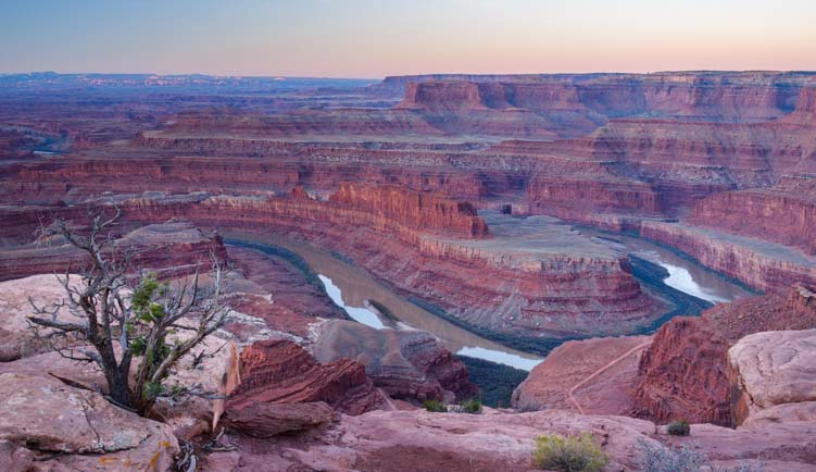
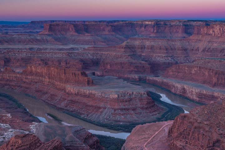
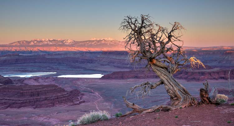
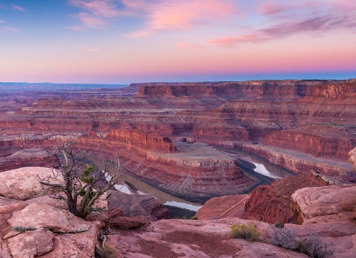
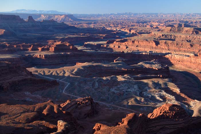
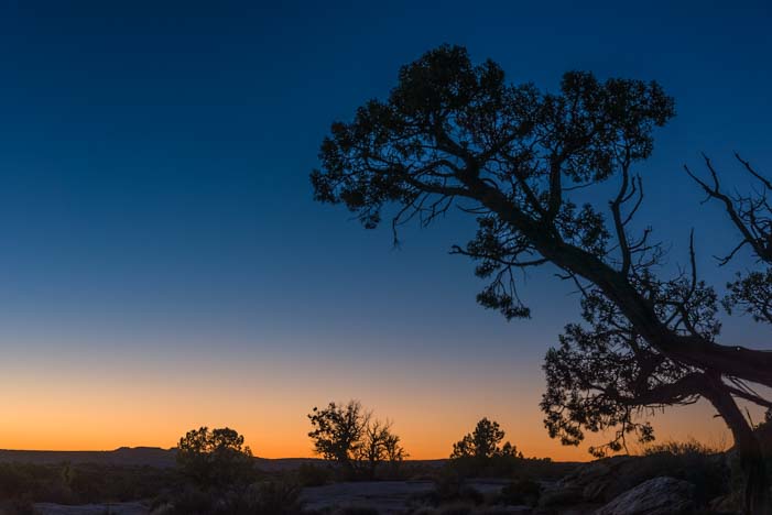
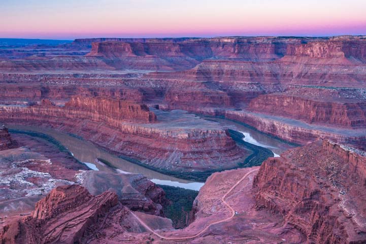
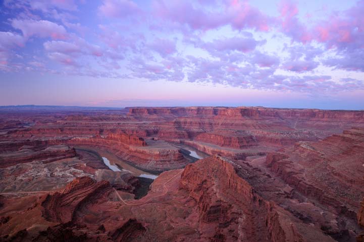
Dead Horse Point State Park, Utah – Magical Sunrises!

April 2016 – The area around Moab, Utah, is teeming with exotic red rock canyons, towering natural stone arches, snowcapped mountains, exotic ancient rock art and exhilarating hikes that go through it all.

Photography at Dead Horse Point State Park Utah

The rim of Dead Horse Point State Park is fabulous for photography at sunrise!

There is a joke that southern Utah’s landscapes are so spectacular that many places would be National Parks if they were located in any other state. But they get relegated to mere State Park or even lower status because they are located in Utah.

Dead Horse Point State Park is such a place.

Dead Horse Point State Park Utah Overlook at dawn

Dead Horse Point State Park in the pre-dawn hours.

Lying just 12 miles from Moab as the eagle flies across the canyons — or 33 miles as the roads go around them — Dead Horse Point State Park is tucked into a dramatic bend in the Colorado River that resembles some of the curves in its big brother, the Grand Canyon, a few hundred miles downstream to the southwest.

Dead Horse Point State Park Utah Sunrise

.

The overlooks at Dead Horse Point State Park are eye-popping at any time of day, but to watch the sunrise there is a magical experience. We snuck out in the pre-dawn hours and tip-toed around the edges of the canyon in the semi-darkness, passing endless wonderful, gnarly old trees.

Tree at Dead Horse Point State Park overlook Utah

Fantastic old trees line the rim of Dead Horse Point State Park

One tree in particular kept drawing us back. It leaned over the edge as if wanting to take a closer look at the canyon.

Tree at Dead Horse Point State Park Utah

This tree captivated us…

Tree at Dead Horse Point State Park Utah

…so it wound up in quite a few photos!

Another stood watch over a bench at a viewpoint.

Bench and tree Dead Horse Point State Park Utah

A tree looks out at the view over a visitor’s bench.

As dawn flirted with us on the horizon, the curves and contours of this magnificent canyon slowly began to take shape. Gradually, the wispy clouds in the sky took on the brilliant peach and orange hues of sunrise.

Sunrise at Dead Horse Point State Park Utah

The sky lights up as the sun begins to rise.

What a blessing it was to be there on a day when there were enough clouds to create a colorful sunrise!

Dead Horse Point State Park Utah sunrise

What colors!
The thin trail along the river is the 4×4 White Rim Road that crosses into Canyonlands National Park.

All of a sudden, the sun crested the horizon over the mountains to the west, and it sent shafts of orange light across the canyon.

First Light Dead Horse Point State Park Utah

First light at Dead Horse Point State Park

Then a few of the red rock peaks lit up in the distance.

Sunrise Dead Horse Point State Park Utah

As soon as the sun peeked over the mountains to the east, shafts of light cut across the canyon.

If there is a place in this world to watch the sun come up, this is it. And what a spot for photography!!

Until this moment, we had had the entire canyon to ourselves, but we’d heard a car drive up and park. As the sunlight grew brighter, we noticed a person sitting out on a ledge and soaking in the miracle of a new day arriving in this special place.

Overlooking Dead Horse Point State Park Utah Before Dawn

“Morning has broken…” — Cat Stevens

Slowly, the sun’s rays lit up more and more of the canyon.

Dead Horse Point State Park Utah at dawn

Gradually, the shadows crept down the canyon walls as the sun highlighted their peaks.

As the sun rose higher, the Colorado River began to reflect the orange cliffs in its depths. Magnificent!

Sunrise Dead Horse Point State Park Utah

.

As we watched the splendor before us, we were surprised to hear the squawking of Canada Geese in the distance. They seemed to be way over on the opposite side of the canyon to the west. They never did come into view, but for about 5 minutes we could hear the flock talking together as they commuted down the river and across the canyon from the west side of the horizon to the east!!

Dawn Dead Horse Point State Park Utah

Light and shadow play on the rock faces of Dead Horse Point State Park.

After the sunrise was over, we returned to our campsite where we noticed the most beautiful little blue bird flitting about out the back window of our trailer. He kept landing on the handlebars and shifting cables on our bicycles mounted on our bike rack. He seemed quite enamored of our bicycle bell!

Mountain Bluebird on bicycle bell Moab Utah

When we got back to camp, this little guy was hanging out on the handlebars of our bikes!

Fortunately, he didn’t seem to be fazed by our movements inside the rig, and he settled down long enough for us to get a good look at him through the window and to get some really nice photos. We checked him out in our bird guide, and he was a Mountain Bluebird. How cool!

Mountain Bluebird Moab Utah

What a handsome fellow!!

Then his little girlfriend stopped by. She was a real cutie too, with soft brown wings and a splash of Mountain Bluebird blue on her back! We never found out what these birds’ fascination was with our bikes on the back end of our RV, but they hung around for a very long time.

Female Mountain Bluebird Moab Utah

She keeps her vibrant blue colors under wraps…

Where our visit to Arches National Park had been shared with a gazillion other visitors, and our visit to the town of Moab had been a little wild during Jeep Safari week, the utter calm at Dead Horse Point State Park was intoxicating. At twilight we snuck back to the rim of the canyon and got some shots of the sunset on the horizon with a tree in the foreground.

Twilight tree at Dead Horse Point State Park Utah

At twilight, the horizon turned vivid orange.

The sunrise at Dead Horse Point State Park is worth getting up for on any morning you are nearby, so we set our alarms each morning we were there, reminding ourselves as we groaned when it went off that it isn’t everyday you have a view like this within driving distance.

Dead Horse Point State Park Utah Before Dawn

Sunrise is worth getting up for in this neck of the woods!

It was tough to climb out of our snug, warm bed to go stand at the rim of the canyon (in four layers of jackets) and wait for the sun to come up. But the beautiful photos and feeling of tranquility that reached across the miles and miles of canyon were well worth it.

Sunrise Dead Horse Point State Park Utah

Little puffy clouds marched across the sky at dawn.

One morning as I hiked across the huge, flat boulders towards the rim, I looked up and was astonished to find myself face to face with a white desert fox. I was loaded down with my camera, my pack, my tripod and my travel coffee mug, and I knew there was no way I could juggle it all and get his photo without scaring him off.

So, I simply basked in the moment, and talked to him softly. His ears perked up in my direction and he took a long look at me. I admired his bushy white tail, tipped with a little black tuft at the end. To my utter surprise, he sat down for a moment! Then he got up and trotted away in silence on velvet paws.

Dead Horse Point State Park at dawn Utah

Once the sun was up, the puffy clouds turned white.

The sunrises at Dead Horse Point were sensational, but that private moment with the desert fox in the dim pre-dawn light was extraordinary.

Inspired by the professional videographers we met at Horsehoe Bend in Arizona, I set up a timelapse sequence on my camera to show the shadows retreating from the red rock canyon walls as the sun rose. What fun!!

For those with limited bandwidth, this video is 19 MB and 20 seconds long.

Dead Horse Point State Park is a fabulous place for outdoor lovers of all kinds to visit, and for RVers especially.

There is a campground with electrical hookups within the park (no need for solar power!) and loads of other campground options nearby (links below). In early April there were few people, if any, at the rim at dawn, but we have heard the place can be very busy at sunrise later in the season.

We enjoyed the sunsets at Dead Horse too, but the sunrises were most magical for us.

Happy campers at Dead Horse Point State Park at dawn Utah

Does life get any better than this??!!

The best viewpoints at dawn are to the west of the main overlook. Simply follow the paved trail heading to the right of the parking lot, and then cut across the rocks to the rim at whatever point looks appealing to you.

It’s all wonderful!

Subscribe
Never miss a post — it’s free!

More info about Dead Horse Point State Park in Utah:

Posts from similar river bend overlooks:

Other posts from our RV travels in Southern Utah:

<-Previous || Next->

Our most recent posts:

More of our Latest Posts are in the MENU above.