Burro Days! Burro Races, Llamas & Outhouses in Fairplay CO

Burro Days! Burro Races, Llama Races, Outhouse Races and More!

Burro Days in Fairplay Colorado - Last full weekend in July_

.

July 2023 – We’d been hanging out in Buena Vista, Colorado, during our summer RV tour, and one afternoon we took a drive north to check out the town of Fairplay. As we came into town, we spotted a big sign that said, “Burro Days – Last Full Weekend in July”

Huh? What on earth was Burro Days? Whatever it was, we were intrigued! We checked the calendar, and the festival started the very next day. Perfect!

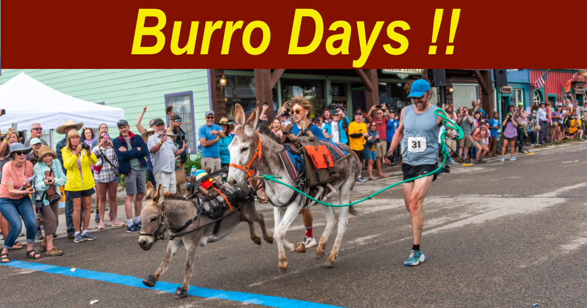
When we got back to our RV, we poked around on the internet and discovered that Burro Days is an annual festival — and burro race! — that has taken place in Fairplay, Colorado, every summer since 1949.

Officially known as the World Championship Pack-Burro Race, there were just 21 entrants back in 1949, and they ran from Leadville, Colorado, up and over towering Mosquito Pass (13,185’ elevation!) and down the other side of the mountain into the town of Fairplay for a $500 cash prize. Not surprisingly, only 8 participants finished that race!

Today, there’s 3-day festival that features not only burro races starting and ending in Fairplay (with one race still taking contestants on mountain trails to the top of Mosquito Pass and back!), but also a “Llama Rama” (a what??), a dog race, a llama race, a parade down Front Street and an outhouse race!

We just HAD to check this out!

Front Street Fairplay Colorado

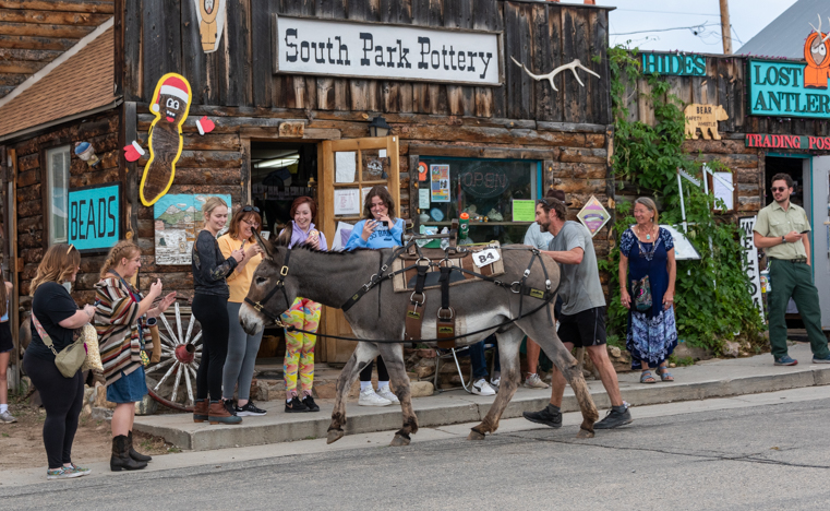
Fairplay’s historic buildings on Front Street are quaint and inviting.

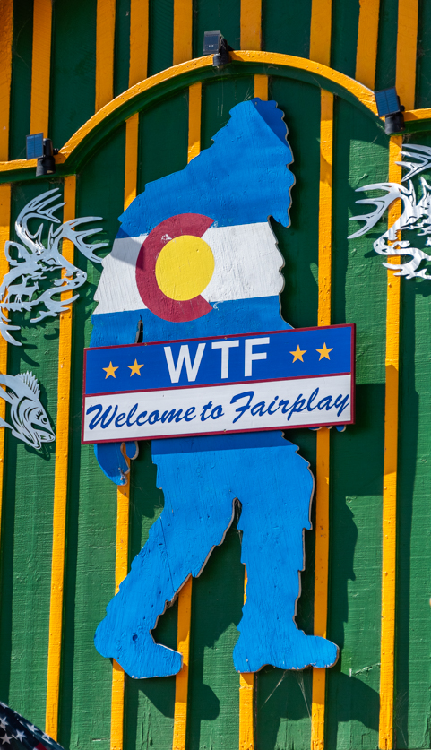
Fairplay got its name back in 1859 when gold rush latecomers found themselves unable to get into one of the bigger mining camps in the area called Tarryall. Frustrated, they nicknamed that camp “Grab-all” and set up a new camp which they called “Fair Play.”

Still fond of playing with words, Fairplay welcomes visitors to town today with a big blue silhouette of Sasquatch bearing the Colorado logo and the letters “WTF” — “Welcome to FairPlay!”

Welcome to Fairplay Colorado

.

While Highway 9 runs right through the middle of town, the historic part of town is on Front Street, and that was where the Burro Days races and parade took place. Much of the rest of town was filled with artisan tents and food tents throughout the weekend.

The buildings along Front Street are really appealing, and crowds grew quickly in front of each establishment in anticipation of the races.

Fairplay Colorado Front Street Buildings

All the shops were open and people milled around waiting for the fun to begin.

Ellen's Place on Front Street in Fairplay Colorado

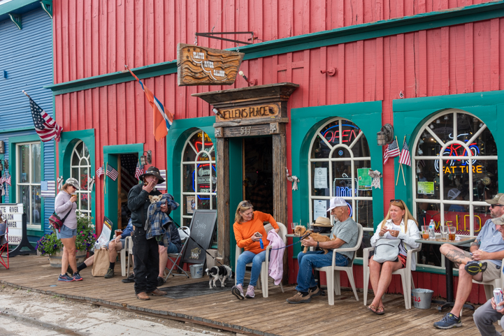
There were plenty of places to grab lunch and/or a brew!

The Distillery in Fairplay Colorado on Burro Days

.

Colorado Delorme Atlas

Unfortunately, we missed the first race of the day — the Dog Race — by 5 minutes. The contestants in that race are all kids, and they run alongside their leashed dogs. The course is short, so arriving a few minutes late meant we missed it all together. Rats! Next time!!

However, the llamas had begun to arrive in their trailers, and we saw a few peeking out at the growing crowd.

A Llama waits for the Llama Rama on Burro Days in Fairplay Colorado

.

Buddy was especially disappointed that we missed the dog race, so when we saw the llamas hanging out with their owners in the middle of Front Street — the “Llama Rama” — he wanted to make sure he saw one up close.

He was very intrigued by their smell — and vice versa!

Llama and puppy meet at the Llama Rama during Burro Days in Fairplay Colorado

Buddy meets his first llama.

If you haven’t seen a llama up close, they are really big! When you look at them they look back at you at eye level!

Llama Rama at Burro Days in Fairplay Colorado

Llamas are as tall as people, just a different shape!

Llama Rama during Burro Days in Fairplay Colorado

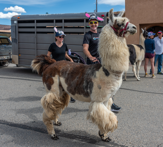
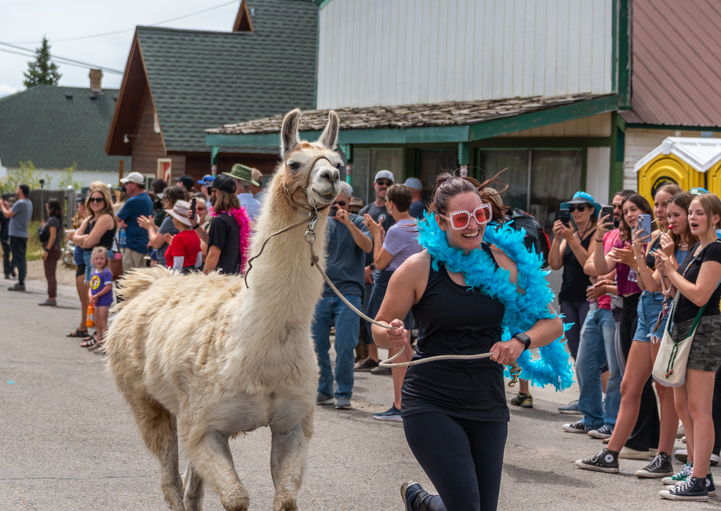
Racers were posing with their llamas for anyone with a camera or phone!

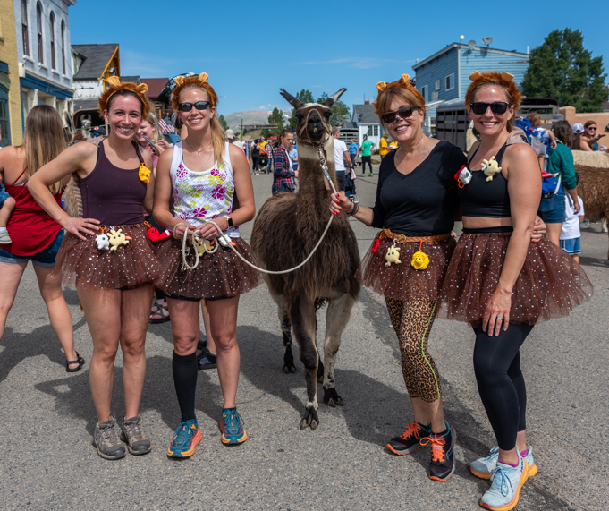
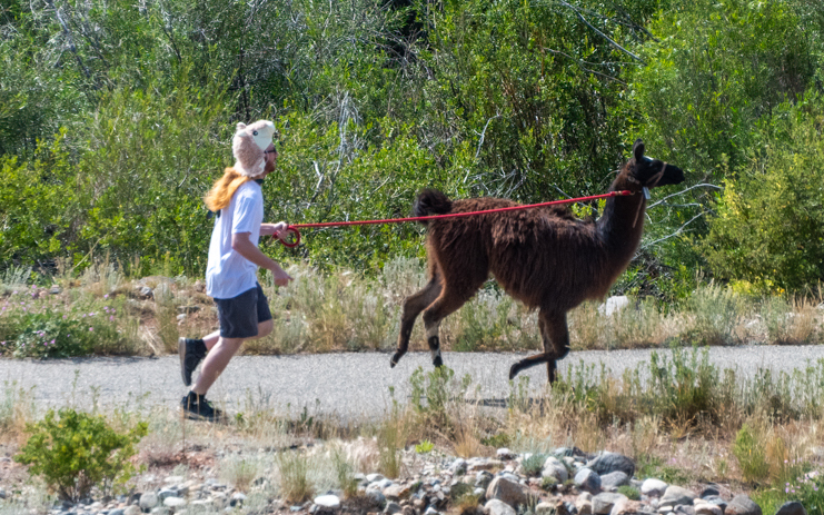
As proud owners showed off their beautiful llamas, we realized that the llama race involves a lot of whimsy. The entrants were teams of four people and one llama, and the idea was that all five would run together, the llama tethered on a leash and the four people running alongside.

But the runners weren’t wearing typical running race garb. They were dressed up in all kinds of crazy costumes!

One group of gals paid homage to the brown furry coat of their llama with brown tutu skirts. They wore little llama ears too.

Llama Races at Burro Days in Fairplay Colorado

.

Most of the llamas came dressed in regular llama attire, but one had been to the groomer and wore fluffy knickers and a thick llama fur stole around her neck. Her black two-toed feet looked like she was wearing party shoes!

Llama Rama at Burro Days in Fairplay Colorado

Dressed for success!

Suddenly, Mark said, “Hey, there’s a guy over there in pajamas!” I turned and grabbed a quick pic, but it was only later that I remembered the Ogden Nash poem (and explanatory footnote):

The one-l lama, he’s a priest.
The two-l llama, he’s a beast.
And I will bet a silk pajama
There isn’t any three-l lllama*

*The author’s attention has been called to a type of conflagration known as a three-alarmer. Pooh.

I’m not sure if this guy’s pink, llama-covered PJs were made of silk, but his outfit definitely was a three-alarmer!
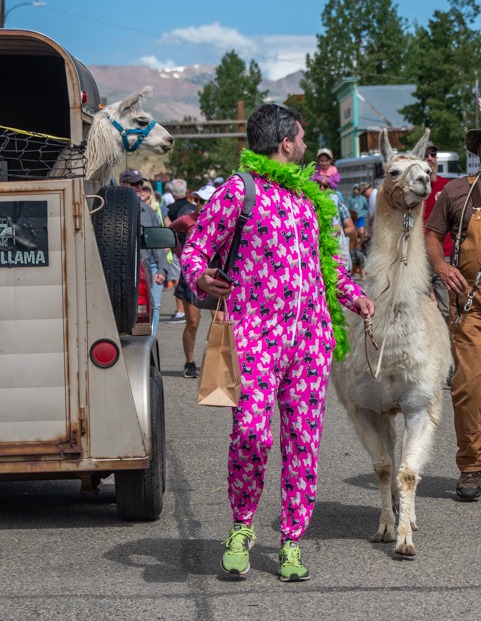
Silk pajama Llama at Llama Rama in Fairplay Colorado

Three-l lllama?

Mark also remembered a song that his daughter loved when she was a little girl: “Me and my llama are going to the dentist today.”

He’d sung it to me before, and it’s cute, but I’d never gotten the joke until I took a few portrait shots of these wonderful llama faces.

Llama portrait at the Llama Rama during Burro Days in Fairplay Colorado

“Going to the dentist today!”.

Reese Goosebox

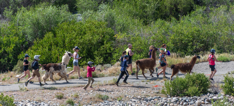
We roamed among the llamas and their people at the Llama Rama for a while, and then suddenly they all lined up behind the start line and took off running on the count of three.

Llama Race at Burro Days in Fairplay Colorado

The race is on.

As soon as the llamas had raced down Front Street, the crowd ran to the far side of the street to a ridge overlooking a dirt trail in the distance. Before long, the llamas and their people appeared on that trail, racing away.

Llama Race during Burro Days in Fairplay Colorado

.

Some of them were bunched together and others had gotten a little separated, leaving the person holding the llama’s tether to run on his or her own.

In some cases the llama bounded happily ahead.

Burro Days llama races in Fairplay Colorado

“Weeeeee!”

And in some cases the person was towing the llama behind!

Llama Race during Burro Days in Fairplay Colorado

“Not so fast!”

There was lots of confusion in the crowd about where the course would go from there and how long it would be until the llamas came back to the finish line, but suddenly the announcer said the leaders were coming in. It was the team of Game Wardens — all very fit looking runners — and they soon crossed the line for the win.

Not far behind, the Search and Rescue team came running in for second place with four guys looking equally fit and serious.

Llama Race winners at Burro Days in Fairplay Colorado

The Game Wardens took the win in the Llama Race.

Although the first two teams duked it out for the win, most of the teams and their llamas seemed to be happy just to be out running together on such a beautiful day.

Llama Race at Fairplay Colorado Burro Days

All smiles.

As the llama teams went past, a gal standing next to me named Amanda was keeping a close eye out for her team. She and her husband have 9 llamas on their 35 acre ranch, Shining Mountain Llamas, and they had selected two for the Burro Days events.

She explained that they raise their llamas for high altitude hikers who want to have help carrying their gear. Llamas are good natured animals, are native to mountains that are 17,000′ high, can make their way over difficult terrain like fallen trees, and contentedly eat pine cones and other things found on the trail so there’s no need to carry special feed for them. Hunters and mountaineers love having a llama or two along on their high altitude expeditions!

Llama Race at Fairplay Colorado Burro Days

One of Amanda’s two llamas happily trotted past us.

Of course, a few llamas were not very enthusiastic about the running aspect of the race. A few put their foot down and said, “No more!” and had to be coaxed over the finish line — to lots of laughter and cheers from the crowd!

Reluctant llama in the Llama Races at Burro Days in Fairplay Colorado

“Come on — it’s just a few more feet to the finish line!

The dog race, llama race and Llama Rama were all held on Saturday, while the headline event — the burro races — were reserved for Sunday. We could feel the excitement as we pulled into town for the first of the two burro races the next day.

The announcer was standing on a second floor balcony, entertaining the crowd and keeping all the events running smoothly.

Race and parade announcer at Burro Days in Fairplay Colorado

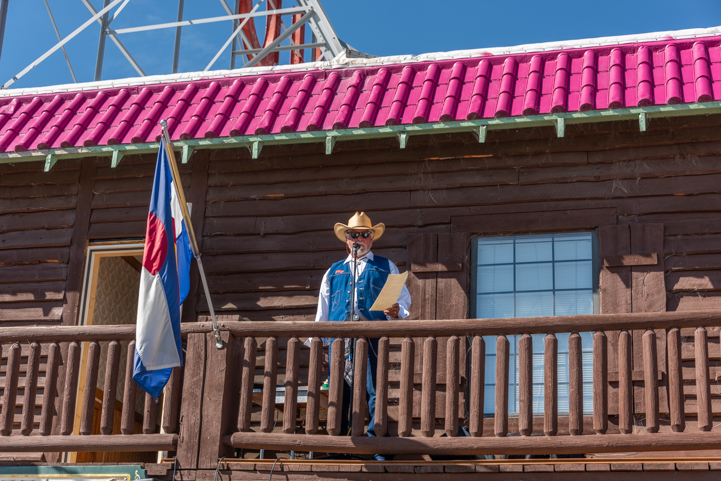
The announcer kept everything rolling, from races to the parade, all day long.

We’d done a little homework overnight and learned that “burro” is simply the Spanish word for “donkey,” a particular species of equine animal.

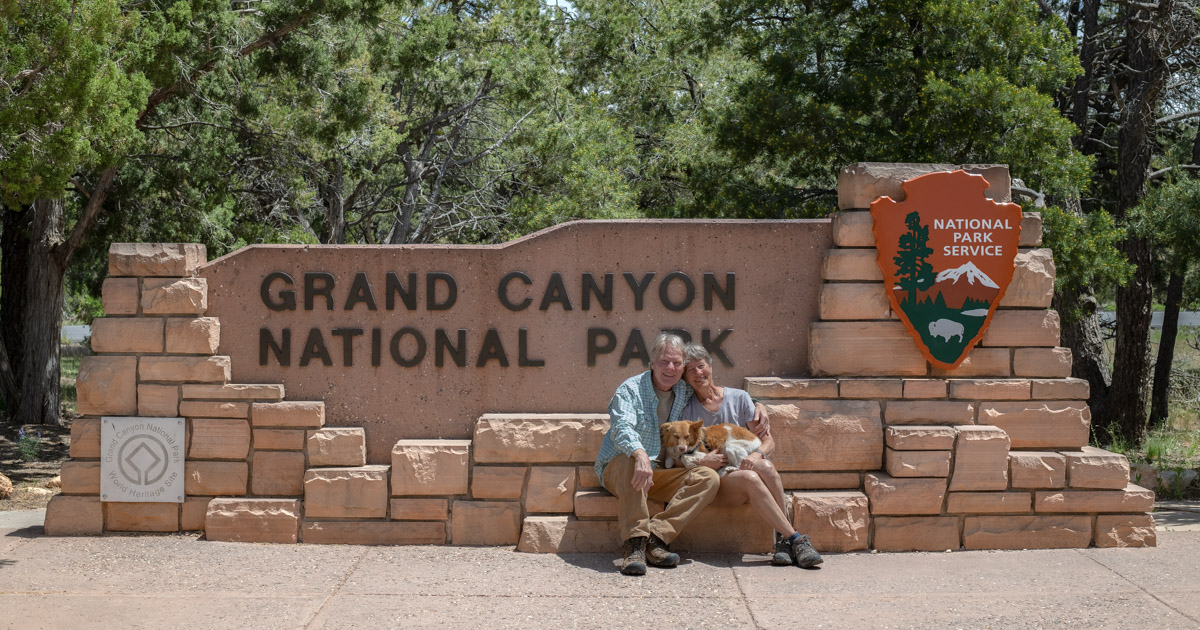
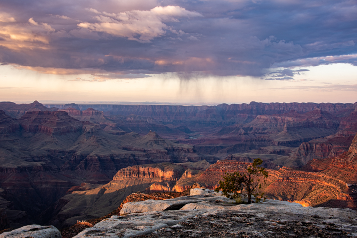
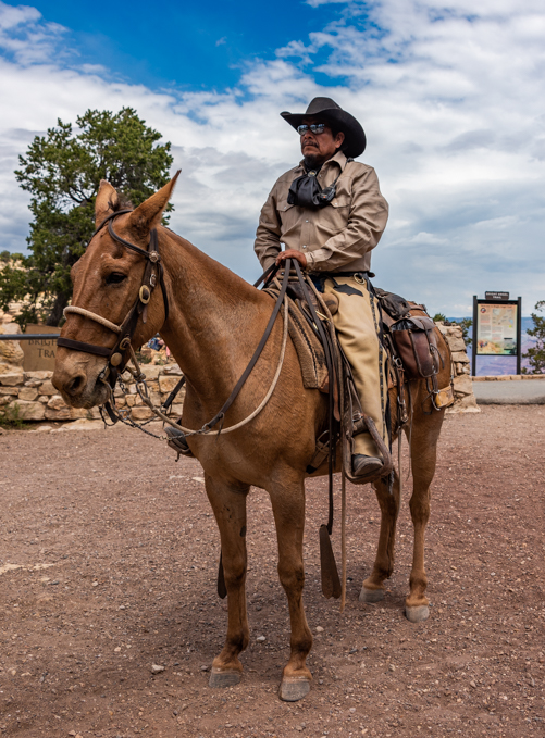
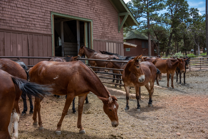
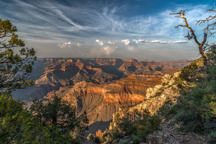
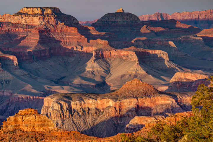
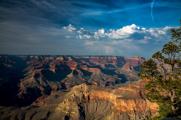
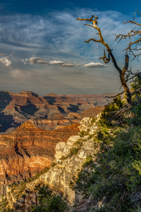
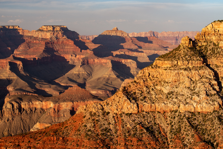
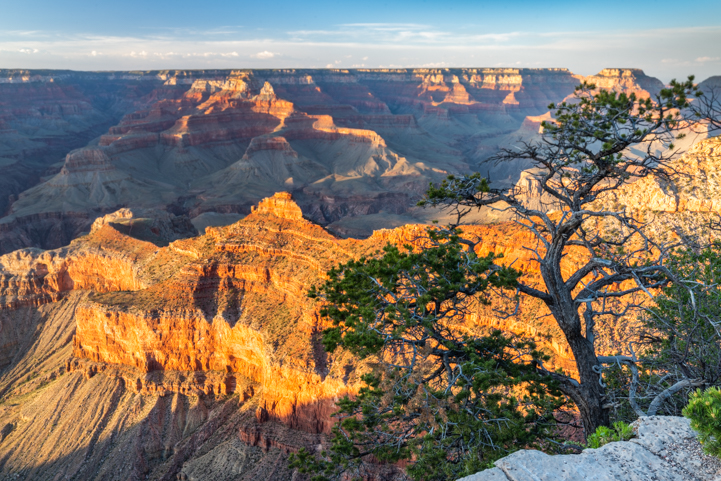
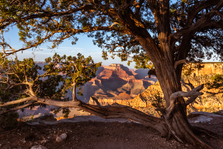
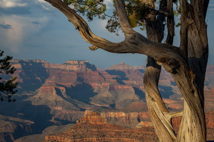
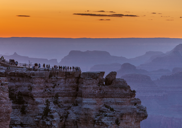
Mules, on the other hand, like the ones we had seen at the Grand Canyon a few weeks prior, are not a species but are a hybrid animal that is the offspring of a female horse and a male donkey. The resulting animal is infertile. Cross-breeding the other way — a male horse and female donkey — isn’t done because of the large size of the baby and the small size of the mother donkey.

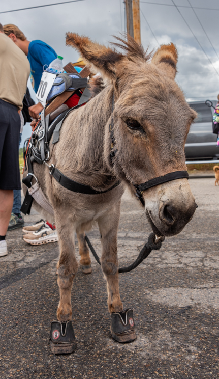
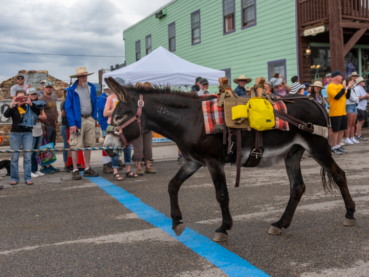
It turns out that burros come in three sizes, small, medium and large (“miniature,” “standard” and “mammoth”). When the burros lined up at the starting line, you could see the size differences between them!

The first burro race was the “long course” race — 29+ miles round trip from Fairplay, which is at 9,953’ elevation, to the top of Mosquito Pass at 13,185’ elevation, and then back down again. Longer than a marathon (which is 26.2 miles) and raced at insanely high elevations, this is one heck of a race!!

Start of the long distance burro race at Fairplay Colorado Burro Days

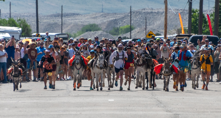
29 miles to go — Both mini and standard burros and their runners left the starting line for a long day of racing high up into the mountain peaks and back down again in the “long course” race.

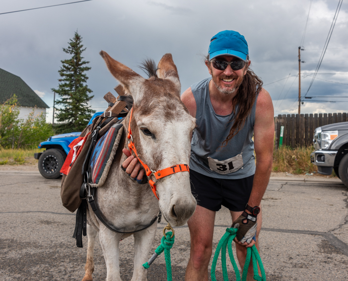
Each racing team consists of just one runner and one burro, and it is very grueling for both. Unlike a traditional marathon, there are no water stations along the way, although there are checkpoints, and fans can watch from public property.

The burros were carrying packs which held whatever the racers might need: water bottles, energy food, clothing for the high elevation at the top and/or other survival necessities. The runners carried the burro’s tether and more water and food and other goodies.

We found out later that the long race at Burro Days in Fairplay is actually the first race in the “Triple Crown” of burro races each summer. The other two races are held in nearby Leadville and Buena Vista in August.

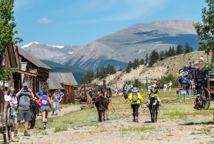
At the far end of Front Street there is a reconstructed living history museum mining camp called South Park City, and when the runners and burros passed under the South Park City gate around 10:20 in the morning to begin their trek to Mosquito Pass and back, they weren’t expected to be seen again until late afternoon at the very earliest. Some wouldn’t come in until sunset or after dark or even as late as midnight!

Burro Race heads out the South Park Gate in Burro Days at Fairplay Colorado

The “long course” burro racers left Front Street and entered the living history museum mining camp of South Park City on their way into the mountains for a very long trek to Mosquito Pass and back.

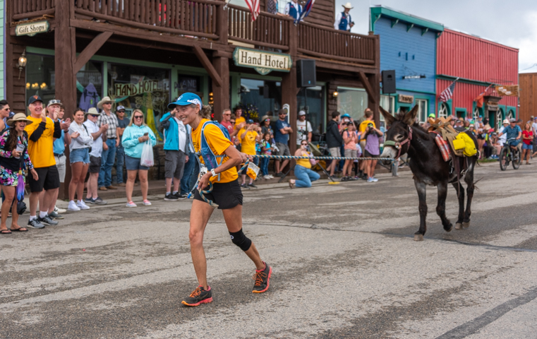
But for the crowd on Front Street, attention quickly turned to the second burro race of the day, the “short course” race which is a mere 15 miles of similar outback terrain!

The burros, large and small, soon lined up with their owners. Again, the burros wore packs and the runners were prepared for anything and everything the mountains might throw at them.

Burro Days Fairplay Colorado start of the short distance burro race

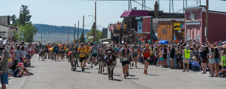
The “short course” burro race (a mere 15 miles) gets underway.

We watched a burro named Ivy go by with her owner. We’d met them before the race, and she’d told us that Ivy was a rescue burro. Her mother had been kept in very poor conditions and fed candy bars, so she was diabetic. Fortunately, Ivy was thriving now, and both owner and burro were eager to do the race.

Burro Days shorter distance burro race in Fairplay Colorado

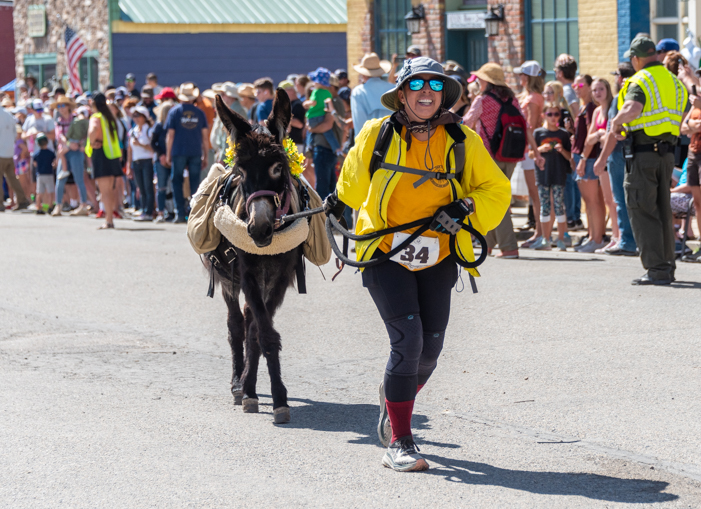
Ivy and her owner begin the “short course” burro race.

Soon, the “short course” racers passed under the South Park City gate and headed into the mountains beyond. Although their race wouldn’t take all day, the fastest racers still weren’t expected back for about two and a half hours!

Burro Race leaves Front Street and South Park in Fairplay Colorado Burro Days

Off they go into the mountains!

With nothing else to do while we waited for the burros and their companion runners to chase each other back to us, the crowd settled in for a really fun parade. Burro Days is non-stop action!

The parade began with the rumble of motorcycles in the distance. Soon, the color guard marched past followed by a group of roaring bikes.

Parade during Burro Days in Fairplay Colorado

.

Humorous costumes are a big theme at Burro Days, and there were several fun floats and groups in the parade. The “pothole patrol” went by followed by a clever rendition of the Titanic, complete with an iceberg.

Parade during Burro Days in Fairplay Colorado - the Pothole Brigade

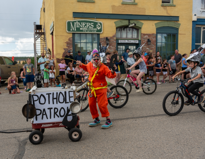
Watch out for those potholes!

Burro Days Parade in Fairplay Colorado - Titanic Float

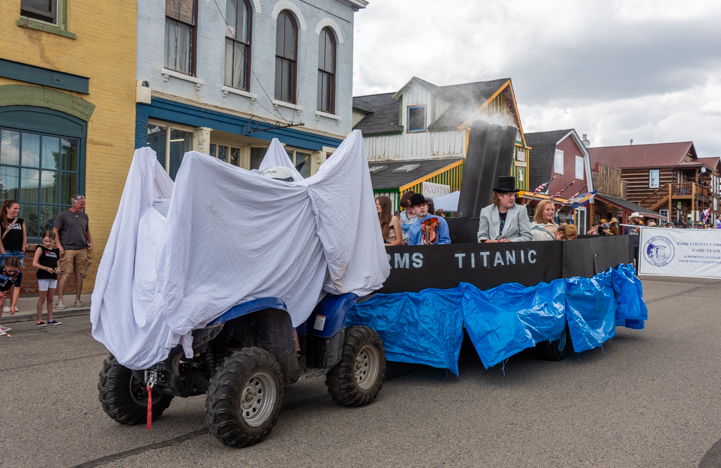
And watch out for that iceberg too!

The Rodeo Queen and Princess looked very regal as they went by in full regalia on their horses.

Rodeo Princess and Rodeo Queen at Burro Days Parade in Fairplay Colorado

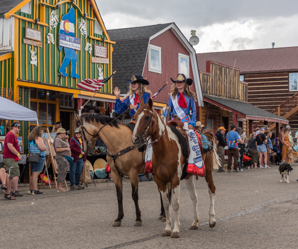
Rodeo Queen and Princess.

The sky had been growing darker and darker during the parade, and then all of a sudden the heavens opened up and let loose, drenching everything and everyone in a massive torrent. The crowd scattered to shelter under any kind of overhang we could find, and umbrellas popped up here and there.

Luckily, the parade was almost over, and in no time the downpour ended and people wandered back out onto Front Street, no worse for wear.

A banjo player strolled around entertaining everyone.

Banjo player and little girl at Burro Days in Fairplay Colorado

.

Ryobi drill set

And then news of the returning “short course” burros filtered through the crowd and the emcee announced their arrival.

The gates to South Park City swung wide, and two runners and their burros appeared, flying towards us at top speed, racing neck and neck.

Winning stretch of short distance burro race at Burro Days in Fairplay Colorado

The first two “short course” burro racers appeared in the distance.

A roar went up in the crowd as they sprinted down Front Street. It was going to be a photo finish! And it was going to be a little burro against a big burro and younger runner against an older runner to boot!

Final stretch short distance burro race at Burro Days in Fairplay Colorado

It’s going to be a photo finish!!

The crowd went wild as we watched the fast footfalls of these four racers. They were racing their hearts out!

It was impossible to tell which pair might win until suddenly, at the last second, the little burro surged ahead and stretched out his feet and nose across the line for the win.

What a fantastic race!

Photo Finish short distance burro race at Burro Days in Fairplay Colorado

The little burro wins by a whisker!

We found out the little burro’s name was Ben and his 15 year old companion runner was Aidan Malherbe. Aidan’s family raises burros and he’s been racing them his whole life! He runs track and cross country and trains about 50 miles a week.

Burro Days Champion Ben in Fairplay Colorado

Zippy Fast Little Ben…with special shoes on his front hooves!

Burro Race Champions Ben (Burro) and Aidan (runner-trainer) Fairplay Colorado

The champs, Ben and Aidan Malherbe.

Edged out by inches, the second burro over the line was Tito with companion runner Brian Rawlings. Brian also runs about 50 miles a week and has raced burros for years. He hadn’t planned to run in this race, but a friend called him the night before asking if he could run with Tito because a runner had pulled out. Tito is a wild BLM burro that Brian’s friend had rescued and trained.

What a great story!

Burro Days 2nd place Tito (burro) and Brian (runner-trainer) Fairplay Colorado

2nd place by a hoof length, Tito and Brian Rawlings.

The winning time for these four outstanding athletes was 2 hours and 24 minutes, similar to fast marathon times. Even though the distance wasn’t a marathon distance (15 miles vs. 26.2), the race was held at extremely high altitude and the runners were managing a running burro the whole way.

What a fabulous athletic accomplishment for all of them, and what a thrill these fine athletes gave the crowd!

Of course, the front of the race was very intense, but further down the line it was sometimes a different story. One burro took a very casual attitude and decided it would be more fun to walk rather than run down the finishing stretch. And who could blame him after running 15 miles through the mountains?!

Burro Days short distance burro race with reluctant burro in Fairplay Colorado

“Come on…we’re almost there!”

He took his time and stepped delicately over the finish line.

Burro Days burro race - no need to rush over the finish line! _

“What’s the rush?”

Another burro crossed under the South Park City sign — still two blocks from the finish line — and decided to take a break. His companion runner tried to coax him down Front Street, but this burro had other ideas.

Burro Days burro doesn't want to run any more at the end of the race

“I know the finish line is right up ahead, but I’m going to take a little breather.”

The burro took matters into his own hands (hooves?) and headed off the race course straight into the crowd.

Burro Days racing burro decides to join the crowd at the end of the race in Fairplay Colorado

“I wonder what these people are doing over here?”

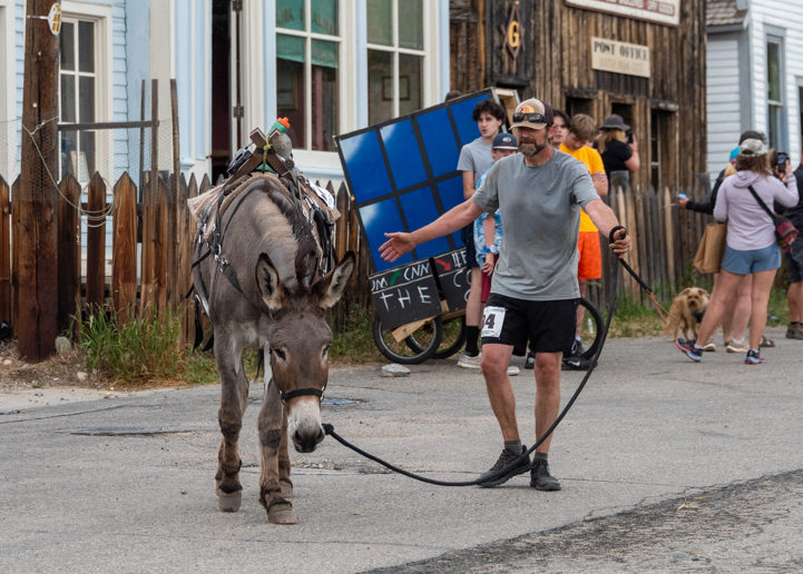
Eventually, all the burros made it across the finish line, and after a round of well earned congratulations and photos, the burros and their owners made their way back to their trailers. Meanwhile, the Outhouse Race participants were getting ready to roll!

B&W Tow & Go bumper hitch

There were only two entries in the Outhouse Race, but each team had been huddling at the starting line for a while, discussing their race strategies. Maneuvering an outhouse down a race course isn’t so easy!

Suddenly, they were off and running/rolling with a pair of runners on either side of the outhouse and a third guy sitting on the throne inside. Talk about laughter and hoots and hollers from the crowd!

Burro Days Outhouse Race in Fairplay Colorado

Ya gotta love an outhouse race!

Burro Days Outhouse Race in Fairplay Colorado

Don’t fall in!!

The long course burro racers were still a few hours out at this point, but we were pooped even though we hadn’t raced a step! So, we decided to leave all the festivities and head back to our trailer.

I’m not sure how the race went for the long course burro race contestants or when the winners finally arrived back in town, but their names will appear on the World Championship Pack-Burro Race Winners monument that stands near the finish line.

Burro Days monument of winners in Fairplay Colorado

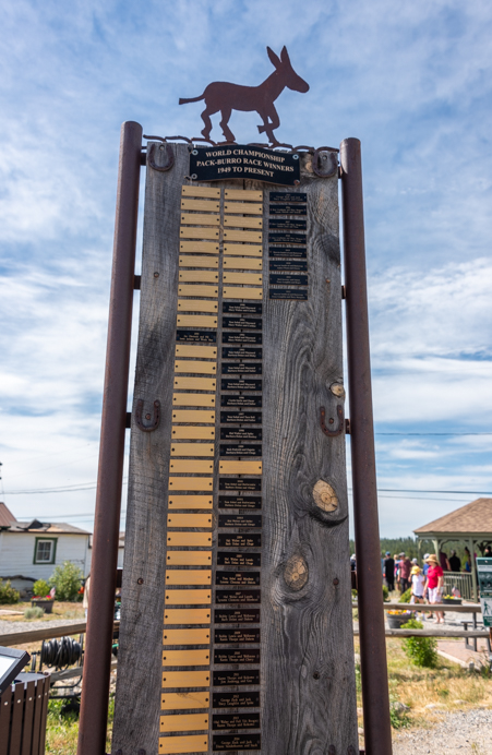
World Championship Pack-Burro Race Winners, 1949-Present.

If your travels take you anywhere near Fairplay, Colorado, at the end of July, don’t miss the very special Burro Days festival.

Meet a llama, pet a burro, and laugh as the outhouses careen down the road. It’s a total blast!

Note added later: RVing friends of ours who saw the burro race in Leadville told us that the winner of the long course races in both Fairplay and Leadville this year was the adorable little burro named Buttercup. She won the Fairplay Burro Days World Championship race in 5 hours, 26 minutes and 11 seconds with her running partner, Martin Sandoval. Unfortunately, the winner’s wreath did not adorn her neck in Buena Vista the following week, so she didn’t win the Triple Crown, but she has a lot of fans that love her!
Storage ottoman with tray top and drawer

Subscribe
Never miss a post — it’s free!

More info:

Other races we’ve seen in our travels:

More articles from Colorado:

Our most recent posts:

More of our Latest Posts are in the MENU.   New to this site? Visit RVers Start Here to find where we keep all the good stuff. Also check out our COOL NEW GEAR STORE!! *** CLICK HERE *** to see it!

<-Previous || Next->

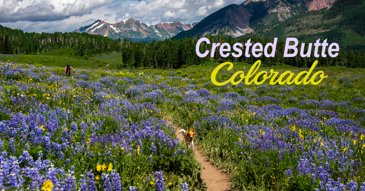
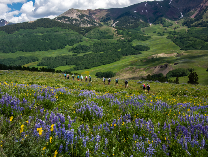
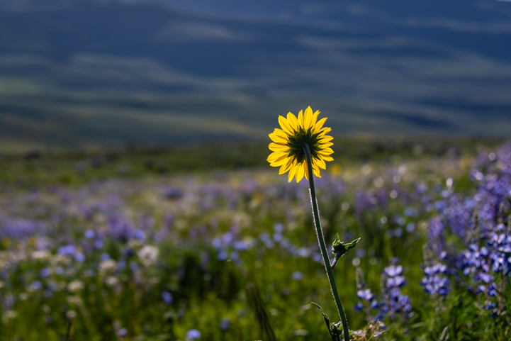
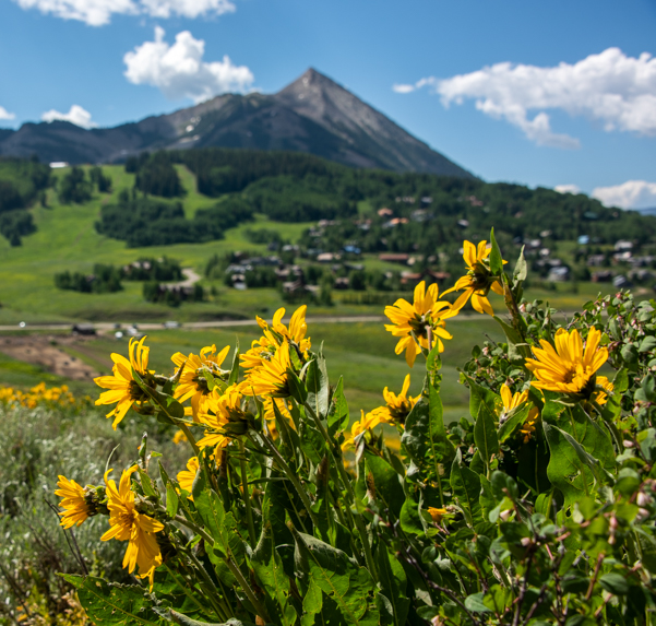
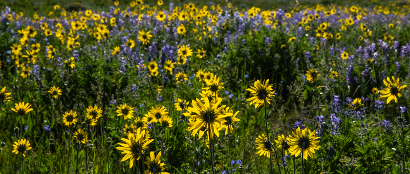
Crested Butte – Wildflower Capital of Colorado!

July 2023 – We’ve often heard that Crested Butte is the Wildflower Capital of Colorado, and this year we discovered that that statement is 100% true! The hillsides and valleys were absolutely covered with wildflowers during our visit in mid-July, and the views were breathtaking!

Crested Butte is the Wildflower Capital of Colorado!

Wildflower Capital of Colorado!

When we stopped at the Visitors Center in Crested Butte to find out which hiking trail had the best flowers, the kindly lady behind the counter just smiled. “The flowers are everywhere. All the hiking trails are great!”

Crested Butte Wildflowers on a hillside

Wildflowers everywhere!

She grabbed a map and began circling trails all over the vast area that surrounds Crested Butte as a crowd of eager tourists, including ourselves, listened intently.

For an easy and super rewarding stroll among the flowers, the best reports she was getting for wildflowers at that particular moment was out on Snodgrass Trail.

That was all we needed to hear — off we went!

Colorado's Best Wildflower Hikes

No sooner had we parked the truck at the trailhead than we were surrounded by blossoms smiling up at us. We couldn’t stop taking photos, and we’d only gone 10 steps from the truck!

Crested Butte Colorado wildflowers

From our first steps out of the truck, we were blown away by the beautiful flowers.

We ascended a short dirt two track road to a gate. Valleys filled with wildflowers stretched out on either side of us. From our feet all the way out to the horizon, the flowers were basking in the sun. What a place!

Fields of wildflowers in Crested Butte Colorado

Such an abundance of wildflowers — by far the best we’ve ever seen!

Wildflowers in Crested Butte Colorado

The flowers were breathtaking — and so were the mountain views!

Crested Butte Colorado- Wildflower Capital of Colorado

Color everywhere.

We were awestruck by the beauty. Forget hiking. We just stood and stared, turning around and around and taking in the incredible display of flowers.

Photographing Crested Butte Colorado wildflowers

“Can you believe this?!”

Hiking Snodgrass Trail at the peak of the wildflowers in Crested Butte Colorado

“It’s awesome — I’m blown away!”

Beautiful Crested Butte Colorado wildflowers

.

While our pace was “take a step, take ten photos,” Buddy, our Trail Scout, wanted to hike a little faster!

Crested Butte Colorado wildflowers and puppy

“Are you coming??”

Suddenly, a mountain biker appeared on the trail in the distance. It looked as if he were floating through a bed of flowers. We stepped to one side to let him pass.

“I’ve never seen so many wildflowers on this trail in my entire life!” He said to us with a big grin as he rode past.

Wildflowers surround mountain biker on Snodgrass Trail in Crested Butte Colorado

More wildflowers on this trail than he’s ever seen…

Another mountain biker came from the opposite direction. What a cool place to ride a bike!

Mountain biker in wildflowers on Snodgrass Trail in Crested Butte Colorado

There were lots of mountain bikers rolling through the valleys of flowers.

We’d never been to Crested Butte during the wildflower season before, but this year was said to be a peak year. The heavy snowfall during the winter combined with the drenching spring rains had created the perfect environment for the flowers to bloom with exuberance, and bloom they did!

A few months prior, we’d seen a gorgeous display of wild poppies near Phoenix, Arizona, but that was just for a mile or two along a highway. This was completely different because it was a variety of flowers on hillsides near and far.

Wildflowers on Snodgrass Trail in Crested Butte Colorado

.

Columbine is the Colorado State Flower

Dainty and delicate, the Columbine is Colorado’s state flower.

Crested Butte Colorado wildflowers

State flower or not, they were all wonderful!

Wildflower Guide Book

As the sun rose higher in the sky, more and more people joined us on the Snodgrass Trail. The trail is very narrow, so we were constantly stepping around each other, exchanging “oohs” and “aahs” over the wondrous beauty we were all experiencing together.

Buddy and the many other dogs on the trail were loving the outing too. Fresh air, good smells, new dogs to sniff, and a hiking trail — what more could anyone with four paws and a tail ever ask for?

Snodgrass Trail wildflowers and puppy in Crested Butte Colorado

Buddy was loving it, even if he had to wait for us.

Everyone was taking photos and there were quite a few photographers with tripods. When we set up our tripods, Buddy kept watch for anyone coming down the trail.

Photographer and puppy in Crested Butte Colorado wildflowers on Snodgrass Trail

“I’ll let you know if anyone is going to photo bomb your picture!”

It was such a beautiful day and place, Mark suggested we get a family shot, so we took a quick pic of the three of us in this spectacular setting.

Happy campers in the wildflowers on Snodgrass Trail in Crested Butte Colorado

For the family photo album.

There are many ways to enjoy the trails that go through these valleys of flowers, and hiking, mountain biking and photography are just a few. We spotted several groups of horseback riders out on trail rides too!

Horseback riders and wildflowers on Crested Butte Colorado Snodgrass Trail

What a place for a trail ride!

Crested Butte hosts a weeklong Wildflower Festival in the middle of July each summer, and groups of people were out with leaders and teachers who were describing the flowers’ habits, calling them by their botanical names, and explaining how this one spot in Colorado has a unique soil, enriched by Mancos shale, that wildflowers just love.

Hikers and wildflowers on Snodgrass Trail in Crested Butte Colorado

A hiking group from the Crested Butte Wildflower Festival passed in the distance.

The sun was rising high in the sky and it was getting quite hot, so we finally decided to turn around. It had taken us almost two hours to go less than a mile, so it could easily take us another two to get back to the truck!

Crested Butte Colorado wildflowers on a hillside

When we turned around, the flowers were beautifully backlit.

I’d worn a wide brimmed cowboy hat that morning to keep the sun off my face, and it was just at this moment when we turned around that I suddenly realized I’d lost my hat out in the flowers somewhere…a while ago.

I’d worn a special backpack (that I love, by the way) to carry my spare camera gear, water bottle and jacket, but I’d discovered that when I crouched down to shoot the flowers at their level, the back brim of the hat would hit the backpack, tip forward and cover my eyes. So, I’d taken my hat off each time I stopped to take photos, and somewhere out there in the vast valleys of flowers I’d left it on the ground.

Talk about looking for a needle in a haystack!

Wildflowers on Snodgrass Trail in Crested Butte Colorado

Hmmm…there’ a cowboy hat out there somewhere!

I hurried back to the last three or four places I’d been. I found the one tall flower that had caught my attention 20 minutes before, and I was convinced the hat was somewhere near there.

Goodmorning Sunshine! Wildflowers on Snodgrass Trail in Crested Butte Colorado-2

I loved this single tall flower and was quite cetain my hat lay somewhere nearby.

I searched and searched, but found nothing. I was so disappointed. What a glorious day this had been, but what a frustrating ending. I really liked that hat. It had a cool band around it made from braided horsehair, and I’d bought it from an interesting character at a swap meet just six months prior.

Oh well. After we both searched for an hour and retraced my steps a bunch of times, we gave up and went back to the truck.

Best Colorado Wildflower Hikes

That night we studied our photos to see if we could piece together where I might have been when I last put my hat on the ground.

We knew I hadn’t had it when we took our family shot, and I remembered that I’d been photographing clumps of purple lupine just before that.

Lavender Crested Butte Colorado wildflowers

Luscious lupine!

For some reason, Mark had taken a series of photos of me right around that time. So, on the computer, he blew up the area right around my feet in those photos — and there was my hat right next to me on the ground!

Honda EU2200i portable gas generator

We checked the times on our cameras and discovered mine was 2 minutes and 47 seconds ahead of his. Then we looked at the photos I had been taking when he took the photo of me. My pics at that time were of the clumps of lupine, as I’d suspected. Mark remembered that I’d been standing just off the trail, and in his photos of me there were three big yellow flowers nearby.

Photographing wildflowers on Snodgrass Trail in Crested Butte Colorado

These three yellow flowers were the clue — but could I possibly find them again?

All I had to do was walk along the trail until I found the spot where three big yellow flowers were growing together!

The next day we raced back to Crested Butte. We were camping over 30 miles away, but the miles flew by. When I dashed out onto the trail, I was instantly caught up in the beauty again! My camera couldn’t help itself, and it took lots of photos while I ran down the trail in hot pursuit of my hat.

Wildflowers in Crested Butte Colorado

The cheerful flowers took my breath away…again!

Columbines in Crested Butte Colorado on the Snodgrass Trail

We were supposed to be looking for yellow flowers, but ended up totally distracted by gorgeous Columbines!

The valleys were filled with happy yellow flowers. How could I ever find those three?

Wildflowers at Crested Butte Colorado on the Snodgrass Trail

Just three yellow flowers…

I came to the area where I’d been photographing the lupine and began to look for those three yellow flowers where I’d been standing… I walked slowly and passed lots of yellow flowers, but no groups of three.

Then, suddenly, I saw them, the only group of 3 yellow flowers on the entire trail! I peered into the vast garden of flowers behind them…and there was my hat! Right where I’d left it! I put it on my head and couldn’t help but laugh out loud. What are the chances?

Happy camper in the wildflowers in Crested Butte Colorado

Someone was watching out for me…needle in the haystack found!!

Snodgrass Trail is just one of dozens of great trails in the area, and the wildflowers on each trail peak at a different time between mid-July and August. In fact, a local hiker on the trail told us he thought Snodgrass was still a week from peaking when we were there! The red Indian Paintbrush hadn’t bloomed yet and the dark purple Larkspur were just beginning to bud.

We’d heard fabulous reports about the wildflowers on Brush Creek Trail, but by the time we got out there many of the flowers had faded. So, it’s hit-or-miss, not only with the overall abundance of flowers for a given season but also which hillsides have the most dazzling displays at any particular time.

Wildflowers on Brush Creek Trail in Crested Butte Colorado

Wildflowers on Brush Creek Trail

Ironically, the best wildflowers in the Brush Creek area were on the roadside in the last hundred yards before the Brush Creek Trailhead!

Wildflowers on Brush Creek Road in Crested Butte Colorado

Wildflowers on the roadside as we approached Brush Creek Trailhead.

Notes for taking an RV trip to Crested Butte

The wildflowers in Crested Butte are worth going way out of your way to see. However, it’s not super easy with an RV.

Tourists staying in the big hotels in and around Crested Butte are able to roll out of bed and hit the hiking trails at dawn while we’d already been driving for over half an hour when we joined them.

There’s only one RV park in Crested Butte, and the rate we saw was over $100/night, including taxes, and the reviews weren’t great.

However, there are both USFS campgrounds for smaller rigs and designated boondocking sites for bigger rigs if you are willing to drive many miles down dusty dirt roads. If that doesn’t sound appealing, you may be happiest staying in Gunnison which is 27 miles south of Crested Butte.

We drove that route three times to see the wildflowers, and as I mentioned, the miles flew by. It’s a beautiful drive!

Wildflowers + mountain on Snodgrass trail in Crested Butte Colorado

Good morning, Sunshine!

Subscribe
Never miss a post — it’s free!

More info about Crested Butte and its spectacular wildflowers:

Mountains and wildflowers on Snodgrass Trail in Crested Butte Colorado

Crested Butte’s wildflowers are worth making an extra effort to see!

Other places we’ve seen great wildflowers:

Wildflowers in Crested Butte Colorado

.

More articles from our travels in Colorado:

Our most recent posts:

More of our Latest Posts are in the MENU.   New to this site? Visit RVers Start Here to find where we keep all the good stuff. Also check out our COOL NEW GEAR STORE!! *** CLICK HERE *** to see it!

Magma Stackable RV Cookware

<-Previous || Next->

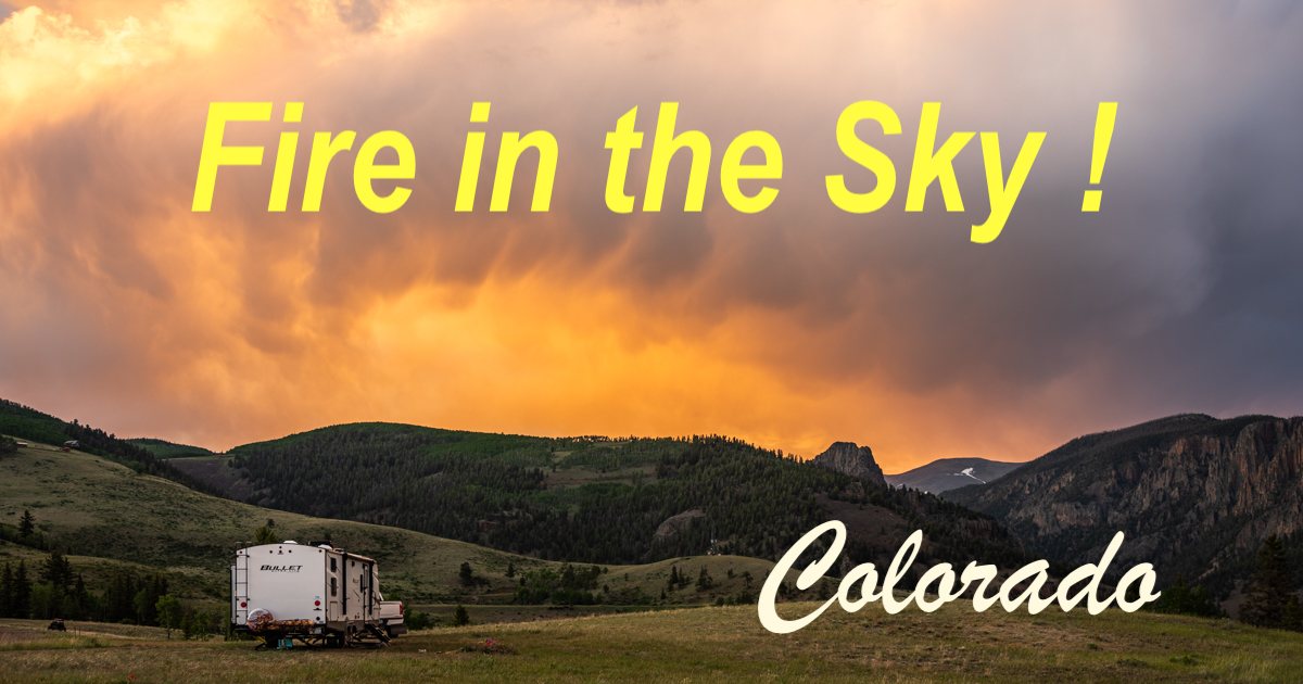
Silver Thread Scenic Byway in Colorado – Fire in the Sky!

July 2023 – The Silver Thread Scenic Byway in Colorado meanders between mountains, over rolling hills and past scenic lakes for 120 miles on Colorado State Route 149 between the Blue Mesa Reservoir and the town of South Fork.

This is a very remote area that is wide open country for much of the way, punctuated by two picturesque villages, Lake City and Creede.

We found a place to RV camp in the hinterlands, and along with utter peace and quiet during our stay, we were blessed with two extraordinary sunset light shows that produced fire in the sky!

Silver Thread Scenic Byway in Colorado - Fire in the Sky!

A dramatic sunset on the Silver Thread Scenic Byway in Colorado

Many years ago, we rode this route on our bicycles as part of the Bike Tour of Colorado. Our most vivid memory from that ride is Slumgullion Pass, a beast of a mountain climb that peaks at an elevation of 11,530’. This lofty summit is preceded by umpteen tight turning switchbacks on the ascent and is followed by a screaming descent down umpteen more fast switchbacks on the other side!

On our RV trip along the Silver Thread Scenic Byway in Colorado this year, we did lots of sightseeing but no pedaling. After soaking in the views for a while, we stopped at the beautiful Weminuche Wilderness Vista Overlook. What an exquisite panorama of Brown Lakes and the mountains beyond!

Weminuche Wilderness Vista Silver Thread Scenic Byway in Colorado

View from the Weminuche Wilderness Vista Overlook on the Silver Thread Scenic Byway in Colorado.

Another highlight on the Silver Thread Scenic Byway was a stop at North Clear Creek Falls which is considered Colorado’s most photographed waterfall.

It was easy to see why this cascade is so well loved. Not only is it a gorgeous waterfall, but after winding through endless meadows and forests, it was a wonderful change of scenery to see water crashing down the side of a cliff.

North Clear Creek Falls Waterfall Silver Thread Scenic Byway in Colorado

North Clear Creek Waterfall on the Silver Thread Scenic Byway in Colorado.

North Clear Creek Falls Silver Thread Scenic Byway in Colorado

North Clear Creek Falls drops more than 100′ over the side of a cliff.

Colorado Scenic Drives

Mountain weather is always unpredictable, and so it was during our stay. The wind howled so fiercely in the afternoons that, at times, we thought we were going to get blown right off the hillsides!

At dusk, however, the wind completely stopped. On one afternoon, we noticed storm clouds beginning to form on the horizon. We ran out of the RV to see what was going on!

Storm clouds on Silver Thread Scenic Byway in Colorado

After a wildly windy afternoon, stillness prevailed and storm clouds began to form.

Mountain light on Silver Thread Scenic Byway in Colorado

We were dry but there was lots of rain beginning to fall across the valley.

The sky began to show hints of yellow and orange as the heavy storm clouds gradually filled the sky. We weren’t sure if we were going to get drenched, but we didn’t want to miss a moment of this incredible heavenly spectacle that was unfolding before us.

Brooding sky on Silver Thread Scenic Byway in Colorado

The storm clouds began to show a hint of sunset colors.

Wild sky on Silver Thread Scenic Byway in Colorado

The heavens filled with color when the sun vanished for the day!

Some crazy patterns formed as the mist and clouds rolled across the sky.

Roiling clouds on Silver Thread Scenic Byway in Colorado

The clouds formed patterns as they rolled over on themselves.

Sunset on Silver Thread Scenic Byway in Colorado

The patterns in the heavens looked like fingers!

In another direction, the whole underbelly of a mammoth cloud turned orange.

Sunset on Silver Thread Scenic Byway in Colorado

The sunset was evolving differently in every part of the sky!

We turned to head back towards the RV, and our trailer looked like it was facing a raging fire in the sky!

Sunset with RV on Silver Thread Scenic Byway in Colorado

These weren’t flames but they sure look like they could be!

The storm clouds soon darkened the landscape around us. Only the fiery embers of the sunset still burned above us.

Sunset on Colorado's Silver Thread Scenic Byway

Our jaws hung open as the constantly changing and extraordinary views evolved all around us.

Vibrant sunset on Colorado's Silver Thread Scenic Byway

What a sight!

Finally, darkness fell and we made our way back into the cozy confines of our RV.

But sleep was elusive. We couldn’t stop talking excitedly about the unbelievable sunset light show we’d just seen. It had come upon us just as quickly as it had left, and there had been no hint ahead of time that anything unusual was about to begin. The sky had been clear blue until the first cloud showed up!

A few nights later, we were treated to more drama in the sky. Again, late in the afternoon, the howling wind that had buffeted us for hours on end came to a sudden stop, and the clear blue sky gave way to a big puffy cloud with a dark underbelly growing above us.

We noticed a lone car camper on a distant hillside that had just arrived for the night. The camper looked really tiny under that big menacing cloud as he got his camping gear out of his trunk!

Camping under storm clouds on the Silver Thread Scenic Byway in Colorado

A huge storm cloud threatens a lone car camper on a distant hillside.

Then the cloud began to swirl and roil within itself, showing off peachy yellow highlights that flamed between dark edges.

Storm clouds on the Silver Thread Scenic Byway in Colorado

The play of light and shadow within this cloud was fantastic!

As all this happened in the heavens, Buddy’s attention was on the local chipmunk population which skittered about from burrow to burrow.

Rain clouds and puppy on the Silver Thread Scenic Byway in Colorado

We were enthralled by the wild skies but Buddy had more terrestrial interests.

Honda EU2200i portable gas generator

A few minutes later, that massive cloud began to fade, break apart and float away. We wandered down a trail, keeping our eyes on the sky. Suddenly, the clouds began to organize into stripes with pink highlights.

photographing sunset on the Silver Thread Scenic Byway in Colorado

Meanwhile, a pink glow began to radiate in another part of the sky.

Pink sunset on the Silver Thread Scenic Byway in Colorado

Suddenly, part of the sky began to blush pink.

By chance, I turned my head towards a very dark part of the sky and noticed a bright orange spot in the distance. WTH?

Then, from our many nights of sailing on blackened seas under inky skies, we suddenly realized it was a bright orange full moon rising behind the mountains!

How awesome is that?!

Moonrise on the Silver Thread Scenic Bywayin Colorado

The full moon — dressed in flaming orange — peeked over the darkened mountains!

Full moon rising on the Silver Thread Scenic Byway in Colorado

What great fortune to have all this happen on the night of a fiery full moon!

Panning back to take in the whole view, we watched the pink glow of sunset arch over the landscape as the moon rose steadily and silently.

Moon rise on the Silver Thread Scenic Byway in Colorado

The moon rose in the middle of a glorious sunset.

We were both breathless from witnessing this glorious sunset light show. What a blessing to stand here on this mountain and see this miraculous display of color and drama!

The moon disappeared for a while behind the clouds, but then it reappeared above them, soaring peacefully across a fluffy bed of vivid orange.

Full moon on the Silver Thread Scenic Byway in Colorado

The full moon rose above the sunset — sensational!

As we put away our gear and turned to go back to the RV, we noticed a quietly cheering crowd on the far hillside — a row of trees had deemed the whole show a worthy of a standing ovation.

Sunset over pine trees on the Silver Thread Scenic Byway in Colorado

These trees witness sunsets here every night, but they knew this one was extra special.

What beauty! What a sunset light show! What a glorious moment on the Silver Thread Scenic Byway in Colorado!!

RV under the stars in the mountains

Goodnight!

Subscribe
Never miss a post — it’s free!

More info about the Silver Thread Scenic Byway in Colorado:

Other places where we saw wild skies!

Dog Bowl with Kibble Storage

More articles from our travels in Colorado:

Our most recent posts:

More of our Latest Posts are in the MENU.   New to this site? Visit RVers Start Here to find where we keep all the good stuff. Also check out our COOL NEW GEAR STORE!! *** CLICK HERE *** to see it!

<-Previous || Next->

Grand Canyon South Rim RV Tips + Lesser Known Overlooks!

June 2023 – We visited the South Rim of Grand Canyon National Park in our RV travels this year in part because we’d never really gotten to know the place, despite several previous trips. Our hope was that on this visit we would spend more time, be less rushed, and come away feeling a bond to it that had been lacking before. By the time we left 10 days later, we’d fulfilled that dream in spades. This post shares our tips for finding peace and quiet at this busy place and suggests some lesser known overlooks that are worth seeing!

Grand Canyon National Park South Rim RV tips + Lesser Known Overlooks!

This sign is so popular for selfies that there is a special side road to it as you drive in.
But ya gotta do it!!

In the past, like everyone else, we had zipped to the rim, dodging the crowds as we went, peered over the edge in a few places, been awe-struck by every view, and left.

This time, for some reason, there were very few crowds. Perhaps it was the colder than normal spring season. Perhaps it was the impact of inflation keeping travelers at home. Or perhaps it was just our own personal timing.

1000 Places to See Before You Die

After a few days, we realized that we kept going into Grand Canyon National Park at odd and unpopular hours, and maybe that was the reason it was quiet!

We’d arrive at Grand Canyon at 5:30 in the afternoon, just in time to find a spot to watch the sunset, and shortly after the crowds had left! There was no line at the entrance gate, plenty of parking spaces anywhere we wanted to park, and only a few people milling around. Perfect!

Pre-dawn at Mather Point Grand Canyon National Park

What a view!

We also visited the park in the early morning.

There would be a peace and calm in the air at this magical hour as only a handful of people strolled around. They’d be quietly enjoying the views while sipping their morning coffee, and some would be walking their dogs.

Everyone was very friendly, and for the first time I can remember at any National Park in the last ten years, we heard as much or more American accented English as we did all the other languages of the world. That was very heartwarming. It’s wonderful to see Americans enjoying the National Parks.

We also found the South Rim to be extremely dog friendly.

Dogs greet each other at Grand Canyon National Park South Rim Trail

While their owners checked out the views, the dogs checked out each other!

A pooch rode in a bike basket to Hermits Rest at Grand Canyon National Park

This lucky pup rode in this bicycle handlebar basket all the way to Hermits Rest and back!

Dogs on leash can walk anywhere on the Rim at Grand Canyon National Park South Rim but they can't enter any buildings

Dogs aren’t allowed in the buildings…but Buddy took a peek inside the Hopi House from the doorway.

We came away feeling that this would be a fantastic place for a week-long family vacation. A lot of families pack several National Parks into one trip, but if you stay in the Trailer Village RV Park (full hookups and big-rig friendly) or at Mather Campground (dry camping for RVs under 27-30 feet), both of which are inside the Park and close to the rim, you’ve got a home base right by some of the best views in the world as well as paved bike trails that go all through the woods and take you to the hotel and concession hubs and out to the rim too.

The shuttle buses are frequent so you don’t have to drive anywhere, and if you stay long enough, you can take your time exploring each viewpoint or historical building, come back to camp to rest and regroup, and not wind up with that massive National Park Overload that hits all of us when we try to see too much in too short a time.

Yaki Point at Grand Canyon National Park

The views and the light change all day long — storm clouds are a blessing!

It also dawned on us after we’d watched the arrival of the train one day that the train (which is many cars long) brings thousands of people to the heart of Grand Canyon Village every day, just as the Santa Fe Railroad magnates had originally intended. It arrives in the late morning, and all those people descend on the park in one fell swoop. However, it also leaves every afternoon and whisks them all away.

Each time we went to Grand Canyon at midday, it was quite busy. Not packed, by any stretch of the imagination, but much busier than in the early mornings and late afternoons.

RV Log Book Journal

So, we’d suggest that if you want to have an intimate Grand Canyon experience that is similar to what you find at the North Rim all day long (the North Rim gets only 10% of the traffic that the South Rim does), then do your sightseeing at the South Rim around breakfast time and/or cocktail hour! Or better yet, for sunrise and sunset.

Another trick is to visit some of the lesser known overlooks. Not all of them appear on the map that the National Park Service provides, and that’s what keeps the crowds in check.

SHOSHONE POINT

One of the lesser known and more remote overlooks is Shoshone Point which is on the eastbound road to Desert View. You can get a detailed map at the entrance station or Visitors Centers if you ask. The best thing about this overlook for anyone with a dog is that there is a one mile long hike along a flat forest road through beautiful ponderosa pine woods to get there. Buddy loved it.

Grand Canyon Shoshone Point has a great hike for dogs

“That was a really great hike. Can I go do it again while you take photos here?”

The Shoshone Point overlook isn’t very big and there aren’t any railings. We did find we needed to scramble over various rocks to get ourselves situated to enjoy the view, however. We watched the sunset with about 8 other people.

Shoshone Point Grand Canyon National Park

Rich Grand Canyon colors just before sunset at Shoshone Point.

Shoshone Point Overlook at Grand Canyon National Park

There’s a cool triangular formation just below Shoshone Point.

Shoshone Point Grand Canyon Naitonal Park

Shoshone Point.

There are some lovely trees, and it’s a great place to get a Grand Canyon portrait of yourself and your family. We did, and so did everyone else!

Tree at Shoshone Point Grand Canyon National Park

.

Shoshone Point Overlook at Grand Canyon National Park is great for selfies

Happy campers.

Happy Campers at Grand Canyon National Park

Another one!

GRANDVIEW POINT

Grandview Point overlook appears on the map the National Park Service provides, but we found it a frustrating place to visit at sunset. Perhaps at another time of day it would be different. The actual overlook is tiny, and the narrow trail around the edge is off-camber and includes some awkward maneuvers over the rocks.

It started to rain just as we arrived, making the rocks quite slick, and at that very moment two backcountry tours showed up in huge oversized off-road vehicles: Buck Wild Tours and Pink Jeep Tours.

Suddenly, an overlook that could comfortably hold 10 people all together had about 35 people squeezed in, all of them rushing to see and do everything they wanted to before their tour vehicle left for the next stop.

We still enjoyed ourselves there, but finding a place to stand among all those excited and pushy people was a challenge!

The storm clouds and mist more than made up for the various inconveniences, though, and the drama out in the Canyon was a sight to see.

Grand View Point at Grand Canyon National Park

Rain in the distance at Grandview Point.

Photography at Grand View Point in Grand Canyon National Park

Storm clouds and the sinking sun create wonderful light and shadow at Grandview Point.

Grand View Point Grand Canyon National Park

Sun, mist, rain and two rainbows!

Grand Canyon National Park Grand View Point Overlook

At last the sun breaks through just before setting.

Happy Camper Holding Tank Treatment

YAKI POINT

There are free shuttle buses as well as parking areas for most of the overlooks at Grand Canyon’s South Rim. However, Yaki Point is a little different because the ONLY way to get there is either by shuttle bus or by your own two feet. Cars are not allowed on the access road that goes to Yaki Point from the eastbound road to Desert View.

Since dogs aren’t allowed on the shuttle buses, we opted to park at an overlook nearby slightly west of Yaki Point and hike about 1.5 miles through the woods to get to it. Of course, Buddy was all over that!!

The storminess we’d seen the day before at Grandview Point was lingering and we saw some fabulous crepuscular rays as the sun went down.

Point Grand Canyon National Park

Light bursts forth from the heavens.

Yaki Point at Grand Canyon National Park

The setting sun peeks through the clouds.

Point Grand Canyon National Park

Sunset.

WE SEE SUNRISE – AT LAST

It’s not too hard to make an appointment with Nature to see a sunset at Grand Canyon. You’re awake and the only compromise you might have to make is that it occurs right at Beer-Thirty and/or dinnertime.

However, sunrise is a totally different story because it involves getting out of a warm bed, driving somewhere in the cold and dark, and standing at the Rim shivering while you wait for the sun to rise. We kept putting it off, but finally got ourselves motivated at 4:00 in the morning to head out to the Rim Trail at Mather Point.

Wow, did we get lucky that morning! The storm clouds were still lingering, and they put on quite a show.

Sunrise at Mather Point in Grand Canyon National Park

Wow!

Mather Point sunrise Grand Canyon National Park

This sunrise was worth getting up for!

Mather Point is a popular place for both sunrise and sunset, and there were quite a few other people who’d dragged themselves out from under their warm covers to go shiver on the edge of this massive chasm.

People watch the sunrise at Mather Point in Grand Canyon National Park

Everyone had a camera or cell phone pointed at the incredible display.

There were several little groups of people all along the rim, and when I stepped back, I saw two more familiar figures taking in the show.

People watch and photograph sunrise at Mather Point in Grand Canyon National Park

Mark captures the action while Buddy looks on.

Grand Canyon Fodors Guide

In the end, I estimated at least 100 people had come to Mather Point that morning to witness the sunrise.

The brilliant clouds finally gave up their pre-dawn color, and then we had a few minutes’ wait for the sun to creep above the horizon.

Some stragglers came running to the edge from their hastily parked cars, still zipping up their jackets and messing with their phones, only to realize when they got out to the rim that it was almost over!

Then Poof! — then sun was up!

Starburst at sunrise in Grand Canyon National Park

The sun peeks over the edge.

Everyone at the Rim was enraptured by the whole show and kept their eyes (and cell phones) glued to the spectacle. No one said a thing. it was so quiet you could hear a pin drop.

Well, there was ONE person who wasn’t watching…

People watch the sun crest the horizon in Grand Canyon National Park at sunrise

.

DESERT VIEW

As you head east out of Grand Canyon National Park, the very last overlook is Desert View. This is a big area with a gift shop and Mary Colter’s famous Desert View Watchtower.

We drove out to Desert View at oh-dark-thirty on our last morning on the way out of the Park so we could catch the sunrise, and there were only three people there with us. It wasn’t nearly as special a sunrise as we’d had at Mather Point, but it was still lovely and still very exciting to be there for it.

Desert View sunrise Grand Canyon National Park

Sunrise at Desert View.

Sunrise at Desert View Grand Canyon National Park

Desert View is a great place to see the Colorado River far below.

Sunrise at Desert View in Grand Canyon National Park

Desert View Sunrise.

Desert View Overlook Grand Canyon National Park sunrise

.

Desert View Sunrise Grand Canyon National Park

The clouds formed a swirling, inky backdrop to this “window” next to the Desert View Watchtower.

We enjoyed our visit to Grand Canyon’s South Rim this year so much we revised our previous opinion of the North vs. South Rims. When we first visited the North Rim many years ago, we nicknamed it “Grand Canyon’s Better Half” because it was so much more intimate, historic and authentic feeling than what we had seen of the South Rim on short visits at that point. However that’s not really true. Both rims are well worth seeing, and neither one is superior to the other. They’re just different.

The North Rim is 1,000’ higher, more remote and takes a lot longer to get to from any major freeways. It has a fabulous historic lodge, restaurant and campground right on the Rim, and most of the visitors are from the neighboring states. The South Rim is much more commercial, much busier, and plays host to far more international visitors, but we discovered you can avoid the chaos, and even share the experience with your pup if you like, if you plan your visit carefully.

Renogy 200 watt solar panel

Interestingly, the last time we visited the North Rim (2019), we had a hard time finding parking at the central area near the Lodge, whereas this year at the South Rim we had no trouble at all anywhere. The North Rim doesn’t allow dogs on any trails, even the main paved trail, whereas the South Rim is a dog mecca along the entire 5+ mile long paved Rim Trail. Yet we never saw any dog poop and heard only one dog bark, and he was well controlled by his owner.

The views are comparable on both rims, but the distances between the overlooks are much shorter at the South Rim than at the North Rim.

Desert View Overlook Grand Canyon National Park

Now THAT is a spot for a park bench!

In some ways, choosing which one to visit — if you plan to visit only one — may come down to which rim currently has a large active fire burning. Both rims have frequent fires that are deliberately set by the US Forest Service, and they last for months, creating haze across the views, a brown tinge to the sky at the horizon, and the smell of smoke in the air.

The clearest skies are during the winter and early spring when the previous year’s fires are fully extinguished by snowfall and the new fires haven’t started yet.

It’s chilly at that time of year (the South Rim is at 7,000’ elevation and the North Rim is at 8,000’ elevation), but the clear air makes the views even more stunning, and of course you’ll be ahead of the summer crowds.

Grand Canyon National Park sign

Goodbye, Grand Canyon…til next time!

Subscribe
Never miss a post — it’s free!

More info about Grand Canyon National Park:

Grand Canyon National Park – National Park Service (NPS) Official Web Page
RV Parks and Campgrounds In and Near the Park – NPS Official Web Page
Trailer Village RV Park – Big rig friendly with hookups inside the Park near Mather Point
Mather Campground – Smaller RVs and no hookups inside the Park near Grand Canyon Village
Desert View Campground – Smaller RVs and no hookups inside the Park near Desert View
Ten-X Campground – Smaller RVs and no hookups outside the Park 10 miles from Grand Canyon Village
Grand Canyon Camper Village – Big Rig friendly with hookups outside the Park 9 miles from Grand Canyon Village

We heard a rumor from a local resident that a very large RV park is planned and has been approved for the town of Tusayan about 10 miles south of Grand Canyon Village. However, it is just a rumor as of the summer of 2023.

All of our blog posts about the Grand Canyon:

Our most recent posts:

More of our Latest Posts are in the MENU.   New to this site? Visit RVers Start Here to find where we keep all the good stuff. Also check out our COOL NEW GEAR STORE!! *** CLICK HERE *** to see it!


<-Previous || Next->

Grand Canyon History: A Navajo & a Mule Link Us to the Past

The Grand Canyon is most beloved for the raw power of its majestic views, but Grand Canyon history is fascinating too. Learning some of the stories behind the development of this world famous tourist destination and being able to make a personal connection to that history through the world famous mule rides (of all things!) was thought-provoking…and fulfilling.

Grand Canyon History and Mules!

Our Grand Canyon visit took a very special turn when we met this man!

As we have discovered America’s history during our many years of RV travel, I have felt a special attachment to the late 1800s and early 1900s because, as a child, my much adored great-uncle, who was born in 1885 and was a professional artist, lived with my family until his death in 1971 when I was 11.

Throughout my life, whenever we’ve encountered anything to do with his era, I’ve thought of him and wondered whether he saw it, or was aware of it, or what kind of stories he might have heard about it from friends and relatives.

Near the end of his life, he would often say that he’d lived during a period of history that had seen more change than any other: growing up with horses, buggies and trains for transportation in the late 1800s, witnessing the transformative rise of the automobile followed by the airplane in the early to mid-1900s, and finally flipping on a TV to watch astronauts ride a rocket ship to the moon and back in 1969.

Puppy checks out the train tracks

Buddy checks out the train tracks that travel through time at Grand Canyon

One of his treasured memories from his young adulthood was the trip he took to the Grand Canyon around 1907. Sitting around the dinner table in urban Massachusetts in the 1960s, we heard about his ride on a mule down the Bright Angel Trail and the beauty of the El Tovar hotel.

I couldn’t picture any of it, though. Not the Grand Canyon, not the narrow cliffside trail, maybe the hotel, but definitely not my very ancient great-uncle as a nimble young man astride a mule!

Grand Canyon Fodors Guide
Hikers on Bright Angel Trail in Grand Canyon National Park

The beginning of the Bright Angel Trail in Grand Canyon National Park.
Hikers and mules pass each other on these narrow cliff-side trails.

Hikers on Bright Angel Trail in Grand Canyon National Park

Bright Angel Trail, like most trails in the Park, has lots of exposed areas where you’re hiking right on the edge!

So, on this trip to Grand Canyon, I wanted to peel back the layers of what modern tourists see at the Grand Canyon, especially Grand Canyon Village, and try to envision something of what the experience might have been like back around 1907 for a newly minted Art Institute of Chicago graduate (class of 1905) who was in his early 20s.

He rode the train from Chicago to get to there, of course, and today thousands of people come to the Grand Canyon by train everyday on the same tracks that the Santa Fe Railraod completed in 1901.

Grand Canyon history - the Railway train prior to 1910

A train at the Grand Canyon depot before 1910 when it was still just a humble shack!

The arrival of the train in the tiny settlement on the edge of this vast and charismatic chasm changed everything about it.

Settlers had lived in the area since the mid-1800s, and everyone who dared make a go of it struggled to make a life for themselves in the harsh and remote land. Most were miners and cattle ranchers. The few people who saw the tourism potential built their own private roads from Flagstaff and Williams through 70 miles of forest to their own rustic properties at different points along the rim. Many homesteaded their land.

Grand Canyon history - the arrival of the train at Grand Canyon National Park

The arrival of the Grand Canyon Railroad changed everything about Grand Canyon.

Before the train arrived, only a trickle of die-hard travelers would visit Grand Canyon. They would take the train to Williams or Flagstaff and then catch a stage coach or rent a buggy to travel one of the private roads that led to a proprietor’s guest house or tent somewhere along the rim.

What is now an hour and a half long ride in a car generally took two bumpy days by horse-drawn stage coach, and the accommodations for most travelers visiting the the Grand Canyon were simple tents.

Grand Canyon Railway arrival at Grand Canyon National Park 2

The train took just a few hours to get to Grand Canyon whereas a stage coach ride took two days!

The big money railroad men recognized the immense tourism potential of the Grand Canyon, and after completing the train tracks, Santa Fe Railroad went on to build a stunning resort hotel in 1905. They called it El Tovar and positioned it right at the end of the train tracks next to the Bright Angel Trail that took hikers down into the Canyon.

At this point in time, destination spa hotels in remote locales were rare or didn’t even exist. Not only were the rooms at El Tovar beautifully appointed, but there were two barbershops, a solarium, hot and cold running water, and the freshest food imaginable.

In addition, the El Tovar hotel had a chicken coop for fresh eggs, two roof gardens, a music room, an art room, a billiard hall and a gift shop! Staying there was an elegant and all inclusive affair.

It was the finest of high class living in a place that had never offered visitors much more than the most basic, rustic accommodations.

Grand Canyon Guide Book

Unlike today’s tourists, many of whom drive straight to the rim, say “WOW!” a few times, get a selfie and then leave, a journey to the Grand Canyon in those days was a trip that deserved a fairly long stay, making those barber shops a necessity.

El Toval Hotel and Grand Canyon history

El Tovar Hotel.

A room at El Tovar cost $4.50 a night as compared to just $1.00 to $3.00 for a tent or rustic hotel room. However, a stage coach ride cost $15 while the train was a mere $3.50. (For reference, rooms at El Tovar are going for $394 per night now!).

No doubt customers did some quick calculations and realized there was no reason to undertake a two day bone jarring journey on a small private road to a second rate hotel or tent when you could watch the world go from a comfortable window seat on a train for a mere three hours and stay at a top flight resort for a similar outlay, depending on how long you stayed.

Rooftop of El Toval Hotel and Grand Canyon history

El Tovar has a beautiful roof line.

Not surprisingly, the stage coach lines and livery stables went out of business shortly after the Santa Fe Railroad began bringing tourists to El Tovar and other hotels at the head of the Bright Angel Trail. The smaller hotels and guest tents that were miles away from Bright Angel Trail along Grand Canyon’s rim soon went out of business too.

Sadly — and shockingly — in the end, only one of the original proprietors that homesteaded and initially developed the land on the rim of the Grand Canyon made a profit on the sale his property!

The hub at Bright Angel Trail eventually became known as Grand Canyon Village, and the tourism age for this iconic spot was off and running. It would be decades before the other areas along the South Rim were further developed or redeveloped.

El Tovar Hotel in Grand Canyon Village

El Tovar has a unique look with wonderful, huge, shady porches.

One such place is Grandview Point, 13 miles from the Bright Angel Trailhead. Today, it is just an overlook with a parking lot and a very steep trail heading down below the rim past remnants of the mine that once put Grandview Point on the map. However, nothing remains of the Grandview Hotel, and it is hard to imagine where it might have stood.

With all of this info swimming in our heads (the stories are told on plaques along the Rim Trail in Grand Canyon Village and in a PDF document I’ve linked to at the bottom), we gazed at the El Tovar Hotel in wonder.

There’s a charming beer garden out back with a view of the Grand Canyon that is a delightful place to while away the afternoon.

Beer Graden at El Toval Hotel Grand Canyon National Park 2

El Tovar Beer Garden.

One of the nicest features of the El Tovar, to this day, are the big shaded porches that are filled with wooden rocking chairs and porch swings. This is yet another perfect place to unwind with a world class view.

Swing on the porch of El Toval Hotel Grand Canyon National Park 2

Just kicking back.

Arizona Delorme Atlas

The Bright Angel Lodge is another historic hotel that is very close to El Tovar. Originally a cabin and some tents dating back to 1885, it was renovated 50 years later by Mary Jane Colter into a complex that incorporates several historic buildings. A few of the doors have vivid Indian designs on them.

Elaborate door at Bright Angel Lodge: Grand Canyon history in the Park

Bright Angel Lodge has some very colorful doors painted with an Indian motif.

In the 1930s Mary Colter began exerting a strong influence on the construction of new buildings at the rim. She designed the Hopi House to resemble the stone pueblos of the Hopi Indians nearby.

Hopi House: Grand Canyon history in the National Park

Hopi House has some fabulous Indian artwork inside.

Other artists had studios in fantastic dwellings that hang right out over the rim. What an inspiring place and view for a studio!

Kolb Studio: Grand Canyon history in the National Park 2

Kolb Studio.

Kolb Studio: Grand Canyon history in the National Park

Kolb Studio.

Lookout Studio: Grand Canyon history in the National Park 2.jpgLookout Studio

The Lookout Studio was built under Mary Colter’s guidance in 1914

In Grand Canyon Village at Grand Canyon National Park

All of the historic buildings in Grand Canyon Village are just steps from the rim.

This was all wonderful and interesting to learn about, but it was the mules I was really after. I wanted to make a connection to my great-uncle’s past, and it seemed a great way to do that would be to get a photo of the mules coming up the Bright Angel Trail after their overnight at Phantom Ranch at the bottom.

When I asked around to see what time they usually returned, a mule ride leader I saw giving instructions to a group of customers told me they arrived between 1:00 and 1:30, although “it’s an inexact science!”

I got to the trailhead at 1:00, and a bus stop attendant right there told me they hadn’t come up yet that day. Yay! So, I stood in the sun waiting patiently for two hours while Mark and Buddy amused themselves in the shade by El Tovar. But the mules never showed up!

Bright Angel Trail: Grand Canyon history at the National Park

I’m here. But where are the mules?

Hiking Grand Canyon

I spoke with a concierge at Bright Angel Lodge, and she told me they actually come up between 11:30 and 12:30 at this season due to the heat. So, I arrived around 11:00 the next day and milled around at the rim for a while first. Suddenly I caught a whiff of mule sweat and dung. Oh no! Were they already here?

I rushed over to the mule corral next to the bus stop at Bright Angel Trailhead, and there they were, lined up side by side. A wrangler was attending to each one. The sight was something from another era.

Grand Canyon Mule and wrangler at Grand Canyon National Park

A wrangler was tending to the mules after their two day journey down to Phantom Ranch and back.

I ran over to the wrangler and quickly got swept up in conversation about the mules, the rides and the history. His name was John, and he’d been guiding the mule rides since December, although he’d done guiding elsewhere for many years.

He proudly told me that this mule outfit had taken a million people in groups of less than 10 at a time down to Phantom Ranch and back on the narrow, twisting, cliff-hanging Bright Angel Trail since they began operations in1890, and not one mule, not one wrangler and not one guest had ever died.

Grand Canyon Mule named Cholla and wrangler John at Grand Canyon National Park

John and friendly mule Cholla (she is one of the good natured mules that guests get to ride)

He casually mentioned that people die rafting the Colorado River at the bottom of the Grand Canyon all the time, and that people fall off the edge to their deaths quite frequently too.

Sitting on the edge of Bright Angel Trail in Grand Canyon National Park

It’s tempting to get yourself right out to the very edge, but it’s not always a good idea!

Over the Edge at Grand Canyon

“These mules are the safest way to get to the bottom of the Grand Canyon,” John said earnestly.

For inexperienced riders, though, I’ve heard the several hour long journey can leave you very sore and struggling to walk when you get to Phantom Ranch! And then you have to ride your mule back out again the next day!

I asked him if mules are stubborn, and he said that they’re actually super smart.

“They can sense 32 different things that might go wrong if they put their foot in a certain place, and they just won’t take the risk if they think it’s unsafe.” And they hold their ground on that opinion!

He gestured to another wrangler, Simon, and said that he’d been guiding these Grand Canyon mule rides for 16 years. John said he’d learned a lot from Simon.

Simon introduced himself as a Navajo, and when I asked if he’d mind if I took a photo of him with his mule (named Paco), he not only posed next to Paco but quickly mounted him for another photo.

Grand Canyon Mule named Paco and wrangler Simon at Grand Canyon National Park

Ride leader Simon and his trusty mule, Paco.

Once seated on Paco, Simon began talking about the meaning of the Grand Canyon to the Navajo and how it is a sacred place for them. He loves being able to bring visitors into this beautiful canyon that he holds so dear, and share God’s wonder with them.

He went on to describe a huge monolith stone that is shaped like an Indian face that you come to after going through the second tunnel on the Bright Angel Trail descent. It is a sacred rock for the Navajo, and they refer to its spirit as the Keeper of the Canyon.

Bright Angel Trail first tunnel Grand Canyon National Park

This is the first tunnel on Bright Angel Trail. Simon told me that after the second tunnel you come to a huge stone that looks like an Indian face which the Navajo refer to as the Keeper of the Canyon.

“When we reach that point in the trail, I always say a prayer for our group, asking God for a safe journey for everyone on our way to Phantom Ranch and for a safe journey home the next day. In English it goes like this…”

He then recited the prayer.

Grand Canyon mule wrangler Simon and Mule Paco at Grand Canyon National Park

Simon recited the prayer he says each time he takes a group of guests down Bright Angel Trail.

I was touched by his sincerity and openness, and I imagined his guests sitting on their mules and listening to him saying this prayer to the Almighty while they were next to the towering rock Indian face.

Then he said, “In Navajo it goes like this…” and he suddenly launched into the prayer in Navajo.

My mouth fell open and I felt a shiver run up my spine…I was mesmerized watching him as he gazed up at the sky saying this lovely prayer in the language of his forebears.

Grand Canyon mule wrangler Simon and Mule Paco at Grand Canyon National Park

I had goose bumps listening to Simon recite the prayer in Navajo.

When he was done, I was speechless. I wished I’d recorded him with a video, but it was such an intimate gift he’d gave me that it wouldn’t have felt right.

We chatted a little more and then he suggested I go to the Mule Barn where I could read the prayer if I wanted to. So off I went.

A bunch of mules were roaming about outside the barn nibbling grass and hay, and two wranglers were working inside. I started chatting with one of them, explaining that my great-uncle had ridden a mule to the bottom of the Grand Canyon around 1907. “This mule barn was built in 1907” he grinned.

Grand Canyon Mules resting at the Mule Barn in Grand Canyon National Park

Mules relaxing at the Mule Barn.

Suddenly, he turned and said, “They’re here!”

I looked out the door and there were John and Simon coming around the corner with all the mules from the ride they’d just finished in tow. I snapped away taking pics as they approached, my heart singing as my wish for a unique Grand Canyon mule experience was completely fulfilled.

Grand Canyon Mules being brought back to the Mule Barn at Grand Canyon National Park

John and Simon bring the mules back to the Mule Barn for a much needed rest after two days on the trail.

We can’t step into the past and live it exactly as it was, but if we’re lucky, we can capture the spirit of a time and place and feel its essence envelop us.

I don’t know what captivated my great-uncle’s imagination most about his visit to Grand Canyon and his mule ride to Phantom Ranch, but I remember that he painted several beautiful and evocative images of Indians in his last years.

I believe he would have been as moved as I was listening to a Navajo guide seated on his mule and reciting a special prayer in the native tongue of his people. If there were a way to connect a beloved great-uncle and his great-niece through the veil of life and death and across more than a century of time, surely that was it.

Grand Canyon National Park

Grand Canyon.

Sidney Riesenberg, artist and illustrator, 1968

My great-uncle, Sidney Riesenberg, as I knew him, painting at his easel, in 1968

Sidney Riesenberg, artist and illustrator 1968 2

Sidney Riesenberg as a young man

Subscribe
Never miss a post — it’s free!

More info about Grand Canyon History and the Mule Rides:

Articles from our travels to the Grand Canyon:

Inspiring Encounters with Special People, Unusual Travelers and the Divine:

Living the Dream:

Our most recent posts:

More of our Latest Posts are in the MENU.   New to this site? Visit RVers Start Here to find where we keep all the good stuff. Also check out our COOL NEW GEAR STORE!! *** CLICK HERE *** to see it!


<-Previous || Next->

Grand Canyon South Rim RV Trip – Views, Views, VIEWS!!

June 2023 – We decided to start off this year’s RV summer travel season with a bang, so off we went to the South Rim of Grand Canyon National Park!

Grand Canyon National Park Mather Point Sunset

Grand Canyon South Rim at sunset.

There are many RV camping options at the Grand Canyon South Rim, including RV parks and campgrounds with hookups ranging from none to full and either dirt or paved campsite pads both inside and outside the Park. There’s also a USFS campground with paved loops but no hookups in the Kaibab National Forest ten miles away and dispersed campsites scattered further afield. It all depends on how close you want to be to the Grand Canyon views and how much dust you can tolerate when it gets windy in the forest.

We found a spot to call home for a few days, set up camp, and promptly drove into Grand Canyon National Park, grinning from ear to ear. A beautiful summer had begun!

RV camping in a toy hauler in the US National Forests

Home sweet home.

Renogy 200 watt solar panel

It was late in the afternoon, and we had white line fever from a long day of driving. Even though we have both been to the South Rim of the Grand Canyon many times, we realized we still did’t know it all that well.

The National Park Service has quite a task on its hands to manage the more than three hundred million Grand Canyon visitors each year, and in many ways their Job #1 can be boiled down to one thing: Crowd Control.

People arrive at Grand Canyon’s entrance gates via car, bus, train, bike, horse and even on foot, and once there, they need to figure out what’s where. We were no exception!

Grand Canyon National Park sign

Grand Canyon here we come!

In a smooth move that reminded me of the way the crowds were handled by the East Germans back in the 1980s when I and an array of hitchhiking college age kids ventured through the Iron Curtain into East Berlin, the maps handed out by the National Park Service are, well, minimalist.

When my youthful pals and I arrived in East Berlin, we were given tiny maps that had just four intersecting streets on them and nothing else for the whole city. The authorities wanted us to stay on the streets surrounding a single city block.

And so it is at the Grand Canyon where the NPS maps show certain roads in bright colors and others in faded gray. The colorful roads are the city bus routes that take people from place to place without having to find parking. The other roads can be driven, but the NPS map doesn’t make that clear.

So, we followed the purple road to the orange road, and that led us straight to a mammoth parking lot just steps from the Yavapai Point overlook. Perfect! Those simple directions turned out to be just what we needed at that late hour of the day.

Grand Canyon Fodors Guide

In hindsight it was smart of the National Park Service to guide new visitors away from the hotel, restaurant and boutique store hubs in the interior of the Park where things get congested and, instead, take them right to a satisfying overlook well worthy of their long journey through Arizona to get there.

Looking to the west where the sun was falling fast, the Grand Canyon view was layer upon layer of silhouetted mountain shapes.

Grand Canyon at dusk

Looking west from Yavapai Point.

Layers in the mist at Grand Canyon National Park

Layers of peaks fade into the distance.

Looking to the east, the mysterious forms took on their true shape and color, the peaks highlighted by the vivid orange and yellow sunlight and the valleys steeped in shadow.

Grand Canyon golden hour before sunset Yavapai Point

Looking east in the late afternoon.

The lovely paved Rim Trail goes along much of the South Rim, offering one jaw dropping view after another. Sometimes the views are wide open, and sometimes they are slightly obscured by wonderful gnarly trees.

Grand Canyon tree silhouette

.

You can choose to look at the view from an official overlook behind very sturdy steel and masonry fencing or you can take a seat anywhere on the ground that looks appealing and soak it all in.

Grand Canyon overlook at Yavapai Point

The formal overlooks have very solid barriers and bench seating so you don’t fall off the edge.

Grand Canyon view at Yavapai Point

However, you can also sit anywhere you’re comfortable and enjoy the astonishing view without a barrier.

We strolled slowly along the Rim Trail, our eyes glued to the view. As the sun sank lower and lower in the sky, the colors of the Canyon became ever richer and deeper.

Grand Canyon at Yavapai Point sunset

Grand Canyon South Rim view.

Grand Canyon late afternoon Mather Point

Crevices and peaks created by erosion.

RV patio mat 9x18
Grand Canyon Yavapai Point

.

Tree silhouette at Grand Canyon National Park

Another fabulous tree.

Surprisingly, the Grand Canyon South Rim is one of the more dog-friendly National Parks we have seen. Although the Park Service strongly recommends leaving your pooch at home, especially in the heat of the summer when the pavement is searingly hot for bare paws and the temperatures soar, dogs on leashes are allowed on the trails at the rim of the Canyon.

The Rim Trail goes for over 5 miles along the edge of the Canyon, and we were just thrilled there was a place for us to enjoy the Grand Canyon with Buddy as long as we stayed on that trail or elsewhere along the rim. Otherwise, of course, we would have gone somewhere else for the first leg of our RV trip!

Buddy loved walking the Rim Trail and found lots of wonderful smells along the way. Sometimes he plopped down in the shade and insisted we stop for a spell.

Patient puppy on the Rim Trail at Grand Canyon National Park

The Rim Trail.

We stopped to grab a lot of photos too.

Grand Canyon Photography

.

We strolled the Rim Trail between Yavapai Point and Mather Point. What a wonderful area this was for our first foray into the Grand Canyon on this trip.

Grand Canyon sunset at Yavapai Point

.

As you can see in the photo above, several forest fires deliberately set by the US Forest Service nearby created a thick brown haze of smoke above the horizon in certain directions, but the views were still out of this world

Grand Canyon Rim Trail

.

Grand Canyon Guide Book
Grand Canyon views at Yavapai Point

Some of the canyon walls seemed like they were molded in clay.

Mather Point golden hour at Grand Canyon

.

As full-time RVers we spent a lot of time at Grand Canyon’s North Rim, and we also took our RZR to a few of the overlooks that are outside Grand Canyon National Park on the north side.

We’ve always struggled, though, as everyone does, to try to capture the awe-inspiring beauty and vastness of the Grand Canyon in photos. It is so huge and so barren and so craggy, but too often the immensity and raw power of the place vanish in photographs. It’s hard to convey that wind-blown feeling of standing on the edge looking down 5,000 feet and across to the far side 9 miles away.

The light constantly changes too, especially at the beginnings and ends of each day as the sun plays along the horizon.

I found a beautiful little tree growing alongside a spectacular view and took a photo at the peak of the golden hour when the cliffs were lit up in full glory. Twenty minutes later I rushed back to that spot to catch the same view in the pink glow of sunset. What a startling difference. I couldn’t decide which one I liked better!

Grand Canyon Mather Point golden hour graceful tree

I loved the jaunty look of this little tree.

Grand Canyon Mather Point graceful tree at sunset

All dressed up in pink.

Ken Burns National Parks DVD Set

There were lots of beautiful trees all along the Rim Trail, each one unique, twisting and curving in unusual ways.

Grand Canyon view under a tree at Mather Point

Some trees live on the edge.

Grand Canyon tree on the Rim Trail

.

The sunlight and shadows played with each other on the distant Canyon peaks as we wandered between Yavapai Point and Mather Point.

Sunset at Mather Point at the Grand Canyon

.

Grand Canyon view from the Rim Trail

.

Although you can catch a glimpse of the Grand Canyon with just one step to the edge (and you’ll leave forever changed after taking in that view), we’ve been fortunate on this trip to have been able to return again and again, checking out different overlooks and going back to favorite spots where we see new things on each repeated visit.

Hiking Grand Canyon

The town of Tusayan is just a few miles south of the Grand Canyon South Rim, and we stopped at the Chocolate Factory there one day for a yummy ice cream. The walls were adorned with metal prints of incredibly stunning photos of Grand Canyon, and we studied each one as we savored our treats.

Grand Canyon Chocolate Factory in Tusayan Arizona

When you get your chocolate or ice cream treat here, check out the beautiful photos on the walls!

One of our favorites had been taken somewhere at Mather Point. We were so enamored of the photo, we went back to Mather Point to see if we could find where the photographer had stood.

Grand Canyon Mather Point at sunset

The photo we liked was taken near here.

Sure enough, we found the spot. A huge tree is growing there now, and we had to lean into the branches to get the same shot. But it was worth the extra effort and we were pleased with the outcome, both before the sunset and during.

Grand Canyon Mather Point sunset

This is the spot!

Grand Canyon sunset at Mather Point

And again during the peak of sunset.

Taking the Rim Trail back to the parking lot, we saw the crowd at the Mather Point overlook. Their silhouettes looked really cool against the layered backdrop of the canyon walls and the vivid orange glow of sunset above the Grand Canyon’s North Rim plateau in the distance.

Sunset crowd at Yavapai Point in Grand Canyon National Park 1

.

Back at camp, Buddy’s inner puppy came out in spades as he frolicked in the grass, chasing lizards and mice around old logs and exploring every nook and cranny of our campsite. He’s really loving this summer’s RV adventure — and so are we!

Puppy peeks at his RV at the campsite

“That was really fun. What’s next?”

RV hose Water Bandit

Subscribe
Never miss a post — it’s free!

More info about the Grand Canyon South Rim:

Honda EU2200i portable gas generator

Blog posts from our previous RV trips in the Grand Canyon area:

Blog posts from the National Parks & Monuments and World Heritage Sites we’ve visited:

Articles from our adventures in Red Rock country:

Our most recent posts:

More of our Latest Posts are in the MENU.   New to this site? Visit RVers Start Here to find where we keep all the good stuff. Also check out our COOL NEW GEAR STORE!! *** CLICK HERE *** to see it!

<-Previous || Next->

xx

Willow Lake (& more) around the Granite Dells in Prescott AZ

Willow Lake is like the quiet, hands-in-his-pockets, unassuming brother to its neighbor, the more popular, vibrant and beloved Watson Lake. Both lakes are situated on the edge of Prescott, Arizona, and they share the wonders of the stunning rock formations known as the Granite Dells. Willow Lake is on the west side of the Dells and Watson Lake is on the east side, and miles of hiking trails roam through the vast acreage of boulders between them.

Willow Lake Arizona & More!

.

After taking in lots of “WOW” sunset moments at Watson Lake, we finally went over to Willow Lake to see what was there. It was midday and the light was harsh, but what a beautiful place it turned out to be. We wished we’d gone there earlier in our Prescott RV trip!

We started at the Willow Lake boat ramp on the north shore and were surprised to see waves incessantly lapping the shore and the trees trunks! The lake level was very high and the wind was strong that day.

Willow Lake Arizona boat ramp

High water on a windy day at Willow Lake.

Along the shore of Willow Lake there were huge expanses of boulders, and we were soon hopping from one to another. There were fabulous patterns in the rocks, like veins running all through them.

Willow Lake Arizona Patterns in the Dells at Willow Lake Arizona

Colorful veins meander through these rocks by Willow Lake.

Buddy was on the lookout for any stray ground squirrels that might be scampering about. Mark caught him up on his lookout perch from below.

Willow Lake Arizona It's a long ways down!

“Is there a squirrel down there?”

Willow Lake Arizona Photographer and pupppy

I see you!

Arizona Delorme Atlas

Some of the rocks in the Dells had quite a bit of color.

Willow Lake Granite Dells in Arizona

.

Suddenly we heard the familiar haunting cry of a Gambel’s quail. I just love the way these guys dress up with very dapper trim on their bodies and faces and that wonderful little topknot on their heads.

721 Gambel Quail at Willow Lake Arizona

All dressed up and ready to go!

Gambel Quail at Willow Lake Arizona 2

“Are you taking my picture? I wasn’t ready yet!”

We noticed a young man expertly navigating the crazy boulder formations and discovered he’s a local who hikes around the Dells around Willow Lake all the time. He highly recommended that we follow a trail that headed to the north and east past an RV park on the edge of the Dells, and he mentioned intriguing things we’d see, including a red bench and a bridge.

This sounded like fun, so off we went.

Hiking at Willow Lake Arizona

“C’mon, Dad, let’s go find that red bench!”

As we hiked away from Willow Lake, we saw some wonderful old trees and lots of massive expanses of boulders.

Tree and shadow at Willow Lake Arizona

.

Willow Lake Arizona granite dells

.

We came to a sign with a large map on it and could clearly see the trail that went to the red bench. Woo hoo! This was definitely a really cool area. We hiked along the trail for quite a while.

But then the trail suddenly went straight up a boulder hill. Mark stayed below while Buddy and I checked it out. At the top it seemed like we were standing in a sea of boulders, but I sure didn’t see a red bench or a bridge anywhere.

Willow Lake hike through the Granite Dells in Arizona

.

On the way down we met a couple hiking the Willow Lake trails with a dog. After the pups introduced themselves with a few sniffs, I asked the couple where the heck the red bench was. It turned out we’d missed a fork in the trail and had taken the Ascent Trail instead of the Red Bench Trail. Oops!

Oh well. What we saw was still cool and it was a beautiful day to be out hiking.

Suddenly, a mountain biker rode over the boulders past us. Wow! Then his friend appeared and the two of them rode up and down the boulders like experts. What fun!

Granite Dells at Willow Lake Arizona mountain biking

Don’t try this at home!

Mountain biker in the Granite Dells at Willow Lake Arizona

These mountain bikers at Willow Lake made it look so easy.

Granite Dells mountain biking at Willow Lake Arizona

Weeeee!

Arizona Highways Scenic Drives

Buddy watched the mountain bikers for a moment, but he was much more interested in athletes of the rodent kind.

Regal pup

“Not just rodents, Mom. I’ll chase anything that moves. Lizards are good!”

Willow Lake is definitely worth a visit, and we’ll be back at sunrise or sunset next time to add a dash of color to our photos. In the meantime, we found a few more photos of the Granite Dells at Watson Lake buried in our computers along with some more lovely shots of Lynx Lake that we thought you’d enjoy.

Here you go — the Granite Dells and cactus flowers at Watson Lake:

Granite Dells at Watson Lake Arizona

Granite Dells at Watson Lake (next door to Willow Lake).

Full moon at the Watson Lake Granite Dells in Arizona

Granite Dells under a full moon.

Red cactus flowers at the Watson Lake Granite Dells Arizona

Red cactus flowers in the Dells.

Red cactus flowers in Arizona

Happy cactus flowers smiling at the world.

Red cactus flowers at the Watson Lake Granite Dells Arizona

Look for these red beauties in the springtime!

And here’s the southeastern corner of Lynx Lake where the water trickles into the lake and forms wonderful shallow pools on its way:

A trickle of water flows into Lynx Lake in Arizona

The pools of water in the southeast corner of Lynx Lake are as clear as glass.

A glorious sunset reflected at Lynx Lake, Arizona

Tree reflections at Lynx Lake Arizona

A reflected archway in the lake.

Lynx Lake Sunset

Goodnight!

We really enjoyed our brief RV trip to explore the lakes in the area around Prescott Arizona. There are actually even more lakes nearby that were on our list but we didn’t get to…so now we have to go back, and we will!

Puppy fur blown by gentle breezes

Buddy is looking forward to exploring the Prescott area some more.

Subscribe
Never miss a post — it’s free!

More info about Prescott and the Granite Dells:

Other blog posts about the lakes near Prescott, Arizona:

More fun articles from the cool pines in Arizona:

Our most recent posts:

More of our Latest Posts are in the MENU.   New to this site? Visit RVers Start Here to find where we keep all the good stuff. Also check out our COOL NEW GEAR STORE!! *** CLICK HERE *** to see it!

<-Previous || Next->

Granite Dells at Watson Lake near Prescott AZ – SPECTACULAR!

May 2023 – The Granite Dells at Watson Lake near Prescott, Arizona, are a spectacular moonscape of rounded granite boulders that beg to be climbed on and explored. These gorgeous rocks line the shore of the lake and pop up out of the water here and there, forming mini islands. The views from every vantage point are magnificent.

Watson Lake Granite Dells in Prescott Arizona

.

We have seen The Dells from a distance many times, catching brief glimpses of them as they appeared on the horizon for a split second while we drove to or from Prescott’s historic Courthouse Square.

This year, on an RV trip to nearby Lynx Lake, we had a chance to get a closer look at Watson Lake’s Granite Dells, and what a rewarding experience that turned out to be!

Granite Dells at Watson Lake near Prescott AZ

The Granite Dells are a magnificent moonscape of rounded boulders on the shores of Watson Lake.

Kayak at the Granite Dells at Watson Lake near Prescott AZ

The Dells are a fabulous place to explore on foot — or by boat!

We climbed and scrambled and followed the narrow hiking trails along the edges of Watson Lake. The trails dodged between the boulders and sometimes vanished to become just white dots painted on the rocks until the trail resumed on the other side of the boulders. It made for fun and easy route finding and gave each hike an amusing twist!

Hiking trail through the Granite Dells at Watson Lake near Prescott Arizona

The hiking trails were gravel in some places but became white dots painted on the rocks in others!

Storage ottoman bench for RV

Buddy was totally in his element and scampered over the rocks in sheer delight!

Climbing the boulders at the Granite Dells at Watson Lake near Prescott AZ

Buddy was in his element. We were too!

Hiking the boulders at the Granite Dells at Watson Lake near Prescott AZ

All smiles!

We made a point to go to Watson Lake at dusk on several afternoons, hoping to catch the Granite Dells in the beautiful soft golden light of late afternoon and then watch a stunning sunset. Mother Nature has its own agenda for sunsets, however!

The boulders seemed to glow as the last rays of sun hit the Dells.

The Dells at Watson Lake in Prescott Arizona

Golden glow.

Sunset at Watson Lake Granite Dells Prescott Arizona

What a place!

As I began setting up for a shot, I noticed my shadow on the rocks. How cool is that?!

Photography at the Granite Dells and Watson Lake Prescott Arizona

A ghostly figure under a full moon across from me was busy taking photos of the incredible landscape!

Watson Lake is very popular with kayakers, and we saw lots of them out on the water. As the sun began to sink low in the sky, the kayaks came in from all directions to return to the boat ramp.

Kayaking on Watson Lake between the Dells in Prescott Arizona

Exploring the hiking trails was great, but checking out the views from a kayak might be even better!

Kayaking past the Granite Dells at Watson Lake in Prescott Arizona

Kayaks returned to the boat ramp at the end of the day.

Kayak at Watson Lake Granite Dells in Prescott Arizona at dusk

A kayaker navigates the island Dells to return to shore after a nice ride.

Every direction we looked we saw a stunning view, and we wandered happily from one dazzling photo op to the next. Some of the trees were standing in the water. They looked quite peaceful and very much at home!

Granite Dells at Watson Lake near Prescott Arizona

Heavy rains this year raised the water level until the trees were immersed.

Granite Dells at Watson Lake in Prescott Arizona

The trees didn’t seem to mind this extra drink one bit.

Flashlight

When the sun slipped over the horizon, Mark caught a starburst between the tree branches. Just as he hit the shutter button, Buddy walked right into the picture! But we both love how it turned out.

Puppy at the Dells in Prescott Arizona Watson Lake

Buddy photo-bombed this photo at just the right moment.

Buddy then took a seat so as not to photo-bomb any more images, and he kept a close eye on us.

Puppy resting in the Granite Dells at Watson Lake near Prescott AZ

Buddy patiently waited and watched as we took endless photos.

One night, the sunset was more subdued than we would have wished, but the setting was so glorious it didn’t matter. Such beauty!

Watson Lake Dells near Prescott Arizona the Granite Dells

The Granite Dells at dusk.

Watson Lake Granite Dells near Prescott AZ

Magnificent!

On another night, the brilliant colors in the sky we’d hoped for never appeared at all. But we were in seventh heaven anyway, crawling around on these rocks and savoring the gorgeous views.

The Granite Dells at Watson Lake near Prescott Arizona plus a puppy

I noticed this wonderful dead tree by the side of the trail and Buddy watched me as I got set up. Behind him, Mark was busy creating another beautiful composition.

Watson Lake Granite Dells near Prescott Arizona

Watson Lake and the Granite Dells are such a surprise in the high desert and pine forests of Prescott AZ.

Watson Lake Granite Dells in Prescott AZ

.

At last we got a sunset to remember. The sky and its reflections in the water went from bright orange to peachy pink to a rich pink and blue.

Granite Dells at Watson Lake Prescott AZ

Lots of people come out to Watson Lake to watch the sunset, and when the sky first lit up on fire, we heard a roar of cheers from somewhere high up in the rocks!

Sunset behind the Granite Dells at Watson Lake near Prescott Arizona

Then the sky turned peach and pink.

Granite Dells at Watson Lake near Prescott Arizona

.

over

And then it settled into a rich pink and blue. Ahhhh!

Granite Dells at Watson Lake Prescott AZ.jpg

“That was such a rush, I’ve gotta rest for a while!”

We will always remember that afternoon!

If you visit Prescott, Arizona, be sure to wander down to Watson Lake Park and explore the Granite Dells. There are lots of trails to choose from. We stayed close to the shore but the Dells fill a huge area that extends all the way from Watson Lake to neighboring Willow Lake a few miles away.

Watson Lake is popular with both locals and visitors, and you’ll have plenty of company to share the experience with. But everyone around you will be grinning from ear to ear and will be very happy to be there. It’s that kind of place!

Subscribe
Never miss a post — it’s free!

Location of The Dells – Google Maps

Other blog posts about the lakes near Prescott, Arizona:

More cool blog posts from rocky areas that are fun to explore:

Our most recent posts:

More of our Latest Posts are in the MENU.   New to this site? Visit RVers Start Here to find where we keep all the good stuff. Also check out our COOL NEW GEAR STORE!! *** CLICK HERE *** to see it!

<-Previous || Next->

Lynx Lake, Arizona – Great RV Camping Near Prescott!

Lynx Lake, Arizona, and the nearby attractions around Prescott proved to be a great place for a week-long RV camping shakedown cruise in our toy hauler. This trip gave us a chance to do some exploring and test our solar power upgrade and generator repair before we headed out on our summer travels.

Lynx Lake Arizona sunset

A fiery sunset at Lynx Lake’s South Shore.


Lynx Lake is a quiet spot in the higher elevations of north-central Arizona that is known for great fishing. Sitting at 5,500′ altitude, it is cooler than the Verde Valley and Sonoran Desert parts of Arizona.

We were hoping to get some nice photos, and we played a lot with bracketing our photos (taking identical shots at different exposures) and HDR (combining those images to get the most out of the highlights and shadows).

Sunset at Lynx Lake Arizona

Lynx Lake at dusk.

Lynx Lake is manmade and has two recreational areas, one at the north end near the dam and the other at the south end. The South Shore Day Use area is a wonderful spot with picnic areas and lots of places to fish. That’s where we spent most of our time.

Picnic Day Use area at Lynx Lake Arizona

The day use area at the South Shore of Lynx Lake is beautifully outfitted with picnic areas and grills.

Lynx Lake is known for good fishing and it’s well stocked! There were fishermen along the shore and trolling in boats at every time of day.

Fishing at Lynx Lake Arizona

People were fishing all along the shoreline.

Fishing and trolling at Lynx Lake Arizona

Fishermen were trolling in boats too!

Arizona Delorme Atlas

We followed the shoreline to the far southeast corner where we found a large gravel beach that was perfect for kids and dogs to play in the shallow water.

Shoreline of Lynx Lake Arizona

There’s a beach with shallow water that’s idea for kids and dogs.

A stream ran through a small craggy canyon to the lake. I suspect this area is usually dry or just a trickle, but because of the heavy winter and spring rains, the water spread out into marvelous shallow pools that mirrored their surroundings.

Stream leading to Lynx Lake Arizona

We followed a craggy canyon upstream at the southeast end of the lake.

We caught the trees making lacy shadows in the water.

Tree shadows at Lynx Lake Arizona

Leafy patterns in the water.

Buddy just loved this part of the lake. He loves going in the water, but only up to his armpits! The water was the perfect depth, and he and a few other dogs had fun chasing sticks.

Happy puppy

Buddy and other dogs had fun playing in the water.

A slightly overgrown trail followed these pools far back into the canyon and took us to a surprise manmade waterfall. It was wonderful to be here when there was so much water flowing.

Manmade waterfall at the South Shore of Lynx Lake Arizona

We came across a manmade waterfall that was flowing really well after the heavy winter and spring rains.

At dusk, we wandered back through the canyon along the stream to the main part of the lake where the sun was beginning to do its magic.

Lynx Lake Arizona southeast tip

Peace at twilight.

Lynx Lake Arizona peaceful shoreline

.

After all that fresh air and fun at the lake Buddy crashed when we got back to the RV!

Tired pup after a day at the lake

Buddy was dog tired after all that!

There are two campgrounds at Lynx Lake: Lynx Lake Campground and Hilltop Campground.

Lynx Lake Campground has hookups and the sites are better suited to larger RVs. It’s also located halfway between the two main access points to Lynx Lake — the North Shore and the South Shore.

Hilltop Campground is near the South Shore and is better suited to smaller RVs and tents. It is dry camping only. Campsites at both campgrounds can be reserved.

Renogy 200 watt solar panel

We decided to take our chances on squeezing into a site at Hilltop Campground. Some campsites are first come-first serve, which we prefer because you can see what you’re getting yourself into. But with busier campgrounds these days, and not knowing how busy Hilltop Campground might be, we opted to reserve a campsite ahead of time.

We chose a campsite the USFS website said was suitable for a trailer up to 40’ long. Since ours is only 33’ we thought it would be fine. Not!

As we stood there scratching our heads trying to figure out how to shoe-horn our rig into the sloped and tightly curved pull-through campsite, the campground host showed up in his golf cart and kindly offered to put us in a big former campground host site that he kept available for people in a bind like we were. Phew! It was plenty long enough and didn’t have any weird sharp turns.

RV Camping at Hilltop Campground Lynx Lake Arizona

We had a wonderful stay at Hilltop Campground.

Many sites at Hilltop Campground are called pull-through sites, but they are really just pullouts along the campground loop road. You’re basically just pulled over on the side of the road. We would have fit into several of those but they were full.

campsite at Hilltop Campground at Lynx Lake Arizona

Most pull-through campsites at Hilltop Campground are simply pull-outs from the campground loop road.

The campground pads in the campsites themselves are beautifully constructed, however. It’s a very hilly area, and each site has a large tent pad, picnic table and fire ring, often at different levels and facing into the woods.

Campsite at Hilltop Campground at Lynx Lake Arizona hiking trails

The campground pads are nicely constructed. Many are multi-level and there’s always a large tent pad and area around the picnic table and fire ring. Plenty of room to spread out!

There are wonderful hiking trails running all through ponderosa woods around Hilltop Campground and down to the lake. These would be ideal for mountain biking. We didn’t bring any bikes with us, but we walked these trails every day. Well, Buddy ran them at full speed sometimes! We were always the only ones on the trail.

Hilltop Campground at Lynx Lake Arizona hiking trails

The hiking trails around the campground were fabulous and rarely used.

We love ponderosa pine woods because the trees are spaced wide apart, creating a natural park-like atmosphere. You don’t feel closed in by the trees and have lots of open areas between them strewn with soft pine needles.

Ponderosa pine forest at Lynx Lake Arizona

A natural alley in the ponderosa pines.

Happy Camper Holding Tank Treatment

Each evening we wandered down to the lake to catch the sunset.

Lynx Lake Arizona at sunset

.

A pretty sunset was reflected in the lake’s surface.

There is a hiking trail that goes all the way around the lake. On the eastern shoreline it is a narrow trail that is very lightly used. On the western shore it is a paved walking path that is very popular. We liked the intimacy of the eastern shoreline trail.

Hiking trail on the eastern shore of Lynx Lake Arizona

The hiking trail along the eastern shore of the lake is narrow and has very few hikers on it.

Park bench on the eastern shore of Lynx Lake

At one point on the eastern shoreline trail we came across a park bench with a pretty view.

The sunsets were lovely. The week we were there was windy, but on a few evenings the wind quieted down completely and all the ripples in the water disappeared.

Lynx Lake Arizona at sunset

The water was perfectly still as the sun set.

Sunset at Lynx Lake Arizona

The sky lit up just as the sun sank behind the distant trees.

It is amazing how much we relax when we’re out in our RV. As soon as we set up camp, we both let out a huge sigh of relief.

It’s not that our conventional home-based lifestyle is stressful, but somehow there’s always a lot to do that keeps us busy all the time. Also, the focus is very much inward and homeward.

On the road, the focus of the RV lifestyle is outward and full of curiosity about what lies around the next corner. The “busy-ness” of day-to-day living slips away. When we’re camping in the woods, our to do list dwindles to the simplest things: eat, sleep, smell the fresh air, hike, ride the side-by-side, take photos and relax. Napping sneaks in here and there too!

Napping in a toy hauler

Buddy and Mark love napping in the upper bunk bed!

Our newly upgraded solar power system worked great. The batteries never dipped below 12.5 volts. We also had a chance to run the generator, and it purred like a kitten. Yay!

But our real reason for this trip — besides doing a shakedown and exploring Lynx Lake — was to spend some time at nearby Watson Lake and Willow Lake, home to the spectacular Granite Dells.

Here’s a sampler of what’s over there — with lots more to come!

Watson Lake Granite Dells in Prescott Arizona

The Granite Dells at Watson Lake were fabulous — more pics coming!

Subscribe
Never miss a post — it’s free!

More info about Lynx Lake:

Other blog posts about the lakes near Prescott, Arizona:

More fun articles about Arizona’s many lakes:

Other special campgrounds we’ve enjoyed:

Our most recent posts:

More of our Latest Posts are in the MENU.   New to this site? Visit RVers Start Here to find where we keep all the good stuff. Also check out our COOL NEW GEAR STORE!! *** CLICK HERE *** to see it!

<-Previous || Next->

Fossil Creek Waterfall – A Pretty Hike to a Scenic Cascade

November 2022 – The Fossil Creek Waterfall in Arizona’s Verde Valley is a scenic cascade at the end of a pretty hike through the woods. It’s especially beautiful when there’s a bit of fall color!

Fossil Creek Waterfall in Arizona a pretty hike to a scenic cascade

.

The whole Fossil Creek area was closed for several years due to wildfire erosion damage. When it reopened, lots of people jumped at the chance to hike in this beautiful area once again, and we were among the the very first who showed up the day it opened!

The trailhead is accessed via Fossil Creek Road. One end of this road intersects with AZ Route 260 about 8 miles east of Camp Verde and the other end rolls into the west side of the town of Strawberry.

Arizona Delorme Atlas

Coming from the west, Fossil Creek Road is a dirt road, and since we were unsure what condition it might be in, we thought it would be fun to drive our Polaris RZR side-by-side instead of our truck. The road turned out to be well graded and the drive was easy, even for a passenger car.

Riding a side-by-side to Fossil Creek Arizona

The RZR made getting to the trailhead a lot of fun!

The area near the trailhead had sustained quite a bit of damage. Fortunately, another pair of hikers who knew the area well were parking their car just as we arrived, and they helped us find the start of the trail to the Fossil Creek Waterfall.

Buddy, our little Trail Scout, was excited to lead the way after that!

Dog on the trail at Fossil Creek in Arizona

Buddy loves his job as Trail Scout!

It was autumn and some of the trees were wearing their finest fall colors.

A tree lights up with fall color on the Fossil Creek Waterfall trail in Arizona

Quite a few trees were outfitted in their Fall Finest.

We walked slowly and savored the pretty autumn colors around us. It wasn’t as dazzling as the fall foliage along Colorado’s San Juan Highway or in Michigan’s Upper Peninsula, but it was lovely nonetheless.

Fall foliage at Fossil Creek in Arizona

We saw some yellow…

Fall color at Fossil Creek in Arizona

…and some red.

Arizona Highways Scenic Drives
Autumn leaves in Arizona

.

The trail was a little rocky in some spots and there were a few small water crossings too. Someone had built a bridge across the creek, although it was probably easier to hop over the thin stream of water since it wasn’t very high!

The trail took us across a small bridge

It was easier to jump over the tiny creek, but I took the rickety bridge instead!

Suddenly, we heard rushing water in the distance ahead of us. Some hikers who had done the hike before noticed us staring at it hopefully as they passed. “That’s not the waterfall!” one said with a wink.

We spotted the first cascade at Fossil Creek in the distance

We spotted a small waterfall in the distance.

This little cascade was very pretty, though, and we hung out for a while, sitting under the canopy of trees listening to the sounds of the water tumbling over the rocks.

Fossil Creek Arizona has many waterfalls

We found ourselves in a lovely grotto next to the rushing water.

Fossil Creek Arizona waterfall cascade

.

Buddy found his happy place up on a rock and watched us as we took photos.

Beautiful dog at Fossil Creek in Arizona

Buddy surveyed the scene from up on a rock.

We finally tore ourselves away from this lovely little oasis and continued our delightfully shaded hike.

Hike to the Fossil Creek Waterfall in Arizona

The hike to the Fossil Creek Waterfall has plenty of shade.

Fossil Creek Arizona in autumn with fall foliage

.

The sounds of the little cascade faded away and were soon replaced with the growing roar of the Fossil Creek Waterfall ahead of us.

Suddenly, the waterfall came into view. Wow!

Fossil Creek Waterfall in Arizona in autumn with fall color

And there it was…beautiful!

A small group of people arrived shortly after us. Some jumped in the water for a swim and made their way over to the waterfall, clambering up on the rock shelf beneath it and going behind the spray to peek out from behind the wall of water.

Swimmers dive into the water at Fossil Creek Waterfall in Arizona

Fossil Creek is a popular swimming hole!

Swimmers stand behind Fossil Creek Waterfall in Arizona

They made it!

We sat down for a while, enjoying the pretty surroundings while hikers and swimmers came and went. We learned that Fossil Creek is so popular in the summertime that you have to get a permit and only a small number of permits are given out each day.

We felt fortunate because it was the off-season and the area had just opened (without fanfare), so we didn’t have to get a permit, and there weren’t any crowds.

Fossil Creek waterfall in Arizona

Seeing Fossil Creek Waterfall is a great reward at the end of this pretty hike.

If you find yourself in Arizona’s Verde Valley, and Fossil Creek is open, we highly recommend you do the hike to the waterfall!

Subscribe
Never miss a post — it’s free!

More info:

Other blog posts from the Verde Valley area in Arizona:

Beautiful waterfalls we’ve seen in our travels:

Our most recent posts:

More of our Latest Posts are in the MENU.   New to this site? Visit RVers Start Here to find where we keep all the good stuff. Also check out our COOL NEW GEAR STORE!! *** CLICK HERE *** to see it!

<-Previous || Next->