Utah – Off the Beaten Path…then FURTHER Off the Beaten Path!

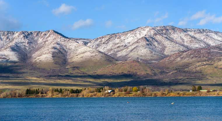
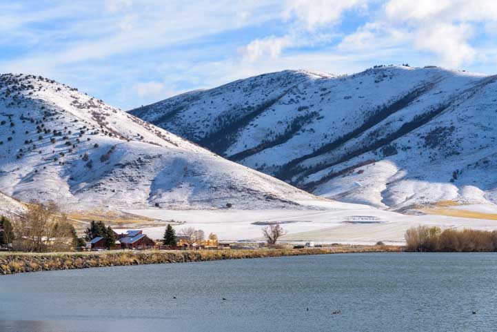
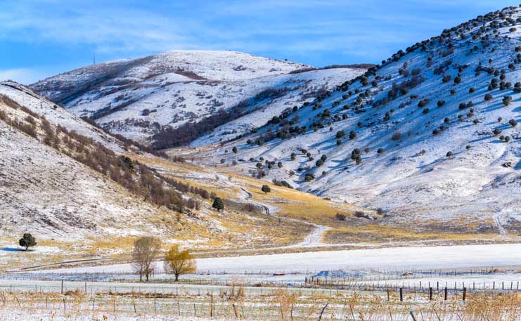
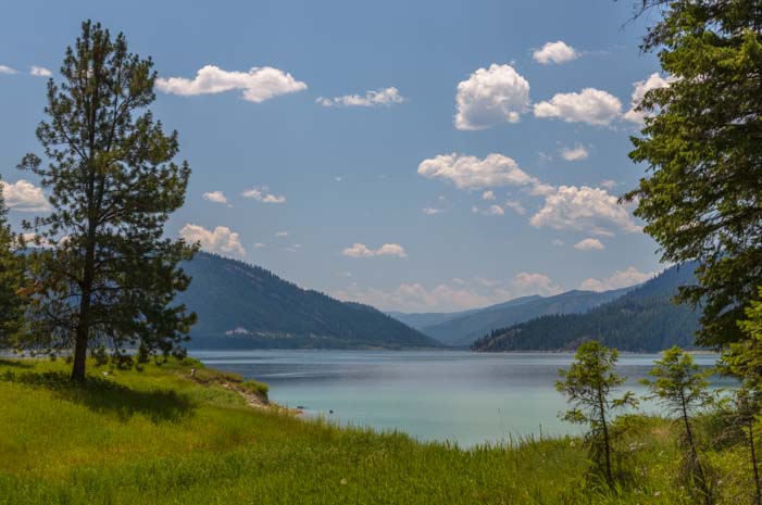
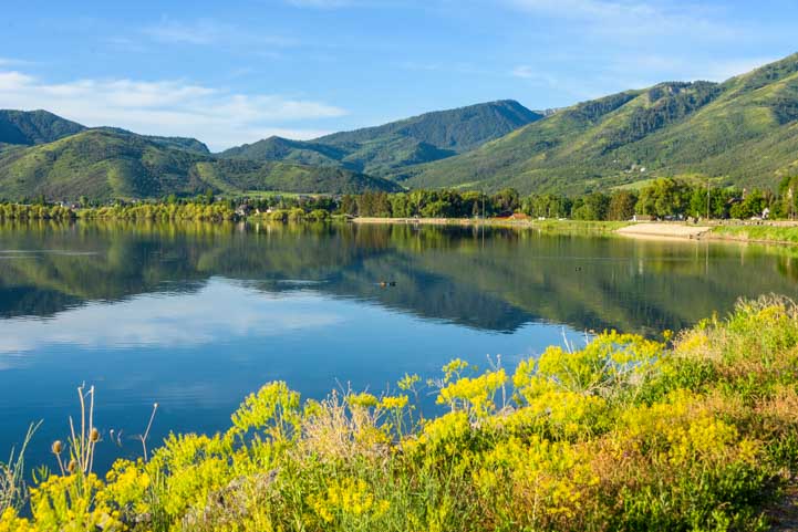
June 2022 – When we pulled into Mantua, Utah, we suddenly realized we’d been here before. We hadn’t recognized the town’s name when we planned our route on the map, but as we looked around at the pretty lake and quaint homes, we instantly remembered the place. This time, however, everything was green and in bloom. Last time, the whole place had been a winter wonderland of snow!

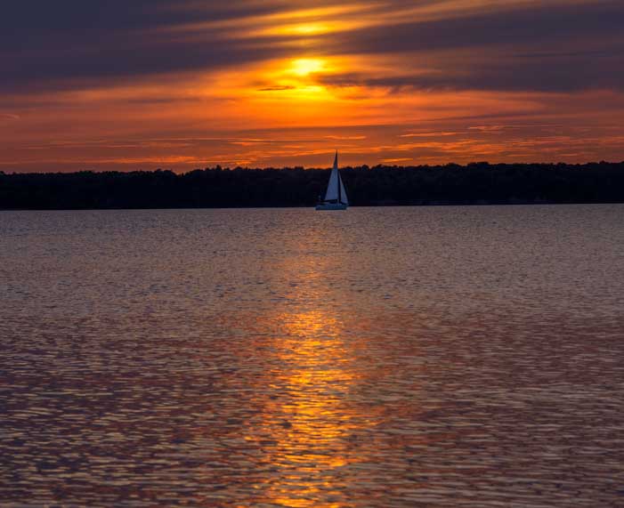
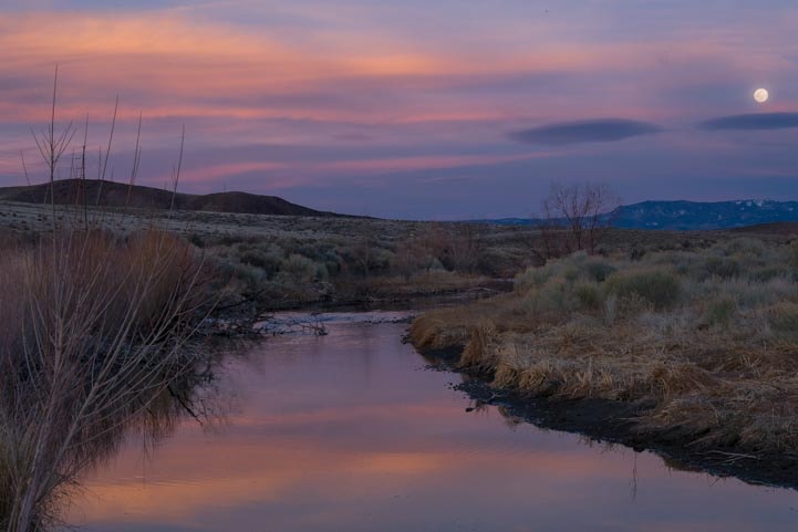
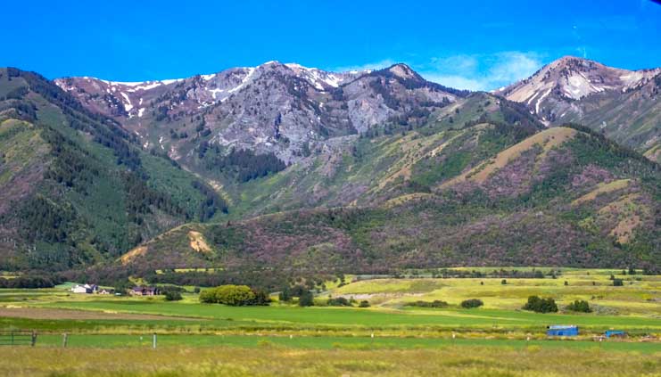
At dawn, the sun was just cresting the mountains on the far side of the lake, spreading its rays across the land. How magnificent!

Mantua Reservoir in Utah at Sunrise

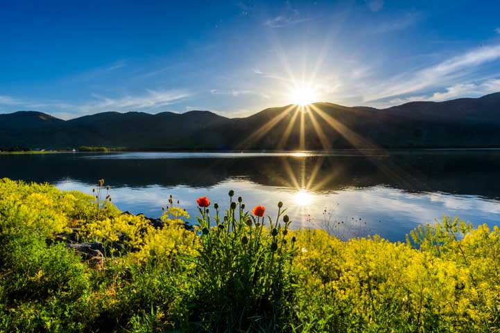
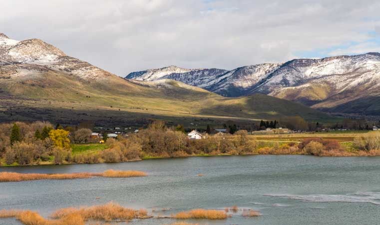
Mantua Reservoir at Sunrise

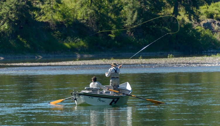
A four mile trail goes around the lake, and we took our cameras and Buddy for an early morning walk. The light was soft and the water was perfectly still. A few people were fishing at the water’s edge.

Fishing at Mantua Reservoir in Utah

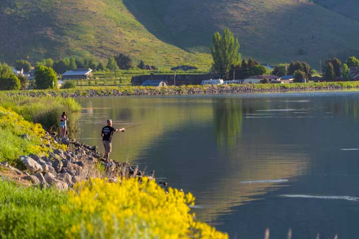
A peaceful time to go fishing!

Mantua Reservoir in Utah at dawn

Morning light

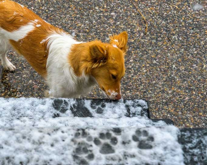
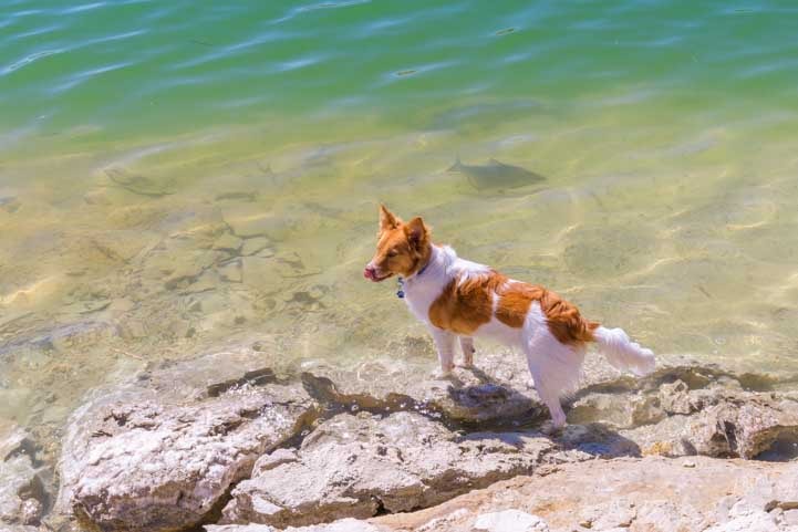
Buddy tip-toed into the water for a drink.

Puppy tests the water at Mantua Reservoir in Utah

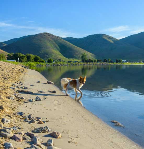
Buddy makes waves on the mirror smooth lake.

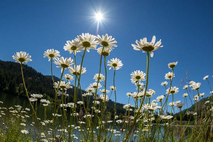
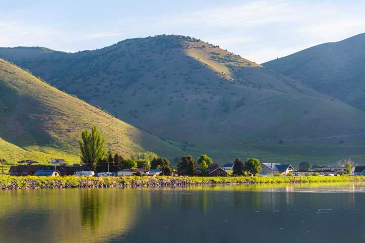
On the near shore, blooming yellow flowers turned their faces towards the sun. Across, the lake on the far shore, pretty houses beamed in the morning light.

Mantua Utah Reservoir flowers

.

Mantua Reservoir Utah

View of the far shore across the lake.

We turned around and walked in the opposite direction and noticed people were out on the water in kayaks.

Kayaks on Mantua Reservoir Utah

Kayaks on the lake

The kayaks were being launched from a small beach where sunbathers lounged on beach towels and in beach chairs. This was classic summertime waterfront fun in a mile high mountain town. The spirit reminded us of McCall, Idaho (which is a much bigger town).

Mantua Reservoir Beach Utah

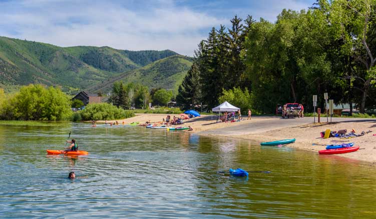
Mantua is a beach town in the mountains!

Mantua Reservoir Beach Utah

Summertime.

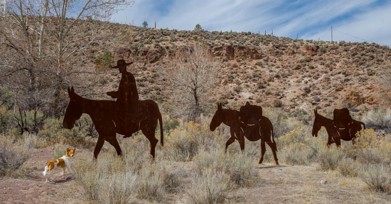
Suddenly a young boy rode up on a dirt bike. I’d noticed on the map that there are some trails that head up into the mountains on the east end of town.

Dirt Bike

.

As we walked the trail along the water’s edge, we noticed a group of teenagers hanging out on docks. I was impressed that they were all talking and giggling together, and not one held a phone in their hands.

A little while later, we watched three little girls riding their bikes down the middle of the main drag trying to best each other riding no-handed. These were heartwarming scenes straight out of my own childhood!

Mantua Reservoir Boat Dock Utah

Teenagers being teenagers…without phones!

Something that wasn’t right out of my childhood was the sound of a sheep ba-a-a-a-ing nearby. Huh? I turned and spotted a young girl walking her sheep down the street. What next!

Girl walking her sheep in Utah

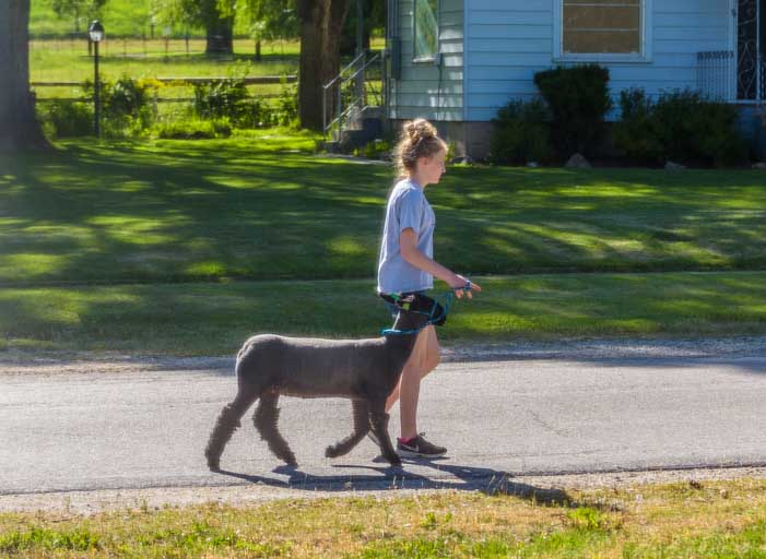
Taking the family sheep for a walk.

Over at the town park we found large fields of deep green grass. Buddy was in heaven as he rolled this way and that in the soft grass.

Puppy rubbing his face in the grass

Puppy rolls in the grass

Puppy grassy back scratch

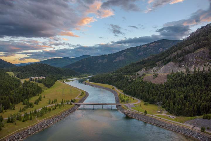
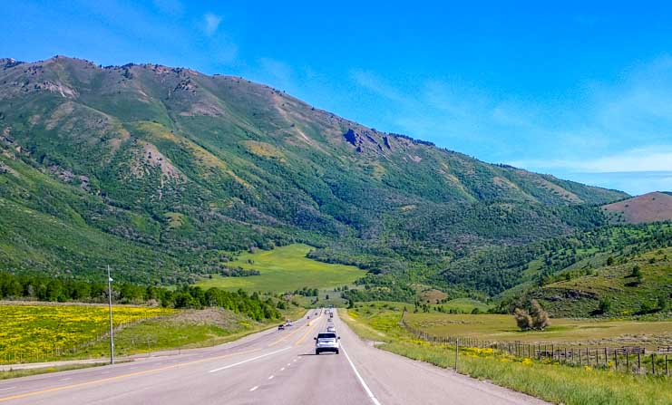
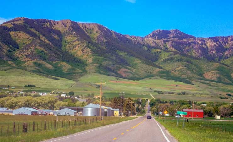
We had rushed through the 75 mile long interstate nightmare of Salt Lake City at full speed, eyes closed (figuratively, of course). So, it felt great to unwind in such a peaceful small town where the population is not even 1,000 people. That same relaxed feeling continued as we carried on northwards on US-89 and Route 23.

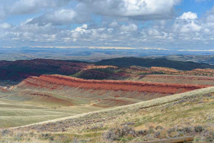
The scenery was spectacular.

Back country highway in Utah

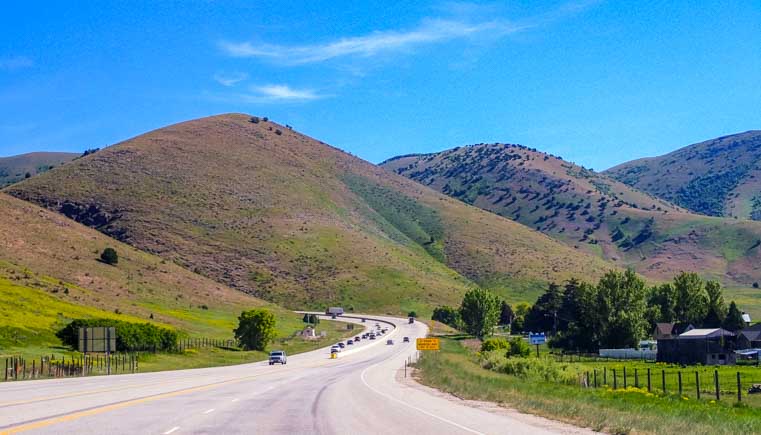
As we drove north, the views were fantastic.

Scenic mountains in Utah

.

Snow capped mountains in Utah

Snow on the peaks!

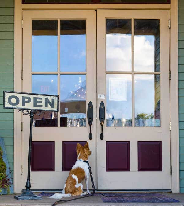
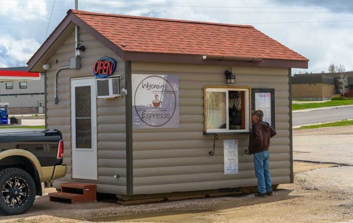
We were headed for Idaho Falls, Idaho, but we didn’t want to rush on our way. So, we wandered off onto some smaller roads. We knew we were in a very small town when we saw the City Office was barely bigger than a phone booth.

City Office

Open…occasionally.

We also knew we were in a rural farming area when we saw the craziest high wheel tractor ever coming down the road towards us.

Tractor on the road in Utah

Yikes!

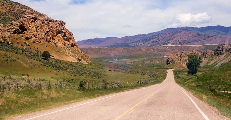
I had a route in mind that would take us to what looked to be very scenic and remote places, and I was juggling my trusty DeLorme Utah Atlas that never steers me wrong but doesn’t zoom in super close and my iPad which is great at zooming in but loses all the small roads completely when you zoom out.

It was hot in the lower elevation areas, though, and as I thought about our route, I didn’t like the idea of spending a day or two in an unreasonably hot place.

I spotted an intriguing looking small town backed by towering mountains out the window and impulsively said, “Let’s go there!” I was envisioning a friendly town with a grassy park to rest in for a moment while we collected our thoughts about where we were going and checked the weather forecast in various places.

Mark made the turn and off we went. I no longer had a real live route to follow in either the atlas book or the iPad, but I had a good solid imaginary route in my mind that would skirt the base of the mountains and be incredibly beautiful.

Heading into town in rural Utah

Maybe we’d find cool shade in town or cool temps in the mountains behind town!

We got to the center of town and I confidently said, “Turn right.”

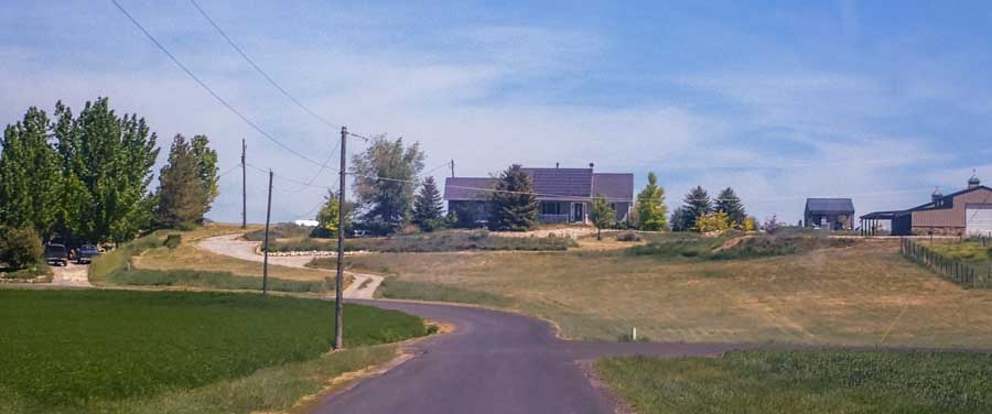
Mark did as I requested and we passed some very pretty homes. An older gentleman was watering his stunningly colorful flower garden and we waved at him. He smiled and waved back but he had a puzzled look on his face as he watched our massive rig lumber past.

The road narrowed and Mark said, “Are you sure we’re going the right way? It looks like we’re driving into someone’s yard…or farm.”

“Oh yes,” I said with great confidence. “It goes right through!”

Small country lane in northern Utah

Are we going the right way?.

Thirty seconds later the pavement ended and we were staring at a skinny dirt road going between farm fields.

Dirt road in Utah farm fields

Oh no!

Lordy me. Now we faced an unknown amount of driving on a dirt road through farm fields to see if we could find a spot big enough to turn around a 33′ long fifth wheel trailer. Oh, great!

After about ten tense minutes of driving at 6 mph, we found a place just big enough to turn around by doing a twenty-point K turn. Putting the truck in forward and reverse a bunch of times, Mark eventually got the rig turned around and we slowly rolled back onto the paved road.

The man with the beautiful flower garden was no longer in his yard. He was probably watching us through the living room window, though, chuckling to himself about those crazy out-of-towners with the huge toy hauler that had no idea where they were going.

Utah barn and dirt road

.

Utah Delorme Atlas

We continued on in an awkward silence. Who exactly had gotten us into that predicament? Didn’t she have both an atlas and an iPad in her lap? But all was forgotten when we looked up the road and spotted a procession coming towards us.

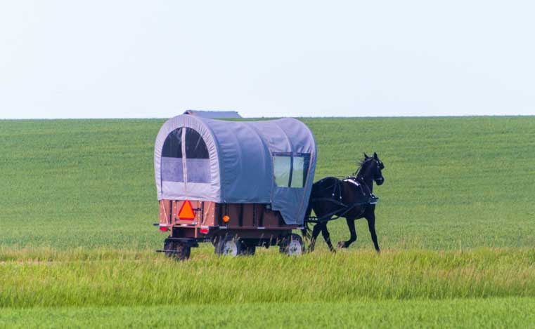
In the lead was a horse and carriage with two men in starched white shirts, black pants and long beards sitting up high in front driving a team of two horses. As they neared us, we saw that their carriage held a casket behind glass. The name “Nelson” was in the window. A line of cars with their headlights on followed behind them.

Funeral procession rural Utah

A horse-drawn hearse leading a funeral procession – WOW!

It’s not every day that you see a funeral procession any more. And I can’t say that we’ve ever seen one led by a horse-drawn hearse.

We pulled over and let the procession pass.

What a special moment this was out here in a very remote part of rural America, a place where narrow paved lanes turn to dirt and lead through farm fields without any advance warning.

We savored the moment and realized that this unique sighting was precisely why I’d suddenly gotten the impulse to abandon my carefully constructed itinerary and blindly head down a narrow road that went to who knows where. If we hadn’t gotten hosed up on the dirt road, we never would have seen the unusual funeral procession.

And so it goes on the roads less traveled, as we bump into beautiful things off the beaten path and then find more exotic things even further off the beaten path!

Scenic back road in Utah

The roads less traveled — preferably two lanes and paved!

Subscribe
Never miss a post — it’s free!

More info:

Other back roads RV trips:

More blog posts from Northern Utah:

Our most recent posts:

More of our Latest Posts are in the MENU.   New to this site? Visit RVers Start Here to find where we keep all the good stuff. Also check out our COOL NEW GEAR STORE!! *** CLICK HERE *** to see it!
.

<-Previous || Next->

Wisconsin’s Lake Superior Shoreline – Cute Towns & Great Sunsets!

September 2018 – After our delightful stop in Walker, Minnesota, we continued our RV travels towards Lake Superior, and we made landfall (waterfall?) just east of Duluth on the lakeshores of Wisconsin.

Lake Superior Scenic Drive Wisconsin RV trip

.

Our first glimpse of mighty Lake Superior was very humble. We parked the rig and ran down a short path between thigh high bushes to a spot where endless small waves landed on a thin ribbon of driftwood strewn beach. The water was very red and muddy. We thought the red tint would look cool at sunset, but we were too excited to stick around to wait for sunset, so we kept going.

Lake Superior First Glimpse in Wisconsin-min

Our first glimpse of Lake Superior — It’s red!

The road hugged the shoreline but offered few views of the water until we rounded a slight bend and saw the most charming harbor. Big sailboats were lined up by docks along the shore.

Sailboats in Cornucopia Wisconsin Lake Superior-min

When we spotted sailboats in a small harbor we had to stop.

Docks and Sailboats Cornucopia WIsconsin Lake Superior-min

Beautiful!

The juxtaposition of the tall pine trees of Wisconsin and the towering masts of ocean worthy sailing vessels was fantastic.

Sailboats in Cornucopia WIsconsin Lake Superior-min

.

We were in Cornucopia, a little beachside hamlet that has a few charming tourist boutique gift shops.

Boutique gift shop Cornucopia Wisconsin Lake Superior-min

Pretty tourist boutiques were lined up by the docks. So cute!

Summer flowers Cornucopia WIsconsin Lake Superior-min

Summer flowers on the sides of the buildings.

Across the street there was a small cluster of buildings that make up the town. Cornucopia is nicknamed “Corny,” and the Corny Coffee Shop was very inviting.

Corny Coffee Cornucopia Wisconsin Lake Superior-min

Across the street we found the Corny Coffee Shop.

But the area that kept drawing us back was the little harbor.

Kayaks in harbor at Cornucopia Wisconsin Lake Superior-min

Last summer days.

Sunset Lake Superior Wisconsin-min

.

Just a little further east on Wisconsin’s Lake Superior shoreline we found Meyers Beach. The National Park Service has a tiny outpost here for the Mainland Sea Caves around the corner, and lots of people launch their kayaks from the beach to get to them.

Kayak on Lake Superior in Wisconsin-min

A kayak returns to Meyers Beach from the nearby Sea Caves.

Kayaks on the beach on Lake Superior in Wisconsin-min

.

Every so often in the latter part of wintertime this part of Lake Superior freezes and you can walk the mile or so out to the sea caves. This happened a few years ago, and when the phenomenon made the national news, the cars lined up for miles as people came to Meyers Beach to explore the frozen caves.

Kayaking to Apostle Island Caves in Wisconsin Lake Superior-min

Kayaks head out towards the Sea Caves.

From Meyers Beach we traveled to Little Sand Bay on the northern tip of this peninsula on Wisconsin’s Lake Superior shoreline. There is a campground up there with lots of boating activities in the summertime. It was pretty quiet by this time in September, but we did catch a cute pic of our fifth wheel next to a sailboat on a trailer in the parking lot!

Sailboat and fifth wheel RV Little Sand Bay Wisconsin Lake Superior-min

Up in Little Sand Bay we got a kick out of seeing our buggy next to a sailboat on a trailer.

Fall was progressing and apples were ripening on trees all over the place. One day when we parked I noticed that the ground was strewn with apples. I looked up and the tree branches above me were filled with ripe apples. I picked a few, and those were the juiciest and most sweet/tart apples we’ve had in a long time.

The apples were tastiest when eaten with thin slices of extra sharp Wisconsin cheddar cheese to go with. When we first got to Wisconsin I started hunting around for a good sharp cheddar and discovered that unlike cheddar cheese from other places (like Vermont), all Wisconsin cheddar cheeses are yellow, no matter how mild or sharp!

Fresh apple from the tree in Lake Superior WIsconsin-min

Juicy, sweet and tart, and especially delicious with Wisconsin extra sharp cheddar cheese!

Our shore-side route along Wisconsin’s piece of Lake Superior took us to Red Cliff where we found a wonderful restaurant, campground and marina right on the edge of the lake at the casino.

A little further down the coast we found the pretty town town of Bayfield.

Bayfield Marina Lake Superior in Wisconsin-min

Bayfield, Wisconsin, is a picturesque waterfront town on Lake Superior.

We made our way down to the boat docks. A big flock of resident seagulls took off as we approached.

Seagulls flying Bayfield Wisconsin Lake Superior-min

.

As we talked to boat owners about what it’s like to sail on Lake Superior, I noticed that many boaters had planted flowers, tomatoes and peppers in between the rocks in the breakwater that protected their boats from the wild waves of the lake. What a clever idea! Almost every slip resident had created a boatside garden in the rocks.

Flowers in the rocks at_-min

At Bayfield Marina boaters planted gardens between the rocks in the breakwater. So clever!

Bayfield is a charming waterfront town that has a very salty air, even though it is on a lake and not the ocean.

Old Salts Bayfield Wisconsin Lake Superior-min

Old Salts and a pirate’s parrot on freshwater Lake Superior.

Pretty building Bayfield Wisconsin on Lake Superior-min

What a great deck for lunch overlooking the bay during summertime…

One morning we got down to the waterfront at dawn to take some photos. The sun was playing games with the clouds, and as we walked around Memorial Park taking pics, I captured a photo of the sun peeking out from behind the clouds and backlighting a flag on a lamp post.

Later that day when I was going through my photos I realized the date was 9/11. The photo seemed very fitting.

Dawn in Bayfield Wisconsin on Lake Superior-min

Dawn in Bayfield, Wisconsin, on 9/11.

Up in town there were several coffee shops, and once the sun was up we picked a place for a morning cuppa joe. Buddy saw me go into the coffee shop and sat transfixed by the slightly open door until I emerged again, latte in hand.

Puppy waits for coffee Bayfield Wisconsin Lake Superior-min

Buddy waited expectantly outside while I got coffee and muffins.

A lot of rain had fallen overnight and there were big puddles in the parking areas near the marina. As we walked back down through the parking lot Buddy wandered through a puddle and then suddenly sat down in a dry spot. He was on his own little island.

Puppy in a puddle Bayfield Wisconsin Lake Superior-min

In a mellow mood, Buddy suddenly began to model for us on a dry spot in the middle of a puddle.

We both noticed that the puddle was creating fantastic reflections of him as he sat there, and for some reason he seemed very content to stay on his little island for quite a while.

Puppy reflections Lake Superior Wisconsin-min

.

I crept around him to try to line him up with Lake Superior in the background.

Puppy puddle reflection Lake Superior Wisconsin-min

We couldn’t believe he stayed so still for so long.

Looking at the pics afterwards, I turned my laptop on its side to show the above photo to Mark. As I flipped the laptop back, I caught a glimpse of the image upside down.

Wow!! It was as if Buddy was sitting in the heavens!

Buddy Angel Puppy puddle reflection Lake Superior Wisconsin-min

Buddy Angel.

Our friend Bob who has created many marvelous magazine covers of Buddy for “Dog Life Magazine” (pretend ones, of course) had suggested a while ago that Buddy’s song is “Buddy Angel,” sung to the tune of the 1960s hit “Johnny Angel” (listen here).

Although Buddy is definitely a little angel sent to us straight from heaven, he is still very much a dog. A little further south when we did a brief walk through the woods to get down to the beach, Buddy suddenly stopped at the foot of a tree and stared into the branches.

High overhead a little squirrel scolded him.

Puppy looks at squirrel in tree Lake Superior Wisconsin-min

With his angel wings folded Buddy is still all puppy as he looks up at a squirrel in the tree.

Squirrel in tree Lake Superior WIsconsin-min

“Hey Puppy — Catch me if you can!!”

But it was lying in the warm sand that was most satisfying. We had arrived on Lake Superior just in time for a fantastic week of Indian Summer and the temps were in the 80s. I was astonished that the water was fairly warm too and we saw quite a few people swimming.

Puppy on the red sand Lake Superior Wisconsin-min

The hot sand feels so good…

But the warm temps didn’t stop the wind from blowing and whipping up the waves. When we stopped in the town of Washburn the waves kicked up against the town jetty and sloshed all over the place.

Wild waves Washburn WIsconsin Lake Superior-min

Wild chop at the jetty in Washburn.

This didn’t seem like a great time to jump in the water, but over at a small beach we watched two guys set up their kiteboards for a bit of fun.

Kiteboard Washburn WIsconsin Lake Superior-min

Kite boarders were thrilled that the wind was up.

In just a few minutes they were airborne!

Kiteboard flying Washburn Wisconsin Lake Superior-min

In no time the kite boarders were soaring over the water.

Kiteboarding Washburn WIsconsin Lake Superior-min

.

This little trip along the shores of Lake Superior in Wisconsin had been full of delights, including a bright blue canoe that had been transformed into a planter full of flowers.

Canoe flower box Lake Superior Wisconsin-min

Flowers in a canoe.

And what a blessing it was to arrive on the shores of Lake Superior in the middle of such ideal summer weather.

Sunset Lake Superior Wisconsin-min

Sunset on Lake Superior in Wisconsin.

If your travels take you to Wisconsin, be sure to sample some of the shoreline route, even if you have a big RV like ours.

Subscribe
Never miss a post — it’s free!

More info about this area:

Other Scenic Back Roads RV Trips + Kiteboarding in Mexico:

Kite Boarding World Cup in Puerto Vallarta, Mexico

Our most recent posts:

More of our Latest Posts are in the MENU.   New to this site? Visit RVers Start Here to find where we keep all the good stuff. Also check out our COOL NEW GEAR STORE!! *** CLICK HERE *** to see it!
.

<-Previous || Next->

RVing Central Montana – Great Falls, Cool Coffee & Amish Buggies

June 2018 – After leaving stunning Many Glacier in Glacier National Park, we wandered east and south through central Montana on a wonderful and leisurely tour of rolling green farm country.

Small villages and hamlets dotted the landscape, and when we pulled into the town of Choteau (pronounced “show-tow”), it was so cute we had to stop and have a look around.

Airstream trailer RV parked in Choteau Montana-min

Tiny Choteau, Montana, was so intriguing we had to stop and check it out!

Choteau seems to love summer and summertime visitors, and we were intrigued by a collection of little buildings that stood side by side on the main drag. One was an ice cream parlor and another was a one room school house!

Ice cream parlor Choteau Montana RV trip-min

Choteau had a unique flair that was very inviting.

There was a Basque sheep wagon nearby too, something we can now recognize after enjoying the fabulous Basque festival in Buffalo, Wyoming, last year (blog post here).

Basque sheep wagon Choteau Montana RV trip-min

We noticed a Basque sheep wagon on display.

We really liked the slightly funky spirit of Choteau and got a chuckle out of seeing two dinosaurs in town.

Dinosaur Choteau Montana RV trip-min

The greeter…

Dinosaur in Choteau Montana-min

…and his sidekick.

We always enjoy visiting mom-and-pop coffee shops, and we noticed an “Espresso” sign in front of a shop called Maddimo & Company.

Maddimo interior design front entrance Choteau Montana RV trip-min

Maddimo turned out to be much more than just a coffee shop!

Their front door was made of old barn boards and was very cool.

Front door Maddimo workshop design studio Choteau Montana RV trip-min

The boards in this door were once part of a barn!

Inside Maddimo we found the most intriguing and inviting little boutique shop filled with home decorations and plaques with cool sayings on them and a coffee bar too.

Maddimo interior design Choteau Montana RV trip-min

.

The owner, Samantha, started chatting with us as she made our yummy drinks. She explained that she holds crafting workshops right there in the shop, and she showed us a wonderful table filled with paints and other artists’ goodies.

Maddimo workshop Choteau Montana RV trip-min

Samantha offers workshops on how to make these wonderful plaques and home decorations.

Samantha makes all the plaques she sells, and she teaches other people how to make them too.

One had a saying that is perfect for would-be adventurers who are on the fence about becoming full-time RVers!

Plaque from Maddimo Choteau Montana RV trip-min

Indeed!

Samantha also sells stencil templates so craftsy people can make sets of plaques for friends and family.

‘It’s a work in progress,” she said, gesturing around the cute little shop. Growing up in Choteau, Samantha’s family had owned a deli restaurant that they eventually sold. After she moved away and lived elsewhere for a few years, Samantha and her husband decided to move back to Choteau and, along with her mother, they bought back the deli and opened it again.

This was the first season for their new venture, and the place was hopping. How satisfying it must be to return home to your roots and buy back and reopen the family business to great success!

Maddimo unique gifts Choteau Montana RV trip-min

There were lots of neat sayings and stencil templates to reproduce them easily.

We continued on down the road towards Great Falls, Montana, which has always had a special place in my heart even though I’d never been there. One of my childhood idols, the figure skater John Misha Petkevich, grew up in Great Falls. For years I cherished an embroidered patch from his figure skating club in my collection of club patches, and I always wondered what his hometown of faraway Great Falls was like.

We aren’t city folk, but with a name like Great Falls, we figured this town had to have some kind of fabulous waterfall, and sure enough there are several.

We drove to Ryan Island at the edge of town, a lovely little grassy park that is accessed via a suspension bridge for walkers. Tall shade trees fill the park and a short and pretty trail takes you to an incredible view of Ryan Dam and the Missouri River spilling over.

Ryan Island Park Great Falls Montana-min

The grassy park at Ryan Island has lots of big shade trees. A bald eagle had a nest in one!

Rainbow in Ryan Dam Waterfall Great Falls Montana-min

Great Falls, tamed a bit by Ryan Dam.

Back in 1805 when Lewis and Clark made their 16 month trek across America from St. Louis, Missouri, to the Pacific Coast at the mouth of the Columbia River, they came upon these waterfalls. At the time, of course, the falls flowed freely and unhindered. I got goose bumps when I read a plaque that said Merriweather Lewis had likely stood right where I was standing.

Ryan dam waterfalll Great Falls Montana RV trip-min

Merriweather Lewis stood somewhere near here!

Mandan Indian Chiefs had told Lewis that his group would encounter the falls during their voyage on the Missouri River. Lewis wrote in his diary:

“…my ears were saluted with the agreeable sound of a fall of water and advancing a little further I saw the spray arrise above the plain like a column of smoke…..it began to make a roaring too tremendous to be mistaken for any cause short of the great falls of the Missouri.”

After arriving at the falls, the entire Corps of Discovery team, about four dozen people, spent the next three weeks carrying all their boats and equipment 18 miles around the falls so they could continue their journey afloat on the Missouri River.

In contrast, we had driven up in an air conditioned truck with music playing over multiple speakers and had adjusted our heated and vented electric seats just so.

Interestingly, Captain Lewis had stood pretty close to where we were standing on Thursday, June 13, 1805. It was now Tuesday, June 12, 2018. The dates were so close yet were separated by over 200 years and such radical change. How awesome!

Rainbow in Ryan Dam Waterfall Great Falls Montana-min

The Lewis & Clark expedition had to carry their boats and equipment overland 18 miles to get beyond the series of waterfalls.

We continued our back road RV travels in Montana heading east and south from Great Falls. Pastures and farm fields stretched in every direction on gently rolling hills.

Central Montana farm land-min

Our drive through rural central Montana took us past beautiful rolling farmlands.

We passed an old truck with a straw man riding a stack of hay bales bronco style in the bed. Cute!

Bronco riding a hay bale on a farm truck in Montana-min

Ride ’em, Cowboy!

Suddenly we saw a horse-and-buggy warning road sign, and within a few minutes we spotted a horse pulling a young Amish couple in an open two person “courting” buggy that the young men drive. We had talked to a young Amish man about his cool ride in upstate New York. He was as proud of his buggy as any teen is about their new wheels. How neat to find more Amish out here in rural Montana!

Amish couple riding in a courting buggy in central Montana-min

Some Amish families have settled in this area.

Amish couple riding in a courting buggy in central Montana-min

.

Within a few minutes we saw another Amish horse and buggy go by. How fun!

Amish buggy trotting down the road in central Montana-min

.

As we dropped south and approached the small town of Harlowton, Montana, we suddenly started seeing a different kind of farming: wind farming. There were rows and rows of windmills in huge clusters here and there.

Wind farm in central Montana-min

We came across a different kind of farming!

We stopped in Harlowton and noticed that windmills adorned a lot of buildings and business logos.

Harolowton Montana wind farm appreciation-min

Windmills are a common theme on stores and businesses in Harlowton, Montana.

Even the local brewpub, Gally’s Brewing Company, had a windmill on their logo!

We decided to grab a pint and stepped inside Gally’s Brewing Company. I asked the bartender why they had a windmill on their logo and why windmills were such a popular motif all around town. She explained that the wind farms were bringing a lot of money to the community.

The brewery wasn’t open for a few more hours, so we didn’t get to taste any of their brews, but we continued chatting with the bartender and she explained a little more about these wind farms. The ranchers graze their cattle on their land and also lease it out to wind generating companies to erect windmills. The cattle just munch the grass all around the base of the windmills.

So, the ranchers make money from the leases, the community makes money from taxes that the wind generator companies pay, and there are a few more jobs to be found. “It’s a win-win,” she said with a smile.

Gally's Brewing Company Harlowton Montana-min

There was even a windmill on the brewpub’s logo!

We continued driving south towards Big Timber through this is a very quiet part of the country. There were lots of open spaces and small peaceful spots tucked under the trees alongside streams and rivers.

Big storm clouds swept across the sky, whipping themselves into a frenzied windy storm that dumped buckets of rain across the land.

Afterwards, a beautiful rainbow appeared.

Rainbow between the trees in central Montana-min

Stormy skies and a huge rainstorm produced a beautiful rainbow.

Rainbow over farm fields central Montana-min

.

And then the sun set in vibrant shades of pink and orange that filled the sky.

Montana sunset-min

.

If you are traveling across Montana, whether with or without an RV, these quiet roads through the middle of the state make for a rewarding trip, and the village of Choteau, the waterfall and dam at Ryan Island in Great Falls, and the town of Harlowton are fun stops along the way.

RV camping at sunset in central Montana-min

.

Perhaps you’ll catch Gally’s Brewing Company when they’re open for business in the afternoon and you can sample some of their brew and tell us how you like them!

Subscribe
Never miss a post — it’s free!

More info about these areas:

Other blog posts from Montana:

Our most recent posts:

More of our Latest Posts are in the MENU.   New to this site? Visit RVers Start Here to find where we keep all the good stuff. Also check out our COOL NEW GEAR STORE!! *** CLICK HERE *** to see it!
.

<-Previous || Next->

Montana Road Trip – Wildflowers, Bison, a Mission Church + Good Eats!

June 2018 – We recently visited our friends Bob and Donna Lea in western Montana, and they took us on a wonderful daylong road trip into the wildflowers and mountains that lie between Missoula and Flathead Lake.

Scenic views driving Montana back roads on an RV trip-min

We saw some wonderful pastoral scenery on a day trip in western Montana.

The scenery on the drive was delightful, with snow capped mountains and pretty farms dotting the landscape.

Barn in the mountains Montana-min

.

After we’d drive on lovely back roads for a little while, we pulled into the Windmill Village Bakery in Ravalli for a cup of coffee and some freshly made pastries.

Windmill Village Bakery Ravalli Montana RV trip-min

Windmill Village Bakery is known for fresh made donuts.

This cute little roadside bakery is known for its fresh donuts, which are made right behind the counter, and for its beautiful patio that overlooks a small pond and windmill.

Windmill Village Bakery Ravalli Montana RV trip-min

Out back there is a patio overlooking a pond with a windmill.

With our tummies happily full, we made our way to the National Bison Range. Managed by the US Fish & Wildlife Service, this land is part of the National Wildlife Refuge System and is a refuge for 350-500 buffalo that was established by President Theodore Roosevelt in 1908.

National Bison Range in Montana RV trip-min

The National Bison Range has buffalo and a whole lot more!

Other animals also call the refuge home, and when we arrived we saw an enormous stack of elk antlers. Elk naturally shed their antlers each year, and these antlers were collected at the range.

Antler pile National Bison Range Montana RV trip-min

A pile of shed elk antlers greeted us at the Visitors Center.

There is a loop drive that meanders through the refuge, and as we drove into the park we climbed quite high up in the hills and had a great view of the Flathead River.

River view National Bison Range RV trip-min

The loop drive took us high up for a view of the Flathead River.

The scenic drive is a gravel road, but it is easy to drive in a passenger car.

Winding road National Bison Range Montana RV trip-min

The ribbon of road is gravel and easily driven.

We arrived just after the peak of wildflower season, but there were still lots of beautiful flowers in bloom blanketing the hillsides. We walked on a trail through the vast beds of flowers and spotted some wild photographers sitting among them!

Photographing wildflowers National Bison Range Montana-min

Photographers were enjoying quiet moments with the wildflowers.

Photographing wildflowers National Bison Range Montana-min

A trio of photographers.
The peak for wildflowers in the BIson Range is mid-May but they were still lovely two weeks later.

The flowers were so thick and so colorful that we vowed we will return another year to experience this place during the peak in mid-May.

Spring wildflowers National Bison Range in Montana-min

.

Spring wildflower National Bison Range Montana RV trip-min

.

Of course, flowers don’t follow the Gregorian Calendar too closely, so we’ll call ahead to see how the flowers are doing before visiting!

Lupine in bloom National Bison Range Montana-min

.

As we were strolling and crouching between the flowers to get their pics, Bob pointed out the Bitterroot flower. This beautiful pink flower is the namesake of the Bitterroot Valley.

Bitterroot flower National Bison Range Montana-min

Bitterroot flowers used to be very common in Montana’s Bitterroot Valley!

This seemed like a fantastic place to get a selfie. Of course, nowadays our selfies include a certain furry person, and sometimes it takes more than one shot to get it right. In the first pic he let out a big yawn. Luckily we got another!

Selfie with puppy yawning at the National Bison Range in Montana-min

What a great spot for a selfie. Oops, Buddy was yawning!

Selfie with puppy at the National Bison Range in Montana-min

That’s better.

Montana had a ton of snow this past winter and loads of rain in the spring too, so the rolling hills were lush and green.

Montana rolling hills National Bison Range-min

Rolling green hills of Montana.

We were very surprised to learn that the very flat valley below us was once the bottom of a huge lake that reached from the mountains we were standing on to the mountains in the distance.

Mountain views National Bison Range Montana RV trip-min

At one time a lake filled the valley between the mountains.

Just like driving through parts of Arizona and Utah that were once covered with an inland sea where you feel like you are driving on the bottom of an ocean with tall islands sticking up around you, it was easy to imagine a huge glacial lake with waves lapping the sides of these mountains. The lake came up about two-thirds of the height of the mountains.

Snowcapped mountains and valley National Bison Range Montana RV trip-min

Looking down at the ancient lake bottom.

We had been enjoying the wildflowers and the beautiful views, but the buffalo herd was apparently on break that day. We did see two sauntering by the car at one point but couldn’t get our cameras going fast enough to get a photo. However, near the end of our drive we saw a lone buffalo in the distance.

A lone bison National Bison Range Montana RV trip-min

A solitary bison.

By now we were ready for another scenic snack so we stopped at the Ninepipes Lodge which has a wonderful outdoor patio overlooking a pond with mountains in the distance.

Inspired to take on your own road trip adventure?
Check out ROLLiN’ young driver’s insurance for peace of mind as you travel.
Views at Ninepipes Lodge on Montana RV trip-min

We had a fabulous view for lunch from the patio at Ninepipes Lodge.

There’s an indoor dining room too, but the weather was just perfect to sit outside. The fish and chips was terrific, and we got a kick out of the gift shop too!

Dining room view Ninepipes Lodge Montana-min

The indoor dining room was beautiful, but we liked being outside on the deck.

Gift Shop Ninepipes Lodge Montana-min

The gift shop had lots of goodies.

Our final stop for the day was at St. Ignatius Mission Church. This church was built in 1891.

St. Ignatius Mission Montana with wooden sign-min

St. Ignatius Mission was built in 1891.

St. Ignatius Mission Montana RV trip

We explored the pretty interior of this Catholic church.

The mission is very ornate inside with elaborate paintings on every nook and cranny. There are 58 paintings in all, each one painted by Brother Joseph Carignano.

Inside the St. Ignactius Mission Montana-min

The church walls are decorated with 58 different paintings.

Inside the St Ignatius Mission in Montana-min

Church services are still offered here.

The paintings have been meticulously restored and are vibrant and colorful.

Alter in the St. Ignatius Mission in Montana-min

.

Interior of the St. Ignatius Mission in Montana-min

.

Detail painting from the Interior of the St. Ignatius Mission in Montana-min

Almost all the paintings have been lovingly restored. Just a few remain to be done.

If you are taking your RV to Montana and are looking for a scenic drive with some unique places to see that are not necessarily the headliners in the tourist literature, the National Bison Range and St. Ignatius Mission are well worth a visit, and you’ll find tasty eats in a beautiful setting at both the Windmill Village Bakery and at the Ninepipes Lodge!

Rainbow in Montana on an RV trip-min

What a beautiful day in a pretty state!

Subscribe
Never miss a post — it’s free!

More info about these places:

Related Posts:

Our most recent posts:

More of our Latest Posts are in the MENU.   New to this site? Visit RVers Start Here to find where we keep all the good stuff. Also check out our COOL NEW GEAR STORE!! *** CLICK HERE *** to see it!
.

<-Previous || Next->

RVing Wyoming – Lakes, Mountains and Waterfalls

May 2018 – Wyoming is best known for the eye-popping beauty of its National Parks on the western side of the state. Both Yellowstone and Grand Teton blew us away with easy to see herds of big animals, and seeing Jenny Lake glittering in the middle of the towering snow-capped Tetons is an image we will always cherish.

But when we took our RV across the northern part of Wyoming recently, we found some wonderful lakes, mountains and waterfalls that are less well known just a bit off the beaten path.

Cliffs on the shore of Keyhole State Park on RV camping trip to Wyoming-min

Keyhole Reservoir, Wyoming

Keyhole Reservoir is a horseshoe shaped body of water that is lined with rocky cliffs, and we had a ball strolling on the hiking trails along the shore and taking pics as we walked.

Rock cliffs at Keyhole State Park Wyoming RV trip-min

The steep rock cliffs on the water’s edge were an unexpected surprise.

Even though it was early Spring, there were lots of boats out on the water. There were pleasure boats zipping around and there were fishermen slowly trolling and reeling in the catch of the day.

Boating at Keyhole State Park Wyoming RV camping trip-min

Lots of boaters were out on the lake.

We were within earshot of the fishermen drifting past in their boats, and we called out to the guys in one boat. We had seen fish jumping clear out of the water in a small cove nearby, and sure enough, these fishermen had a big fish to show off for us before they threw it back in the water.

Fishing at Keyhole State Park on Wyoming RV trip-min

Buddy looks down at the fishermen below.

Fishing at Keyhole Reservoir Wyoming-min

Nice catch!

Around the lake signs of Spring appeared in patches here and there on the ground in beautiful sprays of purple flowers.

Wildflowers in rural Wyoming RV trip-min

Spring is here!

But having flowers on the ground didn’t guarantee sun in the sky, and the sky was overcast for most of the day! Finally, in the late afternoon, the sun made an appearance just above the horizon and cast a yellow glow across the cliffs.

Steep rock cliffs Keyhole State Park Wyoming RV trip-min

The landscape took on a glorious golden glow in the late afternoon.

Golden hour Keyhole State Park rock cliffs RV camping trip in Wyoming-min

.

Keyhole State Park Wyoming RV trip shee rock cliffs-min

.

The next morning we awoke to a wonderfully mystical layer of fog.

Keyhole State Park RV trip - stone cliffs with fog-min

.

Foggy morning Keyhole State Park RV trip-min

.

About 120 miles west of Keyhole State Park we found Lake De Smet. The water was mirror-calm and the eerie light of an impending rain storm made for some beautiful reflections.

Cloudy sky reflections De Smet Lake Wyoming RV trip-min

A wonderful moodiness sets in at Lake De Smet, Wyoming.

De Smet Lake State Park RV camping in Wyoming-min

No rock cliffs here, but lots of wonderful reflections.

There were a few fishing boats on the lake and quite a few birds were out fishing too.

De Smet Lake Wyoming RV camping trip-min

A cormorant takes off.

And the fishing went on until dark!

Lake De Smet fishing at sunset-min

A fisherman keeps fishing even as the sun sets around him!

Around the lake and in nearby gardens, we found some lovely flowers blooming.

Bleeding heart flowers in Spring in Wyoming-min

Bleeding hearts.

Lupine with rain water droplets on each petal-min

Lupine glisten with droplets of rain.

Silvery spring flowers in Wyoming-min

.

Spring blossoms in Wyoming-min

.

We had taken I-90 to get between Keyhole State Park and Lake De Smet, but on the next leg of our journey we traveled on the fabulous Bighorn Scenic Byway that crosses the Bighorn mountains between Sheridan and Ten Sleep on US-14.

Scenic drive on RV trip in rural Wyoming-min

We headed out on the Bighorn Scenic Byway.

What a great drive! We had been a little concerned about tackling all the hairpin turns and steep climbs at the beginning of the Bighorn Scenic Byway, but they are big sweeping gentle turns that are easy with a big rig, and the gradients are not difficult if you have a strong tow vehicle or motorhome engine.

Wyoming Bighorn Mountains scenic drive Route 14 RV trip-min

Parts of the Bighorn Scenic Byway passed between towering rock walls.

We loved the rolling hills and views as we climbed, but it was the waterfalls that really got our attention. We noticed one as we rounded a bend and quickly pulled over to hike down a berm to get a few pics.

Waterfall in Bighorn Mountains RV trip-min

When we spotted a waterfall we quickly pulled over.

This first waterfall was like a warmup for the magnificent waterfalls we found at around the midpoint of the Bighorn Scenic Byway at Shell Falls. These falls have been beautifully developed to allow visitors to view the falls and surrounding canyon from many viewpoints.

Shell Falls Bighorn Mountains RV trip Wyoming-min

Shell Falls, Bighorn Scenic Byway, Wyoming

Shell Falls Bighorn Mountains RV trip Wyoming-min

There are several levels of walkways at beautiful Shell Falls

The sound of the falls was a thunderous and never ending roar.

Waterfall at Shell Falls Bighorn Mountains Wyoming RV trip-min

What a rush!

Shell Falls waterfall RV trip in Wyoming Bighorn Mountains-min

Hear me roar!

I imagine that later in the summer season the falls are a little more tame, but with the snow melt in the mountains filling the streams leading here, the volume of water was enormous.

Shell Falls waterfall Bighorn Mountains RV trip in Wyoming-min

.

Shell Falls Canyon Wyoming RV camping trip-min

Looking deep down into the canyon.

We had driven the southern scenic drive across the Bighorn mountains along US-16 last year after spending time in the charming town of Buffalo, and it was lovely, but this northern route via US-14 has quite a few jaw-dropping moments that make it particularly stunning.

After we left Shell Falls, the mountains closed in around us in sheer rock cliffs and then slowly subsided as we descended into the town of Ten Sleep.

Bighorn Mountains scenic drive Route 14 Wyoming RV trip-min

Views on the Bighorn Scenic Byway in Wyoming.

If you are traveling through northern Wyoming with your RV, a stop at Lake De Smet or Keyhole Reservoir makes for a delightful waterfront excursion, and the Bighorn Scenic Byway is an exhilarating drive that is very doable with an RV. Just keep your eyes on the road because the views will knock your socks off!

RV camping trip to Wyoming Bighorn Mountains-min

.

Subscribe
Never miss a post — it’s free!

More info about these places:

Other blog posts from our RV travels in Wyoming:

Our most recent posts:

More of our Latest Posts are in the MENU.   New to this site? Visit RVers Start Here to find where we keep all the good stuff. Also check out our COOL NEW GEAR STORE!! *** CLICK HERE *** to see it!
.

<-Previous || Next->

Wyoming Back Roads by RV – Rugged, Remote and Wild!

May 2018 – We recently took a beautiful drive with our RV on the scenic back roads of Wyoming, going across the lower part of the state on an eastbound route from Bear Lake, Utah, to Newcastle, Wyoming.

Wyoming Back Roads RV Trip - Rugged, Remote Wild and Free

.

Years ago we drove a similar westbound route on I-80 across Wyoming, and that drive has stood out in our minds ever since as one of the most boring drives of our lives. So we stuck to the back roads a bit north of the interstate this time, and what a rewarding decision that was!

At the start of our drive, as we pulled into the town of Kemmerer, Wyoming, we did a double take when we passed a small J.C. Penney store on a street corner because a sign on the storefront said it was the first of its kind. James Cash Penney opened this store in 1902. On his first day of business in his new little store, could he have possibly imagined that one day there would be 850 JC Penney stores across the country?!

First JC Penney store in Kemmerer Wyomng-min

The J.C. Penney “Mother Store” opened in 1902.

This part of the country is a rich area for fossils, and embedded in the sidewalk on each street corner we found a little plaque that said “Wyoming’s Aquarium in Stone” decorated with the image of a fossil. There were fish, trees and crustaceans of all kinds.

Sidewalk plaque for Fossil country in Kemmerer Wyoming-min

Kemmerer, Wyoming, is in the heart of fossil country.

We decided not to hunt fossils and continued our journey east. Pronghorn antelope watched us as we passed.

Pronhorn antelope by the highway n a Wyoming RV trip

Pronghorn lined the hillsides along the road.

We had known the weather was going to take a nasty turn because Mark had just finished washing and waxing the truck and trailer when we were at Bear Lake and our rig was finally sparkling clean. As everyone knows, the sure fire way to do a successful rain dance in the modern era is to wash and wax your vehicle!

Rain drops on our RV window in Wyoming-min

We stopped for lunch and noticed rain drops streaking down our windows!
So much for our clean truck and trailer!

We took a small detour to Fontenelle Reservoir where we were very surprised to discover that the tiny white dots on the sandbars out in the water were pelicans.

Pelicans at Fontenelle Recreation area Wyoming-min

Pelicans in Wyoming?!

The reservoir was very low, so the coming rain storms would be welcomed.

Bottom of Fontenelle Reservoir Wyoming-min

Fontenelle Reservoir was so low people had been driving their trucks out on the lake bed.

We were treated to some extraordinary skies. Big black clouds loomed overhead and we could see them spilling rain onto the landscape in the distance.

Stormy skies Fontenelle Recreation Area Wyoming-min

Storm clouds at Fontenelle Reservoir.

The sky was constantly shifting, and the growing storm seemed to be boiling on the horizon for a while as it approached.

Storm clouds Fontenelle Reservoir Wyoming-min

.

We ran around taking photos and soaking up the intoxicating crisp air that preceeds a huge rain storm. It was bitterly cold out, but it was too beautiful to stay inside and miss the spectacle.

Puppy running in storm at Fontenelle Wyoming-min

We romped around and took pics even though it was extremely cold.

Fifth wheel RV in storm at Fontenelle Recreation Area Wyoming-min

It might be warm in the rig, but the views and air outside were wonderful.

Eventually the storm cleared and peace reigned as sun shone through late in the afternoon. The distant shore turned a rich shade of burnt orange.

Red rocks at sunset Fontenelle Reservoir Wyoming-min

At the tail end of the day the far shore lit up beautifully.

At sunrise the colors changed again.

Sunset at Fontenelle Reservoir on a Wyoming RV trip-min

.

Fontenelle Reservoir is busy in the summertime, but we were getting delightful paybacks for our runny noses and layers of clothes because we had the place to ourselves in the pre-season cold. We took a lot of long walks and played many games of fetch with our puppy Buddy.

Puppy with a log at Fontenelle Reservoir Wyoming-min

.

A large resident group of noisy marmots who live by the lake taunted Buddy mercilessly. They had dug extensive burrows with lots of big entrance holes, and Buddy was forever diving headfirst into the holes trying to get them.

Puppy head down a marmot hole-min

Marmots had dug a vast network of burrows all over the place, and Buddy kept poking his head down their holes looking for the little furry guys.

But then we’d hear a cackling cry in the distance, and Buddy would pull his head out to see a little fellow standing on his hind legs outside a different entrance hole, his mouth wide open as he chattered and teased from a safe distance.

Marmot at Fontenelle Campground Wyoming RV trip-min

“Ha ha ha! I’m over here, silly puppy!”

The next leg of our trip took us east across wide open land that stretched lazily to the horizon in every direction.

Open road RV trip in rural Wyoming-min

Rush hour in rural Wyoming.

There were no cars ahead of us and no cars behind us for miles as we drove, and we were entertained by various road signs that warned us about the other folks that might be sharing the road.

Road sign rural Wyoming RV trip Slow traffic-min

.

Road sign Sage Grouse Crossing rural Wyoming RV trip Slow traffic-min

.

Road sign Antelope Crossing rural Wyoming RV trip Slow traffic-min

.

We had been on a remote stretch of road similar to this in Nevada a few years back, but luckily this time it went a short fifty miles or so rather than several hundred miles!

And then, just as we were beginning to get that white line fever of boredom, the road took a turn and headed into the mountains. The torrential rains we’d experienced a few days prior had blanketed the mountains in a layer of white snow, and the storm clouds loomed once again.

Snowy mountains in rural Wyoming RV trip-min

We climbed from the open prairies into wonderfully snowcapped mountains.

Lake and snowy mountains in rural Wyoming RV trip-min

.

We were amused to watch the temps drop from the low sixties to the low thirties as we climbed into the mountains, and my shutter finger was on overdrive as one spellbinding vista after another came into view.

Clouds and snowy mountains in rural Wyoming RV trip-min

.

Ponds, clouds and snowy mountains in rural Wyoming RV trip-min

.

Suddenly the road descended off the mountain pass and the snow vanished, but the dark clouds still hung heavy above us.

Curvy road in rural Wyoming RV trip-min

By the time the scenery settled down on the far side of the mountain pass we were breathless!

When I had studied the Wyoming atlas and looked for interesting things along the route we would be taking, I had noticed the words, “Red Canyon.” Even knowing it was coming, my jaw still dropped when a ribbon of rich red cliffs angled off into the distance in front of us.

Red Canyon Wyoming RV trip-min

Red rock cliffs in Wyoming.

A red dirt road wandered to and fro at the base of the cliffs and we wanted to explore it. But the rains had made everything very gloppy and muddy, and we were concerned the dirt road would be a gooey mess. Next time!

Red dirt road in Red Canyon Wyoming-min

A tempting dirt road leads into the hinterlands below the red cliffs, but it was too muddy to try it.

Red rocks in rural Wyoming-min

Oh well, we saw lots of red rocks on the main road too.

We arrived in Riverton, Wyoming, still grinning from ear to ear after our sensational drive. The next morning we fueled up for another great day of scenic driving at a little Wyoming Espresso coffee shack. I love these little coffee outposts scattered throughout the west

Wyoming Espresso coffee shack in Wyoming-min

Back to civilization in Riverton, we made a beeline to a coffee shack for a hazlenut latte for yours truly!

But Mother Nature decided to keep the curtains closed on her beautiful stage that day. As we embarked on our scenic drive thick fog rolled in. We passed a scenic viewpoint and could only guess at what lay behind the mist!

Scenic Area road sign in fog Wyoming RV trip-min

What a view!!! (Sigh…)

This part of the route follows the Oregon Trail and passes two sites that commemorate the Mormons’ arduous cross-country walking trek pushing hand carts every step of the way. But the rain began to pour in pitchforks and we decided to hold off on those explorations until another time.

We love taking small back roads roads like these rather than the interstate, and once the fog cleared and rain stopped and sunshine filled our views, we were charmed by the rural scenes around us. But navigating small roads requires paying close attention, and we were quite shocked at one point when the road in front of us suddenly turned to dirt.

Mark slammed on the brakes and looked at me. “Ummm… does this turn back to pavement?” He asked. I had no idea. I was as surprised as he was that it had turned to dirt without any warning!!

We decided to go a little ways and see what lay ahead, but we knew we had gone too far on the roads less traveled when we crested a small hill and saw a cow in the road staring at us.

Cow on the road on rural Wyoming RV trip-min

A cow welcomes us to the Roads Less Traveled.

Oops! Mark skillfully got our rig turned around and we chose another route.

Of course, just because we were now on pavement didn’t stop the farm animals from crossing the road in front of us!

Sheep on the road in rural Wyoming RV trip-min

A flock of sheep wanders across our path.

At long last we made it to Newcastle, Wyoming. It had been a wonderful trip of about 600 miles on lovely back roads, and this little RV trip will stand out in our memory for its wild weather, beautiful scenery and quiet charm!

Fifth wheel RV boondocking in rural Wyoming-min

Tranquility in rural Wyoming.

Subscribe
Never miss a post — it’s free!

More info about this area:

Other blog posts from Wyoming:

Our most recent posts:

More of our Latest Posts are in the MENU.   New to this site? Visit RVers Start Here to find where we keep all the good stuff. Also check out our COOL NEW GEAR STORE!! *** CLICK HERE *** to see it!
.

<-Previous || Next->

Utah Back Roads – Lakeside RVing Near Salt Lake City

April 2018 – We have been enjoying an RV travel theme of rivers and lakes since we first camped on the beach at Sand Hollow State Park in Utah six months ago. Over the winter we explored Arizona’s Salt River, Lake Pleasant, Canyon Lake, Lake Havasu, the shores of the Colorado River. In early Spring, as we traveled north, we stopped by Lake Mead and Gunlock State Park and then frozen Strawberry Reservoir in Utah.

Now, as we neared northern Utah, we were looking for a route around Salt Lake City that would avoid the traffic and high speeds of I-15. When we veered off to the east by Park City we got a fabulous view of Jordanelle Reservoir over our shoulders.

Jordanelle State Park Utah-min

Our first lake sighting on this leg of our journey: Jordanelle Reservoir, home of Jordanelle State Park.

There is a state park campground there that we camped at years ago, but on this trip we slipped by and relished the view from a distance.

The 80 mile north-south stretch of greater Salt Lake City from Provo in the south through the heart of Salt Lake City and on to Ogden in the north is bounded on the east side by towering mountains and on the west by the Great Salt Lake.

This makes for a tight funnel of congestion, so we were delighted to find a back road route with almost no traffic to take us along the eastern side of these same mountains and skirt greater Salt Lake City all together. Life was so tranquil on this side of the mountains we’d never guess a huge metropolis lay on the other side of the snowy peaks!

Farm and ranch land in northern Utah-min

In this peaceful farmland it’s hard to believe we’re just outside Salt Lake City.

Our first stop at the shore of a lake was at Rockport Reservoir, home of Rockport State Park. We romped around at a few overlooks and beaches on the western shore and waved to the state park on the far side.

Rockport Reservoir Utah back roads RV trip-min

Rockport Reservoir, home of Rockport State Park.

A little further north we found the town of Coalville which has a fantastic Union Pacific Rails to Trails path that runs alongside the Echo Reservoir.

Union Pacific Rail Trail back roads Utah RV trip-min

The Union Pacific Rail Trail runs from Park City past Coalville to the Echo Reservoir.

The weather began to deteriorate as we continued north, making for some wonderful drama in the skies above the farmland.

Storm clouds over farm Utah back roads RV trip-min

Brewing storm clouds.

We arrived at Pineview Reservoir to find the sun playing with its shadows across the the mountains and the farm houses on the far shore.

Pineview Reservoir Huntsville Utah back road RV trip-min

Pineview Reservoir after a dusting of snow in the mountains.

Pineview Reservoir with snowcapped mountains Huntsville Utah back roads RV trip-min

Pineview Reservoir.

A few miles north of Pineview Reservoir is the town of Eden, aptly named for its truly picturesque spot in a valley between three tall mountains that are now home to ski resorts. This has brought a trendiness and cuteness to the village that wa evident on every corner.

Yoga Tea and Espresso shop in Eden Utah on backroad RV trip-min

Yoga – Spa – Tea – Espresso – Gifts, all in a beautiful Victorian house.
Nearby ski resorts give the pastoral area around Eden a trendy vibe.

Cute log cabin shops in Eden Utah on a back roads RV trip-min

A circle of log cabins joined by a boardwalk has a cute boutique store in each one.

Behind the combination General Store and Mexican Cantina a fence around the outdoor eating area was made of snow skis, lest anyone forget that this area is a winter skiing paradise when they’re hanging out over beers in the summer sun.

Ski fence in Eden Utah on backroad RV trip-min

Ski country.

Despite the chill in the air, Spring was doing its best to get underway. In one garden beautiful hyacinths were beginning to blossom, and a robin was making the rounds looking for worms.

Hyacinth blooming in Eden Utah on back road RV trip-min

Spring is coming!

Spring robin Mantua Utah backroad RV trip-min

A robin reminds us that any snowfall we get should be pretty much the last of the season!

But Spring was playing hide-and-seek with Winter, and one morning we woke up to snow. It melted quickly on the ground but hung out long enough on our RV stairs for Buddy to make some paw prints and get a taste of snow.

Puppy sniffs snow on RV steps-min

Snow on our trailer’s steps capture some paw prints from our furry friend.

Then the skies cleared, and the dusting of snow on the mountains flanking Pineview Reservoir began to light up.

Snowy mountains Pineview Reservoir Huntsville Utah back roads RV trip-min

Pineview Reservoir reflects the mountains after the snowstorm.

Snowy mountains Pineview Reservoir Huntsville Utah back roads RV trip-min

.

As we continued north, following a meandering path, on two occasions our back roads RV trip took us over the mountains separating the Salt Lake and Ogden area from this bucolic wonderland. Fog and brightly lit low clouds hung in the valleys between the mountains as we crossed over in the morning.

Fog and snow on mountains near Ogden Utah on back roads RV trip-min

Clouds and fog light up in the morning sun.

We had gotten a very early start, and when we arrived in the village of Mantua it was a winter wonderland worthy of a Christmas card.

Mantua Utah backroad RV trip-min

The village of Mantua was enchanting.

The town sits on the western shore of the small Mantua Reservoir, and we were delighted to find that there is a wide path that goes along its edge.

Mantua Reservoir in Utah with snow on mountains RV trip-min

An inviting path led us partway around the lake.

As we walked along the path the views ahead of us were just spectacular.

Snowcapped mountains Mantua Reservoir RV trip in Utah-min

How glorious to arrive on the morning after a Spring snowfall.

Thistle and Snowcapped mountains Mantua Reservoir RV trip in Utah-min

.

Horses ambled across a frosted pasture. What a pretty scene!

Farm by Mantua Reservoir on Utah RV trip-min

.

Fresh snow Mantua Reservoir RV trip in Utah-min

.

We had never heard of any of the towns or lakes on this back country route, but this particular morning in Mantua, strolling leisurely along the banks of the Mantua Reservoir, we felt like we were strolling through the pages of a picture book.

Mountain trail Mantua Reservoir Utah-min

A trail wanders up between the mountains.

We made our way back to the village and were mesmerized by the quaint views going in that direction too.

Sun and snow Mantua Reservoir RV trip in Utah-min

Mantua, Utah.

Fall color and snow Mantua Reservoir RV trip in Utah-min

Reminders of last Fall’s golden colors complemented the white snow and blue water.

As we’ve often said, getting off the Interstate and staying off it is our favorite way to travel with our RV. Some of these roads looked really small on the map, but once we were on them, the driving was easy and the scenery was eye-popping.

Subscribe
Never miss a post — it’s free!

More info about the things along this route:

Other back roads scenic drives in Utah:

Wonderful places to visit in Northern Utah

Our most recent posts:

More of our Latest Posts are in the MENU.   New to this site? Visit RVers Start Here to find where we keep all the good stuff. Also check out our COOL NEW GEAR STORE!! *** CLICK HERE *** to see it!
.

<-Previous || Next->

A Back Roads RV Trip – AZ to NV to UT – Colorado River & Spanish Trail

March 2018 – We love getting off the beaten path in our travels, and as we headed north from Arizona in our seasonal migration this year, we looked for new treasures and new routes through Nevada and into Utah.

Colorado River overlook Arizona RV trip-min

Our first detour at Katherine Landing in Arizona took us to a beautiful overlook on Lake Mohave.

We had driven the North Shore Road alongside Lake Mead outside of Las Vegas last fall (blog post here), and we had been smitten by the beauty and quiet we found along the way. So in our Spring migration we drove back up that route, but this time we drove down as many of the tributaries leading to the Colorado River and its two lakes in the area, Lake Mohave and Lake Mead.

Before reaching Lake Mead, we drove along the east side of the Colorado River in Arizona and discovered beautiful Willow Beach Marina and Campground.

Wildflowers at Willow Beach Colorado River Arizona RV trip-min

Wildflowers at Willow Beach, Arizona

Tucked into a bend in the Colorado River where the rugged mountains loom up on either side, Willow Beach has a marina for boaters and a pretty campground for RVers. We loved the views from the overlooks and found that some of the sites in the campground have spectacular views too.

Willow Beach Marina and Campground Colorado River Arizona-min

Willow Beach has a big marina…

Willow Beach Campground and Marina Colorado River Arizona-min

…and a campground.

US-93 doesn’t offer too many views of the Colorado River as it runs between Kingman, Arizona, and the outer eastern edges of the Las Vegas suburbs, but one scenic overlook just north of the Willow Beach turn-off was lovely.

Colorado River Sunset Willow Beach Arizona RV trip-min

A glimpse of the Colorado River in Arizona at sunset.

We didn’t have a sunny day for our drive along Lake Mead’s North Shore Road in Nevada, but it was striking and dramatic nonetheless.

Lake Mead North Shore Road scenic drive on an RV trip-min

The North Shore Road around Lake Mead east of Las Vegas has some great views.

At times the landscape was filled with red rocks.

North Shore Road Scenic Drive Lake Mead NV-min

Driving into the red rocks.

There are lots of pullouts on the North Shore Road and quite a few hiking trails as well. We stopped at several and hiked up to dramatic vistas overlooking the otherworldly land.

Magical stripes of color on Lake Mead North Shore RV trip scenic drive

Layers of color in the landscape.

Views on Lake Mead North Shore Road scenic drive Nevada-min

There are lots of pullouts and some fun hikes along the North Shore Road.

Red rocks on Lake Mead North Shore Road scenic drive Nevada-min

The tiny ribbon of road is almost lost in the sea of red rock ripples.

There was very little traffic on the road, but we weren’t the only RVers!

RV trip on Lake Mead North Shore Road scenic drive in Nevada-min

.

Last fall we stopped at Redstone Trailhead and did the pretty half mile hike around a red rock outcropping, and we couldn’t resist doing it again this spring. This time we had a spirited companion with us who wanted to check out every nook and cranny in these glorious red rock formations!

Red rock hiking at Redstone Trailhead Lake Mead North Shore Road scenic drive-min

Buddy explores the Redstone Trail.

In addition to dozens of pullouts and hikes along this route, including some that go back to natural springs (very cool!), there are also quite a few turn-offs that go down to the water’s edge.

Lake Mead Nevada RV trip-min

Lake Mead, Nevada.

Lake Mead Nevada back roads RV trip-min

.

Like all the desert lakes that have been created from wild rivers in the West, the places where the desert meets the water around Lake Mead are stunning, and we loved photographing all we saw.

Golden hour Lake Mead Nevada back roads RV trip-min

Magical light at the golden hour on Lake Mead as a storm threatens in the distance.

Photography on Lake Mead Nevada RV trip-min

.

Before the landscape was filled with river water to make Lake Mead, there were deep canyons and washes everywhere. These became islands and peninsualas when the Colorado River water rose, and today there are endless coves and promontories all around the lake.

Lake Mead Nevada North Shore Scenic Drive-min

.

Views on Lake Mead North Shore Road Scenic Drive in Nevada-min

.

The water in Lake Mead is well over 100 feet below where it was intended to be when the lake was created. The water height fluctuates a little through the seasons each year depending on rainfall in the desert, snowfall in the mountains and water releases at the various dams upstream.

One fascinating effect of all this water management is the plethora of sea shells everywhere. Piles of clamshells and crustaceans can be found half a mile from the water’s edge! By the same token, lots of trees and bushes wind up immersed in water for a season or two.

We loved the ripples in the sand under the water.

Ribbed sand in Lake Mead Nevada-min

.

Buddy romped all over the place. We’ve discovered he loves climbing rocks and he’s very good at it too. Naturally, our cameras clicked away. What a shock it was to look at one of our photos later and see the big fish swimming by him in the water!

Dog on shore and fish in water Lake Mead Nevada-min

Nevermind the dog. Look at that fish!

Sunrises and sunsets were especially beautiful in this exotic land.

Lake Mead Sunset

Sunset at Lake Mead.

We wanted to go to Valley of Fire State Park, a fabulous little jewel in southern Nevada. We had been twice before (blog posts here and here), and we had loved every minute of those visits, but the last one had been nine years ago.

Both times we had gone during the first week of October and there had been plenty of room in the campground for folks without reservations. Not so this time during the Utah schools’ Spring Break. There was no room at the inn. Darn!

Studying our atlas of southern Utah, we decided to try a route we had never driven before. This led north from Littlefield up towards Gunlock State Park, well away from the heavily traveled south-to-north routes that go into Utah’s most dramatic red rock scenery.

But there were still some glorious views to be seen!

Scenic drive approaching Gun Lock State Park Utah-min

Red rocks fill our views on the way to Gunlock State Park, Utah.

Gunlock State Park has a small campground on the edge of the water with pretty views of the small lake.

Gunlock State Park RV camping views-min

Gunlock State Park embraces Gunlock Reservoir, a small lake.

The campground was vacant except for one fifth wheel perched on the edge of the reservoir next to a staircase leading down to the water.

RV camping at Gunlock State Park Utah-min

What a spot!

One thing we just love about wandering through rural regions, going from one village of 2,000 residents to the next, is that each town has its own flavor and claim to fame. When we arrived in Veyo, Utah, and pulled into the gas station to fuel up, we noticed a huge red sign across the street telling us, “You have reached your Pie Desination!”

All Right!! We hadn’t even known a Pie Destination was on our itinerary!

Mark is a big pie lover, and I hold my own too, so we made a beeline over to Veyo Pies to sample their chicken pot pie for lunch and take home a blueberry pie for dessert. Yum!

Veyo Pies in Veyo Utah-min

Mark the Pie Man found his Pie Destination (even though he wasn’t looking!).

Nearby, we stopped at Baker Dam to play along the edges of the small lake. Baker Dam Campground was chock full with families for the local Utah schools’ Spring Break, but the sunset views along the river were very pretty.

River sunset

Sunset during the full moon at Baker River.

It is always a gamble in the spring to leave the growing warmth of the southwestern deserts and head north into the mountains. As we continued towards Cedar City we got our first glimpse of snowcapped peaks.

Snowcapped mountains in Southwestern Utah-min

In early spring the mountains were still capped in snow.

The nights grew cold and we had to dig out an extra blanket, but the views during the days were worth it!

Snowcapped mountains in southwestern Utah-min

.

Continuing north on secondary roads, we stopped at a few Recreation Areas along our route. Only a few intrepid RVers and fishermen in winter jackets and hats were out enjoying them.

In a month these places would start to get busy, but at this early season they were very quiet.

Farm fields and snowcapped mountains near Cedar City Utah-min

.

In true Spring fashion, Nature teased us with some beautiful warm sunny days in between chilling reminders that Old Man Winter hadn’t retired just yet.

Mountain biking near Minersville Utah-min

.

We swung through the tiny hamlet of Minersville, stopping briefly at Minersville Recreation Area, and continued on through to Beaver. Portions of our route through Utah had followed the Old Spanish Trail which is marked in many places with large metal cutouts of riders on horseback.

Spanish Trail metal cutouts

We saw metal cutouts like these in several places along the Old Spanish Trail.

If you are heading out of Arizona to points north, consider trying a route that includes one or several of these smaller roads instead of battling it out with the big rigs on I-15!

Subscribe
Never miss a post — it’s free!

More info about this area:

Other drives we’ve done on America’s back roads:

Our most recent posts:

More of our Latest Posts are in the MENU.   New to this site? Visit RVers Start Here to find where we keep all the good stuff. Also check out our COOL NEW GEAR STORE!! *** CLICK HERE *** to see it!
.

<-Previous || Next->

An Idaho Panhandle RV Trip on US-95: Sandpoint, Moscow & McCall

July 2016 – After a truly stunning few weeks in northern Montana — from adventures on the east side of Glacier National Park to learning about the unique history of Libby, Montana, and photographing the special wildlife and unique giant trees nearby — we took our RV on Idaho’s scenic back roads in the panhandle southbound from Sandpoint through Moscow to McCall.

RV on a river in Idaho

On the back roads of Idaho

The summer was really heating up in northern Idaho, and when we arrived in Sandpoint, on the shores of beautiful Lake Pend Oreille, we were delighted to find that the small town of Sandpoint transforms into a beach town when the temps climb over 80 degrees.

Sandpoint City Beach Park in Idaho

Sandpoint City Beach Park on Lake Pend Oreille

The small town hugs the shoreline of Lake Pend Oreille, and people were taking full advantage of the summer sun to get out on the lake in anything that floated, from boats to kayaks to stand-up paddleboards.

Standup paddle boards Sandpoint Idaho

Sandpoint idaho has lots of summertime action on the lake.

We discovered the wonderful Pend Oreille Bay Trail that runs along the water’s edge. This biking and hiking path offers both brief glimpses of the lake through the trees and open sweeping views.

Pend Oreille Bay Trail Sandpoint Idaho

Pend Oreille Bay Trail

The trail is wonderfully shaded for much of its length and is a joy to walk, run or ride at any time of day.

Pend Oreille Bay Trail bike path and running trail Sandpoint Idaho

This shaded path goes right along the shoreline.

There are paved bike paths all around Sandpoint City Beach Park too, and we rode everywhere.

Riding the bicycle path in Sandpoint Idaho

Sandpoint has bike paths all over the place.

Sandpoint, Idaho, is such a bike friendly town, we even found a colorful sculpture celebrating two wheeled transport.

Bike sculpture Sandpoint Idaho

Sandpoint is a two-wheeler town!

One day we spotted a van with bicycles on the roof. It turned out to be the famous PAC Tour, a challenging cross-country bicycle tour that puts even the hardiest cyclists to the test.

Pac Tour cross-country bicycle tour in Sandpoint Idaho

We bumped into the PAC Tour in Sandpoint!

Their route travels from west to east and takes a little over 30 days. The cyclists were still fresh, as it was only Day 5. They had barely hit the big western mountains and were still a week away from the daylong 130 mile slogs across the flatter plains states. Kudos to all of them for taking on this huge athletic challenge!

PAC Tour cross-country bicycle tour route for 2016

These energetic cyclists had just started and had a long ways to go…

The town of Sandpoint is very cute, and we enjoyed walking around the historic district. At one end of town we found the Libation District which has both brewpubs and a winery on both sides of the street. No shortage of fun there!!

At the other end of town we found Evans Brothers Coffee Roasters where we got a peak at all of their coffee roasting equipment. For lovers of dark, rich coffee, their Guatemalan roast is really yummy. We took home a bag!!

Evans Brothers Coffee Raosters Sandpoint Idaho

Evans Brothers Coffee Roasters makes delicious coffee!

We later discovered that they won 3rd place in the America’s Best Coffeehouse competition at the 2015 Coffee Fest Portland!!

Just a few blocks away, we were very surprised to find the Litehouse Bleu Cheese factory where the popular salad dressing is made.

Litehouse Bleu Cheese Factory Sandpoint Idaho

Litehouse Bleu Cheese salad dressing is made here!

But Lake Pend Oreille was the real focal point of our time in Sandpoint. One day we decided to get a view of it from high above. Locals suggested we take a drive up Schweitzer Mountain, a nearby ski resort.

Schweitzer Mountain Ski Resort Sandpoint Idaho

Schweitzer Mountain Ski Resort is on a nearby mountain overlooking the lake.

The view from up there was wonderful!

Schweitzer Mountain Ski Resort view of Lake Pend Oreille Sandpoint Idaho

What a view — Sandpoint tucked up against Lake Pend Oreille!

After a week in Sandpoint we meandered south a little further and bumped into the cute town of Moscow. Instead of finding the grand turrets of Red Square, we discovered a lovely shaded main street that is lined with all kinds of boutiques and tempting eateries.

Downtown Moscow Idaho streets

Tiny Moscow, Idaho, has a cute downtown area.

A fun paved bike path passes through Moscow, and we jumped on the Latah Trail to ride through the farmlands out to the village of Troy about 11 miles east.

Latah Bike Path from Moscow Idaho to Troy Idaho

Lovely rolling farmland on the Latah Trail from Moscow to Troy, Idaho.

Much of this pretty trail goes through open land with views across rolling hills covered with pastures and farm fields.

Latah Trail from Moscow to Troy Idaho

The Latah Trail goes through pretty farmland.

After a few hours of riding on the bike path, we returned to Moscow and stopped in at Bucer’s Coffeehouse and Pub. We got there shortly after the noon hour, perfect timing for a brew…either coffee or beer!!

Bucer's Coffeehouse and Pub in Moscow Idaho

We stopped for brews at Bucer’s Coffeehouse and Pub — coffee for me and beer for Mark!

Continuing our journey south along Idaho’s pretty US-95, we passed lots more farmland with hay bales spread across the fields and farmhouses looking very quaint in the summer sun.

Farmland in western Idaho panhandle

The drive on US-95 was as lovely as the small towns along the way.

Motorhome among hay bales in Idaho

We passed some beautiful rural scenery.

The Little Salmon River accompanied us on our drive, and we had to stop a few times to get photos as we passed through a wonderful canyon.

Idaho scenery Little Salmon River

The Little Salmon River ran alongside us the whole way.

We had never thought of Idaho as being home to vibrant beach towns, but when we arrived in McCall, we discovered that, just like Sandpoint, the whole town was out in force soaking up the rays at the town beach.

Sunbathers were lying on beach towels, and people were swimming and playing in the water, eating ice cream cones while strolling the paths by the water’s edge, and fooling around on boats and jet skis on pretty Payette Lake.

We loved the vibe of McCall so much that we stuck around for two weeks!!

Legacy Park on the beach in McCall Idaho

What a great surprise to find another sweet little Idaho beach town in McCall!

If you are taking your RV on a north-south route through Idaho, Route 95 makes for a very scenic and enjoyable drive. There are some links with more info below.

Subscribe
Never miss a post — it’s free!

Info about Sandpoint, Moscow and McCall, Idaho:

Other blog posts from our RV travels in NW Montana and Idaho’s Panhandle:

Scenic Drives for RV Touring in Idaho:

Our most recent posts:

More of our Latest Posts are in the MENU.
New to this site? Visit RVers Start Here to find where we keep all the good stuff!!

<-Previous || Next->

Whitefish to Libby – Big Surprises on the Back Roads of Montana

June 2016 – With the wonders and spectacular beauty of the east side of Glacier National Park still vivid in our minds, we took our RV south and west around the bottom of Glacier and out onto the back roads of northwestern Montana. On our way, we passed an RV park sporting a fantastic mock-up of a Volkswagen Beetle towing a small trailer. What fun!

Volkswagen Beetle Towing a Trailer RV Whitefish Montana

Now there’s a cool rig!!

In an earlier life, we were both avid recreational racing cyclists, riding well over 200 training miles a week. To make it through our long training rides and races, we relied a lot on products made by Hammer Nutrition, a company that is based out of Whitefish, Montana.

So we had to stop by and pay them a quick visit as we went through Whitefish!

Hammer Nutrition Headquarters Whitefish Montana

Hammer Nutrition makes amazing supplements for athletes and for good health.

They were more than cordial when we knocked on the door, and they gave us an impromptu tour of their facility. We’d expected to see enormous vats and cauldrons with steam rising out of them, but the products are actually made elsewhere by subcontractors. However, this is where the order fulfillment happens.

Besides their electrolyte replacements (very handy during a long, hot, sweaty hike), Mark got a few bottles of Tissue Rejuvenator which has been working wonders on his tender knees.

Hammer Nutrition Truck Whitefish Montana

.

With our shelves restocked with Hammer goodies, we continued on Montana’s back roads, passing some beautiful scenery on the way.

Bridge and colorful rocks Montana

There is some lovely scenery on Montana’s back roads.

We stopped to watch some horses in a pasture and saw that one had a little bird riding on its back. The horse didn’t seem to mind. It was busy eating grass!

Horse and bird in Montana

A little bird catches a ride.

We dropped south along the shores of Lake Koocanusa, and we enjoyed several lovely stops to catch a view.

The lake gets its name from the first three letters of the word “Kootenai,” the word “Canada” and the word “USA,” all concatenated together, because it spans both countries and is located in the region of the Kootenai tribe.

Lake Koocanusa Libby Montana

Lake Koocanusa

There are quite a few National Forest campgrounds along the banks of Lake Koocanusa, and lots of families were enjoying boating and playing in the water.

Kootenai River Libby Montana

Crystal clear water at Lake Koocanusa.

The daisies were out in force everywhere too, soaking up the sun.

Daisies in the sun Montana

Daisies were sunning themselves in the summer sun.

Lake Koocanusa is formed by the Libby Dam which blocks the flow of the Kootenai River just east of Libby, Montana. Like all the big western dams, this dam is quite an engineering marvel.

We took a wonderful tour and were amazed by the high stakes game the US Army Corps of Engineers has to play to satisfy the widely varying needs of everyone that is affected by the dam.

Libby Dam

Libby Dam

From communities that need electricity, to farmers wanting water for irrigation, to the fish and ecological system that are disrupted by an unnatural obstruction in their way, to fishermen, swimmers, boaters and campers looking for some good old fashioned summertime fun, the Libby Dam supports many uses of the lake and river.

Lake Koocanusa Recreation Area and Boat Dock

Lake Koocanusa

I’ve written quite a bit about public land management on this blog, as public lands are an integral part of our lifestyle. Too often, we’ve seen the government’s land management agencies reducing public access, threatening to transform these precious places until they become “public” in name only.

Former campgrounds and dispersed camping areas have been blocked off with “Road Closed” signs. Behind these blockades weeds grow tall, graffiti grows wild and structures deteriorate.

Other former campgrounds sport brand new “Day Use Only” signs, but they go unused because no one is going to drive a long distance to a remote place just to have a picnic.

Worst of all, 40% of America’s public lands that were given to 11 western states at statehood have been sold off. For more info click here.

Kootenai River dusk Libby Montana

The Kootenai River below the dam.

However, on the Kootenai River and Lake Koocanusa at Libby Dam, the US Army Corps of Engineers is getting it right, and it is a total thrill to see a public area so well taken care of. In addition to managing the dam, they have also built a wonderful recreation area on the banks of the river that offers a little something for everyone. We dabbled our toes in the water at a large boat dock that has swim ladders.

Swimming dock Kootenai River Libby Montana

There’s a nice boat dock with swim ladders near Libby Dam.

They even offer free “borrow and return” life preservers for boaters who get to the lake and realize they don’t have enough to go around.

Life preservers Kootenai River boat dock Libby Montana

If boaters forget their life preservers, they can borrow one from here.

The kids’ playground and its massive series of jungle gyms, slides, chutes and climbing bars near the dam are truly heaven on earth for the three-to-twelve set. I have never seen a jungle gym or playground that is so big and so inviting, even for the over 50 crowd (I confess, I really loved swinging on the big swingset!).

Corps of Engineers Playground Libby Montana

The playground built by the Corps of Engineers next to Libby Dam is wonderful.

Out on the Kootenai River below the dam, fly fishermen zip downstream carried by a very fast moving current. The oars on these cool fishing boats are just for steering purposes!

Fly fishing Kootenai River Libby Dam Montana

Fly fishermen float downstream.

Hiking trails from Libby Dam’s recreation area took us past pretty lake views, and we found wildflowers blooming on the trails.

Lavender wildflowers Montana

Pretty lavender wildflowers.

We rode our bikes on some of the back roads in the area, and along with discovering beautiful scenery we also bumped into a woman “long rider” who has been traveling cross-country on horseback for 12 years and 28,000 miles (blog post here).

Fog and mist on the Kootenai River Montana

Fog and mist on a small fork of the Kootenai River.

With all this quiet beauty surrounding us in every direction, we were blown away when we learned that due to decades of vermiculite mining as well as carelessness on the part of the mine owner, W. R. Grace, the area around Libby, Montana, is now a Superfund Site.

We discovered this when we camped with a group of out-of-towners who had grown up in Libby while the dam was being built in the 1970’s. They had returned to celebrate their 38th Libby High School reunion. While they were in the area, besides hanging out with old friends and reminiscing, they were all getting tested for Mesothelioma, the cancer caused by asbestos exposure.

Sunset at Lake Koocanusa Libby Montana

Sunset at Lake Koocanusa.

Although this vermiculte mine had been active since 1919, when W. R. Grace bought it in 1963, they began distributing excess asbestos related material around town by for use in playgrounds, gardens, roads, school yards and even the high school track (which was known as being especially springy and fast!).

In the end, W. R. Grace was fined $250 million to contribute to the cleanup of the area. The EPA has removed the asbestos from 2,100 properties, including all the public areas, and has a few hundred more private properties to take care of. The cleanup has cost $540 million to date with at least $64 million more in anticipated expenditures.

Recently, asbestos has turned up during controlled burns in the Kootenai National Forest around the former mine site. The EPA is has shifted its Superfund focus in Libby and has increased the size of the area they are concerned about.

Lake Koocanusa at sunset Libby Montana

Sunset on Lake Koocanusa

Unfortunately, the latency period for Mesothelioma cancer symptoms to surface is 20 to 50 years. Several hundred residents of Libby and nearby Troy have died already, and another few thousand are suffering illnesses related to asbestos exposure. As our newfound friends waited nervously for their cancer test results, one of them told us he had already tested positive last year.

It was very shocking to look around at the stunning beauty of this part of Montana and hear this sad tale.

Reading about Superfund Sites while living far away from them, I’d always imagined them to be forelorn, desolate communities that had a post-nuclear explosion look about them. I had no idea that one of the most pristine natural areas that America is fortunate enough to embrace, a beautiful place that is so remote in spots that you can’t get cell phone service for many miles, is a Superfund Site.

Lake Koocanusa Libby Montana

.

We were charmed by Libby and the warmth of the people we met, both camping and around town.

There’s a sweet little campground right in the middle of town (smaller rigs only), called Fireman’s Memorial Park Campground, and there’s a fun microbrew pub, Cabinet Mountain Brewing, that refers to itself as “Libby’s Living Room.” They serve a fantastic coffee porter and have live music many nights.

Live Music Cabinet Mountain Brewing Company Libby Montana

Cabinet Mountain Brewing Company has great beer and live music.

We stopped in Libby because we got a flat tire on our truck while taking photos at the Libby Dam (blog post here). That turned out to be a wonderful stroke of good fortune, because otherwise we might have kept going and missed this really pretty part of Montana. Instead we stayed in the area for two weeks!

RV at sunset Montana

.

For RV travelers heading to Libby, Montana, there are some travel planning links below:

Subscribe
Never miss a post — it’s free!

More info about Libby Montana:

Other blog posts from this neck of the woods:

Our most recent posts:

More of our Latest Posts are in the MENU.
New to this site? Visit RVers Start Here to find where we keep all the good stuff!!

<-Previous || Next->