Great Smoky Mountains National Park – A First Glimpse

May, 2015 – We left the beautiful antebellum estates of Georgia behind us as we took our RV into North Carolina. The land began to undulate beneath us, and the rolling green hills of the Smoky Mountains appeared ahead. What struck us immediately during our first excursion into the park was the constant proximity of rushing water, babbling brooks and waterfalls.

Oconaluftee River Great Smoky Mountains National Park North Carolina

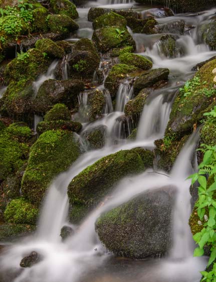
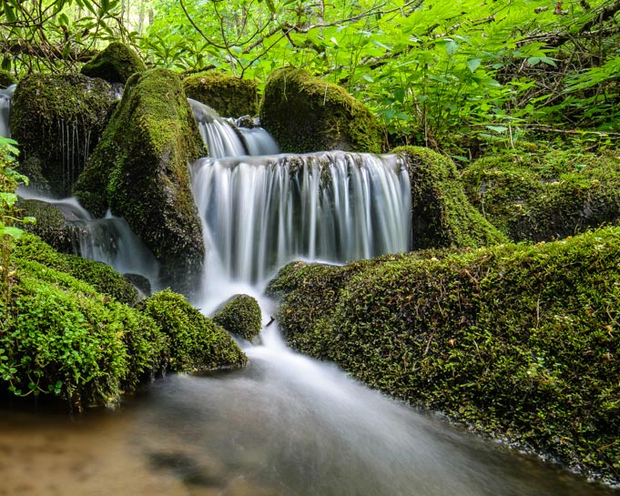
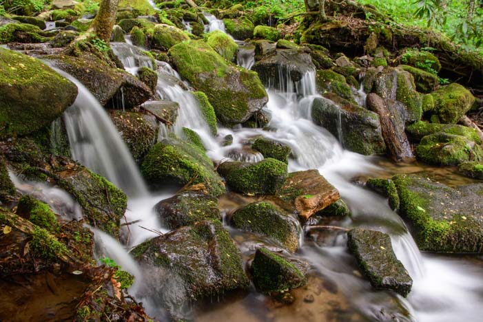
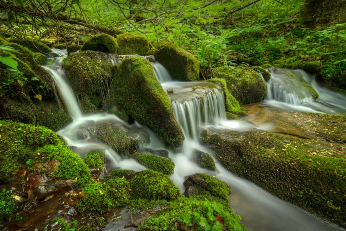
The Oconaluftee River captivated us.

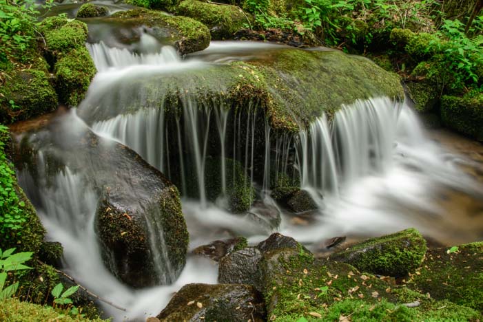
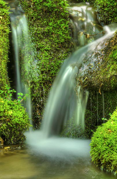
We had a blast playing with our cameras on this beautiful mountain stream, trying to catch its movement as it slipped over rocks and around logs on its way down the mountain.

Oconaluftee River Smoky Mountains North Carolina

Water slides over rocks and past logs as it tumbles downstream.

Newfound Gap Road is the main north/south road across the middle of Great Smoky Mountains National Park. It winds up and over the mountains, and for much of its length we found ourselves shrouded by an archway of vivid green trees.

Newfound Gap Road Great Smoky Mountains National Park North Carolina

Newfound Gap Road, the main road between the north and south sides of the park, winds under a canopy of trees as it goes from North Carolina to Tennessee.

The river was our constant companion, and we stopped frequently to take its photo.

Oconaluftee River Great Smokies Mountain National Park North Carolina

We just couldn’t get enough of all this rushing water!

River Great Smoky Mountains National Park North Carolina

.

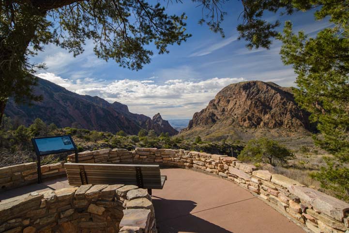
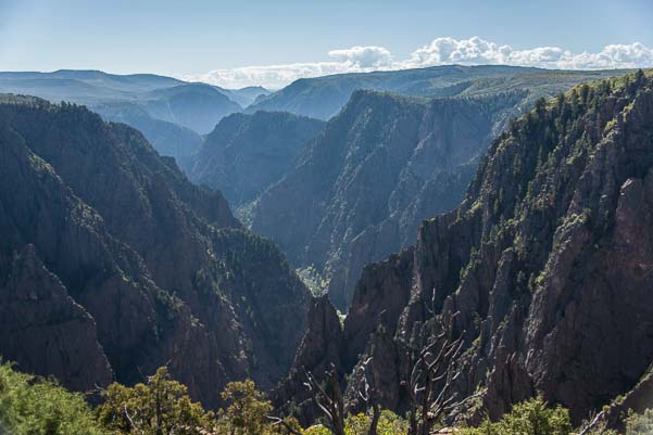
After about 10 or so miles and a few switchbacks on Newfound Gap Road, some openings began to appear in the trees and we were able to stop at various overlooks to get a view of the mountains stretching into the distance.

The Smokies N. Carolina

Classic layers of mountain ridges in the Smokies.

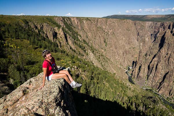
We weren’t immune to taking a few selfies along the way!!

Selfie in the Smoky Mountains Cherokee N. Carolina

Everyone was taking selfies at the overlooks, so why not us too?

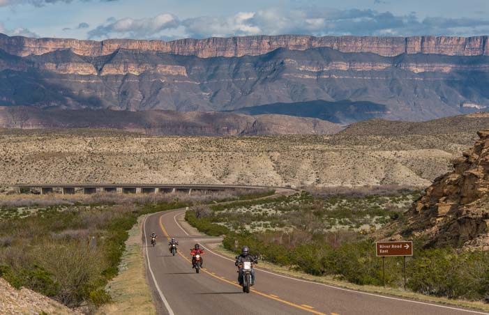
There was a lot of traffic on this road, and most of it was motorcycle traffic. This seems to be the place for groups of motorcycles to go for a ride. Clusters of them passed us repeatedly.

Motorcycle Smoky Mountains

Probably the best way to enjoy the roads over the Smokies is by motorcycle — and we saw hundreds!

The occasional RV uses this road to get between the Tennessee and the North Carolina sides of Great Smoky Mountains National Park too, but we kept ours on the North Carolina side for this trip.

Motorhome RV Smoky Mountains

A few RVs tackled the twisties too.

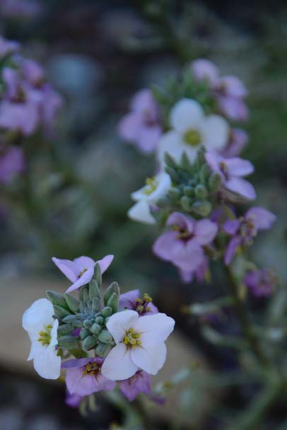
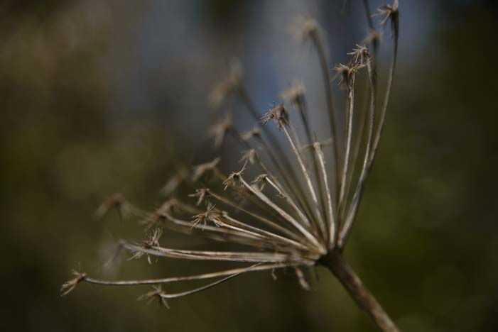
Wildflowers were in bloom everywhere.

Wildflowers in the Smoky Mountains N. Carolina

Springtime flowers in the Smokies

We saw trillium flowers here and there, and many other beautiful wildflowers too.

Trilium flower Great Smoky Mountains National Park North Carolina

We spotted little thickets of trillium flowers in a few places.

Wildflower

We found dandelions parading among the lavender wildflowers!

Dandelion and wildflower

Heck, even the occasional brown weed looked good out here in the Smokies!

Weed

We drove out to Clingman’s Dome a few times to see the view from the highest vantage point in the park. There is a wonderful spiral walkway that goes up to a viewing platform, and the view from the top is a full 360.

Clingman's Dome Great Smoky Mountains National Park

Clingman’s Dome is a marvelous ramp that spirals up to a 360 degree overlook.

The layered mountains were mesmerizing at dusk as the sun set.

Smoky Mountains at dusk

Dusk steals over the sky.

Mountain layers in the Smokies

The mountain layers have a mystical air…

Great Smoky Mountains National Park sunset

Sunset in the Smokies!

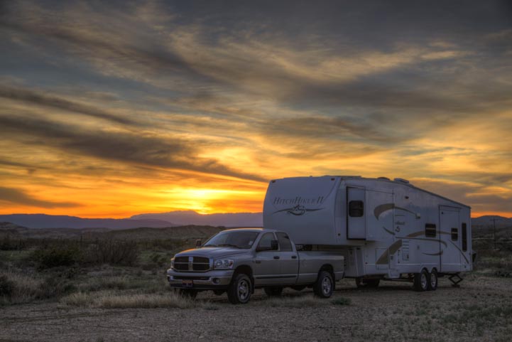
If you are planning an RV roadtrip to the North Carolina side of the Smokies, there are several RV parks in the Cherokee, North Carolina, area. This gives you access to both the Great Smoky Mountains National Park and the southern terminus of the Blue Ridge Parkway.

We saw lots of big rigs in the area, but we did find that it can sometimes be a little dicey to drive a large RV on these skinny, twisting mountain roads. The Blue Ridge Parkway, in particular, has several low bridges in the first few miles that prevent taller RVs from driving that beginning stretch.

Subscribe
Never miss a post — it’s free!

Our most recent posts:

More of our Latest Posts and Quick Pics are in the top MENU above.

Links for the Smokies in North Carolina:

Related posts:

<-Previous || Next->

A Jewel of a Waterfall – Great Smoky Mountains National Park

For the last few days we have been enjoying the beauty of the Great Smoky Mountains National Park and the Blue Ridge Parkway in North Carolina. These two adjacent national parks are enormous, and it can be a little overwhelming to figure out how to see it all.

Falls at Smoky Mountains North Carolina

A spectacular waterfall we “discovered” in Great Smoky Mountains National Park

There are waterfalls and hikes and biking loops and all kinds of things to see and do — not to mention a bunch of visitors centers to help you get oriented! Just getting from one side of the park to the other can take a few hours of driving (especially if you stop to take pics all the time!).

great smoky mountains national park oconaluftee river

As usual, we gathered lots of reading material and went over it all with the folks at the Oconaluftee Visitors Center, trying to come up with a sightseeing strategy. How to get started?? Hmmm…

cascading waterfall in Great Smoky Mountain National Park North Carolina

We did a few drives and saw some lovely things, but these two sprawling parks didn’t really capture our hearts until one afternoon when we accidentally bumped into a true jewel by the side of the main road that scales the peaks of Great Smoky Mountains National Park.

Oconaluftee waterfall Great Smoky Mountains National Park

We were just driving along when out of the corner of our eyes we spotted a fabulous waterfall cascading down the vivid green hillside.

waterfall on oconaluftee river great smoky mountains national park

Mark did a quick U-turn, and we rushed back to find a place to park so we could run out and see this gorgeous waterfall up close.

North Carolina Oconaluftee River Waterfall

Before I jumped out, I scanned the maps, but there was no mention of this glorious waterfall anywhere. And there were no road signs marking this stunning gem either. There was barely room for a three or four cars to park!

Smoky Mountains National Park waterfall

We scampered up the steep, muddy trail alongside the waterfall. The stunning cascade went up and up and up, disappearing into the lush green woods high above the highway. We followed the lure of pretty arcs of water washing over moss covered rocks until we felt like we were in the treetop canopy.

waterfall Great Smoky Mountains National Park North Carolina

What a discovery!! We clambered around and took photos for hours, thoroughly enjoying this perfect, unnamed and unsung showpiece in this mammoth park.

closeup waterfall Oconaluftee River

We’ve been reading up on all the waterfalls there are in the Smokies and along the Blue Ridge Parkway — there are dozens — and we’ve checked the photos of them all. But this unknown one keeps calling us back. It is so beautifully balanced, with water tumbling down a magnificent pattern of rocks. There is no doubt that this was one designed by a divine hand.

So far we’ve visited three times!!

sitting by waterfall in smoky mountains north carolina

If you take your RV to Great Smoky Mountains National Park in North Carolina, I’m sure there are loads of beautiful waterfalls to see — we’ll be finding out in the coming days and weeks and reporting back about what we find. But be sure to check out this unmarked beauty.

From Cherokee, North Carolina, the waterfall is located 8.5 miles west of the Oconaluftee Visitors Center on Newfound Gap Road on the left hand (south) side. You won’t see it as you drive west from the visitors center, but if you drive out about 10 miles and then turn around and come back east (towards the visitors center) slowly, you’ll see it flowing oh-so-happily on the right.

Subscribe
Never miss a post — it’s free!

Our most recent posts:

More of our Latest Posts are in the top MENU above.

More info about the Smokies:

Related posts from our travels:

Gulf Islands National Seashore – Florida’s Emerald Coast!

March, 2015 — After a wonderful visit at the Escapees RV Club headquarters in Livingston, Texas, we huslted east on I-10, enjoying several really fun stops at the interstate rest areas along the way. We had endured more rain and crummy weather in the last few weeks in Texas than we had experienced anywhere in years, so the gorgeous sunshine that greeted us in Florida was especially welcome.

Dawn on Pensacola Beach in Florida

The beach at dawn — bliss!

Pensacola Beach and the Gulf Island National Seashore on Florida’s Emerald Coast are just gorgeous, with white sand and water the color of jade stretching for miles and miles.

Girl plays on Pensacola Beach in Florida

Pink bathing suits, sand castles and aquamarine water — what could be better?

We were told that we had arrived on the first really great days of the season, and everyone was out enjoying the beautiful weather. It was spring break, and kids were everywhere, playing frisbee, suntanning, flirthing and hanging out.

Kids play ball on Pensacola Beach in Florida

Play ball! Spring break in Florida!

Even the seagulls seemed to be getting into the playful spirit.

Seagull flies over Pensacola Beach in Florida

Checking out the beach scene from above!

Seagulls on the beach in Florida

“It wasn’t us!”

There is a paved path that goes along the Gulf Islands National Seashore for miles and miles, and we took our bikes out for a spin along the coast.

Riding bicycle on Gulf Islands National Seashore Florida

There are many miles of paved bike paths along the Gulf Island National Seashore.

The paved bike path parallels the Gulf Island National Seashore road, so you can walk, run, bike, drive or ride a motorcycle along this beautiful scenic drive.

Bicycle on white sand Gulf Islands National Seashore Florida

It’s like biking in a sugar bowl!

The sand in this part of Florida is blindingly white and sugary soft. Birds and other creatures leave tracks all over the place. We saw the tiny footprints of little sandpipers, the webbed tracings from gulls, and the huge footprints left by large herons.

Bird tracks in white sand Gulf Islands National Seashore Florida

Little birds leave tracks of all kinds in the sand.

And we also saw the birds themselves…

Seagull Gulf Islands National Seashore Florida

.

But it was the color of the water that just plain knocked us out. Wow!!

Gulf Islands National Seashore Florida

The Gulf Islands National Seashore on the Emerald Coast

There were loads of pretty seashells too.

Seashells in white sand Gulf Islands National Seashore Florida

Pretty seashells were strewn about.

This was all such a delight and such a huge change after the vast, inland landscapes of Big Bend Texas and the piney woods in east Texas. We were loving being on the coast again.

Happy Campers on the Florida Gulf Islands National Seashore

Happy campers!

As we were riding back from the Gulf Islands National Seashore to Pensacola Beach, we came across an outdoor bar in front of a resort. The bar tender had blenders lined up to make yummy frozen drinks. What a place!

Outdoor bar Pensacola Beach Florida

This is the land of Vacations and Parties!!

This whole area is totally geared towards tourists and beach life, and it was so great to change gears completely and get swept up into beach vacation mode.

Hot crabs and cold beer sign Florida

Get it here…!

Windsurfing on Pensacola Beach Florida

We were told we’d arrived on the first real beach day of the season.

Little girl on the beach in Florida

Is there anything better than a sunny day on the beach?

We breathed deep, walked the beach, and unwound for a few days.

Pink lilly flowers

I love the beach because there is always something going on, and sure enough, one day when we went to the beach we watched a fisherman reel in a shark, then two young gals in bikinis walked by with large snakes wrapped around their necks!

Colorful umbrella on Florida beach

The sunshine and colors were a true feast for the eyes after all that rain in Texas.

The funny cries of the laughing gulls filled the air and the sunsets and sunrises were exquisite.

Seagulls flying over people on Florida beach

Even the gulls were having a good time.

Seagull flying into camera

These guys laugh and laugh and laugh.

It had been a long hike to get from Texas to Florida, but we both agreed these wonderful beach days were well worth the drive!

Sunset at Pensacola Beach Florida

The colors at sunset and sunrise were beautiful.

RV at sunset

Subscribe
Never miss a post — it’s free!

Our most recent posts:

More of our Latest Posts are in the top MENU above.

More info about the area…

Related posts…

<-Previous || Next->

Boondocking at Big Bend National Park – Cheap & Scenic RV Camping

How to “Boondock” at Big Bend National Park

Big Bend in Texas is an unusual park in the National Park System because they offer a few inexpensive RV dry camping sites scattered about the park grounds. It isn’t really “boondocking” like you’d find on other government public land managed by the US National Forest Service and the Bureau of Land Management. However, it is a very inexpensive and scenic alternative to staying in a conventional RV park or campground. For first-time boondockers, it can offer a great introduction to dry camping amid nature and solitude in your RV.

Big Bend National Park assigns these campsites on a first-come first-serve basis, as if the entire National Park were one huge campground. The sites that are big enough for large RVs are very few and are tightly controlled, and the system for obtaining a “Backcountry Camping Permit” to stay in one can be confusing. Here is what we learned about the system when we took part in it a few years back.

RV Boondocking and camping in Big Bend National Park Texas

“Boondocking” at Big Bend National Park

All five of the Visitors Centers in the park have computer access to a database of dispersed campsites throughout the park. You can obtain a permit and reserve a site in person from a ranger at one of these Visitors Centers 24 hours ahead of your stay. The permit is $10 and you can reserve up to 14 consecutive nights in specific campsites on a single permit, reserving as many different sites as you like and as are available.

An important point is that the permit is good only for the actual nights and sites you reserve through the ranger when you purchase the permit. If you want to extend your stay or change your campsite after you buy your permit, you have to cancel the remaining nights on your permit and buy a new one. Also, you can’t obtain a permit to reserve a site without appearing at a Visitors Center in person.

As a courtesy to other campers: if you don’t use all the nights on your permit (the weather might turn and send you scurrying, as it did to us), be sure to cancel the remaining nights on your permit by stopping in at the Visitors Center or calling them. Otherwise, the site will sit vacant while other RVers are wishing they could use it.

Big Bend National Park Texas RV boondocking_

“Boondocking” at Big Bend National Park

Many RVers have small driveable rigs and there is no evidence they are using a site during the day while they are out hiking, so unless you tell the Park Service you are vacating your site, they will have no way of knowing that you left early.

Our Experience Getting a Permit

From what we observed, there is one computer at each Visitors Center that has access to the backcountry camping permit database, so a line for permits forms during popular times. We stood in line at the Panther Junction Visitors Center in the middle of the park for 30 minutes on a Saturday morning when the weather for the next few days was predicted to be sunny and in the high 70’s.

The other people in line were primarily backpackers and car/tent campers getting permits either to do extended overnight hikes across the park or to camp in remote dispersed campsites we could never reach with our truck and trailer. We were the only RVers in line waiting for a site big enough for a big rig.

Each person spent about 5 minutes with the ranger, first reviewing the map of the National Park to pick out a campsite and to learn from the ranger what the site was like, and then filling out the permit application, and lastly listening to the ranger read the camping rules aloud.

Big Bend National Park RV camping and boondocking in Texas_

Hannold Draw

When our turn came, we were advised against staying in a particular site that we later found out would have been perfectly fine. However, an RVer had complained at one time that the site was unlevel, so this particular ranger decided not to present that site as a viable option to other RVers with big rigs.

It is wise to study the National Park map (click here and go to “View Park Map” — the campsites are the light colored tents) and even to drive to the various dispersed campsites to assess whether or not your rig will fit and whether you might enjoy camping there. In general, rigs under 30-35 feet in total length end-to-end (hitched up) would fit in most sites along the main roads.

One of the rules that appears to be enforced is that you are not allowed to run a generator in backcountry camping sites. We overheard two rangers discussing a tent camper who had hidden a generator in his tent! If you don’t have solar power installed on your RV, a small portable solar power kit may be the way to go.

amping in Big Bend National Park in an RV in Texas

“Government Spring” site at Grapevine Hills

RV Camping Strategies at Big Bend

It is common to find that all the campsites are booked for the first few days after you arrive. So, plan to stay elsewhere at first and keep checking back until a site opens up.

The campground at Rio Grande Village on the far eastern end of the park has both full hookup sites that can be reserved online and dry camping sites that are first-come first-serve.

The other two campgrounds inside Big Bend National Park — Cottonwood, towards the southwest near the Santa Elena Canyon hike, and Chisos Campground, up in the mountains near the Lost Mine and Window Trail hikes (review of those hikes here) — have smaller sites that may not accommodate bigger rigs. However the Big Bend Resort & Adventures RV Park in Terlingua-Study Butte just outside the western boundary of the park offers full hookups and advanced reservations.

Each of the “boondocking” campsites we saw in Big Bend has pros and cons. One strategy for tackling Big Bend National Park with an RV is to spend a few days camped on the western side at Big Bend RV Adventures, a few days of “boondocking” in the dispersed campsites in the middle and a few days in Rio Grande Village at the eastern end of the park, as there are outstanding things to see and do in each of these locales. Camping near your planned activiites will cut way down on the commuter driving you do across the park!

For those with more rugged rigs, there are some fabulous sounding campsites that will get you deep into nature. We didn’t camp at or even see these locations, but friends with an Earth Roamer RV enjoyed some true backcountry camping experiences in their rig.

RV camping boondocking in Big Bend National Park Texas

Grapevine Hills

Summary of the Larger Backcountry RV Campsites in Big Bend:

Grapevine Hills

There are three campsites on this dirt road that goes 6 miles out to the Grapevine Hills hike with the balancing rock. The first is 0.3 miles in on the left side and is suitable for a big rig. This particular site is also known as “Government Spring” and can accommodate a big rig and a smaller one comfortably if friends are traveling together.

Campsites two and three are 3.7 miles down the road on the right hand side and they are essentially a double site. The views of the Chisos Mountains are lovely, however this is a very busy road with lots of people flying by at wild speeds to get to and from the hiking trail at the end, so it can be very dusty.

Paint Gap

There are three campsites on the first part of this dirt road. The first at 0.9 miles would be suitable for a rig of 35′ or less end-to-end. The second and third are 2.1 miles in and are good for a trailer of 25′ or so. We weren’t sure we could have squeezed our 36′ fiver in there. See the comment from Robin below who had a great time there with a 24′ travel trailer.

Croton Springs

There are two campsites in a huge open area at the end of this dirt road down about 0.5 miles. Probably 3 or 4 big RVs could fit if friends were traveling together. This is the site that one RVer apparently felt was too unlevel for a big rig, but when we drove down here we thought it would have been an awesome place to stay and just wished the ranger had mentioned it as an option.

K-Bar

This is a very rough dirt road that has a small site for a small trailer, van or truck camper at 1.1 miles. Further on, at 1.5 miles, there is a little more room, but it would take some jockeying for a big rig to get set up. See the comment below from Robin who said they loved the second site and got their 24′ travel trailer into it just fin!

Hannold Draw

This is a highway maintenance yard about 0.1 miles down a dirt road that has a huge site big enough for several RVs and even has a horse corral. The entrance is quite steep and we used 4×4 Low Gear to climb out. The enormous trash heaps are a little off-putting as you drive in (“Are we going camping in a junkyard?” we asked each other!), but there is a berm on the west side that provides wind protection (if it’s from the west), and the mountain view is beautiful.

Dust on the road camping in Big Bend Texas

Dust can be a problem at some sights (this is Grapevine Hills).

Notes

  • The busy seasons at Big Bend National Park are Thanksgiving, Christmas and Spring Break in March.
  • There is water at the Panther Junction VIsitors Center (limit: 5 gallons per person per day)
  • There are RV dump stations at Big Bend Adventures RV Park outside the western boundary of the park and at Rio Grande Village at the eastern end of the park.
  • Cell phone and cellular based internet access is acceptable at the boondocking sites with a WiFi booster and antenna. WiFi is sometimes available at Rio Grande Village, however when we were there we heard it had been turned off because someone had been abusing the priviledge.


Subscribe
Never miss a post — it’s free!

More info from the National Park Service website:

Related Posts about Big Bend National Park:

Related Posts about Solar Power and Boondocking:

Other great RV camping areas:

Our most recent posts:

More of our Latest Posts are in the top MENU above.

Big Bend National Park – Mountain, River & Desert Hikes

February, 2015 – Big Bend National Park in Texas has a really varied landscape. It is possible to go from a river habitat to a desert habitat to a mountain habitat without ever leaving the park! There are lots of hiking options in each of these terrains, and we enjoyed sampling the different locales, sticking to lower elevation hikes on cold days and higher elevation hikes on hot days.

The heart of the park is the Chisos Mountains, a range that juts up from the desert floor (down around 1,800 feet elevation), and soars to heights of over 7,800 feet. A quick walk out to an overlook gave us some beautiful views.

Overlook at Big Bend National Park Texas

An overlook in the Chisos Mountains.

We hiked the Window Trail one day, an easy 5.6 mile round trip hike from the central lodge. Because of the huge variations in elevation in this park, any mountain hike like this one is good for a warmer day.

Window Trail Hike in Big Bend National Park Texas

Beginning the Window Trail hike.

We expected to find a “window” somewhere along this hike. Descending a scenic dirt path, we were amazed when we suddenly found ourselves in a fun little canyon that was lined with large, flat and smooth rock that had been worn down over the ages by Oak Creek. The rangers have carved some really neat stairways through this part to make the hiking super easy.

Window Trail Hike Big Bend National Park Texas

Stairs make this hike even easier!

We were still on the lookout for that “window” as we made our way across the cool, shaded rocks. What we found, however, was not a window so much as vast opening in the canyon walls that peeked out at the desert floor in the distance. It was very dramatic — but quite slick too. Our intrepid RVing friend, Amanda, braved the slippery slope and went out for a closer look.

The Window on the Window Trail Hike in Big Bend

At last… a glimpse of the “window.”


The Santa Elena hike is down at the desert floor level of the park at the southwest end, and it follows the Rio Grande river into another stunning canyon. The scenic drive to get there warmed up our camera shutter fingers, and when we arrived at Santa Elena we found people out enjoying the warm sunshine on the banks of the river. Farmilies played on the edge of the water, and other folks kicked back for a little relaxation in the sun.

This 1.7 mile hike involves a lot of climbing, twisting and turning through a series of switchbacks at the beginning. At one switchback I noticed a beautiful glow coming from behind the rocks out on a ledge. I left the trail to go see what I could see, and soon found myself precariously tip-toeing along a steep rock face with the Rio Grande twinkling up at me from many feet below. I managed to get past the spooky part and found a huge rock overhang that was beautifully lit in the late afternoon light.

On the beach Santa Elena Canyon Big Bend Texas

Santa Elena Canyon has a beach in front of it!

Santa Elena Canyon Big Bend National Park Texas

A nice place to kick back and get some sun.

At Santa Elena Canyon in Big Bend Texas

Views at the beginning of the hike

Light glowing under rocks in Big Bend National park Texas

Late afternoon light glowing behind a rock overhang lures me off the trail.

Once I got back on the trail, I realized I had totally lost track of Mark (and we’d forgotten to bring our trusty two-way radios…darn!). I kept asking hikers that were on the return trip if they had seen a guy in a gray shirt taking lots of photos. I got plenty of reassurances that he was ahead of me — and that all the climbing was well worth the views at the end!

Hikers descend on trail in Santa Elena Canyon Big Bend National Park Texas

Hikers returning down the trail ahead of me.

We had chosen to do this hike in the afternoon, and that turned out to be a great time to go, as the sun had finally penetrated the depths of the canyon. Photographers who were there in the morning said the light hadn’t been great — but the shade would be a welcome respite at a hotter time of year!

When I finally caught up with Mark, the trail was empty, and we were the only ones in the wonderful big open area at the end of the trail. Huge boulders begged to be climbed on, and a fabulous view between the lofty canyon walls opened up to the sunset-lit cliffs beyond.

Rio Grande at Santa Elena Canyon iin Big Bend Texas

The Rio Grande laps boulders on its way out the canyon.

Big Bend National Park looking into Santa Elena Canyon in Texas

Santa Elena Canyon

After enjoying the cool rock walls carved by creeks and canyons that we saw on the Window Trail and Santa Elena hikes, we then sampled a true desert hike out in abundant sunshine: the Grapevine Hills hike. This hike was at the desert floor altitude, but instead of finding ourselves surrounded by sheer rock cliffs that had been formed by a flowing river or stream, we passed through a wide open area that was rimmed with wonderful rock hoodoos.

The further we went on the trail, the more fun this hike became, as it twisted and turned its way into the rock hoodoos. This was like a kid’s playground. We scampered all over the rocks, feeling very much like kids, and at the end of the hike we found the signature rock formation — a balancing rock.

Balancing Rock Big Bend National Park Texas

The Balancing Rock at the end of the Grapevine Hills Hike.

Under the balancing rock in Big Bend National Park Texas

Looking through the balancing rock.

Grapevine Hills hike to Balancing Rock in Big Bend Texas

Having fun crawling around on the boulders.

Grapevine Hills Balancing Rock hike in Big Bend Texas

Nature in balance.

The wonderful thing about Big Bend National Park is that you can pick your destinations within the park to suit the climate of the day. We saw both hot, dry weather and freezing cold, wet weather during our two week stay, and we were grateful that during the heat we could play outside in the mountains and during the cold spells we could hang out at the lower elevations.

We also saw a very unexpected weather pattern that we’ve never experienced before: a thermal inversion between the desert floor and the mountains. For quite a few days it was 15 degrees warmer in the Chisos Mountains than it was at the lower elevation parts of the park thousands of feet below!

Lost Mine Hike Big Bend National Park Texas

Ascending the Lost Mine Trail.

Another very popular hike is the Lost Mine trail. This 5.1 mile hike took us on a steady climb through woods and trees, opening up after a while to huge views. We did the hike in the afternoon, so the mountains that filled our views as we hiked were shaded and not as dramatic as they could be.

As we approached the summit, the trail took a turn, and the golden light of late afternoon lit up the distant mountains in spectacular color. Like the other hikes, this end point was a true playground, with boulders to climb on and spots to perch and enjoy a snack with a view.

At the summit of the Lost Mine Hike Big Bend National Park

The summit opens up dramatic views in the late afternoon sun.

Tree at the top of Lost Mine Hike Big Bend Texas

I just LOVE that tree!!

Big Bend is a hiker’s paradise, and many people we met were embarking on multi-day backpacking hikes across the park. We stuck to short day hikes, but found them all very fulfilling.

RV Camping at Big Bend National Park Texas

Goodnight, Big Bend!!

Backpacking is great, but there is something about having a warm, soft bed and no twigs or rocks in your back at night that we really like, especially when you have a beautiful view!! (Here are some details about boondocking and RV camping in Big Bend).

Subscribe
Never miss a post — it’s free!

Our most recent posts:

More of our Latest Posts are in the top MENU above.

More info about day hikes in Big Bend National Park (from the US National Park Service):

Related posts:

<-Previous || Next->

Big Bend National Park TX – Vast and Varied with Views!

February, 2015 – The first thing we noticed about Big Bend National Park is the sheer size of the park. Everything is bigger in Texas, of course, and this park is no exception. Simply driving from one area to another covers many many miles. But the great thing about these drives is that they pass some wonderful scenery!

Big Bend National Park and Sierra del Carmen mountains in Texas with motorcycles

Sweeping views in Big Bend National Park!

Big Bend scenic roads with a tunnel

Don’t worry, RVs fit through this tunnel!

Big Bend National Park Texas

The Sierra del Carmen mountains peek from behind a ridge.

The terrain is really varied in Big Bend National Park, and that is one of the magical things about this place. There’s the Rio Grande river that snakes along the south end of the park, the Chisos Mountains that tower at great heights in the middle, and the desert lands in between.

The Sierra del Carmen mountains at the far eastern edge of the park form a dramatic landmark that is easily visible from 21 miles away in the center of the park. These mountains sport horizontal stripes, and they turn gorgeous shades of pink at sunset. They also mark the location of Boquillas, the tiny Mexican village that sits on the other side of the Rio Grande.

Sierra del Carmen mountains in Big Bend National Park Texas

The imposing Sierra del Carmen mountains can easily be seen from miles away.

Sierra del Carmen mountains in Big Bend

These are at the east end of the park by Rio Grande Village and the Mexican town of Boquillas.

One of the loveliest drives is the Ross Maxwell Scenic drive that goes from the center of the park to the southwest corner. This drive winds up and down through craggy mountains that made us feel like we were back in Arizona. In the late afternoon, on our return, the mountains lit up bright orange.

Scenic drives in Big Bend National Park Texas

The Chisos Mountains tower over the center of the park

Mountain scenery in Big Bend

Returning on the Ross Maxwell Scenic drive in late afternoon…

We were there in late February, and spring was already in the air. The Texas state flower is the lovely bluebonnet, and they were in full bloom everywhere. They love the roadsides, and all over the park we passed areas that were blanketed with them.

RV surrounded by Texas bluebonnet flowers

Spring arrives in February, heralded by abundant bluebonnet flowers.

When we rounded one corner, we found a natural rock garden that was littered with a wonderful combination of bluebonnets and yellow flowers that looked absolutly vibrant against the jagged rocks.

Spring in Big Bend bluebonnets blooming

After a swoopy turn on the Ross Maxwell Scenic drive, we found a huge
bluebonnet rock garden planted by Mother Nature.

Birds sang in the trees, and we even saw a bird’s nest in a cactus. This seemed like a precarious place to put a home, but I guess it works! Cactus of all types are prolific in Big Bend National Park, especially prickly pear cactus. We saw many varieties. Some have no thorns, and some have very long sharp ones.

Bird on a twig

This little guy kept an eye on me.

Bird nest in a cactus in Big Bend Texas

Not far away was a well protected nest.

Prickly pear cactus

Prickly pear LOVE Big Bend and come in many varieties.

Big Bend can deliver all kinds of crazy weather, and we saw it all during our two week stay. When we first arrived the temps were warm and the air was dry and clear. It was perfect. But Texas is one of those places where if you don’t like the weather (or even if you do!), just wait a minute, and it will change.

All of a sudden one night the temps plummeted into the 20’s, and we woke up to a winter wonderland of ice covering all the desert plants. If the scenic drive up to the Chisos Mountains was pretty before, now it was absolutely stunning.

Snow and ice in Chisos Mountains Big Bend National Park Texas

Texas can deliver some crazy weather, and Big Bend is no exception.

Century plant with snow in Big Bend Texas

The ice on the century plants was very cool.

Snow on plants in Big Bend

Ice in the desert!

Ice on the trees in Chisos Mountains of Big Bend National Park Texas

The drive into the Chisos Mountains was even more thrilling with all the lower elevation plants laced in ice.

Luckily, this round of ice melted quickly and we were able to enjoy a few hikes which I’ll cover in the next post!

______________

Subscribe
Never miss a post — it’s free!

Our most recent posts:

More of our Latest Posts are in the top MENU above.

More info about Big Bend National Park:

Related Posts:

<-Previous || Next->

A Glimpse of Big Bend National Park in Texas

A huge windstorm has wiped out cell service in Big Bend National Park here in Texas, so we have been scurrying to the Visitors Center every so often to check our email, get a weather report and make sure the real world out there is still okay. in the meantime, Big Bend has given us some incredible beauty and big surprises.

Surprised face in a tree

Big Bend has been full of surprises, including this surprised looking face in a tree!

It’s a huge park, and going anywhere is at least a 25 mile drive. But the drives are awesome! There are rock formations, badlands, cliffs, mountains, rivers and more.

Entering Big Bend National Park Texas

The drives around the park are full of sweeping views.

An RV drives past Sierra del Carmen in Big Bend National Park Texas

Huge vistas dwarf an RV on the road in Big Bend

We’ve enjoyed some fabulous hike through boulder fields, to balancing rocks and into canyons with cliffs towering above us. But this place always keeps you on your toes. A few mornings ago, after enduring below-freezing temps overnight, we woke up to dense fog and lacy frost decorating everything.

Balancing Rock Big Bend National Park Texas

There are cool rock formations everywhere.

Icicles and frost on a yucca in Big Bend National Park Texas

A century plant flower is covered with glittering frost.

Icicles and frost in Big Bend National Park Texas

The Chisos Mountains were transformed by frilly frost on the trees.

Despite our red noses and beanie hats, we loved every icy minute we spent in this world of mini icicles, and we’re hoping it happens again! The delicate patterns on all the desert plants were exquisite. Pretty tendrils of ice on a yucca plant gave it a whole new look.

Lace patterns of ice and frost on a yucca in Big Bend Texas

Graceful tendrils of ice and frost make pretty patterns on a yucca plant

And then, as quickly as it formed, the frost disappeared under the rising sun. Little birds began chirping again, and the wildflowers opened up to the warm sunshine.

Wild flowers in Big Bend National Park Texas

Once the frost melted away, the wildflowers bloomed again.

Little bird on a yucca plant

Bird songs filled the air on some of our mountain hikes.

The day faded away with a beautiful sunset…

RV at sunset in Texas outside Big Bend National Park

The sunsets at Big Bend have been beautiful

Our most recent posts (find more Latest Posts in the MENUS above):

Related Posts from our RV travels to Big Bend:

Subscribe
Never miss a post — it’s free!

White Sands National Monument – New Mexico’s Desert Dunes!

February, 2015 – The first thing we noticed when we arrived at White Sands National Monument in New Mexico, was the beautiful patterns in the sand. The wind leaves ripples across the sand, the way the ocean does at the beach, and the patterns wriggled away from us in semi-parallel lines as far as we could see.

Rippled sand of White Sands National Monument in New Mexico

We saw beautiful patterns in the sand everywhere.

When we first were driving towards the National Monument, we wondered where the sand was, becauase all we could see was vast brown landscapes all around us. But as soon as we got onto the Dunes Drive inside the park, the white sand enveloped us on all sides.

Vast landscapes and tiny person at White Sands National Park New Mexico

The landscape at White Sands is vast.

The sand was virgin in most places, filled with patterns that Mother Nature chose. But in some spots we saw the tracks of little creatures and the footprints of people, some wearing shoes and many running barefoot!

Sand Patterns at White Sands New Mexico

Ripples weave across the desert floor.

Animal tracks in the sand

Animals and people left tracks here and there.


There are hundreds of square miles of brilliant white sand in this area, and White Sand National Monument encloses 223 of those square miles. The sand is a crystallized form of gypsum that usually dissolves in the rain before being washed away. But this area is in a basin that doesn’t drain, which leaves beautiful dunes and “beaches” on the earth’s surface.

Standing on virgin sand

This is a unique landscape!

There are many different kinds of dunes, and sand piles, and flat open expanses of sand. Desert plants poke up through the sand here and there, and the light and shadows play with each other on the dune faces as the sun travels across the sky.

Plant and shadow in White Sands New Mexico

Plant and shadow…

Desert plants in White Sands National Monument New Mexico

Desert plants

We were enchanted by the patterns we found everywhere. In some places the sand makes crisp little ridges, and in others the sand undulated in large, soft waves.

Dodge RAM 3500 truck in White Sands National Monument New Mexico

Some of the dunes undulate in large, soft waves.

It was nearly Valentine’s Day, and Mark got inspired, drawing hearts and writing “Sweety” and my name in the sand. We played with making shadow puppets and made two wonderful hearts as we stood side by side. As we looked down at our perfect shadows on the ground, we both said simultaneously, “Now all we need is someone to take our picture!” Oh well, no one was around so we got just one heart shadow instead of two.

Sand swirls leading to a heart

We got into the Valentine’s spirit…

Shadow Puppet heart in the sand

…but with double-heart shadow-play, who takes the photo?


We were both drawn to the beauty in totally different ways, and we ran off in different directions to try to capture it. I turned around at one point and saw Mark lying down in the sand! Luckily, the sand brushes off really easily. His little bit of lolling around on this desert beach yielded some beautiful photos from sand level!

Getting down for a low shot of White Sands National Monument New Mexico

Mark gets low for a shot from sand level…

Blue sky at White Sands National Monument New Mexico

Nice!!!!

White Sands National Monument is a really FUN park. We watched kids making snow angels in the sand and families sledding down hills on flying saucers they’d rented at the visitors center. The beauty of this crazy sand paradise is that whenever the wind blows, the tracks left by people are erased, and the sand palette is wiped clean.

Brushed and rippled sand with grass plant

Footsteps leading to me in White Sands National Monument New Mexico


Like an old fashioned Etch-A-Sketch, or a sand castle made at low tide, you can leave your mark here, but only for a short while.

Desert plants in the white sands of New Mexico

The road that goes through the park isn’t paved. Instead, the National Park Service seems to use a snowplow to clear the sand to the sides! Some people bring their RVs down the Dunes Drive, but it looked like their wheel wells got pretty sandy.

Curving dunes in the sand in New Mexico

Plowed roads at White Sands National Monument in New Mexico

The Dunes Drive is a plowed road through the sand!!

Our visit was way too brief, and we didn’t get to see the magic hours of sunrise and sunset. Oh well — next time!!!

Motorhome and sand dune in New Mexico

We had a wonderful introduction to this magical place,
and we’ll be back for sure!!

Subscribe
Never miss a post — it’s free!

Our most recent posts:

More of our Latest Posts are in the top MENU above.

More info about the area:

White Sands National Monument – Official Website
White Sands National Monument – Wikipedia

Related Posts:

Bisti Badlands, New Mexico – Exotic Rock Formations and Alien Eggs!

<-Previous || Next->

Black Canyon of the Gunnison National Park, CO – Steep and Deep!

Bikes on Castle Creek Road in Colorado

Bicycles on scenic Castle Creek Road

September, 2014 – Maroon Bells may be the most photographed spot in Colorado’s Rocky Mountains, but nearby Castle Creek Road is also very scenic and not nearly as heavily visited.

We drove out one day and passed a steady stream of cyclists enjoying an exhilarating road ride. What a place for a morning workout!

A tiny historic ghost town named Ashcroft lies at the end of the road.

The old buildings were interesting, but we were more intrigued by a row of colorful rugs we saw hanging outside a shop very close by.

Teotitlan de Valle Oaxaca Rug Weavers

The rug weavers of Oaxaca come to Colorado!

Above the shop a sign read: “Welcome to the Catto Center at Toklat.”

We walked past the many rugs, admiring their designs, and then stepped inside.

We were suddenly surrounded by woven wool rugs that looked very similar to the ones we had seen near Oaxaca at Teotitlán de Valle in Mexico a few years ago.

A friendly looking woman was giving a demonstration to several tourists, showing them how the blue dyes were derived from indigo.

Views at Black Canyon of the Gunnison National Park Colorado

Black Canyon of the Gunnison

Our jaws dropped. That was exactly the same demonstration that we had seen in Teotitlán de Valle!

It turned out that this woman came from a family of rug weavers in that very same Mexican village.

I remembered vividly how our tour guide in Oaxaca had squished a bug in the palm of a girl’s hand to demonstrate how they made their red dyes (see my blog post about it here).

Apparently, the owner of this shop’s building had brought a few Oaxacan weavers to Colorado to promote their craft each summer. How fun!

Black Canyon of the Gunnison Colorado

The chasm is vast and deep

Where Maroon Bells and Castle Creek had shown us Colorado’s Rocky Mountains in the early stages of their fall glory, another land of stunning scenery — Black Canyon of the Gunnison — beckoned.

This canyon’s jagged cliffs are nothing like the soaring Rocky mountains.

Instead of craning our necks to look up at tall mountain peaks, the Black Canyon of the Gunnison is like a massive crack in the earth’s surface, with the sides parted to reveal sheer rock walls plunging nearly straight down to a thin ribbon of river far below.

Turkey vulture in flight

A turkey vulture soars past

The canyon wasn’t formed by the walls cracking apart, however. It was formed by the very fast moving Gunnison River cutting through the rock like knife.

The Gunnison River falls from great heights to great depths, dropping an average of 95 feet per mile. This keeps the water moving at quite a clip.

This raging water has cut through the black rock like a laser, deepening the canyon faster than other kinds of erosion can widen it.

Black Canyon National Park Colorado

The canyon is steep and deep!

At its narrowest point, it is just ¼ mile across, and the depths of the sheer walls range from 1,750 to 2,700 feet (by comparison, the Empire State Building is 1,454′ feet tall and would reach just partway up the walls!).

As we approached the rim at an overlook, we saw several turkey vultures circling right overhead. They played with the air currents and dove down into the canyon and rose back out again effortlessly.

What a thrill it would be to fly like that, letting the earth fall away from under you as you flew over the rim of the canyon!

The Black Canyon of the Gunnison fills a huge area along the Gunnison River, and there are two wonderful areas for exploring it: a National Park with an entrance on the south rim and a gorgeous scenic drive that snakes along Route 92 on the north rim.

Sitting on the edge of the Black Canyon of the Gunnison in Colorado

I got a kick out of crawling around on the ledges.


At the Visitors Center for the Black Canyon of the Gunnison National Park we noticed a bulletin board covered with little hand written notes.

“Happy Birthday, Wilderness!” a sign said, recognizing 2014 as the 50th anniversary of the Wilderness Act.

We learned that this 1964 Act set aside 110 million acres of land, created the National Wilderness Preservation System, and gave Congress the ability to designate official “Wilderness Areas.”


Craggy crevasse at Black Canyon National Park Colorado_

The “Painted Wall” is one of the most stunning overlooks.

Beneath the sign was a quote from Edward Abbey, novelist, environmentalist, and critic of public land policies.

“Wilderness is not a luxury but a necessity to the human spirit,” he was quoted as saying.

On this bulletin board, the rangers had posed the question, “What does Wilderness mean to you?” The notes tacked all over the board were full of thought-provoking answers:

“Free & Wild!” penned one person, adding a smiley face for emphasis.

Happy campers on the north rim of Black Canyon of the Gunnison Colorado

What a great place to explore!

“A place to discover who/what you are made of/for/by” responded another with a little red heart.

“It humbles me…puts me back in place,” someone had written. Next to that another had scrawled, “DITTO.”

I got a kick out of reading these notes.

In hindsight, it is especially interesting to read them now in light of the recent public outcry against restricting commercial filming in officially designated Wilderness Areas.

People treasure wild land.

Towering peaks at Black Canyon National Park Colorado

To get a feeling for the scale of the place, here’s our truck dwarfed by the peaks!

“Wilderness speaks…to my soul,” one card said.

Wildnerness is “one place in the world where man is insignificant and always will be,” another proclaimed.

The Black Canyon of the Gunnison is a National Park with the usual roads and overlooks. However, portions of it are officially designated “Wilderness.”

Yet, back in 1881-82, over 1,000 immigrants from Italy and Ireland worked in horrible conditions full of rock slides, avalanches, and unreliable explosives to push the Rio Grande narrow gauge railroad through this canyon.

At the base of the cliffs of Black Canyon Colorado

At the base of the cliffs of Black Canyon

It is hard to imagine the harsh working environment these men endured, sleeping and eating in wooden work cars and bedding down on wooden planks.

The Gunnison river at Black Canyon Colorado

We drove along the Gunnison River at the bottom of the canyon.

Staring down into the canyon from the overlooks that have been carefully designed and built by the National Park Service, it is even harder to imagine the raw triumph these men must have felt when the first train puffed its way through the canyon.

The trains and railroad had defeated the wilderness at last.

This railway was touted as the “Scenic Line of the World,” and the trains carried thousands of people and tons of goods and livestock through the canyon.


“Wilderness is my heaven,” says one of the cards at the Visitors Center.

“What a Creator we have! Praise His name!” says another.

Mirrored water in the Gunnison River at Black Canyon Colorado

The sun played on the leaves of the trees as they reflected in the water.

Down at the base of the canyon along the Gunnison River, the sun played with the green leaves of the trees and their reflections in the placid water.

Finding that delicate balance between our urge to conquer and make use of our most beautiful landscapes and our urge to protect them and leave them alone has challenged our leaders and thinkers for nearly two centuries.

Mark and I both read the Autobiography of Ansel Adams and were astonished to learn just how hotly the mission of the National Park Service and other public land agencies were debated in the early 1900’s.

Trees reflect in the Black Canyon's Gunnison River in Colorado

Mirror images in the Gunnison River.

We think of Adams as a photographer, but he was deeply involved in the early development of the Sierra Club, and he had very strong opinions about the National Park Service, most of them far from flattering.

He was fortunate to see these lands at their most untouched, and he felt that in many ways he was documenting a disappearing landscape.

Of course, he was not nearly as comfortable in his tent in the early decades of the 1900’s as we are running around in our luxury fifth wheel today. And that is the deepest irony of what “wilderness” really means.

River's edge Black Canyon of the Gunnison Colorado

At the river’s edge in the bottom of the canyon.

To make wild landscapes easily accessible requires roads, railways and other development. That gives us laymen a chance to get inside the scenery and enjoy the beauty.

But the very presence of those developments changes the landscape forever.

The “wild” in “wilderness” springs from its very inaccessibility. The more accessible it becomes, the less wild it can be, by definition.

Even though much of the Black Canyon of the Gunnison is officially a Wilderness Area, much of it has also been tamed.

Curecanti National Recreation Area

Curecanti National Recreation Area (Blue Mesa Reservoir) is at the east end of the Black Canyon of the Gunnison.

“Earth untouched by man,” is what ‘wilderness’ means to one person who answered the ranger’s query with a card on the wall at the Visitors Center.

Yet that very description is a dream and a fantasy for all but the most intrepid trekkers among us.

That kind of wilderness certainly isn’t a place you can drive by in a heated or air conditioned car, like the beautiful overlooks at the Black Canyon that are the only parts of it most of us will ever reach.

Perhaps the last card summed it up best:

Wilderness means “Hope — even if I never see those places that are truly wild.”

____________________


Although I wouldn’t drive a big RV on scenic Route 92 (where the views of the canyon are truly dramatic), this whole area can be enjoyed using Montrose, Gunnison or the Curecanti National Recreation Area as a home base. Lake Fork Campground is on the water’s edge at Blue Mesa Reservoir and was almost empty when we visited. Check out these links to learn more about:

More blog posts from our RV trips to Colorado:

<-Previous || Next->

Grand Teton National Park Wyoming – Rare Sightings!

Fifth wheel RV with bikes and a rainbow

A rainbow appeared off in the distance…

September, 2014 – We had a lot of dark rainy days during our stay at Wyoming’s Grand Teton National Park, and one afternoon we looked out the window to see a very bright rainbow dramatically piercing through the black sky in the distance.

We were waiting for sunset at that particular moment, kind of resting up a bit and relaxing.

We’d been taking so many photos and running around so much that when we saw this stunning rainbow, we greeted it with a shrug.

“It’ll never last,” I said.

Vivid rainbow at Mormon Row Grand Teton National Park Wyoming

This rainbow was so much more intense than most!

“Yeah. It’s way over there, and there’s nothing in the foreground but grass,” Mark added.

If it had been in the opposite direction, over the mountains, we would have leaped into action. But it wasn’t. So why bother?

Talk about blasé!! Our stay in this gorgeous park had totally spoiled us!

“It would look great with the Mormon barns,” I suggested after a while, wishing we were closer to those classic buildings.


rainbow on the Mormon barns at Grand Teton National Park Wyoming

It touched down right between the historic cabins at Mormon Row

But Mormon Row was a good ten minute drive away, and rainbows last just a few minutes, at best.

We went back to doing whatever we were doing — nothing really — while we each secretly kept an eye on this incredibly vivid arc that was flooding the land with light from the heavens.

Finally, we couldn’t take it any longer. We jumped up, grabbed all the camera gear we could find, and dashed out to the truck.

Mark floored it, and we zoomed onto the highway in hot pursuit. Unbelievably, the rainbow just got brighter.

Happy photographer with rainbow at Mormon Row

The rainbow crossed the sky, showing first one side and then the other.

We stopped at the most famous Mormon barn, along a dirt road of century old buildings, but the crowd of swarming photographers was thick. No way!

We raced back to the truck. I was running so fast over the uneven ground that I tripped and fell flat on my face — but I saved the camera!

I got up, brushed myself off, and saw that the rainbow was still there. So I kept running!

A bit further down the road we found some less picturesque but still very cool log cabins, and in this quiet spot we instantly busied ourselves taking a zillion photos.

Rainblow into an outhouse at Grand Teton Wyoming

Right to the pot of gold…in the pot!

We worked frantically at first, and then a little more calmly and with a little more thoughtfulness once we realized that our special rainbow was here to stay.

The sun fell lower in the sky, and the rainbow shifted, showing first one side and then the other, while the sun played with its shadow on the buildings and the land.

Mark cracked a wry smile and lined up the perfect shot, making the rainbow come right down onto an old outhouse.

The Milky Way and stars in the night sky at the Tetons

Starry starry night…

He’d found the true pot of gold at the end of the rainbow — in the pot!

Now that the rain had scrubbed the air clean, the nights became brilliantly clear, and Mark got another stunning shot, this time of stars.

While I snoozed and mumbled something unintelligible into my pillow at two in the morning, he snuck outside with his camera and aimed it at the sky.

A few minutes later he’d caught the Milky Way in its ethereal glow, rising out of a pair of silhouetted trees.

Next time I’ll make a point of joining him. That was much too good to miss!!

Mormon Row Grand Teton

One of the famous barns on Mormon Row

Church Bell Episcopal church in Grand Teton

Since 1925, this church bell has welcomed worshippers to this little log church that looks out at the mountains.

We did end up getting some photos of the classic Mormon barns at dawn, just as the peaks of the Teton Mountains were glowing pink.

The park has lots of other intriguing historical buildings, and one is an Episcopal log church that dates back to 1925.

Services are still held there, and what a heavenly view the congregation has through the windows behind the altar. It’s a wonder anyone ever hears a word of the sermon!

Badger at the Tetons

A badger waddles through the grass.

The Tetons are known for wildlife too, and in between our moments spent in enraptured communion with the landscape, we had quite a few wildlife sightings.

I saw my first badger, a little raccoon-like guy who waddled around in the grasses, perfectly camouflaged.

A red fox crosses the road in the Tetons Wyoming

A fox trots across the road

One day, out on a dirt road somewhere, we suddenly saw a bushy-tailed fox go by.

We weren’t the only car on the road, but the fox didn’t seem to mind.

He trotted right down alongside all the slow-moving cars for quite a distance before he darted into the woods.

We often saw bison grazing in the distance, and a few times we got hung up in traffic jams when the herd decided to cross the highway.

Bison jumping over fence Grand Teton Wyoming

Can he make it?

The leader of the pack was a huge brute of a beast, and one day Mark saw him take aim and jump over a fence.

Buffalo in Grand Teton National Park

…I think so…

This big guy eyed up that fence for quite some time, pacing back and forth, which gave Mark just enough time to get ready for the shot.

Bison jumping in the Tetons Wyoming

…Yup, he cleared it!!

And then he went for it — and cleared it like an expert high jumper!


Happy campers at Grand Teton National Park in Wyoming

What a beautiful place to spend a little time…

We really wanted to see a moose, and we got word that there was a big one with huge antlers that hung out by the bridge at Moose Junction (how fitting!).

Sure enough, one morning we saw him, just fifty yards from his bridge. He was with another moose friend — perfect!

But we had set our alarm clock so we could wake up before dawn to go take photos of the little log cabin church at sunrise.  Moose weren’t on our agenda!


Teton Mountains in Wyoming at sunset

Sunset at the Tetons

In our sleepy state, somehow we didn’t grasp the gift of the moment, and we kept on driving to the church, totally intent on our mission.

Silly us. The church was there every morning, but the moose in the Tetons play hide-and-seek. Unfortunately, we never saw them again.

Oh well. In the long run, it didn’t really matter. Wyoming’s Grand Teton National Park is a place we’ll return to again and again, and now we have a great reason to go back — to see moose!


Subscribe
Never miss a post — it’s free!

Our most recent posts:

Our other posts from our RV travels to Grand Teton National park:

<-Previous || Next->


New to this site? Visit our Home page to read more about our full-time traveling lifestyle and our Intro for RVers to find out where we keep all the good stuff. If you like what you see, we'd love for you to subscribe to receive our latest posts!