When 2016 burst upon us last year, our only goal for the year was to take our RV to the Canadian Rockies. As it turned out, on the way there and again on the way back, our year of full-time RV travels took us to a slew of National Parks.

Lake Louise, Banff National Park, Alberta, Canada
By mid-year, we had visited so many that we gathered all of our National Parks adventures from our nearly 10 years of travels onto one page:
National Parks and UNESCO World Heritage Sites Travel Adventures
We always keep a list of our most recent posts at this link (under “Latest” in the menu bar). But we also wanted to share our yearlong journey from 2016 on one page for RVers and other travelers who would like to follow in our path.
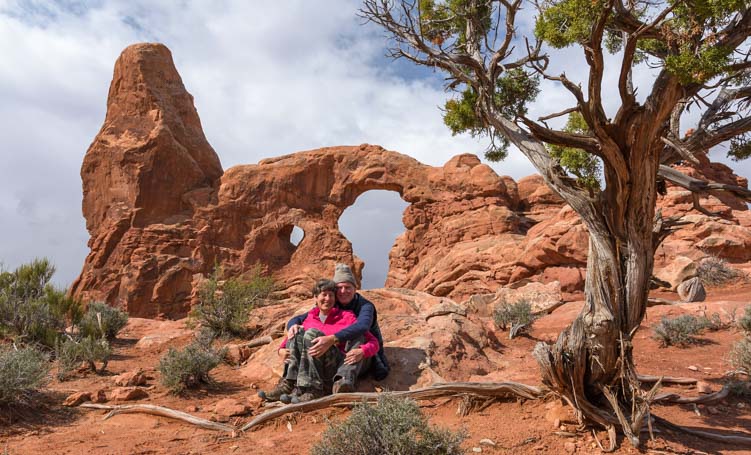
Arches National Park, Utah
Living as we do is a dream come true for us, and we began the year with some reflections on what it takes to live the dream. We were in Phoenix, Arizona, to ring in the new year where we enjoyed some wonderful encounters with wild (feral) parrots that take up residence in the saguaro cacti.

A peach faced lovebird perches on a saguaro cactus in Phoenix, Arizona.
From Phoenix we made our way to Quartzsite, Arizona, the RV gathering place.

Quartzsite, Arizona, is the RV Gathering Place each winter
The Quartzsite RV Show was in full swing in this crazy truck stop town where the name of the game is “Anything Goes.”

Sunrise in the Arizona desert in Quartzsite
From Quartzsite we headed east to Tucson, Arizona, where the historic part of town is filled with wonderful old adobe doorways.
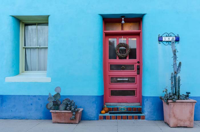
Historic Old Town Tucson in Arizona
We visited the beautiful Xavier Mission in Tucson which evokes the days of the Spanish explorers.

San Xavier Mission, Tucson, Arizona.
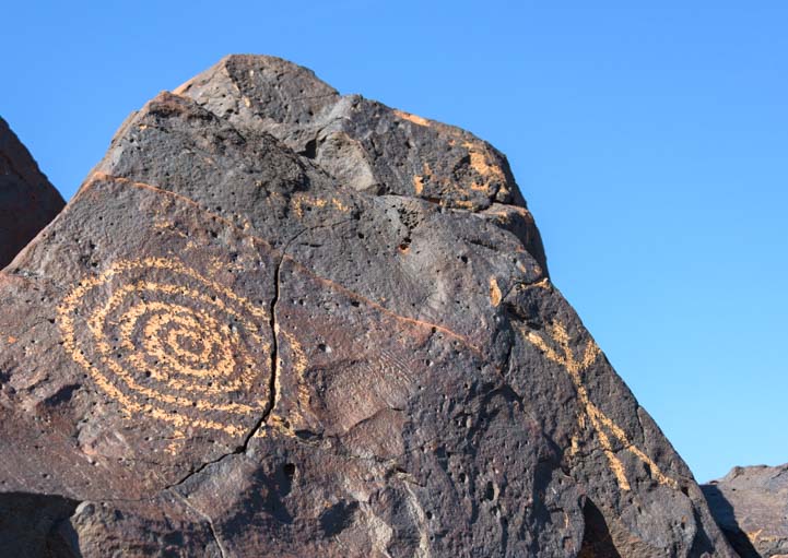
We found even more ancient history among Saguaro National Park’s ancient Indian petroglyphs. This was our first National Park visit of the year, and we discovered wonderful native Arizona animals in their habitats at the Arizona-Sonora Desert Museum there as well.

A mountain lion at the Arizona-Sonora Desert Museum in Tucson, Arizona.
Despite being February, temps suddenly hit 90+ degrees in Tucson, so we began our trek north, stopping in Sedona, Arizona, to ride our bikes on the Bell Rock Pathway and hike The Crack at Wet Beaver Creek.
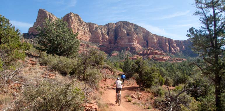
The Bell Rock Pathway is an easy hike or bike ride in Sedona’s quintessential red rock scenery
We took in some sunsets under stormy skies.
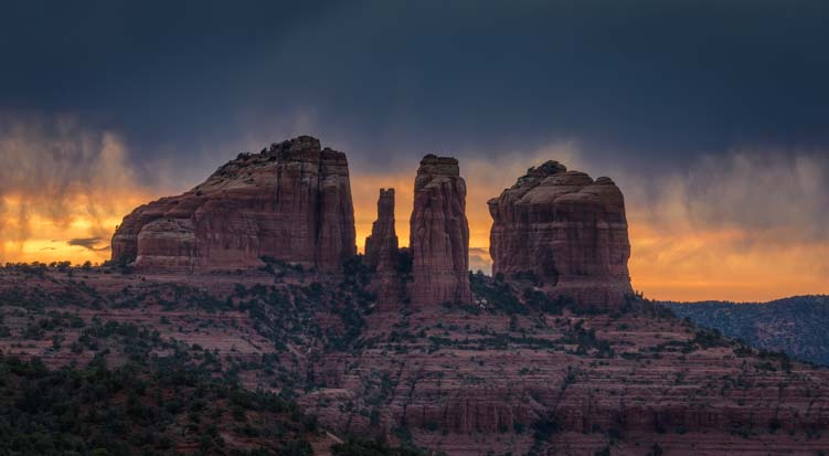
Sunset peeks through brooding skies at Cathedral Rock in Sedona, Arizona
In early March, we witnessed another stunning sunset and sunrise at Horseshoe Bend Overlook near Page, Arizona and explored Lees Ferry and Marble Canyon nearby.

Horseshoe Bend, Arizona
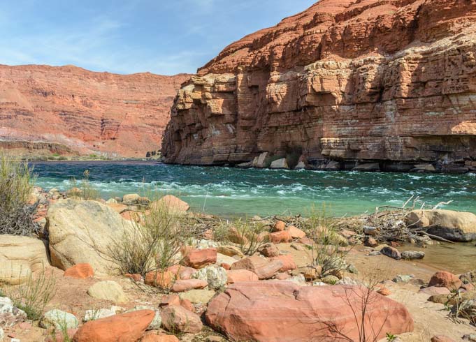
The Paria Riffle at Lees Ferry, Arizona
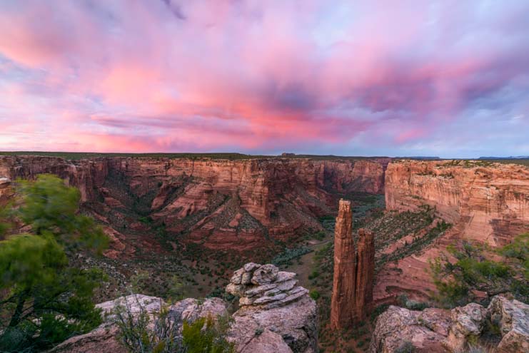
The ancient Indian ruins at Navajo National Monument and Monument Valley beckoned, and we learned about the proposed (and staggeringly massive) Bears Ears National Monument. For the next few weeks we would travel in and around the land area that would become Bears Ears National Monument by year’s end.
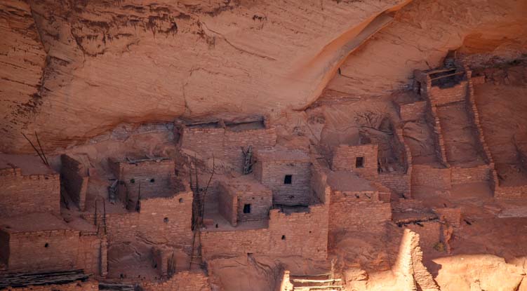
Betatakin cliff dwelling ruins at Navajo National Monument.
At Valley of the Gods and Goosenecks State Park, we were swept us up in the otherworldly red rock beauty of southern Utah.
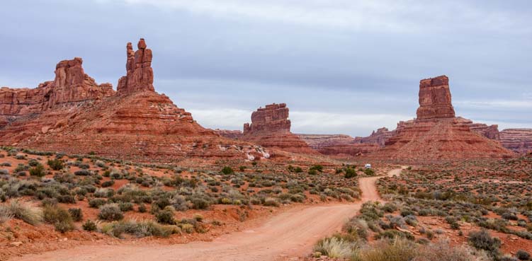
Valley of the Gods, Utah.
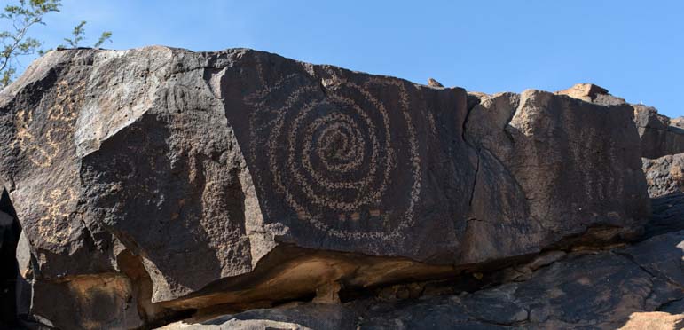
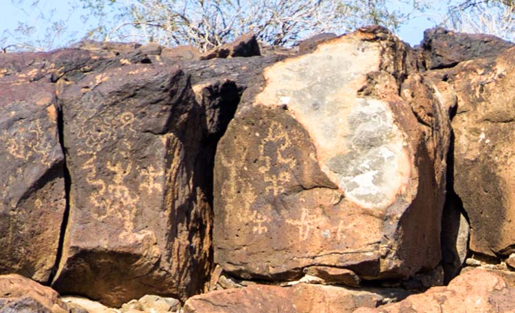
It was only mid-March, so a surprise snowstorm at Newspaper Rock wasn’t really a surprise.

A few of the hundres of petroglyphs at Newspaper Rock in Utah
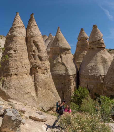
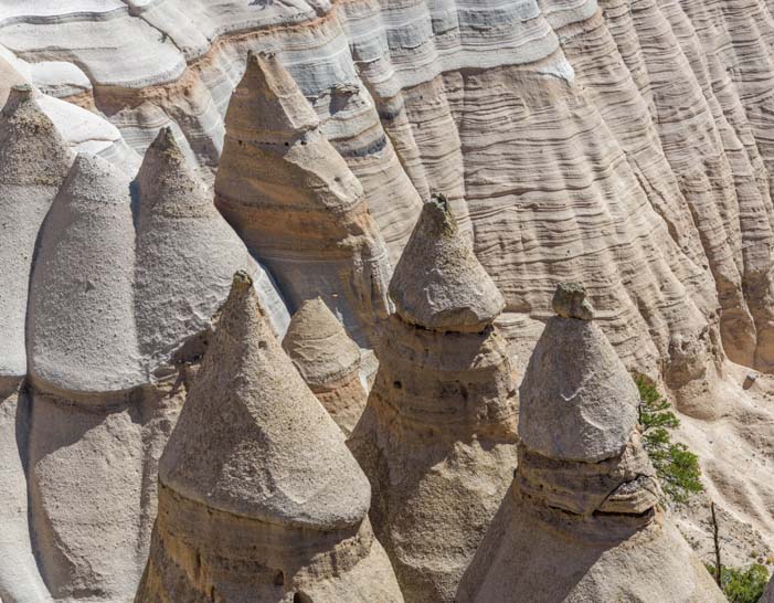
Southern Utah is peppered with stunning scenery and National Parks, and our eyes were popping as we hiked the Needles District of Canyonlands National Park.

Canyonlands National Park – Needles District.
We took in Moab’s gorgeous snowcapped mountain views and visited Arches National Park.
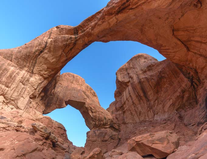
Double Arch in Arches National Park Utah
Nearby, we witnessed a stunning sunrise at Dead Horse Point State Park, a spit of land that is embraced by the much bigger Island in the Sky District of Canyonlands National Park where we enjoyed brilliant night skies.
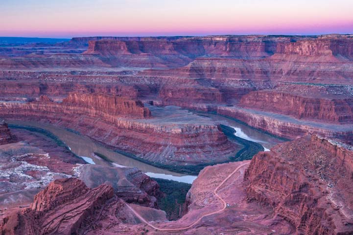
Dead Horse Point State Park, Utah
It was now April, and it was warm enough to take our trailer further north through southeastern Idaho’s picturesque mountains and farmland.
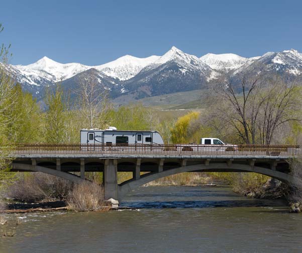
RVing Idaho’s back roads on the Salmon River.
We traveled along US-93 following the Salmon River through Challis and Salmon, Idaho.

Idaho in early Spring
Driving up through the Bitterroot Valley of Montana, we watched a herd of elk cross the highway in front of us.

.
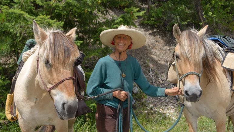
We had a chance to sample a little cowboy life and cattle ranching too.

Savoring the views of Montana’s Bitterroot Valley on horseback.
In Phillipsburg, Montana we discovered a sweet town that’s been dubbed one of “America’s Prettiest Painted Places.”

Philipsburg, Montana, one of “America’s Prettiest Painted Places.”
Early May found us on the western side of Montana’s Glacier National Park before the park was really open for the season. Placid Lake McDonald shimmered lovely reflections.

Lake McDonald, Glacier National Park
Crossing into British Columbia, Canada, we had finally arrived in the Canadian Rockies. We were blown away by the casual attitude of the big horn sheep who wander all over the roads in and around Kootenay National Park.

Big Horn Sheep just outside Kootenay National Park, British Columbia, Canada
Kootenay National Park gave us glimpses of bears nibbling Spring’s earliest treats, but our arrival at Lake Louise was when we began to feel like we were in the heart of the Rockies!

Lake Louise, Banff National Park, Alberta, Canada
We took several trips up and down the southern half of the Icefields Parkway, a scenic drive like no other.
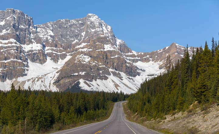
Icefields Parkway, Banff National Park, Alberta, Canada
We were stunned by the majesty of the towering snowcapped mountains all around us in Banff National Park.

Icefields Parkway, Banff National Park, Alberta, Canada.
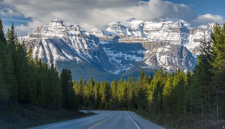
Icefields Parkway, Banff National Park, Alberta Canada
On the Icefields Parkway, which included a stop at royal blue Peyto Lake, we felt like we were driving on a highway right across the pages of a brochure for the Alps.
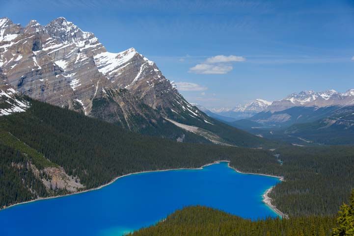
Peyto Lake in Banff National Park is an incredibly vivid royal blue.
In contrast, we reached picture perfect Moraine Lake in Banff National Park by bicycle, and we had it almost to ourselves because the road to it was still closed for the season.

Moraine Lake, Banff National Park, Alberta, Canada
Canada has four National Parks that are adjacent to each other in the heart of the country’s best Rocky Mountain scenery, split between the provinces of Alberta and British Columbia. On our trip to Emerald Lake in Yoho National Park, we bumped into the fabulous waterfall at Natural Bridge.

Natural Bridge surprised us on our way to Emerald Lake in Yoho National Park, British Columbia, Canada.
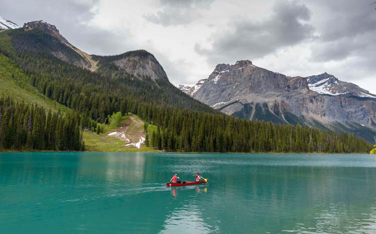
Emerald Lake, Yoho National Park, British Columbia, Canada
Banff, Alberta, has been a resort town since its inception, and we met an inspiring pair of young artists at the historic hotel in town.

Banff, Alberta, Canada
It was late May by now, and we celebrated our 9th anniversary of full-time travel by splashing around in the outdoor hot springs that bring a touch of summer to Canada’s snowy Rockies year round.
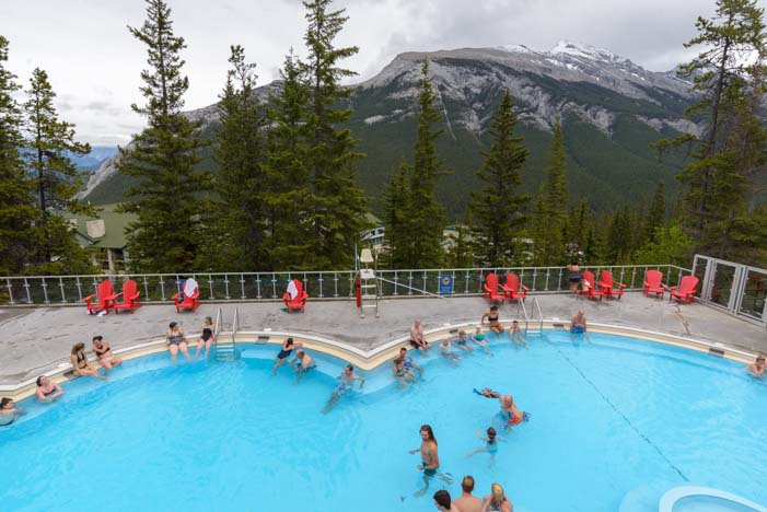
Banff Upper Hot Springs, Banff National Park, Alberta, Canada.
Visiting Athabasca Falls in Jasper National Park and spending some time in the outdoorsy town of Canmore rounded out our visits to this part of the Canadian Rockies.

Beautiful patterns of snow on the mountains near the Columbia Ice Fields.
But there was still more to come with a scenic drive through jaw-dropping Kananaskis Country, where some of the 1988 Winter Olympic events were held.

Dawn in Kananaskis Country.
Dropping south from there, we visited Waterton Lakes National Park, Canada’s sweet little sister to Montana’s Glacier National Park.

Waterton Lakes National Park, Alberta, Canada.
Waterton Lakes National Park is a beautiful jewel in Canada’s National Park system. Taking the Waterton Shoreline Cruise on a historic ship to the southern side of the lake in Montana gave us even more incredible views.
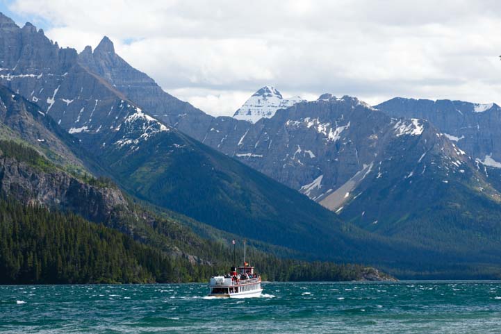
Waterton Shoreline Cruise in Waterton Lakes National Park, Alberta, Canada
We were now well into June, yet when we arrived in Saint Mary on the east side of Glacier National Park, we were surprised to learn that the Going to the Sun Road that traverses the Park was just opening!
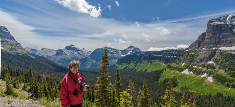
Going to the Sun Road in Glacier National Park, Montana.
The heat of the summer was on in full force by the 4th of July, and after all those National Parks we were ready to spend some time in quiet, less visited communities. We found just that in pretty Libby, Montana, where we spent happy days watching eagles and hummingbirds.

Sunset in Libby, Montana
We met some special travelers while we were there: a lady who had traveled cross country by horse for many years and a couple sightseeing by bicycle.
Long Rider Bernice, and her beloved mares Essie Pearl and Montana Spirit.
Nearby, we visited Kootenai Falls and Ross Creek Cedars, Montana’s answer to California’s sequoias.
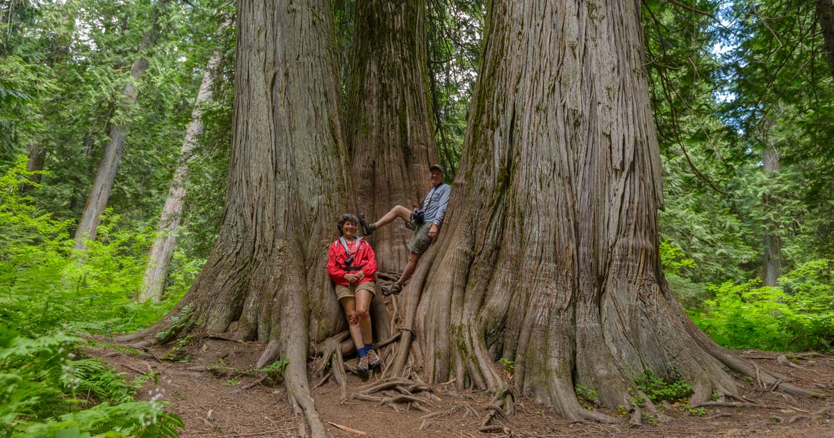
Ross Creek Cedars Scenic Area, Montana
As we dropped down along the back roads of Idaho, we visited the charming small towns of Sandpoint, Moscow and McCall.

Idaho’s back roads
What an absolute delight it was to find a summer beach town in the middle of Idaho’s mountains perched on Payette Lake.
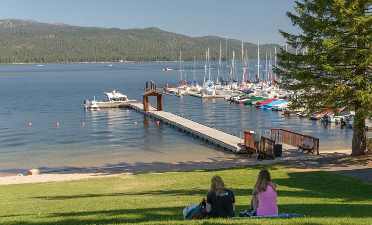
McCall, Idaho, is a fantastic beach town!!
Unfortunately, the summer months in America’s west always bring huge wildfires, and we soon found ourselves dodging fires and smoke. We had planned to spend several weeks in beloved Sun Valley Idaho, but were chased away by smoke.
Dashing far down south, we landed in Cedar City, Utah, where we witnessed a most moving event: the release of a golden eagle in honor of America’s First Responders.
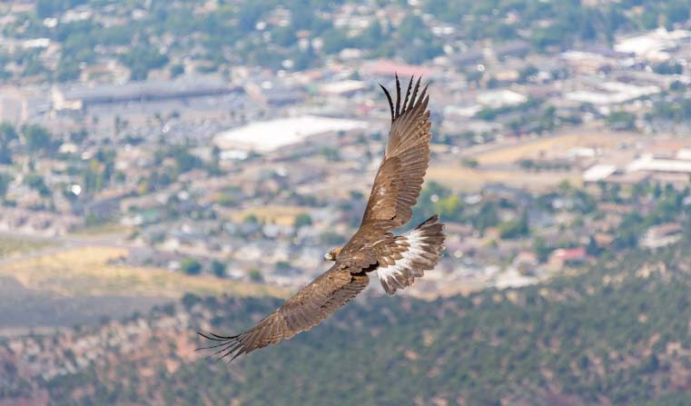
A rehabilitated Golden Eagle flies to freedom, honoring America’s First Responders.
Just like the Banff area in the Canadian Rockies, we were once again situated in a sea of National Parks. Cedar Breaks National Monument is a lesser known gem in the area, but it is Bryce Canyon National Park that really knocked our socks off (as it always does, no matter how many times we see it).
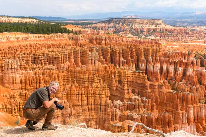
Bryce Canyon National Park, Utah
After walking along the Rim Trail with our eyes popping, we then explored special parts of Bryce Canyon we’d never visited before.

Hiking down into the hoodoos in Bryce National Park, Utah.
We hiked the Fairyland Trail and took our bikes on the newly extended Bryce Canyon Bike Trail.

.
We even discovered a year-round waterfall in the Park.
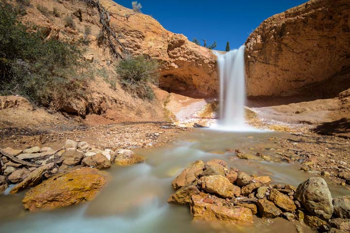
Bryce Canyon’s Waterfall.
Mother Nature was in grand form while we were there, letting loose several August hail storms that pelted the area, but rainbows appeared and the sun shone as we wandered among the thousand year old bristlecone pine trees at Rainbow Point.

A bristlecone plays with its shadow
Satiated with red rock scenery, we were ready for some fall color, so we spent much of September crossing Utah from west to east. Scenic Byway 12 is a stunning drive, and we stopped along the way to do the wonderful Lower Calf Creek Falls hike.

Lower Calf Creek Falls, Utah.
A little further on, we drove between the towering cliff walls of the Burr Trail.

Burr Trail, Utah.
Arriving in Colorado in late September, we drove the fabulous San Juan Skyway through the dazzling fall color.

Fall colors on the San Juan Skyway, Colorado
A surprise snow storm turned the world into a spectacular landscape filled with orange and yellow and a dusting of snow.

A dusting of September snow on Colorado’s San Juan Skyway.
Life in an RV is cold when it snows, so we quickly dropped to Durango at the south end of the San Juan Skyway to enjoy a Cowboy Poetry Gathering.
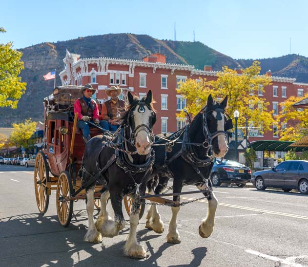
Durango, Colorado, is the perfect setting for a Cowboy Poetry Gathering.
Heading west across northern Arizona, we drove alongside the Vermillion Cliffs where we took a peek at the “Cliff Dwellers” roadside stop.

Arizona’s Vermillion Cliffs National Monument
Our “National Parks” travel theme was so well established by now that we just had to make a quickie stop at Grand Canyon’s North Rim to do both day and night photography.
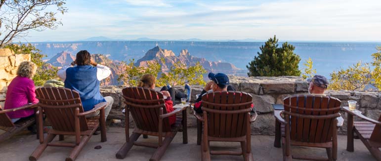
Tourists on the cozy back deck of the North Rim’s Grand Canyon Lodge in Arizona.
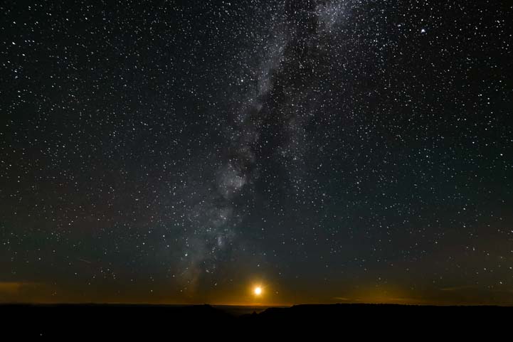
Full moon and the Milky Way at the Grand Canyon’s North Rim!
Then we continued on to the majestic scenery of Zion National Park.
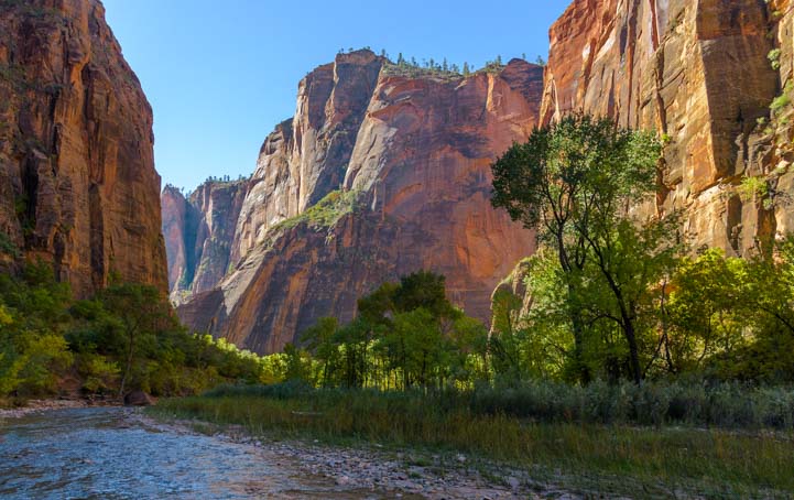
Zion National Park, Utah
Exploring an area in Zion National Park that we hadn’t visited before, we did a hike into the autumn colors of Kolob Canyons on Taylor Creek Trail.

Zion National Park’s Kolob Canyons in Utah.
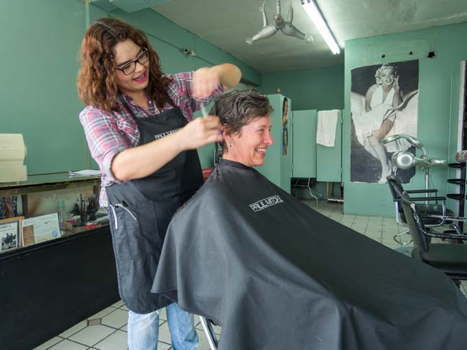
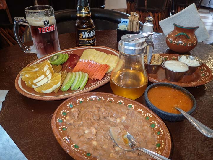
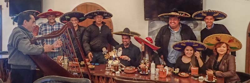
November and December saw us flitting between Arizona, California and San Luis Rio Colorado Mexico as we made several visits to our dentist and spent time socializing with friends.
What a fabulous year of RV travels!!
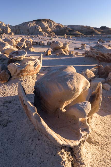
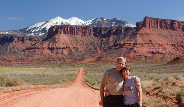
Moab, Utah
During 2016 we published quite a few non-travel posts as well. The links are below:
RV Tips, Tricks and Tech Topics:
Truck Related Topics:
RV Warranty & Repairs:
Lifestyle:
Product Reviews:
Dental Care on the Road:
Mexico’s Gold Coast:
An Overview of Our First 10 Years of Full-time Travel + Reflections after 9 Years!
Summaries of Each Year on the Road - All of our travel posts in chronological order:
Subscribe
Never miss a post — it’s free!
Our most recent posts:
More of our Latest Posts are in the MENU.
New to this site? Visit RVers Start Here to find where we keep all the good stuff!!
<-Previous || Next->