Windy Hill Campground + Tonto National Monument

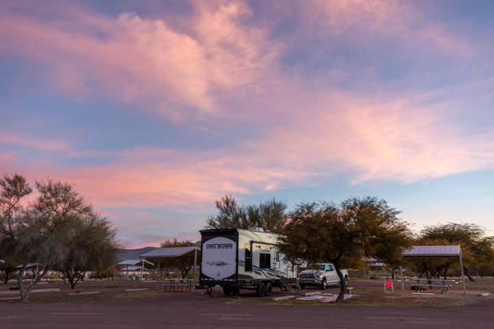
January 2024 – Roosevelt Lake is a beautiful lake in Central Arizona that was created by damming up the Salt River, and it is one of our favorite places to go winter RV camping in Arizona. When a warm “January thaw” swept through the state, we took advantage of the spring-like weather and spent a few days at Windy Hill Campground.

Four Peaks seen from Windy Hill Campground Roosevelt Lake Arizona

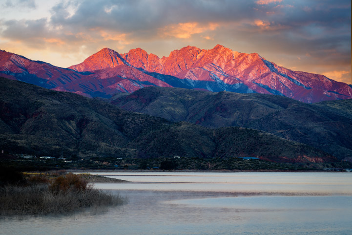
Mist rises from Arizona’s Roosevelt Lake in view of Four Peaks at dawn.

There are several campgrounds around Roosevelt Lake, but our favorite is Windy Hill Campground. There are quite a few campground loops at Windy Hill, and each is lovely. Some campsites can be reserved, but we always take our chances with first-come-first-serve because there are usually dozens and dozens of empty sites.

This year we had an entire campground loop to ourselves. What luck!

RV camping at Windy Hill Campground at Roosevelt Lake Arizona

We had an entire campground loop to ourselves at Windy Hill Campground.

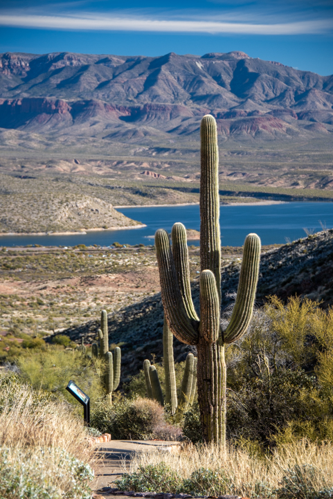
Many of the campsites are near the water’s edge. This year the lake level was quite high, so it was just a few steps down a short trail to get to the water from our campsite.

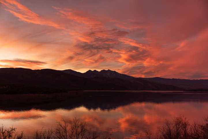
At sunrise the world was very quiet as wispy clouds painted pastel shades of pink and orange across the heavens. Reflections appeared in the water below.

Sunrise Windy Hill Campground at Roosevelt Lake Arizona

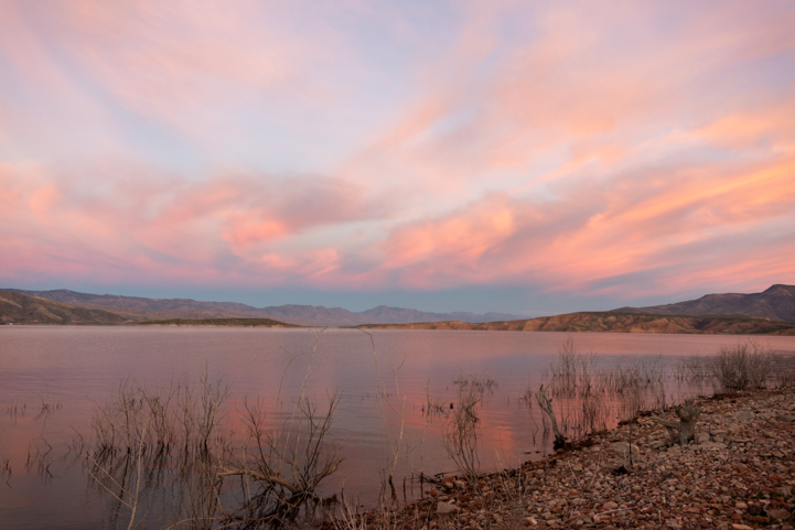
Sunrise at Roosevelt Lake, Arizona.

In the distance, we could see the winter snow on Four Peaks in the early morning glow.
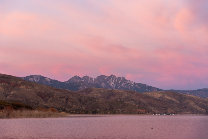
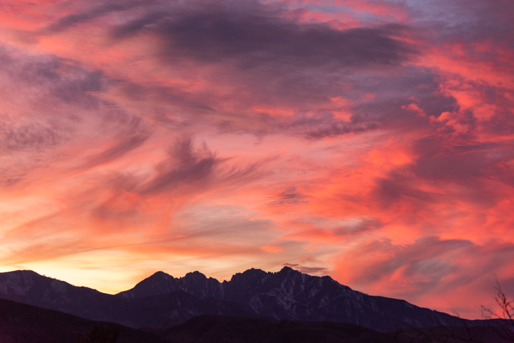
Four Peaks at sunrise Windy Hill Campground at Roosevelt Lake Arizona

Pink everywhere.

The light was constantly changing and once the mist cleared, the mountains took on a fiery hue for a few moments.

Four Peaks over Roosevelt Lake seen from Windy Hill Campground

“Morning has broken…”

Roosevelt Lake is especially loved by fishermen, and there are fishing tournaments year round. There weren’t any fishing tournaments going on during our stay this year, but there were plenty of anglers out on the water.

Fishing on Roosevelt Lake at Windy Hill Campground in Arizona

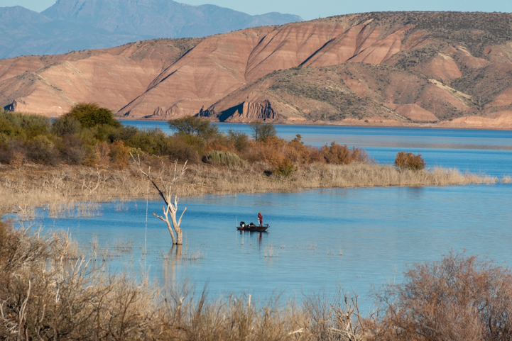
What a place to fish!

Hiking trails hug the water’s edge around several of the peninsulas just below the campsites, and we happily hit the trails each morning and evening. The campground hosts had done a great job of keeping these trails clear.

All the campground loops are paved while the campsites themselves are gravel.

One day while returning to our campsite, the shadow of Buddy’s inner wolf suddenly appeared in the road.

Inner Wolf

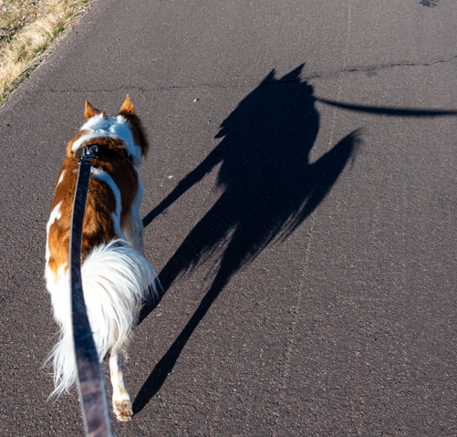
On a late afternoon walk, Buddy was stalked by his inner wolf.

Despite the shadow monsters out there, we felt a wonderful peace in the air and just hung out and relaxed.

RV Camping at the Windy Hill Campground at Roosevelt Lake in Arizona

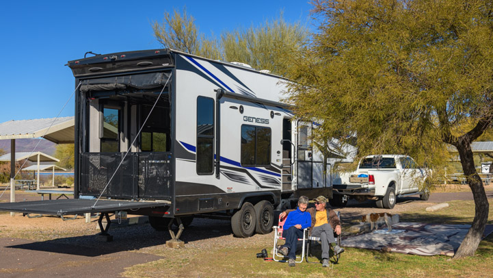
Soaking up some winter sunshine in our campsite.

Just chilling in the RV

Just chillin’ on the sofa.

Sunsets are just as dramatic as the sunrises at Roosevelt Lake, and they were a bit easier to enjoy since we were already up and out of bed!

Sunset reflection at Roosevelt Lake in Arizona.jpg

Sunset!

Sunset view of Four Peaks from Roosevelt Lake Arizona.jpg

Wow!

For such a beautiful RV camping area in such a scenic setting, it has always bewildered us that very few of Arizona’s thousands of winter RV snow birds ever go there. Oddly, even fewer locals have ever heard of it!

The US Forest Service recreation areas around Roosevelt Lake were built decades ago with great anticipation that hordes of campers and boaters would flock to the lake from both Phoenix and Tucson, each about 100 miles away. There were hundreds of campsites built on both sides of the lake in all kinds of pretty settings.

Although the campgrounds at Roosevelt Lake, including Windy Hill Campground, are dry camping only, the loops are paved, the campsites are spacious, each one has a shaded picnic ramada and campfire ring, there are ample water spigots around each loop and there are bathroom buildings with flush toilets and showers.

But the expected crowds never came.

Roosevelt Lake is 2 hours from both Phoenix and Tucson, and it is just too far for a family to go for a Saturday night camping trip. Lots of people come for longer stays like Spring Break and the big three-day weekends, but not at any other time. As for winter RV snowbirds, most want hookups, and who can blame them in January when the onshore lake winds pipe up and temps turn chilly?

But if you choose a campsite that isn’t waterfront property (I know, it’s hard to do that!), then there’s little wind and it’s a lot warmer.

The USFS has allowed the Roosevelt Lake campgrounds to fall into decay, and they are deliberately letting several loops at Windy Hill Campground sites “return to nature” as one camp host put it. The picnic tables and campfire rings have been removed and the campsite pads are disappearing under the weeds.

Yet, at the same time, they installed a major upgrade this past year: a new RV dump station! They rerouted the road on one of the closed campground loops, and although it’s not the best dump station layout we’ve ever seen, it’s there and it’s open and it’s a lot more convenient than going to the other RV dump station at Roosevelt Lake located 10 miles away at Cholla Bay Campground.

In 2024, campsites at Windy Hill Campground cost $25/night ($12.50/night for seniors with the Federal Interagency Pass).

Roads Less Traveled Amazon Store

⬆⬆⬆ Check out our GEAR STORE where we've gathered together the things we love and depend on! ⬆⬆⬆

One big surprise this year was that they now allow winter RV snowbirds to stay at Roosevelt Lake for as long as they wish. In the past, they wanted RVers to leave after the standard 14 days. During our stay we met several RVers who had been there for a few months and were planning to stay for a few months more. For seniors, at $12.50/night or ~$375/month, it’s a great deal for monthly rent in a scenic spot with paved loops and good sized campsites.

Roosevelt Lake isn’t near anything, and that may be part of the reason that most Snowbird RVers don’t flock there. The bustling town of Payson, Arizona, is 50 miles away to the north and the mining town of Globe, Arizona, is 80 miles to the east.

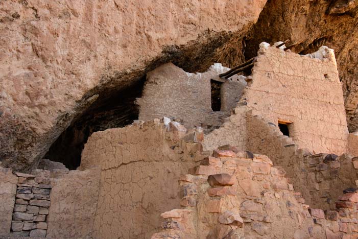
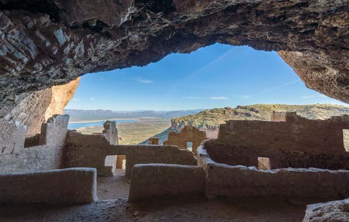
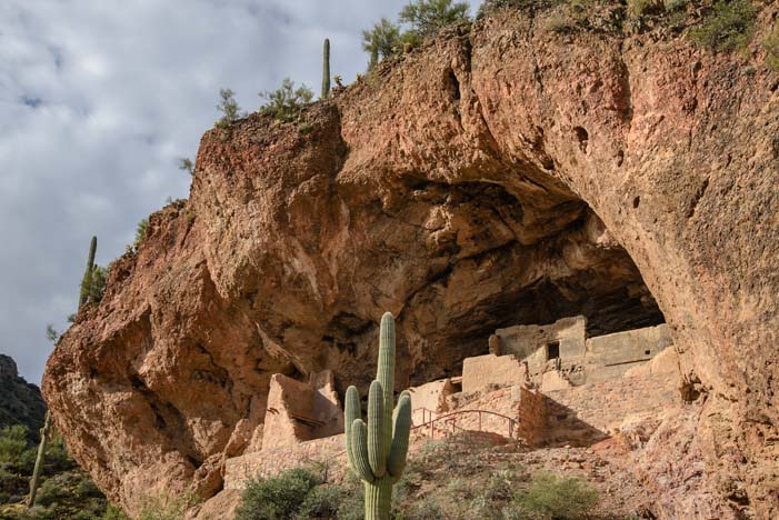
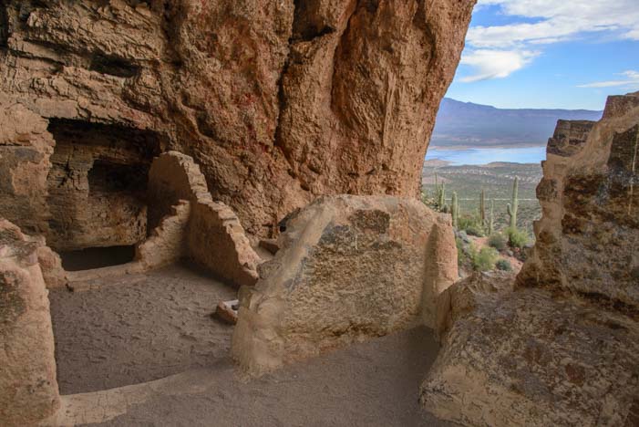
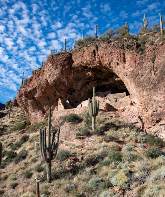
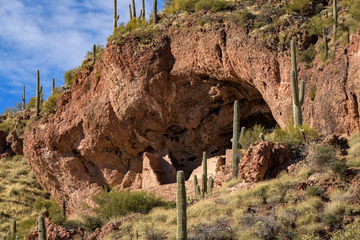
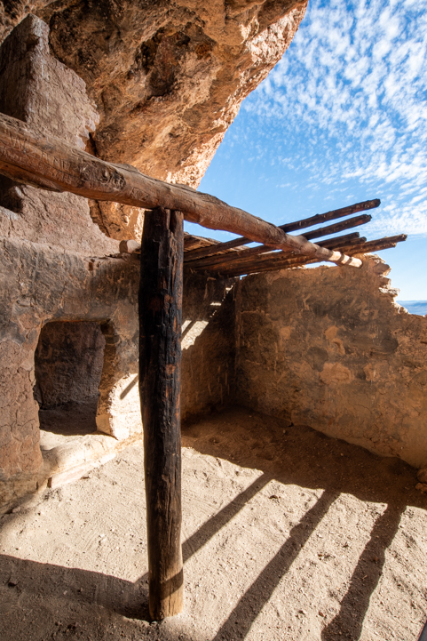
However, right across the street from Windy Hill Campground is a wonderful ancient Indian cliff dwelling ruin, Tonto National Monument. Even though we have visited several times before, we decided to go there once again during our stay this year.

Tonto National Monument trail to Lower Ruins

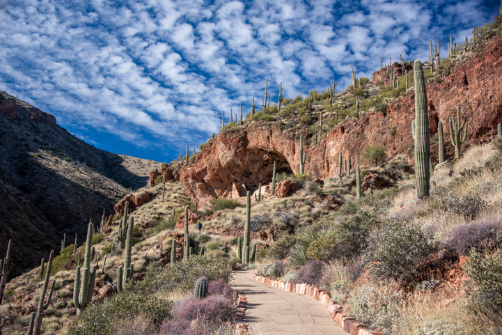
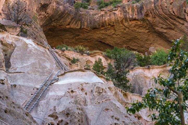
A paved path heads up to the Lower Cliff Dwellings cave at Tonto National Monument.
This is across the street from Windy Hill Campground.

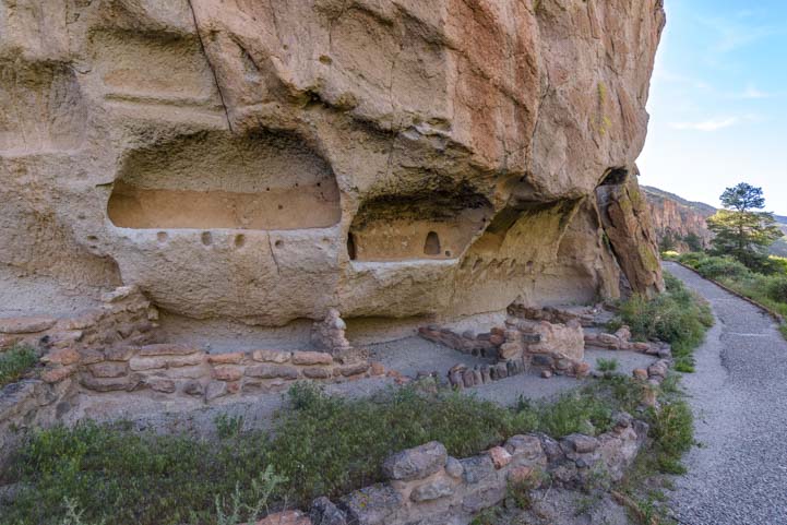
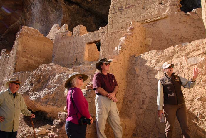
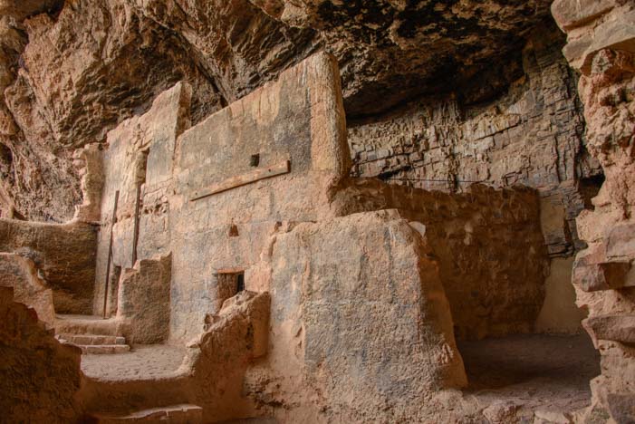
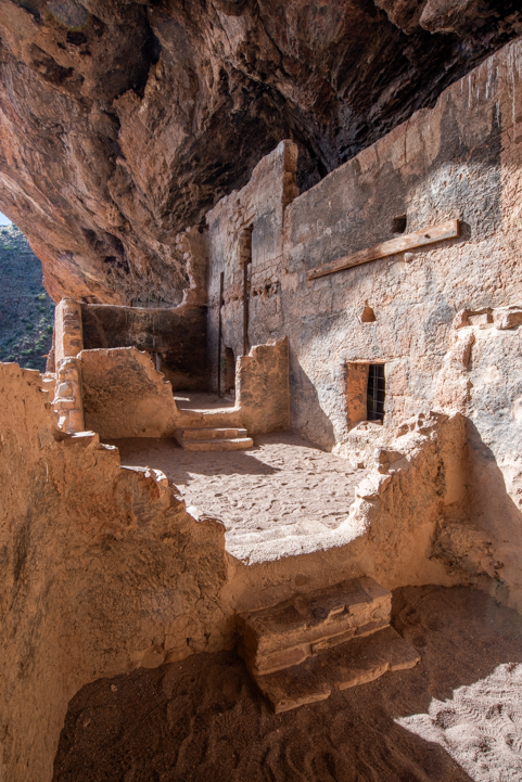
The fun thing about these ruins is that you can go right inside the pueblo and get a feeling for what life might have been like for the ancients living high up on this mountainside.

There are two sets of ruins, the Lower Cliff Dwelling and the Upper Cliff Dwelling. Each set of ruins was found very much intact by the settlers in the 1800s, and there were fabulous artifacts strewn about as if the former inhabitants had just moved out last week.

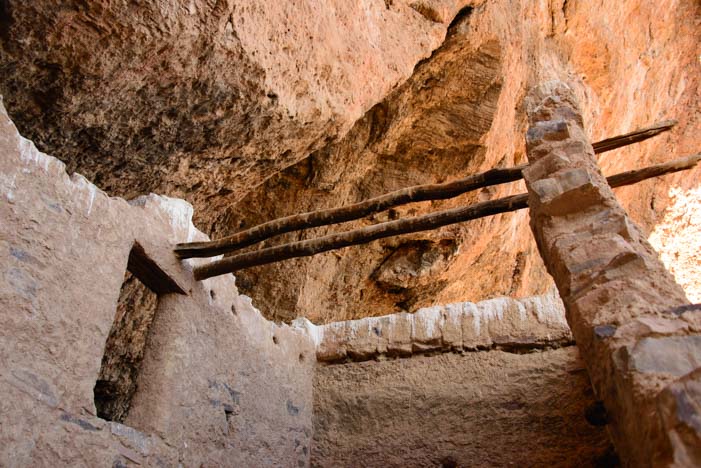
In the 1940s, the Civilian Conservation Corps (CCC) built a hiking trail to each ruin, and the Navajo Mobile Unit that had worked on stabilizing the massive ruins at Chaco Canyon in New Mexico were brought in to stabilize these ruins.

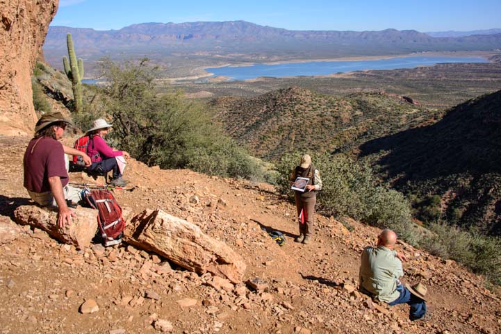
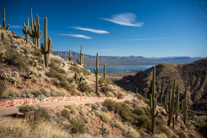
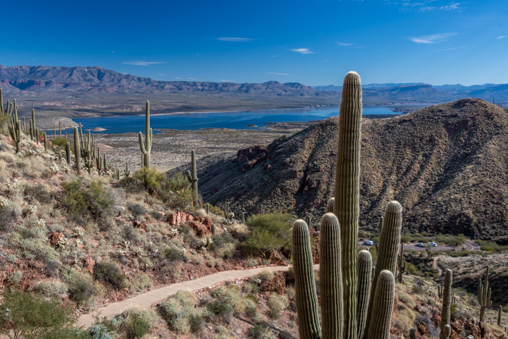
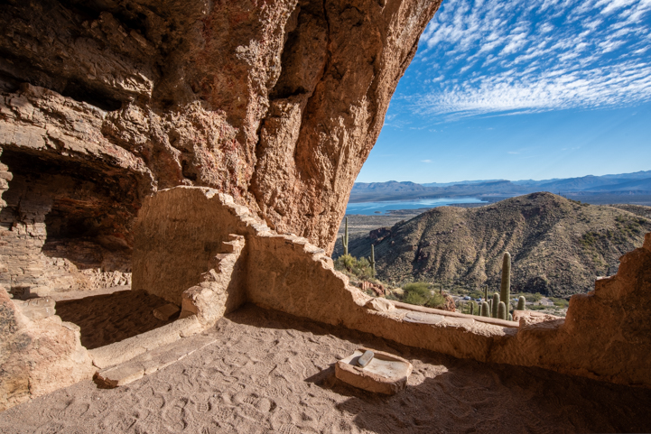
The paved half-mile trail to the Lower Cliff Dwelling is very steep and has lots of switchbacks. But between our huffs and puffs as we tackled this vertical hike, we paused to soak in the fantastic views of Roosevelt Lake behind us.

View from Tonto National Monument trail to Lower Ruins

We enjoyed sensational views as we ascended and descended the trail to Tonto National Monument’s Lower Cliff Dwellings.

View from Tonto National Monument trail to Lower Ruins

It’s worth it to hike up to the cliff dwellings just to see the views!

Roosevelt Lake didn’t exist 700 years ago when these cliff dwellings were built, but it sure is pretty today. Back then, the Salt River meandered through the valley below but its flow was temperamental during droughts and floods.

Roosevelt Lake seen from the trail to the Lower Cliff Dwellings at Tonto National Monument

The ancient Indians didn’t have these mesmerizing lake views…

Saguaro skeleton Tonto National Monument trail to Lower Ruins

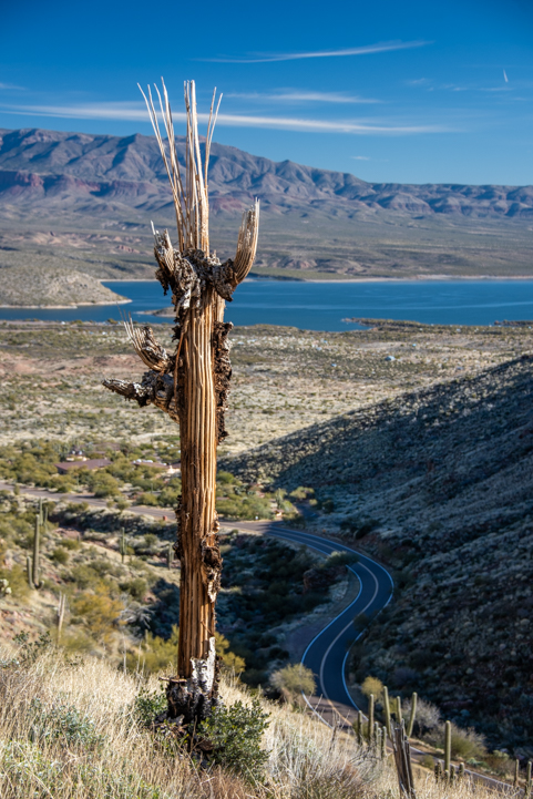
Saguaro cacti leave exotic skeletons behind when they die.

The hike to the Upper Cliff Dwelling is 3 miles long and you can only do it on a ranger guided tour (the tours are free).

When we did that hike a few years back, the ranger explained that current theories about the Salado People who lived on these hillsides and in the valley 700 years ago were that the valley dwellers arrived and built homes before the cliff dwellers did. They farmed the flat lands by the riverbanks and in the river’s flood plains.

View from Tonto National Monument trail to Lower Ruins

Ancient farmers raised crops in the valley before the cliff dwelling builders arrived.

Tonto National Monument trail to Lower Ruins view of Roosevelt Lake

.

As this modern theory goes, the cliff dwellers arrived at a later date, and because there was no room to set up housekeeping on the valley floor, they built their homes into the cliffs. It is also thought that the cliff dwellers were tradesmen and made pots and other things for trade with other peoples elsewhere (macaw feathers from Costa Rica have been found in this area, perhaps traded for a pot or two!).

So, you had two groups of people living here, farmers in the valley and artisans on the mountainsides.

Tonto National Monument Cliff Dwellings Roosevelt Lake Arizona

Today’s theory is that these cliff dwellings in the mountainside caves were inhabited by artisans while farmers lived on the valley floor.

Tonto National Monument cliff dwellings Arizona 2

There is even a theory that the Salado People manufactured clay pots specifically for trade and the pots were warehoused in structures built just to store them.

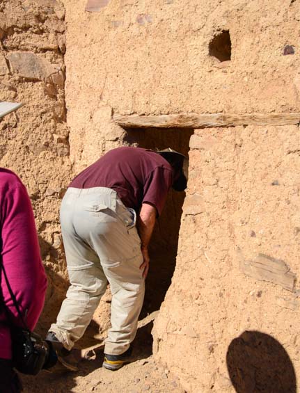
Dogs are allowed on the Lower Cliff Dwelling trail, but only up to a certain point which is marked by a trash can. That is the holding area where you can either tie up your pooch and take a quick peek at the Cliff Dwelling or leave him with another member of your party and take turns roaming through the ruins.

We took turns, and Buddy patiently — but a bit nervously — waited for each of us to go up to the ruins and have a look around. He wasn’t keen on having his pack separated!

Other dogs arrived and had to wait too, so we all chatted together. The wonderful thing is that we could take our dogs on the trail at all and enjoy the hike together. It is understandable that they don’t want any peeing or pooping mishaps inside the ruins because that would attract wild animals into the ruins when no one is there.

Tonto National Monument cliff dwellings Arizona

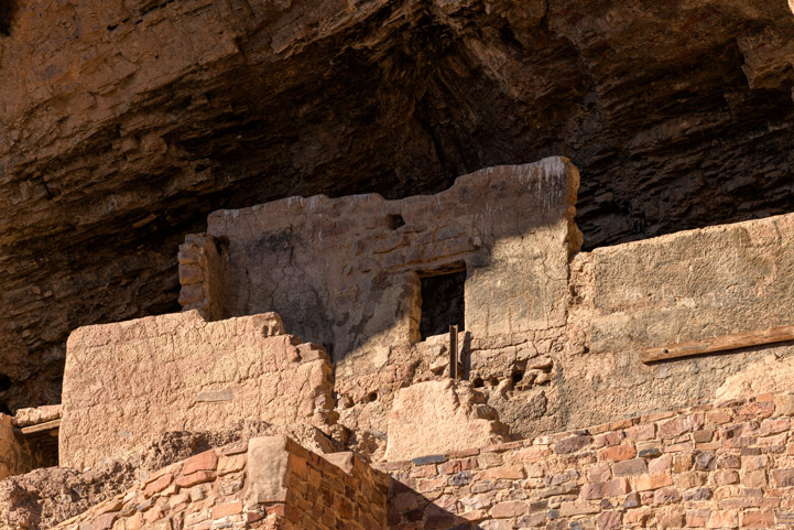
The front of the cave was originally walled in.

Tonto National Monumnet Lower Cliff Dwellings Arizona

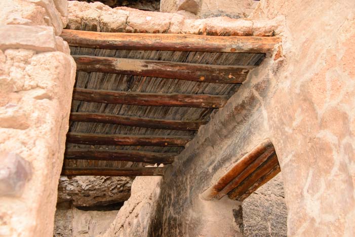
Photos from over a century ago show these walls extending much higher.

For me, one of the most interesting tales related to these ruins is that of Angeline Mitchell who rode her horse five miles through the brush, tied him to a tree and then scrambled up the mountainside to “the caves” with five friends, Melinda, Clara, Tom, Frank and Bud, in December, 1880.

She describes the mountainside as being covered with debris from the ruined walls and says she and her friend found traces of 33 rooms, 18 of them in “fair preservation.”

She describes the ruin as seven or eight stories high, or more, and says there was originally no opening in the outer wall and that the people got into the pueblo via the second story.

Tonto National Monument cliff dwellings Arizona

This cave is not seven or eight stories high, so perhaps Angeline Mitchell was writing about a different cave nearby (there are other ruins in the area that are inaccessible).

She mentions that another person who explored the ruins found the skeleton of an infant and that the fingerprints of the builders were as “perfect as the day ages ago when the hands were pressed into the plastic clay.”

Tonto National Monument cliff dwellings Arizona

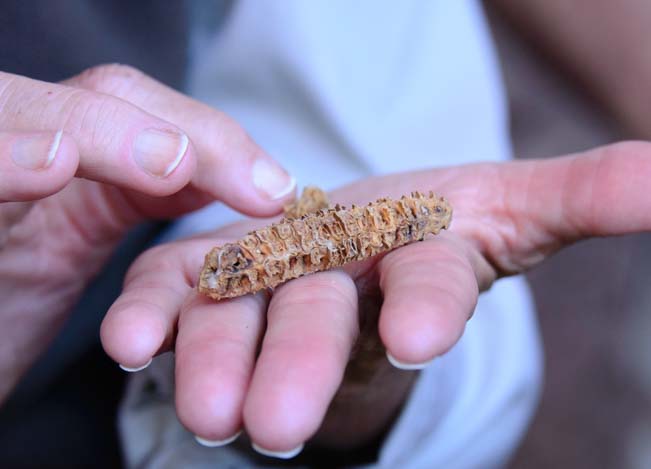
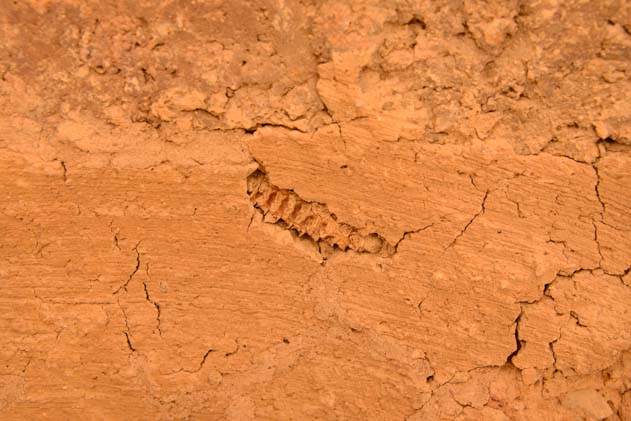
A metate for grinding grain sits on the ground today. Angeline Mitchell wrote in 1880, “The floor is formed partly by a big rock…and in this rock were 1/2 a dozen metates hollowed out of it and varying in size, depth & shape.” Again, I’m not sure she’s writing about the Lower Cliff Dwellsing or about another cave in the vicinity.

In another cliff house, she and her friend found 22 rooms of which 16 were in “fair order, three of them and a hall…as perfect as the day they were finished.” That might be the Lower Cliff Dwellings as there appears to have been a hall at the front of the cave.

While marveling at the “fine state of preservation” of these rooms, her friend Clara suddenly fell through an opening to a lower level and landed in a pile of cholla cactus. Ouch! Removing just one barbed cholla cactus thorn will pull out a hunk of flesh with it. I can’t even imagine falling into a pile of chollas!

Nonetheless, Clara was eventually freed from the chollas and the group reconvened in another room.

Tonto National Monument Arizona cliff dwellings

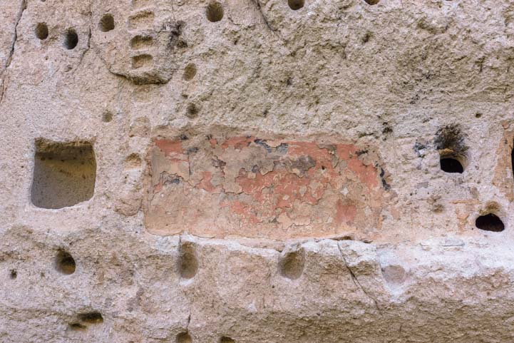
It seems many of the rooms were fully intact when the ruins were first explored. Here there’s a hint of a roof.

Angeline later writes of the reactions they all had to this unbelievable adventure:

“It seemed so strange to be chatting and laughing so gaily in a house built unknown centuries ago by people unlike us in appearance but who had known joy and grief, pleasure and pain same as our race of today knows them, and who had laughed, cried, sung, danced, married & died, mourned or rejoiced their lives away in this once populous town, or castle, or whatever one would call it! It made an uncanny feeling come over us as we rested till moon rise and talked of this long dead people and told the little we knew concerning them.”

Juniper roof structure Tonto National Monument Arizona cliff dwellings

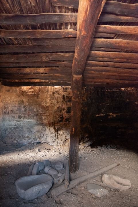
A few relics lie on the floor today. Whole pots and other treasures were in abundance when the dwellings were first explored.

Even though the ruins and the experience of seeing them today is nothing like what it was for Angeline and her friends in 1880, those sentiments of wonder about the people who “had laughed, cried, sung, danced, married & died, mourned or rejoiced their lives away” are still very much alive today.

We heard exclamations of “This is incredible” “Wow” and “I had no idea…” from everyone who came up into the ruins from the steep path.

We’d had a great adventure too, and as we left, I spotted two saguaro cacti waving goodbye to us.

Happy Trails to You

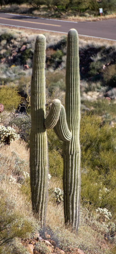
“Happy Trails to you, until we meet again…”

For some reason, I instantly thought of the song sung by Roy Rogers and his wife Dale Evans at the end of every episode of the Roy Rogers TV Show, “Happy Trails to You!”

I didn’t see the TV show when it aired 60-70 years ago, but I heard this song when we were at an Escapees RV park a few years back and some folks were watching the Roy Rogers Show on TV in the common room.

Its simplicity and sincerity touched me, and as you can see by the YouTube comments, it is beloved by thousands who grew up watching the Roy Rogers show:

Lyrics to the song “Happy Trails to You” (here) — There’s a cool surprise in the last verse!

Subscribe
Never miss a post — it’s free!

More info about Roosevelt Lake, Windy Hill Campground and Tonto National Monument:

More from our travels to Roosevelt Lake and Tonto:

Other blog posts about ancient ruins:

Other special campgrounds we’ve enjoyed:

Our most recent posts:

More of our Latest Posts are in the MENU.   New to this site? Visit RVers Start Here to find where we keep all the good stuff. Also check out our COOL NEW GEAR STORE!! *** CLICK HERE *** to see it!

<-Previous || Next->

Bandelier National Monument – Fun Pueblo Cliff Dwellings in New Mexico!

May 2017 – A priceless jewel of antiquity lies just west and north of Santa Fe, New Mexico, not far from Kasha-Katuwe Tent Rocks National Monument. It is the classic ancient pueblo ruins at Bandelier National Monument.

Ladder to cliff dwelling Bandelier National Monument New Mexico

Bandelier National Monument is a “hands-on” (actually “feet-on”) kind of place!

We’ve visited lots of cliff dwellings and pueblo ruins over the years at Tonto, Wupatki and Montezuma’s Castle in Arizona and Aztec Ruins in New Mexico, but the glimpses of the past and the evidence of the ancients’ ingenuity at Bandelier National Monument makes this place my personal favorite so far.

One of the most wonderful aspects of Bandelier National Monument is that the National Park Service has installed lots of replicas of pueblo ladders for visitors to use so they can get a closer look inside!

Ladder climb Bandelier National Monument New Mexico

We loved climbing up and down the ladders
to peek into the cliff dwellings.

The Ancestral Puebloan people lived here between 1150 and 1550 AD. They lived not only in the caves in the cliff walls but also in adobe brick dwellings. A large group of buildings very similar to those at Aztec Ruins National Monument fills a field and is called Tyuonyi Village. Other masonry buildings were built as extensions off the cliff dwellings in the cliff walls.

Rebuilt cliff dwellings Bandelier National Monument New Mexico

The Ancestral Puebloans took advantage of the huge bubbles in the volcanic rock,
building out from there with adobe brick.

Adolph Bandelier first saw the ruins in 1880. Then, in the early 1930’s, CCC workers created a huge camp to house themselves as they set about stabilizing and reconstructing the ruins. A reconstructed “Talus House” has been rebuilt and was easy to see as we passed it on the Main Loop Trail.

Renovated cliff dwellings Bandelier National Monument New Mexico

This reconstructed building is what all the buildings looked like at one time.

Bandelier National Monument is so popular that visitors arriving during the prime daytime hours between mid-May and mid-October must take a free shuttle bus into the park. The free Atomic City Transit bus picks people up in nearby Los Alamos, home of the secret Manhattan Project that developed the atomic bomb in the 1940’s.

We wanted to see the ruins without the bus crowds, however, so we were at the gate with our truck when they first opened, before they close the parking lot to private cars. We ran out on the trail and discovered to our delight that we were the only people there.

Ladder to cliff dwellings Bandelier National Monument New Mexico

.

Being at the ruins in the quiet morning air was fabulous. We scampered up and down the ladders in sheer delight.

Climbing ladder to cliff dwelling Bandelier National Monument New Mexico

Going for a peek inside!

The astonishing highlight of the Main Loop trail is the very long Long House. This is a huge expanse of sheer rock cliff that has dozens of indents and holes in it where the Ancestral Puebloan people anchored their homes.

The Long House Bandelier National Monument New Mexico

The Long House is a series of apartments that were built to butt up against the sheer cliff walls with adobe brick construction extending out from there.

The cliffs are part of the Jemez Volcanic field, and the bubbly nature of the cooling lava is readily apparent with thousands of one- or two-person sized holes and crevices lining the stone.

Long House Bandelier National Monument New Mexico

Each indent is the end of a room. Holes bored in the rock supported tree trunk beams
that were floor joists and roof trusses.

The ancients used these holes — and carved others — as rooms or as ends of rooms. They also bored holes in the cliffs to support the ends of wooden beams. These beams supported ceilings and floors and second and third story rooms.

Ancient pueblo Bandelier National Monument New Mexico

.

What amazed me as I looked a little closer at these ruins along the cliff face was that these people of 500 to 900 years ago took the time and had the inclination and ingenuity to decorate their interior walls.

They kind of plastered the walls and impregnated them with colors. The cracked and faded “plaster” is readily visible today.

Cliff holes for timer ceilings Bandelier National Monument New Mexico

Dozens of rooms are lined up along the cliffs. The structures were two and three stories tall.

They also created rectangular holes in the cliffs, perhaps for storage purposes.

Pueblo ruins Long House Bandelier National Monument New Mexico

A kind of colored “plaster” decorated the interior walls.

I was really taken by this idea that the ancient puebloans decorated their walls.

Pueblo fresco wall art Long House Bandelier National Monument New Mexico

The “fresco” walls are peeling but are clearly visible.

Some of the indents in the cliffs were deeper than others, and many seemed to have been decorated with a kind of wainscotting. The plaster on the lower half of those walls had been painted, while the upper half of the walls and roof were black from soot and smoke from their household fires.

Pueblo architecture Long House Bandelier National Monument New Mexico

Some walls had a kind of wainscotting with the lower half decorated in colored “plaster” and the upper half black from soot. A bullseye petroglyph adorns the wall of top floor.

Wall fresco Long House Bandelier National Monument New Mexico

A closer look at the “wainscotting.”

One of the indents was decorated with an artistic gemoetric pattern. The National Park Service has black and white photos of this wall from years ago where a ranger was pointing it out to visitors, right up close.

Now visitors have to stand far back from the cliff wall and the decocrative pattern is covered with a protective covering so it doesn’t vanish too quickly in the elements.

Fresco art pattern Long House Bandelier National Monument New Mexico

One wall with a particularly vivid pattern is protected from the elements.

The Long House goes on for a very long distance with room after room lined up along the cliff face. It seems that the adobe brick structures that fronted these back walls extended out about two room’s width from the cliff wall, and the buildings were generally two or three stories tall too.

Ancestral Pueblo ruins Long House Bandelier National Monument New Mexico

The Long House is very long and the trail wanders alongside it.

Holes in rock walls Long House Bandelier National Monument New Mexico

Some holes, or caves, are natural but others are rectangular and very obviously man-made.

We saw only two petroglyphs, but there are probably more. A bull’s-eye was pecked out of the cliffs in an upper story in one area, and an unrecognizable animal was pecked out high up in another.

Petroglyph rock art Bandelier National Monument New Mexico

Some strange animal…

Eventually, leaving the Long House behind, the Main Loop trail took us through a ponderosa pine tree studded woodsy area. Pretty wildflowers looked up at us.

Wildflower Bandelier National Monument New Mexico

.

Then we arrived at Alcove House, a massive natural cave that lies high up on the cliffs. The ancients must have used ladders to get up to this cave, and the National Park Service has placed ladders leading up to it for us modern visitors to use.

Alcove House ladders and cave Bandelier National Monument New Mexico

Alcove House is reached by two very long ladders and a third shorter ladder.

Climbing ladder to Alcove House Bandelier National Monument New Mexico

.

What a climb!

Long ladder to Alcove House Bandelier National Monument New Mexico

.

Climbing ladder to Alcove House Bandelier National Monument New Mexico

.

The Alcove House cave is huge and may have housed all kinds of rooms and other things. There are remnants of a circular kiva which has been restored but can’t be entered.

Alcove House Cave Bandelier National Monument New Mexico

The cave at Alcove House is very deep and must have offered great natural protection.

We liked the two person-sized openings that went into very small closet-like rooms!

Storage rooms in cave at Alcove House Bandelier National Monument New Mexico

.

After getting our fill of these ruins (for one day), we returned to the visitors center where we saw a very cool RV parked in the parking lot. It had animal tracks painted on one side and Chinese letters on the other and sported a German flag by the door.

Ironically, as I write this post a month later, we saw the exact same rig parked in Custer, South Dakota, earlier today. It is a small world!

Unusual rugged RV

Back at the Visitors Center we saw this unusual rig…and then saw it again a month later 700 miles away!

Another day we ventured out to Bandelier National Monument’s waterfall which lies at the end of the mile-and-a-half long Falls Trail.

Waterfall Bandelier National Monument New Mexico

A beautiful waterfall is the reward at the end of the Falls Trail.

There are ancient ruins all over America’s southwest, and various groups of modern day Native Americans believe they are descended from certain ancient cultures in different locations.

Interestingly, the modern Pueblo Indians who claim descent from the ancient people who built the Long House and Alcove House at Bandelier National Monument are the Cochiti Puebloans who live a ways away near Cochiti Lake and Tent Rocks.

The modern Pueblo Indians who live closest to Bandelier National Monument, the San Ildefonso Puebloan people, claim descent from the unexcavated ruins that lie just outside Bandelier at Tsankawai Ruins.

The hike through Tsankawai Ruins began with a ladder climb as well, but it was totally different in nature because the ruins don’t back up to a massive cliff face and they are hard to spot on the grassy plateau since they haven’t been dug up yet.

Tsankawai hike Bandelier National Monument New Mexico

A ladder at the beginning of the Tsankawai Ruins Trail.

Unlike all ancient archaeological sites where the ruins have been studied, thoroughly excavated, stabilized and rebuilt, the Tsankawai Ruins site is an explorer’s dream because some artifacts are still lying around.

I was shocked when Mark pointed to a rock that had some pottery shards lying on it. It didn’t take long for us to find a few others in the grass and dirt nearby.

Obviously, we left them in place so the next visitors could enjoy the same surprise as we did, but how fabulous it was to see the finely painted decorations on these centuries old bits of pottery.

Pottery Shards Tsankawai Ruins Bandelier National Monument New Mexico

Painted pottery shards on the Tsankawai Ruins Trail.

The Tsankawai Loop trail can be done either clockwise or counterclockwise, and we chose to go in the clockwise direction (taking a left at “Loop Trail” sign). After crossing a high plateau where the ancient ruins lie sunken into the dirt, the trail seemed to end. After a little scouting over the edge Mark noticed a ladder going down, so down we went.

I wonder how many people simply turn around at that point not knowing the trail continues down the well obscured ladder! Going in the counter clockwise direction, this ladder would be very obvious as the trail leads right to its base.

Tsankawai Ruins hike Bandelier National Monument New Mexico

.

We skirted along the edge of a sloping hillside with wonderful views to one side, and rounded a bend to find some petroglyphs on a rock wall next to us.

Except for a spiral, the imagery was nothing like other petroglyphs we have seen elsewhere.

Petroglyphs Tsankawai Ruins Bandelier National Monument New Mexico

.

We continued on and were absolutely floored by the many very narrow foot trails that have been carved into the rock.

Hiking the Narrow Carved Trail Tsankawai Ruins Bandelier National Monument New Mexico

The Tsankawai Ruins Trail includes some very cool skinny and curvy paths.

These were very clearly man-made and not the work of water or wind. But they weren’t made by the National Park Service either!

Skinny groove trail Tsankawai Ruins Bandelier National Monument New Mexico

.

In another spot, we looked up along the rounded rock hills and noticed a little staircase that had been carved out of the rock.

How ingenious of the ancients to make these trails and staircases, and what a wonderful way for us to be transported back to a time centuries ago.

Strange stairway Tsankawai Ruins Bandelier National Monument New Mexico

In the footprints of the ancients…

If you are traveling in New Mexico with your RV — or if you find yourself anywhere near this area without an RV! — Bandelier National Monument is a true jewel that is well worth visiting.

For the Main Loop Trail to the Long House and Alcove House, be sure to get there early on a weekday if you want to see the ruins without the crowds. The Falls Trail and Tsankawai Ruins are much less visited.

More links and info below…

Subscribe
Never miss a post — it’s free!

More info about Bandelier National Monument and Tsankawai Ruins:

Other ancient ruins in America’s southwest:

Blog posts from our RV travels in New Mexico

Our most recent posts:

More of our Latest Posts are in the MENU.
New to this site? Visit RVers Start Here to find where we keep all the good stuff!!

<-Previous || Next->

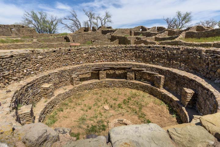
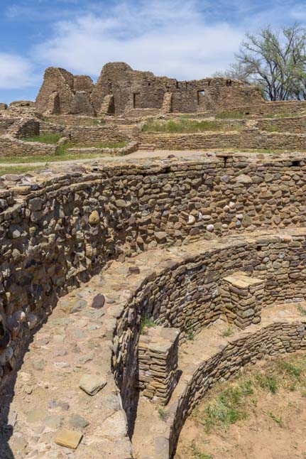
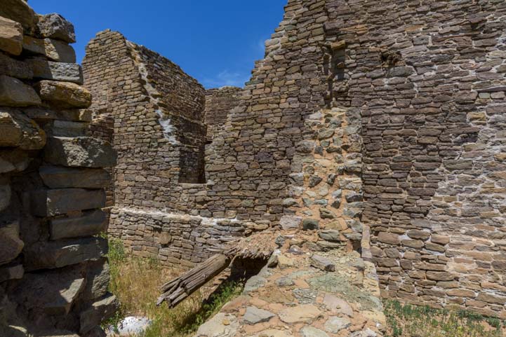
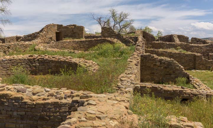
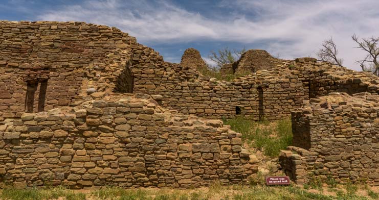
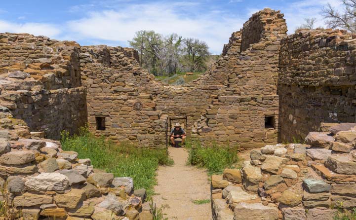
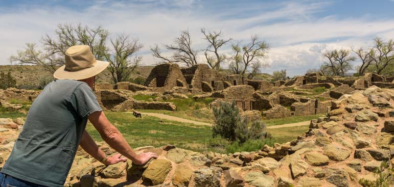
Aztec Ruins National Monument – Whispers from the Ancients in New Mexico!

May 2017 – After spending some quality time with the alien eggs at Bisti Badlands in New Mexico, we took our RV about 50 miles north to Aztec Ruins National Monument near Farmington, New Mexico. We’ve visited a lot of ancient Indian ruins over the years, but this site was astonishing because of its sheer size.

Aztec Ruins National Monument New Mexico

.

The “Aztec” ruins are not Aztec at all. Those people were way down south in today’s Mexico City. The name was given by early discoverers of the New Mexico site who may or may not have known better.

These ruins were actually built by the Ancestral Puebloan people about 900 years ago.

This particular site is startling because it contains as many as 400 rooms! Most of the rooms are square or rectangular and abut each other, however there are quite a few circular structures too, some of which are thought to have been ceremonial.

Aztec Ruins National Monument Map

The layout of the many rooms at Aztec Ruins National Monument

The first thing we saw as we entered Aztec Ruins National Monument was the Great Kiva, a large round structure that has been stabilized and renovated several times since the 1930’s.

Great Kiva at Aztec Ruins National Monument New Mexico

The Great Kiva has been stabilized and renovated several times.

It is now a very modern feeling building, and as we walked through it Indian sounding music played softly in the background to give the place a certain air.

Inside the Kiva at Aztec Ruins National Monument New Mexico

Inside the Great Kiva. Indian music was playing as we walked through.

Ceiling of Kiva at Aztec Ruins National Monument New Mexico

The ceiling in the Great Kiva.

After walking through the Great Kiva we passed several more round structures.

Ceremonial circle Aztec Ruins National Monument New Mexico

There were several circular structures. Some were ball courts.

Aztec Ruins National Monument New Mexico

.

Aztec Ruins National Monument is called a “Great House,” and when it was first discovered several of the rooms had quite a bit of pottery in them as well as grain. It is thought that some people lived here beacuse there is evidence of smoke from fires in some of the rooms. But it is also thought that it was a ceremonial gathering place.

Round walls at Aztec Ruins National Monument New Mexico

.

As we walked through the rooms, we passed through a “T” shaped doorway. This reminded me of the “T” shaped windows we saw in the Mayan ruins in Palenque in southern Mexico and the “T” shaped doorways we saw in the ancient Khmer ruins in Cambodia (I haven’t posted those pics yet).

Rooms in Aztec Ruins National Monument New Mexico

A T-shaped doorway.

T-shaped doorway Aztec Ruins National Monument New Mexico

.

Although the ancient Khmer people were building Angkor Wat and the surrounding temples in Cambodia at about the same time the Ancestral Puebloans were building this site and many others in the American Southwest, the Mayan structures in southern Mexico actually pre-dated them by about six hundred years.

Walls at Aztec Ruins National Monument New Mexico

.

Even though these ruins are not on a scale of complexity or size that is anywhere near those in Cambodia or southern Mexico, it is still fascinating to walk from room to room and contemplate what life might have been like back when it was being built and occupied.

Window and room at Aztec Ruins National Monument New Mexico

.

This stuff definitely gives me a thrill, but Mark doesn’t get quite as excited about it.

We both had to laugh as we remembered visiting exotic Monte Alban outside Oaxaca Mexico when I wondered out loud about the communities that had lived there and the succession of builders who had created the mammoth temples.

I mused that first there were the Zapotecs, and then the Mixtecs, and later the Aztecs… after which Mark had joked that next came the Discotecs followed by the Village People.

Double windows at Aztec Ruins National Monument New Mexico

.

Stone walls at Aztec Ruins National Monument New Mexico

.

I love traveling because it allows us to share a moment in time with people from all over the place who are living in the same world but have very different backgrounds and histories than ours. By the same token, I love seeing ancient ruins because they allow us to share a place, if not a moment in time, with a culture and group of people who stood in the exact same spot many centuries ago.

Ironically, we also share the spot with all the discoverers and archaeologists who have examined these same ruins in the light of their own cultures and personal histories, whether it was the mid-1800’s when “Aztec Ruins” was first uncovered, or the 1930’s when it was studied yet again, or today.

If only the walls could talk.

Walls and grass at Aztec Ruins National Monument New Mexico

.

Overgrown walls at Aztec Ruins National Monument New Mexico

.

I always find it kind of amusing, though, that so many aspects of ancient cultures get attributed to ceremony and spiritual beliefs. It sometimes seems as if the archaeologists believe that ancient people lived largely in the spiritual realm and not so much in the here and now.

A work camper at Tonto National Monument surprised me when she mentioned that a modern archaeologist was pursuing a line of thinking that much of the exquisite pottery that was created by the Ancestral Puebloans throughout the Southwest was actually made just for trading purposes. She said the thought was that perhaps the pottery was manufactured in large quantities, and stockpiled, and warehoused for distribution. Apparently there is evidence in many ancient sites from the American Southwest on down into Mexico that this could have been the case.

I love this idea because it gives the ancient people a kind of sophistication and practicality and accessibility to our own culture that is often absent when everything they built or pecked out of rock walls is seen solely through the lens of ceremonial spirituality.

Brick wall construction Aztec Ruins National Monument New Mexico

.

Rooms and walls at Aztec Ruins National Monument New Mexico

.

Back in 4th Grade, I remember my teacher reading a document to our class about a very strange group of people who had extraordinary ceremonial body grooming customs that they performed on a daily basis in a very special shrine they found in every home. They were the Nacirema People.

Low doorways Aztec Ruins National Monument New Mexico

.

Log beam at Aztec Ruins National Monument New Mexico

.

Our class was studying ancient Greece, and our teacher wanted show us the challenges that archaeologists and anthropologists face as they study various cultures both current and ancient.

As she read this anthropological study to the class (link below), the Nacirema seemed very odd. They had a very involved “mouth-rite” that they performed daily because of a strongly held belief that if they didn’t do this ritual their teeth would fall out.

As we listened to our teacher we kind of shrugged because we saw weird stuff like that on National Geographic shows on TV fairly often. It seemed perfectly believable.

Walls with doors at Aztec Ruins National Monument New Mexico

.

Original ceiling beams Aztec Ruins National Monument New Mexico

.

She read to us about the Medicine Men who would visit certain members of the Nacirema tribe who spent all day lying in beds in a special temple called a latipsoh, and she read to us about a very painful ritual where the Medicine Man jabbed tribal members in their arms with a needle.

We also learned about the unusual witch doctors who were “listeners” that encouraged tribal members to pour out all their woes, going back to early childhood.

It was only as our teacher got near the end of the document that a few brighter buttons in the class began to snicker. I wasn’t one of them.

Series of doorways Aztec Ruins National Monument New Mexico

.

When our teacher finished reading to us, she stood up and put the word “Nacirema” on the blackboard, writing it from right to left. Then she put up the word “latipsoh” and wrote it from right to left as well.

The light bulb suddenly went on for the whole class, and we were all in stitches. She read the whole essay a second time and we were all doubled over in laughter throughout.

Ever since then, I’ve been a little skeptical about attributing too much spirituality and religious ceremony to the various relics that the ancients left behind!

Looking at Aztec Ruins National Monument New Mexico

.

No matter what the fabulous buildings at Aztec Ruins National Monument were used for — whether it was housing, product warehousing, or spiritual gatherings — it is a terrific site that evokes a thousand questions and answers very few.

Subscribe
Never miss a post — it’s free!

More info about Aztec Ruins National Monument:

Other blog posts about Ancestral Puebloan ruins in the Southwest:

Our most recent posts:

More of our Latest Posts are in the MENU.
New to this site? Visit RVers Start Here to find where we keep all the good stuff!!

<-Previous || Next->

Tonto National Monument AZ – Workamping with the Ancients!

December 2015 – During our RV travels in central Arizona we took an outstanding volunteer-led tour of the ancient Indian “Upper Cliff Dwellings” at Tonto National Monument. We had already visited the “Lower Cliff Dwellings” on our own, as those are open to the public for exploration without a guide. But a visit to the Upper Cliff Dwellings can only be made if you take a guided tour.

Saguaro cactus with sunshine starburst

The hike up to Tonto National Monument’s Upper Cliff Dwellings goes through some beautiful scenery.

The cost was just the price of admission to the National Monument ($5 per person or free with a Federal Interagency Pass or Senior Access Pass). But that low cost was deceiving — this was no ordinary tour!

The depth of knowledge and enthusiasm of our guide, Susan Treneer, as she taught us about these ancient Indian ruins was unbelievable, and our whole group was fascinated as we listened to her explain the theories behind the history of this special place.

Upper Cliff Dwelling Tour hike Tonto National Monument Arizona

The hike was uphill but not too strenuous.

A group of about eight of us gathered at the Visitors Center and then hiked the 3 mile round trip up the steep hillside to the ruins and back. We began by going through some lovely riparian habitat (wetlands) where sycamores and other hardwoods were still showing off their autumn color.

Sycamore tree fall colors Arizona

A sycamore tree just off the trail in a riparian area.

Periodically, Susan stopped us as we hiked to explain the different vegetation we were seeing and to talk about the people who lived in the Tonto Basin 700 years ago.

Hike to Upper Cliff Dwellings Salado People Tonto National Monument Arizona

Susan pauses to tell us about the Salt River and the people who lived here centuries ago.

We climbed higher and higher on the hillside as we approached the cliff dwellings at the top, and the view of Roosevelt Lake grew more and more expansive below us.

Roosevelt Lake Arizona from Tonto National Monument

The views of Roosevelt Lake were outstanding.

Right before we entered the Upper Cliff Dwelling ruins, Susan brought out photos of some of the astonishingly beautiful and intricate pottery that the people of this place had made all those centuries ago. They are called the Salado People by archaeologists today, named for the Rio Salado (Salt River) that they lived near and which was dammed up in 1911 to create Roosevelt Lake.

Guided tour Upper Cliff Dwellings Tonto National Monument Arizona

Susan showed us photos of beautiful Tonto Basin pottery made right here centuries ago.

The Salado people were extraordinary potters, and their pottery has been found as far away as the Paquimé ruins in northern Mexico, some 350 miles or so southeast of Tonto National Monument.

Upper Cliff Dwellings Tonto National Monument Arizona

The people who built these ruins came down from Mesa Verde in southwestern Colorado and from other Colorado Plateau cliff dwelling communities.

Our guide, Susan, excitedly explained that no one really knows why the Salado built their homes in these caves so high up on the mountainside. She explained that the valleys were already filled with people living an agrarian lifestyle. Those old-timers had been raising cotton, beans, squash and corn in the Tonto Basin for 1,000 years already.

Ancient Indian upper cliff dwellings Tonto National Monument Arizona

The adobe structures had roofs made of saguaro cactus ribs and juniper. These are original!

The cliff dwellers were the newcomers to the area. They may have been artisans who wanted to make a life selling their unique tricolor pottery. Or they may have been workers for the wealthier farmers who lived below them. No one is 100% sure!

Ancient cliff dwellilngs Tonto National Monument Arizona

The adobe homes, storage rooms and workshops were built right into the caves.

All that is known is that they came down from the Colorado Plateau, and traveled through the Kayenta, Arizona, area, and ultimately set up housekeeping in the Tonto Basin and stayed for about 100 years.

Volunteer National Park Service Guide leads tour Tonto National Monument

Susan was extraordinarily knowledgeable about the ancient southwest cultures.

Susan’s enthusiasm for the subject was infectious, and it struck me that she was absolutely loving her wintertime volunteer job with the National Park Service at this special spot.

Salado cliff dwelling roof construction Tonto Basin Arizona

For archaeology buffs, working at a site that is being actively studied by scientists must be a thrill.

In between describing the tools and other relics that have been found at Tonto National Monument, she also told us that archaeology has been her lifelong interest. She hadn’t studied it formally or been a professional in the field during her career, but now, as a retiree, she was able to work alongside scientists and archaeologists studying this site and stay on top of the most recent findings and theories while “on the job” with the National Park Service. How cool is that?!

Tour group upper cliff dwellings Tonto National Monument Arizona

Most members of our group had traipsed through ancient ruins in Mexico and Central America
as well as all over the southwest.

Susan’s volunteer job requires 32 hours a week of work, and she has taken the position for a few months. In exchange, she receives an RV campsite with full hookups overlooking Roosevelt Lake. This may not sound like a very fair exchange if you multiply out the hours worked and the value of the campsite. Even if it were a resort campsite, like nearby Monte Vista RV Resort with its swimming pools, hot tubs, sports courts and art studios, the pay would equate to just $8.20/hour. However, there is a deeper meaning to doing this kind of work, and she was obviously thrilled to have the opportunity to learn about the ancient southwestern cultures in a professional setting and to share her passion with others.

Salado upper cliff dwellings Tonto National Monument Arizona

The public can only see the Upper Cliff dwellings on guided tours given on weekends.

Susan told me she has volunteered for the National Park Service for several years and has held similar positions at a few of the most significant ancient cliff dwelling ruins sites across the southwest, including Mesa Verde, Chaco Canyon and the Gila Cliff Dwellings.

In one job, she didn’t work with the public but spent her days cataloging and storing ancient pottery. She said that having the opportunity to hold, examine and study 700 and 800 year old pots — some of them perfectly intact — was just thrilling.

National Park Service volunteer leads tour of Tonto National Monument Cliff Dwellings Arizona

These ruins were overflowing with artifacts and debris when they were first studied 100 years ago. In those days tourists were free to take home whatever artifacts they found lying around!

I asked Susan how she got started with the National Park Service, and she explained that when she started as a volunteer, she had to undergo an intensive 40 hour training class and also do a beginner’s stint as a campground host at Big Bend National Park (not her favorite line of work). But it was clear that the personal rewards she has found since starting work at the various cliff dwelling sites have been enormous.

Short doorway Salado cliff dwelling Tonto Basin Arizona

The Salado people weren’t all that short — 5’6″ was average for men, the same as their counterparts in Europe – but the floor of the caves has built up over time.

Her enthusiasm for all things ancient and puebloan — like the small “T” shaped window that looked out from the window onto modern day Roosevelt Lake where the free spirited Salt River once irrigated the farmlands — was truly infectious.

Upper Cliff Dwellings Salado People Tonto National Monument T-Window

The “T” window shape was used by the ancients in many places. We remember seeing this shape at the Mayan ruins in Palenque in southern Mexico.

Lots of folks think “work camping” is simply working as a campground host checking people in and out of a campground or cleaning the bathrooms. But as I learned from Susan, if you have a passion for a particular field of study that is a focus of a particular National Park, like the puebloan culture and associated archaeological ruins, volunteering is a fabulous way to apprentice yourself to get hands on experience and learn everything you can.

Salado Matate Tonto National Monument Arizona

Susan pointed out a “matate” grinding stone that remains on site.

When Susan started, she was given a two page reading list of books to study. She was thrilled. “I like the intellectual stimulation,” she said. She wanted to spend her retirement not just traveling but learning new things and expanding her horizons in every way.

700 year old corn cob

Corn was similar but a bit smaller back then. This corn cob is 700 years old!

More than once she mentioned the names of the archaeologists who are her favorite mentors. They are pioneering new work on the origins, migrations and lives of the ancient people of the southwest, and some of their theories challenge those of the researchers of prior decades. So, their work is new, their ideas are fresh, and they are breaking new ground in understanding what the earlier people of the southwest were really all about.

Corn cob in adobe wall cliff dwellings Arizona

A corn cob got mixed into the adobe mud during construction and ended up in a wall!

We were totally impressed by the high quality of this tour. It felt like we were on a guided field trip with a true scholar. Susan had brought materials with her to show and instruct us, and she pointed out relics that were found at the Upper Cliff Dwellings and remain onsite and that the public can’t see without a guide. Best of all, she gave us insights into the lives of the people of an earlier time.

Charlie Steen shovel from 1930's excavation Tonto National Monument Arizona

The remains of a shovel used by archaeologist Charlie Steen during the 1930’s excavation of these ancient ruins.

Perhaps even more important, she opened our eyes to the kinds of volunteer work that are possible within the National Park Service and on public lands in general. It isn’t always just cleaning up after tourists!

Susan did say, however, that there is a lot of competition for the premium volunteer positions, and that you have to build your credentials and your resume, just as you would with a paying job. After all, they aren’t going to trust just anyone off the street with handling and cataloging priceless pottery that is centuries old! But once you get yourself established in the system, there are intriguing opportunities to learn and to share — and to get an RV campsite with a view too boot!

View from Upper Cliff Dwellings Tonto National Monument Arizona

Looking out over Tonto Basin from the back of the cave

If you have a chance to travel to central Arizona with your RV, take a trip to Tonto National Monument in the Tonto National Forest and see these wonderful ruins.

If you are lucky enough to be able to RV seasonally or full-time as a retiree, perhaps you too will pursue a lifelong interest by taking a short term volunteer position on America’s public lands!

There’s more info and links below.

Subscribe
Never miss a post — it’s free!

More info about Tonto National Monument and Workcamping:

Other posts from our RV and sailing travels to ancient Southwestern and Mesoamerican ruins:

Our most recent posts:

More of our Latest Posts are in the top MENU above.

<-Previous || Next->

Tonto National Monument AZ – Lower Cliff Dwellings

December 2015 – One of the treasures in the Sonoran Desert in Arizona is the exquisite sunrises and sunsets that light up the sky in vivid shades of pink and orange.

Arizona sunset fifth wheel trailer RV

Sunset over our fifth wheel

Another treasure that lies inside the Tonto National Forest near Roosevelt Lake high up on the mountain sides is the Tonto National Monument ancient Indian cliff dwelling ruins.

Lower Cliff Dwellings Tonto National Monument Arizona

Tonto National Monument Lower Cliff Dwellings

These ruins, built by the Salado people around 1300 A.D., are surrounded by saguaro cactus that stand so thickly on the hillside that, from a distance, they seem to transform the landscape into a pincushion! Up close, however, they are very tall.

Saguaro cactus Arizona Sonoran Desert

Saguaro cactus are very tall plants!

One of the best things about visiting the Tonto National Monument cliff dwellings is the half mile uphill hike to get to them. A narrow paved path takes numerous switchbacks up the hill, passing by dozens of beautiful saguaro cactus on the way to the ruins.

Tonto National Monument trail to Lower Cliff Dwellings

It is a half mile hike on a paved path through lush Sonoran desert to get to the ruins.

Saguaro at Tonto National Monument Lower Cliff Dwellings Arizona

.

As the path climbs ever higher, the view of Roosevelt Lake down in the valley grows ever wider.

Tonto National Monument view of Roosevelt Lake Arizona

The hike to the lower cliff dwellings is short and steep but has some incredible views of Roosevelt Lake

Then the ancient ruins appear, built into a huge cave in a sheer rock wall cliff face.

Cliff Dwellings Ancient Indian Ruins Tonto National Monument Arizona

High rise apartments!

It is startling, after climbing up through all the natural vegetation of the Sonoran Desert, to come face to face with the remnants of a distant culture’s masonry creations. The current theory is that the 20,000 or so Anasazi people who had built and lived in the immense Mesa Verde cliff dwellings in Colorado had left there for some reason and moved south, a few of them making their way through northeastern Arizona to the Tonto Basin to live here.

Tonto National Monument Lower Cliff Dwellings Arizona

You can wander freely in and around the Lower Cliff Dwellings

As a point of reference, in this same time period over in Europe, Florence had become the heart of commercial and cultural activity, and the Renaissance (the rebirth of interest in classical literature, art and music) was in its earliest stages.

At Tonto National Monument, the 700 year old walls are still standing, although they have broken down over time. With a little imagination, we could visualize the structure as it once stood as we moved from room to room.

Anclient Cliff Dwellings Tonto National Monument Arizona

Crumbling walls that must have many a story to tell…

There were quite a few rooms, most of them quite small, just 8′ square or so. The rooms near the front of the cave have a view across the valley to the lake.

Tonto National Monument Arizona Lower Cliff Dwellings

The ruins are built into a huge cave. The outer rooms have an incredible view!

Little openings led from one room to another, and the rooms stretched to the back of the cave.

Tonto National Monument Lower Cliff Dwellings Arizona

The cave faces east, so after about noon, it is shaded and cool, even in the blistering heat of mid-summer.

Tonto National Monument has two sets of cliff dwellings that are open to the public, the Lower Cliff Dwellings and the Upper Cliff Dwellings.

Lower Cliff Dwellings Tonto National Monument Arizona

.

Even though the Lower Cliff Dwellings are slightly smaller, the fun thing about them is that you are free to explore them at your own pace and they lie just 1/2 mile from the visitors center.

Tonto National Monument Salado Cliff Dwelling Ceiling

A few roofs made of juniper logs and saguaro ribs are still intact.

It’s a fairly steep hike to reach these ruins, but it is short, and the views along the entire trail are just wonderful.

Roosevelt Lake view Tonto National Monument Cliff Dwellings Arizona

Even if you’re not into ancient Indian stuff, the views are well worth the hike.

The hike to the Upper Cliff Dwellings is about 3 miles long, and those ruins are open to the public only on guided tours on the weekends. We took that hike too and will share photos in an upcoming post.

Saguaro cactus Tonto National Monument view of Roosevelt Lake Arizona

.

Tonto National Monument makes a terrific daytrip from the Mesa and eastern Phoenix area, and it is an absolute “must see” if you are camping at one of the campgrounds at Roosevelt Lake.

Sunset on Four Peaks at Roosevelt Lake Arizona

Sunset over Roosevelt Lake

A word of caution to travelers taking a big RV to this area: The once stunningly scenic drive along US-60 from Superior to Globe is now a chaotic nightmare of construction (probably in preparation for the world’s largest copper mine that will be built between the two towns). Even though the distance is 10 miles longer, it is a much less stressful (and also very scenic) rout to take SR-87 (the “Beeline Highway”) from Fountain Hills north to Punkin Center and then go south on SR-88 to Tonto National Monument.

Subscribe
Never miss a post — it’s free!

Our most recent posts:

More of our Latest Posts are in the top MENU above.

A little more about Tonto National Monument

Other fun excursions for RV travelers headed to Central Arizona plus some Indian Mystery:

<-Previous || Next->

Montezuma’s Castle & Schnebly Hill – Sedona Heights!

Montezuma's Castle National Monument

“Montezuma’s Castle” – were the Aztecs in Arizona??!!

May, 2014 – We have driven past those tantalizing signs on I-17 in Arizona a hundred times:
“Montezuma’s Castle” & “Montezuma’s Well.”

But we have always been in a rush either to get up to Flagstaff or down to Phoenix.

Did those signs refer to the 16th century Aztec king, Montezuma?

If so, what the heck had he been doing way up here in Arizona when his real castle was down by Mexico City?

If not, then why did these places bear his name? Continue reading

Mesa Verde National Park, CO – Life on the Edge with the Ancients

Great pics and stories from our trip to Mesa Verde National Park. Also includes our visit to Blanding, Utah and Utah's Bicentennial Highway.

Unusual rock formations line the road.

A deer says

A deer says "hello" at Mesa Verde.

We peer out over The Tower House, Mesa Verde Nat'l Park

The Tower House, Mesa Verde Nat'l Park

We take a closer look at The Tower House, Mesa Verde Nat'l Park

Stone masonry from sandstone bricks.

The Ansazi built round walls as well as straight ones at The Tower House, Mesa Verde Nat'l Park

They were as good at round walls as straight ones.

Communities are tucked under overhanging cliff walls.

Communities are tucked under overhanging cliff walls.

Looking closer in at Balcony House.

Looking closer in.

Mesa Verde was scarred by wildfilres but the cliff dwellings survived unharmed.

Above the cliffs is flat land -- some has

been burned by wildfires.

You'll need a telephoto lens or binoculars to see the cliff dwellings across the canyon at Mesa Verde.

A closer look at the buildings below.

The Ancestral Puebloans built split-level homes in caves along the canyon walls at Mesa Verde.

Split-level living with some buildings on a higher ledge

and others on a lower one.

The Cliff Palace is the biggest Anasazi ruin at Mesa Verde Nat'l Park.

Cliff Palace.

Here are a few of the rooms at Cliff Palace.

A closer look at Cliff Palace.

A tour group walks through the Cliff Palace ruins.

A tour group walks through the Cliff Palace ruins.

An above-ground structure at Sun Temple.

An above-ground structure at Sun Temple.

The Far View Sites.

Don't Touch!!!

No climbing -- unless you're a

ranger.

There are beautiful fields and farm country between Colorado and Utah.

Landscapes as we leave Colorado and enter Utah.

We met a young, hard-working cowboy in Blanding.

The real deal.

Winter wheat at twilight in Blanding, Utah.

Winter wheat at twilight.

An old truck out back behind JM Welding.

An old truck out back behind Jack's shop.

Twilight in the fields around Blanding Utah.

What else to do while waiting for work

on the trailer - take photos!

The round plastic handle was becoming square.

An excellent welding shop that does awesome metal fabrication:  JM Welding in Blanding, Utah. What our hitch extension will look like.

The design.

Jack brings us the finished product.

Jack and the finished product.

Here's how our hitch extension works and what it does.

How it works and what it does.

Finished product.

Ta da!!

Photos from the Bicentennial Highway, Scenic Route 95 in Utah.

The Bicentennial Highway, Route 95 in Utah.

These are typical rock formations seen along the Bicentennial Highway, Scenic Route 95 in Utah.

Typical sights along the "Bicentennial Highway"

Here's one of many spectacular views along the Bicentennial Highway, Scenic Route 95 in Utah.

Scenic Route 95.

We spot a perfect boondocking spot.

"Oh oh oh oh -- it's perfect!!"

We're happily camped alongside the Bicentennial Highway, Scenic Route 95 in Utah. Views out our window from our boondocking spot on the Bicentennial Highway, Scenic Route 95 in Utah.

View out the window.

We have found one of the most amazing camping spots ever, on Scenic Route 95 in Utah.

No one for five miles in any direction.

Here's why we love RVing in Utah.

Why we love RVing in Utah.

Mesa Verde National Park & Eastern Utah.

Early June, 2012 - The mysterious cliff dwellings of Canyon de Chelly

National Park in Arizona had inspired us, so now we pointed our buggy

in the direction of Colorado's Mesa Verde National Park where another

massive cluster of cave homes lines the canyon walls.

We passed many

dramatic rock

formations on our

way, and we were

greeted by a deer

when we first

entered the park.

Mesa Verde is a vast park that requires a lot of driving on hilly twisty roads to

see all the sights.  We were surprised by the huge number of tourists crammed

into the Visitors Center, especially compared to the quiet and laid back nature

of Canyon de Chelly.  This is a park where you could easily stay a week or

more.  The place is packed with different cliff dwelling structures as well as

above-ground ancient Indian ruins.

We tried to get our bearings quickly and headed out to the

Square Tower house.  After driving some 10 miles or so

through the park winding along hill crests on curvy roads, it

was quite a surprise to walk down a short trail, turn a

corner, and find ourselves staring down at a beautiful intact

ruin.

The little community stood tightly pressed against a back-sweeping cliff

wall.  The tower building was four  stories tall with a large window on each

floor.  But it all looked like a miniature doll house compound down there, far below our feet.

The buildings are made of sandstone bricks, each one about the size of a

loaf of bread, and they are mortared with a mixture of dirt and water.  The

Ancestral Puebloans - or Anasazi - built these structures around 1100 to

1300 AD, but sadly left no written documentation behind.

At the Mayan ruins of southern Mexico we had been shocked to discover

that entire dynastic histories are known in detail today, right down to kings'

birthdays, city-state conquests and squabbles for power.  However, at

these Indian ruins in Colorado we learned that very little is known with

certainty about the people who built and lived in them.

As we wound along the tops of the canyon walls, we were amazed to look

out across the narrow ditch and see all the tiny dwellings tucked into the

opposite canyon wall.  At first all we could see was the faces of the cliffs,

but as our eyes adjusted to spotting the cave homes across the way,

suddenly they become obvious in every nook and cranny.

The park offers inexpensive tours of most of the ruins, but we contented ourselves

with getting an overview of it all from the top rather than climbing down in.

When we finally reached the Sun Temple overlook, the best place

to view the magnificent Cliff Palace ruins, we were amazed by the

complexity and density of the buildings.  It was a complete town

nestled into a cave midway up a rock wall.

A tour group was passing through the ruin, and the tiny, brightly

colored people walking among the buildings gave us an interesting

perspective on this place.  This canyon and its massive rock

formations is immense and timeless.  But the people who built their

homes here stayed for just a few generations and filed through this

ageless place rather quickly.  Fortunately for us today, they left a

most unusual signature behind: uneven, jam-packed housing.

We learned that the

first people to settle

this region were the

Basketmakers who wove very fine

basketry and built pole-and-adobe

houses above ground starting

around 750 AD.  By 1,000 AD, just

before the Norman conquests of

England, they began building their

homes using stone masonry.

Interestingly, archaeologists say

their basketmaking skills showed

a marked decline once they

began to specialize in masonry.

It's intriguing to me that one skill rose while another

fell.  And isn't it still so true today.  We are all expert

at moving over ground at 60 mph but most of us

would balk at killing, plucking and carving up a

chicken for dinner, something our great-

grandparentss happily did years ago.  We have all

become so adroit with electronic and keyboard

technology, but gosh darn if we aren't all forgetting

how to spell.

We wandered among the above-ground dwellings

and hiked around the Sun Temple and Megalithic

house.  Like the Mayans at Bonampak who had

created an elaborate series of murals inside one

of their ruins but abandoned the building before

it was finished, here at Mesa Verde the Anasazi

had also abandoned their property before it was

totally completed.  It is baffling to ponder how a

society can reach such heights of sophistication

and then vanish.

Unlike the Mayan ruins, however, where today's

visitors can scamper all over every building at

will, we saw signs posted everywhere telling us

not to touch or climb on anything.

Rangers, of course, are excepted…

Somewhere in our meanderings through Mesa

Verde we realized that we had reached total saturation with seeing the ancient

dwellings of antique cultures.  We had seen some of the best of the best in the

last six months, and we were ready for a change of pace.

We left the Indians and Colorado behind and

crossed over into Utah, stopping at a gas station

to fill the truck.  From somewhere in the distance

we heard the clank-clank-clank of spurs coming

towards us, and suddenly we found ourselves

face to face with a cowboy.  Not a cowboy-hatted

urbanite donning the clothes and stance of his

country idol, but the real deal: a young,

hardworking cowboy who had just finished a dirty

week of cattle work.

When he started gassing up his truck, Mark struck up a conversation.  It turned out he'd been

ranching all his life and now commuted every other week between Ogden at the north end of Utah

and Blanding a few hundred miles south at the other end of the state, to work on a ranch.  He beamed

as he told us he had just found a house in the Blanding area so he could move his family down this

way.  "Heidi is real happy," he drawled slowly, his bright blue eyes twinkling.

We asked him if our planned drive along Route 95 would be okay with our big truck and trailer (we

had read something about 8% grades).  "Oh yeah," he said very slowly.  "It's a real pretty drive.

That's how I go back and forth to Ogden."  What a life: outdoors all day in some of the country's most

dramatic landscapes, and commuting to work on a National Scenic Highway.

Reassured that we would't be facing any gnarly

driving, we left the gas station and promptly

bottomed out the back end of the trailer on the

lip of the driveway.  Our brand new bike rack that

we both just love scraped the pavement loudly

and the truck ground almost to a complete stop.

Mark made a face at me, and we leaped out of

the truck to check the damage.  "We gotta fix

that!" He said nervously.  But we were both

relieved that there was no damage worse than a few scratches.  Our fantastic

new bike rack has been such a great addition to our travels this season, but it

hangs way out from the back of the trailer.  This was the fourth time we'd

scraped it hard on the ground, and the once-round plastic knob on the back

was becoming rather square.

We drove over to the Visitors Center and found an old fellow deep in conversation with

the lady behind the desk.  We asked if there was a good welder in town who could

fabricate something for a trailer hitch.  They told us that JM Welding just on the edge of

town by the airport would do a great job for us.

Still uneasy about the Scenic Route 95 ahead of us that was known to

be so beautiful but scurried diagonally across the Utah map as if it

were a cat chasing a butterfly, I asked the pair if that route was okay

for a big truck and trailer.  "Route 95?" the man said, "Why, I built that

road."  Turns out that the construction of this road, known as the

Bicentennial Highway, had spanned from the 1930's to 1976 when it

finally got paved, and this man, Ferd Johnson, had been part of the

team that built it.

"We all lived out in the canyons for two and a half years while we built

that road."  He said, telling us how rugged and wild and beautiful the

land was.  "There are three bridges crossing the Colorado river, and

those were tough…" he trailed off.  The lady behind the desk piped

up.  "I did the drive once with him," she said nodding in his direction,

"and he talked the whole way.  He had a story about

every mile of that road."

We left really excited to see this

scenic highway for ourselves.  But our

first stop was at JM Welding.  Jack,

the owner, understood exactly what

we wanted and said he could order

something like that and have it for us

tomorrow.  "Or I can build one for you

right now that would be better quality

for about the same cost."  Go for it!!

He grabbed a piece of chalk from his

pocket and drew an outline of a z-shaped

hitch extension on the shop's concrete

floor.  Within moments his son had cut the

pieces and welded them.  Jack powdered

coated it and cooked it for an hour while we chatted with Jed,

one of Jack's long-time customers who had just showed up.

"I'm really looking forward to driving that famous scenic Route

95 tomorrow," I said, making idle conversation.  Jed looked at

me blankly.  "Scenic road?  There's a scenic road out

here?"  I did a double-take.  "You know, that Scenic Route

95.  You take a right just a mile south of here…"  He

scratched his head.  "Oh, right…of course…oh yeah.  I

drive that road all the time.  It's pretty."

As we drove this magnificent road over the next two days,

our jaws dropping repeatedly at the stunning beauty around

us, we had to laugh.  Utahans live in some of the most

spectacular scenery America has to offer, but I guess after

a while it becomes an ordinary backdrop for their lives.

In no time Jack had finished our hitch extension

and Mark mounted it on our trailer.  Suddenly all

our fears of grinding our new bike rack into the

dust while boondocking down rough dirt roads

vanished.

Next morning, after a peaceful

night parked out behind Jack's

shop where fields of winter wheat

waved softly in the twilight and

dawn, we struck out on scenic

Route 95.

From red rock cliffs to exotic

pink-and-white striped swirling

rock formations to dramatic

descents into vivid green valleys,

we drove with our heads turning

constantly.

I literally hung

my whole

upper body out

the window a

few times to

snap photos at

55 mph.

The road swerved here and

there, curving deliciously

between cliffs and canyons.

Suddenly I saw a dirt road

scooting off to a wide flat

plateau.  "Oh oh oh!!!"  I

cried, not quite getting any

words out.  "It's perfect!"

Mark skidded to a stop,

squeaked out a u-turn and

drove back.  What a

sweetie!

Down the dirt road we went, bumping along to the most fabulous

and dramatic boondocking spot.  There wasn't anyone around

us for at least five miles in any direction, and we had the

canyon, the cliffs and the sky to ourselves.  That is the magic of

RVing in Utah.  50% of the state is public land, and you can

camp anywhere you dare to take your rig.  It was so beautiful we

stayed for a few more days before exploring Natural Bridges

National Monument.


More blog posts from our RV trips to Colorado:

Our most recent posts:

More of our Latest Posts are in the MENU.   New to this site? Visit RVers Start Here to find where we keep all the good stuff. Also check out our COOL NEW GEAR STORE!! *** CLICK HERE *** to see it!

Wupatki Nat’l Monument – Ancient Indian Ruins & Great Camping in AZ!

Flagstaff's San Francisco peaks seen across the meadow outside Bonito Campground.

Flagstaff's San Francisco peaks seen across the meadow outside Bonito Campground.

Coconino Forest's ponderosa pine woods.

Coconino Forest's ponderosa pine woods.

Wildflowers at Bonito Campground, Flagstaff, AZ

Wildflowers at Bonito.

Sunflowers and San Francisco Mountains, Flagstaff, AZ San Francisco peaks, Flagstaff, AZ

San Francisco peaks.

National Forest Service campground, Bonito Campground, Flagstaff, AZ

Bonito Campground.

NFS Campground, Coconino National Forest, Bonito Campground, Flagstaff, AZ Coconino National Forest, Bonito Campground, Flagstaff, AZ Coconino National Forest, Bonito Campground, Flagstaff, AZ Meadow near Coconino National Forest Bonito Campground.

The meadow that used to be filled with

sunflowers is now parched and cracked.

Sunflowers outside Coconino National Forest Bonito Campground.

Some sunflowers line the road.

Ponderosa Pine outside Coconino National Forest Bonito Campground. Sunset Crater National Monument

Sunset Crater just before a downpour.

Nalakihu Dwellings in Wupatki National Monument.

Looking down at Nalakihu from Citadel Pueblo.

Nalakihu Pueblo in Wupatki National Monument.

Nalakihu Pueblo.

Box Canyon Dwellings in Wupatki National Monument.

Lomaki Box Canyon dwellings.

View from inside Wupatki Pueblo, Wupatki National Monument.

View from inside Wupatki Pueblo.

Lizard spotted at Wupatki National Monument, Flagstaff, AZ Lizard spotted at Wupatki National Monument, Flagstaff, AZ Box Canyon Dwellings at Wupatki National Monument, Flagstaff, AZ

Lomaki Box Canyon dwellings.

Lomaki Pueblo at Wupatki National Monument, Flagstaff, AZ

Lomaki Pueblo.

Window in Lomaki Pueblo at Wupatki National Monument, Flagstaff, AZ

Lomaki Pueblo.

Citadel Pueblo at Wupatki National Monument, Flagstaff, AZ

Looking out at the high desert plains from Citadel Pueblo.

Wupatki Pueblo and Kiva at Wupatki National Monument, Flagstaff, AZ

Wupatki Pueblo and its round Kiva (gathering place).

Wupatki Pueblo at Wupatki National Monument, Flagstaff, AZ

Wupatki Pueblo, home for about 100 people.

Blow hole at Wupatki National Monument, Flagstaff, AZ

Mark plays with the blow hole's breezes.

Imminent thunderstorm and downpour in Coconino National Forest outside Sunset Crater National Monument

Our picnic is cut short by looming black skies.

Lightning in Coconino National Forest outside Sunset Crater National Monument

Lightning!

Bonito Campground & Wupatki Nat'l Monument, Flagstaff, AZ

August, 2011 - We crossed the Sea of Cortez from just north of Bahía Concepción on the Baja side of Mexico to San Carlos on

the mainland side in late June, a 75 mile jaunt.  It was the very best sailing day in our entire seven months spent cruising the

Mexican coast: bright sunny skies, flat seas, and a sprightly wind drawing us along on a close reach.  Our arrival in San Carlos was

the first step of our re-entry into civilization and the US, and each stage of re-entry was a shock.

Perhaps the most jarring

moment in this process was our

first trip to a Super Frys

supermarket in Phoenix.  What a

staggering abundance of

gorgeous produce, so beautifully

presented and in such perfect

condition!  Mark and I stood and

stared in amazement, mouths

open in awe.  "Where's my

camera?" I cried.  Our friends

thought we were nuts.

Getting to Phoenix from San

Carlos required an 11 hour bus ride,

and we then returned to San Carlos by

truck (a mere eight hour drive) to deliver

some things to the boat and relieve the

boat of other things

we didn't need any

more (winter

clothing!).

Then over the next

six weeks we

skidded from being

merely bone tired to

being utterly

exhausted as we ticked off the endless items on our "to do" list of

chores.  We lived as perennial house guests, bouncing between

generous friends' homes.

The madness culminated with finding new tenants for our

townhouse.  Sleeping on an air mattress in our empty

townhouse during a frantic week of repainting the interior, we

realized we had come full circle.  Four years of traveling, with

only the briefest visits to Phoenix, and here we were back in

our townhouse again, surrounded by the same smells, the

same noises, the same sensations that had been the essence

of our old home.  What had the last four years meant?  Had we

grown or just taken a big detour through life?  There was no

time to think about that; there were chores to do!

Once our

responsibilities were

behind us, we grabbed

the trailer out of

storage and dashed up

to Flagstaff as fast as

we could go.  We made

a beeline for Bonito

Campground, our all-

time favorite

campground.  Despite

being die-hard

boondockers, we splurged on a weeklong stay there while we re-familiarized

ourselves with the RV lifestyle and restocked the trailer with everything we had

pillaged from it for the boat.

Here at 7000' elevation we finally began to take stock and get some perspective on all

that we'd been through.  When we left Phoenix in 2007, real estate was peaking at

astronomical prices.  Now, on our return, there was a sea of homes in various stages

of financial distress and foreclosure.  Few real estate signs were visible, however.  The

panic was largely on paper and online, and too often was manifested in midnight

moves.  Some of our once-wealthy friends were now scrambling to pick up the pieces

of their lives, while other less well-heeled friends were suddenly able to afford

gorgeous homes.

The city's everpresent, massive

expansion into the outlying pristine

desert was temporarily on hold while it adjusted to the new economy.  Our

memories of Phoenix as it once was were overlaid onto Phoenix as it is today,

and there were areas where the images meshed, and areas where they were

like two different places.

Some of the changes were within ourselves as well.  Our souls were the same,

but all this traveling had expanded our knowledge of the lands around us, and

we had come to know ourselves better too.  These thoughts swirled around us

as we rested and strolled about Bonito's pretty grounds.  Life aboard Groovy in

Mexico felt like a far distant dream.

The land surrounding Bonito Campground has changed too.  Last year this part

of Coconino National Forest was devastated by the Schultz wildfire which wiped out some

15,000 acres, mostly on the area's mountain slopes.  Campers at Bonito were evacuated

twice, first to escape the fire and later to avoid the erosion-caused floods.  As a ranger

explained to us, the floods altered the landscape forever and

even moved floodplains.  Many nearby homes were damaged

or lost, a young girl drowned, and the water rose to about 8' in

the campground's amphitheater, leaving the place buried in

sludge.

Knowing some of this before we arrived, it was with trepidation

that we approached the campground.  The meadow that is

usually teeming with bright yellow sunflowers at this time of

year was devoid of blooms and parched and cracked in

places.  But what a thrill it was to see and smell our beloved

ponderosa pine woods.  Bonito's soul is the same, just singed

a bit here and there.  The wildflowers still line the edges of the

roads and promise to return to the meadows.  The

hummingbirds still buzz the campers looking for easy

meals in feeders.  Some ponderosas have blackened

trunks, but the tops are green.

However, the Schultz fire was

nothing compared to the volcano

that erupted at next-door Sunset

Crater around 1050 AD.  Spewing

marble-to-football sized chunks of

rock into the air for a few months

(or possibly several years), the

evacuation of the local farmers

lasted for generations.  The

volcano layered the land for many

miles around in a thick blanket of

cinder.  In its last moments it spat

out a final burst of cinder that was oxidized to a rust color.  This gives the mountain a distinctive

orange-red top to this day, and the sun and shadows spend their days playing with the color.

We took a drive through the

nearby Indian ruins at Wupatki

National Monument.  These

were built 50-100 years after

the eruption by the so-called

Sinagua people who returned

to the area to find that the

blanket of volcanic ash now

helped keep rare moisture in

the soil.  They somehow eked out a farm life, living essentially

"sin agua" or "without water."

The ruins are like tiny dots on vast open plains, each located

several miles apart.  The San Francisco mountains line the

horizon, but there are few trees or other protection between the open lands and the sky.

We opted to start at the far end of the drive, visiting the more remote

ruins first. These were built above small box canyons that are

essentially ditches in the ground bounded on two or three sides by 100'

rock cliffs.  The cliffs provide the only weather protection in the area.

The Sinagua people understood real estate:  location location location.

It was early

morning and utterly

silent.  The

crunching of my

feet on the gravel paths made the cottontail

bunnies run, and lizards of all shapes and

sizes scurried for cover under rocks along

the trail.  We were the only visitors at each

ruin, lending a sense of magic to each

place.

At the biggest ruin, Wupatki Pueblo,

Mark played with the natural

"blow hole" air vent.  The

National Park Service has built

a structure around it, but the

blow-hole itself is the real deal,

blowing air out or sucking it in

depending on ambient

temperatures and air pressures.

As we returned to the

campground the sky turned

black, thunder rolled and

lightning streaked the sky.  For

seven months on the boat in

Mexico we hadn't seen a single

drop of rain.  The deluge that came now was fantastic.

We drove through it

laughing, barely able to

see the road ahead, and

we jumped back in the

trailer, glad to have real

shelter.  It was so great to

be back in our RV lifestyle

again.  The rain pummeled

our roof all afternoon, and

we fell asleep to the plink

plink plink of raindrops

overhead.  Little did we

know the downpours

would continue for several days.  The sun finally returned in full blaze

as we took off to head north to Dixie National Forest in Utah.


Other great RV camping areas:

Our most recent posts:

More of our Latest Posts are in the MENU.
New to this site? Visit RVers Start Here to find where we keep all the good stuff!!