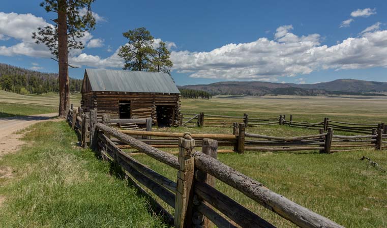
July 2017 – The US Forest Service, which manages all the National Forests in America, dubs its land the “Land of Many Uses.” The uses we love most are camping with our RV, hiking, biking and photography. But when we are on public land, we share it with folks who hunt, fish, ride horses, graze cattle and extract various natural resources.
For urban and suburban folk who come out to America’s public lands to smell the pungent fresh air and see the stunning scenery, the omnipresence of cattle can be a bit of a surprise. In our many years of nightly boondocking, we have found ourselves sharing our back yard with cows quite a few times. It is, after all, open range.

In the west, the public lands are Open Range. Literally!
Cattle ranching is very much alive today, and cowboys really do exist in the real world, far from the classic TV shows and western movies. The other day, as we were driving to town in Buffalo, Wyoming, we came across a cattle drive going right up the highway.

On the highway one day we came upon a cattle drive. How cool is that?!
We crept past and were amazed at the huge number of cows and calves. The cowboys herding them were on horseback.
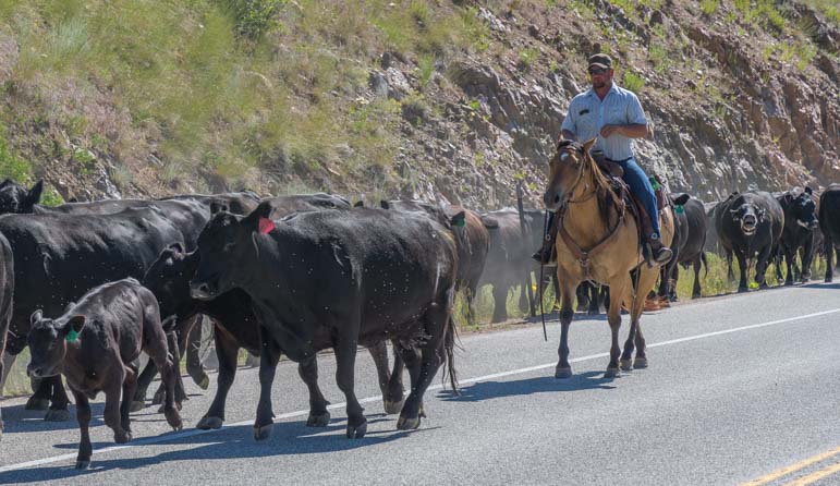
The cattle were being driven by cowboys on horseback.

This is what a traffic jam in the big western states looks like!
As we went down the line of mooing cows and watched the calves trotting along to keep up with their moms, it was like stepping back in time. America has a rich history in cattle ranching, and in many ways it is a way of life that hasn’t changed all that much in the past 150 years.
But technology has definitely made deep inroads, and besides using ATVs to zip around the many square miles of a ranch, it helps simplify many other things too. Towards the end of the herd of cows we came across a cowboy riding his horse with a coiled rope in one hand and a cell phone in the other! How much easier it must be to coordinate the herding process when you can simply call your buddy cowboy at the other end of the herd!

Modern day ranching: a coiled rope in one hand and a cell phone in the other!
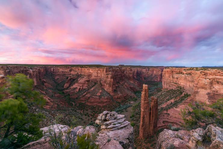
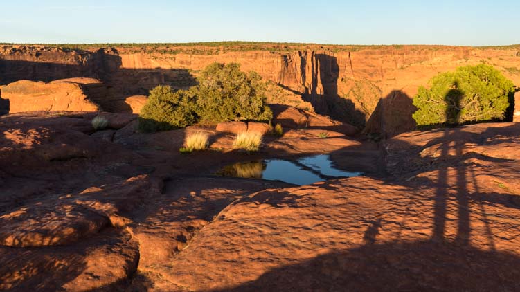
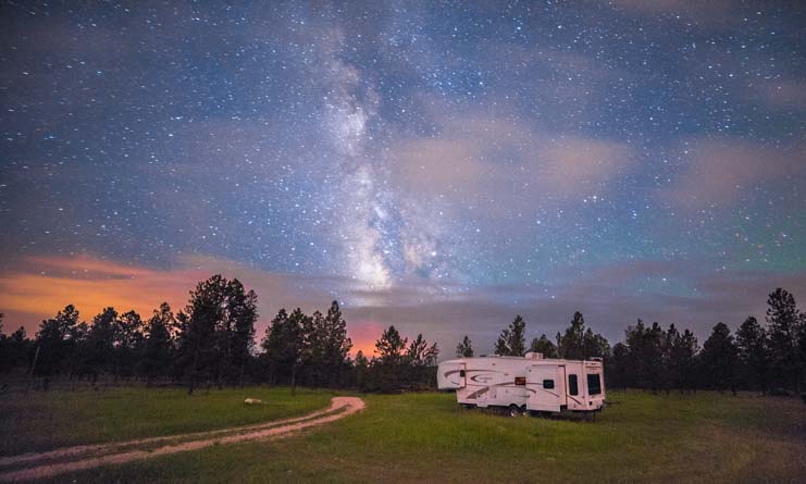
In South Dakota’s Black Hills National Forest we found a lovely spot to camp with our RV for a few days, and as we were first setting up, we couldn’t help but take a few photos of our idyllic little campsite.
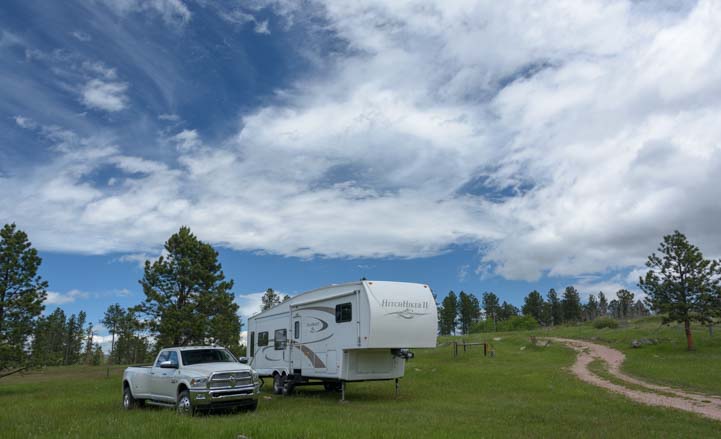
Finding a beautiful place to camp in the National Forest is one of the biggest highlights of our lifestyle.
Boondocking in the National Forest is always a treat for the senses. In the early mornings we spotted deer nearby.
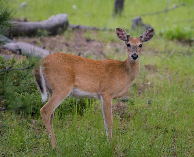
Hi Neighbor!
A wild turkey caught Mark’s eye on a solo hike he did at dawn another morning.

A wild turkey fluffs his feathers and shakes his tail.
He’s not a birder, but his camera managed to catch a woodpecker searching for bugs, a robin carrying a bug in his mouth, and a stunning Western Tanager.
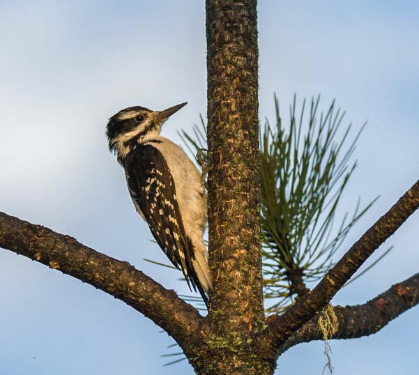
Woodpecker.
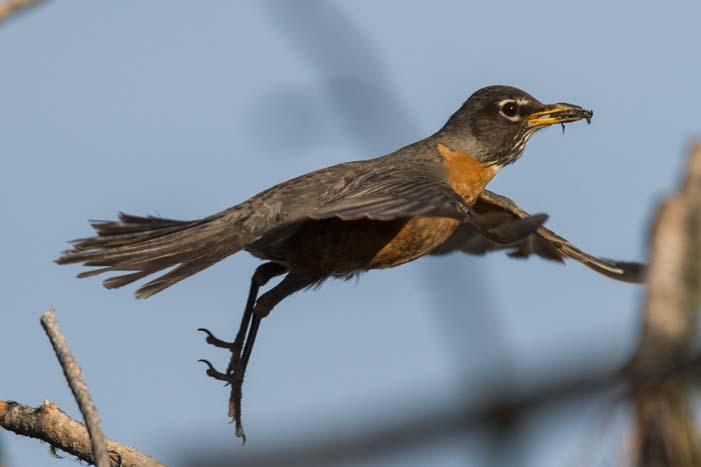
Robin.

Western Tanager.

.
The nights were glorious. The Milky Way marched across the sky all night every night for a few days.

Starry, starry night!
Beautifully mysterious trail of clouds crossed the sky one night, and we were astonished later when Mark lightened his photos on his computer later and saw how much orange and pink lingered in those clouds.
Wispy clouds cross the Milky Way.

Clouds whirl past the stars.
But the most humorous and heartwarming aspect of this particular South Dakota campsite wasn’t the stars or the natural wildlife.
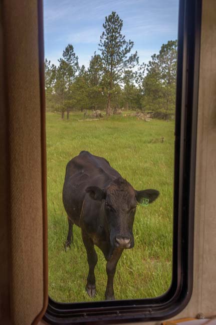
We were both jolted out of bed one morning by the raucous braying of a huge animal standing right under our fifth wheel’s overhang. Right under our bed! Good grief, what was that?
I jumped out of bed and poked my head out the door and found myself face to face with an enormous brown bull with a white face and an expectant expression. It was the ideal photo op. Our trailer and awning framed this huge bull’s head as he stared at me.
But I was in my PJs and was still wiping my eyes with disbelief, while my camera was tucked away in some safe place out of reach. By the time I got my hands on my camera, the bull was walking away to greener grass.

This big bull stood under our bedroom and bellowed loudly to wake us up!
It turned out that his noisy braying — he sounded suprisingly like a very loud donkey on steroids — was a call to the herd to come check out our trailer. Before I knew it, our little buggy was surrounded with USDA Choice Grade A Grass Fed Beef!

Cows and calves check out our trailer.

.
Over the next few days these cows came by our campsite on a regular basis. They seemed to be fascinated by us. And we were fascinated by them. We’d be sitting quietly minding our own business in our trailer when suddenly we’d hear the sound of grass being ripped out by the roots and footsteps clomping around in the dirt. We’d look out the window, and sure enough, there they’d be.

We’re surrounded!
On a few mornings we woke to the trailer rocking as the cows rubbed their shoulders and scratched their itches on its corners.
I look out the window to see a peeping Tom!

.
Moms and calves would gather together and stare at us whenever they heard us come out of the trailer. The calves were skittish and would run away if we got too close, but the moms would stand calmly facing us, slowly grinding grass in their mouths and staring.

.

The herd moves in on us.
One morning we were both woken from a deep sleep when we heard another strange sound just outside the trailer. We ran outside to see what it was and saw a balloon floating past. The sound we’d heard was the balloonist firing up the gas flame. Every few seconds he’d do that and the flame would fill the balloon with hot air to make it rise.

The sound of a balloonist filling his balloon with hot air woke us up at dawn.
But it was those darn cows that kept the smirks on our faces and gave our days a special funkiness. I began to imitate their mooing, and that would make them turn around and look at me. I had to laugh when Mark commented, “That’s pretty good. You sound just like them!”

All ears perked up when I mooed.
Mark took out his guitar one day and sat on our steps and played for them. They seemed to like the music and began mooing. Just like howling dogs, they seemed to want to add their own melody to his tunes.

The cows responded to Mark’s guitar playing by adding their voices in a moo-along!
A few calves got bold and ventured close to our truck. They were very intrigued by it.

A brave calf approaches our truck.

Another calf sniffs our bumper.
One day I came out of the trailer to find myself facing a lineup of cows. If I hadn’t knowd better, they would have seemed a little intimidating. They looked a lot like a gang of thugs in the hood.

The gang’s all here — in the hood!
Mark got busy taking portrait shots of a calf one day, and it was hilarious to see the little guy’s mind turning as he approached the camera.

.

.

By placing the camera so low, Mark got a neat angle on this calf’s face.
Suddenly Mark saw his big wet nose and thick black tongue going for his camera. Uh oh!!

What does that thing taste like?
He pulled his camera away just in time, but when we started to pack up to leave the campsite a few days later, he discovered that one of the cows had gotten into our barbecue and had damaged the latch on the cover. He did a quickie repair job on the fly before we hitched up to leave.

Camping in the National Forest sometimes gives us close encounters with cows.
It’s most fun with moms and their calves in Spring!
After we arrived at our next campsite, we found gooey prints from cow lips in a few places on our truck and trailer. Oh well! That’s all just part of the unusual experience of RV boondocking in the National Forest.
Subscribe
Never miss a post — it’s free!
More info on the Black Hills:
- Black Hills National Forest in South Dakota – Official USFS Website
- Location of Black Hills National Forest – Interactive Google Maps
Other blog posts about South Dakota and boondocking:
- A Smoky Moon, Badlands & Hummingbirds on the South Dakota Prairie
- Americas Mailbox – Mail Forwarding & More in South Dakota!
- An Old Time Country 4th of July – Custer, South Dakota
- Badlands National Park – Beauty & Wildlife in South Dakota
- Black Hills National Forest, SD, RV Boondocking – Camping with Cows!
- Black Hills, SD – Mt. Rushmore and More
- Custer South Dakota Highlights on an RV Trip
- Custer State Park Burros & Bison – Close Encounters of the Animal Kind
- Custer State Park Wildlife Loop Road – Where the Animals Are!
- Fall River Balloon Festival in Hot Springs, South Dakota
- Soap Box Derby & Barrel Races – A Labor Day to Remember!
- Solar Eclipse 2017: Time-Lapse Videos from the South Dakota Badlands
- Sturgis Motorcycle Rally – Wild and Free in South Dakota’s Black Hills!
- The “Right to Vote” is a PRIVILEGE Some Nomadic RVers Might Lose
- Wall Drug – An Iconic Pit Stop on a South Dakota RV Road Trip
- What To Do in the Rain while Boondocking? Wash the RV!!
- San Diego Anchorages – Boondocking on the Water
- RV Solar Upgrade with Renogy and Go Power – QUICK & CHEAP!
- RV Solar Power Made Simple
- RV Heater – How to Install a Vent-Free Propane Heater in Your RV
- RV Boondocking – Tips for Living Off the Grid in an RV
- Remote RV Camping: Antero Reservoir & Blue River Colorado
- Nature’s Capriciousness in Idaho – Streams, Mountains and Storms!
- Lakes and Light in Wyoming and Colorado
- How To STAY WARM in an RV – Survival Tips for Winter RVing!
- How to Beat the Summer Heat in an RV
- Dirty Little Secrets from the RV Dump Station – RV Dumping Tips + Composting Toilets
- Boondocking at Big Bend National Park – Cheap & Scenic RV Camping
- Boondocking (“free camping”) – How to find free RV campsites
- Black Hills National Forest, SD, RV Boondocking – Camping with Cows!
- “Wild Camping” & RV Boondocking Tips – Escapees Magazine
Our most recent posts:
- Buckskin Mountain State Park – Fun on the Colorado River! 01/31/26
- How to Install Starlink Gen 3 in an RV? Use the Speedmount! 08/07/25
- Escape to Paradise – Rocky Mountain Magic! 08/01/25
- Is Forest River a Good RV? Well Built? Here’s Our Experience 06/20/25
- Sunset Crater Nat’l Monument – Lava & Camels at Bonito CG! 06/06/25
More of our Latest Posts are in the MENU.
New to this site? Visit RVers Start Here to find where we keep all the good stuff!!
<-Previous || Next->