Cedar Breaks National Monument – A Hidden Jewel in Utah

August 2016 – Cedar Breaks National Monument is a jewel of a destination in the heart of southwestern Utah’s many spectacular State and National Parks. It looks a lot like Bryce Canyon National Park, but it’s smaller, more intimate, less well known and much much less visited. On our last visit we wondered, “Is Cedar Breaks better than Bryce?

Photographer Sunrise Cedar Breaks National Monument Utah

Cedar Breaks National Monument – WOW!

Cedar Breaks National Monument lies just above Cedar City, Utah, at a lofty elevation of 10,000 feet, ideal when the summer temps in the surrounding desert get unbearable.

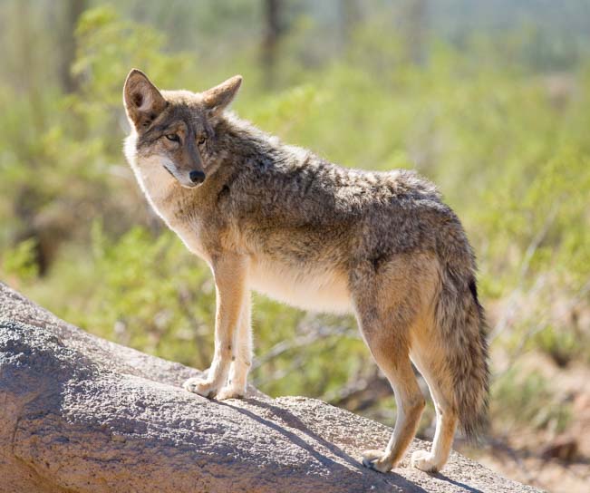
Prior to visiting Cedar Breaks, we had an incredibly heartwarming experience while in Cedar City. Some of our readers might have missed this post, thinking it was just another bird story about the release of a golden eagle back into the wild.

However, if you have ever been a First Responder — working in law enforcement, search and rescue, fire fighting, EMT services or other professions that send you headlong into danger to help others get out of danger — this story will have special meaning for you. For those that have lost a loved one in the line of duty, this post will touch your heart.

It was one of the most moving experiences we have had in our nine years of travel. The link is here and also at the bottom of this page:

Eagle Whisperer & Healer of Angels – Martin Tyner of Southwest Wildlife Foundation in Utah

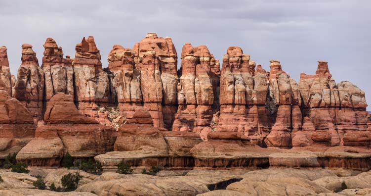
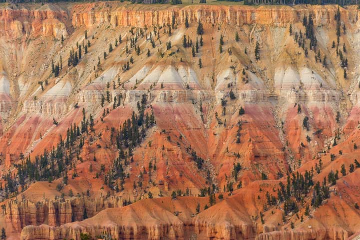
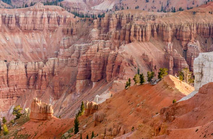
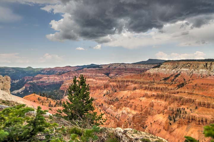
Soaring high above Cedar City, Cedar Breaks National Monument is a mammoth crater filled with pink and orange sandstone spires that jut up from the canyon floor like turrets in a fairytale castle. We snuck onto the trail before dawn to catch the soft colors in the sky above the canyon.

Sunrise Cedar Breaks National Monument Utah

Sunrise at Cedar Breaks National Monument

Suddenly the sun peeked over the horizon.

Sunrise starburst Cedar Breaks National Monument Amphitheater Utah

“Here comes the sun…”

All the exotic sandstone shapes in the canyon came to life in vivid color.

Dawn Cedar Breaks National Monument Utah

Early morning light at Cedar Breaks

Amphitheater Cedar Breaks National Monument Utah

.

The neat thing about hiking as the sun is rising at Cedar Breaks National Monument is that no one else is out there.

Sunset light Cedar Breaks National Monument Utah

.

Cedar Breaks is a quiet park to begin with, but at dawn the silence in this majestic canyon was broken only by the occasional bird chirping in the trees or the rustling of some small critter in the underbrush along the trail.

Dawn Cedar Breaks National Monument Utah

Patterns of light and shadow dance across the canyon.

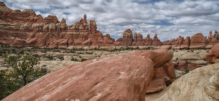
There are quite a few overlooks that offer slightly differing views looking down into Cedar Breaks from above or across the canyon to the colorful walls on the far side.

Colorful Cedar Breaks National Monument Utah

Vivid colors — and dark pine trees — on the canyon walls

It is impossible to comprehend the size and scale of this canyon unless you are standing on the rim trying to take it all in.

Pinnacle red rocks Cedar Breaks National Monument Utah

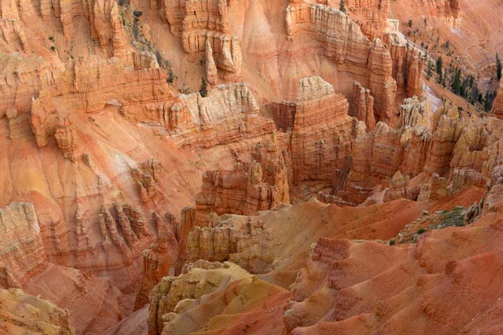
Looking down into the Cedar Breaks amphitheater

Looking down from above, the red rock turrets at the bottom seem miniscule, yet the the tall pine trees offer a hint of their size.

Orange rock formations Cedar Breaks National Monument Amphitheater Utah

The tall pines were dwarfed by the fairy tale spires.

There are no hiking trails that go down into the Cedar Breaks National Monument amphitheater of rocks. This is a canyon that is enjoyed entirely from the rim up on top.

pink rocks Cedar Breaks National Monument Utah

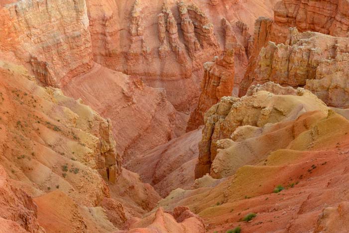
We could peer down from the rim, but there are no trails to the bottom of Cedar Breaks.

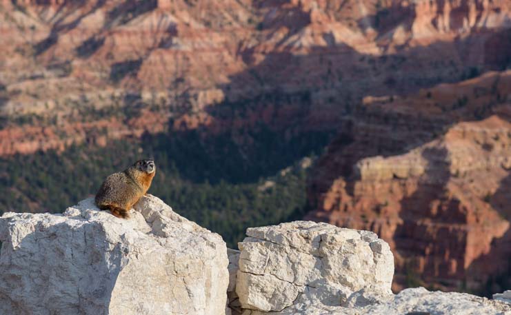
Even though people can’t crawl around in the depths of this beautiful canyon, the local marmot population wanders freely all over the place. These little guys are quite fearless, and I was amazed at how close they let us come.

Marmot Cedar Breaks National Monument Utah

A marmot pauses in the middle of his busy morning.

Cell phone and internet access is very sparse in this area, but I discovered that one place you can get a reasonable signal is at the overlook by the visitors center. One morning, I perched my laptop on the railing at this overlook, and started writing emails that were many days past due while I savored the view between sentences. Suddenly, I noticed a marmot was sitting on a ledge right in front of me.

Marmot Cedar Breaks National Monument Utah

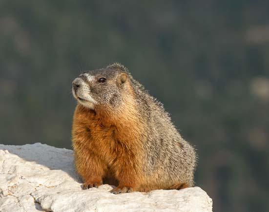
“Who are you writing to on your laptop??”

Darn if “being in touch with the world” on the internet wasn’t getting in the way of snagging a great photo at one of America’s most beautiful National Monuments!! What was I thinking doing email silliness instead of taking pics? Mark wandered by and snickered while he got a great photo of the little guy with the canyon in the background.

Marmot at Cedar Breaks National Monument Utah

A marmot’s eye view of Cedar Breaks!

But my camera was way down in the parking lot in our truck! Oh well. I just watched the marmot as he went about his business with grass in his mouth and I went about mine on my laptop.

Fifteen minutes later, when I finally put away the darn computer, I was amazed that the little guy was still sitting there right in front of me, doing his thing with the grass in his mouth. So, I ran back to the truck, got my camera and came back to the overlook to get some photos of him myself.

Not only was he still there, he was kind enough to pose for a few shots.

Marmot Cedar Breaks National Monument Utah

This marmot did his thing while I did mine until I finally went and got my camera!

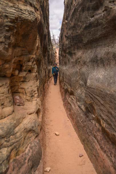
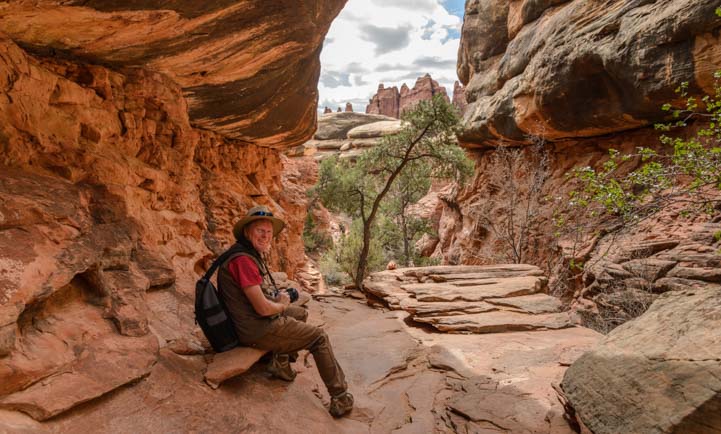
Cedar Breaks National Monument is home to one of my all time favorite hikes, the Spectra Point Trail. This trail follows the rim of the canyon from the parking lot right out onto a huge peninsula that juts out into the middle of the red rock amphitheater.

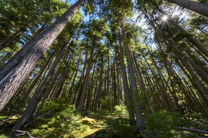
It starts with a fabulous passage through tall pine trees that heads towards the rim. The heavenly scent of pine needles nearly knocked me off my feet!

Hiking trail Cedar Breaks National Monument Utah

Spectra Point trail heads through pine trees to the canyon rim.

We did this hike at dawn one morning, and as we looked back towards the parking lot, a dead tree was silhouetted against the colorful sky.

Dead tree at sunset Cedar Breaks National Monument Utah

The bright colors of sunrise played behind an old dead tree.

This is an easy hike that has stunning canyon views the whole way. However, even though the path is wide and smooth, it goes uphill and downhill a lot, and being at 10,000 feet elevation, not only are the views breathtaking but you end up out of breath too!

Red Rocks Cedar Breaks National Monument Utah

The views on the Spectra Point Trail were stunning.

One of the special treats at Cedar Breaks National Monument is the neighborhood of Bristlecone pines that lives near the end of the peninsula at Spectra Point. Many of these unique trees are 1,000 years old or more, and one beautiful biggie has celebrated its 1,600th bithday. We could see him standing half naked at his sentry point out near the end.

1600 Year Old Bristlecone Pine Cedar Breaks National Monument Utah

A 1600 year old Bristlecone pine tree stands sentinel at the end of the trail.

As we walked out onto Spectra Point, the Bristlecone pines crowded in around us. These trees are the very definition of “gnarly,” with claw-like roots that snake across the ground without bothering to tunnel underneath.

Bristlecone pine Cedar Breaks National Monument Utah

Bristlecone pine trees are gnarly and tenacious, hanging onto the rim of the canyon in brutal weather.

Life is tough here where they like to live, with high altitudes and strong winds, nasty cold winters and all too brief summers. I think these trees must slumber through life with just one eye open. Whole branches and trunks of these trees are totally devoid of any signs of life.

Yet there are a few branches on every tree that are covered in the softest bristles. For such craggy trees that are entirely bald and bent like little old grandpas, their short pine needles are as soft and as full of life as can be.

The 1,600 year old great-grandaddy Bristlecone of them all gave me pause for thought as I walked around and around it to try and fit its expansive branches into my camera’s viewfinder.

1,600 years is a very long time!

1600 Year Old Bristlecone Pine Cedar Breaks National Monument Utah

A 1,600 year old Bristlecone pine tree – a true antique!

There are lots of tree species that live a long life. In Arizona, the “ancient” saguaro cactus that preside over the Sonoran Desert with a regal (and whimsical) air don’t even bother to grow their first branches until they are 75 years old. And the grand multi-branched 150 year old beauties that dot the scorching desert were mere babes when Americans were first settling the Arizona Territory.

But this Bristlecone Pine in front of me predated those juvenile saguaro cacti by centuries PLUS a millenium. It even predated the “ancient” Native Americans who roamed this area! The prehistoric Anasazi people of the southwest who left their artwork behind on canyon walls didn’t make their mark until this Bristlecone pine already had a few hundred years under its belt.

This tree put its roots down right around the time that the Goths sacked Rome!

And it has looked out on this fabulous view at the end of Spectra Point the whole time.

Sunset light Spectra Point Cedar Breaks National Monument Utah

Spectra Point overlook at the end of the trail.

Besides red rock beauty and ancient trees, Cedar Breaks National Monument is also known for it’s incredible wildflower displays in mid to late July. The monument even celebrates with a special wildflower festival.

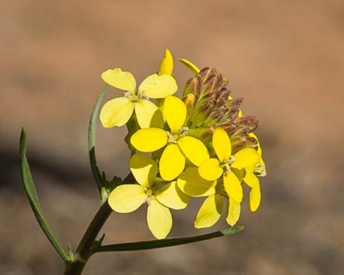
We got there a little late for seeing the blankets of wild color in the meadows, but brilliant yellow Snowy Goldeneye were blooming thickly everywhere, right up to the fencing by the visitors center.

Snowy Goldeneye wildflowers at Cedar Breaks National Monument Utah

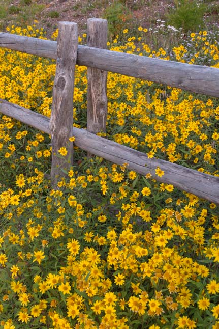
Snowy goldeneye swarm a fence post.

Snowy goldeneye wildflowers Cedar Breaks National Monument Utah

.

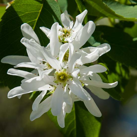
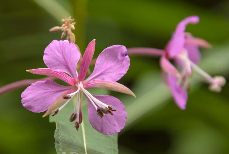
There were a few other pretty wildflowers here and there.

Wildflowers Cedar Breaks National Monument Utah

.

We just loved finding a bright red Indian Paintbrush tucked in between some low lying pine boughs.

Indian Paintbrush in pine branch

Indian paintbrush — surrounded by pine needles!

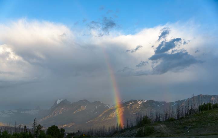
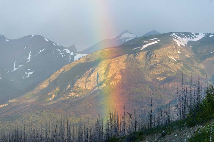
The weather in late August at Cedar Breaks National Monument can be very unpredictable. While many folks in other parts of the country were enduring an intense heat wave, we got hit with lots of afternoon thunderstorms that made the nights downright chilly.

Thunderstorm brewing over Cedar Breaks National Monument Utah

August is thunderstorm season at Cedar Breaks.

One day we even got a wild hail storm that left a sheet of icy pellets on the road!!

Hail storm Cedar Breaks National Monument Utah

A surprise hailstorm left a layer of ice on the road… yikes!

Cedar Breaks National Monument is a little gem in Utah that gets overshadowed by the more famous National Parks nearby. But if you take your RV to southwestern Utah, a detour to Cedar Breaks is an absolute must!! There are some links for planning an RV trip to Cedar Breaks National Monument below.

Note: The road from Cedar City to Cedar Breaks (Rte 14) is steep and winding. If you have a strong engine in your motorhome or a strong truck to tow your trailer, it’s no problem. We towed our 14k lb. 36′ fifth wheel up the hill easily. Driving the road with your toad/tow vehicle first will help alleviate any concerns you might have (we did!).

Subscribe
Never miss a post — it’s free!

More info about Cedar Breaks National Monument:

Other posts from our RV travels in Southwestern Utah:

Our most recent posts:

More of our Latest Posts are in the MENU.
New to this site? Visit RVers Start Here to find where we keep all the good stuff!!

<-Previous || Next->

“Going to the Sun” from Glacier National Park’s East Side – Breathtaking!

June 2016 – During our visit to the east side of Montana’s Glacier National Park, we saw lots of storm clouds roll in and out, and at dawn and dusk the sky lit up in astonishing patterns and colors.

RV at sunset Glacier National Park Montana

We saw some amazing light shows in the sky.

The Going to the Sun Road is the famous and extraordinarily scenic drive that cuts through the center of the park from west to east, and one great way to do it is on one of the Red Bus Tours. Many of these buses were built by the White Motor Company in the early 1900’s but have been converted to run on propane and gasoline. Some have been in service since the 1930’s!

Glacier National Park Red Bus Tour

Here’s a fun way to tour Glacier National Park – with a Red Bus Tour!

We saw the red buses all over the place. They have tours of the west side of the park and tours of the east side of the park.

Red Bus Tour Glacier National Park Montana

What a classy ride!

Sometimes we saw them in groups of two or three. With the top of the bus rolled back, folks could stand up inside to take pics of the mountains with a totally unobstructed view. This seemed like the best way to enjoy this incredible drive, as the traffic can be pretty intense. Why not leave the driving to someone else?

Three Red Bus Tours Glacier National Park Montana

We saw the red buses everywhere!

Of course, there are many ways to enjoy the Going to the Sun Road, and driving it in a Led Zeppelin van looked pretty cool too.

Stairway to Heaven on the Going to the Sun Road

Take a drive up the Stairway to Heaven on the Going to the Sun Raod!

The views of Saint Mary Lake on the east side are just gorgeous, and we marveled at the ever changing colors of the water and the sky as the storms rolled in and out.

Saint Mary Lake Glacier National Park Montana

Saint Mary Lake – teal blue water under misty gray skies.

One of the nice things about driving your own vehicle (especially if you have a sweet hubby who chauffeurs you around) is that you can stop in every single pullout and see what’s there. We found wildflowers blooming on the banks of Saint Mary Lake.

Wildflowers Saint Mary Lake Glacier National Park Montana

Pretty flowers throw a splash of color in the greenery.

At the beginning of the Going to the Sun Road, we were greeted by tall, craggy, gray mountains that didn’t have a whole lot of snow on their peaks.

Going to the Sun Road Glacier National Park Montana

Going to the Sun!!

As the road twisted and turned and rose higher, the mountains grew taller too, and they were dressed in their snowy white best. The road snuck right through a mountain at one point too!

Tunnel Going to the Sun Road Glacier National Park Montana

The Going to the Sun Road has snowy peaks and cool tunnels!

The temperatures quickly cooled as we climbed higher, and the snow on the highest peaks got thicker.

Snowcapped mountains Glacier National Park Montana

Mid-June in Glacier National Park!

Near the top, we found ourselves rounding a tight curve that took in an incredible view of the vivd green valley floor. What a setting!

Happy camper Glacier National Park Montana

The views down into the valleys from the Going to the Sun Road are stunning.

There were patches of snow on the ground in the valley, and the tall evergreens seemed miniscule so far below us.

Snow and trees Going to the Sun Road Glacier National Park Montana

Patches of snow were tucked between the trees in the valley.

In 1995, Waterton-Glacier National Park was named a World Heritage Site.

A century earlier, America and Canada joined hands across the border to to unite their adjacent National Parks, Waterton Lakes National Park in Alberta, Canada, and Glacier National Park in Montana, USA.

12,000 years ago, thick, moving slabs of ice and snow — glaciers – carved the valleys between these towering mountains, giving them a distinctive U-shape.

Glacier valleys Glacier National Park Montana

Eons ago, glaciers carved wonderful U-shaped valleys.

Waterton-Glacier National Park is referred to as the “Crown of the Continent,” and no wonder. The spiky mountains that encircle the valleys and lakes look like a crown.

This area also straddles the Continental Divide, the ridge that runs north-south down the continent and separates the water flow through the eastern states provinces from that going through the western ones. The water that spills down the mountains from the Continental Divide in streams and rivers heads towards the two opposite and very distant oceans, the Atlantic and the Pacific.

Happy Campers Glacier National Park Montana

Happy campers on the Crown of the Continent.

Far below us, tucked between the cliffs and grassy slopes and pine trees, we spotted a waterfall that was about a quarter inch tall from our vantage point. No doubt this is a tall cascade that plunges down with a thunderous roar.

Waterfall Glacier National Park Montana

Far below us we saw a tiny waterfall.
A zoom lens brings it in close!

We found another waterfall right alongside the Going to the Sun road near the top of the continent’s crown. This one was wide and shallow, and it scurried this way and that as it rushed downhill between the rocks.

Waterfall Going to the Sun Road Glacier National Park Montana

We explored a beautiful wide waterfall right by the road.

Up near the visitors center at Logan Pass, the snow was still very deep in places.

Thick Snow Glacier National Park Montana

Mark stands by a wall of snow at the visitors center.

Snow covered much of the ground, and it was really fun to follow the little animal tracks in the snow until they disappeared into round and deep holes. We didn’t see anyone peeking out of their burrows, but we knew they were under there. We threw a few snowballs at each other too!

Snow Glacier National Park Montana

The Going to the Sun Road had just opened at Logan Pass when we were there in mid-June!

There are three entrances to Glacier National Park on the east side. The Going to the Sun Road starts/ends in Saint Mary, but 37 miles south of there is the entrance at Two Medicine, near the town of East Glacier Park Village.

Two Medicine is home to a fabulous historic log building that was once part of the Two Medicine Chalet rustic vacation destination built by the Great Northern Railway in the early 1900’s. Today it is just the Two Medicine Store, but it offers a little bit of everything to visitors.

From souvenirs to guidebooks, hiking gear and tourist info, they also serve fancy fluffy lattes and yummy lunch fare and bottled microbrew beer. This cute cabin in the middle of nowhere has everything the modern hiker needs!

The Lodge at Two Medicine Glacier National Park Montana

This simple log building serves up cheap beer and lattes as well as yummy lunches and souvenirs.

We were shocked at how reasonable the prices were too, especially after visiting the village of Waterton in the heart of Waterton Lakes National Park where the prices of certain essential food items (beer) were more than double the norm.

We were also very intrigued to chat with our latte barista and find out she was a college student from Colorado who was working at the store as a summer job. Her boyfriend was also working a summer job nearby at Amtrak’s East Glacier Park station.

People often wonder how to make a living while RVing full-time. One option is to get fun seasonal jobs at popular tourist destinations. You just have to be as much of a go-getter as a college kid and be willing to do things like make espresso drinks or work at a train depot!

Inside the lodge at Two Medicine Glacier National Park Montana

Inside the historic Two Medicine Store.

Mark had just purchased a Rokinon 12 mm lens for his camera, and he was absolutely loving the very wide angles that it could capture. He also found it made fantastic starbursts, so he had a wide-angle-starburst theme going for a lot of his photos at Two Medicine.

Starburst Two Medicine Glacier National Park Montana

A fiery sun shines on Two Medicine Lake.

Two Medicine Lake is a beauty. We wanted to get out on it for the little boat ride that goes across, but we ended up saving that treat for our next visit!

Beach Two Medicine Glacier National Park Montana

Two Medicine offers Glacier National Park beauty with a bit of peace and solitude to go with.

There are lots of canoe rentals, and this lake would be a great place for a kayak too, especially in the mornings before the wind picks up.

Canoes Two Medicine Glacier National Park Montana

Rental canoes wait for a ride at Two Medicine.

Besides camera-created starbursts in the sky, we also loved seeing the stunning crepuscular rays at sunset when the sun lit the sky on fire.

RV in sunset Glacier National Park Montana

The changeable weather at Glacier National Park created some wonderful sunrises and sunsets.

On the morning we left Glacier National Park, the gods treated us to some unbelievable theatrics in the heavens. It began innocently enough with a beautiful pastel sunrise over the mountains. The thick forest of dead trees below seemed to mirror the shades of gray in the heavy moisture-laden clouds.

Sunrise over dead trees Glacier National Park Montana

Storm clouds mirror the dead gray forest while pink shades dance in the sky.

As we drove, the sky began to turn wild shades of yellow and orange, and heavy rain fell from the clouds in the distance. We pulled over the enjoy the spectacle and were stunned by the light show that followed.

RV in dawn stormy skies Glacier National Park Montana

As we were leaving, the sky went wild.

The rising sun cut across the valley and lit the mountains in the distance with soft orange hues while rain fell from black clouds. Suddenly a brilliant rainbow appeared.

RV in rainbow stormy skies Glacier National Park Montana

Wow.

We ran around like mad snapping photos, and as if in joyful response to our excitement, the rainbow got brighter and brighter.

RV under rainbow Glacier National Park Montana

The rainbow seemed to jump out of the clouds!

Then a second rainbow appeared outside the first one. This surely meant double good luck — but which one led to the pot of gold??

RV in a double rainbow Montana

And then there were two rainbows, one inside the other.

The outer rainbow eventually faded, so we knew it wasn’t that one! Off in the distance the remaining rainbow seemed to fall right into the heart of the valley below.

Rainbow Glacier National Park Montana

The rainbow ultimately aims right at the pot of gold down in the valley at Glacier National Park.

As clouds slowly parted and we made our way back to our buggy, we were breathless with excitement. What a sensational light show that had been.

Rainbow Glacier National Park Montana

The rainbow lands in the middle of the forest of dead trees, promising a new beginning.

We loved our visits to Glacier National Park this year, both the west side and on the east side. If you have a hankering to take an RV trip there too, there are more links for planning your adventure below.

Subscribe
Never miss a post — it’s free!

More info about the east side of Glacier National Park:

Other blog posts from our RV travels to Glacier National Park:

Other blog posts from our travels where the Sky went Wild

Our most recent posts:

More of our Latest Posts are in the MENU.
New to this site? Visit RVers Start Here to find where we keep all the good stuff!!

<-Previous || Next->

Glacier National Park’s Quieter Side – Saint Mary

June 2016 – After nearly six weeks in the Canadian Rockies, it felt funny to cross over the border with our trailer and be “home” again in America. And what a gorgeous spot we landed in — the east side of Glacier National Park in Montana! We were welcomed home with some incredible sunrises and sunsets.

RV at sunset in Montana

The mountain clouds gave us some incredible sunrises and sunsets.

Glacier National Park is joined with Canada’s Waterton Lakes National Park just over the border from the eastern side of Glacier National Park to create Waterton-Glacier National Park, and the beautiful scenery around St. Mary Lake was very reminiscent of the vivid blues and towering mountains we had been enjoying in Waterton Lakes National Park for the last two weeks.

Saint Mary Lake Glacier National Park Montana

Saint Mary Lake is reminiscent of Upper Waterton Lake just over the border in Canada.

There are three entrances to the eastern side of Glacier National Park, one at Many Glacier, one at St. Mary and one at Two Medicine.

Glacier National Park’s eastern side is adjacent to the Black Foot Indian Reservation, so the communities have a distinctly Indian flavor. We were amused to see a series of teepees set up for visitors who wanted to camp the way the Indians used to.

Indian Teepees in East Glacier Montana

Tired of your RV? Try a teepee!

The main entrance to Glacier National Park’s eastern side is at the tiny community of Saint Mary where the eastern half of the Going to the Sun Road that bisects the park from west to east comes to an end after passing by stunning Saint Mary Lake.

St Mary Lake Glacier National Park Montana

Saint Mary Lake

There are many different hikes in Glacier National Park on both the eastern and western sides and in the middle too! We were on the hunt for wildflowers, and a ranger told us there were some beauties on the Beaver Pond Loop trail right by the ranger’s station at the St. Mary entrance.

So we set out on that trail behind a mom and her three year old daughter who was a real trooper. This is a flat and easy hike that took us out towards the bright blue lake.

Beaver Pond Loop Hike Glacier National Park Montana

The easy Beaver Pond Loop hike is not notable or exotic or a signature hike, but we enjoyed it very much.

The ranger was right about the flowers. They weren’t in thick abundance in vast fields the way we’ve seen in some photos of Saint Mary Lake, but they were definitely there, scattered about the meadows.

Wildflowers Glacier National Park Montana

Wildflowers were in bloom… wonderful!

Lupine wildflower East Glacier National Park Montana

A pretty lupine (“loopin”)

The flowers were so pretty it was impossible not to sit down among them.

Little girl in the flowers East Glacier National Park Montana

Simple pleasures.

Daisy blooming East Glacier National Park Montana St Mary

.

The trail also took us through some nice stands of aspen and other wooded settings. Mark was totally in his element. He is a woods guy and a true tree hugger.

Tree hugger Glacier National Park Montana

Mark embraces his roots.

The most beautiful parts of the trail were a few off-shoots that went down to the pebbly beaches on Saint Mary Lake.

Saint Mary Lake Glacier National Park Montana

Saint Mary Lake has the lovely teal blue color created by glaciers.

The wind was quite strong and small waves lapped the beach, one after another.

Sitting at Saint Mary Lake Glacier National Park Montana

The strong wind kept the waves coming.

The hike crossed the meadows before turning into the woods and then delivering us to the beach again.

Hiking Beaver Pond Loop Trail Glacier National Park Montana

Hiking across the meadows.

Saint Mary Lake Glacier National Park Montana

What a view!

Near the end, we came across the original Park Ranger’s cabin for the eastern side of Glacier National Park. Built in 1913, the stories on the plaques told amazing tales of what it was like to live in this remote outpost with nothing but nature all around back in those days.

Ranger's cabin St Mary East Glacier National Park Montana

Back in the 1910’s, this is where the ranger and his family lived. No car, no stores…

One of the early rangers, Chance Beebe, went out hiking on patrol one day (there were no roads for cars in those days, and he preferred hiking to riding a horse). His wife and child were back at the cabin patiently waiting for him to return.

Suddenly, she heard something rattling around up in the attic of the log cabin. It was a mountain lion! He had jumped in from a tree through the open attic window!! Luckily, the mountain lion eventually went on his way, and she and her child were okay. When she told her husband about it later, he knew she wasn’t making it up when he saw lion paw prints in the dust in the attic!

The attic window has a wooden door covering it now, but the ground level window gives a glimpse of the simple life lived by the ranger’s family 100 years ago.

Ranger's house St Mary Glacier National Park Montana

Life was so rustic, the ranger’s wife discovered a mountain lion in the attic. Yikes!

One of the duties for rangers, both then and now, was to keep an eye on wildfires and try to extinguish them. In recent years, due in large part to mismanagement of the forests and wooded areas for a century, wildfires have become particularly intense.

Towards the end of the Beaver Pond Loop hike we came across a stand of trees that had been bleached silver by the sun during the years since a wildfire swept through the area. The tree trunks swayed and creaked in the breeze, as if they were talking with one another.

Live and dead trees East Glacier National Park Montana

Remnants of wildfires are prominently visible in all of the National Parks, and we found a ghostly tree community that was ravaged a while ago.

It was eerie and beautiful at the same time. We felt as though we had come across a community of ghostly tree spirits standing in each other’s company today just as they had for decades, but without even a hint an animal’s footsteps or the faintest rustle of a leaf.

Wildfire dead trees Glacier National Park Montana Saint Mary

The tree tops bent and swayed and knocked into each other and made wonderfully eerie noises.

We stayed among these skinny souls for a long time, looking for ways to capture the wistful beauty of this silver world.

Dead trees Glacier National Park St Mary Lake Montana

There was a special aura here that gave us a feeling of reverence.

The most famous part of Glacier National Park is the Going to the Sun Road, and we drove it many times during our stay. For a few days, the weather was misty and soggy, and the towering mountains were as mysterious as they were majestic.

Going to the Sun Road Saint Mary Glacier National Park Montana

The Going to the Sun Road looked more like the Driving Into the Mist Road.

On July 21, 2015, a wildfire erupted right along this road, sending huge plumes of smoke in the air and torching the forest. Again, we found ourselves wandering through wildfire devastation, but this one had happened just one year prior. And again, we found ourselves witness to an unexpected beauty.

The trees were wet from the mist and rain, and they still bore the scars of charring from the fire. The bark was peeling off many of them, revealing rich brown wood beneath, and tiny hints of life grew at their feet.

Stand of dead trees from Reynolds Creek Wildfire Glacier National Park

Last year’s fire was a fresh memory for these trees.

One of the surprise blessings of a big wildfire like this along a famous scenic road is that it opens up the view.

As the years have gone by, many of the most scenic roads in America’s National Park system have lost their views because the trees that were saplings when the road was built have grown tall and strong — and totally blocked the view.

We found this was true on much of the Blue Ridge Parkway, and we have seen it on many other scenic drives as well. So, although our hearts broke at the way the woods were stripped of life in a matter of days last summer, we loved being able to see the lake between the remaining trunks!

Continuing on, around one bend we noticed a thicket of bright blue wildflowers that jumped out from the misty backgdrop of mountains. They were growing right along the rocky cliffs.

Wildflowers on a cliff Glacier National Park St Mary Lake Montana

The gods threw a splash of color onto our gray day with wildflowers growing on a rocky cliff.

We snuck closer and saw they were growing against orange lichen covered rocks. Mother Nature had chosen a very colorful palette for her handiwork once again.

Wildflowers on cliffs Glacier National Park Montana

Bright blue flowers and orange lichen on the rocks. Wonderful!

There were several different types of blue flowers, each a slightly different shade. We loved them all!

Wildflowers Glacier National Park Montana

The wildflowers at Glacier National Park were delightful.

The East side of Glacier National Park is the much less visited side. The villages on the east side are tiny, with just a few stores and family restaurants for the tourists. But in many ways it is the more beautiful side.

Although the Going to the Sun Road is not a good road for any but the smallest RVs, it is easy to reach Saint Mary and the other eastern villages from the western side of Glacier National Park with an RV simply by driving from west to east on Route 2 south of the park.

It is also an ideal jumping off point for a visit to eye-popping Waterton Lakes National Park just a few miles over the Canadian border.

RV Sunset Glacier National Park Saint Mary Montana

The east side of Glacier National Park is the less visited side, but it may be the more beautiful too!

There are more RV trip planning links below…

Subscribe
Never miss a post — it’s free!

A Little More info About Saint Mary and the East side of Glacier National Park:

RV Camping Options at Saint Mary:

Blog posts from our RV travels to Waterton-Glacier National Park:

Our most recent posts:

More of our Latest Posts are in the MENU.
New to this site? Visit RVers Start Here to find where we keep all the good stuff!!

<-Previous || Next->

Glacier National Park in Montana – Mirrors at Lake McDonald

May 2016 – After enjoying a bit of the cowboy life and ranching life of the Bitterroot Valley in Montana, and then taking a zippy day trip over to charming Philipsburg, we took our RV north to Glacier National Park. This park is tucked right up against the Canadian border in northern Montana.

Lake McDonald Going to the Sun Road Glacier National Park Montana

Lake McDonald at Glacier National Park, Montana

It was early May, and the main road through the park, the Going to the Sun Road, wasn’t completely open yet due to avalanche activity in the appropriately named Avalanche Creek area.

Lake McDonald Glacier National Park Montana

Dawn lights the snowcapped peaks at Lake McDonald

But the road was open as far as Avalanche, so we took full advantage of doing a few drives up and down its length.

Dawn Glacier National Park Lake McDonald Montana

Early morning reflections.

We had been to Glacier National Park once before, back in the late summer of 2007, and we had dashed through the park so fast that we didn’t even notice the large and beautiful Lake McDonald that greets visitors coming in from the southwestern entrance. Oh my!!

Lake McDonald Glacier National Park Montana

Lake McDonald.

The early morning air was very brisk when we drove alongside this stunning lake one morning, and the trees stood utterly motionless and silent. Hardly a breath of wind stirred their leaves.

Trees at Lake McDonald Glacier National Park Montana

Trees hung over the shore at Lake McDonald

The thick woods were lined with a lush carpet of moss, and the sun filtered between the trees.

Trees on Going to the Sun Road Glacier National Park Montana

The woods were thick alongside the Going to the Sun Road

The water was like a mirror, reflecting everything in its depths.

Lake McDonald Glacier National Park RV travel

.

And it was so clear that we could see each and every stone on the bottom perfectly.

Lake McDonald Glacier National Park Montana

The lake created perfect reflections with a few rocks peeking through from under the water

We stopped at McDonald Falls where the water coming down from the mountains rushed past us in a blur.

McDonald Falls Glacier National Park Going to the Sun Road Montana

McDonald Falls was moving fast!

A few wildflowers were just starting to peek their heads out here and there.

Wildflower Glacier National Park Going to the Sun Road Montana

Flowers were just beginning to bloom.

It was one of those ideal mornings that you wish could last forever.

When we got to Avalanche, we noticed that cyclists were unloading their bikes from their cars to ride a few miles further up the road. Because the road was closed to cars up ahead, they could do this wonderful bike ride without having to share the road with anyone but other bicyclists. What fun! We hadn’t brought our bikes this time, but made a mental note for the future.

This pre-season bike ride opportunity is similar to cycling the McKenzie Pass outside Bend, Oregon before it opens to motor vehicle traffic, something we had really enjoyed doing two years prior.

RV on Going to the Sun Road Glacier National Park Montana

Only the first third of the Going to the Sun Road was open to motor vehicles.

Nearby, the Hungry Horse Reservoir made for another lovely day trip. Again, we were blessed with crisp air and sunny skies.

Hungry Horse Reservoir Montana

Snowcapped mountains framed Hungry Horse Reservoir.

The road winds along the south fork of the Flathead River and along the reservoir, offering pretty views of the river and reservoir the whole way. We got out at one point and hiked down to a pebble beach where a series of tree stumps made for an eerie scene.

A man sitting in a camp chair at the trail head and working on his laptop while soaking in the view of the river told us that he remembered the river before it was dammed, back when those tree stumps were towering trees at the water’s edge.

Tree stumps at Hungry Horse Reservoir Montana

Before the river was dammed, there were tall trees on the shore.

Crossing the Hungry Horse Dam, we got a terrific view of the mountains backing the reservoir.

View from Hungry Horse Reservoir Montana

There were some beautiful views at Hungry Horse Reservoir

This would be a great road for a bike ride too, and as we stood staring at the lake a cyclist suddenly zoomed by, his eyes fixed on the pretty view too!

Cyclist checks out the view at Hungry Horse Reservoir Montana

A cyclist zoomed by

But it was Lake McDonald over in Glacier National Park that kept drawing us back. We drove the Going to the Sun road as far as we could a second time, late one afternoon, hoping for a knock-your-socks-off sunset to top it all off.

The pebble beach at the Lake McDonald Lodge was very beautiful, and we got a kick out of exploring the cabins at the Lodge, many of which were in the process of spring cleaning for the summer season.

Lake McDonald Lodge Glacier National Park Montana

Late afternoon light lit up the shores of Lake McDonald.

But we thought we might get a better view of the lake at sunset back at Apgar Village where there is a boat ramp that marches right out into the lake and offers a splendid panorama of the mountains.

Dawn at Glacier National Park Montana Lake McDonald Apgar Village

At Apgar Village there is a dock that goes right out into the lake.

We poked around on the shore waiting for this oh-so-sensational sunset to happen.

Apgar Village Glacier National Park Montana

That colorful sunset should be along any minute…

The lake undulated reflections of the mountains in shades of silver and blue.

View of Lake McDonald from Apgar Glacier National Park Montana

Silver and blue hues shimmer on Lake McDonald at dusk.

A couple came down to the dock with a photographer and did a bunch of romantic shots with the mountain backdrop behind them. They had had the same idea of catching this majestic view at the golden hour, sealing their undying love with a beautiful photo at Nature’s golden hour. But the skies just didn’t deliver that night, and the best we all got was a hint of pink.

No matter. This place is gorgeous anyway!!

Romance on Lake McDonald Glacier National Park Montana

Romance on Lake McDonald

We were on a mission to continue our RV travels north, so we didn’t stick around for the Going to the Sun Road to open up all the way to the top a few weeks later. But we loved what we saw and will hopefully be back for some wildflowers later in the season.

RV camping in Montana

.

This year we traveled north from Arizona ahead of the crowds by just a bit, and it made a big difference in many ways. Not only were there few crowds (and fewer people in general), but there was still snow on the mountains. However, the flip side was that the nights were often cold and many days barely got warm. Also, we arrived before the rangers had opened certain gates and attractions for the season.

But I have to say, there’s a special intimacy to a place like Glacier National Park when you have the scenery to yourself, even if you’re shivering!

Subscribe
Never miss a post — it’s free!

More info about Glacier National Park:

Our RV travels in Montana:

Our most recent posts:

More of our Latest Posts are in the MENU above.

<-Previous || Next->

Canyonlands National Park UT – Island in the Sky (and Night Skies!)

April 2016 – Canyonlands National Park in Utah is so big and sprawling that it has two entrances at opposite ends of the park. The south entrance is a 50 mile drive to the south and west of Moab, and it takes you to the Needles District. The north entrance is a 30 mile drive to the north and west from Moab and takes you to the Island in the Sky district.

Hikers Utah Canyonlands National Park Island in the Sky  Shafer Canyon

Canyonlands National Park in Utah – Island in the Sky

We had explored the beautiful pink and white spires of the Needles District in Canyonlands National Park a few weeks earlier on the Chesler Park hike, and we were eager to check out the vistas and views of the Island in the Sky district.

Shafer Canyon didn’t disappoint…Wow!!

Canyonlands Shafer Canyon Island in the Sky District Utah photography

Shafer Canyon, Canyonlands National Park Utah

Although all of America’s National Parks are best enjoyed in depth over a several day period, with hikes out into the scenery to see the various sights up close, on this RV roadtrip we were doing a survey and an overview of all the beauty surrounding Moab.

We dashed into Canyonlands National Park for a day to check out all the overlooks and scenery visible from the main road.

White Rim Road Shafer Canyon Canyonlands Island in the Sky District Utah

The wild White Rim Road zig-zags across the landscape

We wandered around the overlook at Shafer Canyon for a long time soaking in the view.

A fabulous and enticing dirt road snaked across the canyon. This is part of the 71 mile long White Rim road that we had seen a few days earlier at Dead Horse Point State Park.

An intrepid jeep driver was descending a wall of the canyon near us. What a cool drive that must be. Someday!!

Shafer Canyon Canyonlands National Park White Rim Road Jeep travel Utah RV camping

The White Rim Road looks like quite a ride!!

Each canyon and overlook in the Island in the Sky district of Canyonlands is beautiful.

Hiking boots Canyonlands Island in the Sky District Utah

.

Canyonlands National Park Utah RV travel Island in the Sky

.

It had rained a few days earlier, and some of the depressions in the wide flat rocks were filled with water.

Canyonlands National Park Island in the Sky Utah RV camping

Puddles had formed in the red rock depressions.

Funny thing is that we kept getting in each other’s photos!

Photography at Canyonlands National Park Island in the Sky District Utah

.

And a few times we got in each other’s photos on purpose too…

Hiking Canyonlands National Park Island in the Sky Utah camping

Is that a painting behind us??

The red rocks of Canyonlands National Park and the white capped mountains in the distance made a beautiful contrast.

Red rocks snowcapped mountains Canyonlands National Park Utah

Red rocks and snowy mountain peaks – Gorgeous!

Utah Canyonlands National Park La Sal Mountains Island in the Sky

.

Without a doubt, Grand View Point has the most dramatic landscapes in Canyonlands National Park’s Island in the Sky district.

Canyonlands National Park Utah Grand View Point Overlook

Grand View Point looks out over a crazy landscape

Here the flat earth seemed to have been carved by an enormous stick that had been dragged across the land to gouge out a pattern.

Canyonlands National Park  Grand View Point Overlook Island in the Sky Utah photography camping

Nature’s handiwork – what a fabulous design!

The tiny White Rim Road was still visible, but it was impossible to fathom the size and scale of this immense landscape before us.

Canyonlands National Park Island in the Sky Grand View Point Overlook

I just LOVE this pattern!

.

In the evening, our attention turned to the heavens. The southern part of Utah has some of the darkest skies in America, and the stars were thick above us.

Stars Canyonlands National Park Utah camping

There were layers upon layers of stars in the sky.

As the night wore on, the celestial dance in the stratosphere became ever more intense, and the clouds of stars that make up the Milky Way practically jumped out at us.

Milky Way Canyonlands National Park Utah Island in the Sky RV camping

The Milky Way came to life in the heavens.

Moab, Utah, is a wonderful destination for an RV roadtrip, and along with Arches National Park, Dead Horse State Park, the Canyonlands Needles District and Newspaper Rock, the Island in the Sky district of Canyonlands National Park has to be included in the Moab “to do” list.

RV Canyonlands National Park Island in the Sky Utah

The whole area around Moab is wonderful for an RV adventure.

And it doesn’t matter what kind of RV you have: big, small, new, old, solar powered or not, any kind of RV that can be driven or towed will fill the bill, and while we were there we saw some pretty unusual get-ups!!

RV fifth wheel trailer towing_

If you can drive it or tow it, any kind of RV will do!!

For more info about Canyonlands National Park, check out the links below.

Subscribe
Never miss a post — it’s free!

Info and links for Canyonlands National Park – Island in the Sky:

More travel stories from our RV adventures in Southeastern Utah:

Our most recent posts:

More of our Latest Posts are in the MENU above.

<-Previous || Next->

Arches National Park Utah – A Playground of Soaring Red Rock Bridges!

April 2016 – Arches National Park lies just outside of Moab, Utah, and it has the highest density of natural stone arches in the world. Like all the National Parks, it deserves a week’s stay, at the least, but on this particular RV roadtrip we spun through in just a day.

Double Arch Arches National Park Utah

Double Arch in Arches National Park Utah

There are dozens of arches, each with its own name and personality. Our first stop was at Double Arch, so named because it is exactly that: two arches that are joined together at one end.

The thing that is impossible to grasp from photos of these magnificent sandstone sculptures that Nature has crafted by way of water, ice and wind, is the immense size. We crawled all around the interior of this beautiful pair of arches for quite some time and then got a selfie at their doorstep.

People at Double Arch Arches National Park Utah

.

All of the arches at Arches National Park are gargantuan, and people exploring them disappear into mere specks.

Arches National Park Utah

One of the most fun things at Arches National Park is crawling all around these beautiful arches.

Every arch has a different shape, and they all change shape as you hike towards them and through them.

Arches National Park Utah

There are arches of every imaginable size and shape.

Some have a long staircase leading up to them, courtesy of the National Park Service.

Staircase leading to the Windows arches at Arches National Park Utah

Stairs lead up to a beautiful arch.

And some offer a wonderful framed view when you stand beneath the peak of the arch and look out.

Sandstone arch at Arches National Park Utah

A peek at the world from inside Double Arch

Sometimes, the view through the arch is sensational!

Turret Arch within an Arch Arches National Park Utah

View of Turret Arch from the South Window

Arches aren’t all there is to see at Arches National Park, though. There are towers and cliffs of all kinds.

Truck at Arches National Park Utah

Arches National Park has wonderful pinnacles and red rock walls too.

The red rock sandstone is very sheer in places, forming immense walls and giant corridors.

Arches National Park Utah

Park Avenue — Nature’s version!

Arches National Park Utah

“Darling, I love you, but give me Park Avenue!” — Green Acres

Arches National Park is an ideal family destination, with room aplenty for the kids to run around. The tourists were thick — it was Spring Break while we were there — and people were having a blast climbing all over the rocks everywhere.

Walking around Arches National Park Utah

Arches National Park is a fabulous place for families with a little something for everyone.

Moms and dads were very busy with young kids who’d discovered that Arches is one enormous playground.

Kids climbing on rocks Arches National Park Utah

Two adorable girls kept dad busy in the mammoth “playground” that is Arches National Park.

The scenery is astonishing, and it is impossible to take more than a few steps without getting yet another photo.

Turret Arch Arches National Park Utah

We were blown away by the landscapes.

Picture in a picture Arches National Park Utah

So many folks were taking photos, lots of pics became photos of photographers taking photos!

Like the Needles at Canyonlands and Valley of the Gods and Horseshoe Bend, we couldn’t help but join the crowd of selfie takers to get a shot of ourselves in this extraordinary setting.

Turret Arch Arches National Park Utah

What a great day and place!

Turret Arch Arches National Park Utah

Aww, we had to take more than one. Turret Arch makes a wonderful backdrop!

The clouds rolled across the sky in thick battalions, and there was an intense threat of rain on the horizon.

People at Arches National Park Utah

.

As we watched one particularly menacing black cloud gathering steam in the distance, we decided to hustle back to the truck to avoid getting drenched.

Storm clouds at Arches National Park

Time to get moving!!!

We had had hopes of catching the arches at sunrise and sunset, playing with twinkling starbursts and the Milky Way.

The Spectacles Arches National Park Utah

The Spectacles!

But the weather didn’t cooperate, so we’ll have to return. Once again, rather than checking a destination off of our bucket list, all we did was whet our appetites to come back with our RV for more!

RV on road to Arches National Park Utah

Arches National Park is awesome for an RV roadtrip.

If your RV travels take you to the Moab area, Arches National Park is stunning and a definite “do not miss” destination.

A word of caution: Arches National Park is extremely overrun with tourists. By noon everyday, the line of cars waiting at the entrance numbered at least 15 or more while we were in Moab. But it is for very good reason: Arches is fabulous!

If you can sneak into the park before sunrise (camping inside the park helps!) or shortly thereafter, you’ll have the first arch or two to yourself. After that, it’s a big old party. But what a great party it is!!

Snowcapped mountains and red rocks Moab Utah

The roads near Arches National Park offer magnificent views.

And if you go during Jeep Safari Week in Moab, the scenery in every direction will be decorated with colorful Jeeps!!

Jeep Safari Moab Utah

.

Love red rock bridges and arches? There are three true beauties at Natural Bridges National Monument in Utah, and more info and links for Arches National Park below.

Subscribe
Never miss a post — it’s free!

More info about Arches National Park:

Related posts from Utah’s Awesome Red Rock National Parks, State Parks & National Recreation Areas:

<-Previous || Next->

Our most recent posts:

More of our Latest Posts are in the MENU above.

Tourists at Arches National Park Utah

.

Canyonlands National Park Utah – Hiking in the Needles District!

March 2016 – Canyonlands National Park is a stunning and massive National Park full of red rock hoodoos and towering red rock cliffs and wonderful hikes.

Happy Hikers Canyonlands National Park Needles District Utah

We’d often heard about Canyonlands National Park and were excited to get here at last.

There are three districts within the Park, two of which can be accessed by car on a paved road: the Needles District in the south and the Island in the Sky District a 100 mile drive around the park to the north. After our brief stop at Newspaper Rock outside Monticello, Utah, we continued on the same road about 25 miles further north to the Canyonlands southern entrance at the Needles District.

Red Rocks Canyonlands Needles District Utah

Just standing in the parking lot at the trailhead our cameras began to click!

As we stopped at the entrance station to flash our pass and get maps, Mark joked with the attendant who had been making change and issuing passes to a line of cars all day long.

“So, this is what a degree in Forestry gets you…” Mark winked. “You might as well be working at fast food joint!”

The ranger gave him a wry smile. “Actually, it’s even better than that.” He said. “I have a master’s degree in Geology.”

We both got a chuckle out of that, but we understood exactly what he meant when went on, “All my colleagues are in Houston making six figures. But guess who’s jealous of whom?!”

Log Canyonlands Needles District Utah

All along the trail there were fabulous gnarled limbs and logs that were bleached by the sun.

We found out later that this ranger does a Night Sky lecture that is really awesome, but we were there for a daytime hike. He recommended we do the Chesler Park hike, and before we even got the truck parked at the trailhead, we were already immersed in red rock beauty.

This is a 6 miles out-and-back hike that is loaded with fabulous scenery right off the bat, so whether you go the whole distance or do just a small bit, it is really rewarding.

Needles District Canyonlands National Park Utah

On the Chesler Park hike, the scenery is awe-inspiring as soon as you begin.

Right from the get go, after a fairly steep bit of climbing, we were within range of the “needles” red rock formations that give this area its name. Along with the spiky needles, we were surrounded by cool rock formations of all kinds, and it was really tempting to stop hiking and just play in the rocks.

Playing in Canyonlands Needles District Utah

So many cool rock formations lured us off the trail, we found it impossible to stay on the trail!

The sandy dirt trail is very clear and easy to find in spots.

Hiking Trail Canyonlands Needles District Utah

In places the trail was a thin ribbon of sand.

But in other places it wanders off across vast flat rocks. Fortunately it is very well marked with little rock pile cairns.

Chesler Park Hike Canyonlands Needles District Utah

The trail wandered off over the boulders, kept in check only by the rock cairns rangers had built for hikers.

The fun thing is that there are hundreds of places to sneak off the trail and explore.

Gnarly Tree Chesler Park Hike Canyonlands National Park Needles

The views were inspiring in every direction.

As we followed the trail, continuously tempted by things that were off the trail, it occurred to me that you could do this hike a dozen times and have a totally difference experience each time.

Hiking Canyonlands Needles District Utah

Some rock formations resembled spires.

The “needles” stand in neat rows, and some rows are more needle-like than others.

The Needles Canyonlands National Park Utah

Suddenly we found ourselves standing among the needles themselves.

Canyonlands National Park Needles District Utah

The needles rose up hundreds of feet in the air.

The sky was filled with clouds, and the sun played with the rock formations, alternately shading them and lightening them up.

Trail to Chesler Park Needles Canyonlands National Park Utah

The entrance to Nature’s Cathedral…

Chesler Park Hike Canyonlands National Park Utah

.

I was caught up by the incredible vistas of rock formations standing all around us, but Mark looked down at his feet and noticed some beautiful wildflowers.

Wildflowers Canyonlands National Park Utah

While I gazed at the mammoth rock faces, Mark noticed the little smiling faces of wildflowers at his feet.

We had been enjoying all kinds of different scrambles here and there as the trail wandered in and around the rock formations. Then, suddenly, the trail descended into a slot.

Skinny slot Canyonlands National Park Needles Utah

We shimmied through a skinny slot.

It was just wide enough to fit a person. We love little slots like this.

Slot Canyon Chesler Park Hike Canyonlands National Park Needles District Utah

This was fun!

It wasn’t very long, though, and soon we were out at the other end. We took a break under an overhang.

Resting on Chesler Park Trail Canyonlands National Park Needles District

At the other end of the slot a huge rock overhang stretched over us.

We were both going crazy taking photos. Back in the rig, Mark played with one of his in black and white. Cool!

Old time photo Canyonlands National Park Needles District Utah

.

We turned around to retrace our steps and saw the needles from another vantage point. What a spectacular area.

Red Rocks Needles Canyonlands National Park Utah

.

This is a popular hike, and as we walked back we saw dozens of people of all kinds starting out. It’s a great hike for all ages. Lots of families had brought little kids who ran around on the trail, and older couples came with hiking sticks. We even saw a young couple doing the hike as a trail run. Wow!

Chesler Park Hike Canyonlands National Park Needles District

Hikers of all ages love the Needles!

When we passed a woman carrying a little while pooch with pink and purple ears, we knew we’d seen it all.

Dog on hiking trail Canyonlands National Park Utah

Even stylish pooches enjoy an outing on this red rock trail.

The Needles District of Canyonlands is stunning, and there are hikes galore. Lots of families were camping there for Spring Break (and more than a few mentioned having been caught in the snow in their tents a few nights back like we were).

Needles Red Rocks Canyonlands National Park Utah

The Needles District is said to be the more beautiful and less touristy side of Canyonlands National Park.

On the way in and out of Canyonlands National Park, there is a tiny homestead on the west side of the road that begs for exploration.

Tiny house homestead Canyonlands National Park Needles District Utah

We found an abandoned cabin just outside the park. Our “tiny house” on wheels is bigger than this!!!

This little cabin couldn’t have been much more than 250 square feet. We couldn’t resist poking around for a bit.

Tiny house antique homestead Canyonlands National Park Needles District Utah

I could barely stand up straight inside!

“Tiny houses” are very popular these days, and lots of people want to downsize into minimal square feet, whether on a foundation or on wheels. Imagine living in this wee cabin, miles from nowhere, during the winter. To stay cool in summertime, it even had an outdoor fireplace!

Tiny house outdoor fireplace hearth Canyonlands Needles Utah

The summertime fireplace was just beyond the front door.

If your RV travels take you through southeastern Utah, it is well worth the detour to visit both Newspaper Rock and Canyonlands, to check out the intriguing sites in between, and especially to do the Chesler Park hike into the Needles red rock formations!

More info and links below.

Subscribe
Never miss a post — it’s free!

More info about Canyonlands National Park:

Other blog posts from our RV travels in Southeastern Utah:


Our most recent posts:

More of our Latest Posts are in the MENU above.

<-Previous || Next->

Navajo National Monument, Monument Valley and Bears Ears

March 2016 – The Northeastern quadrant of Arizona and a bit of southeastern Utah is the Navajo Nation, an Indian reservation that is over 27 thousand square miles. It is larger than the state of West Virginia (~24k sq. mi.). It is also larger than the states of Massachusetts, New Hampshire, Rhode Island and Delaware combined, with enough left over to add in the southern half of Vermont.

Just under 175,000 people call it home.

Within the borders of the northern part of the Navajo Nation, the National Park Service manages the Navajo National Monument, an area where there are some ancient Indian cliff dwellings and ruins.

Hiking at Navajo National Monument Arizona

Navajo National Monument is home to ancient Indian cliff dwellings.
One is in a cave across the canyon.

After visiting stunning Horseshoe Bend and Lees Ferry near Page, Arizona, we drove our truck and trailer across the northern part of the Navajo Nation to see Navajo National Monument.

There are three short hikes at Navajo National Monument, each one progressing along the canyon rim and offering views down into the canyons. We started with the Sandal Trail which was an easy stroll on a paved path to a viewpoint at the end which looked across the canyon at the Betatakin Ruin.

Navajo National Monument Arizona

The Sandal Trail took us along the edge of the canyon to an overlook facing the Betatakin Ruins

In the summers there are guided tours of these ruins, but they don’t start until May 29th, and we were there in mid-March. But the view of the ruins — with binoculars or our long telephoto camera lens — was wonderful.

Betatakin Ruins Navajo National Monument

The Betatakin ruins are in the back of this cave.

Ruins at Navajo National Monument Arizona

In the summer months you can take a guided tour of these ruins. We were there too early!

The Canyon View Trail hike gave us views of this same canyon, although there were no Indian ruins to be seen.

Navajo National Monument canyon view

The Canyon View Trail gave us different views of the same canyon.

Unlike the first two “mesa top” hikes, the Aspen Trail hike descended down into a canyon and gave us a terrific stair-stepping workout going down and then climbing back out.

We were definitely missing the “prize” at this park since we couldn’t do any tours of the ruins themselves, but spring was in the air and wildflowers were just starting to bloom.

Spring flower Navajo National Monument Arizona

Pretty wildflowers on the trail.

There are two dry camping campgrounds at Navajo National Monument, and they are free. Only one campground was open (and only two campsites were being used!), and with some jockeying a bigger rig could fit during seasons where there is little traffic. The signs give RV size limits of 25′ to 32′, depending on the sign, not just in the campground but on the road leading to Navajo National Monument, but in reality a 35′ fifth wheel could manage in one or two of the campsites we saw (with patience). Busy summer weekends might be more hair-raising with a big rig.

This is high desert country (7,300′) so it was quite cold during our stay, but we saw a beautiful sunset.

Sunset starburst Arizona

Remote and quiet in March, we had the sunset to ourselves.

Sunset Navajo National Monument

Sunset at Navajo National Monument

Traveling northeast from there, we passed through Monument Valley, which sits on the Arizona and Utah border. This ia a vast flat plain that is dotted with towering rock formations.

The most dramatic rock formations of Monument Valley are in the Monument Valley Navajo Tribal Park in the Navajo Nation, a four mile detour east of US-191, the road we were on. We decided to save a trip there for another time, but stopped in at a Welcome Center to get some info.

At least, the building had a sign on it that said “Welcome Center!”

When I walked in the door, I expected to see racks of literature and a helpful person behind a desk. Instead, I found myself staring at the backs of several rows of people in folding chairs listening to a man giving a speech. His voice was low, melodic and wistful. And the language he was speaking was Navajo!

Monument Valley Arizona

Monument Valley is dotted with enormous rock formations

I wasn’t sure if I should back out quietly or stick around and see what this was all about. Suddenly, a woman approached me and whispered and gestured towards some pamphlets on a table. She wanted me to sign a petition.

“What’s it for?” I whispered.

“It’s a petition to create Bear’s Ears National Monument,” she said. She handed me a map and a glossy brochure.

Monument Valley selling Indian crafts Arizona

Indians sell crafts from stands on the side of the road.

It turned out that the Navajo Nation (together with 25 other Indian tribes) has approached the federal public land agencies for help protecting their artifacts, relics and ruins. They have been struggling with preventing the desecration of archaeological sites (ancient ruins and petroglyphs), and they want to phase out mining too.

The Navajo have never sought this kind of help before, but apparently they simply don’t have the manpower or the authority to protect the unique archaeological sites. So they are proposing to convert 1.9 million acres of land (about 3,000 square miles) into a National Monument.

Monument Valley Arizona

Towering rock formations in this part of the country often hide Indian archaeological treasures

The parcel of land is enormous. It is the size of Delaware plus half of Rhode Island.

It is a triangle that stretches, more or less, from a bit SW of Moab, Utah, in the north, down about 90+ miles to the Utah/Arizona border in the south, and westward about 50 miles to Glen Canyon, and then about 80+ miles back up on a diagonal along the Colorado River towards Moab.

The popular landmarks and destinations of Natural Bridges National Monument, the Valley of the Gods, Goosenecks State Park, Newspaper Rock and Manti La-Sal National Forest would all be enclosed inside the boundaries of the new National Monument land.

Canyonlands National Park and Glen Canyon National Recreation Area would border it to the west and south. The north-south highway of US-191 would be outside the eastern boundary but would more or less parallel the eastern border of the National Monument between the Moab area and the Arizona/Utah border.

You can see a map here:

Map of Proposed Bears Ears National Monument in Utah

RV at Monument Valley Arizona

This whole area is extremely popular with RVers and other travelers

This proposal is unique because it requires cooperation between several different agencies that manage public land, including the US Forest Service, Bureau of Land Management, and National Park Service, all of which manage portions of the land parcel already (most of the land is currently under BLM management).

The organization that is behind this and that was making presentations and gathering signatures to present to President Obama when I walked in the door is called Utah Diné Bikéyah. “Diné” is the Navajo word for the Navajo people.

I spoke briefly with Gavin Noyes, the Executive Director. He explained that this has been in the works for a few years and that the hope is that Bears Ears National Monument will be created by President Obama before his presidency is over.

He explained that in many ways the process is being modeled on Grand Staircase Escalante National Monument, another ~3,000 square mile public land conversion in southern Utah that was designated a U.S Presidential National Monument under the Antiquities Act of 1906 by President Bill Clinton.

Grand Staircase Escalante was created to preserve unique natural treasures (like red rock formations). Bears Ears National Monument will be created to preserve Native American cultural and archaeological treasures (ruins and petroglyphs and ceremonial sites).

RV at Monument Valley in Utah

The landscapes in this corner of the world are stunning.

I asked what the impact would be on recreational use of the land, like dispersed camping, hiking, mountain biking, rock climbing, etc. Gavin explained that the intention was for better management of the archaeological artifacts and that recreational use would still be allowed, just as it is still allowed in Grand Staircase Escalante National Monument.

Photos in the proposal’s brochure show situations where people have attempted to remove petroglyphs from rock faces by cutting them out with high powered saws. They also show images of mining and other commercial land use. These are the things that this proposal is seeking to eradicate.

Of course, even presidential protection doesn’t guarantee anything. In 1955 President Eisenhower protected a four square mile portion of Tonto National Forest in Arizona, making it off limits to all future mining. In late 2015, that was overturned by the National Defense Authorization Act, signed into law by President Obama, enabling the very same National Forest public land to be sold to a private, for-profit Australian and British mining operation. Eventually, this mine will destroy a beloved recreation area once used by campers and rock climbers that at least one president sixty years ago thought was worth hanging onto. (More info here).

An editorial in the LA Times by former Secretary of the Interior (1993-2001), Bruce Babbitt, spells out all the political back and forth that is going on behind the scenes. Just like the situation that arose in Tonto National Forest where foreign copper mines have trumped recreational use of America’s public land, mining seems to be playing a central role here as well.

Monument Valley reflected in fifth wheel trailer RV

Monument Valley reflections on our RV

All of this was news to me, and perhaps it is news to you too. I am sharing it here because the recreational use of public land is a large part of what this website is about.

Further questions can be directed to Gavin Noyes, Executive Director of Utah Diné Bikéyah by phone: (801) 521-7398 or by email: gavin [at] xmission.com

For more information about the proposed Bears Ears National Monument, see these links:

Further info:

Subscribe
Never miss a post — it’s free!

Things We’ve Learned About Public Land Management Since We Began Full-time RVing:

Other posts from our RV travels to Indian Ruins and to Indian Country:

Our most recent posts:

More of our Latest Posts are in the MENU above.

<-Previous || Next->

Horseshoe Bend Overlook – Page, Arizona – Stunning!

March 2016 – Horseshoe Bend is a jewel of spot just a few miles south of Page, Arizona, that’s easy to access and is a fabulous place to spend a few hours or more, especially for RVers headed through northeastern Arizona. As we brought our truck and trailer up from Sedona, Arizona, we stopped at Horseshoe Bend in the afternoon.

All smiles at Horseshoe Bend Arizona

At the Horseshoe Bend overlook it’s easy to be all smiles!

From the parking lot there is a 3/4 mile walk up and over a rise to get to the Horseshoe Bend overlook. Hundreds of people were on this trail going in both directions.

As we crested the rise and began the descent on the other side, we could see people scattering like ants as they approached the Horseshoe Bend overlook.

Walking towards Horseshoe Bend Arizona

Horseshoe Bend is extraordinarily popular, and swarms of tourists roam along the rim all day long.

This is a Very Cool Place. Even though we were there with throngs of other people, we felt a rush of excitement as we neared the edge. Everyone else seemed to feel the same way, and the unprotected rim of the overlook was jammed with tourists peering over the edge.

People at Horseshoe Bend Arizona

Tourists were fearless at the edge.

Far down below, rafters were making their way along the Colorado River. The mighty Colorado has carved Horseshoe Bend over millenia, and it is staggering to think of the force necessary to dig this huge ditch through sandstone rock, especially with the river looking so meek and mild down there.

Colorado River rafters Horseshoe Bend Arizona

1,000 feet below, rafters were floating on the Colorado River

This is a great place for selfie shots too!

At the rim of Horseshoe Bend Arizona

I wasn’t the only one who wanted a pic of themselves at this overlook.

Selfie sticks were held high aloft all around us.

Taking selfies at Horseshoe Bend Arizona

Selfie sticks were everywhere!

Taking selfies at Horseshoe Bend Arizona

No selfie stick? Use a folded up tripod!

Some folks were pretty creative getting photos of themselves. Others just laid on their bellies to get a shot of the incredible bend in the river a thousand feet down below.

Taking selfies at Horseshoe Bend Arizona

Hmmm…. should I take a photo of me or a photo of that incredible view out there??

Some were brave and crept far out on a precipice for a very dramatic photo of themselves.

Horseshoe Bend Arizona Sitting on the RIm

The more daring the photo the better!

I’m not sure how many people had noticed the sign on the way in saying that the sandstone is crumbly and the overhanging edges have a tendency to break off…!

Photographer Horseshoe Bend Arizona

Everyone liked to be right on the edge.

As the afternoon wore on, the crowd swelled as people came in to get a shot of the sun setting over the bend in the river.

Photographers at Horseshoe Bend Overlook Arizona

Photographers lined up on the rim with their tripods.

The rim was packed with photographers getting set up for this special moment. Finding a place to squeeze in along the rim wasn’t so easy!!

Photographers Horseshoe Bend Arizona

We waited patiently for the sun to go down.

The excited discussion between everyone standing on the rim alternated between what kind of photography gear they had and speculation about whether we’d all have a chance to go for a starburst shot at the moment the sun vanished from the sky on the far side of the canyon. One woman said she had gotten a doozy of a starburst photo two nights before. We all crossed our fingers.

But Mother Nature had other plans for us that afternoon, and the sun slipped behind the horizon with nary a wink.

It was still very special!

Horseshoe Bend Sunset Arizona

We didn’t get a starburst, but the sunset was beautiful.

I had an 18-35 mm lens, but the best images were a little wider. Mark whipped out his favorite trusty 14 mm lens and got a fabulous image.

Horseshoe Bend Arizona sunset photo

Mark was able to get a beautiful and slightly wider shot at 14 mm.

As we watched the clouds drift across the sky in shades of orange and yellow, suddenly the river down below began to reflect the color. How cool!

Sunset at Horseshoe Bend Arizona

For a split second, the river reflected pink and orange back at the sky.

We left Horseshoe Bend on a total high, absolutely exhilarated by Nature’s show. If the sunset could be that magical, we thought, then what might be in store at sunrise?

The next morning we were on the trail before dawn. There were three cars in the parking lot, including ours, and a young couple was just ahead of us on the trail, weighed down with some serious looking photography gear.

I got chatting with Brittany as we trudged along the trail in the dark, and I discovered that she and her companion, Justin, were professional videographers with their own video production company, Chiet Productions. They had just landed a gig for a regular show on PBS about a nightclub in Washington, DC, that will begin airing in April. It’s called “Live at 9:30.”

They were here at Horseshoe Bend for pleasure, however, and they were planning to shoot the sunrise using timelapse photography.

Timelapse photography Horseshoe Bend Overlook Arizona

A pair of professional videographers set up three cameras on the rim for a timelapse video of the sunrise.

Mark and I went for stills, however, since that was where our heads were at this morning. it was too early to think clearly enough to figure out everything we’d need to do to set up a timelapse, although I LOVED the idea!!

The sunrise was lovely.

The funny thing is that the sunrise wasn’t all that different than the sunset the night before. The sun had set over the horizon in the distance in front of us, but the sun rose behind us, so it would seem the canyon would look quite different. However, the colors we saw at sunrise filled the sky opposite the sun as it rose, casting a soft light across the horizon front of us.

Sunrise Horseshoe Bend Arizona

This morning’s sunrise was just as lovely as last evening’s sunset.

A little while later, the sun lit up the top of the peak in front of us. As the sun rose higher and higher, the shadow on the cliff slipped lower and lower.

Horseshoe Bend Arizona between the cliffs

As the sun rose it lit more and more of the cliffs across the canyon, while the shadow crept slowly downwards.

When the big show was over, we found Justin and Brittany where we had left them with all their gear on the edge of the canyon. They had done three timelapse videos, one on a GoPro, one on a Sony mirrorless camera and one on a cell phone. Brittany showed me the one she’d done on her cell phone. She had caught the sun lighting the top of the pinnacle in the canyon and had captured the shadow slipping down its front as the sun rose higher. Wonderful!!

Videographers at Horseshoe Bend Arizona

Brittany and Justin captured some great timelapse video of the sun rising in the canyon.

The morning wasn’t over yet, though. In fact, the day was just beginning. Where there had been just four of us on the rim at sunrise, we could now see a steady stream of people pouring down the trail, cameras and tripods in hand. The rim slowly became crowded with photographers and tourists once again!

Photographers with tripods at Horseshoe Bend Arizona

After sunrise, we were joined by lots of photographers at the rim.

Curious about some rock formations nearby, we headed off to the right (north). Leaving behind the growing rush of visitors arriving at the rim, we walked out into these cool rocks.

Lines in the rocks Horseshoe Bend Arizona

Away from the fray, to the north, we found some wonderful rock formations.

There were lots of curvy lines and ripples in the sandstone.

Patterns and Lines Horseshoe Bend Arizona

The curving lines and formations in the rocks were beautiful.

Rock crevices Horseshoe Bend Arizona

What magical shapes and formations!

We were both really intrigued by the contours of this fantastic land, and we roamed around this spot for quite some time.

Rock patterns Horseshoe Bend Arizona

The lines and patterns in the rocks drew us in.

If your RV travels take you to Page, Arizona, a stop at Horseshoe Bend is a must.

A few tips:

To avoid the crowds, the best time to get there is early in the morning.

If you are driving your RV, your best chance for finding a place to park it in the parking lot is early morning, not too long after dawn. There is turnaround room (big buses come and go regularly all day long), but it seemed to me that on weekends at peak season, especially holidays, this parking lot probably fills early and would be nearly impossible for an RV. We were there midweek in mid-March, and the number of tourists was mind boggling. The numbers intensify in the afternoon, especially near sunset.

Rock lines Horseshoe Bend Arizona

Horseshoe Bend is an overlook that deserves more than a fleeting glimpse over the edge

As you hit the walking trail to Horseshoe Bend, there’s a sign that says this is a Fee Area managed by the National Park Service. Interestingly, no money was being collected and no one asked to see our Federal Interagency Pass. The National Park Service could be making a small fortune here, as I’m sure several thousand people visit every day.

Subscribe
Never miss a post — it’s free!

More info about Horseshoe Bend:

National Park Service Website – Official description of Horseshoe Bend
Allstays – RV Parks near Page, AZ
Location of Horseshoe Bend – Google Maps (it is mis-labled “Houseshoe” and called a “chapel” – funny!)

Other blog posts from our RV travels in northeastern Arizona:

Our most recent posts:

More of our Latest Posts are in the MENU above.

<-Previous || Next->

Arizona-Sonora Desert Museum – Wild Animals in Tucson AZ

February 2016 – During our RV travels in Tucson, we visited the Arizona-Sonora Desert Museum which is located in Saguaro National Park. This really fun “museum” is really more of an outdoor nature walk and zoo that lets you see all the creatures native to the Sonoran Desert up close in their natural environment.

Big horn sheep Arizona Sonoran Desert Museum

The great thing at this “museum” is that the animals don’t run away!

The Sonoran Desert spans the states of Arizona on the US side of the border and Sonora on the Mexican side of the border, and it is an ecosystem and habitat that we just love. But the most exotic birds and animals are a bit reclusive, and the iconic creatures aren’t so easy to find while out hiking in the desert.

So it was just fabulous to see a big horn sheep sitting up on a rocky hill and to be able to admire him will he slowly turned his head this way and that in the morning sun.

Big horn sheep Arizona Sonoran Desert Museum

Within moments of entering the park, we saw a big horn sheep sunning himself.

The Arizona-Sonora Desert Museum has several habitats for the animals of the different regions of the desert, with a mountain habitat for the animals that like the cooler climes amid big rocks and trees, and open grasslands for the creatures that prefer those areas.

Fox Arizona Sonoran Desert Museum

A cute little fox walks by

We haven’t ever seen a fox or a wolf while out hiking, but we got see both here at the Arizona-Sonora Desert Museum. A beautiful wolf who was pacing in his enclosure, no doubt looking for Little Red Riding Hood.

Wolf Arizona Sonoran Desert Museum

A wolf on the prowl — looking for Little Red Riding Hood!

Little did he know that Little Red Riding Hood was actually over at the mountain lion enclosure!

Mountain lion Arizona Sonoran Desert museum

A little girl checks out a mountain lion… or vice versa!

You can watch the mountain lion on two sides of her enclosure. There is a plexiglass window in one corner where the little girl was, or you can stand on a slightly elevated viewing area on the opposite side of the enclosure for another view down into her mini canyon.

Mountain Lion Arizona Sonoran Desert Museum

What a beautiful cat.

This lioness kept everyone guessing and on the run. First she’d hang out by the window, but when the crowd got thick, she’d move around the corner out of sight. Then the crowd would trot around on the path to try and see her from the open viewing area on the other side.

What a hoot! As this enormous cat leaped effortlessly between the rocks by the window and the big open gully around the corner, all of us tourists ran back and forth on the path outside her enclosure, cameras and cell phones at the ready!

Mountain lion Arizona Sonoran Desert Museum Saguaro National Park Tucson

This mountain lion kept all the tourists on the run!

The trick to getting the most out of this museum is to arrive a little before the place opens at 8:30 a.m. When we arrived at 8:32, the parking lot was quickly filling and there was a line for tickets at the door already. The thing is, the animals are fed at opening time, so if you hustle down the path to the ones you want to see, you’ll catch them as they eat their breakfast.

Within an hour, most of the animals were settling in for a nap, and many of them were hard to spot!

We caught a fleeting glimpse of an absolutely gorgeous ocelot. What a fur coat!!

Ocelot Arizona-Sonora Desert Museum

The ocelot ran past so fast she was just a blur.

But after that out-of-the-corner-of-our-eyes peek at her, she was gone for the day in a quiet corner where we could just see her head moving as she licked her paws…

But we did see the bobcats. They were snoozing under a rock!

Bobcats Arizona Sonoran Desert Museum

Bobcats catnap under a rock

The Arizona-Sonora Desert Museum is artfully laid out, with paved and dirt walking paths that intersect and wind through the property. In some higher areas there are lookouts, and we loved the gnarly shade shelter that protected one of them.

Lookout Area Arizona Sonoran Desert Museum

A fun and crazy awning over a viewing platform.

There are lots of more common animals too, and we got a kick out of the javelina, an animal we have spotted many times in the desert.

Javelina Arizona Sonoran Desert Museum

Arizona’s desert “pig” – a javelina (pronounced “havaleena”

A little squirrel was busy scratching…

Squirrel Arizona Sonoran Desert Museum

I’m not sure if this guy was on display or just stopped by for the free food.

And a coyote posed for several minutes while a crowd of camera shutters clicked away.

Coyote Arizona Sonoran Desert Museum

A coyote strikes a classic pose.

We even spotted a deer back in the brush.

Deer Arizona Sonoran Desert Museum

We saw deer through the trees.

One of the big highlights of a trip to the Arizona-Sonora Desert Museum is the Raptor Free Flight presentation which happens twice a day at 10:00 and 2:00 all winter long. Again, even though we were there on a mid-week school day, the crowds were thick. Everyone stands along the walking path in one area and then a presenter begins to talk about the various birds that will be flying by.

Raptor Free Flight demonstration_

The highlight of a visit to the Arizona-Sonora Desert Museum is the raptor free flight show.

There are two trainers who have yummy dead animal pieces in their pockets, and they go into the various bird enclosures and ask the birds if anyone wants come out and fly around and get a snack.

They bring out only those birds that are in the mood, so there is no guarantee who will be flying on the day you are there!

The first bird we saw was a raven. These guys love the western National Parks, and we’ve seen them many times, but it was still a thrill to see one swoop over our heads and land on the trainer’s hand.

Ravens and crows are extraordinarily smart birds, and I’ve read of a study of a flock of crows where one member of the flock was taken away for seven years and then brought back. The flock went wild upon his return, obviously recognizing their long lost buddy.

Free Flying Raptor Exhibit Arizona Sonoran Desert Museum

A raven flies to the trainer for a snack.

Perhaps most thrilling was the great horned owl. I have a super sweet spot for owls (we had a wonderful encounter with some adorable wild burrowing owls just a little southeast of Phoenix last year and watched a wild great horned owl at the sandhill crane roosting area in southeastern Arizona too).

Great horned owl Arizona Sonoran Desert Museum

A great horned owl came out to see the crowd.

To keep all these free flying birds within reasonable range, the trainers pulled bloody bits of thawed quail out of their pockets every so often and lure the birds over. (These weren’t pieces of the southwest’s sweet Gambel’s quail, thank goodness, but were commercially grown to feed raptors). Mark got an awesome shot of the great horned owl downing a bite!

Great horned owl Arizona Sonoran Desert Museum

Mmmm, mmm, good!!

What a beautiful bird!!

Great horned owl Arizona Sonoran Desert Museum

.

Last up was a peregrine falcon, and it was really wonderful to see a falcon flying without the leather hood that falconers usually put on them. This guy zipped around and did some fabulous dives.

Peregrine Falcon Arizona Sonoran Desert Museum

A peregrine falcon comes in for a landing.

Arizona was once home to a parrot species too. The Thick Billed Parrot lived all over the American southwest and was last seen in the Arizona’s Chiricahua Mountains in the 1930’s. They were reintroduced to the wild in Arizona in the 1980’s, but the effort was a tragic failure, in part because of predators, like hawks, and also due to releasing adults that had lived in cages for too long and had lost their street smarts.

The Arizona-Sonora Desert Museum had two thick billed parros on display, and they were making a wonderful racket!

Thick Billed Parrot Arizona Sonoran Desert Museum

A pair of thick billed parrots squawked happily

There are two big walk-through aviaries in the Arizona-Sonora Desert Museum — one for bigger birds and one for hummingbirds.

What we’ve discovered in our RV travels around the southwest is that hummingbirds of all varieties are super easy to attract with a hummingbird feeder hung outside the rig, or mounted an RV window, and filled with a concoction of four parts water and one part table sugar.

Hummingbirds

Hummingbirds are easy to attract and fun to photograph from an RV if you’ve got a feeder.

Hummingbird hand-feeding kit

A hand-feeding kit!

Even better — and a reader just alerted us to this — get a hummingbird hand-feeding kit. Doesn’t that look like fun?! We’ve just ordered one ourselves!

Another great way to attract both birds and other small animals is to put out a dish of water a little ways from the rig. We’ve used a big upside down frisbee with great results. Several birds at a time, including cardinals, will stand in and around the frisbee, taking baths and drinking.

The Sonoran Desert spans the Sea of Cortez too. This is an unusual eco-region because the creatures that live in or near the water have to contend with the very cold Pacific Ocean temps and climate that sweep up from the open ocean and the very hot desert climate and water temps that develop each summer.

The Arizona-Sonora Desert Museum has a tropical fish display that shows some of the fish of the area.

Fish Arizona Sonoran Desert Museum

The Sonoran Desert includes Baja California and the Sea of Cortez where tropical fish abound.

A trip to the Arizona-Sonora Desert Museum is a really fun excursion, especially for RV snowbirds looking for a neat daytrip during their stay in Tucson. Be sure to get there early so you can catch the animals as they chow down their breakfast!!

There’s more info at the links below…

Subscribe
Never miss a post — it’s free!

More info about the Arizona-Sonora Desert Museum:

Other fun animals sightings we’ve enjoyed in our Arizona RV travels:

<-Previous || Next->

Our most recent posts:

More of our Latest Posts are in the top MENU above.