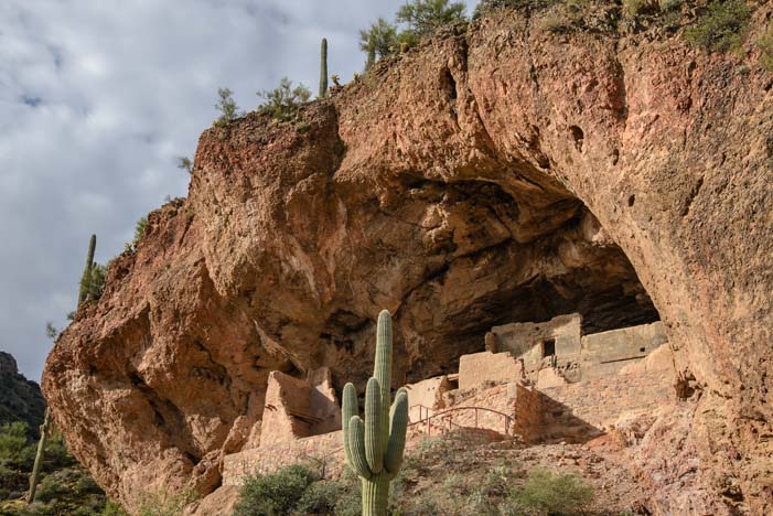
December 2015 – During our RV travels in central Arizona we took an outstanding volunteer-led tour of the ancient Indian “Upper Cliff Dwellings” at Tonto National Monument. We had already visited the “Lower Cliff Dwellings” on our own, as those are open to the public for exploration without a guide. But a visit to the Upper Cliff Dwellings can only be made if you take a guided tour.

The hike up to Tonto National Monument’s Upper Cliff Dwellings goes through some beautiful scenery.
The cost was just the price of admission to the National Monument ($5 per person or free with a Federal Interagency Pass or Senior Access Pass). But that low cost was deceiving — this was no ordinary tour!
The depth of knowledge and enthusiasm of our guide, Susan Treneer, as she taught us about these ancient Indian ruins was unbelievable, and our whole group was fascinated as we listened to her explain the theories behind the history of this special place.

The hike was uphill but not too strenuous.
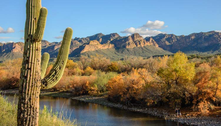
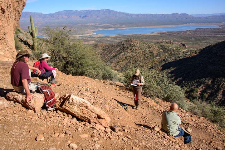
A group of about eight of us gathered at the Visitors Center and then hiked the 3 mile round trip up the steep hillside to the ruins and back. We began by going through some lovely riparian habitat (wetlands) where sycamores and other hardwoods were still showing off their autumn color.

A sycamore tree just off the trail in a riparian area.
Periodically, Susan stopped us as we hiked to explain the different vegetation we were seeing and to talk about the people who lived in the Tonto Basin 700 years ago.

Susan pauses to tell us about the Salt River and the people who lived here centuries ago.
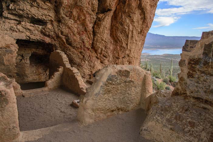
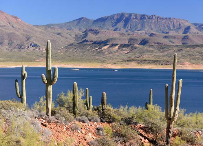
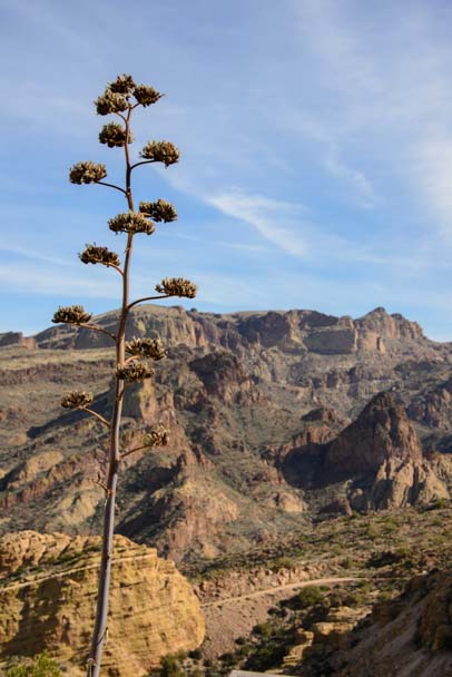
We climbed higher and higher on the hillside as we approached the cliff dwellings at the top, and the view of Roosevelt Lake grew more and more expansive below us.

The views of Roosevelt Lake were outstanding.
Right before we entered the Upper Cliff Dwelling ruins, Susan brought out photos of some of the astonishingly beautiful and intricate pottery that the people of this place had made all those centuries ago. They are called the Salado People by archaeologists today, named for the Rio Salado (Salt River) that they lived near and which was dammed up in 1911 to create Roosevelt Lake.
Susan showed us photos of beautiful Tonto Basin pottery made right here centuries ago.
The Salado people were extraordinary potters, and their pottery has been found as far away as the Paquimé ruins in northern Mexico, some 350 miles or so southeast of Tonto National Monument.
The people who built these ruins came down from Mesa Verde in southwestern Colorado and from other Colorado Plateau cliff dwelling communities.
Our guide, Susan, excitedly explained that no one really knows why the Salado built their homes in these caves so high up on the mountainside. She explained that the valleys were already filled with people living an agrarian lifestyle. Those old-timers had been raising cotton, beans, squash and corn in the Tonto Basin for 1,000 years already.

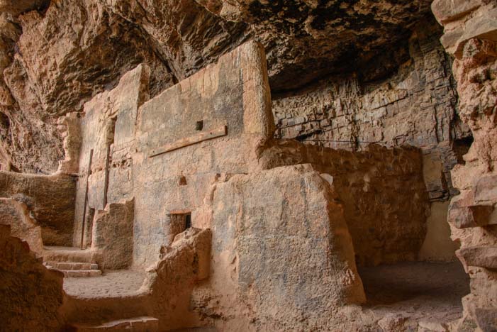
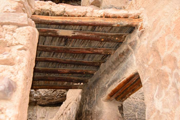
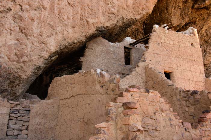
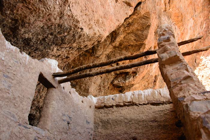
The adobe structures had roofs made of saguaro cactus ribs and juniper. These are original!
The cliff dwellers were the newcomers to the area. They may have been artisans who wanted to make a life selling their unique tricolor pottery. Or they may have been workers for the wealthier farmers who lived below them. No one is 100% sure!
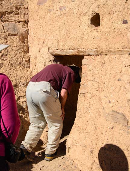
The adobe homes, storage rooms and workshops were built right into the caves.
All that is known is that they came down from the Colorado Plateau, and traveled through the Kayenta, Arizona, area, and ultimately set up housekeeping in the Tonto Basin and stayed for about 100 years.
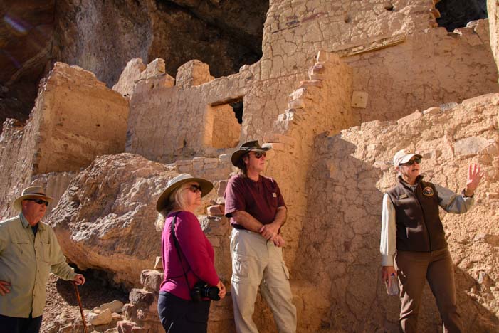
Susan was extraordinarily knowledgeable about the ancient southwest cultures.
Susan’s enthusiasm for the subject was infectious, and it struck me that she was absolutely loving her wintertime volunteer job with the National Park Service at this special spot.

For archaeology buffs, working at a site that is being actively studied by scientists must be a thrill.
In between describing the tools and other relics that have been found at Tonto National Monument, she also told us that archaeology has been her lifelong interest. She hadn’t studied it formally or been a professional in the field during her career, but now, as a retiree, she was able to work alongside scientists and archaeologists studying this site and stay on top of the most recent findings and theories while “on the job” with the National Park Service. How cool is that?!

Most members of our group had traipsed through ancient ruins in Mexico and Central America
as well as all over the southwest.
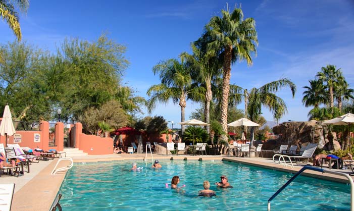
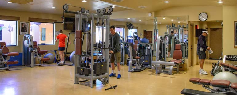
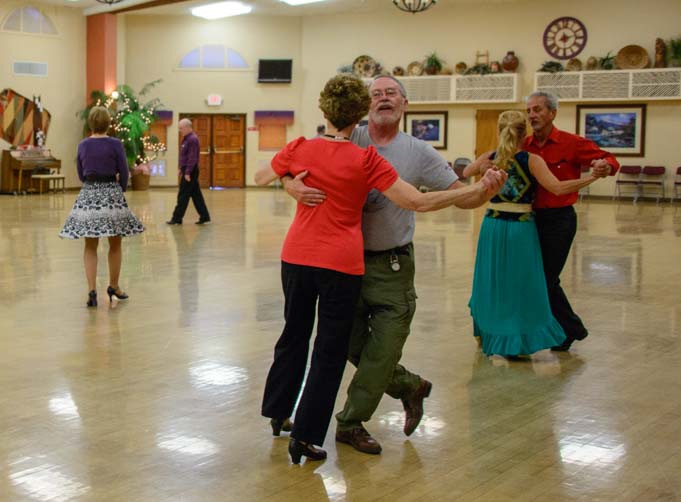
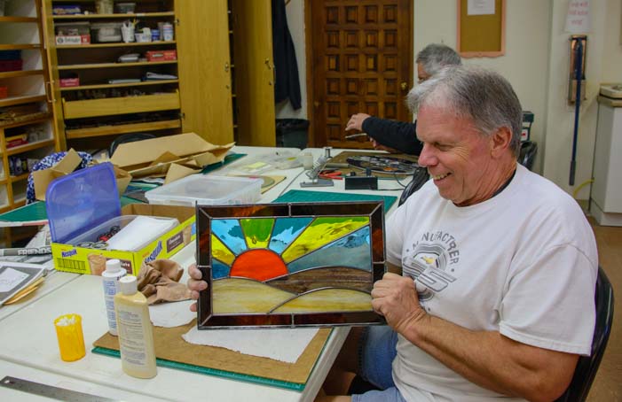
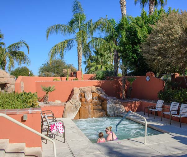
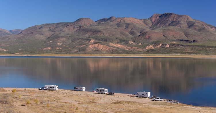
Susan’s volunteer job requires 32 hours a week of work, and she has taken the position for a few months. In exchange, she receives an RV campsite with full hookups overlooking Roosevelt Lake. This may not sound like a very fair exchange if you multiply out the hours worked and the value of the campsite. Even if it were a resort campsite, like nearby Monte Vista RV Resort with its swimming pools, hot tubs, sports courts and art studios, the pay would equate to just $8.20/hour. However, there is a deeper meaning to doing this kind of work, and she was obviously thrilled to have the opportunity to learn about the ancient southwestern cultures in a professional setting and to share her passion with others.

The public can only see the Upper Cliff dwellings on guided tours given on weekends.
Susan told me she has volunteered for the National Park Service for several years and has held similar positions at a few of the most significant ancient cliff dwelling ruins sites across the southwest, including Mesa Verde, Chaco Canyon and the Gila Cliff Dwellings.
In one job, she didn’t work with the public but spent her days cataloging and storing ancient pottery. She said that having the opportunity to hold, examine and study 700 and 800 year old pots — some of them perfectly intact — was just thrilling.

These ruins were overflowing with artifacts and debris when they were first studied 100 years ago. In those days tourists were free to take home whatever artifacts they found lying around!
I asked Susan how she got started with the National Park Service, and she explained that when she started as a volunteer, she had to undergo an intensive 40 hour training class and also do a beginner’s stint as a campground host at Big Bend National Park (not her favorite line of work). But it was clear that the personal rewards she has found since starting work at the various cliff dwelling sites have been enormous.
The Salado people weren’t all that short — 5’6″ was average for men, the same as their counterparts in Europe – but the floor of the caves has built up over time.
Her enthusiasm for all things ancient and puebloan — like the small “T” shaped window that looked out from the window onto modern day Roosevelt Lake where the free spirited Salt River once irrigated the farmlands — was truly infectious.

The “T” window shape was used by the ancients in many places. We remember seeing this shape at the Mayan ruins in Palenque in southern Mexico.
Lots of folks think “work camping” is simply working as a campground host checking people in and out of a campground or cleaning the bathrooms. But as I learned from Susan, if you have a passion for a particular field of study that is a focus of a particular National Park, like the puebloan culture and associated archaeological ruins, volunteering is a fabulous way to apprentice yourself to get hands on experience and learn everything you can.

Susan pointed out a “matate” grinding stone that remains on site.
When Susan started, she was given a two page reading list of books to study. She was thrilled. “I like the intellectual stimulation,” she said. She wanted to spend her retirement not just traveling but learning new things and expanding her horizons in every way.
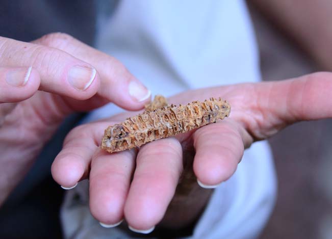
Corn was similar but a bit smaller back then. This corn cob is 700 years old!
More than once she mentioned the names of the archaeologists who are her favorite mentors. They are pioneering new work on the origins, migrations and lives of the ancient people of the southwest, and some of their theories challenge those of the researchers of prior decades. So, their work is new, their ideas are fresh, and they are breaking new ground in understanding what the earlier people of the southwest were really all about.
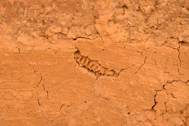
A corn cob got mixed into the adobe mud during construction and ended up in a wall!
We were totally impressed by the high quality of this tour. It felt like we were on a guided field trip with a true scholar. Susan had brought materials with her to show and instruct us, and she pointed out relics that were found at the Upper Cliff Dwellings and remain onsite and that the public can’t see without a guide. Best of all, she gave us insights into the lives of the people of an earlier time.

The remains of a shovel used by archaeologist Charlie Steen during the 1930’s excavation of these ancient ruins.
Perhaps even more important, she opened our eyes to the kinds of volunteer work that are possible within the National Park Service and on public lands in general. It isn’t always just cleaning up after tourists!
Susan did say, however, that there is a lot of competition for the premium volunteer positions, and that you have to build your credentials and your resume, just as you would with a paying job. After all, they aren’t going to trust just anyone off the street with handling and cataloging priceless pottery that is centuries old! But once you get yourself established in the system, there are intriguing opportunities to learn and to share — and to get an RV campsite with a view too boot!
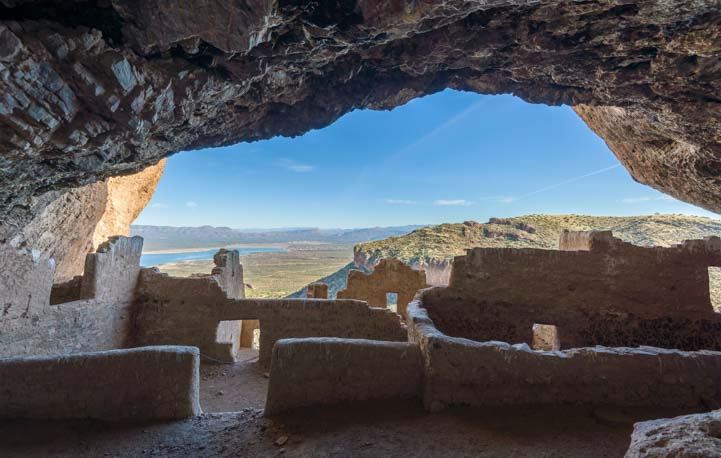
Looking out over Tonto Basin from the back of the cave
If you have a chance to travel to central Arizona with your RV, take a trip to Tonto National Monument in the Tonto National Forest and see these wonderful ruins.
If you are lucky enough to be able to RV seasonally or full-time as a retiree, perhaps you too will pursue a lifelong interest by taking a short term volunteer position on America’s public lands!
There’s more info and links below.
Subscribe
Never miss a post — it’s free!
More info about Tonto National Monument and Workcamping:
- Tonto National Monument in central Arizona – Official Website
- Upper Cliff Dwelling Guided Tours – Info about the tour we took
- Volunteer.gov – The website for finding volunteer workcamping positions with the National Park Service, US Forest Service, Bureau of Land Management and many other public land agencies
- Work camping with Amazon Camperforce – Hard work with good pay for RVers, shipping and packing during the holidays
- Where is Tonto National Monument? – Google Maps
Other posts from our RV and sailing travels to ancient Southwestern and Mesoamerican ruins:
- Windy Hill Campground + Tonto National Monument 03/08/24
- Aztec Ruins National Monument – Whispers from the Ancients in New Mexico! 06/11/17
- Ta Prohm Temple – Exotic Ancient Ruins at Angkor Wat Cambodia 04/09/17
- Tonto National Monument AZ – Lower Cliff Dwellings 12/16/15
- Montezuma’s Castle & Schnebly Hill – Sedona Heights! 05/19/14
- Mesa Verde National Park, CO – Life on the Edge with the Ancients 06/19/12
- Yaxchilan and Bonampak – Haunting Ruins & Ancient Art in the Jungle 04/08/12
- Palenque – Ancient Mayan Ruins and Terror in the Jungle! 03/20/12
- Oaxaca’s Monte Alban – Mysterious Ancient Zapotec Ruins 02/24/12
- Wupatki Nat’l Monument – Ancient Indian Ruins & Great Camping in AZ! 08/25/11
Our most recent posts:
- Buckskin Mountain State Park – Fun on the Colorado River! 01/31/26
- How to Install Starlink Gen 3 in an RV? Use the Speedmount! 08/07/25
- Escape to Paradise – Rocky Mountain Magic! 08/01/25
- Is Forest River a Good RV? Well Built? Here’s Our Experience 06/20/25
- Sunset Crater Nat’l Monument – Lava & Camels at Bonito CG! 06/06/25
More of our Latest Posts are in the top MENU above.
<-Previous || Next->