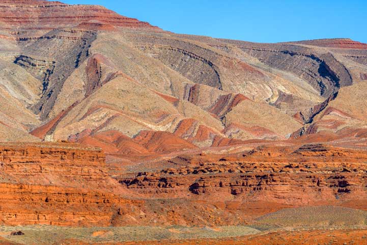
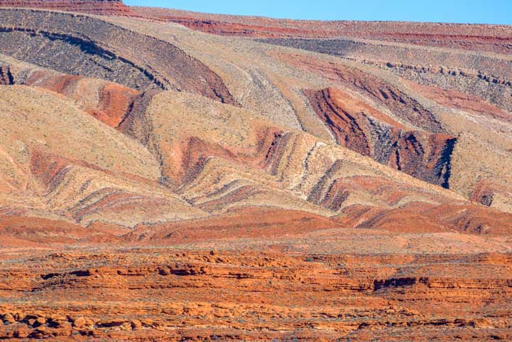
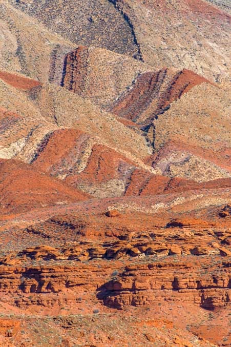
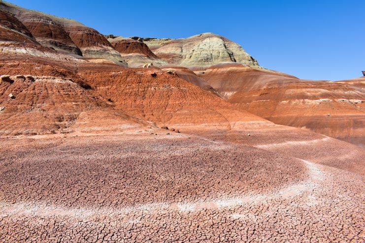
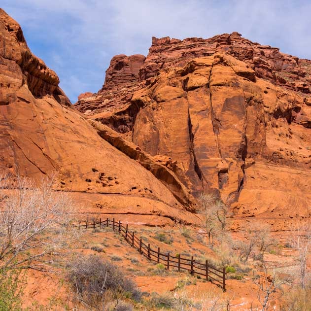
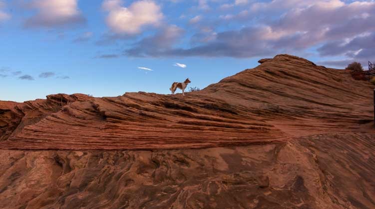
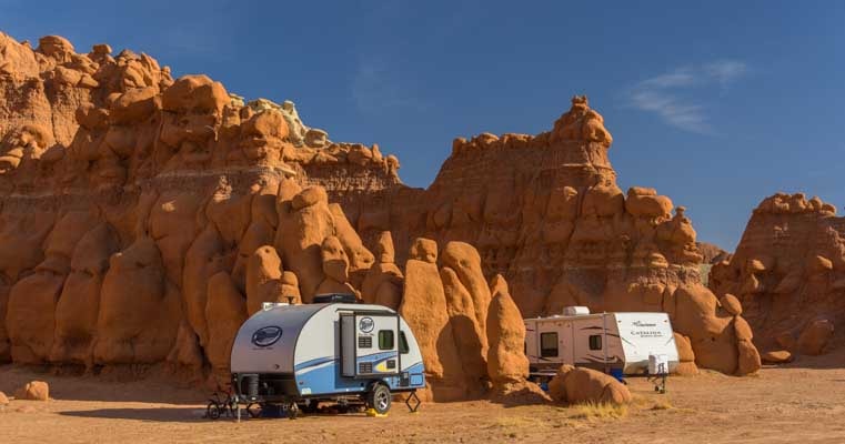
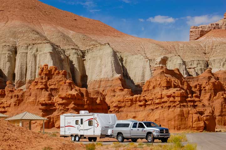
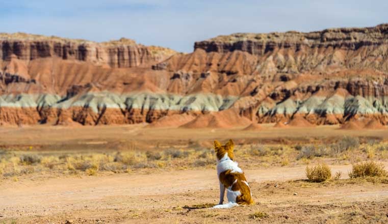
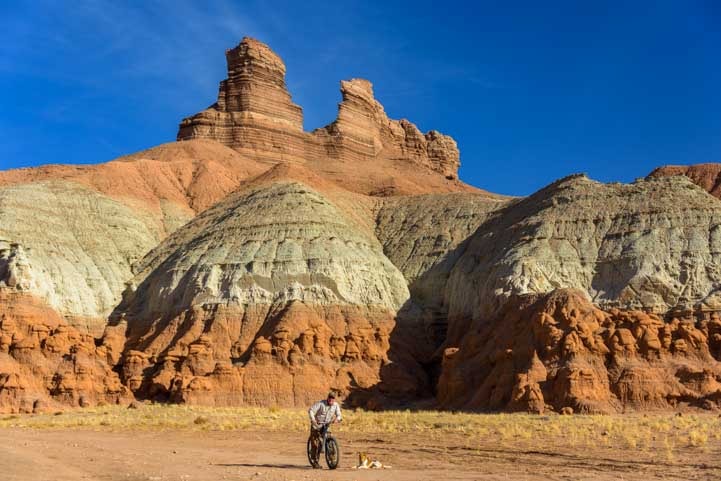
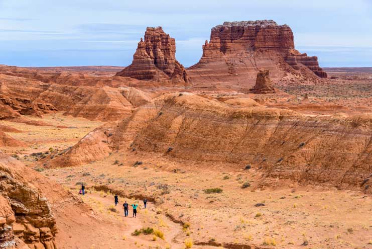
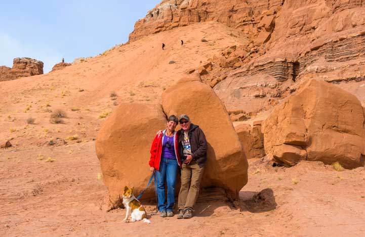
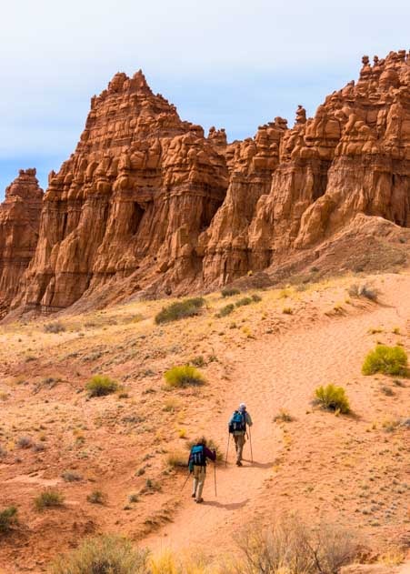
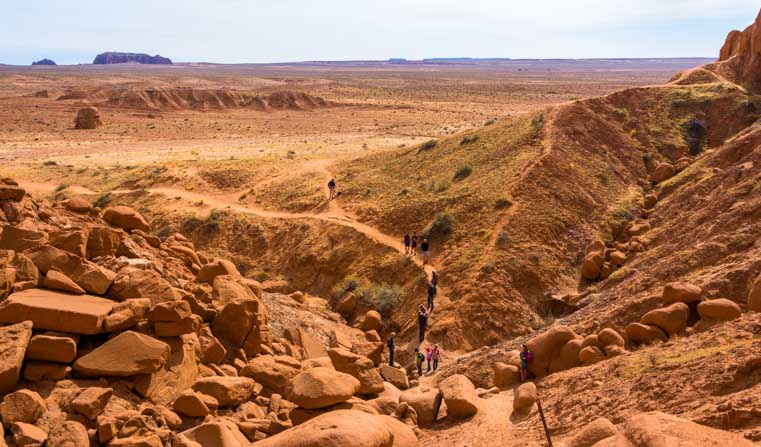
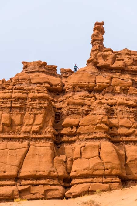
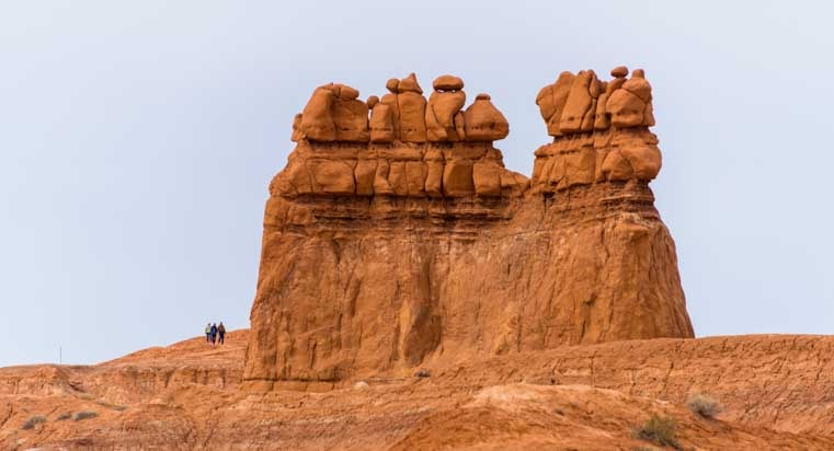
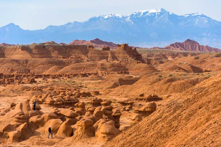
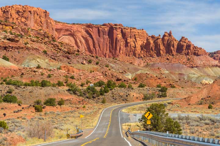
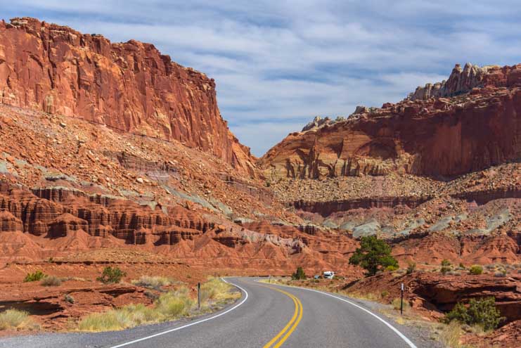
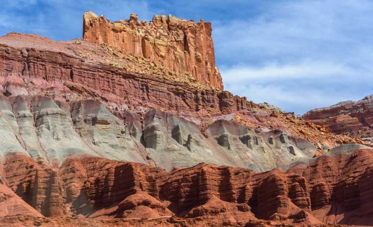
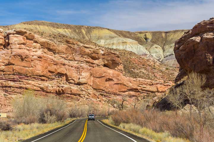
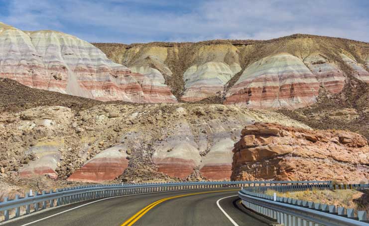
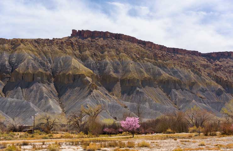
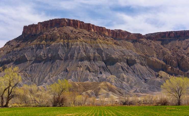
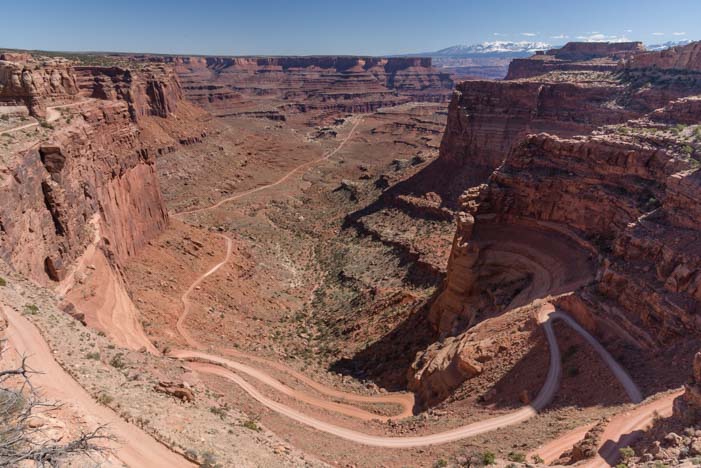
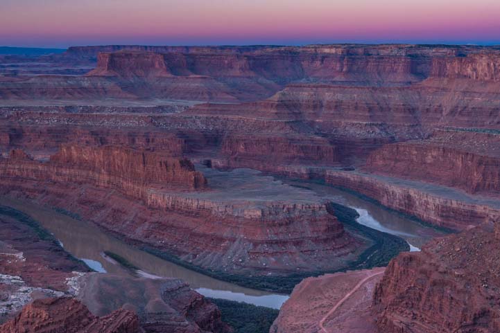
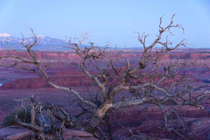
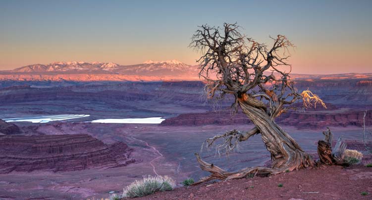
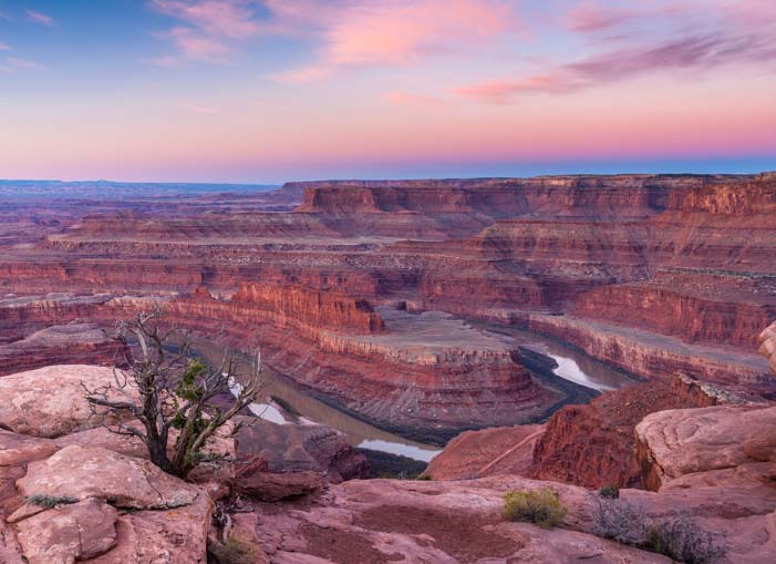
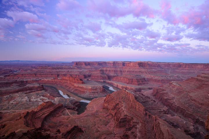
Heavenly Theatrics in Utah’s Red Rocks

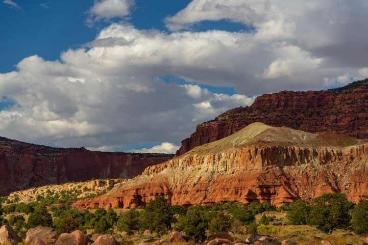
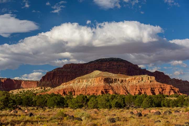
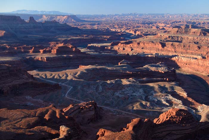
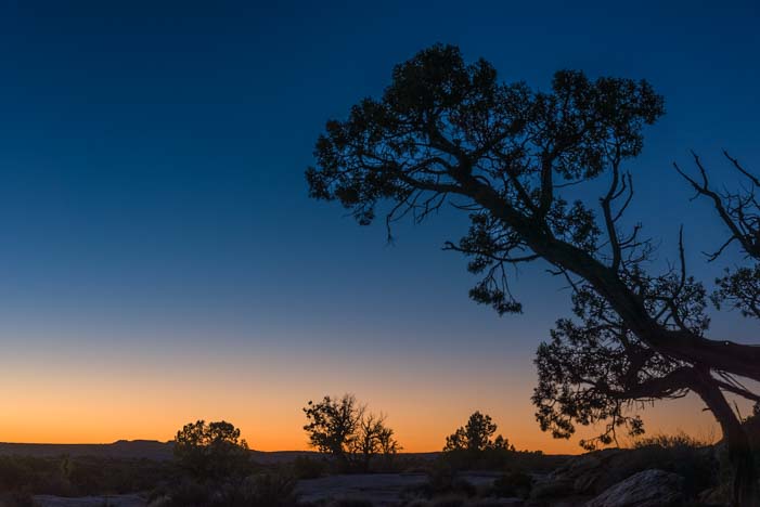
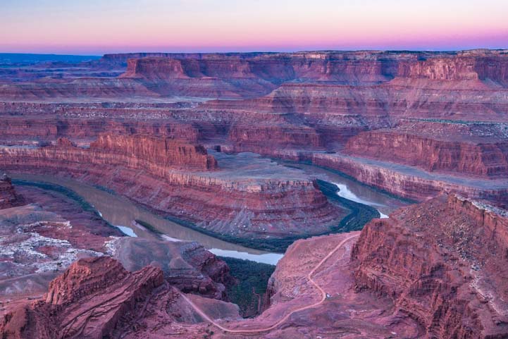
September 2019 – We spent a lot of time roaming around in the backcountry of Utah in recent weeks, and some of our best days were when we the skies grew gloomy or when the sun and clouds chased each other across the beautiful vistas.

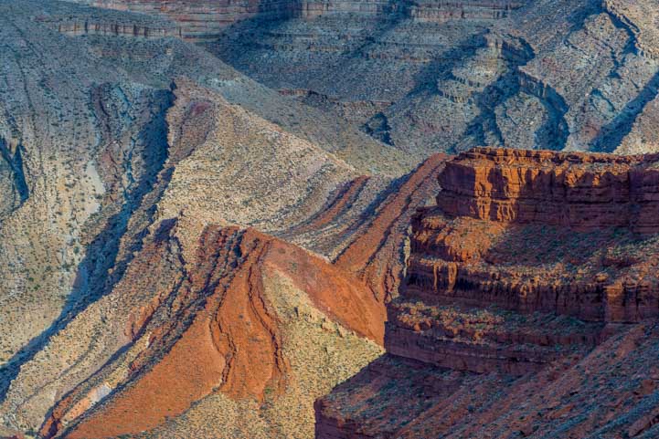
FB 1200 Light and Shadow in the red rocks of Utah

.

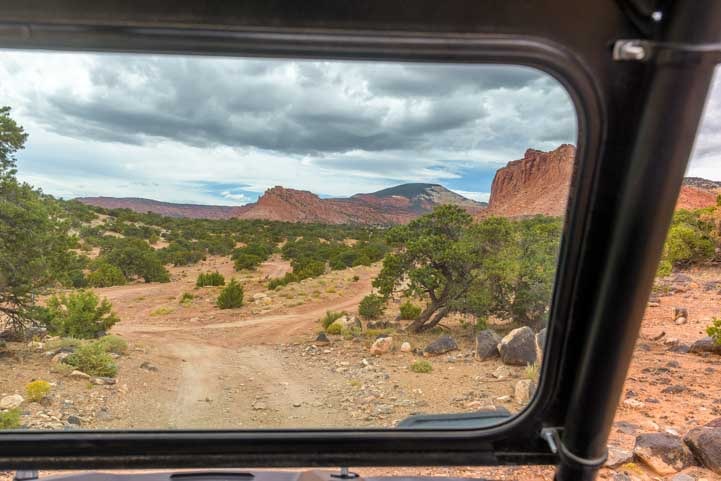
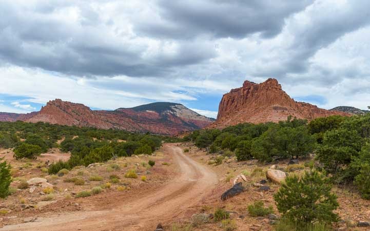
Some of the trails and two-track roads we ventured out on started out simply enough.

Backcountry trail in Utah-min

Red rocks beckon in the distance.

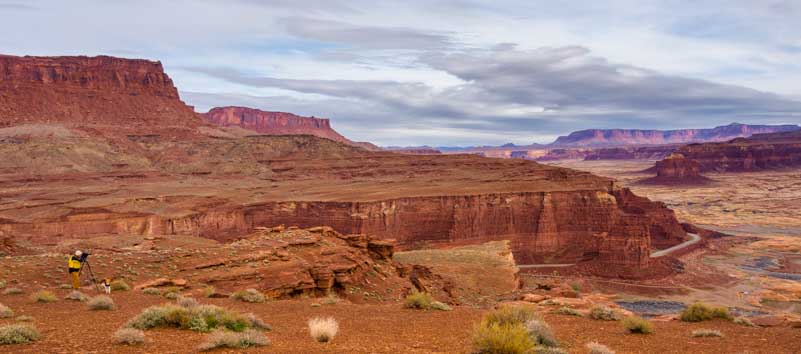
And then within a few minutes we’d find ourselves staring at the most amazing view from up on a plateau.

Red rock vista Utah-min

What a view!

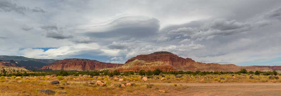
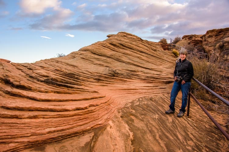
Sometimes storm clouds would gather, and we’d notice the patterns they formed in the heavens complemented the patterns of the rock formations on the ground.

Red rocks and clouds Utah-min

.

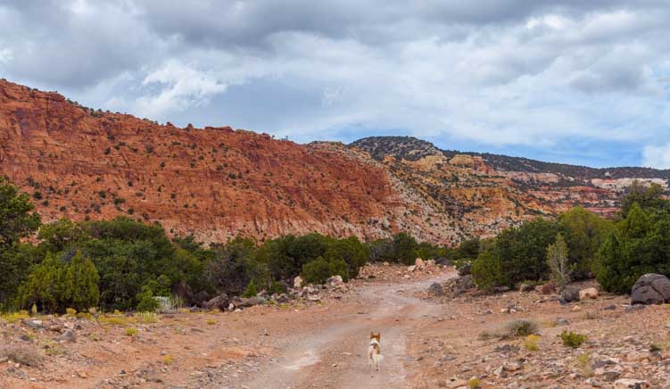
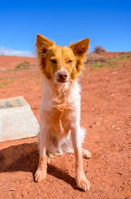
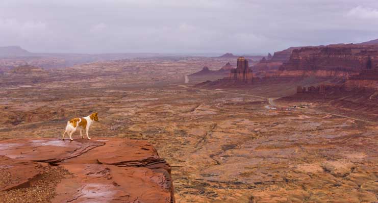
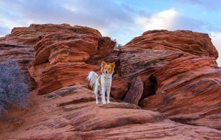
As we would gawk at the mysterious wonder of the beauty before us, Buddy would keep it real and look for chipmunks in the bushes!

Puppy in red rocks Utah-min

.

There are vast networks of trails and two track roads through all the Utah National Forests, and the possibility of discovery lured us down one trail after another.

Red rock view from a Polaris RZR in Utah-min

.

Cloud formations and red rocks in Utah-min

.

On some excursions the dramatic views changed with every turn in the road or trail. Our little Trail Scout would lead the way, but sometimes he’d have to run back to us to see what was taking so long (we’d be busy with our cameras!).

Red rock trail in Utah-min

.

Puppy on the trail in the Utah red rocks-min

.

Running on a red rock trail in Utah-min

.

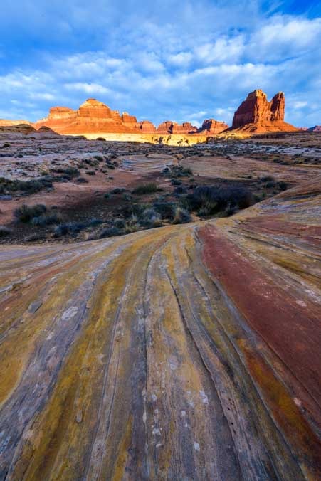
Shades of orange and red dominated many landscapes, but we found the most curious patch of yellow rocks mixed in with the orange ones in one spot.

Yellow patches in the Utah red rocks-min

.

The cloud patterns were astonishing and everchanging. One day, we watched one group of clouds that looked like space ships moving across the sky. It was amazing how these clouds and others seemed to mirror the shapes of the rock formations below.

Crazy clouds in the Utah red rocks-min

.

Wild cloud pattern over red rocks in Utah-min

Wow!

Beautiful red rocks in Utah-min

.

One afternoon the sun came out and chased the big fluffy clouds all over the sky. The sun spread warmth and light across the hills only to have the clouds sweep everything into darkness for a brief moment. Then the sun would return and embrace the land once again.

Dramatic sky and red rocks in Utah-min

.

Light and shadow on red rocks in Utah-min

.

Red rocks in Utah light and shadow-min

.

Utah red rock cliffs and clouds-min

.

Afternoon sun in the Utah red rocks-min

.

Utah continues to be our favorite state, and it’s easy to see why: breathtaking views like these are all over the place. It’s no wonder that lots of folks say Utah’s most minor destinations would likely be National Parks if they were located somewhere else!

Subscribe
Never miss a post — it’s free!

Related posts:

Our most recent posts:

More of our Latest Posts are in the MENU.   New to this site? Visit RVers Start Here to find where we keep all the good stuff. Also check out our COOL NEW GEAR STORE!! *** CLICK HERE *** to see it!

<-Previous || Next->

Mexican Hat, Utah – A Special Hoodoo in the Red Rocks

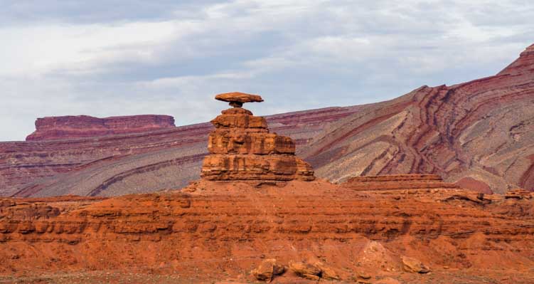
March 2019 – The Utah red rocks are full of whimsical formations that are easily recognizable. One of the most charming is Mexican Hat, a rock formation that unmistakeably resembles a sombrero.

Mexican Hat Utah RV trip adventure

A Mexican sombrero caps off the landscape in Utah.

We were traveling through southeastern Utah with our RV, and before we arrived at this fantastic stone hat we found some wonderful patterns in the red rocks. We spent a little time doing some wide angle photography, playing with the colorful lines in the sandstone.

Leading lines in wide angle photo in Utah-min

.

As the golden hour unfolded before sunset, I was astonished to look down at my feet and see a rainbow of colors!

Wide angle photography in Utah-min

So much color right at my feet!

The red, yellow, orange and gray stripes were beautiful, and we explored these unusual patterns at dusk and again at dawn.

Sunrise with puppy in Utah-min

Buddy watched the sunrise with us.

In some cases we focused our photos on the tiny patterns at our feet, but the size and scale of these immense rock landscapes was mind boggling.

Utah landscape-min

Huge landscapes dwarf Mark and Buddy on a rock outcropping.

In many places the sandstone was solid underfoot, but in other places it gave way to patches of red beach sand and small dunes.

Red rock patterns in Utah-min

Ancient sand dunes turned to stone — lines and patterns everywhere.

Buddy loved lying in the hot sand in the heat of the day and rubbing himself in its toasty warmth.

He also got a kick out of chasing the lizards and birds that live in this exotic land. Of course, the bigger birds just stood their ground when they saw the excited puppy coming.

One crow began to tease him, flying just out of reach and squawking. Buddy took the bait and tore after the crow, running and jumping as the bird swerved and dipped his wings near him.

Suddenly Buddy took a big leap, eyes focused intently on the crow. He misjudged the uneven ground beneath him, lost his footing, and crashed into the sand chest first in a cloud of red dust.

When he stood up and shook himself off he was wearing a pink bib and gloves!

Puppy in red rock sand Utah-min

Buddy sports a peach bib and gloves after taking a flying leap after a bird and crash landing in the sand.

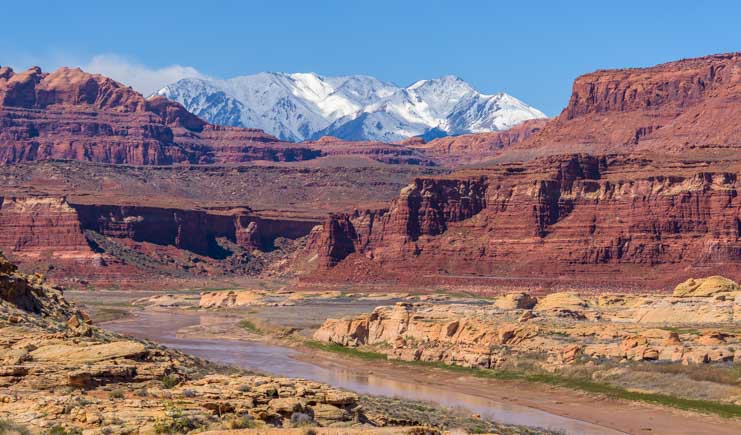
Rivers and waterways are responsible for the fantastic landscapes in this area, and when we drove over a bridge crossing the Colorado River we loved the contrast of the crimson cliffs and snowy mountains in the background.

Colorado River in Utah Glen Canyon-min

Snowy mountains and red rock cliffs.

The landscapes were filled with color and vibrance.

Colorful landscape at the golden hour in Utah-min

Vivid colors at the golden hour.

We crossed the San Juan River at the town of Mexican Hat. After driving over a hundred miles through vast empty landscapes, this village perched above the river was a fun surprise, and we got out to explore a bit.

Colorado River Bridge at Mexican Hat Utah-min

The village of Mexican Hat is perched along one side of the river.

Someone had put a three-legged chair in a spot with a great view of the village on the opposite bank. You never know what you’ll find out here!

Town of Mexican Hat Utah-min

Have a seat — but don’t fall over!

We continued on and the skies clouded over. Storms brewed in the distance while the sun lit portions of the land here and there. What a magical place.

Storm clouds and rain over red rock landscape in Utah-min

Storm clouds and rain drift across the red rock landscape.

Storm and dark clouds in the Utah red rocks-min

The rain never made it to us, but what a wonderfully brooding sky this was!

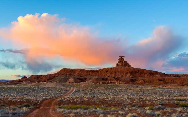
The village of Mexican Hat is named for the fun rock formation that looks like a Mexican sombrero. It was easy to spot and made us smile. What a perfect name for this formation and the village nearby!

Mexican Hat rock formation under storm clouds in Utah-min

Mexican Hat is impossible to miss!

Buddy decided to try it out and see how it fit.

Sombrero Mexican Hat over puppy-min

Buddy tries the hat on for size.

Catching it from different angles and zooming in, the hat really dose look like a sombrero.

Mexican Hat Utah-min

It’s a true sombrero from this angle!

Just how big is this rock formation? Enormous! There were some hikers standing at its base…

Hikers at Mexican Hat Utah-min

It doesn’t look that big until you notice the hikers!

As the afternoon wore on, the hat cast its shadow across the valley below.

Shadow of Mexican Hat rock formation in Utah-min

In the late afternoon Mexican Hat cast a shadow across the valley.

And as the sun set it became a silhouette against the sky.

Mexican Hat Utah sunset silhouette-min

.

And then it grew wings.

Sunset at Mexican Hat Utah-min

With colorful flying clouds!

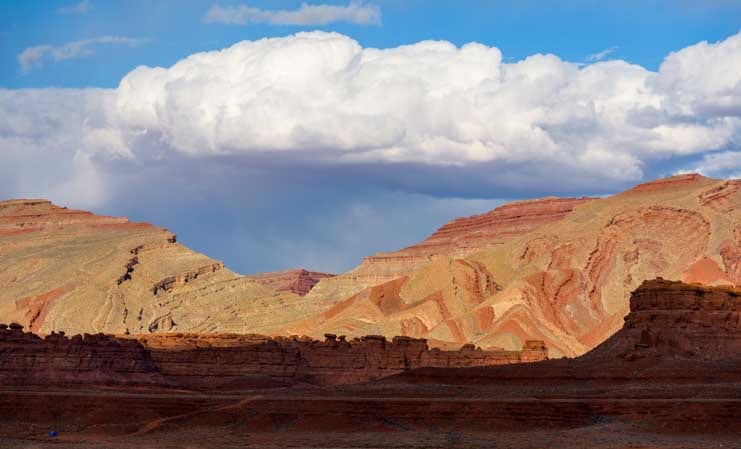
Continuing on, we saw incredible wavy patterns in the red rocks.

Clouds over red rocks in Utah-min

We noticed vivid patterns in the distant hills.

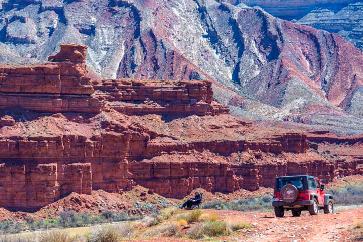
We hopped in the RZR to drive into the landscape a little further. We rounded a bend and found a couple taking a break from their Jeep ride to enjoy a quiet moment in their camp chairs with a fabulous view.

Polaris RZR ride in Utah red rocks-min

We followed a jeep road into the landscape.

Exotic landscape in Utah-min

A couple relaxes in their camp chairs in the middle of their Jeep ride!

These landscapes just begged us to head off into the red rocks to take photos.

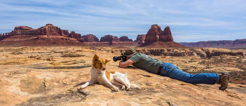
Photographer in Utah red rocks-min

Mark heads out to take some pics.

We were drawn to the swirling patterns on the hillsides and couldn’t stop our cameras from clicking away.

Swirling rock formations in Utah-min

Triangular patterns swirled across the base of the mountains.

Red rock swirl formations in Utah-min

Red rock waves.

Wave patterns in Utah red rocks-min

An undulating landscape.

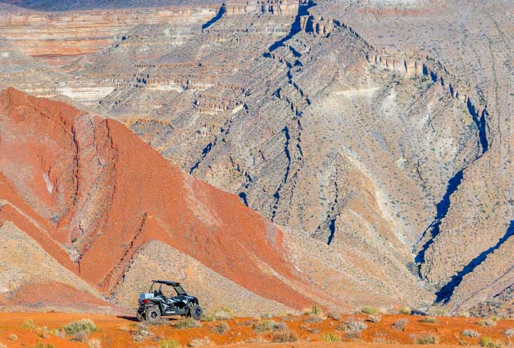
Just how big are these wavy patterns? I had wandered around on foot exploring and then I looked up and noticed our RZR leaning up against this jaw-dropping landscape. Wow!

Wavy patterns in red rocks with scale shown by Polaris RZR-min

How big are those patterns? Pretty big!

With that in mind, here are a few more images taken as clouds rolled in overhead.

Wavy red rock patterns and swirls in Utah-min

Approaching clouds played with the light.

Utah red rock wavy patterns and swirls-min

.

We wanted to stay longer, but it was still quite cold in this part of Utah. Our fingers and toes were tired of being numb! We had been in long pants and jackets for too long and we were ready to get back to central Arizona where the temps were hovering in the high 70s. Ahhhh….!

Fifth wheel trailer RV triple tow-min

What a great area. We’ll be back!!

Subscribe
Never miss a post — it’s free!

More from Southeastern Utah:

Our most recent posts:

More of our Latest Posts are in the MENU.   New to this site? Visit RVers Start Here to find where we keep all the good stuff. Also check out our COOL NEW GEAR STORE!! *** CLICK HERE *** to see it!

<-Previous || Next->

Traces of Antiquity and the Not-So-Ancient in Utah!

March 2019 – Over the years we’ve been asked how we plan our travels, and we’ve usually said that we move on or stay put on a whim. But it might be more accurate to say that we generally follow the weather, staying put when it’s nice and moving on when ugly conditions are expected.

This has made for some hasty departures with rain, sleet or snow looming, but until this past week we have never been stuck right where we were because of deep mud!

Utah RV trip

Hitting the road is easier when you don’t have to drive through a foot of mud

The Utah desert is filled with sandstone, sand and silty stuff, and when it is dry it hardens to something like concrete with a soft layer of dust around the edges. But when it rains for 48 hours, as it did while we were camping, the water soaks into the silty sand and makes a very squishy mud.

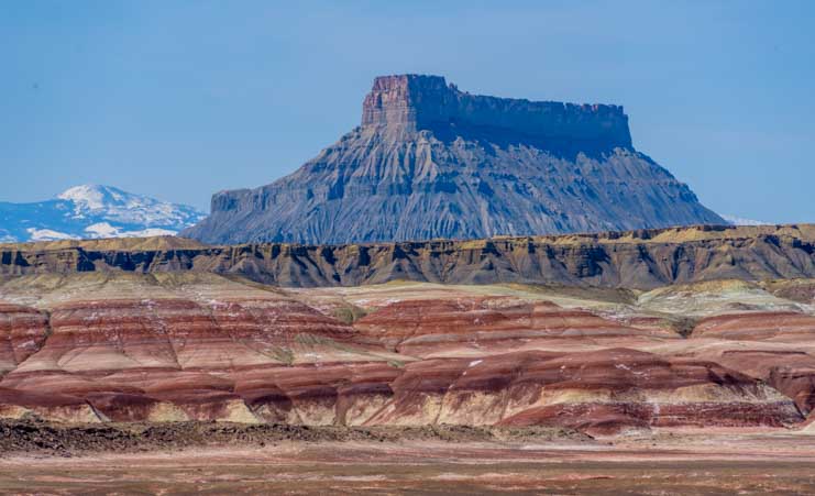
Factory Butte Utah-min

An immense tower rises out of Utah’s red rocks courtesy of rain, wind and sometimes drippy muddy conditions

As we drove to and from our campsite every other day or so, our truck swam through portions of the road, even in 4×4 low gear at 5 mph. There was no way we could tow our 14k lb. trailer out of there.

So, we stayed put and we waited for the mud to dry!

Utah landscape near-far wide angle image-min

While we were waiting for the mud to dry we practice the near-far composition techniques we’d learned in our photography workshop the week before.

We kept busy practicing the wide angle photo techniques we had just learned. The key to putting some real zing into this kind of photography is having a fabulous sky and a fabulous foreground right at your feet. Finding those things is no small trick, though, even in this wonderfully scenic part of Utah.

Puppy Uah landscape near-far wide angle image-min

The near-far wide angle view is a new way of seeing for us, but we’re starting to get the hang of it!

We spent hours scouring the area looking for engaging backdrops in the distance and fascinating foregrounds at our feet while hoping we’d get a jaw-dropping sunrise or sunset to top it off.

The sky didn’t cooperate, but we did find some lovely places and really enjoyed the search.

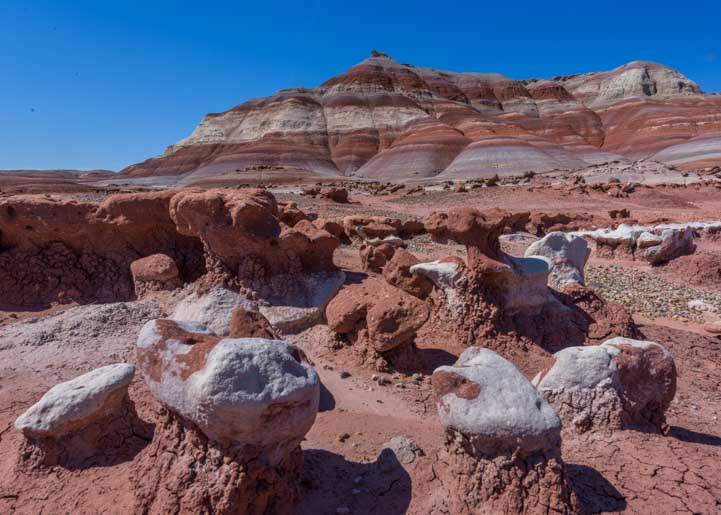
Utah red rock landscape-min

Low toadstool hoodoos and softly rounded mountains

Of course, what’s funny about doing this kind of photography with our pooch Buddy along is that he has a habit of photo-bombing our shots. We’d get everything set up just so, and then Buddy would suddenly wander right through the middle of the photo, sniffing around and curious about what we were up to.

Utah red rock landscape with puppy-min

Buddy stops by right in the middle of things to say hello!

While I was crawling around on my hands and knees to try and capture these ground level images, Mark hiked up onto the colorfully striped mounds in the distance and took some stunning pics of the softly rounded shapes from eye level.

Striped hills in Utah-min

Up close, the softly rounded mounds were very beautiful

Colorful hills and mounds in Utah-min

The hills were a wide variety of earth tone colors

Utah striped mounds-min

Natural patterns

Slowly, the mud slowly began to dry everywhere, and it made pretty patterns of cracks as it shrank. Mark noticed the pattern of a tree in one set of cracks.

A tree in the cracked mud in Utah-min

The image of a tree appeared in the cracking mud

With the mud quickly drying, we realized our escape from our campsite had to be timed so that the mud on the road was sufficiently dry but the predicted strong winds hadn’t yet begun whipping dust around. Everyday we surveyed the mud and it seemed like our leave-taking was still a few days away.

But Mother Nature has her own sense of timing and her own schedule.

One day, just as we were returning from a walk down the road and agreeing that we should give it another day or two, the predicted winds suddenly arrived and kicked up some huge clouds of dust.

Yikes!

Dust and high winds in Utah-min

Buddy squints his eyes as he makes his way through a swirling dust cloud.
Wild dust storms are the desert West’s answer to the hot and muggy stickiness of mid-summer in the East!

When the desert becomes enveloped in dust storms you can get white-out conditions, and that thin layer of silt finds its way onto everything in the camper, even with the doors and windows closed. Just one swirl as you open the door and dash inside can be enough to coat the counters and table with grit.

It was time to leave!

Within an hour we were swimming down the muddy section of the road, but we had just enough traction to make it out.

Once the tires hit the pavement we heaved a huge sigh of relief!

We headed south on US-95 which is also known as the Bicentennial Highway because it was completed in 1976. It is one of Utah’s most spectacular scenic drives with occasional pull-outs where you can stop to take a photo or rest a bit. After driving for a while we pulled over to stretch our legs.

Hog Canyon Utah-min

The beautiful scenery on the Bicentennial Highway was a welcome sight after our great escape!

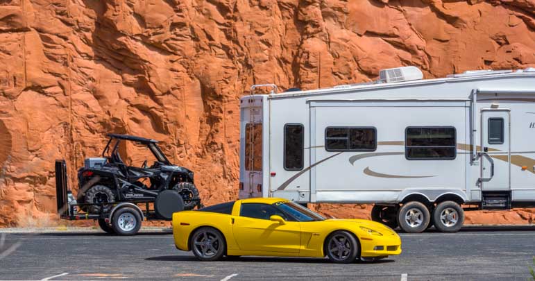
A gorgeous yellow Corvette had stopped too. We’ve often said that if we ever stop traveling by RV we might start traveling by sports car and motel. Wouldn’t that be fun! What better way to see America’s incomparable scenic drives that in a zippy and maneuverable Porsche?! We had the chance to do just that in Colorado a few years ago, and what a blast that was! (Blog post here).

RV and Porsche and side by side-min

There are many ways to travel and they’re all fun!

We wandered through the brush by the side of the road and crossed a narrow stream and found ourselves in a shallow cave. Such wonders. Our spirits soared as we roamed around.

View from cave in Utah-min

Mark takes a pic from the floor of the cave

One of the things I love most with Utah’s red rocks is the “desert varnish” on the surface of many cliff faces. It appears as though the gods have taken cans of paint and spilled them over the edges. Jackson Pollack may have made human drip painting famous, but for me, these paintings made by Mother Nature have him beat.

Desert varnish on red rocks in Utah-min

Nature’s drip paintings on towering red rock cliffs.

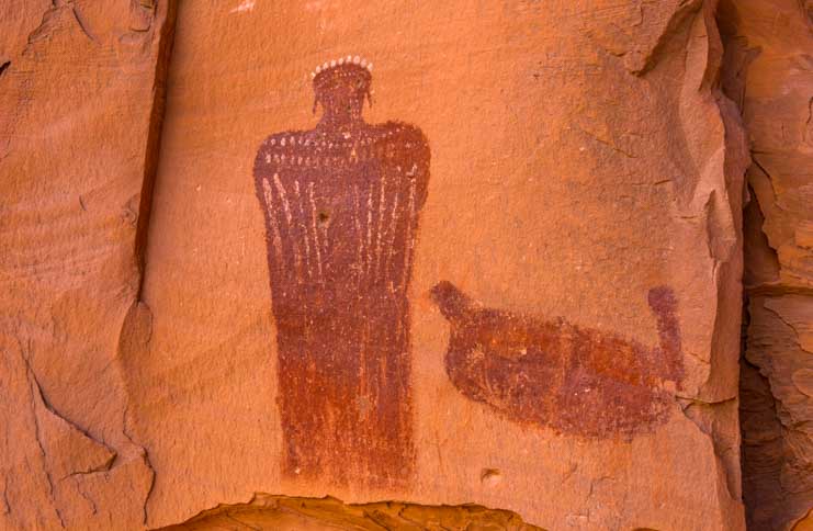
Artistic expression fill human history back to prehistoric times, and the ancients who lived in Utah thousands of years ago were no different. Using some kind of method to impregnate the smooth cliff walls with various colors, they created pictographs that remain to this day.

Buddy came across an especially beautiful one.

Puppy finds Moqui Queen pictograph in Utah-min

“Look what I found!”

It was about five feet tall and seemed to depict a person wearing a crown of some kind, along with decorations across the neck and shoulders as well as earrings. The figure appeared to have bird wings with long flight feathers, or perhaps it wore a cape that concealed its arms.

I have no idea what the thing next to this being was. But surely the person who meticulously created this image eons ago knew exactly what it was. If only it were possible to know the origins of the artwork in the context of the culture that created it.

Gazing at this image of a very specific something — human? god? — I remembered my astonishment when we watched a school field trip of young kids visiting the evocative ancient pyramid ruins at Monte Alban near Oxaca in southern Mexico.

As the kids sat attentively listening to a guide teach them about some huge stone carvings the Zapotecs had made, he pointed to various images in the stone sculptures and asked the kids if they recognized who they were.

With each question, a few kids’ hands shot up and they answered eagerly. They had studied the ancient mythology that had its roots right where they were sitting.

Moqui Queen pictograph in Utah-min

This intricately detailed pictograph is about five feet tall and appears to be a person wearing a crown and ornaments around the neck and shoulders, and it seems to have either an elaborate cape or wings.

Not too far from this incredible pictograph we found some more recent petroglyphs. The difference between pictographs and petroglyphs is that the pictographs are made by impregnating pigments into the rock face while petroglyphs are made by pecking out an etching.

It’s not so easy to make images by pecking, and in many places we’ve seen poor modern attempts to scrape the rock alongside the expertly made petroglyphs that are hundreds or thousands of years old. However, in this spot some enterprising people whose petroglyph efforts are now fading into recent history did a pretty good job of making a lasting impression.

These petroglyphs dated back as far as 1941 which was long before the Bicentennial Highway was built in 1976 and also before Glen Canyon was dammed to form Lake Powell in 1963.

In the 1940s there was just a rough 4×4 road that, legend has it, a local miner had built between Hanksville and Hite using a borrowed bulldozer!

Modern petroglyph in Utah-min

“Roy Despain + Madeline II – September 1, 1941”

Roy and Madeline covered some rugged terrain to put their mark on these rocks. I wonder if they are still around and if they ever return to see their names on the cliff wall.

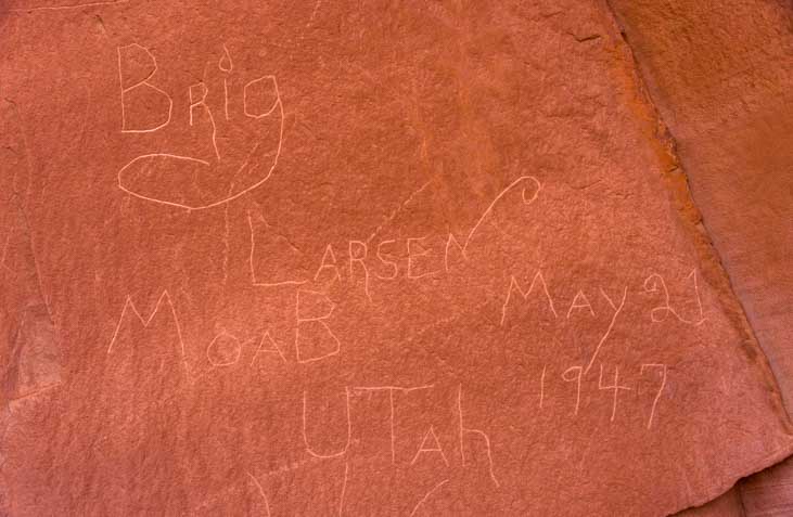
Nearby Brig Larsen left his or her name and listed the town of Moab, Utah (his/her hometown?) and the full date of May 21, 1947.

Modern petroglyph in Utah-min

“Brig Larsen – Moab Utah – 1947”

In 1946, a year prior to Brig pecking out his petroglyph, a geological survey described the concept of a future road going between the mining town of Hite (now submerged under Lake Powell) and the Mormon farming town of Hanksville. A quote from that geological survey says:

“Plans are being considered for a road across the Colorado River at Hite and eastward… At the present time (1946) the road follows the bottom of North Wash and a cable-barge ferry is maintained for crossing the river. In time, no doubt, an improved road will be built that avoids the canyon bottom and crosses the river by bridge, probably near the mouth of the Dirty Devil river. Such a road would be one of the most scenic highway in America.”

How right they were as they looked 30 years into the future!

Nearby a Mr. (or Ms.) S. Allan also made a petroglyph with the date “41.” Was he (or she) traveling with Roy and Madeline in 1941? Maybe they all reached this spot together and decided to put their names on the rock much as the Mormon pioneers had done at the Mormon register which is now inside Capitol Reef National Park.

Ironically, someone named Lockyer visited to the same spot in 1978 after the Bicentennial Highway was fully built and paved with asphalt. I wonder if he intended to write over S. Allan’s date or if he realized only after he got going with his rock pecking that he hadn’t allowed enough room for his name.

Modern petroglyph in Utah-min

“S. Allan 41” and “Lockyer 78”

Either way, I’m just assuming that the numbers “41” and “78” refer to years these people were here in the 1900s. But who knows, they could be their birth years or they could be numbers from their high school varsity sports jerseys!

So it goes with the masterful guesswork of archaeology, whether studying the artistic footprints left 80 years ago or 800 years ago or more.

One thing we’ve noticed in the shifting sands of time here in southeastern Utah is that it is not so easy to leave an indelible footprint. We’ve been here only two weeks, yet the footprints and tire tracks we first put down two weeks ago have almost disappeared. The rain and wind have all but erased them from ever being.

Even the muddy tracks on the dirt road had already begun to flatten out.

Photography in Utah landscapes-min

Happy times in Utah.

Subscribe
Never miss a post — it’s free!

Map of the Bicentennial highway

More articles featuring pictographs and petroglyphs:

More articles featuring Utah’s scenic drives:

Our most recent posts:

More of our Latest Posts are in the MENU.   New to this site? Visit RVers Start Here to find where we keep all the good stuff. Also check out our COOL NEW GEAR STORE!! *** CLICK HERE *** to see it!

<-Previous || Next->

SE Utah – A Mars Colony, Wide-Angle Photography & Snowy Mountains!

March 2019 – We arrived in southeastern Utah just as snow flurries were abating. It was unseasonably cold, but at twilight the Henry Mountains were utterly radiant, a visual gift that was a happy exchange for having to run around in hats and mittens in mid-March!
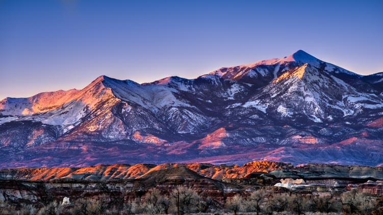
Henry Mountains Utah at dusk-min

Henry Mountains at dusk

We snuck out at the first light of dawn and found the red rocks were glowing with an inner beauty.
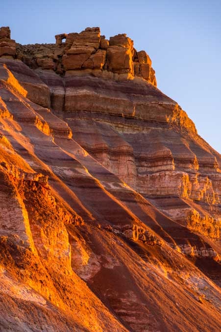
Utah Red rocks glow in early morning light-min

Radiant red rocks at dawn

When a thick blanket of clouds filled the sky and chased the sun away for a few days, we could see the myriad of colors that are hidden in many of the exotic rock formations.

Colorful rocks in Utah-min

Lots of earth tone colors in the rocks

Off in the distance the classic desert mesas led the way to the horizon in receding layers.

Layered mesas in Utah-min

Mesas on the horizon

An excursion to the Dirty Devil River revealed an immense canyon reminiscent of tributaries within the Grand Canyon.

Dirty Devil River and canyon-min

Dirty Devil River and Canyon

We got a few sunny days, and with the ground still damp from the recent rains, we enjoyed some dust-free rides on our Polaris RZR.

Polaris RZR and puppy with driver in Utah-min

“Are we going for a ride? Yippee!”

Puppy and Polaris RZR in Utah-min

“I want to run alongside for a while.”

These UTV rides took us into the back country of Southeastern Utah where we went from one jaw dropping landscape to another. In some places the desert was flat and wide with immense jagged boulders balancing on the soft soil here and there.
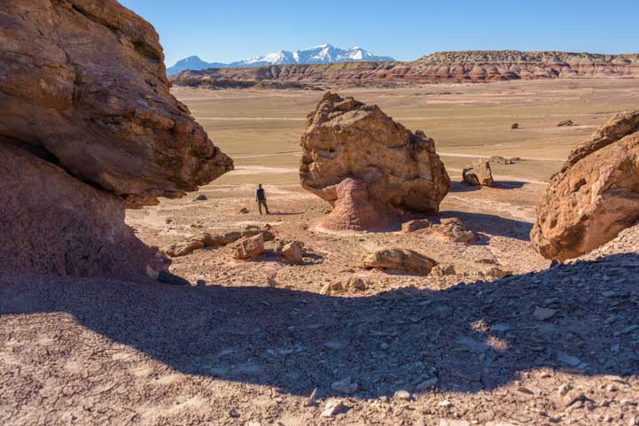
Rock formations in Utah-min

It’s easy to get lost in these rocks!

In other places vividly striped mounds formed a gently rolling landscape.

Puppy explores striped red rock dunes-min

Buddy checks out the rounded mounds of purple, pink and deep brown rocks

Snow capped mountains and purple striped red rocks in Utah-min

Moonscape

“It feels like we’re on another planet!” We kept saying to each other!

This land is so photogenic it’s hard not to take a photo with every step. And it is so whimsical and cheery you just have to strike a pose in a lot of shots too!

Rock formations in Utah-min

Buddy watches Mark pose praising the heavens under a jagged spire.

Utah’s breathtaking and otherworldly landscapes are beloved worldwide, and lots of folks from all over the place come to visit in large numbers between Spring and Fall.
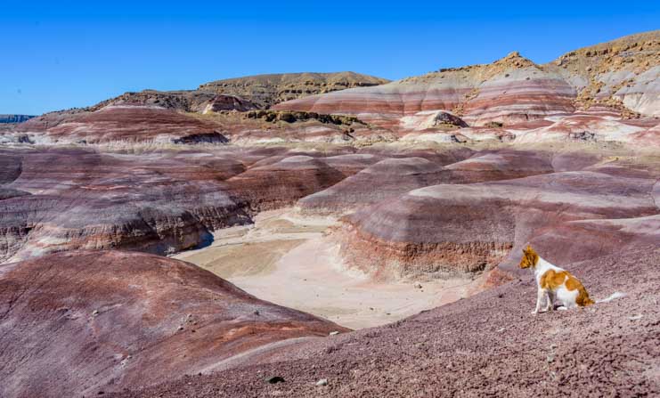
Purple striped red rocks in Utah-min

A huge labyrinth of a layer cake.

When we arrived in Hanksville, a massive and sweeping public land bill had just become Federal law with enthusiastic support from almost everyone in Congress.

We hadn’t known anything about it, but as we talked with the locals we soon discovered they weren’t too pleased. They were frustrated that motorized and mechanized vehicle access to some of the most popular places nearby will be prohibited because they’ll be designated “Wilderness” areas. Also, the locals hadn’t been notified of the bill until three days before it was voted on, so their views were never heard.

With those conversations still ringing in our ears, we were astonished to take our RZR around a corner on a well trodden road on the Bureau of Land Management’s vast square miles of open public land and suddenly see a sign planted in the ground that said:

“The Mars Society. Private Property. No Entry Please.”

Mars Desert Research Station Utah-min

Mars…or BLM land in Utah?

We stood by the sign and stared at the buildings lined up against the striped red rock mounds in the distance. There was a collection of what can only be described as Mars Pods along with a large solar panel array installed on the ground nearby.

We looked at each other in amazement. What in the world was this?
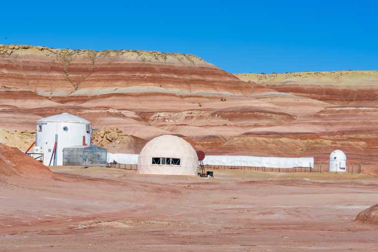
Mars Desert Research Station Utah-min

A Mars colony

We heard voices yelling in the distance and saw the door of the main pod opening and closing repeatedly as young, energetic people ran in and out the door. The yelling didn’t sound like English.

I cupped my hand to my ear to see if I could figure out the language they were speaking, but I couldn’t tell. My first guess was Spanish, and then I thought I heard some French.

Main Pod Mars Desert Research Station Utah-min

There was lots of commotion in a foreign language.

Suddenly, a side-by-side four wheeler came driving out from the pods towards us. There was no engine noise. It looked to be a Polaris Ranger UTV that had been converted to run on an electric engine.

Then two more Mars Rover side-by-sides appeared behind it.

The three vehicles zoomed passed us in a flash and disappeared down the road. One had the word “Opportunity” across the front hood, and they all had a pair of young folks in the seats.

Mars colonizers at Mars Desert Research Station Utah-min

Three UTVs converted to electric engines zipped by

We decided to head into the compound and see if we could learn a little more about what this place was. Driving a short distance, we arrived at the main pod and were greeted by a friendly dog and a young man.

“What is this place?” I asked him.

“Private property.” He said with a strong accent.

“I thought this was BLM land. Public land.” I said.

“We’re borrowing it.” He told me.

Mars Desert Research Station-min

Mars Desert Research Station

I asked if he meant they were leasing the land from the BLM, rather than borrowing it, and he nodded, and then I asked where he and his friends were from, and he said Peru.

He went on to explain that international groups of kids visit this place on two week rotations to live in the Utah desert and drive around in electric UTVs so they can get the feeling of what it would be like to land in a desolate landscape on Mars and establish a human colony.

We later learned that one of their current tasks is to fly teams of 8 drones at a time over the Utah landscape to make digital image maps.

We also learned from some Utah Capitol Reef area tourist literature that describes this Mars colony that whenever the kids step out of the pods into the Utah landscape they are supposed to be wearing space suits just as they would on Mars.

Curiously, we did not see a single space suit on any of the kids going in and out of the pods or driving the UTVs across the desert. They were in street clothes and they looked no different than any other ATV/UTV owners who like to cruise around on dirt roads and go exploring.

Mars colony rovers in Utah-min

Future Mars colonists drive off into the desert in their UTVs to map the desert by flying teams of 8 drones at a time! Despite claims they wear space suits, they actually wore street clothes and looked no different than any other ATV/UTV group playing in the desert.

When we left, we saw a large sign on one of the building pods that said, “All funding by private donations. The Musk Foundation.”

The Musk Foundation-min

Major Sponsors (all funding via private donations)
The Musk Foundation

As I’ve said many times before, the public land debate is immense and complex and there is a lot more to it than meets the eye.

We continued on our own little safari at a modest 18 mph down the dirt road, lost in our own thoughts.

Suddenly, a huge SUV came up behind us from the direction of the Mars colony at about 40 mph and swerved around us, narrowly missing the left side of our little open air buggy. The driver hadn’t beeped to let us know he was coming, and we were left in a cloud of dust.

Dust flies off fast car on Utah desert road-min

Yikes! That was close!

We had come Utah very early this spring to attend a photography workshop with Ian Plant that soon got underway. It was focused on how to take wide angle images that emphasize near-far contrasts.

This was fascinating to study, and we had some outstanding experiences both in the classroom and out in the field.

It will take us a while for us to master the techniques we learned, but we had a lot of fun starting to retrain our eyes to look for interesting patterns at our feet and combine them with interesting things in the distance.
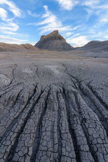
Near-Far wide angle perspective-min

We practiced near-far compositions that go from the shapes at your feet to shapes on the horizon
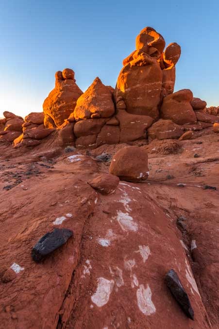
Morning glow on Utah red rocks-min

More practice with some red rock hoodoos at dawn.
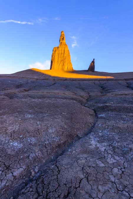
Utah pinnacle at sunrise-min

Early morning light envelops a distant pinnacle.

There are quite a few slot canyons in the area, and these proved to be wonderful for wide angle photography and playing with the shapes created by shafts of light.

Leprechaun Slot Canyon Utah-min

Beautiful light inside Leprechaun Canyon

At one point our instructor, Ian, walked towards Mark as he was taking a photo. The light hit Ian perfectly and suddenly he looked like he was receiving a message from God or being beamed up to the USS Enterprise!

Ghost in the light in a Utah slot canyon-min

The ghost of our instructor

Mark also got a fantastic selfie at a slot canyon opening.

Slot canyon in Utah-min

Mark took a selfie.

There are sand dunes in the area too. Talk about an other-worldy landscape!

Sand dunes in Utah-min

Maybe this really is Mars

After the workshop was over, the rain and snow returned. We watched in awe as banks of black clouds came in.
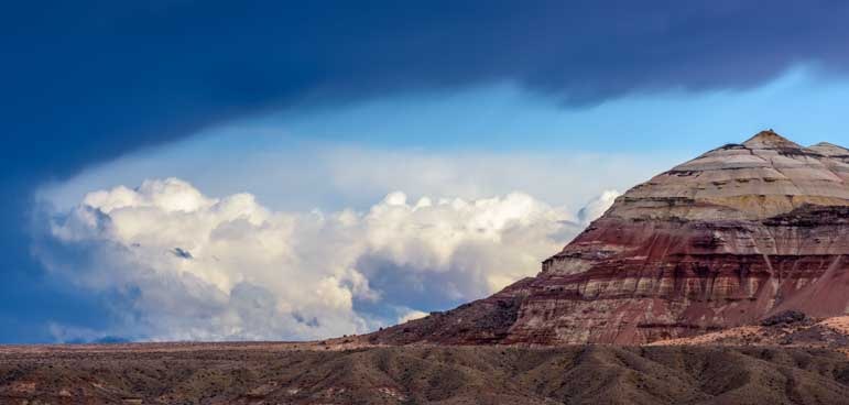
Incoming storm in Utah red rocks-min

An approaching storm

The snow-covered Henry Mountains were suddenly surrounded by swirls of clouds that changed shape with every passing minute.

Henry Mountains with snow panorama Utah-min

Clouds surrounded the Henry Mountains

Clouds over snow capped Henry Mountains in Utah-min

Late afternoon light on the clouds and snow on the Henries

Henry Mountains with snow and red rocks Utah-min

Snow-capped peaks above and red rocks below – Magic!

Snow and clouds on Henry Mountains in Utah-min

The mountain was whisked away by the clouds…!

Snow on Henry Mountains Utah-min

.

There is so much to see in southeastern Utah that we feel like we’ve barely scratched the surface despite several return visits. We think we’re headed back south to Arizona now to finish up a few things there, but the lure of these exotic red rocks and spectacular vistas will probably keep us here a little while longer!

RV Camping in the Utah Red Rocks-min

Southeastern Utah is a beautiful area.

Subscribe
Never miss a post — it’s free!

More info about the goodies mentioned in this article:

Photography Resources We’ve Loved:

Other blog posts from Southeastern Utah:

Our most recent posts:

More of our Latest Posts are in the MENU.   New to this site? Visit RVers Start Here to find where we keep all the good stuff. Also check out our COOL NEW GEAR STORE!! *** CLICK HERE *** to see it!

<-Previous || Next->

Monument Valley & Hite Scenic Overlook – Stone Towers from Below & Above!

March 2019 – What with triple-towing and having a new Polaris RZR side-by-side these days, we had decided not to travel long distances in 2019. But when I got an email announcing that a photographer we admire, Ian Plant, was hosting a four day workshop in southeastern Utah, we decided to make a run for it and take our RV on a nearly 500 mile adventure ride past stunning scenery between Phoenix, Arizona, and the tiny village of Hanksville, Utah.

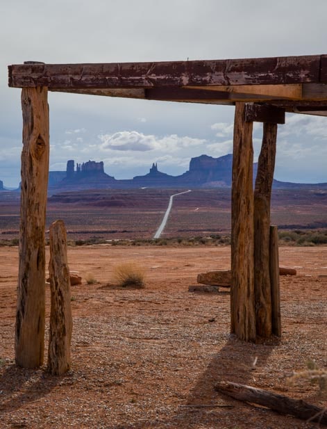
Monument Valley framed by Navajo jewelry stand-min

Monument Valley framed by a Navajo Jewelry stand.

After a crazy cold winter in the Arizona deserts, the temps had just started to warm up in the Phoenix area. But we we hightailed it north for Utah’s higher elevation (and colder) red rock and snowy mountain scenery anyway. Brrr!

What were we thinking?

Just as we crossed through the Navajo Nation into Monument Valley on the border of Utah, the navigation screen on our truck began to flash a Severe Winter Storm Warning for the area!

Monument Valley skyline RV trip-min

Monument Valley skyline

Despite (or because of) the incoming storm, the towering rock formations that form the gateway to Monument Valley stretched across the horizon in dramatic fashion, and we just had to get out and hike down one of the dirt roads to get a better look at them.

Puppy at Monument Valley Utah on RV trip-min

It was time to stretch our legs — whether we had four to stretch or just two.

The clouds intensified as we walked. Every once in a while the sun swept across the vast landscape with the dark storm clouds in hot pursuit. Um… in cold pursuit!! Over on the other horizon a row of red rock cliffs lit up as the sun brightened.

Red rocks in Utah with puppy-min

In another direction a line of red rock cliffs glowed for a brief moment in the distance.

Turning back towards the monuments we noticed a cool cloud had formed above them in the sky.

Monument Valley Utah at twilight with clouds-min

An unusual cloud drifts by in the sky.

We hopped back in our truck for another twenty miles or so and were pelted with rain. But when we turned the corner at Mexican Hat the rain abated just long enough for us to get out again and have a look around.

The Mexican Hat rock formation is very easy to spot!

Mexican Hat Utah

There’s no doubt how the town of Mexican Hat got its name!

Just south of Blanding, Utah, we turned west onto US-95, also known as the Bicentennial Highway, and plunged down lots of 8% to 10% switchbacks to the desert floor far below. This is a fantastic scenic drive that leaves our jaws agape every time we drive it. Even this time in the rain and fog — and snow in the mountains we were passing! — it was still a glorious drive.

How funny, though, in the middle of all that majestic scenery to see an old dilapidated Winnebago sitting in the middle of nowhere. Mark hit the brakes so he could run back for a shot!

Old Winnebago in Utah-min

It might be a little drafty sleeping in there!

Some of the best views on this drive are when it descends into Glen Canyon. I fondly remember how the first time we drove it I was so excited by the beauty that I sat in the window of the passenger’s seat snapping pics as Mark drove!

This time we were driving in rain and mist, but as we pulled into the Hite Scenic Overlook the sun made a valiant effort to push its way out from behind the heavy blankets of clouds.

Hite Overlook Utah-min

The Hite Scenic Overlook is well worth a stop.

The view from the overlook was out of this world.

Hite Overlook Lake Powell Glen Canyon Recreation Area RV trip-min

What a view. That is Lake Powell down there!

What a spot for photography!

Photography at Hite Overlook Glen Canyon Recreation Area Lake Powell-min

Mark sets up a shot of the valley (he’s on the far left side with Buddy!)

We hung around for several hours taking photos. We were standing on a peninsula with views in every direction, and the views went on forever.

The massive stone towers on the desert floor below us looked like they had strayed from Monument Valley.

And how amusing it was to look back at a blog post I wrote about this same area seven years ago and find that I took almost the exact same photo (in sunshine) when we were there!

Hite Overlook Glen Canyon Recreation Area Lake Powell Utah-min

I took almost this exact same photo 7 years ago!

The tiny ribbon of US-95 snaked around in front of the enormous stone towers.

Hite Overlook Glen Canyon Recreation Area Lake Powell RV trip-min

Dazzling scenery, even in mist and fog.

Even Buddy seemed to appreciate the view. He was very cautious looking down over the edge too, holding his weight back as he craned his neck forward to look down at the flat land below.

Puppy at Hite Overlook Glen Canyon Recreation Area Lake Powell RV trip-min

.

Behind us a row of red rocks that stood cheek-by-jowel like city buildings overlapped snowcapped mountains in the distance.

Snowcapped mountains and red rock pinnacles Glen Canyon Lake Powell Utah-min

No wonder we were in jackets and hats — there were snowy mountains right there!

The skies finally began to clear and the last miles of the Bicentennial Highway were flanked with red rock cliffs as we approached the village of Hanksville.

Views on the Bicentennial Highway Utah RV trip-min

Once the rain cleared I got a few pics of the gorgeous winding road that is US-95
The Bicentennial Highway.

At Hanksville, the Bicentennial Highway joins up with Scenic Highway 24 which heads west into Capitol Reef National Park and Grand Staircase Escalante National Monument.

All of the land in the lower half of Utah is spectacular beyond words.

Red rocks on the Bicentennial Highway Utah RV trip-min

Views on the Bicentennial Highway (US-95).

Hanksville is home to about 250 people, and its two gas stations, restaurants and motels are all clustered around the intersection of US-24 and US-95. Most of the back streets in town are dirt. We went exploring and came across the ruins of an old stone homestead. We learned later that this is part of the Giles Ghost Town.

Stone house window Wayne County Utah-min

Someone put some care into building this solid home.

Those stone walls were pretty thick!

Stone house ruins Wayne County Utah-min

This is part of the Giles Ghost Town

All around the area there were lots of exotic rock formations. Some formed beautiful patterns…

Red rock patterns in Utah-min

.

And others made recognizable shapes!

Pinocchio in the rocks in Utah-min

Pinocchio!

Exploring the Utah desert-min

.

We’ll be in this area for another week, improving our photography by day and fending off sub-freezing temps by night!

Sunrise on the Henry Mountains Utah

First light!

Subscribe
Never miss a post — it’s free!

More info about these places:

Other blog posts from Southeastern Utah:

Our most recent posts:

More of our Latest Posts are in the MENU.   New to this site? Visit RVers Start Here to find where we keep all the good stuff. Also check out our COOL NEW GEAR STORE!! *** CLICK HERE *** to see it!

<-Previous || Next->

Canyon Country Highlights – Lake Powell, Horseshoe Bend & More!

January 2019 – Our wintertime National Parks Snowstorm Tour to Grand Canyon and Bryce Canyon was incredible. What a thrill to see snow at both of those gorgeous National Parks. But the drive to get there and back was also spectacular, as it took us past many wonders of Utah’s and Arizona’s “Canyon Country.”

Canyon Country Arizona and Utah Glen Canyon Lake Powell Horseshoe Bend-min

.

Just outside of Bryce Canyon is one of our favorite places, Red Canyon. We love the hiking trails there. What fun it was to see its two tunnels through the red rocks decorated in snow!

Snow at Red Canyon Utah tunnel-min

Red Canyon has two charming tunnels in the red rocks – and in winter they have snow!

The area around Bryce Canyon was beautiful in its winter finery, and we got a huge kick out of driving the scenic roads and seeing familiar red rock formations peeking out from beneath a layer of snow.

Red rocks and a stream in Utah during winter-min

A glimpse of the edge of Red Canyon across a wintry landscape.

Snow on red rocks approaching Bryce Canyon Utah-min

Bryce-like rock formations peered out from the mountains a few miles from the actual Canyon.

Snow at Red Canyon Utah-min

Red rock country makes for wonderful scenic drive in summer, but how beautiful to see it with snow!

The valleys near Bryce Canyon stood silent in their winter slumber save for a few homesteads here and there.

Winter outside Bryce Canyon National Park in Utah-min

The quiet life.

As we descended out of the high 8,000′ plateau where Bryce Canyon is situated, we said goodbye to the snow one last time.

Puppy poses in snow in Flagstaff Arizona-min

Buddy loved the snow, but it was time to leave it behind.

The wonderfully scenic US-89 passes through spectacular red rock landscapes as it approaches and then leaves Kanab, Utah, and we reminisced as we passed the turn-off for the incomparable Wire Pass Slot Canyon hike and the charming Toadstools Hike, both barely noted with small brown signs on the highway.

And then we were suddenly immersed in the beauty of Glen Canyon. This exquisite canyon was carved by the relentless flow of the Colorado River which has sculpted the surrounding colorful sandstone into a myriad of shapes.

Afternoon shadows Glen Canyon Utah-min

Late afternoon at Glen Canyon.

The Colorado River was dammed here to form Lake Powell, and the vivid blue of the lake set against the towering stone cliffs was jaw-dropping in the morning sun.

Glen Canyon and the Colorado River in Arizona-min

Lake Powell is the centerpiece of Glen Canyon National Recreation Area.

Glen Canyon in Page Arizona-min

Lake Powell (Glen Canyon).

Glen Canyon Page Arizona morning light-min

Lake Powell (Glen Canyon).

We had seen brochure pictures of Lake Powell like this, but to see it in person was a feast for the eyes. What a fantastic contrast — or complement — to the snow at Bryce Canyon and the mysterious light show at Grand Canyon that we had just witnessed days earlier.

Glen Canyon Page Arizona morning light-min

.

Glen Canyon Arizona morning color-min

.

We drove down to the beach to get a little closer to the water.

Driving on Glen Canyon beach in Arizona-min

.

The stone monoliths towered on the other side of the small cove. What an exotic landscape!

Photography at Glen Canyon Arizona-min

This is a fabulous spot for photography!

There is a marina, hotel and restaurant complex on the shore at Lake Powell, and we could see the marina docks in the distance. The air became a little hazy as the day wore on, but the deep crimson red rocks were just stunning!

Red rock mesas at Glen Canyon Arizona-min

The distant red rocks were a deep crimson!

A group of houseboats anchored in the bay looked very inviting. We told each other we’ll have to do an overnight in one someday. A concessionaire for the National Park Service rents them out!!

Houseboats at Glen Canyon Arizona-min

Houseboats anchored in the bay. What a fun excursion that would be!

RV camping on the beach at Glen Canyon Arizona-min

Other worldly!

Lone Rock Glen Canyon Arizona-min

This guy loved the beach!

The eye-popping Horseshoe Bend Overlook is a little bit south of Lake Powell, and although we’ve visited before (blog post here), we couldn’t drive through the area without stopping in to take another look.

We were shocked when we arrived to see that massive construction is underway in the parking lot and on the hill between the parking lot and the overlook to make it easier to support the enormous crowds of tourists that flock here every hour of every day.

What used to be a small parking lot will soon be at least four times bigger. A slew of vault toilets have been installed, and it looks like a road is going in to take tourists right to the rim.

Horseshoe Bend Overlook Page Arizona-min

Horseshoe Bend

Right now visitors still walk straight up over the berm on a dirt path to the overlook. The new road will go around the berm on the south side. It’s not clear whether walkers or motorized vehicles or both will use the road, perhaps only tour buses. We were also quite astonished to see a railing protecting part of the rim now as well. Now, anyone who is unnerved by standing on the edge of a several thousand foot drop can stand by the railing with confidence.

Horseshoe Bend Arizona Colorado RIver-min

The rocks near the edge of the overlook have fantastic markings.

Most of the rim is still wide open and easily explored, however, and plenty of crazy people were doing their selfie stunts just inches from a lethal fall (a girl fell off and died over Christmas this year). But it was the beautiful lines and patterns in the rocks at our feet that really caught our attention.

This is a special little gem of a spot.

Horseshoe Bend Arizona fisheye lens-min

A fish-eye view catches the wake of a boat cruising by on the river below!

Whereas Horseshoe Bend is busy busy busy and a true jaw-dropper to boot, a nearby scenic overlook at Glen Canyon Dam is fully developed for people to explore but had no visitors but us when we stopped by one morning.

The Colorado River is visible four thousand feet below — just as it is at Horseshoe Bend a few miles away — and the rust colored canyon walls are incredibly sheer.

Glen Canyon Dam Overlook Page Arizona-min

The Glen Canyon Dam Scenic Overlook was beautiful and dramatic — and we were the only ones there!

We just loved the lines in the rocks and the infinite variety of patterns they create.

Lines in the rocks Glen Canyon Dam-min

Such wonderful lines in the rocks!

It is a kid’s paradise for running around on the rocks.

Scenic Overlook Glen Canyon Dam Page Arizona-min

These rocks are very cool to climb on.

Glen Canyon Dam Scenic Overlook with puppy-min

.

Windblown puppy Glen Canyon Dam Scenic Overlook-min

Mark won a photo contest with this unique photo of a strong gust of wind blowing on Buddy!

Glen Canyon Dam is a short distance away tucked between massive cliffs!

Glen Canyon Dam Overlook in Page Arizona-min

To get a sense of scale, notice Mark in the upper right corner taking a photo of the dam!

Scenic Overlook Glen Canyon Dam in Page Arizona-min

Top dog.

Meanwhile, storms brewed above the mesas and mountains on the horizon.

Storm on the horizon Glen Canyon Lake Powell Arizona-min

Storm clouds gathered.

This whole part of Canyon Country between Bryce Canyon, Utah, and Page, Arizona, is exquisite, and is truly a delight for photography. We were up with the chickens one morning to see if we could capture something special down at Lake Powell. And sure enough, the sun gave us a show to remember!

Magenta sky and water before dawn Glen Canyon Arizona-min

When we first arrived at the shore at dawn, the sky and water took on shades of purple and magenta.

The sunrise was brilliant, but even as the sun made its appearance on one horizon, storm clouds were forming on the other. We loved the contrast of light and dark.

Sunrise at Glen Canyon Arizona-min

The day awakens.

As the sun cast its last glow across the land before giving in to the coming storm, it lit the horizon’s classic southwestern horizon of mesas and rock pinnacles.

Stormy skies at dawn at Glen Canyon Arizona-min

While the sun rose on one side the storm clouds grew darker on the other.

Mesas and rock formations Glen Canyon Arizona at dawn-min

Morning light.

What a beautiful way to end our quick trip through Canyon Country to see the Best of the West under snow!

Before long we were back in our trailer in Phoenix getting ready to head out with our new RZR and try our new triple-towing adventures. But this week-long interlude at some of America’s most beautiful places in mid-winter is a trip we will remember forever.

Subscribe
Never miss a post — it’s free!

More info about :

Other blog posts from our travels in the area:

Our most recent posts:

More of our Latest Posts are in the MENU.   New to this site? Visit RVers Start Here to find where we keep all the good stuff. Also check out our COOL NEW GEAR STORE!! *** CLICK HERE *** to see it!

<-Previous || Next->

Goblin Valley State Park Utah – One Gigantic Playground!

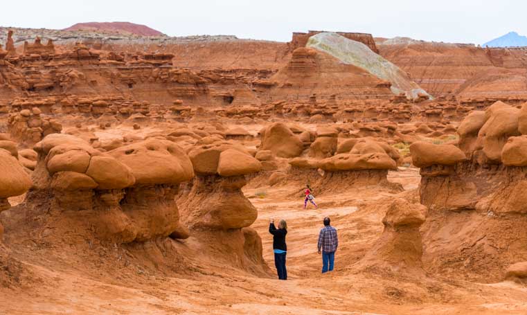
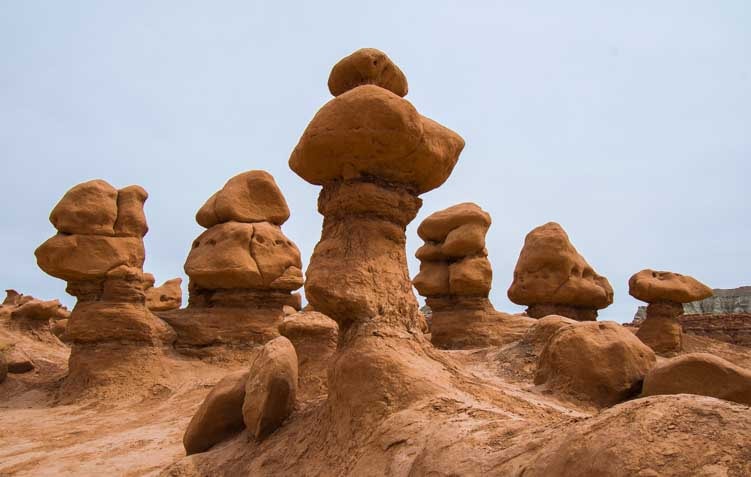
April 2018 – Goblin Valley State Park in Utah is a filled with exotic red rock formations known as “hoodoos” that look for all the world like little people, martians and goblins, and it is a favorite with kids and families because it is one gigantic playground.

RV camping Goblin Valley State Park Utah-min

Goblin Valley is a great place for a family camping trip!

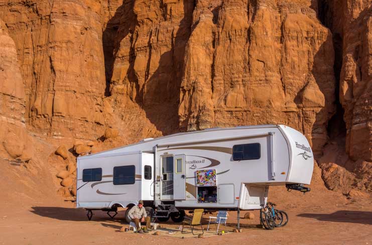
We visited Goblin Valley during our first year of full-time RVing eleven years ago and absolutely loved it. The campground is nestled into a huge rock formation that has cathedral-like buttresses, and tents and RVs tuck into these alcoves for a snug night’s sleep.

RV camping Goblin Valley State Park Utah-min

11 years ago we visited Goblin Valley State Park as new full-timers in our 27′ travel trailer and loved it!

It is located a little away from the concentration of red rock beauty in southern Utah but is an easy detour from I-70 when you’re heading east-west between Utah and Colorado. However, our travels hadn’t taken us in that direction since our first visit in 2007 (blog post here). When we pulled into the area we stopped and let our new pup Buddy out, and we all soaked in the dramatic scenery — just gorgeous!

Goblin Valley State Park Utah Puppy's view-min

Buddy checks out the fabulous scenery.

There are wonderful trails to hike or bike on.

Mountain biking Goblin Valley State Park Utah-min

What a place to ride!

The most famous and iconic part of Goblin Valley State Park is the Valley of the Goblins amphitheater where all the hoodoos stand in a tight huddle, but we decided to do the Goblin’s Lair hike before venturing into the valley of hoodoos.

Welcoming Committee Three Sisters Goblin Valley State Park Utah RV trip-min

The Greeters welcomed us to Goblin Valley State Park.
They are also known as the Three Judges, the Three Kings or the Three Sisters!

The Goblin’s Lair hike shares a trail with the Carmel Canyon hike until the two trails fork and the path to Goblin’s Lair takes a right to go around the outside of the hoodoo amphitheater. Here the land is wide open and vast, carved by the massive earth moving forces of Nature, wind and water.

A 24-hour hair whipping wind storm had just swept through Goblin Valley, and the dust had been swirling so thickly in the air we had to stay inside for an entire day while our trailer got sandblasted.

When we finally ventured out on the Goblin’s Lair hike the next day, the air was so heavy with dust you could taste it on your tongue and feel it on your lips.

So, we didn’t have the iconic bright blue sky and crisp colors that set off the red rocks in famously dramatic fashion, but the whole atmosphere was wonderfully ghostly and ghoulish.

Beginning Carmel Canyon  and Goblin's Lair Hike Goblin Valley State Park Utah RV trip-min

With dust providing a ghoulish haze, hikers head out on the hike to Goblin’s Lair.

The trail has several promontories that are fun to walk out on.

Carmel Canyon  and Goblin's Lair Trail Goblin Valley State Park Utah RV trip-min

The scenery dwarfs us.

Carmel Canyon Trail Hike Goblin Valley State Park Utah RV trip-min

.

The best way to see Goblin Valley is with kids. Since we didn’t have any kids or grandkids with us, we were delighted to find ourselves sharing the trail with a bunch of families both ahead of us and behind us.

It was Spring Break for the local Utah schools and all of Goblin Valley was teeming with kids. As we started down the trail we heard them excitedly running around and calling out to each other. “Sand, wonderful sand!” one boy said as he scooped up a huge handful of soft pink sand worthy of the best tropical beach and let it fly.

Hiking to Goblin's Lair on Carmel Canyon Goblin Valley State Park Utah RV trip-min

.

Solitary boulders stood here and there.

Carmel Canyon and Goblin's Lair Hike views Goblin Valley State Park Utah RV trip

.

We stopped to trade selfies with some other hikers and then began the ascent up towards Goblin’s Lair.

Selfie Goblin Valley State Park Utah RV trip-min

.

Goblin's Lair Hike Goblin Valley State Park Utah RV trip-min

Hiking up to Goblin’s Lair

There is a bit of a scramble in the last part of the climb to Goblin’s Lair, but all the grandmas and grandpas made it while their grandkids cheered them on from the top.

Goblin's Lair Hike Goblin Valley State Park Utah RV trip-min

Looking down at hikers scrambling up to Goblin’s Lair

The lair itself is a big cave, and smart hikers who have read the literature before they start hiking bring flashlights with them. Those of us who just saw the sign “Goblin’s Lair” in the parking lot and started hiking right away ’cause it sounded cool arrived at the cave without one!

The crowd at the cave entrance was sizeable. More people kept scrambling up the trail behind us, and we all kept shifting positions perched on the craggy rocks at the top to make room for the new arrivals. Mark and Buddy slithered to the front and took a peek in the cave and said “Wow!” and then we started back down to make room for others coming up.

We took our time hiking back and saw people peering down at us from the towering red rock cliffs. They had climbed up on the cliffs from the crowd of hoodoos on the other side in the Valley of the Goblins.

Carmel Canyon Hike Goblin Valley State Park Utah RV trip-min

A hiker on the edge of the Valley of the Goblins looks down at us.

Snow and solitude Goblin Valley State Park Utah RV trip-min

Solitude in the red rocks with snow in the distance.

The hike is three miles round trip, and even though the sun was filtered through the dust in the air, it was getting warm. So, one of us found a bit of cool shade under a rock and took a break.

Resting during Goblin's Lair Hike Goblin Valley State Park Utah RV trip-min

Buddy takes a load off in the shade.

Carmel Canyon hike Goblin Valley State Park Utah RV trip-min

.

The Valley of the Goblins is the main attraction at Goblin Valley State Park, and you can look down into it from many overlooks at the parking lot before you head on in.

Valley of the Goblins hike Goblin Valley State Park Utah RV trip-min

Valley of the Goblins with snowy peaks in the distance.

Valley of the Goblins amphitheater Goblin Valley State Park Utah RV trip-min

Hoodoos stand cheek-by-jowel in the Valley of the Goblins inviting kids of all ages to climb on them.

There is no real hiking trail, just a million goblins standing together waiting for kids to come and play on them.

Valley of the Goblins Goblin Valley State Park Utah RV trip-min

There’s no specific trail in Valley of he Goblins — you can just run anywhere have a ball!

Kids giant playground Goblin Valley State Park Utah RV trip-min

Goblin Valley is a fabulous natural playground.

The shrieks of excitement from the kids as they climbed up to the tops and yelled to their friends and parents down below was infectious.

Valley of the Goblins playground Goblin Valley State Park

.

Goblin Valley State Park Utah Giant Playground for kids-min

There were kids all over the rocks — how fun!

Even kids of the canine variety were having fun climbing the hoodoos in Goblin Valley!

Dog's giant playground Goblin Valley State Park Utah RV trip-min

.

The last time we were here we hunted for recognizable shapes among the hoodoos and found space ships and martians and turtles and ducks. That’s the fun of this place. It’s a natural playground for kids of all ages. Your imagination is set free and you can run and climb as much as you want.

Or, you can just take photos, and we got a kick out of that too.

Valley of the Goblins at Goblin Valley State Park-min

Out in the middle of it all a hiker captures the scene on his cell phone.

Families hike Valley of the Goblins Goblin Valley State Park Utah RV trip-min

.

Photography playground Goblin Valley State Park Utah RV trip-min

.

Goblin Valley is a very fun place to get creative with a camera.

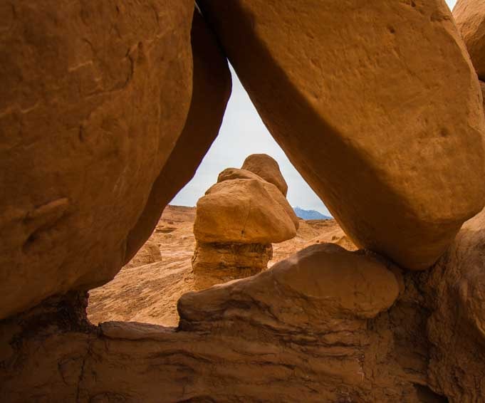
Triangle window Goblin Valley State Park Utah RV trip-min

A triangular window.

Chess pieces Goblin Valley State Park Utah RV Trip-min

Chess pieces.

Goblin Valley State Park is a Utah treasure that would easily be declared a National Park if it were located in a less scenic state, and we’ll definitely be back again.

RV camping Goblin Valley State Park Utah-min

Coming back to Goblin Valley after all these years was a blast!

Related books:

Subscribe
Never miss a post — it’s free!

More info about Goblin Valley State Park:

Other hikes we’ve loved in Red Rock Country:

Our most recent posts:

More of our Latest Posts are in the MENU.   New to this site? Visit RVers Start Here to find where we keep all the good stuff. Also check out our COOL NEW GEAR STORE!! *** CLICK HERE *** to see it!

<-Previous || Next->

Utah Scenic Byway 24 RV Trip – Capitol Reef National Park

April 2018 – Utah Scenic Byway 24 between the towns of Loa and Hanksville goes through Capitol Reef National Park and is one of the most spectacular scenic drives in America. We have been fortunate to drive it several times in each direction, and every single time our jaws have hung open for the entire 64 miles as we’ve been utterly blown away by the dramatic scenery and wild rock formations passing by our windows.

Here’s a series of photos showing how it looked from the passenger seat of our truck as we towed our trailer across the magical wonderland of Capitol Reef Country from west to east.

It started with a lovely view of red rocks as we rounded a bend.

Utah Byway 24 Capitol Reef National Park Scenic Drive-min

Our first big red rocks view begins to take shape on Utah’s Scenic Byway 24

Then our eyes popped open as the contours and texture of the land grew bigger and more complex.

Utah Highway 24 Capitol Reef National Park Scenic Drive RV trip-min

Wow!

Suddenly, we started down a hill and the view exploded in front of us and became knock-your-socks-off stunning!

Utah 24 Capitol Reef National Park Scenic Drive-min

Wow, Wow, WOW!

A group of horses and cows live in this view all day every day, so they weren’t quite as impressed.

Horses on Utah Scenic Byway 24 Capitol Reef National Park RV trip-min

.

But we were loving every minute as we drove head on into that view.

Utah Byway 24 Capitol Reef National Park Scenic Drive RV trip-min

.

Views on Capitol Reef National Park Utah Highway 24 Scenic Drive-min

View out the side window.

Utah Byway 24 is easily driven in an RV, even though there are lots of twists and turns and climbs and descents, and we saw plenty of RVs on the road.

RV on Capitol Reef National Park Utah Scenic Byway 24 Scenic Drive-min

There are lots of RVs on this route.

Capitol Reef National Park Utah Byway 24 Scenic Drive RV trip-min

The road curves, climbs and descends, but it’s easy driving.
Just don’t get too distracted by the sensational views and drive off the road!

Capitol Reef National Park Utah Route 24 Scenic Drive RV trip-min

.

RV on Utah Route 24 Capitol Reef National Park Scenic Drive-min

.

The red rock views just kept coming and coming and coming.

Capitol Reef National Park Utah Route 24 Scenic Drive RV trip-min

.

Red rocks Capitol Reef National Park Utah Route 24 Scenic Drive-min

.

Capitol Reef National Park Utah Route 24 Scenic Drive Red rocks RV trip-min

.

Exotic rock formations Capitol Reef National Park Utah Route 24 Scenic Drive-min

.

The heart of Capitol Reef National Park is an old Mormon farming community called Fruita. As we drove past the village on Utah Highway 24, we noticed that the trees were still showing off their nakedness for winter. However, on other spring and summer visits, we’ve seen these trees lit up in brilliant shades of green that are the perfect visual contrast to the red rocks and blue sky.

Trees and red rocks Fruita Utah Route 24 Scenic Drive Capitol Reef National Park RV trip-min

These trees turn vivid green in spring!

Trees and red rocks Fruita Utah Route 24 Scenic Drive Capitol Reef National Park RV trip-min

Trees line the road near Fruita.

Fruita is a beautiful and tranquil little community, and there are camping options, a fantastic scenic drive into the depths of the red rocks, and some terrific hikes to historic Mormon sites. We have a detailed blog post about some of the highlights of Capitol Reef National Park and the town of Fruita from our visit a few years back (blog post here).

However, on this trip we were just driving through on Utah Highway 24. So, on we went, reminiscing when we passed some favorite spots and then quickly becoming immersed in the majestic scenery of Utah Scenic Byway 24 once again.

We had left red rock country behind and were now driving between rock walls that Mother Nature had painted in lighter shades.

Rock canyon Utah Byway 24 Scenic Drive Capitol Reef National Park RV trip_-min

We’d left the red rocks but were still surrounded by dramatic canyon walls.

Pinnacles Scenic

.

.

Views Utah Route 24 Scenic Drive Capitol Reef National Park RV trip-min

.

Sheer walls Capitol Reef National Park Utah Route Scenic Byway 24 RV truo

.

There were still some hints of red rocks here and there, and we were mesmerized as we drove. A UPS truck went by in the opposite direction and we had to laugh. Surely, that driver has the best UPS route in the country!

Canyon walls Capitol Reef National Park RV trip Utah Highway 24 Scenic Drive-min

Not bad scenery for the few lucky folks who have to drive this route for work every day!

Canyon walls Capitol Reef National Park RV trip Utah Byway 24 Scenic Drive-min

.

Scenic Drive Capitol Reef National Park RV trip Utah Scenic Byway 24

.

Gradually, the soaring rock walls on either side of us receded, and the land opened up, punctuated by occasional towers of stone.

Scenic Drive Capitol Reef National Park RV trip Utah Route 24-min

.


RV Scenic Drive Capitol Reef National Park Utah Route 24-min

.

Scenic Drive Capitol Reef National Park RV trip Utah Route 24-min

.

Scenic Drive Capitol Reef National Park RV trip Utah Route 24-min

.

Scenic Drive Capitol Reef National Park RV trip Utah Route 24-min

.

RV Scenic Drive Capitol Reef National Park Utah Byway 24-min

.

Then the rock formations changed shape and the rock walls were filled with steep and angular channels that were carved with Nature’s sharpest chisels.

Exotic landscape Capitol Reef National Park Utah Scenic Highway 24 RV trip-min

Fine chisel work…

We were no longer in Capitol Reef National Park, but the landscapes in Utah pay no attention to such artificial boundaries. Utah Scenic Byway 24 was still giving us a magic carpet ride through some of the most exotic scenery America has to offer.

Desert landscape Capitol Reef National Park Utah Scenic Byway 24 RV trip-min

.

Rock uplift Capitol Reef National Park Utah Route 24 Scenic Drive by RV-min

Massive rock uplifts make faces.

The chiseled walls returned, but the cows grazing underneath didn’t notice.

Spectacular landscape Capitol Reef National Park Utah Highway 24 Scenic Drive by RV

Dinner with a view!

Flowering tree Capitol Reef National Park Utah Highway 24 Scenic Drive by RV-min

A pink tree shows off its springtime finest.

Farm field Capitol Reef National Park Utah Scenic Byway 24 by RV-min

.

As we neared the hamlet of Hanksville, the road took a few final sweeping turns past some walls of stone.

Stone canyon Capitol Reef National Park Utah Highway 24 Scenic Drive by RV-min

.

Towering rock formation Capitol Reef National Park Utah Scenic Byway 24-min

.

And then, in a final burst of glory, we passed a “mitten” rock formation that seemed to be advertising some of the other wonders of America’s southwest. “If you liked this road, you should check out Monument Valley!” it seemed to be saying.

Capitol Reef National Park Utah Route 24 Monument Valley lookalike-min

A mitten formation reminds us of Monument Valley.

What a glorious drive that was! I looked over at Mark to exchange happy glances and did a double take. Hey, who was doing the driving?

Puppy drives the truck and trailer

.

We will never tire of driving the many wondrous scenic drives in Utah, and Utah Scenic Byway 24 is well worth experiencing many times in both directions. It attaches to Scenic Byway 12 and the fabulous Bicentennial Highway and is close to the little known Burr Trail too.

Even if your itinerary doesn’t include visiting Capitol Reef National Park for its hikes and camping, if you happen to be in southern Utah, treat yourself to an east-west detour and spend a few hours driving Utah Scenic Byway 24!

Subscribe
Never miss a post — it’s free!

More info about Utah Byway 24 and Capitol Reef National Park:

Other “Do Not Miss” Scenic Byways we have loved:

Our most recent posts:

More of our Latest Posts are in the MENU.   New to this site? Visit RVers Start Here to find where we keep all the good stuff. Also check out our COOL NEW GEAR STORE!! *** CLICK HERE *** to see it!

<-Previous || Next->

Canyonlands National Park UT – Island in the Sky (and Night Skies!)

April 2016 – Canyonlands National Park in Utah is so big and sprawling that it has two entrances at opposite ends of the park. The south entrance is a 50 mile drive to the south and west of Moab, and it takes you to the Needles District. The north entrance is a 30 mile drive to the north and west from Moab and takes you to the Island in the Sky district.

Hikers Utah Canyonlands National Park Island in the Sky  Shafer Canyon

Canyonlands National Park in Utah – Island in the Sky

We had explored the beautiful pink and white spires of the Needles District in Canyonlands National Park a few weeks earlier on the Chesler Park hike, and we were eager to check out the vistas and views of the Island in the Sky district.

Shafer Canyon didn’t disappoint…Wow!!

Canyonlands Shafer Canyon Island in the Sky District Utah photography

Shafer Canyon, Canyonlands National Park Utah

Although all of America’s National Parks are best enjoyed in depth over a several day period, with hikes out into the scenery to see the various sights up close, on this RV roadtrip we were doing a survey and an overview of all the beauty surrounding Moab.

We dashed into Canyonlands National Park for a day to check out all the overlooks and scenery visible from the main road.

White Rim Road Shafer Canyon Canyonlands Island in the Sky District Utah

The wild White Rim Road zig-zags across the landscape

We wandered around the overlook at Shafer Canyon for a long time soaking in the view.

A fabulous and enticing dirt road snaked across the canyon. This is part of the 71 mile long White Rim road that we had seen a few days earlier at Dead Horse Point State Park.

An intrepid jeep driver was descending a wall of the canyon near us. What a cool drive that must be. Someday!!

Shafer Canyon Canyonlands National Park White Rim Road Jeep travel Utah RV camping

The White Rim Road looks like quite a ride!!

Each canyon and overlook in the Island in the Sky district of Canyonlands is beautiful.

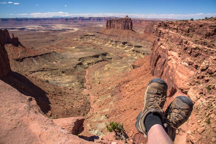
Hiking boots Canyonlands Island in the Sky District Utah

.

Canyonlands National Park Utah RV travel Island in the Sky

.

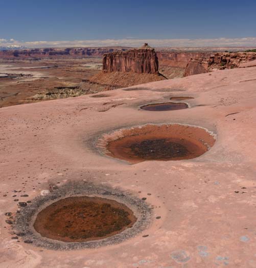
It had rained a few days earlier, and some of the depressions in the wide flat rocks were filled with water.

Canyonlands National Park Island in the Sky Utah RV camping

Puddles had formed in the red rock depressions.

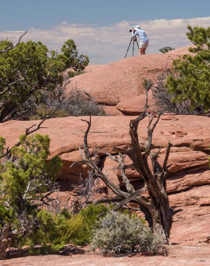
Funny thing is that we kept getting in each other’s photos!

Photography at Canyonlands National Park Island in the Sky District Utah

.

And a few times we got in each other’s photos on purpose too…

Hiking Canyonlands National Park Island in the Sky Utah camping

Is that a painting behind us??

The red rocks of Canyonlands National Park and the white capped mountains in the distance made a beautiful contrast.

Red rocks snowcapped mountains Canyonlands National Park Utah

Red rocks and snowy mountain peaks – Gorgeous!

Utah Canyonlands National Park La Sal Mountains Island in the Sky

.

Without a doubt, Grand View Point has the most dramatic landscapes in Canyonlands National Park’s Island in the Sky district.

Canyonlands National Park Utah Grand View Point Overlook

Grand View Point looks out over a crazy landscape

Here the flat earth seemed to have been carved by an enormous stick that had been dragged across the land to gouge out a pattern.

Canyonlands National Park  Grand View Point Overlook Island in the Sky Utah photography camping

Nature’s handiwork – what a fabulous design!

The tiny White Rim Road was still visible, but it was impossible to fathom the size and scale of this immense landscape before us.

Canyonlands National Park Island in the Sky Grand View Point Overlook

I just LOVE this pattern!

.

In the evening, our attention turned to the heavens. The southern part of Utah has some of the darkest skies in America, and the stars were thick above us.

Stars Canyonlands National Park Utah camping

There were layers upon layers of stars in the sky.

As the night wore on, the celestial dance in the stratosphere became ever more intense, and the clouds of stars that make up the Milky Way practically jumped out at us.

Milky Way Canyonlands National Park Utah Island in the Sky RV camping

The Milky Way came to life in the heavens.

Moab, Utah, is a wonderful destination for an RV roadtrip, and along with Arches National Park, Dead Horse State Park, the Canyonlands Needles District and Newspaper Rock, the Island in the Sky district of Canyonlands National Park has to be included in the Moab “to do” list.

RV Canyonlands National Park Island in the Sky Utah

The whole area around Moab is wonderful for an RV adventure.

And it doesn’t matter what kind of RV you have: big, small, new, old, solar powered or not, any kind of RV that can be driven or towed will fill the bill, and while we were there we saw some pretty unusual get-ups!!

RV fifth wheel trailer towing_

If you can drive it or tow it, any kind of RV will do!!

For more info about Canyonlands National Park, check out the links below.

Subscribe
Never miss a post — it’s free!

Info and links for Canyonlands National Park – Island in the Sky:

More travel stories from our RV adventures in Southeastern Utah:

Our most recent posts:

More of our Latest Posts are in the MENU above.

<-Previous || Next->
Dead Horse Point State Park, Utah – Magical Sunrises!

April 2016 – The area around Moab, Utah, is teeming with exotic red rock canyons, towering natural stone arches, snowcapped mountains, exotic ancient rock art and exhilarating hikes that go through it all.

Photography at Dead Horse Point State Park Utah

The rim of Dead Horse Point State Park is fabulous for photography at sunrise!

There is a joke that southern Utah’s landscapes are so spectacular that many places would be National Parks if they were located in any other state. But they get relegated to mere State Park or even lower status because they are located in Utah.

Dead Horse Point State Park is such a place.

Dead Horse Point State Park Utah Overlook at dawn

Dead Horse Point State Park in the pre-dawn hours.

Lying just 12 miles from Moab as the eagle flies across the canyons — or 33 miles as the roads go around them — Dead Horse Point State Park is tucked into a dramatic bend in the Colorado River that resembles some of the curves in its big brother, the Grand Canyon, a few hundred miles downstream to the southwest.

Dead Horse Point State Park Utah Sunrise

.

The overlooks at Dead Horse Point State Park are eye-popping at any time of day, but to watch the sunrise there is a magical experience. We snuck out in the pre-dawn hours and tip-toed around the edges of the canyon in the semi-darkness, passing endless wonderful, gnarly old trees.

Tree at Dead Horse Point State Park overlook Utah

Fantastic old trees line the rim of Dead Horse Point State Park

One tree in particular kept drawing us back. It leaned over the edge as if wanting to take a closer look at the canyon.

Tree at Dead Horse Point State Park Utah

This tree captivated us…

Tree at Dead Horse Point State Park Utah

…so it wound up in quite a few photos!

Another stood watch over a bench at a viewpoint.

Bench and tree Dead Horse Point State Park Utah

A tree looks out at the view over a visitor’s bench.

As dawn flirted with us on the horizon, the curves and contours of this magnificent canyon slowly began to take shape. Gradually, the wispy clouds in the sky took on the brilliant peach and orange hues of sunrise.

Sunrise at Dead Horse Point State Park Utah

The sky lights up as the sun begins to rise.

What a blessing it was to be there on a day when there were enough clouds to create a colorful sunrise!

Dead Horse Point State Park Utah sunrise

What colors!
The thin trail along the river is the 4×4 White Rim Road that crosses into Canyonlands National Park.

All of a sudden, the sun crested the horizon over the mountains to the west, and it sent shafts of orange light across the canyon.

First Light Dead Horse Point State Park Utah

First light at Dead Horse Point State Park

Then a few of the red rock peaks lit up in the distance.

Sunrise Dead Horse Point State Park Utah

As soon as the sun peeked over the mountains to the east, shafts of light cut across the canyon.

If there is a place in this world to watch the sun come up, this is it. And what a spot for photography!!

Until this moment, we had had the entire canyon to ourselves, but we’d heard a car drive up and park. As the sunlight grew brighter, we noticed a person sitting out on a ledge and soaking in the miracle of a new day arriving in this special place.

Overlooking Dead Horse Point State Park Utah Before Dawn

“Morning has broken…” — Cat Stevens

Slowly, the sun’s rays lit up more and more of the canyon.

Dead Horse Point State Park Utah at dawn

Gradually, the shadows crept down the canyon walls as the sun highlighted their peaks.

As the sun rose higher, the Colorado River began to reflect the orange cliffs in its depths. Magnificent!

Sunrise Dead Horse Point State Park Utah

.

As we watched the splendor before us, we were surprised to hear the squawking of Canada Geese in the distance. They seemed to be way over on the opposite side of the canyon to the west. They never did come into view, but for about 5 minutes we could hear the flock talking together as they commuted down the river and across the canyon from the west side of the horizon to the east!!

Dawn Dead Horse Point State Park Utah

Light and shadow play on the rock faces of Dead Horse Point State Park.

After the sunrise was over, we returned to our campsite where we noticed the most beautiful little blue bird flitting about out the back window of our trailer. He kept landing on the handlebars and shifting cables on our bicycles mounted on our bike rack. He seemed quite enamored of our bicycle bell!

Mountain Bluebird on bicycle bell Moab Utah

When we got back to camp, this little guy was hanging out on the handlebars of our bikes!

Fortunately, he didn’t seem to be fazed by our movements inside the rig, and he settled down long enough for us to get a good look at him through the window and to get some really nice photos. We checked him out in our bird guide, and he was a Mountain Bluebird. How cool!

Mountain Bluebird Moab Utah

What a handsome fellow!!

Then his little girlfriend stopped by. She was a real cutie too, with soft brown wings and a splash of Mountain Bluebird blue on her back! We never found out what these birds’ fascination was with our bikes on the back end of our RV, but they hung around for a very long time.

Female Mountain Bluebird Moab Utah

She keeps her vibrant blue colors under wraps…

Where our visit to Arches National Park had been shared with a gazillion other visitors, and our visit to the town of Moab had been a little wild during Jeep Safari week, the utter calm at Dead Horse Point State Park was intoxicating. At twilight we snuck back to the rim of the canyon and got some shots of the sunset on the horizon with a tree in the foreground.

Twilight tree at Dead Horse Point State Park Utah

At twilight, the horizon turned vivid orange.

The sunrise at Dead Horse Point State Park is worth getting up for on any morning you are nearby, so we set our alarms each morning we were there, reminding ourselves as we groaned when it went off that it isn’t everyday you have a view like this within driving distance.

Dead Horse Point State Park Utah Before Dawn

Sunrise is worth getting up for in this neck of the woods!

It was tough to climb out of our snug, warm bed to go stand at the rim of the canyon (in four layers of jackets) and wait for the sun to come up. But the beautiful photos and feeling of tranquility that reached across the miles and miles of canyon were well worth it.

Sunrise Dead Horse Point State Park Utah

Little puffy clouds marched across the sky at dawn.

One morning as I hiked across the huge, flat boulders towards the rim, I looked up and was astonished to find myself face to face with a white desert fox. I was loaded down with my camera, my pack, my tripod and my travel coffee mug, and I knew there was no way I could juggle it all and get his photo without scaring him off.

So, I simply basked in the moment, and talked to him softly. His ears perked up in my direction and he took a long look at me. I admired his bushy white tail, tipped with a little black tuft at the end. To my utter surprise, he sat down for a moment! Then he got up and trotted away in silence on velvet paws.

Dead Horse Point State Park at dawn Utah

Once the sun was up, the puffy clouds turned white.

The sunrises at Dead Horse Point were sensational, but that private moment with the desert fox in the dim pre-dawn light was extraordinary.

Inspired by the professional videographers we met at Horsehoe Bend in Arizona, I set up a timelapse sequence on my camera to show the shadows retreating from the red rock canyon walls as the sun rose. What fun!!

For those with limited bandwidth, this video is 19 MB and 20 seconds long.

Dead Horse Point State Park is a fabulous place for outdoor lovers of all kinds to visit, and for RVers especially.

There is a campground with electrical hookups within the park (no need for solar power!) and loads of other campground options nearby (links below). In early April there were few people, if any, at the rim at dawn, but we have heard the place can be very busy at sunrise later in the season.

We enjoyed the sunsets at Dead Horse too, but the sunrises were most magical for us.

Happy campers at Dead Horse Point State Park at dawn Utah

Does life get any better than this??!!

The best viewpoints at dawn are to the west of the main overlook. Simply follow the paved trail heading to the right of the parking lot, and then cut across the rocks to the rim at whatever point looks appealing to you.

It’s all wonderful!

Subscribe
Never miss a post — it’s free!

More info about Dead Horse Point State Park in Utah:

Posts from similar river bend overlooks:

Other posts from our RV travels in Southern Utah:

<-Previous || Next->

Our most recent posts:

More of our Latest Posts are in the MENU above.