A Backcountry RV Roadtrip in SE Idaho – Quiet Splendor!

April 2016 – In our RV travels we prefer to take small back roads from town to town instead of zipping past everything on the interstates. As we left the Moab area in Utah to head north into Idaho, we scoured the map to find some skinny roads through the farmlands that would take us through the valleys between the mountain ranges.

RV roadtrip past snowcapped mountains of northern Utah

Wow! We left the red rock canyons of Utah behind and headed into northern Utah.

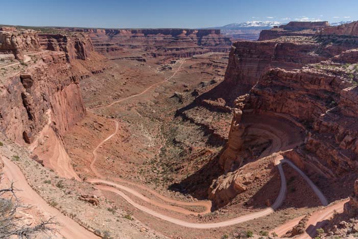
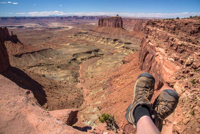
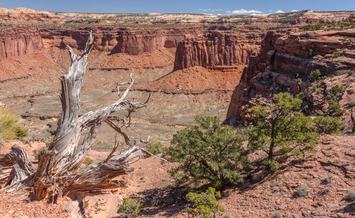
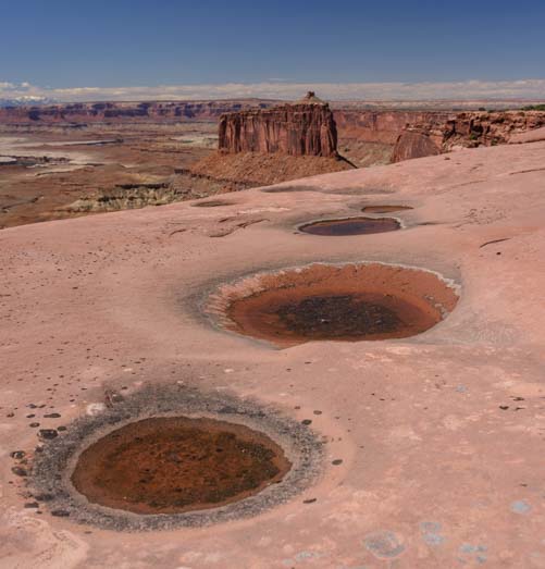
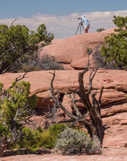
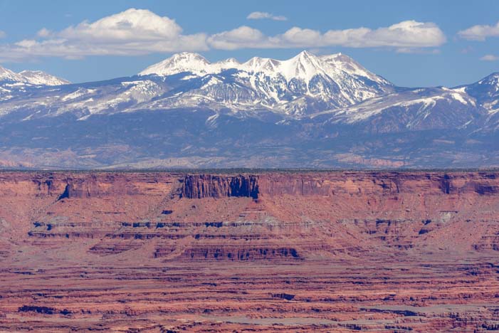
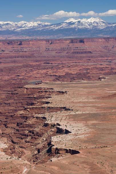
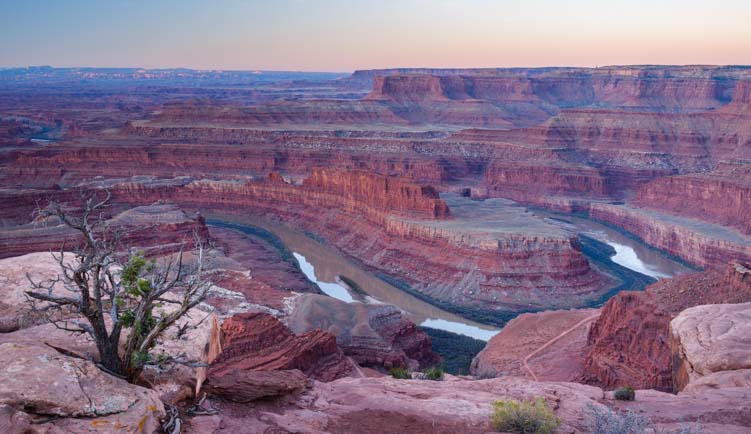
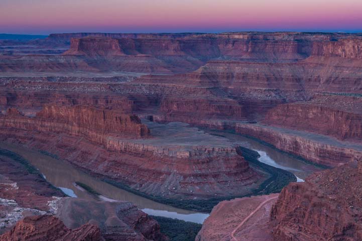
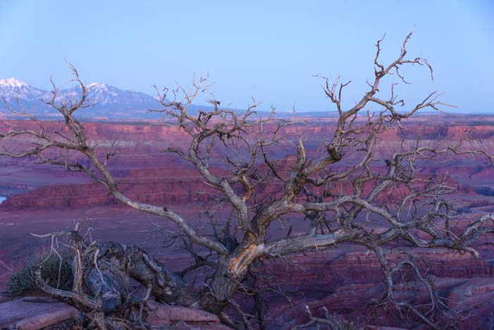
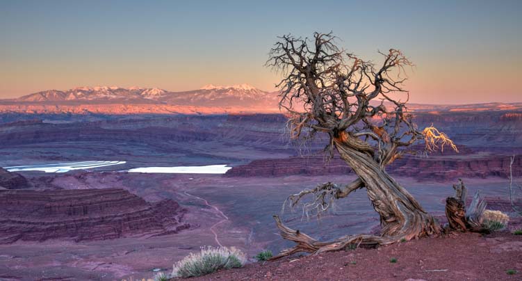
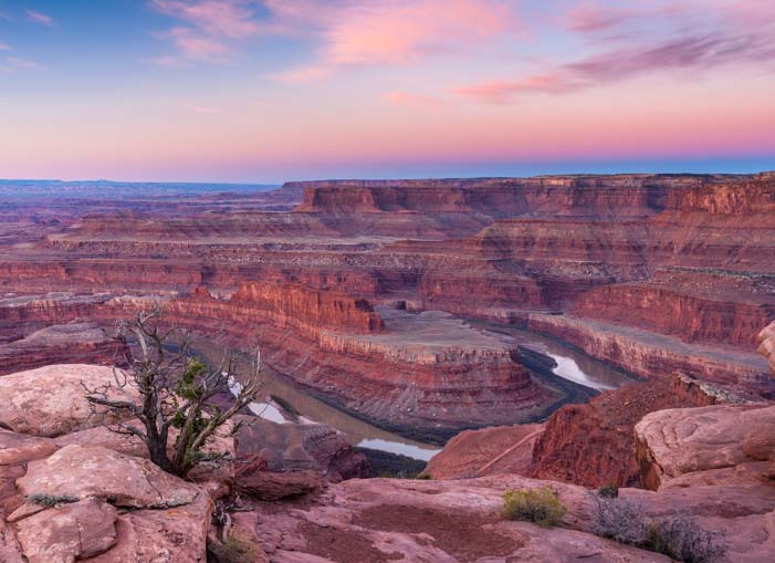
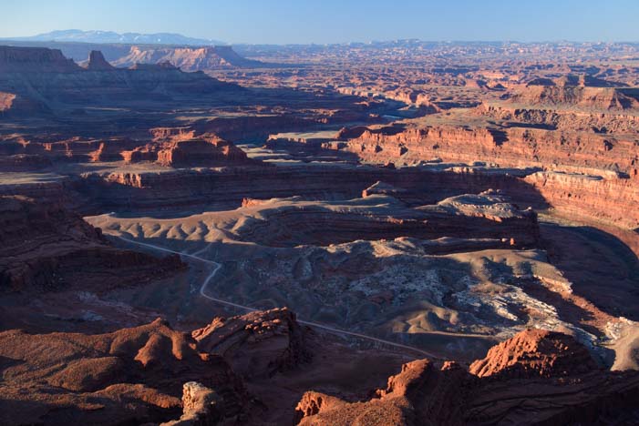
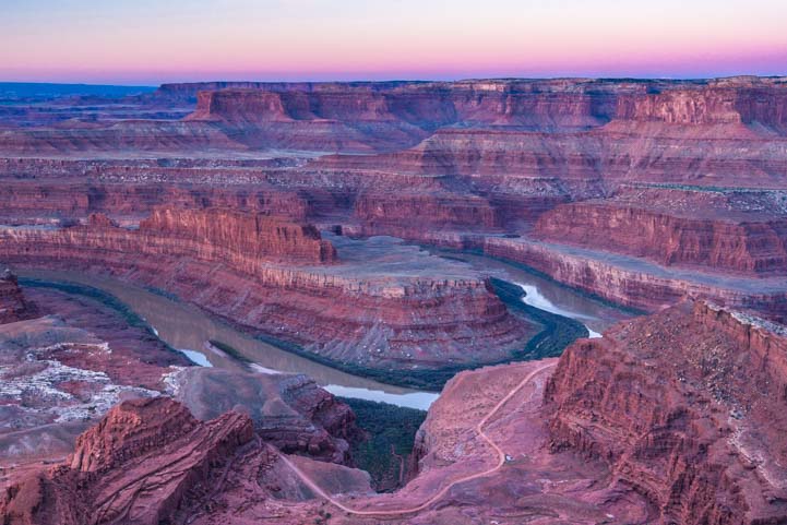
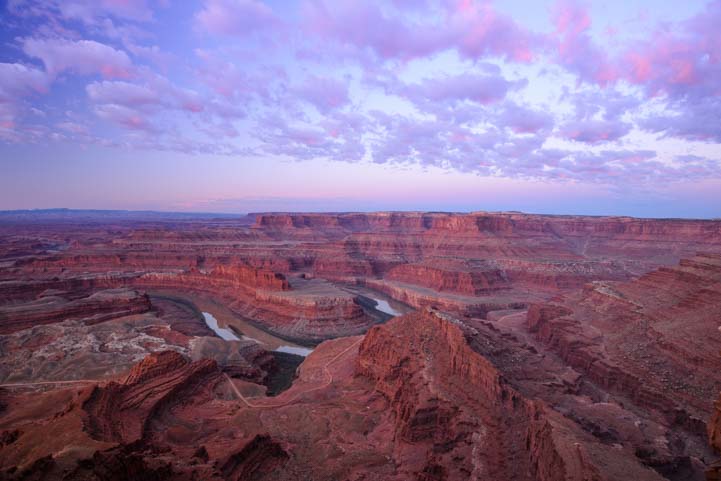
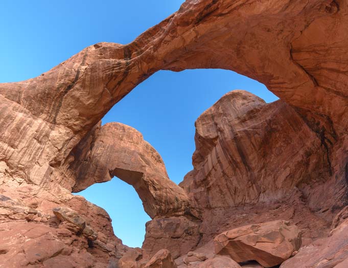
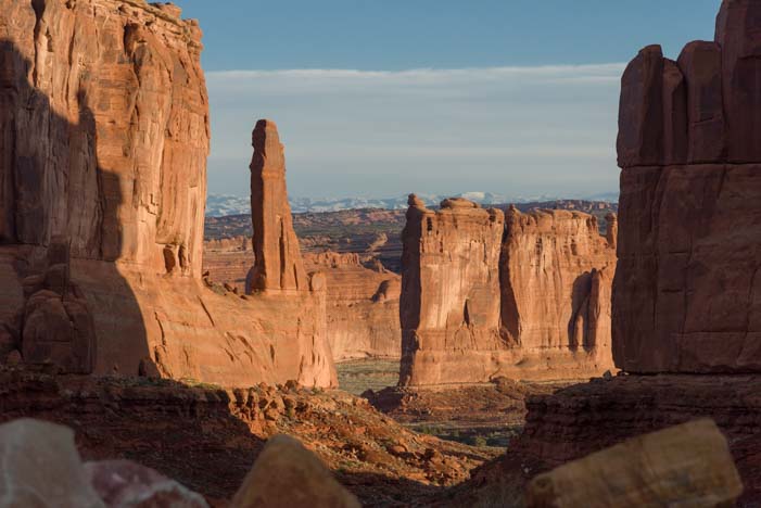
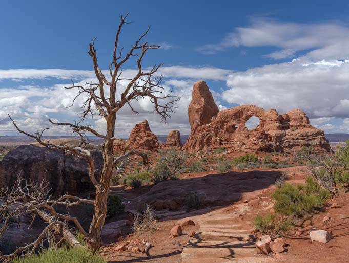
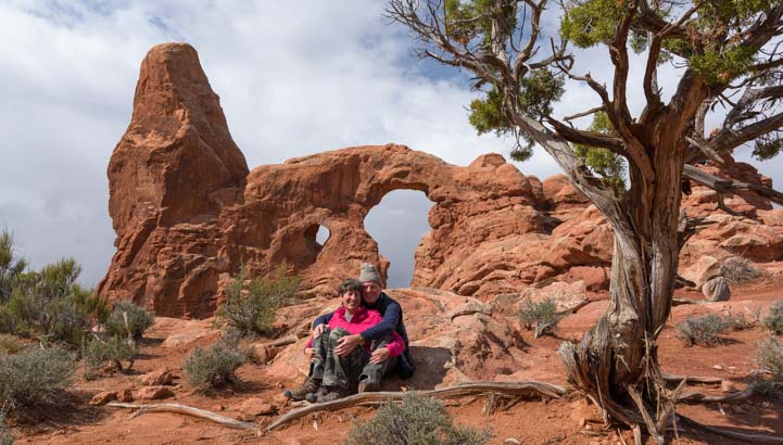
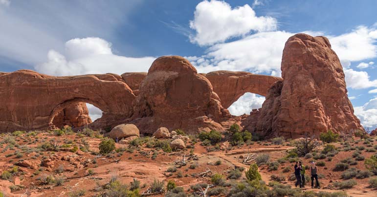
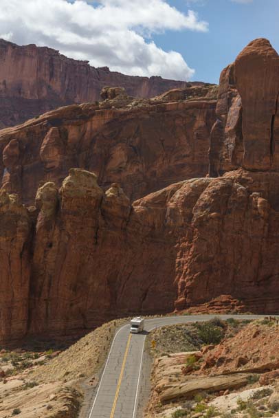
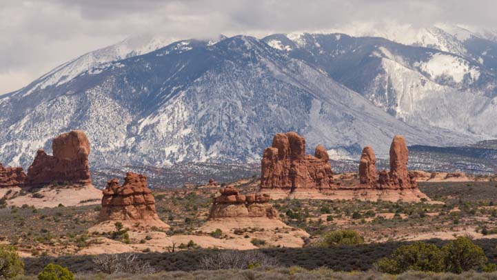
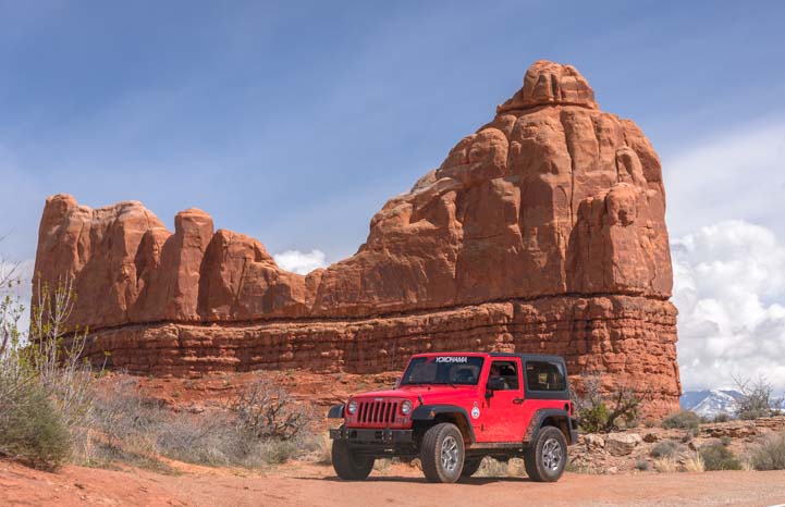
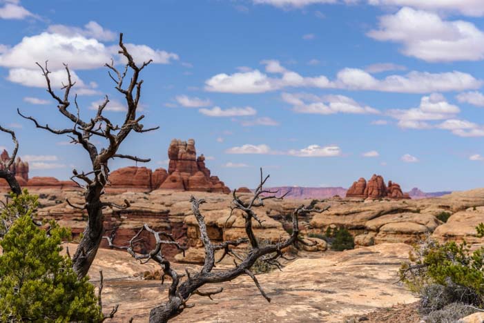
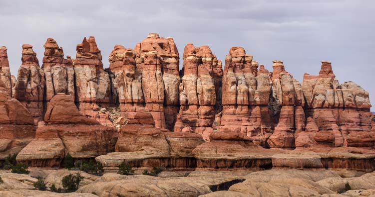
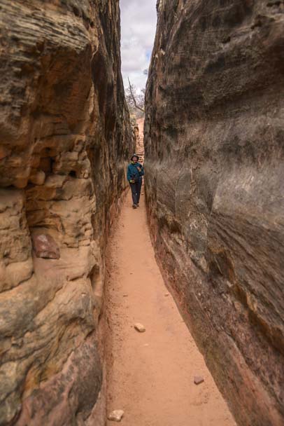
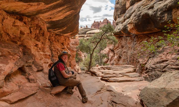
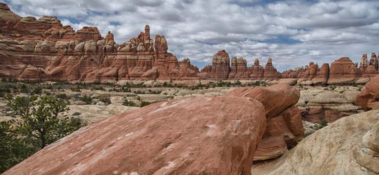
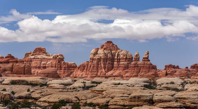
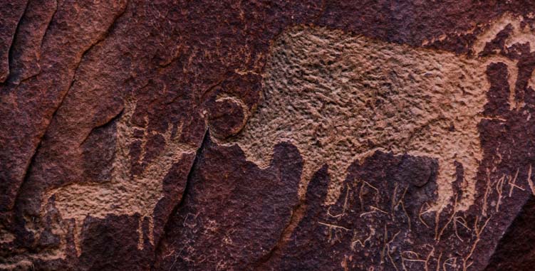
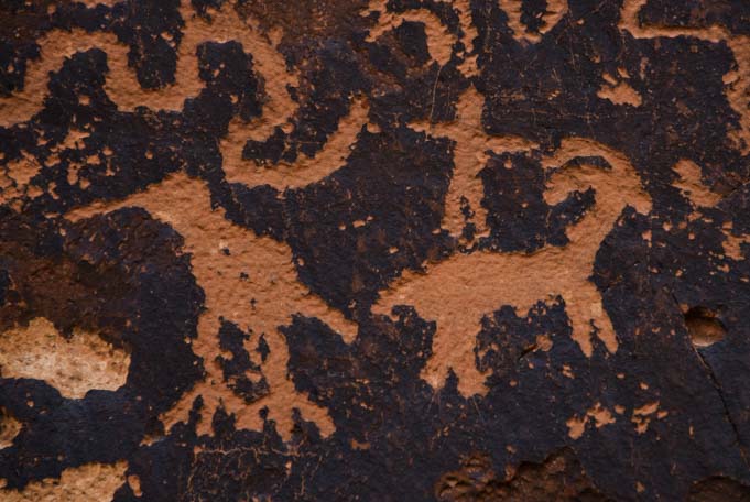
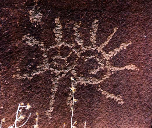
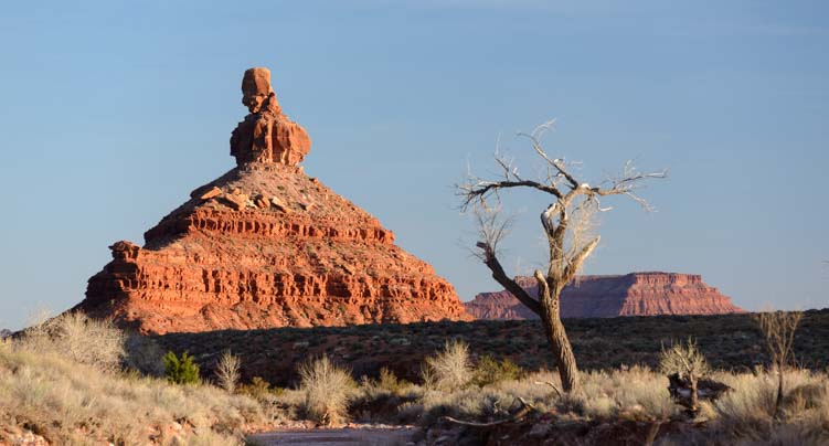
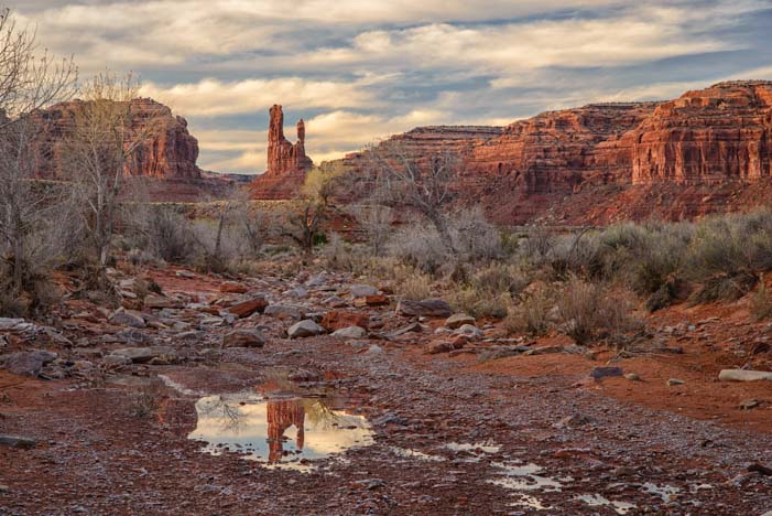
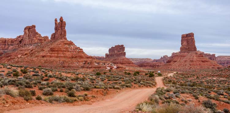
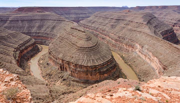
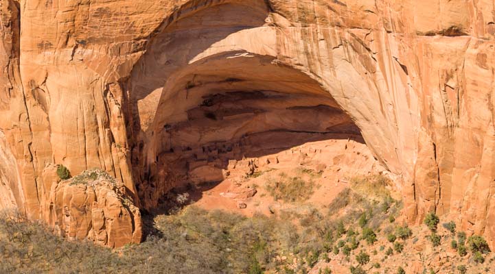
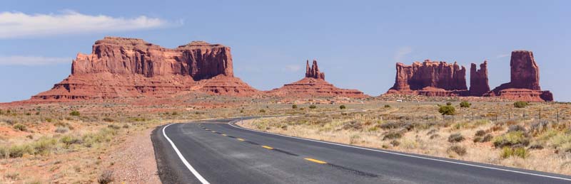
Our minds were still reeling with the incredible and world renowned landscapes we’d enjoyed at Canyonlands National Park (North and South), Arches National Park, Dead Horse State Park and even the roadside stop of Newspaper Rock after coming up through the (appropriately named) Valley of the Gods. But we were astonished by the beauty of our surroundings in this lesser known area as we looked out our truck’s windows.

RV roadtrip through Farmland and mountasin of northern Utah

We knew the farmland around in Logan, Utah, was gorgeous, but this was incredible!

Route 89 heading out of Ogden, Utah, was a little fast paced for our tastes, so we snaked our way through the farmlands on Route 23 and then on Route 36. The views in every direction around us were breathtaking.

Farm and mountain scenery southeastern Idaho

It’s scenery like this that gets us off the highways and onto the backroads of America.

This is farm and ranching country. Horses grazed in the pastures and cows dotted the fields all the way to the mountains in the distance. It was early spring, and newborn calves bounded behind their mothers.

Views from the RV southeastern Idaho mountains

Horses and cattle didn’t seem to notice the views — all they saw was breakfast!

We had traveled through this part of the country several times before, spending time at Bear Lake and Logan Pass in Utah and driving north through Afton Wyoming on our way to and from the Tetons. Despite two visits to the Tetons, there are places there we still haven’t seen. However, we decided to stay on the Idaho side of that stunning mountain range on this trip.

RV camping by southeastern Idaho lake

The lakes were as beautiful as the mountains.

And the scenery we were seeing was plenty glorious enough, and the roads were very peaceful!

RV roadtrip through southeastern Idaho mountains

Not a bad spot to live!

The skies, however, were not peaceful at all, and rumbling in the heavens got our attention.

RV camping southeastern Idaho

The skies began to look a little threatening.

A stormy day that had been promising rain all day long suddenly ended with a spectacular sunset that had us running out of the buggy and down to the shore to take photos.

Southern Idaho sunset on lake

Cloudy skies sometimes bring awesome sunsets. This one was exceptional, especially after a gray day!!

As we were busily snapping away at the sky, I heard a loud splash and looked down at my feet to see a beaver swimming right past me.

What luck!

I managed to catch him surrounded by the sun’s vivid magenta reflection in the water before he dived out of sight.

Camping sunset beaver in Idaho lake

A beaver swam right by me!!

We were doing this little backroad RV roadtrip in a season that fell somewhere between winter and spring, which gave us lots of unpredictable weather. Nasty weather makes for great photography, however, and we continued on our farm road journey on Route 38 under pretty clouds at dawn.

Malad City Idaho sunrise

Reflections at dawn.

Later in the day, however, those clouds got angry once again. We watched a massive black cloud forming in the distance as we drove. Suddenly the cloud was upon us. Fortunately, just at that moment, we saw a huge roadside pullout with a big red sign that said “Stop!” And stop we did!!

RV travel southeastern Idaho_

Yikes! A huge black storm cloud made us pull over and stop!

No sooner had we run back into the trailer and closed the door than the heavens opened up. It rained buckets. It rained so hard the raindrops seemed to be bouncing off the ground. Thank goodness we had our house with us!

We made lunch, and afterwards we soon got drowsy from listening to the rain pelting our roof. So, we crawled under the covers for a nap! When we awoke, the skies had lightened and Nature gave us the “all clear” and go ahead to continue our journey on Route 37.

2016 Dodge Ram 3500 Dually_

Four hours later, after a good nap, the skies began to clear.

We continued north, and after all this time on the backcountry roads of northern Utah and southeastern Idaho, when we arrived in the town of American Falls, we felt like we’d landed at an enormous city.

We watched long trains crossing the train bridge in town. One was so long it had three engines on the front and two on the back!!

Train crossing bridge in American Falls Idaho

In American Falls we saw a long train with five engines!!

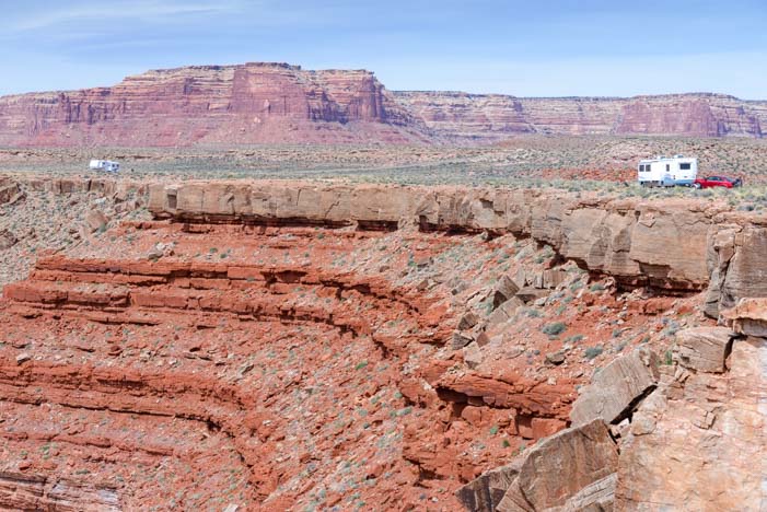
The storm clouds continued to threaten and were moving very fast above us. I’d gotten a kick out of setting up a timelapse video of the clouds moving across the canyon walls of Dead Horse Point State Park a few weeks earlier, and this seemed like a perfect chance to try that technique again:

From American Falls, our journey took us north along Route 39 to Route 26 and through Atomic City which we had enjoyed on an earlier trip to the otherworldly Craters of the Moon National Monument. But instead of seeking out moonscapes, on this trip we had snowcapped mountains in mind and on our agenda.

RV views on Salmon River Idaho roadtrip - nowcapped mountains

Snowcapped mountains were what we were after.

We hooked up with Route 93 and followed it northwest to the village of Mackay. What a sweet town! Mackay, Idaho, is flanked by two gorgeous mountain ranges, and we walked around town with our heads tipped back to take in the beautiful views.

Mackay Idaho main street

Downtown Mackay, Idaho.

Our RV roadtrip had brought us through some remote and quiet lands. To give you a sense of size and scale, the town of Mackay, which was a major landmark on our trip, has a population of 494!

No wonder the local cinema can offer happy birthday wishes to a resident!!

Main Street Cinema Mackay Idaho

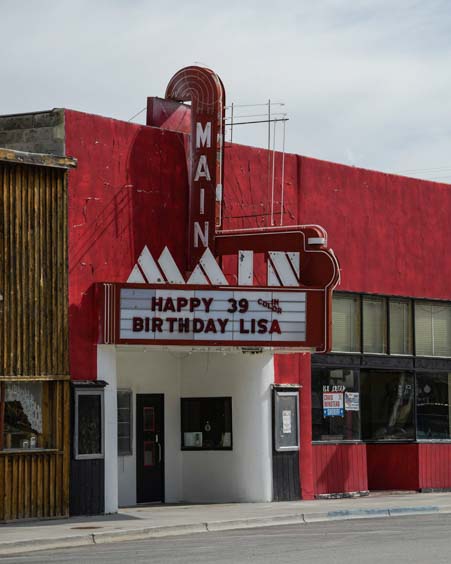
In a small town, your birthday can put your name on the marquee at the cinema! How fun!!

Makcay, Idaho, is on the opposite side of the mountains from the much more well known, busy and trendy community of Sun Valley to the west, and it is “opposite” in spirit as well.

“We like having a mountain range between us and Sun Valley!” One local said to me, laughing.

We meandered the few streets, and admired the rustic, crusty and aging barns and buildings tucked between some of the homes.

Crumbling Barn in Mackay Idaho

.

Old barn Mackay Idaho RV roadtrip

.

This part of Idaho is wonderful for RVing, and it has been popular with RVers ever since RVs were first built!

Antique travel trailer RV

We saw a cute antique trailer in a yard. Cool!

Discovering special places that don’t get top billing in the tourist literature is one of our favorite things about this full-time RVing lifestyle. International tourists flock to the major cities and the National Parks. And why not, they’re spectacular! But the roots of America are in the small towns across the country.

Old store front Mackay Idaho

Get your stretchy suspenders here!!

We were so glad we had chosen a route that we had never taken before through this familiar region. Every sight along the way was new and exciting!

RV camping Salmon River Idaho

Getting off the beaten path is our favorite aspect of RVing.

If you are have an RV road trip planned between northern Utah and southern Idaho, consider getting off the interstate and exploring the smaller roads. It’s a very beautiful part of the country!! More info below…

Subscribe
Never miss a post — it’s free!

More info and more stories from our RV travels in this area:

Our route through the Northern Utah and Southern Idaho farms and valleys

Scenic Drives for RV Touring in Idaho:

Our most recent posts:

More of our Latest Posts are in the MENU above.

<-Previous || Next->

Canyonlands National Park UT – Island in the Sky (and Night Skies!)

April 2016 – Canyonlands National Park in Utah is so big and sprawling that it has two entrances at opposite ends of the park. The south entrance is a 50 mile drive to the south and west of Moab, and it takes you to the Needles District. The north entrance is a 30 mile drive to the north and west from Moab and takes you to the Island in the Sky district.

Hikers Utah Canyonlands National Park Island in the Sky  Shafer Canyon

Canyonlands National Park in Utah – Island in the Sky

We had explored the beautiful pink and white spires of the Needles District in Canyonlands National Park a few weeks earlier on the Chesler Park hike, and we were eager to check out the vistas and views of the Island in the Sky district.

Shafer Canyon didn’t disappoint…Wow!!

Canyonlands Shafer Canyon Island in the Sky District Utah photography

Shafer Canyon, Canyonlands National Park Utah

Although all of America’s National Parks are best enjoyed in depth over a several day period, with hikes out into the scenery to see the various sights up close, on this RV roadtrip we were doing a survey and an overview of all the beauty surrounding Moab.

We dashed into Canyonlands National Park for a day to check out all the overlooks and scenery visible from the main road.

White Rim Road Shafer Canyon Canyonlands Island in the Sky District Utah

The wild White Rim Road zig-zags across the landscape

We wandered around the overlook at Shafer Canyon for a long time soaking in the view.

A fabulous and enticing dirt road snaked across the canyon. This is part of the 71 mile long White Rim road that we had seen a few days earlier at Dead Horse Point State Park.

An intrepid jeep driver was descending a wall of the canyon near us. What a cool drive that must be. Someday!!

Shafer Canyon Canyonlands National Park White Rim Road Jeep travel Utah RV camping

The White Rim Road looks like quite a ride!!

Each canyon and overlook in the Island in the Sky district of Canyonlands is beautiful.

Hiking boots Canyonlands Island in the Sky District Utah

.

Canyonlands National Park Utah RV travel Island in the Sky

.

It had rained a few days earlier, and some of the depressions in the wide flat rocks were filled with water.

Canyonlands National Park Island in the Sky Utah RV camping

Puddles had formed in the red rock depressions.

Funny thing is that we kept getting in each other’s photos!

Photography at Canyonlands National Park Island in the Sky District Utah

.

And a few times we got in each other’s photos on purpose too…

Hiking Canyonlands National Park Island in the Sky Utah camping

Is that a painting behind us??

The red rocks of Canyonlands National Park and the white capped mountains in the distance made a beautiful contrast.

Red rocks snowcapped mountains Canyonlands National Park Utah

Red rocks and snowy mountain peaks – Gorgeous!

Utah Canyonlands National Park La Sal Mountains Island in the Sky

.

Without a doubt, Grand View Point has the most dramatic landscapes in Canyonlands National Park’s Island in the Sky district.

Canyonlands National Park Utah Grand View Point Overlook

Grand View Point looks out over a crazy landscape

Here the flat earth seemed to have been carved by an enormous stick that had been dragged across the land to gouge out a pattern.

Canyonlands National Park  Grand View Point Overlook Island in the Sky Utah photography camping

Nature’s handiwork – what a fabulous design!

The tiny White Rim Road was still visible, but it was impossible to fathom the size and scale of this immense landscape before us.

Canyonlands National Park Island in the Sky Grand View Point Overlook

I just LOVE this pattern!

.

In the evening, our attention turned to the heavens. The southern part of Utah has some of the darkest skies in America, and the stars were thick above us.

Stars Canyonlands National Park Utah camping

There were layers upon layers of stars in the sky.

As the night wore on, the celestial dance in the stratosphere became ever more intense, and the clouds of stars that make up the Milky Way practically jumped out at us.

Milky Way Canyonlands National Park Utah Island in the Sky RV camping

The Milky Way came to life in the heavens.

Moab, Utah, is a wonderful destination for an RV roadtrip, and along with Arches National Park, Dead Horse State Park, the Canyonlands Needles District and Newspaper Rock, the Island in the Sky district of Canyonlands National Park has to be included in the Moab “to do” list.

RV Canyonlands National Park Island in the Sky Utah

The whole area around Moab is wonderful for an RV adventure.

And it doesn’t matter what kind of RV you have: big, small, new, old, solar powered or not, any kind of RV that can be driven or towed will fill the bill, and while we were there we saw some pretty unusual get-ups!!

RV fifth wheel trailer towing_

If you can drive it or tow it, any kind of RV will do!!

For more info about Canyonlands National Park, check out the links below.

Subscribe
Never miss a post — it’s free!

Info and links for Canyonlands National Park – Island in the Sky:

More travel stories from our RV adventures in Southeastern Utah:

Our most recent posts:

More of our Latest Posts are in the MENU above.

<-Previous || Next->

Dead Horse Point State Park, Utah – Magical Sunrises!

April 2016 – The area around Moab, Utah, is teeming with exotic red rock canyons, towering natural stone arches, snowcapped mountains, exotic ancient rock art and exhilarating hikes that go through it all.

Photography at Dead Horse Point State Park Utah

The rim of Dead Horse Point State Park is fabulous for photography at sunrise!

There is a joke that southern Utah’s landscapes are so spectacular that many places would be National Parks if they were located in any other state. But they get relegated to mere State Park or even lower status because they are located in Utah.

Dead Horse Point State Park is such a place.

Dead Horse Point State Park Utah Overlook at dawn

Dead Horse Point State Park in the pre-dawn hours.

Lying just 12 miles from Moab as the eagle flies across the canyons — or 33 miles as the roads go around them — Dead Horse Point State Park is tucked into a dramatic bend in the Colorado River that resembles some of the curves in its big brother, the Grand Canyon, a few hundred miles downstream to the southwest.

Dead Horse Point State Park Utah Sunrise

.

The overlooks at Dead Horse Point State Park are eye-popping at any time of day, but to watch the sunrise there is a magical experience. We snuck out in the pre-dawn hours and tip-toed around the edges of the canyon in the semi-darkness, passing endless wonderful, gnarly old trees.

Tree at Dead Horse Point State Park overlook Utah

Fantastic old trees line the rim of Dead Horse Point State Park

One tree in particular kept drawing us back. It leaned over the edge as if wanting to take a closer look at the canyon.

Tree at Dead Horse Point State Park Utah

This tree captivated us…

Tree at Dead Horse Point State Park Utah

…so it wound up in quite a few photos!

Another stood watch over a bench at a viewpoint.

Bench and tree Dead Horse Point State Park Utah

A tree looks out at the view over a visitor’s bench.

As dawn flirted with us on the horizon, the curves and contours of this magnificent canyon slowly began to take shape. Gradually, the wispy clouds in the sky took on the brilliant peach and orange hues of sunrise.

Sunrise at Dead Horse Point State Park Utah

The sky lights up as the sun begins to rise.

What a blessing it was to be there on a day when there were enough clouds to create a colorful sunrise!

Dead Horse Point State Park Utah sunrise

What colors!
The thin trail along the river is the 4×4 White Rim Road that crosses into Canyonlands National Park.

All of a sudden, the sun crested the horizon over the mountains to the west, and it sent shafts of orange light across the canyon.

First Light Dead Horse Point State Park Utah

First light at Dead Horse Point State Park

Then a few of the red rock peaks lit up in the distance.

Sunrise Dead Horse Point State Park Utah

As soon as the sun peeked over the mountains to the east, shafts of light cut across the canyon.

If there is a place in this world to watch the sun come up, this is it. And what a spot for photography!!

Until this moment, we had had the entire canyon to ourselves, but we’d heard a car drive up and park. As the sunlight grew brighter, we noticed a person sitting out on a ledge and soaking in the miracle of a new day arriving in this special place.

Overlooking Dead Horse Point State Park Utah Before Dawn

“Morning has broken…” — Cat Stevens

Slowly, the sun’s rays lit up more and more of the canyon.

Dead Horse Point State Park Utah at dawn

Gradually, the shadows crept down the canyon walls as the sun highlighted their peaks.

As the sun rose higher, the Colorado River began to reflect the orange cliffs in its depths. Magnificent!

Sunrise Dead Horse Point State Park Utah

.

As we watched the splendor before us, we were surprised to hear the squawking of Canada Geese in the distance. They seemed to be way over on the opposite side of the canyon to the west. They never did come into view, but for about 5 minutes we could hear the flock talking together as they commuted down the river and across the canyon from the west side of the horizon to the east!!

Dawn Dead Horse Point State Park Utah

Light and shadow play on the rock faces of Dead Horse Point State Park.

After the sunrise was over, we returned to our campsite where we noticed the most beautiful little blue bird flitting about out the back window of our trailer. He kept landing on the handlebars and shifting cables on our bicycles mounted on our bike rack. He seemed quite enamored of our bicycle bell!

Mountain Bluebird on bicycle bell Moab Utah

When we got back to camp, this little guy was hanging out on the handlebars of our bikes!

Fortunately, he didn’t seem to be fazed by our movements inside the rig, and he settled down long enough for us to get a good look at him through the window and to get some really nice photos. We checked him out in our bird guide, and he was a Mountain Bluebird. How cool!

Mountain Bluebird Moab Utah

What a handsome fellow!!

Then his little girlfriend stopped by. She was a real cutie too, with soft brown wings and a splash of Mountain Bluebird blue on her back! We never found out what these birds’ fascination was with our bikes on the back end of our RV, but they hung around for a very long time.

Female Mountain Bluebird Moab Utah

She keeps her vibrant blue colors under wraps…

Where our visit to Arches National Park had been shared with a gazillion other visitors, and our visit to the town of Moab had been a little wild during Jeep Safari week, the utter calm at Dead Horse Point State Park was intoxicating. At twilight we snuck back to the rim of the canyon and got some shots of the sunset on the horizon with a tree in the foreground.

Twilight tree at Dead Horse Point State Park Utah

At twilight, the horizon turned vivid orange.

The sunrise at Dead Horse Point State Park is worth getting up for on any morning you are nearby, so we set our alarms each morning we were there, reminding ourselves as we groaned when it went off that it isn’t everyday you have a view like this within driving distance.

Dead Horse Point State Park Utah Before Dawn

Sunrise is worth getting up for in this neck of the woods!

It was tough to climb out of our snug, warm bed to go stand at the rim of the canyon (in four layers of jackets) and wait for the sun to come up. But the beautiful photos and feeling of tranquility that reached across the miles and miles of canyon were well worth it.

Sunrise Dead Horse Point State Park Utah

Little puffy clouds marched across the sky at dawn.

One morning as I hiked across the huge, flat boulders towards the rim, I looked up and was astonished to find myself face to face with a white desert fox. I was loaded down with my camera, my pack, my tripod and my travel coffee mug, and I knew there was no way I could juggle it all and get his photo without scaring him off.

So, I simply basked in the moment, and talked to him softly. His ears perked up in my direction and he took a long look at me. I admired his bushy white tail, tipped with a little black tuft at the end. To my utter surprise, he sat down for a moment! Then he got up and trotted away in silence on velvet paws.

Dead Horse Point State Park at dawn Utah

Once the sun was up, the puffy clouds turned white.

The sunrises at Dead Horse Point were sensational, but that private moment with the desert fox in the dim pre-dawn light was extraordinary.

Inspired by the professional videographers we met at Horsehoe Bend in Arizona, I set up a timelapse sequence on my camera to show the shadows retreating from the red rock canyon walls as the sun rose. What fun!!

For those with limited bandwidth, this video is 19 MB and 20 seconds long.

Dead Horse Point State Park is a fabulous place for outdoor lovers of all kinds to visit, and for RVers especially.

There is a campground with electrical hookups within the park (no need for solar power!) and loads of other campground options nearby (links below). In early April there were few people, if any, at the rim at dawn, but we have heard the place can be very busy at sunrise later in the season.

We enjoyed the sunsets at Dead Horse too, but the sunrises were most magical for us.

Happy campers at Dead Horse Point State Park at dawn Utah

Does life get any better than this??!!

The best viewpoints at dawn are to the west of the main overlook. Simply follow the paved trail heading to the right of the parking lot, and then cut across the rocks to the rim at whatever point looks appealing to you.

It’s all wonderful!

Subscribe
Never miss a post — it’s free!

More info about Dead Horse Point State Park in Utah:

Posts from similar river bend overlooks:

Other posts from our RV travels in Southern Utah:

<-Previous || Next->

Our most recent posts:

More of our Latest Posts are in the MENU above.

Arches National Park Utah – A Playground of Soaring Red Rock Bridges!

April 2016 – Arches National Park lies just outside of Moab, Utah, and it has the highest density of natural stone arches in the world. Like all the National Parks, it deserves a week’s stay, at the least, but on this particular RV roadtrip we spun through in just a day.

Double Arch Arches National Park Utah

Double Arch in Arches National Park Utah

There are dozens of arches, each with its own name and personality. Our first stop was at Double Arch, so named because it is exactly that: two arches that are joined together at one end.

The thing that is impossible to grasp from photos of these magnificent sandstone sculptures that Nature has crafted by way of water, ice and wind, is the immense size. We crawled all around the interior of this beautiful pair of arches for quite some time and then got a selfie at their doorstep.

People at Double Arch Arches National Park Utah

.

All of the arches at Arches National Park are gargantuan, and people exploring them disappear into mere specks.

Arches National Park Utah

One of the most fun things at Arches National Park is crawling all around these beautiful arches.

Every arch has a different shape, and they all change shape as you hike towards them and through them.

Arches National Park Utah

There are arches of every imaginable size and shape.

Some have a long staircase leading up to them, courtesy of the National Park Service.

Staircase leading to the Windows arches at Arches National Park Utah

Stairs lead up to a beautiful arch.

And some offer a wonderful framed view when you stand beneath the peak of the arch and look out.

Sandstone arch at Arches National Park Utah

A peek at the world from inside Double Arch

Sometimes, the view through the arch is sensational!

Turret Arch within an Arch Arches National Park Utah

View of Turret Arch from the South Window

Arches aren’t all there is to see at Arches National Park, though. There are towers and cliffs of all kinds.

Truck at Arches National Park Utah

Arches National Park has wonderful pinnacles and red rock walls too.

The red rock sandstone is very sheer in places, forming immense walls and giant corridors.

Arches National Park Utah

Park Avenue — Nature’s version!

Arches National Park Utah

“Darling, I love you, but give me Park Avenue!” — Green Acres

Arches National Park is an ideal family destination, with room aplenty for the kids to run around. The tourists were thick — it was Spring Break while we were there — and people were having a blast climbing all over the rocks everywhere.

Walking around Arches National Park Utah

Arches National Park is a fabulous place for families with a little something for everyone.

Moms and dads were very busy with young kids who’d discovered that Arches is one enormous playground.

Kids climbing on rocks Arches National Park Utah

Two adorable girls kept dad busy in the mammoth “playground” that is Arches National Park.

The scenery is astonishing, and it is impossible to take more than a few steps without getting yet another photo.

Turret Arch Arches National Park Utah

We were blown away by the landscapes.

Picture in a picture Arches National Park Utah

So many folks were taking photos, lots of pics became photos of photographers taking photos!

Like the Needles at Canyonlands and Valley of the Gods and Horseshoe Bend, we couldn’t help but join the crowd of selfie takers to get a shot of ourselves in this extraordinary setting.

Turret Arch Arches National Park Utah

What a great day and place!

Turret Arch Arches National Park Utah

Aww, we had to take more than one. Turret Arch makes a wonderful backdrop!

The clouds rolled across the sky in thick battalions, and there was an intense threat of rain on the horizon.

People at Arches National Park Utah

.

As we watched one particularly menacing black cloud gathering steam in the distance, we decided to hustle back to the truck to avoid getting drenched.

Storm clouds at Arches National Park

Time to get moving!!!

We had had hopes of catching the arches at sunrise and sunset, playing with twinkling starbursts and the Milky Way.

The Spectacles Arches National Park Utah

The Spectacles!

But the weather didn’t cooperate, so we’ll have to return. Once again, rather than checking a destination off of our bucket list, all we did was whet our appetites to come back with our RV for more!

RV on road to Arches National Park Utah

Arches National Park is awesome for an RV roadtrip.

If your RV travels take you to the Moab area, Arches National Park is stunning and a definite “do not miss” destination.

A word of caution: Arches National Park is extremely overrun with tourists. By noon everyday, the line of cars waiting at the entrance numbered at least 15 or more while we were in Moab. But it is for very good reason: Arches is fabulous!

If you can sneak into the park before sunrise (camping inside the park helps!) or shortly thereafter, you’ll have the first arch or two to yourself. After that, it’s a big old party. But what a great party it is!!

Snowcapped mountains and red rocks Moab Utah

The roads near Arches National Park offer magnificent views.

And if you go during Jeep Safari Week in Moab, the scenery in every direction will be decorated with colorful Jeeps!!

Jeep Safari Moab Utah

.

Love red rock bridges and arches? There are three true beauties at Natural Bridges National Monument in Utah, and more info and links for Arches National Park below.

Subscribe
Never miss a post — it’s free!

More info about Arches National Park:

Related posts from Utah’s Awesome Red Rock National Parks, State Parks & National Recreation Areas:

<-Previous || Next->

Our most recent posts:

More of our Latest Posts are in the MENU above.

Tourists at Arches National Park Utah

.

Moab Utah – Red Rocks and Snowcapped Mountains

March 2016 – Moab, Utah, is at the heart of some of the most majestic scenery that Utah has to offer. Situated between Canyonlands National Park and Arches National Park, it is surrounded by fabulous, rugged red rocks and towering mountains.

Motorhome RV Moab Utah

Moab Utah in Spring is a dazzling mix of red rocks and snow-capped mountains

When we left the Needles District of Canyonlands National Park and Newspaper Rock to the south and drove up to Moab, our views were filled with stunning snow capped mountains framed by red rocks.

Moab Utah La Sal Mountains and red rocks

Everywhere we turned, we saw those magical snow-capped peaks with red rocks out front.

What a gorgeous mix!!

Red rocks and snow capped mountains Moab Utah

.

Moab is the starting point for several scenic drives that fan out in every direction from town. It seems that any road you take is a Scenic Drive or Scenic Byway or Backway, and the views never quit.

Drive to Canyonlands National Park Island in the Sky DIstrict Utah

There are scenic drives in every direction from Moab like this one near Canyonlands.

Snowcapped mountains and red rocks Moab Utah

.

One day we chose a dirt road at random for exploring, and before we knew it we were high in the mountains, surrounded by evergreens, with the snowy summits right in front of us.

La Sal Mountains Moab Utah

A ten minute drive into the mountains and we were in the evergreens with snow on the ground

We just happened to arrive in town during Moab Jeep Safari Week. This is a wild week in March when Jeeps from far and wide descend on the town in the hundreds. Jeeps were crawling all over the place.

Moab Jeep Safari Week Rally

During the Jeep Safari Week Moab is inundated with Jeeps!

Jeep Safari Moab Utah

.

They had a tradeshow going on at a huge outdoor venue, and we found all kinds of interesting things for sale. Jeepers have really clever camping goodies, and there were several vendors selling absolutely wonderful popup style campers that pop up, out and over a Jeep. We climbed the ladder into one built by Turtleback Trailers and laid down on the big bed with a 360 degree view around us. We were totally sold. What a fun way to get out on the back roads and into nature!!

Turtleback Trailers popup campers for Jeeps

Turtleback Trailers are super cute popup campers that give you a room with a view over your Jeep

We also bumped into the guys from Edge Products who sell the engine tuners we’ve installed in our trucks.

Edge Products Juice with Attitude Diesel Engine Tuner

At the Edge Products booth Mark gets the skinny on the Edge Juice with Attitude diesel engine tuner.

Lots of familiar RV goodies were for sale too, and I suddenly got caught up in a conversation with a fellow at the Dometic booth about RV refrigerators. He showed me a very slick portable Dometic fridge that can be operated as a freezer too. He mentioned in passing that his name was Jeff and he was a seasonal RVer, with a blog called Rolling Recess. Jeff’s wife, Deb, came over, and we suddenly discovered we have mutual RVing friends in common, Mike and Donna, whose blog is Flying the Koop. How fun!!

Moab Jeep Safari Week RV travelers at tradeshow

What a surprise to meet RVing friends-of-friends at the Dometic booth at a Jeep show.

We hadn’t been to Moab in years, and one of the highlights I remember from our previous visit was the coffee kiosk called Wicked Brew. Well, lo and behold, it’s still there. For coffee lovers out there, these guys make an awesome latte, and they top it off with a chocolate covered coffee bean. Yum!

Wicked Brew Espresso Coffee Kiosk Moab Utah

Wicked Brew — Wake up and smell the coffee!

Since Moab is in the heart of so much great outdoor country, it is inundated with vacationers every spring and fall. So, it has its touristy side. We came across a wonderful old west style tourist spot that happened to be closed and we had great fun getting pics of their props.

Cowgirl silhouette Moab Utah

We had fun playing with a collection of western tourist props.

Boot Hill tourist attraction Moab Utah

“Boot Hill” where the bad guys got buried with their boots on.

While driving around one day, we noticed a waterfall far in the distance. How could there be a waterfall in the desert? It turns out that this one is a fake. There’s a big pipe sticking out of the side of the mountain with water pouring out, so it’s called “Faux Falls.” But the waterfall it created as the water crashed over the red rocks below was very real and very beautiful!!

Faux Waterfall Moab Utah

“Faux Falls” is man-made, but the waterfall is very real.

Faux Falls Moab Utah red rocks

.

One afternoon we drove the Colorado River Scenic Drive which goes along Route 128 from Moab out to the northeast. This was a lovely drive between steep canyon walls that eventually gave way to the open air at Castle Valley.

Travel trailer RV in Moab Utah Castle Valley Colorado River Scenic Drive

The scenic drive on Route 128 along the Colorado River to Castle Valley is gorgeous.

The beautiful snow-capped mountains peeked out at us from behind the red rocks, and we just had to stop and take pics.

Castle Valley Upper Colorado River Scenic Drive Moab Utah

Ooh… Look at that view and cool dirt road… Quick, grab the camera!!

It was selfie time, for sure. But with that kind of backdrop, who can resist??

Moab Utah Colorado River Scenic Drive Castle Valley RVers

Happy campers at Castle Valley

That afternoon was absolutely ideal, with warm air and bright sunshine. But our little flirtation with summertime didn’t last long. A wild storm front blew in, and we woke up in the morning to a whiteout of thickly falling snow!

Snow on truck in Moab Utah

It can’t be perfect and sunny ALL the time…!

The cold weather stuck around for a few days and we huddled indoors waiting for it to warm up. When the sun finally came out again, our little world around us seemed unfazed. Wildflowers showed their faces…

Wildflower Utah

After the snow, the wildflowers heralded the arrival of Spring.

…and the grounds squirrels did too.

Gopher ground squirrel Moab Utah

“I’m all right… nobody worry ’bout me…”
(sung by this guy’s buddy in the movie Caddyshack)

The stormy skies gave us some pretty sunsets as well.

Sunset over Moab Utah Mountains

A Moab Sunset

Sunset over mountains in Moab Utah

.

Moab is a terrific place for RVers, with a wide variety of campgrounds and RV parks to choose from and loads of fun outdoor activities to take part in. No sooner did the Jeep people leave than a mountain bike festival set up shop at the opposite end of town. Like most visitors, we stuck around for a while to soak up all we could and spend some time in the National Parks!

Subscribe
Never miss a post — it’s free!

More info:

Other blog posts from our RV travels to southeastern Utah:

<-Previous || Next->

Our most recent posts:

More of our Latest Posts are in the MENU above.

Canyonlands National Park Utah – Hiking in the Needles District!

March 2016 – Canyonlands National Park is a stunning and massive National Park full of red rock hoodoos and towering red rock cliffs and wonderful hikes.

Happy Hikers Canyonlands National Park Needles District Utah

We’d often heard about Canyonlands National Park and were excited to get here at last.

There are three districts within the Park, two of which can be accessed by car on a paved road: the Needles District in the south and the Island in the Sky District a 100 mile drive around the park to the north. After our brief stop at Newspaper Rock outside Monticello, Utah, we continued on the same road about 25 miles further north to the Canyonlands southern entrance at the Needles District.

Red Rocks Canyonlands Needles District Utah

Just standing in the parking lot at the trailhead our cameras began to click!

As we stopped at the entrance station to flash our pass and get maps, Mark joked with the attendant who had been making change and issuing passes to a line of cars all day long.

“So, this is what a degree in Forestry gets you…” Mark winked. “You might as well be working at fast food joint!”

The ranger gave him a wry smile. “Actually, it’s even better than that.” He said. “I have a master’s degree in Geology.”

We both got a chuckle out of that, but we understood exactly what he meant when went on, “All my colleagues are in Houston making six figures. But guess who’s jealous of whom?!”

Log Canyonlands Needles District Utah

All along the trail there were fabulous gnarled limbs and logs that were bleached by the sun.

We found out later that this ranger does a Night Sky lecture that is really awesome, but we were there for a daytime hike. He recommended we do the Chesler Park hike, and before we even got the truck parked at the trailhead, we were already immersed in red rock beauty.

This is a 6 miles out-and-back hike that is loaded with fabulous scenery right off the bat, so whether you go the whole distance or do just a small bit, it is really rewarding.

Needles District Canyonlands National Park Utah

On the Chesler Park hike, the scenery is awe-inspiring as soon as you begin.

Right from the get go, after a fairly steep bit of climbing, we were within range of the “needles” red rock formations that give this area its name. Along with the spiky needles, we were surrounded by cool rock formations of all kinds, and it was really tempting to stop hiking and just play in the rocks.

Playing in Canyonlands Needles District Utah

So many cool rock formations lured us off the trail, we found it impossible to stay on the trail!

The sandy dirt trail is very clear and easy to find in spots.

Hiking Trail Canyonlands Needles District Utah

In places the trail was a thin ribbon of sand.

But in other places it wanders off across vast flat rocks. Fortunately it is very well marked with little rock pile cairns.

Chesler Park Hike Canyonlands Needles District Utah

The trail wandered off over the boulders, kept in check only by the rock cairns rangers had built for hikers.

The fun thing is that there are hundreds of places to sneak off the trail and explore.

Gnarly Tree Chesler Park Hike Canyonlands National Park Needles

The views were inspiring in every direction.

As we followed the trail, continuously tempted by things that were off the trail, it occurred to me that you could do this hike a dozen times and have a totally difference experience each time.

Hiking Canyonlands Needles District Utah

Some rock formations resembled spires.

The “needles” stand in neat rows, and some rows are more needle-like than others.

The Needles Canyonlands National Park Utah

Suddenly we found ourselves standing among the needles themselves.

Canyonlands National Park Needles District Utah

The needles rose up hundreds of feet in the air.

The sky was filled with clouds, and the sun played with the rock formations, alternately shading them and lightening them up.

Trail to Chesler Park Needles Canyonlands National Park Utah

The entrance to Nature’s Cathedral…

Chesler Park Hike Canyonlands National Park Utah

.

I was caught up by the incredible vistas of rock formations standing all around us, but Mark looked down at his feet and noticed some beautiful wildflowers.

Wildflowers Canyonlands National Park Utah

While I gazed at the mammoth rock faces, Mark noticed the little smiling faces of wildflowers at his feet.

We had been enjoying all kinds of different scrambles here and there as the trail wandered in and around the rock formations. Then, suddenly, the trail descended into a slot.

Skinny slot Canyonlands National Park Needles Utah

We shimmied through a skinny slot.

It was just wide enough to fit a person. We love little slots like this.

Slot Canyon Chesler Park Hike Canyonlands National Park Needles District Utah

This was fun!

It wasn’t very long, though, and soon we were out at the other end. We took a break under an overhang.

Resting on Chesler Park Trail Canyonlands National Park Needles District

At the other end of the slot a huge rock overhang stretched over us.

We were both going crazy taking photos. Back in the rig, Mark played with one of his in black and white. Cool!

Old time photo Canyonlands National Park Needles District Utah

.

We turned around to retrace our steps and saw the needles from another vantage point. What a spectacular area.

Red Rocks Needles Canyonlands National Park Utah

.

This is a popular hike, and as we walked back we saw dozens of people of all kinds starting out. It’s a great hike for all ages. Lots of families had brought little kids who ran around on the trail, and older couples came with hiking sticks. We even saw a young couple doing the hike as a trail run. Wow!

Chesler Park Hike Canyonlands National Park Needles District

Hikers of all ages love the Needles!

When we passed a woman carrying a little while pooch with pink and purple ears, we knew we’d seen it all.

Dog on hiking trail Canyonlands National Park Utah

Even stylish pooches enjoy an outing on this red rock trail.

The Needles District of Canyonlands is stunning, and there are hikes galore. Lots of families were camping there for Spring Break (and more than a few mentioned having been caught in the snow in their tents a few nights back like we were).

Needles Red Rocks Canyonlands National Park Utah

The Needles District is said to be the more beautiful and less touristy side of Canyonlands National Park.

On the way in and out of Canyonlands National Park, there is a tiny homestead on the west side of the road that begs for exploration.

Tiny house homestead Canyonlands National Park Needles District Utah

We found an abandoned cabin just outside the park. Our “tiny house” on wheels is bigger than this!!!

This little cabin couldn’t have been much more than 250 square feet. We couldn’t resist poking around for a bit.

Tiny house antique homestead Canyonlands National Park Needles District Utah

I could barely stand up straight inside!

“Tiny houses” are very popular these days, and lots of people want to downsize into minimal square feet, whether on a foundation or on wheels. Imagine living in this wee cabin, miles from nowhere, during the winter. To stay cool in summertime, it even had an outdoor fireplace!

Tiny house outdoor fireplace hearth Canyonlands Needles Utah

The summertime fireplace was just beyond the front door.

If your RV travels take you through southeastern Utah, it is well worth the detour to visit both Newspaper Rock and Canyonlands, to check out the intriguing sites in between, and especially to do the Chesler Park hike into the Needles red rock formations!

More info and links below.

Subscribe
Never miss a post — it’s free!

More info about Canyonlands National Park:

Other blog posts from our RV travels in Southeastern Utah:


Our most recent posts:

More of our Latest Posts are in the MENU above.

<-Previous || Next->

Newspaper Rock Utah – Petroglyphs and Rock Art from the Ancients

March 2016 – The one thing about desert camping is that it can get very dusty when the wind blows. And out in the desert, once the wind picks up, there is little to stop if from howling. A rule of thumb we’ve heard is that if it is windy one day, it will be windy for three days.

During our stay in the Valley of the Gods and Goosenecks State Park region of southeastern Utah the clouds gathered steadily each day, and then the wind pick up. Oh my, how the dust was flying. It was in our eyes and our noses and in everything in our rig. We packed it up and hightailed it out of there to the north as fast as we could.

Of course, every region has their own manifestation of bad weather, and the dusty wind storms in Valley of the Gods morphed into threatening dark storm clouds outside of Monticello.

Storm Clouds in Utah

Dust storms give way to menacing storm clouds as we climb in elevation.

Temps plummeted from 80’s in the desert to the 40’s near Monticello and were rapidly dropping as we climbed in elevation to the pine forests. Storm clouds were gathering overhead and the world suddenly looked very ominous.

We looked around, and suddenly, in unison, we both blurted out: “It looks like it’s gonna snow!”

We laughed at this absurd nortion, but I checked the weather forecast on my laptop anyway. My eyes flew open when I pulled up the forecast for Monticello, Utah.

“It IS gonna snow…in the next hour!!!”

Snow on RV in Canyonlands National Park Utah

OMG – It’s snowing!

And snow it did. As the skies turned black and the wind picked up and the temperature fell further, we found a place to hide for the night.

What a shock it was to see the snow flying thickly around us. It began to pile up on everything, from the trees and leaves to our bike seats on the bike rack on the trailer to our front door steps.

Snow on RV steps in Utah

One small step for an RVer…

The next morning we were in an icy winter wonderland!

Fifth wheel RV in snow in Utah

Who ordered this? I don’t know, but if you can stop shivering it’s very pretty!

It didn’t last, though. In no time at all the snow melted and we were on our merry way. We had come into the high country of eastern Utah to visit Newspaper Rock, a fabulous rock art panel that appears to be just what its name implies.

Newspaper Rock is an enormous slab of rock covered in natural “desert varnish,” which gives it a dark, smooth surface, perfect for pecking out images. It stands under a natural rock overhang, just like a huge sheltered bulletin board, out in the middle of nowhere surrounded by woods and other rock cliffs.

Newspaper Rock Indian Rock Art Petroglyph Panel Utah

Newspaper Rock is the Facebook of the Ancients!

The slab is absolutely covered with ancient Indian petroglyphs and rock art.

Newspaper Rock Ancient Indian Petroglyph Rock Art Panel in Utah

What a cacophany of conversations!

Apparently, the older art on Newspaper Rock is attributed to ancient Puebloan Indians who lived in the area for 1,600 years, from 100 B.C. to 1540 A.D. The more recent rock art on the panel is thought to have been created by the ancestors of the Ute people who still live in the area.

Newspaper Rock Art petroglyph panel Utah

If you look closely, there are all kinds of crazy and fun images here.

We were mesmerized by all the different images. They are packed in tightly, with animals and odd looking creatures and images of hands and feet and geometric shapes all crammed together. There’s barely an open inch anywhere on the panel.

Another woman and I excitedly pointed out various images and even possible stories to each other. There was the weird snake charmer guy who wore a fancy horned headdress and fringe leggings and had a very curvy snake crossing right over his neck. All around him were frolicking horned animals, bison, a four toed foot and another guy with a horned headdress.

Ancient Indian Petroglyphs Newspaper Rock Utah Mixture

With horns on his head and fringe on his legs, this guy has a snake winding across him!

In another area there was a very clear image of a hunter shooting an elk or a deer. He had a bow and arrow and the animal had a huge rack of antlers on its head.

Right above this image there were two odd looking space alien creatures. Each had horns, of two different types, and one had four fingers on each hand while the other had only three. Their bodies (or clothes) were very boxy and they had impossibly short legs with no feet.

Hmmm…

Around them were images of feet with only four toes as well as a spoked circle that looked like a wagon wheel.

Petroglyphs Newspaper Rock Utah Elk hunt and people with horns

A hunter on horseback aims at an elk, but who are those chunky guys with horns on their heads?

I find this three, four and five finger and toe thing fascinating. Some rock art depicts the modern day number of human fingers and toes and some just doesn’t. I doubt these people had trouble counting. Scientists working with African Grey parrots have proven they can count to seven very easily. I think there must have been another reason they omitted the toes and fingers — but what was it?

The amazing thing about petroglyphs like these is that they are pecked out of the rock. It isn’t easy to peck this rock. All over the American Southwest there is rock art that has been vandalized with graffiti in the last 200 years, and none of the graffiti comes close to the quality of the original rock art.

In another part of the panel four horned animals are marching in a row. Three are alike, but the one behind them is bigger and looks like it might have been created at a different time. They look a little like Santa’s reindeers!

Next to them is a flying squirrel caught mid-flight. I discovered Northern Flying Squirrels can be found in the conifer forests in Utah, so there he is on the rock art panel!

Petroglyphs Rock Art Newspaper Rock Utah Herd of deer

A deer track and then a line of deer like Rudolph, Dasher, Prancer and Vixen.
Graffiti in the upper left area barely penetrates the “desert varnish” of the rock.

Two other images of flying squirrels are prominant on this panel. One has a Superman S on him and the other has three fingers on each hand!

I imagine the flying squirrel had significance to the ancient people who pecked these images on the rocks. I couldn’t find any Ute or western Indian references to flying squirrels, but several eastern Indian tribes have flying squirrels in their folklore.

Beneath them is the ever-present foot — with 5 toes.

Newspaper Rock Petroglyph rock art Flying Squirrels Utah

Flying squirrels, one with a Superman S on his chest and the other with 3 fingers on his little hands.

Hands and feet are everywhere on this panel of rock art petroglyphs, and in one section it is a veritable track of two people wallking up the rock, a larger person on the left and a smaller person on the right. Some have four toes, some have five and a Very Large Person to their left sometimes has six!

A graphic artist or characature style hand outline also appears above some feet.

Feet and hand petroglyphs Newspaper Rock Utah

Tracking the human race with a bigger person and a smaller person together and a Very Big Person to the left.
What about that cool hand?!

Nearby there are two very cute and small deer, each with a very elaborate pair of antlers on his head.

Below them is a bison that has the same outline styling as the hand in the previous image.

Rock Art Newspaper Rock Utah with deer, foot and bison

A slick bison outline and two deer with very intricate and mature antlers

Bison are very popular on the Newspaper Rock art panel. One image near the bottom of the panel shows a hunter on horseback with a bison. This image is in the lighter color that the Bureau of Land Management says is more recent rock art dating to some time after 1500 AD.

Buffalo roamed all over the North American continent for thousands of years, and many Indian tribes were totally dependent on them.

In 1840 there were 60 million free roaming bison thundering across America. By 1886, 46 years later, there were fewer than 100. They all died at the hands of hunters who were encouraged by the US Army, as they knew the extermination of the buffalo would be the end of the Indians. Buffalo hide also became more popular than cowhide in the eastern states and in Europe, and an average hide hunter could kill 60 bison in a day.

Newspaper Rock Art petroglyph Utah horseback hunter and bison

Buffalo hunting was essential to the Indians.

One bison is depicted with cloven hooves, and it’s little details like these that make these images resemble children’s drawings where one feature or another is drawn with careful detail at the expense of other details that sometimes go missing all together.

Along with bison, those animals with the curved horns are really popular images at Newspaper Rock. They are commonly referred to as Big Horn Sheep, but as I noted in another post about rock art in Arizona’s Saguaro National Park, the horns don’t resemble big horn sheep horns at all. Oh well. They are a mystery bovine!!

There is also a creature with a wide tail, perhaps a beaver, and animal which was once abundant throughout Utah.

Petroglyph rock art at Newspaper Rock Gazelle, bison and beaver tadpole

This buffalo has cloven hooves, and is that a beaver near him, or something else?

There is also a very cool bird with a long beak standing near a horned animal and a very small person.

Bird petroglyphs Newspaper Rock Utah

A very birdlike bird, a horned bovine and a small person here.

Some of the imagery is geometric and some is, well, who knows what it is. There’s also a difference in pecking skill when it comes to creating these images on the rock panel.

Rock art Newspaper Rock Utah Deer, feet geometric designs

Some images are obvious while others a little obscure.

Down near the grass there’s an intriguing double sun that appears to have something inside it.

Newspaper Rock Art Utah Twin Sun Design

A double sun. There is something wonderfully mystical about this.

I loved studying all these crazy images. What do they mean and why were they on this particular rock? There are millions of square feet of smooth flat rock walls covered in desert varnish throughout Utah where there are no petroglyphs. And then there’s a place like this that is packed to the gills with images from different people of different eras.

A newspaper indeed!

One of my favorite images was one I spotted just before leaving. It is a ladder with three fingered hands at the top. What the heck?! Nearby is a guy with his three fingered hands in the air. He sports a tail and horns.

There are also some deer tracks marching right throught the image from bottom to top, and a doodle that looks like a flying saucer or satellite.

Petroglyphs Newspaper Rock Utah Ladder with hands

A ladder with hands, some bizarre shapes, a few feet, and deer tracks running through it all.

In the bottom right is a very elaborate paw print, complete with claws. There are an aweful lot of toes on that paw. Maybe it’s a flower!

Newspaper Rock is a fantastic roadside stop for RVers and other travelers heading into the southern Needles District of Canyonlands National Park. It is right on the way in to the National Park, and it is without doubt the best rock art we’ve seen anywhere.

When we were there after a snowstorm in late March there was hardly anyone there because it was absolutely freezing. But I imagine in warmer seasons the place can get insane because the parking lot is not very big and there are signs up and down the sides of the road before and after the site saying, “No Parking.”

Note: Newspaper Rock is within the boundaries of the 3,000 square mile parcel of land that the Navajo Indians and 25 other tribes have asked the public land agencies to convert into Bears Ears National Monument. It is currently a State Historical Monument managed by the BLM. More info at this link.

Subscribe
Never miss a post — it’s free!

More info:

Related posts from our travels about the Rock Art of the Ancients:

Our most recent posts:

More of our Latest Posts are in the MENU above.

<-Previous || Next->

Valley of the Gods & Goosenecks State Park, Utah – Beautiful!

March 2016 – Just over the border of Utah and Arizona at the eastern edges of the two states, a few miles north of Monument Valley, lies a fabulous scenic drive through an area called the Valley of the Gods.

RV motorhome at Valley of the Gods Utah

Many RVers explore the Valley of the Gods on their way through the eastern AZ/UT region.

This is a 15 mile or so dirt road that winds through incredible rock formations.

Valley of the Gods rock formations Utah

The “golden hour” before sunset is a wonderful time for photography here.

Some of the rocks formations are reminiscent of the famous ones at Monument Valley, but this area is much smaller and much less visited.

Red rock formations Valley of the Gods Utah

A hand with a thumb similar to the more famous rock formations of Monument Valley!

It is a wonderful drive to do at any time of day, but sunrise and sunset are when the colors really jump out.

Tree at Valley of the Gods Utah

.

When we were there in late March, we had the whole place to ourselves as the sun was dropping low in the sky.

Camping at Valley of the Gods Utah

What fun!!

This is a parched desert land, but it had rained in the past few days and there were still puddles on the ground that made for some fun reflection photography.

Tree and rocks Valley of the Gods Utah

Recent rain left puddles that were lots of fun to photograph.

Reflections at Valley of the Gods Utah

.

Puddle Reflections Valley of the Gods Utah

.

We were hoping for a colorful sunset, but the skies darkened before any pink or red hues had a chance to form.

Truck at Valley of the Gods Utah

No sunset, but very cool anyway!

Early the next morning, we did the drive again (it is well worth driving through Valley of the Gods more than once!).

Valley of the Gods Scenic Drive Utah

At dawn, the sun played with its shadow.

For brief periods, the sun penetrated the overcast skies and played with its shadow on the rock formations.

Sunrise Valley of the Gods Utah

The rock formations were filled with vibrant colors in the morning sun.

The most beautiful part of this drive is a two to three mile section in the middle where it makes a series of s-curves between the rock formations.

Road through Valley of the Gods Utah

I love curvy roads!!

Each formation is lovely, and even though the sun decided to call it quits for the day, the muted light showed off the majestic scenery without the glaring brightness and shadows cast by sunny skies.

Truck at Valley of the Gods rock formations utah

.

RV camping at Valley of the Gods utah

The sun didn’t stay out for long, but the colors were still beautiful.

Valley of the Gods Utah Scenic Drive

This is a jaw-dropping drive!

Not far from the Valley of the Gods is a phenomenal road that climbs through a series of very tight and steep switchbacks up to lofty heights. It’s called the Moki Dugway. This road was built in 1958 to move uranium ore from the Happy Jack mine to Fry Canyon.

Moki Dugway Valley of the Gods Utah

The Moki Dugway is a hair-raising drive up steep switchbacks on a dirt road. But what a view!

We climbed up the switchbacks and 10% grades in our truck. At a viewpoint part way up we watched a Class C motorhome making its way along this insanely steep road. What a brave driver!

Class C motorhome climbs the Moki Dugway in Utah

A Class C motorhome braves the Moki Dugway

On another day we took a daytrip to Goosenecks State Park. This park is basically an overlook with sweeping views of a tight turn in the San Juan River, reminiscent of Horseshoe Bend in Arizona.

Goosenecks State Park Utah

Goosenecks State Park is a bend in the San Juan River, much like Horseshoe Bend near Page, Arizona.

I had always thought these two places were one and the same, but they are actually very different.

Horseshoe Bend has vast stretches of red rock sandstone slabs at the top of the rim> The Colorado River far below is blue, because at that point in its journey it has just emerged from the dam at Lake Powell. Goosenecks State Park has more of a crumble rock surface at the rim and has lots of vegetation on the canyon walls. At the bottom, the San Juan RIver is muddy and brown.

Overlook Goosenecks State Park Utah

Goosenecks State Park overlook.

Someone had placed a bunch of stones in spiral near the edge.

Rock Circles Goosenecks State Park Utah

What is this? Some strange meditation ring? A tourists’s artistic contribution to the state park?

Unlike the National Park Service’s Horseshoe Bend, which is overrun with thousands of international tourists and is free, Goosenecks State Park is $5 for day visitors, and $10 a night for camping on the rim, and there is hardly anyone there. When we stopped by, I doubt the daily fees were covering the salary of the gal sitting in the guard shack at the entrance!

Truck Camper Goosenecks State Park Utah

Goosenecks State Park has a handful of dry camping sites right along the rim of the canyon.

There were a few RVs parked along the rim. Some were camped in a cluster near the entrance, but one had claimed a spot far in the distance along the rim. What an incredible view out your RV window!

RV camping Goosenecks State Park Utah

Now here’s a fun spot to camp — with a view!

One RVer was enjoying the morning from his camp chair right at the edge of the overlook. How cool is that?!

RV camping on the rim Goosenecks State Park Utah

Now THAT’s a spot to put your camp chair!!

All three of these places — Valley of the Gods, Moki Dugway and Goosenecks State Park — are at the very southern end of the 3,000 square miles of Utah land that the Navajo and other Indian tribes are asking President Obama to set aside to become Bears Ears National Monument. This will protect their many ancestral archaeological sites that are scattered throughout the region. Currently, these areas fall prey to desecration and to mining and oil drilling activities.

National Monuments are under the jurisdiction of the National Park Service whose mission is the protection of national treasures. In line with their charter, the NPS usually takes a hard stance against free wheeling recreation, and they control access and use with an iron fist.

However, the land in question is currently managed by the Bureau of Land Management, the US Forest Service, and even Utah State Parks, each of which has its own unique mission, from resource extraction to recreational use to tourism.

So, this unusual proposal will require these public land management agencies to cooperate in a way they never have before. With any luck, if Bears Ears National Monument is created, recreational use like scenic driving, hiking, biking and camping will still be possible.

Subscribe
Never miss a post — it’s free!

More info about Valley of the Gods, Goosenecks State Park and Moki Dugway:

Other blog posts from our RV travels in Southeastern Utah:

Our most recent posts:

More of our Latest Posts are in the MENU above.

<-Previous || Next->

Navajo National Monument, Monument Valley and Bears Ears

March 2016 – The Northeastern quadrant of Arizona and a bit of southeastern Utah is the Navajo Nation, an Indian reservation that is over 27 thousand square miles. It is larger than the state of West Virginia (~24k sq. mi.). It is also larger than the states of Massachusetts, New Hampshire, Rhode Island and Delaware combined, with enough left over to add in the southern half of Vermont.

Just under 175,000 people call it home.

Within the borders of the northern part of the Navajo Nation, the National Park Service manages the Navajo National Monument, an area where there are some ancient Indian cliff dwellings and ruins.

Hiking at Navajo National Monument Arizona

Navajo National Monument is home to ancient Indian cliff dwellings.
One is in a cave across the canyon.

After visiting stunning Horseshoe Bend and Lees Ferry near Page, Arizona, we drove our truck and trailer across the northern part of the Navajo Nation to see Navajo National Monument.

There are three short hikes at Navajo National Monument, each one progressing along the canyon rim and offering views down into the canyons. We started with the Sandal Trail which was an easy stroll on a paved path to a viewpoint at the end which looked across the canyon at the Betatakin Ruin.

Navajo National Monument Arizona

The Sandal Trail took us along the edge of the canyon to an overlook facing the Betatakin Ruins

In the summers there are guided tours of these ruins, but they don’t start until May 29th, and we were there in mid-March. But the view of the ruins — with binoculars or our long telephoto camera lens — was wonderful.

Betatakin Ruins Navajo National Monument

The Betatakin ruins are in the back of this cave.

Ruins at Navajo National Monument Arizona

In the summer months you can take a guided tour of these ruins. We were there too early!

The Canyon View Trail hike gave us views of this same canyon, although there were no Indian ruins to be seen.

Navajo National Monument canyon view

The Canyon View Trail gave us different views of the same canyon.

Unlike the first two “mesa top” hikes, the Aspen Trail hike descended down into a canyon and gave us a terrific stair-stepping workout going down and then climbing back out.

We were definitely missing the “prize” at this park since we couldn’t do any tours of the ruins themselves, but spring was in the air and wildflowers were just starting to bloom.

Spring flower Navajo National Monument Arizona

Pretty wildflowers on the trail.

There are two dry camping campgrounds at Navajo National Monument, and they are free. Only one campground was open (and only two campsites were being used!), and with some jockeying a bigger rig could fit during seasons where there is little traffic. The signs give RV size limits of 25′ to 32′, depending on the sign, not just in the campground but on the road leading to Navajo National Monument, but in reality a 35′ fifth wheel could manage in one or two of the campsites we saw (with patience). Busy summer weekends might be more hair-raising with a big rig.

This is high desert country (7,300′) so it was quite cold during our stay, but we saw a beautiful sunset.

Sunset starburst Arizona

Remote and quiet in March, we had the sunset to ourselves.

Sunset Navajo National Monument

Sunset at Navajo National Monument

Traveling northeast from there, we passed through Monument Valley, which sits on the Arizona and Utah border. This ia a vast flat plain that is dotted with towering rock formations.

The most dramatic rock formations of Monument Valley are in the Monument Valley Navajo Tribal Park in the Navajo Nation, a four mile detour east of US-191, the road we were on. We decided to save a trip there for another time, but stopped in at a Welcome Center to get some info.

At least, the building had a sign on it that said “Welcome Center!”

When I walked in the door, I expected to see racks of literature and a helpful person behind a desk. Instead, I found myself staring at the backs of several rows of people in folding chairs listening to a man giving a speech. His voice was low, melodic and wistful. And the language he was speaking was Navajo!

Monument Valley Arizona

Monument Valley is dotted with enormous rock formations

I wasn’t sure if I should back out quietly or stick around and see what this was all about. Suddenly, a woman approached me and whispered and gestured towards some pamphlets on a table. She wanted me to sign a petition.

“What’s it for?” I whispered.

“It’s a petition to create Bear’s Ears National Monument,” she said. She handed me a map and a glossy brochure.

Monument Valley selling Indian crafts Arizona

Indians sell crafts from stands on the side of the road.

It turned out that the Navajo Nation (together with 25 other Indian tribes) has approached the federal public land agencies for help protecting their artifacts, relics and ruins. They have been struggling with preventing the desecration of archaeological sites (ancient ruins and petroglyphs), and they want to phase out mining too.

The Navajo have never sought this kind of help before, but apparently they simply don’t have the manpower or the authority to protect the unique archaeological sites. So they are proposing to convert 1.9 million acres of land (about 3,000 square miles) into a National Monument.

Monument Valley Arizona

Towering rock formations in this part of the country often hide Indian archaeological treasures

The parcel of land is enormous. It is the size of Delaware plus half of Rhode Island.

It is a triangle that stretches, more or less, from a bit SW of Moab, Utah, in the north, down about 90+ miles to the Utah/Arizona border in the south, and westward about 50 miles to Glen Canyon, and then about 80+ miles back up on a diagonal along the Colorado River towards Moab.

The popular landmarks and destinations of Natural Bridges National Monument, the Valley of the Gods, Goosenecks State Park, Newspaper Rock and Manti La-Sal National Forest would all be enclosed inside the boundaries of the new National Monument land.

Canyonlands National Park and Glen Canyon National Recreation Area would border it to the west and south. The north-south highway of US-191 would be outside the eastern boundary but would more or less parallel the eastern border of the National Monument between the Moab area and the Arizona/Utah border.

You can see a map here:

Map of Proposed Bears Ears National Monument in Utah

RV at Monument Valley Arizona

This whole area is extremely popular with RVers and other travelers

This proposal is unique because it requires cooperation between several different agencies that manage public land, including the US Forest Service, Bureau of Land Management, and National Park Service, all of which manage portions of the land parcel already (most of the land is currently under BLM management).

The organization that is behind this and that was making presentations and gathering signatures to present to President Obama when I walked in the door is called Utah Diné Bikéyah. “Diné” is the Navajo word for the Navajo people.

I spoke briefly with Gavin Noyes, the Executive Director. He explained that this has been in the works for a few years and that the hope is that Bears Ears National Monument will be created by President Obama before his presidency is over.

He explained that in many ways the process is being modeled on Grand Staircase Escalante National Monument, another ~3,000 square mile public land conversion in southern Utah that was designated a U.S Presidential National Monument under the Antiquities Act of 1906 by President Bill Clinton.

Grand Staircase Escalante was created to preserve unique natural treasures (like red rock formations). Bears Ears National Monument will be created to preserve Native American cultural and archaeological treasures (ruins and petroglyphs and ceremonial sites).

RV at Monument Valley in Utah

The landscapes in this corner of the world are stunning.

I asked what the impact would be on recreational use of the land, like dispersed camping, hiking, mountain biking, rock climbing, etc. Gavin explained that the intention was for better management of the archaeological artifacts and that recreational use would still be allowed, just as it is still allowed in Grand Staircase Escalante National Monument.

Photos in the proposal’s brochure show situations where people have attempted to remove petroglyphs from rock faces by cutting them out with high powered saws. They also show images of mining and other commercial land use. These are the things that this proposal is seeking to eradicate.

Of course, even presidential protection doesn’t guarantee anything. In 1955 President Eisenhower protected a four square mile portion of Tonto National Forest in Arizona, making it off limits to all future mining. In late 2015, that was overturned by the National Defense Authorization Act, signed into law by President Obama, enabling the very same National Forest public land to be sold to a private, for-profit Australian and British mining operation. Eventually, this mine will destroy a beloved recreation area once used by campers and rock climbers that at least one president sixty years ago thought was worth hanging onto. (More info here).

An editorial in the LA Times by former Secretary of the Interior (1993-2001), Bruce Babbitt, spells out all the political back and forth that is going on behind the scenes. Just like the situation that arose in Tonto National Forest where foreign copper mines have trumped recreational use of America’s public land, mining seems to be playing a central role here as well.

Monument Valley reflected in fifth wheel trailer RV

Monument Valley reflections on our RV

All of this was news to me, and perhaps it is news to you too. I am sharing it here because the recreational use of public land is a large part of what this website is about.

Further questions can be directed to Gavin Noyes, Executive Director of Utah Diné Bikéyah by phone: (801) 521-7398 or by email: gavin [at] xmission.com

For more information about the proposed Bears Ears National Monument, see these links:

Further info:

Subscribe
Never miss a post — it’s free!

Things We’ve Learned About Public Land Management Since We Began Full-time RVing:

Other posts from our RV travels to Indian Ruins and to Indian Country:

Our most recent posts:

More of our Latest Posts are in the MENU above.

<-Previous || Next->

Lees Ferry & Marble Canyon AZ + Pretty Paria River Hike

March 2016 – Arizona boasts lots of incredibly scenic drives, and one beauty is Routes 89 and 89A which double back on themselves between Page and Lees Ferry in the northeast corner of the state. This is a portion of the Vermillion Cliffs Scenic Byway, an area that is great for RV travel. After our wonderful visit to the Horseshoe Bend overlook in Page, we drove to Marble Canyon and Lees Ferry.

RV at Lees Ferry Arizona red rocks

Lots of RVs drive the Vermillion Cliffs Scenic Byway

At Marble Canyon, the Navajo Bridge spans the Colorado River. It was built in 1929 and was an important bridge because it made it possible to cross the moody Colorado River without taking the more antiquated cable ferry across at nearby Lees Ferry.

Cars were new in those days, and the ferry system wasn’t great for carrying cars across the river. In 1928 the ferry sank, killing three men, so the bridge, known then as the Grand Canyon Bridge, was a huge improvement.

Today the original bridge is a walking bridge that runs parallel to the newer highway bridge that was opened in 1997.

Navajo Bridge Marble Canyon Arizona

The old Navajo Bridge (left) is now a footbridge. Highway traffic takes the bridge on the right.

Sheer cliffs plunge down to the Colorado River on either side.

Navajo Bridge Lees Ferry Arizona

The Navajo Bridge crosses the Colorado River

We enjoyed a stroll on the walking bridge. The river is a looooong way down!!

Navajo Bridge Overlook Marble Canyon Arizona

The river is way down there!!

We had loved our stay in the red rock country of Sedona, Arizona, a few weeks earlier, but that little town is just the beginning of the southwest’s explosion of orange and pink color in northern Arizona and southern Utah. Spring was just beginning, and we saw bunches of tiny purple wildflowers here and there.

Wildflowers in Lees Ferry Arizona

Wildflowers were just starting to bloom.

The road that winds from Marble Canyon into Lees Ferry is lined with dramatic red rock cliffs, and it is a jaw-dropper of a drive.

Scenic drive to Lees Ferry Arizona

The drive into Lees Ferry is gorgeous.

The towering red walls are still eroding, and in one area there is a massive debris field of enormous boulders that have broken away from the cliffs and rolled downhill. From a distance they look like gravel, but up close these boulders are gargantuan.

Huge red rock boulders Lees Ferry Arizona

Boulders strewn like gravel around the cliffs are actually really massive!!

We meandered among them and took a breather on a rock, totally awed by the sheer scale of Nature’s handiwork.

Hiking the red rocks at Lees Ferry Arizona

We love red rock country!

The forces of wind and water shaped these rocks, and we saw a jagged tributary leading to the Colorado River where a stream carved a zig-zag pattern through the rocks.

Lees Ferry Arizona crack in the earth

A tributary makes its way to the Colorado River

Prior to the Navajo Bridge, Lees Ferry was home to a cable ferry that was originally built by John Lee in 1873. It was the only place travelers could take their horses and wagons and themselves across the tempestuous Colorado River safely.

At the river’s edge there is a boat launch now, and this is a popular put-in spot for river rafters heading down the Colorado River through the Grand Canyon. Two groups of rafters were launching their rafts when we were there. One group was starting a 24 day voyage down the river and the other was starting a 16 day trip. What fun!

Colorado River Rafters headed to Grand Canyon

Lees Ferry is the start of the Grand Canyon, both geologically and for river rafters too.

Just downstream from the boat launch we found the Paria Riffle and white sand Paria Beach where the Paria River joins the Colorado River. This is a really beautiful spot with turquoise water and pink boulders. For those wondering, Paria is pronounced “PaREEa” and not like the word “pariah.”

Paria Riffle and Paria Beach Lees Ferry Arizona

The Paria Riffle and the white sand Paria Beach are very inviting

John Lee’s homestead is now owned by the National Park Service, and we roamed around a little bit. There is an orchard, and visitors can pick the apples and other fruit for free during the fall harvest. We found an old wagon sitting nearby and chatted a bit with an NPS worker who was tending the trees in the orchard.

Old wagon at Lees Ferry Arizona

We roamed around the grounds of the old homestead at Lees Ferry

The farm house itself is off-limits to visitors, and the National Park Service has an engraved padlock keeping folks out.

NPS Padlock Lees Ferry Arizona

No Admittance.
(What a nice padlock!)

The last family to work the farm and live in these buildings left in the 1960’s when the National Park Service bought the property. We wandered out beyond the farmhouse along the dirt road that passes the old farm fields, and we found an old Chevy dually truck sitting out there. As I looked at it, I couldn’t help but think of the day the first owner proudly put the key in the ignition and drove it home. What kind of deal had he struck with the salesman, and what did his wife think of their new wheels?

Antique Chevy truck Lees Ferry Arizona

The last family that lived in the homestead moved out over 50 years ago and left some things behind.

The dirt road that goes by the Lees Ferry Homestead (the homestead is called Lonely Dell Ranch) is the start of the Paria River Trail hike, and we followed the trail for a mile or so along the river.

Paria River Trail Hike Lees Ferry Arizona

From Lonely Dell Ranch, we walked along the Paria River towards Paria Canyon.

The red rock cliffs glowed a deep orange in the afternoon sun, and the cottonwood trees glowed green. What a spot!

Paria River trail hike Lees Ferry Arizona

How beautiful!

Paria River Trail hike Lees Ferry Arizona

Who knew this gorgeous canyon was back here behind Lonely Dell Ranch?!

There was a corral and cattle chute in a more distant farm field. I think farming and ranching would be a pretty enjoyable activity in a setting like this!!

Cattle chute Lees Ferry Arizona

We found a corral and cattle chute out beyond the farm fields.

We walked back towards the farmhouse and caught some trees shimmering in the sun.

Artsy trees Paria River Trail hike Arizona

.

The Paria River trail at Lees Ferry is actually the end of the 40+ mile Paria Canyon trail that starts at the White House Trailhead and goes through Buckskin Gulch and the Wire Pass Slot Canyon. As we were walking, we met two hikers that were wrapping up a three day hike through Paria Canyon. They were tired and had sore feet, but they said it had been a glorious hike. That multi-day hike is said to be one of Arizona’s best.

Hikers on Paria River Trail Buckskin Gulch Lees Ferry Arizona

We met a pair of hikers doing the last mile of their 3 day Paria Canyon hike. Wow!

If it is anything like the mile or so we walked at the south end, it must be truly stunning. We were catching the late afternoon sun on the eastern red rock canyon walls, but glancing at the shaded cliffs to the west, we could see that they must light up in spectacular color in the mornings…

Dirt road Paria River Trail Lees Ferry Arizona

The golden hour just before sunset lit the red rocks beautifully

We didn’t stay long at Lees Ferry, but we got a taste that will bring us back. This is the edge of the Vermillion Cliffs National Monument, and the whole area is ripe for exploring.

Road at Marble Canyon Arizona

Rush hour on the Vermillion Cliffs Scenic Byway

If you are taking your RV through northeastern Arizona from Page westward towards Jacob’s Lake and the North Rim of the Grand Canyon and Kanab, Utah or north towards Natural Bridges, the detour to Lees Ferry is really worthwhile. The combination of red rock canyons and riverside scenery is hard to beat!

RV camping Lees Ferry Arizona

Red rock country knocks our socks off every time we visit.

Subscribe
Never miss a post — it’s free!

Our most recent posts:

More of our Latest Posts are in the MENU above.

More info about this cool area:

More posts from our RV travels to NE Arizona and SE Utah:

Wire Pass Trail Slot Canyon – A FABULOUS hike further north in Paria Canyon
Two Gorgeous Paria Rimrocks Hikes – Easy to reach (and do) hikes at the far north end of the Paria River

<-Previous || Next->