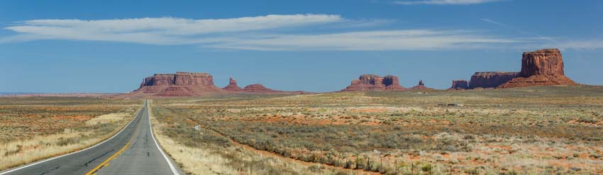
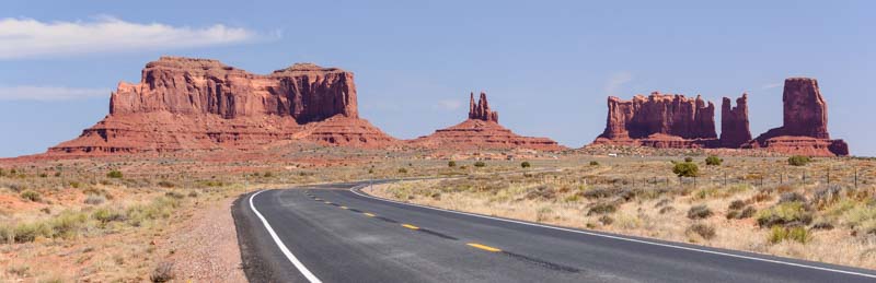
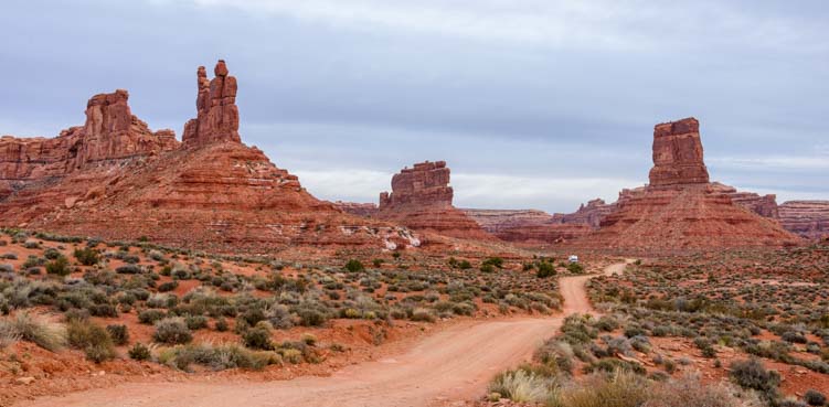
March 2016 – Just over the border of Utah and Arizona at the eastern edges of the two states, a few miles north of Monument Valley, lies a fabulous scenic drive through an area called the Valley of the Gods.

Many RVers explore the Valley of the Gods on their way through the eastern AZ/UT region.
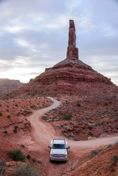
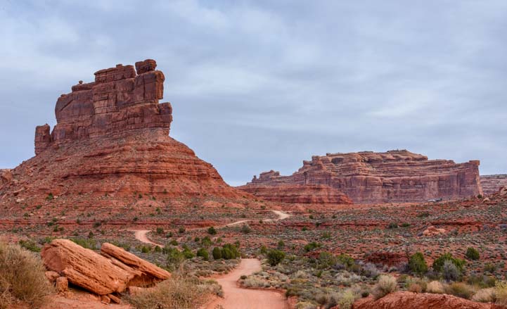
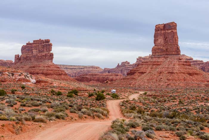
This is a 15 mile or so dirt road that winds through incredible rock formations.

The “golden hour” before sunset is a wonderful time for photography here.
Some of the rocks formations are reminiscent of the famous ones at Monument Valley, but this area is much smaller and much less visited.

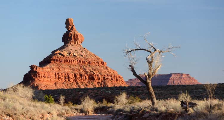
A hand with a thumb similar to the more famous rock formations of Monument Valley!
It is a wonderful drive to do at any time of day, but sunrise and sunset are when the colors really jump out.
.
When we were there in late March, we had the whole place to ourselves as the sun was dropping low in the sky.

What fun!!
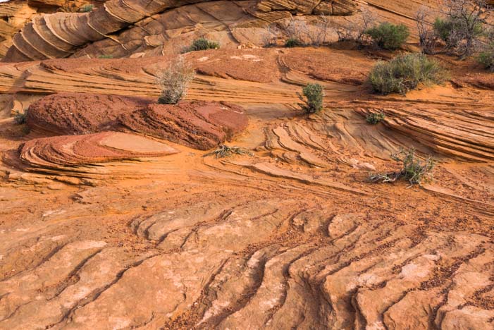
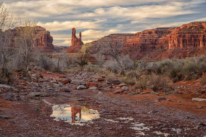
This is a parched desert land, but it had rained in the past few days and there were still puddles on the ground that made for some fun reflection photography.

Recent rain left puddles that were lots of fun to photograph.
.

.
We were hoping for a colorful sunset, but the skies darkened before any pink or red hues had a chance to form.
No sunset, but very cool anyway!
Early the next morning, we did the drive again (it is well worth driving through Valley of the Gods more than once!).

At dawn, the sun played with its shadow.
For brief periods, the sun penetrated the overcast skies and played with its shadow on the rock formations.
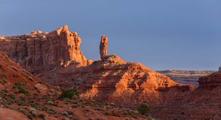
The rock formations were filled with vibrant colors in the morning sun.
The most beautiful part of this drive is a two to three mile section in the middle where it makes a series of s-curves between the rock formations.
I love curvy roads!!
Each formation is lovely, and even though the sun decided to call it quits for the day, the muted light showed off the majestic scenery without the glaring brightness and shadows cast by sunny skies.

.
The sun didn’t stay out for long, but the colors were still beautiful.
This is a jaw-dropping drive!
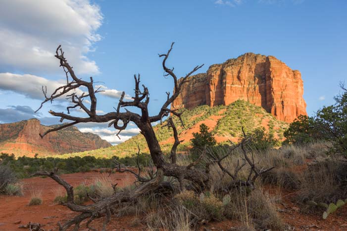
Not far from the Valley of the Gods is a phenomenal road that climbs through a series of very tight and steep switchbacks up to lofty heights. It’s called the Moki Dugway. This road was built in 1958 to move uranium ore from the Happy Jack mine to Fry Canyon.

The Moki Dugway is a hair-raising drive up steep switchbacks on a dirt road. But what a view!
We climbed up the switchbacks and 10% grades in our truck. At a viewpoint part way up we watched a Class C motorhome making its way along this insanely steep road. What a brave driver!

A Class C motorhome braves the Moki Dugway
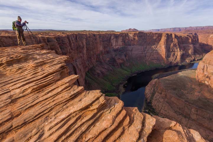
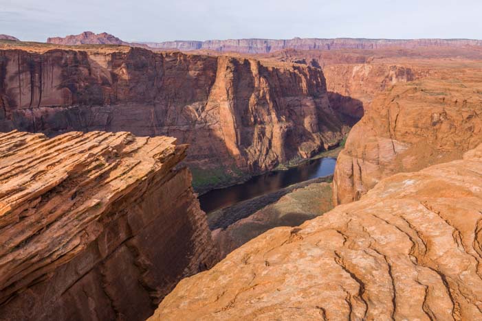
On another day we took a daytrip to Goosenecks State Park. This park is basically an overlook with sweeping views of a tight turn in the San Juan River, reminiscent of Horseshoe Bend in Arizona.

Goosenecks State Park is a bend in the San Juan River, much like Horseshoe Bend near Page, Arizona.
I had always thought these two places were one and the same, but they are actually very different.
Horseshoe Bend has vast stretches of red rock sandstone slabs at the top of the rim> The Colorado River far below is blue, because at that point in its journey it has just emerged from the dam at Lake Powell. Goosenecks State Park has more of a crumble rock surface at the rim and has lots of vegetation on the canyon walls. At the bottom, the San Juan RIver is muddy and brown.
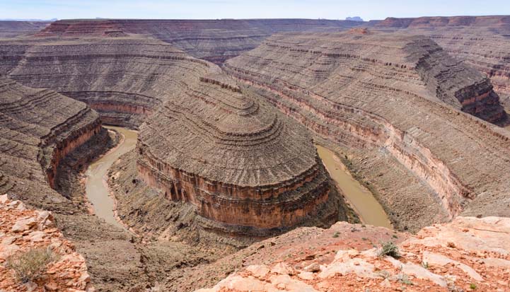
Goosenecks State Park overlook.
Someone had placed a bunch of stones in spiral near the edge.

What is this? Some strange meditation ring? A tourists’s artistic contribution to the state park?
Unlike the National Park Service’s Horseshoe Bend, which is overrun with thousands of international tourists and is free, Goosenecks State Park is $5 for day visitors, and $10 a night for camping on the rim, and there is hardly anyone there. When we stopped by, I doubt the daily fees were covering the salary of the gal sitting in the guard shack at the entrance!

Goosenecks State Park has a handful of dry camping sites right along the rim of the canyon.
There were a few RVs parked along the rim. Some were camped in a cluster near the entrance, but one had claimed a spot far in the distance along the rim. What an incredible view out your RV window!
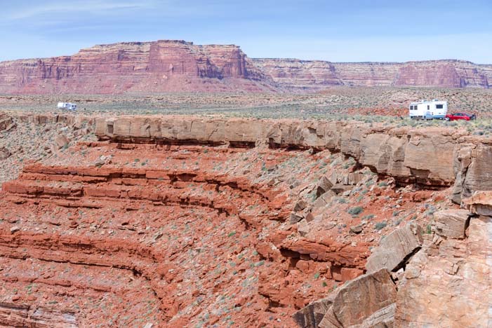
Now here’s a fun spot to camp — with a view!
One RVer was enjoying the morning from his camp chair right at the edge of the overlook. How cool is that?!

Now THAT’s a spot to put your camp chair!!
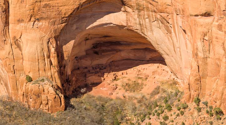
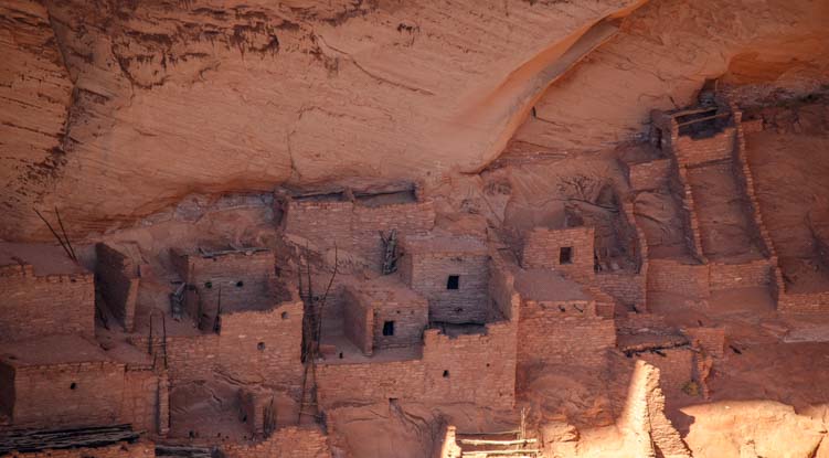
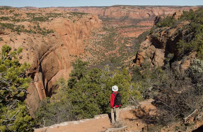
All three of these places — Valley of the Gods, Moki Dugway and Goosenecks State Park — are at the very southern end of the 3,000 square miles of Utah land that the Navajo and other Indian tribes are asking President Obama to set aside to become Bears Ears National Monument. This will protect their many ancestral archaeological sites that are scattered throughout the region. Currently, these areas fall prey to desecration and to mining and oil drilling activities.
National Monuments are under the jurisdiction of the National Park Service whose mission is the protection of national treasures. In line with their charter, the NPS usually takes a hard stance against free wheeling recreation, and they control access and use with an iron fist.
However, the land in question is currently managed by the Bureau of Land Management, the US Forest Service, and even Utah State Parks, each of which has its own unique mission, from resource extraction to recreational use to tourism.
So, this unusual proposal will require these public land management agencies to cooperate in a way they never have before. With any luck, if Bears Ears National Monument is created, recreational use like scenic driving, hiking, biking and camping will still be possible.
Subscribe
Never miss a post — it’s free!
More info about Valley of the Gods, Goosenecks State Park and Moki Dugway:
- Valley of the Godes – BLM Brochure
- Goosenecks State Park, Utah
- Moki Dugway – Wikipedia
- Locations of Valley of the Gods, Goosenecks State Park and Moki Dugway
Other blog posts from our RV travels in Southeastern Utah:
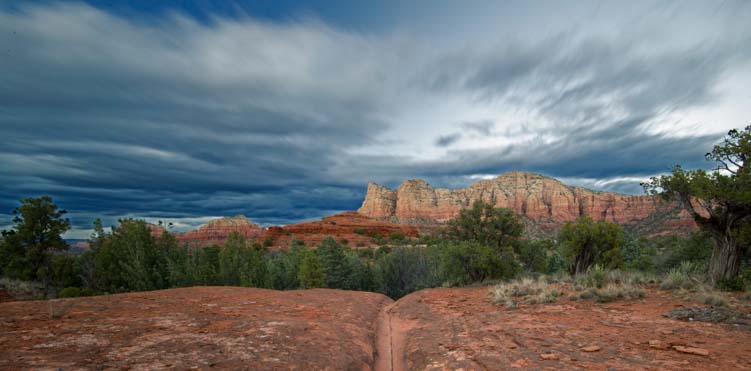
- Heavenly Theatrics in Utah’s Red Rocks 10/04/19
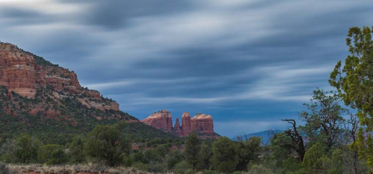
- Mexican Hat, Utah – A Special Hoodoo in the Red Rocks 04/05/19
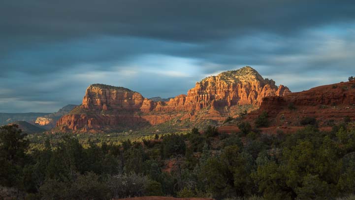
- Traces of Antiquity and the Not-So-Ancient in Utah! 03/29/19
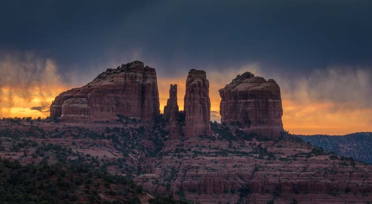
- SE Utah – A Mars Colony, Wide-Angle Photography & Snowy Mountains! 03/22/19
- Monument Valley & Hite Scenic Overlook – Stone Towers from Below & Above! 03/15/19
- Canyon Country Highlights – Lake Powell, Horseshoe Bend & More! 02/01/19
- Goblin Valley State Park Utah – One Gigantic Playground! 04/20/18
- Utah Scenic Byway 24 RV Trip – Capitol Reef National Park 04/16/18
- Canyonlands National Park UT – Island in the Sky (and Night Skies!) 04/28/16
- Dead Horse Point State Park, Utah – Magical Sunrises! 04/23/16
- Arches National Park Utah – A Playground of Soaring Red Rock Bridges! 04/21/16
- Moab Utah – Red Rocks and Snowcapped Mountains 04/14/16
- Canyonlands National Park Utah – Hiking in the Needles District! 04/12/16
- Newspaper Rock Utah – Petroglyphs and Rock Art from the Ancients 04/06/16
- Valley of the Gods & Goosenecks State Park, Utah – Beautiful! 04/04/16
- Paria Rimrocks “Toadstools” Hike to A Hidden Canyon! 05/25/14
- Wire Pass Trail – Slot Canyon Hiking! 05/22/14
- Natural Bridges National Monument & Utah’s Bicentennial Highway 06/15/12
- Goblin Valley, UT – Where the Ghosts Are 10/16/07
- San Rafael Swell, UT – Pictographs & Dinosaur Prints 10/12/07
Our most recent posts:
- Buckskin Mountain State Park – Fun on the Colorado River! 01/31/26
- How to Install Starlink Gen 3 in an RV? Use the Speedmount! 08/07/25
- Escape to Paradise – Rocky Mountain Magic! 08/01/25
- Is Forest River a Good RV? Well Built? Here’s Our Experience 06/20/25
- Sunset Crater Nat’l Monument – Lava & Camels at Bonito CG! 06/06/25
More of our Latest Posts are in the MENU above.
<-Previous || Next->