Grand Teton National Park – 101 Ways to Enjoy The Tetons!

Horseback riders at Grand Teton National Park Wyoming

What a great way to see the Tetons — on horseback!

September, 2014 – The National Park Service has posted some surprising statistics over the years about just how many hours the average visitor spends in each park.

Crazy as it sounds, it is really common for folks to do a quick drive-by, hanging out the car window for some photos to take home, and then checking the park off their bucket list.

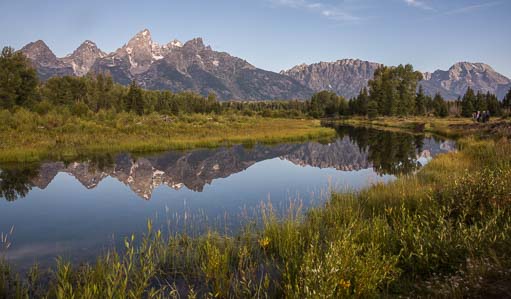
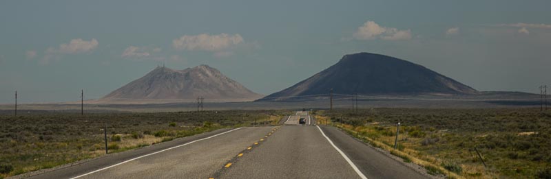
Grand Teton National Park often suffers that fate, largely because it is laid out on a north-south highway that runs from Yellowstone National Park to the town of Jackson, Wyoming.


Grand Teton's new paved bike path

A new paved bike path goes nearly 20 miles along the base of the mountains.

A USA Today article from July, 2012, stated that the average time spent in the Tetons is just 6.5 hours!!

While it’s easy to drive through the Tetons really fast, during our two week stay on this visit we discovered there are all kinds of wonderful ways to get to know this park in a much more intimate way.

A fantastic addition to the park that was built since our last visit in 2007 is a nearly 20 mile long paved bike path that runs from the southern entrance of the park to the far north end of Jenny Lake.


Riding a bicycle with a view of the Tetons

The only problem with riding by views like this is keeping your eyes on the road!

We rode portions of it several times, and it took us to quite a few off-the-beaten-path locations within the park that we never would have stopped at if we’d been touring in our truck.

Every mile of this path was filled with families and cyclists of all ages. They were all enjoying a day of riding in the fresh air, with a stunning view the whole way.

We met cyclists from Jackson doing their daily workout ride (lucky them!!), clubs from out of town that had arranged a group ride of the area, and the Backroads Adventure Tour company with paying customers.


A motorcycle rides into Grand Teton NP Wyoming

Seeing the Tetons by motorcycle would be awesome,
especially on the curvy roads.


The roads throughout the park are ideal for scenic driving in a car, but they are probably a whole lot more fun on a motorcycle.

There’s a series of sweeping turns in the northern portion of Teton Park Road that are just too stunning for words, and doing them on a motorcycle would be quite a thrill!

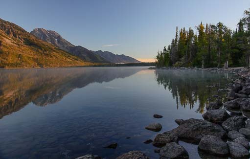
Boating is another great way to go.

One day as we walked along the pebble beach at Jenny Lake, we rounded a point and our jaws dropped when we saw a beautiful sailboat anchored on crystal clear water set against a spectacular mountain backdrop.

A sailboat anchored in Jenny Lake Wyoming

Ahhh… maybe the nicest way to experience the Tetons would be by sailboat.

Kayaks and ferry boats on Jenny Lake in Wyoming

Kayaks and canoes are available for rent.

At the south end of Jenny Lake a small boathouse is home to the ferry boats and rental kayaks and canoes.

Getting out on the water is always a pleasure, especially in a watercraft you can power yourself.

Kayaks on Jenny Lake Grand Teton National Park

These two gals said they were loving their kayak ride as they floated past me.

We saw lots of folks kayaking on the lake, some of whom had brought there own and some of whom were renting them from Jenny Lake Boating.

This company also rents canoes and offers ferry boat rides and scenic boat rides on Jenny lake.

Jenny Lake ferry boat in the Tetons

A quickie ferry boat ride gets you out on the water and across the lake.

Even though we missed the summertime bargain boat fare for this ferry, I ended up scoring a free ride later that morning with some rock climbers who were headed across the lake for a day of climbing.

A kayak at Jenny Lake Wyoming

Now that looks like fun!

Mark had already hiked halfway down the two mile trail that goes from the boathouse to the dock on the far side of the lake, so we chatted on our trusty two-way radios about my good luck and his scenic hike, and later caught up with each other!

If flying across the lake at breakneck speed while hanging onto your hat with both hands isn’t the way you dream of way of seeing the Tetons from the water, a canoe trip is a much more peaceful way to go, and you can share the ride too!

Rafting trip down the Snake River in Wyoming

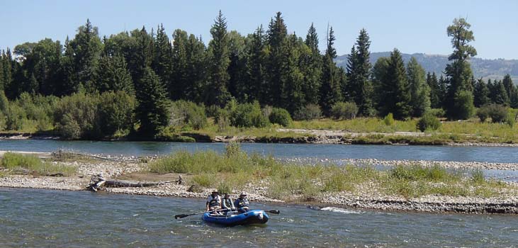
There are loads of rafting trips, from little rafts like this one to huge ones with 10 people aboard.

Powerboats in Jenny Lake Marina Grand Teton National Park

We were astonished by the size of some of the powerboats. What a spot to keep a boat!

River rafting trips are also extremely popular, and we saw several huge rafts filled with ten or so people. A guide stood up in the middle and used an enormous oar to steer the boat.

There were also smaller rafts of all kinds, each flying down the Snake River at a very fast clip

Fishing on the beach at Jenny Lake

Fishing is a nice quiet way to take in the serenity of the Tetons.

There were powerboats of all shapes and sizes at the marina too.

Artist painting at Phelps Lake Grand Teton National Park WY

This is a place that will get your creative juices flowing!

Of course, nothing says you have to be on some kind of moving vehicle to enjoy the Tetons.

The more stationary pursuits of fishing and artwork are other great ways to soak in the beauty of this magical place.

When we hiked to Phelps Lake, we were delighted to come across an artist working at an easel by the water’s edge.

Riding a driftwood see-saw_

Aw heck, when you find a see-saw on the beach you’ve gotta try it out!

Sometimes it’s fun just to be a kid in the presence of these special mountains.

On the shores of Jenny Lake we found a huge driftwood log see-saw, and we promptly jumped on it to give each other a ride.

A motorhome drives in Grand Teton National Park Wyoming

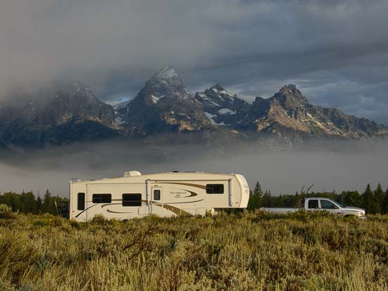
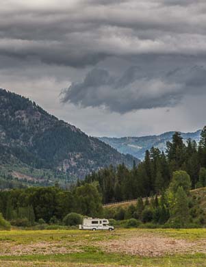
RVs are almost as common as cars in this park.

Of course, the Tetons are RV heaven, with lots of camping options both inside and outside the park.

Every other vehicle on the road was an RV of some sort, and a good percentage of them were rental RVs.

Laurence Rockefeller's audio-visual meditation room at Grand Teton

The Rockefellers built audio-visual (and audio-only) meditation rooms where you can experience nature without the dirt and dust.

For those who don’t want to deal with the grit and effort of hiking and being outdoors, the Rockefeller family (who were responsible for the Park Service’s acquisition of most of the lands in the area), have created a unique “green” building that has several audio-visual meditation rooms.

This might seem goofy, but watching the baby bears climbing trees, the moose lapping water from the lakes and the birds flitting between the trees in larger-than-life scale was actually really cool, especially since we didn’t see those things at close range on any of our hikes.

Reading a book on the beach

What a place to relax and unwind for a while!

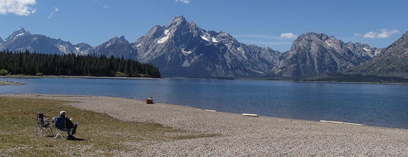
Perhaps the best way to enjoy the Tetons, though, is just to pull up a chair and kick back in the presence of these magnificent mountains. After taking in the incredible views, it is even permissible to look away from the dramatic landscapes for a while and settle in with a book!

__________________________

Well, that’s not exactly 101 ways to enjoy the Tetons, but it’s a whole bunch!

Grand Teton Lodge Company is the National Park’s concessionaire for the campgrounds, (Colter Bay and Gros Ventre are RV campground options at different ends of the park).  They also offer scenic lunch/dinner cruises on Jackson Lake and river rafting trips.  Jenny Lake Boating offers ferry rides, private boat rentals and kayak and canoe rentals on Jenny Lake. 

Subscribe
Never miss a post — it’s free!

Our most recent posts:

Other blog posts from our RV travels to Grand Teton National park:

<-Previous || Next->


New to this site? Visit our Home page to read more about our full-time traveling lifestyle and our Intro for RVers to find out where we keep all the good stuff. If you like what you see, we'd love for you to subscribe to receive our latest posts!

Grand Teton National Park WY – Mirrored Waters

Sunrise at Shwabacher's Landing Grand Teton Wyoming-2

Sunrise at Shwabacher’s Landing.

September, 2014 – The wild skies in Wyoming’s Grand Teton National Park settled down after a while, and clear blue skies began to rein.

We continued our morning ritual of hopping out of bed before dawn to run down to the scenic viewpoints to catch the sunrise.

As the sun rose, pastel shades would silently creep across the sky and then spread across the water below in beautiful mirrored reflections.

The sunrise was different every day, and each one was lovely in its own way.

Teton Mountains at Shwabacher Landing Wyoming

Just before sunrise, mist floats along the base of the Tetons.

Perfect reflections of the Teton Mountains at Shwabacher Landing

At the same place on another day, the mountains blush and check their reflections in the water.

Still water and mountains Shwabacher's Landing Teton Mountains Wyoming

Mirrored reflections of sky and mountains at Shwabacher’s Landing

This business of running around before dawn turned out to be surprisingly popular in the Tetons.

Every morning, headlights pierced the cold black air heading in both directions on the highway, and brake lights lined up at the turn-offs to the viewpoints.

At first we thought the Tetons were full of crazy photographers.

Water reflections Shwabacher Landing in the Teton Mountains-3

Serenity.

But we soon figured out that lots of these people were fishermen, wildlife stalkers and folks getting an early start for their day’s hike.

So much for R&R when you take a vacation to Grand Teton National Park!

What we loved, though, was the stillness of the water and the way its glassy surface mirrored the sawtooth mountain peaks as they changed shades in the morning light.

Placid water at Shwabacher's Landing at the Tetons

Prefect stillness… for a split second!

We returned to Shawbacher’s Landing several times to capture these special moments, and every single time we were teased by the dam-building beavers.

A tree felled by a beaver

Beavers are great lumberjacks. How do they
know when it’s time to bite and run?

Each morning, it was guaranteed that until the sun crested the horizon to the east, the beavers would sit on the tops of their dams, silhouetted perfectly.

They looked so cute and stood so incredibly still as they posed for us, little hunched figures on top of their world.

However, in such hopelessly dim light there wasn’t a chance in heck of getting that dreamed of beaver-sitting-on-his-dam portrait.

Beaver Dam at Shwabacher Landing Grand Teton Wyoming

A dam built by a beaver, nature’s engineer.

Of course, just as the colorful magic in the sky would begin, the beavers would all jump in the water and swim around, totally messing up the reflections.

They’d drag branches to and fro between their dams, true to their reputation as nature’s industrious little engineers, but they’d leave the water completely rippled, shattering the pink mirrored mountains into a zig-zag pattern of fractured images.

Mirrored reflection across Jenny Lake in Wyoming

The mirrored reflection of the mountains stretched clear across Jenny Lake.

The photographers that were lined up on the shore would moan and grumble to each other about those damn beavers, throwing up their hands in total frustration.

They’d call out to the beavers, telling them to get out of the way, and pleading with them to hold off on construction until the work day actually started in another hour or two.

Sometimes the water would settle for a split second, and then a flurry of shutter clicks would fly.


Jenny Lake evergreen trees in morning mist Wyoming

Pines mirrored in the mist at Jenny Lake.

Triumphant grins would flash between us all, only to be followed by another series of loud groans when a fish would snag a bug on the water’s surface, sending out a ring of ripples.

Once the light show was over, of course, and the sun rose high enough to bathe the scene in stark, bright light, the beavers would vanish into thin air, nowhere to be found, and the water would resume its glassy state, a little late.

So it goes with nature photography.


Mirrored mountains Jenny Lake Grand Teton National Park Wyoming

We were captivated by the beauty around us.

Jenny Lake sits in the middle of Grand Teton National Park, and there is a 10 minute ferry ride that shuttles people to the far side where there are several wonderful hikes.

Wandering down to the boathouse one afternoon, we discovered that this ferry ride is $15 per person all day long, but the very first boat ride at 7:00 a.m. is just $5.

Misty morning on Jenny Lake Wyoming

Every way we turned the images were
awe-inspiring.

What a deal! We were there!

So, on yet another ice cold morning, we dashed off in the truck, only to arrive at Jenny Lake and discover that now that Labor Day was behind us, the ferries were on a Fall schedule.

There was no early morning discount deal.

Rising mist on Jenny Lake Teton Mountains

The water was like glass.

In fact, there were no ferries at all until 10:00 a.m.

Argh!!

But this turned out to be a blessing in disguise, as we were now on the shores of Jenny Lake at dawn, a time and place where the Tetons quietly radiate their greatest majesty.

Foggy shores of Jenny Lake Grand Teton Wyoming

Mist rises from Jenny Lake.

The mist was rising off the surface of the water, and we suddenly had nothing to do but wander along the edge of the lake and take in the beautiful scene.

Talk about mirrored reflections on the water!

The whole lake was crystal clear and utterly ripple free!

We picked our way between the rocks on the shoreline, totally captivated by the steaming water and glowing mountains across the lake


Morning mist on the water Jenny Lake Grand Teton National Park

Jenny Lake is a magical spot at dawn.

There was less than a handful of other people down at the lake, and we were all walking around with dreamy smiles on our faces.

Granted, we all needed coffee, and we all had red, runny noses, but we all knew this was life at its finest.

The world was asleep, snug in their sleeping bags or rustic cabins or plush hotels in Jackson Hole, but a breathtaking dawn was silently unfolding around us lucky ones right here.


Mountain reflections in Jenny Lake

The mountains glowed orange.

Time stood still as the mountains gradually glowed fiery orange.

The light intensified for a few moments, stealing over the scene and over us noiselessly, without any kind of announcement or tap on the shoulder saying, “Hey, look at me!”

All this bravado and show was just nature’s way of stretching and shaking off the cold stiffness of the night air before getting up.


Dinghies on the beach at Jenny Lake in Grand Teton National Park

Dinghies and trees on the beach made beautiful patterns.

It was a magic moment that swept us up in its glory, so singular and so special for us that it would stay in our memories forever.

But it happens every day, day after day.

How lucky we felt to have witnessed it. How fortunate we were to be in this spot on this morning to watch the vibrant light grow and fade, to see the mist rise and dissipate from the water.

At the same time, how reassuring it was to know that it is always there for everyone, every morning… Jenny Lake at dawn.


Visit these links for the Official Grand Teton National Park website and Wikipedia’s Grand Teton National Park entry.

Here is a little more about Jenny Lake  and the Jenny Lake ferry.

Subscribe
Never miss a post — it’s free!

Our most recent posts:

Other blog posts from our RV travels to Grand Teton National park:

<-Previous || Next->

New to this site? Visit our Home page to read more about our full-time traveling lifestyle and our Intro for RVers to find out where we keep all the good stuff. If you like what you see, we'd love for you to subscribe to receive our latest posts!


Grand Teton National Park WY – Wild Skies

Rainbow over our fifth wheel in Alpine Wyoming

At the end of the flood…a rainbow!


August, 2014 – After our four days of Noah’s Flood in Alpine, Wyoming, finally ended, we were blessed with a beautiful rainbow right over our little buggy.

The mud around us dried just enough so we could make our way back to the highway and continue our journey north towards Grand Teton National Park.

The deluge wasn’t entirely over, however, and dark gloomy skies filled our views for a few days.


Mist rises at dawn in Grand Teton National Park Wyoming

The Tetons are wreathed in a mysterious mist.


We arrived at the Tetons to find them wrapped in a mysterious mist that rose and fell and enveloped their faces as a cold wind whipped ours.

The clouds moved quickly, coagulating into otherworldly shapes and then dispersing into nothing, as if a magician were shrouding them under a gossamer veil and then laughing with a twinkle in his eye as he pulled it away.


Mountain mist explosion at Grand Teton National Park in Wyoming

The mountains seemed at times to be exploding.


We drove along the highway that runs through this park, awe-struck by the majestic scenery surrounding us.

Wisps of fog reached out along the base of the Teton Mountains and stole up their craggy flanks, giving the regal peaks a mystical air.

Sunlight came and went, teasing us as it lit the jagged faces and then withdrew and left them dark.


RV fifth wheel in Grand Teton National Park Wyoming

Dawn’s light played amid the mountain peaks


We roamed all around, enchanted by this unusual light, until some huge black clouds gathered overhead and gave us a frightening glare.

When they finally burst wide open, we huddled inside the buggy.  Rain pelted our roof, thunder echoed off the jagged peaks and lightning flashed all around us.

At last the rain stopped, and we ran along the Blacktail Pond overlook with vague hope in our hearts that there might be a good sunset.


Storm clouds over our fifth wheel RV

Storm clouds threatened and then burst with fury


We claimed our spots with our tripods and cameras on opposite promontontories, just in case.

I noticed another photographer setting up near me.

“Do you think there’s a chance of a sunset?” I asked him, making a face as I glanced at the grey skies.

“You never know.” He replied. “I’ve been coming here for years, and I’ve seen some incredible sunsets.”


Wild skies in Grand Teton National Park Wyoming

Wild skies at sunset

Just then, we both noticed a faint hint of pink in the sky.

As we stared at it, willing it to grow, the most stunning sunset I have ever seen unfolded.

In moments, the entire sky was on fire, flaming in waves of brilliant pink and orange.

The colors intensified, as if the flames were licking the mountaintops.

A pink glow began to radiate between the peaks.


Sunset in Grand Teton National Park Wyoming

Waves of color formed as the sunset drama played out

I could hear the shutter clicks of my companion and the “oohs” and “aahs” he was muttering.

I was doing the same thing, and hoping feverishly that Mark was as spellbound watching this magical drama over on his precipice as we were on ours.

I turned away from the valley for a moment and was shocked to see the sides of the storm clouds above us had suddenly begun glowing magenta.


Storm clouds and sunset in Wyoming

I turned around and saw the storm clouds glowing, as if from a fire within.

Two trees on the flat plain were silhouetted against this delicious, lugubrious sky.

And then, without a hint of warning, it was over.

Mark and I ran towards each other, bursting with excitement.

“Did you see that?”

“Yes. Did you get it?”

“I think so… Look at this one…”

Pink glow between the Teton Mountain Peaks Wyoming

Vibrant shafts of light radiate between the peaks.

Fire in the sky at Grand Teton National Monument in Wyoming

The gods play with fire in the sky over the Tetons.

Shwabacher Landing Grand Teton National Park before dawn

Before dawn, the misty peaks were reflected in the water.

We traded cameras to see each other’s pics, dashed into the rig and drove off in a flurry, totally flushed with excitement.

The next morning we set the alarm for oh-dark-thirty and snuck down to Shwabacher Landing to see if we might get lucky with a sunrise.

The mountains were shrouded in blue-gray mist.

Only the peaks were visible, but the reflections from the mirror-like water gave the scene an ethereal air.


Sunrise at Shawbacker Landing Grand Teton National Park

But all the sunrise drama was happening behind us!

We set up our tripods for our sunrise shot, totally focused on the mountains and reflecting water in front of us.

Then we turned around and our jaws dropped in astonishment as we watched the most vivid display of pink and orange developing behind us.

We were in total awe. But the cameras were facing in the complete opposite direction!

After a few minutes I finally regained my senses, yanked the camera off the tripod and fired off a few quick handheld shots of this glorious sunrise.

Sunrise lights the peaks in Grand Teton National Park Wyoming

Sunrise lights the tips of the mountains as fog rolls in

No sooner had the color faded in the eastern sky than the rising sun began to light the peaks of the Tetons to the west.

The mist was rising rapidly, leaving just the points of each jagged peak to poke its head above and glow pink for a few seconds.

We caught our images, but our hearts were pounding.

How crazy that a silent sunrise could steal over an entire valley and send us into paroxysms of frustration and thrills: “I’m missing it…No, wait, I’m getting it! I got it I got it!!”

Blushing mountain peaks at Grand Teton Naitonal Park Wyoming

The tips of the mountains catch the sunrise above the mist.

For the next few days we rose with the alarm clock to catch the sunrises over the water.

There were other photographers at every viewpoint, all jumping up and down to keep warm, and blowing into their hands to bring some life back to their fingertips.

We shared stories of missed shots, wrong camera settings, and the ecstasy of catching it just right.

Some photographers had caught The Big Fiery Sunset at Ox Bow and Shwabacher Landing where the theatrics in the sky were doubled by reflections in the water.

Stormy sunrise over an RV

Another stormy sunset fills the sky

Such good fortune!

The stormy skies continued to enchant us, and we were blessed with one stunning sunrise and sunset after another.

After nearly a week of this nonsense of getting out of our warm bed in the ice cold dark and not crawling back into that warm bed until many hours after sunset, we were bleary eyed and tripping over our own two feet.

But the Tetons had gifted us with their magic and we were grateful for every stunning moment.


Glowing with happiness at Grand Teton National Park Wyoming

Glowing with happiness in a truly spectacular place.

Prior to this visit, our RV travels in Wyoming had brought us to this magnificent valley twice. The first time, in our first year of traveling, we had naively rushed through way too fast, and the second, just two years ago, had been devoid of mountain views due to thick wildfire smoke in the air.

This visit, however, was taking us by storm, in the best and most literal sense.

We quickly decided to stick around a while to see what else these mysterious mountains would share with us.

For more information about Grand Teton National Park, click here.

Subscribe
Never miss a post — it’s free!

Our most recent posts:

To see our other posts from our RV travels to Grand Teton National park, see the following links:

<-Previous || Next->

New to this site? Visit our Home page to read more about our full-time traveling lifestyle and our Intro for RVers to find out where we keep all the good stuff. If you like what you see, we'd love for you to subscribe to receive our latest posts!

Craters of the Moon + Cataclysms from Sun Valley ID to Alpine WY

Camping in the Sawtooth Mountains

Sunset in the Sawtooths

August, 2014 – We had been enjoying a wonderful stay in Sun Valley, Idaho, spreading out in some great camping spots and taking in lots of free summertime outdoor events.

The wildfires that had nipped at our heels in Sedona, Arizona, and in Bend and eastern Oregon, were by now long forgotten, and after a few days of summer showers and thunderstorms, the air around us was crisp and clear.

We wanted to do a “signature hike” in the area when the sun finally resumed its rightful place in the sky, and a ranger suggested the hike to Baker Lake.

Starbucks insignia for Sun Valley Idaho

This had been the most popular hike in the area until it was devastated by the Beaver Creek wildfire of 2013.

Now it was a hike through a burnt forest.

“It’s still beautiful,” the ranger insisted.  “But in a different way.”

Well, we’d seen enough fires in action this year, why not see what a national forest looked like once the embers cooled a year later?

Baker Lake Road into the Sawtooth National Forest

Beautiful mountains in the Sawtooth National Recreation Area.

Our trail, which had once wandered between green pines, was soon passing between stands of charred trees that were stark reminders of the devastation

However, as we slowed down and took in the strange landscape around us, we soon found there was an eerie beauty to it all. A mysterious aura enveloped us.

The Beaver Creek Fire had been the result of two separate fires that had joined forces.

By the grace of God, the ranger told us, the winds had turned at the very last minute, before the flames raced down a canyon into town, sparing Ketchum from a true bath of fire.

Fire damaged trees from the Beaver Creek Fire in Idaho

The Beaver Creek fire burned 180 square miles

As we hiked, we saw large shards of blackened bark had fallen off the trunks of the trees, leaving intriguing lace-like patterns on the red-brown wood.

Bark falls off the trees from the Beaver Creek Fire in Idaho

Lace patterns on the tree trunks

Scorched logs lay scattered across the ground, each filled with the funny checkerboard patterns that develop as wood burns.

Hiking the Baker Lake Trail we see lupine blooming

A little lupine grows between the blackened tree roots

Scattered here and there between the singed roots and ravaged remains, little purple lupine flowers poked their heads through the cinders and basked in the sunshine.

A thicket of tiny purple flowers filled the spaces between a stand of black stick-like trunks, and a few yellow flowers smiled up at us from their hiding places amid the wreckage.

Life was returning.

RV Camping in the Sawtooth National Forest Idaho

Fire in the sky at sunset — flames of the gods!

Craters of the Moon National Monument

Craters of the Moon National Monument

We had been in Sun Valley for nearly a month, and we were ready to move on.  We packed up and made our way east from Ketchum, Idaho, through Craters of the Moon National Monument.  This monument is a vast sea of lava flows that is the result of a series of violent volcanic eruptions between Idaho and Wyoming.

Driving alongside this moonscape for many miles, there was nothing but black lava rock as far as we could see into the distance.

Ironically, here we were facing another cataclysm, one much bigger than a forest fire and dating from a much more distant time thousands of years ago.

Most of the hiking trails wound through crooked trees and craggy lava rock, but the best one climbed straight up along the lava cinders to the top of a cinder pile.

The more we explored the park, the more we felt its air of haunting melancholy.

Tree at Craters of the Moon National Monument in Idaho

Craters of the Moon has some wonderful landscapes

Placards along the trails told how, decades ago, in a misguided attempt to beautify the park, the National Park Service had poisoned all the trees that were afflicted with an ugly parasitic vine.

Only after all the parasitic vines had been successfully exterminated did the Park Service discover the delicate symbiosis between the vines and the now dead trees, one that is critical to the survival of the remaining trees.

Ancient volcanos in northern Idaho

An old volcano on the horizon in central idaho

We left the park pondering the immense forces of nature and the wisdom of tampering with their balance.  Can human knowledge control nature without disastrous consequences, or mastermind its energies without paying a price? An old volcano decorated with cell phone and radio towers slipped quietly past the car window.

High school class years on the hill in Arco Idaho

The hillside in Arco is covered with enormous white numbers.

Arco Idaho first atomic city in the world

Arco holds a unique distinction.

We arrived in the town of Arco, Idaho, and were immediately struck by the strange numbers that covered the hillside on the edge of town.  What the heck was that all about? Were there mines up there?

Looking a little closer, we soon realized these numbers were years — 2000, 89, 95 — and, asking around, we found out there’s been a long-standing tradition for the high school seniors to sneak up on the mountain and paint their school year on the rock.

That’s no small feat, as the numbers appeared to be 30′ or so tall!  Unfortunately, the Bureau of Land Management put an end to this practice about a decade ago.


ERB-1 Nuclear Power Plant control room_

The EBR-1 control room is right out of Star Trek.

We also learned that Craters of the Moon and the other vast barren landscapes in this region of the country are remote enough to have become the site of lots of weapons testing and nuclear power development over the years.

The little town of Arco stands out in history as the first city in the world to be lit by atomic power, and the nuclear power plant responsible, named EBR-1, is just down the road.

We took a tour, marveling at the 1950’s switches and dials in the control room. They seemed to come right out of Star Trek!

Storm clouds swirl above our RV

A fast moving storm swirls above our buggy.

RV parked under storm clouds

Storm clouds threaten…

Leaving Arco and EBR-1 behind, we traveled on to the shores of beautiful Palisades Reservoir. Just as we pulled the rig around to set up, nature unleashed her fury with a cataclysmic thunder and lightning storm.  I was so taken by the sky, as I “helped” Mark get the rig parked, that I began snapping photos of it with the buggy in the foreground.

Mud and rain out our window

It poured pitchforks for four days!

Mark, of course, was struggling to get the rig parked and set up before the deluge hit while I leaped around singing, “Wow, this is AMAZING, it’s so BEAUTIFUL!” as I took more photos.

Just in the nick of time, I got the camera put away and we got our little home set up.  For the next four days we hunkered down as the rain fell in relentless torrents.

Muddy tracks outside our door

Will we ever be able to leave?

At one point, a knock on our door summoned us to the aid of four teenage boys whose muddy joyride in their Rubicon had left them stranded, hubcap deep, in lakeside muck.

Luckily, the Mighty Dodge (with the help of Mark’s skillful driving and four eager boys pushing) was able to pull the Rubicon back to solid ground.

Sunrise over our RV in Idaho

A beautiful sunrise heralds the (temporary) end of the storms…

At long last we awoke to a glorious sunrise, and the puddles around us soon began to dry. We looked around for Noah’s raven and dove to send out as scouts, but his little winged messengers were nowhere to be found. We had to don our boots and go outside for a look ourselves! After a day of drying out, we deemed it safe to hitch up and leave, and we slowly rolled on to Grand Teton National Park.


<– Previous Post: The Artsy Side of Sun Valley……………………………………..Wild Skies – Grand Teton WY  Next Post –>


See the following links for more info about:

For more from our RV travels to Sun Valley, ID, both past and present, see these links:


New to this site? Visit our Home page to read more about our full-time traveling lifestyle and find out where we keep all the good stuff. If you like what you see, we'd love for you to subscribe to receive our latest posts!

Crater Lake National Park in Oregon – Bluer than blue!

May, 2014 – After recovering from our mad dash across northern Nevada and southern Oregon, our first priority was to visit Crater Lake National Park. We had heard about this beautiful park many times over the years, and now we were blessed with the most perfect weather to go see it on the Saturday of Memorial Day Weekend.

Waist deep snow at Crater Lake

Wow – the snow is waist deep!

As we approached the park, we suddenly found ourselves driving between banks of snow.

We had seen ankle deep snow in lovely Lamoille Canyon back in Nevada, but this stuff was waist deep! Continue reading

Montezuma’s Castle & Schnebly Hill – Sedona Heights!

Montezuma's Castle National Monument

“Montezuma’s Castle” – were the Aztecs in Arizona??!!

May, 2014 – We have driven past those tantalizing signs on I-17 in Arizona a hundred times:
“Montezuma’s Castle” & “Montezuma’s Well.”

But we have always been in a rush either to get up to Flagstaff or down to Phoenix.

Did those signs refer to the 16th century Aztec king, Montezuma?

If so, what the heck had he been doing way up here in Arizona when his real castle was down by Mexico City?

If not, then why did these places bear his name? Continue reading

Colorado National Monument & Fruita CO – Red Rocks, Cycling & Wine!

Fruita Colorado National Monument Mountain Biker

Fruita is cycling heaven!

Mid-September, 2012 – We dropped south from Dinosaur National Monument to Fuita, Colorado, where we found a huge billboard of a mountain biker catching air on the side of an industrial building. How cool! We had heard from friends that this area was mountain biking and road cycling heaven, and so it was!

WTF - Welcome to Fruita

Besides a vibrant mountain biking culture — or maybe because of it — this town seems to enjoy being a little bit irreverent. Stickers and patches emblazoned with “WTF” were for sale everywhere. It’s short for “Welcome to Fruita.”

Fruita lies to the west of its much bigger neighbor, Grand Junction. Paved bike paths weave along the edge of the Colorado River, which flows alongside by these towns, and we enjoyed several rides in the area.


Fruita Colorado Paved River Bike Path

Paved bike paths weave along the river.

Colorado National Monument - Scenic Rim Rock Drive

Scenic Rim Rock Drive

However, most serious road cyclists here head into Colorado National Monument to take on the challenging climbs and sweeping descents of Scenic Rim Rock Drive. We decided to tackle it with the truck instead, so we could bring spare lenses and tripods, and were told at the gate, “You can do the drive in about 45 minutes…”

Colorado National Monument a great place to take your RV!

Beautiful views!

Four hours later we’d made it through only half of the park! What a stunningly beautiful drive. It is loaded with gorgeous viewpoints and short hikes, and we found it impossible to drive straight through without stopping every few minutes. We came back the next day to try to see the rest of it, and after another four hours still hadn’t seen it all.

Colorado National Monument - Window Rock

Window Rock

The road twists and turns along the edges of the canyon, poking out onto peninsula-like points and winding back around valleys, offering ever-changing views of red rock formations. One of the most impressive pinnacles is Independence Monument, a 450 foot tall monolith that dominates the center of the valley.

Fruita Colorado National Monument - Independence Monument

Independence Monument

As we scrambled along the wonderful flat rock shelves that make up the Canyon Rim and Window Rock hiking trails, we kept hearing voices from the valley below us.

Rock climbers on Independence Monument at Colorado National Monument

Watch this!!

We couldn’t tell exactly where they were coming from for the longest time, but then suddenly a group of people appeared on the top of the spire. Independence Monument is a tall skinny rock, and the tiny figures ambled around on top, peering over the edges.

Suddenly they threw a rope over the side and started rappelling down. Now this is not just a straight sided cliff. There is a huge rock overhang at the peak, and each climber dangled for a few moments on the rope, bumping his way down until he got his footing on the rock below. Yikes. We were glad to have lots of solid footing all around us on all sides!

Monument Canyon at Colorado National Monument

Monument Canyon

We learned later that every Fourth of July local climbers scale this peak and plant a huge American flag on the summit of the spire.

The first climber to scramble up that sheer rock wall was John Otto, and today’s most popular route to the top is the one he took in the early 1900’s. He loved this canyon and wanted it to be preserved for future generations, and he campaigned tirelessly for the creation of the Colorado National Monument.


Devils Kitchen - Colorado National Monument

Devils Kitchen – for scale, see my red shirt!!

It was finally established in 1911. Not only did he oversee construction of Rim Rock Drive, which was initially called the Serpents Trail with 52 switchbacks in just four miles, but while he was the park’s first custodian he created many of the hiking trails that are still enjoyed in the park today.

Fruita Colorado National Monument Cold Shivers Point

Cold Shivers Point

Even more intriguing than the official park history, however, was the bizarre history we found engraved in the stones at Cold Shivers Point. As we walked towards the edge of this spectacular overlook, stepping across nature’s broad, unevenly spaced patio stones, we looked down and saw each one was etched with all kinds of names, initials, and dates. The dates ranged as far back as the early 1930’s, and included every decade to the current year.

Fruita Colorado National Monument Cold Shivers Point graffiti

Engraved initials date back to the 1930’s

Some names were big, some small, some were in pairs with a plus sign, and others were surrounded by hearts.

Fruita Colorado National Monument Cold Shivers Point graffiti

The Wongs were here 70+ years ago

The Wongs had included a Chinese character, and “R.A.S” had pecked his/her initials out like a woodpecker in 1938.

Fruita Colorado National Monument Cold Shivers Point graffiti

This guy used a woodpecker technique

This was a lover’s lane of sorts, and we found out later it has also been used as something of a lover’s leap too.

Back down in the valley of Fruita we discovered this area is rich farmland. The farmer’s market had some of the most wonderful fruits and vegetables we have sampled anywhere. The apples were tiny but crisp and bursting with flavor, the cucumbers tasted heavenly — who would think a cucumber could taste heavenly? — and the melon stand had a line of people around it slurping noisily. “We don’t have to go to Green River to get good melons,” an old fellow said to me, wiping his chin. We knew what he meant. We’d been to Utah’s Green River during the melon festival years ago, but these melons were every bit as delicious.

Fruita Colorado Farmers Market band

A band was playing at the farmer’s market

A lady selling alpacas and their wool kept the kids occupied for hours. These friendly, gentle animals made sweet humming noises as the kids hung over the fence and petted their thick fur. They are relatives of camels, she told us, but they’re so much cuter!

Fruita Colorado Farmers Market Alpacas for sale

Alpaca

This is also wine country, and on the other side of Grand Junction the small town of Palisade is home to lots of vintners. We drove the wine route and sampled some delicious wines. The port wine from Graystone Winery  was my favorite, while Mark fell for a white wine early on in our tour. But by the end neither of us could remember which one it was!!

Fruita Colorado Palisade Colorado Wineries and Wine Country

Palisade boasts lots of wineries

In late September we often go to the Interbike trade show in Las Vegas to check out the latest bicycles and cycling gear.  This year, however, we opted to attend a photography workshop in Colorado instead.

Fruita Colorado Palisade Colorado Wineries

We had fun on a wine tour

We did get a tiny whiff of bike stuff, though.  A friend of ours builds bicycle wheels at DT Swiss in Grand Junction, and we got a peek at the shop. Spokes were flying off the production line and the truing stands were whirring at this small, high end bicycle wheel manufacturer.

Grand Junction Colorado DT Swiss Wheel Building Factory

DT Swiss bicycle wheel builders

Soon the photo workshop day arrived, and we made our way to Ridgway, Colorado, where the leaves were in the absolute peak of color. What a majestic place that turned out to be!!

More blog posts from our RV trips to Colorado:

<- Previous                                                                                                                                                                                       Next ->


Dinosaur National Monument, UT – More than fossilized dinosaur bones!

Dinosaur National Monument has great road cycling

Dinosaur National Monument is great for cycling.

Early September, 2012 – Dinosaur National Monument is a big park that sprawls between NE Utah and NW Colorado. Many visitors buzz through this park, seeing only the bone display at the quarry.

However, the scenery, homesteads and petroglyphs elsewhere in the park kept us hanging around for quite a few days.

Dinosaur National Monument Road Cycling

We had fun on the bikes.

Dinosuar National Monument Lizard Petroglyphs

Lizard images crawl up the wall

We rode our bikes on the ~12 mile road that heads into the western heart of the park. This is a fantastic road for cycling.

Dinosaur National Monument skulls in a tree

Skulls hung in a tree.

Only a handful of cars passed us in four hours of pedaling and stopping for photos, and the sweeping turns, rolling hills and stunning vistas were a total thrill.

Dinosaur National Monument Petroglyph

What’s that on his head??

There are lots of petroglyphs along this road.  Most are a bit faint, and you have to do the billy goat thing to get up close to a few of them, but they are intriguing, with odd designs of people wearing strange things on their heads.

Dinosaur National Monument Josie's Cabin

Josie’s Cabin


Someone had hung a slew of animal skulls in a tree that we passed.  It was a little weird and gave the area an air of mystery.

The clearest petroglyphs we found on this road were on a sheer wall filled with lizards (photo above).  They march upwards from the bottom of the wall towards the top.  One six foot long lizard heads off to the right.  A perfect photo op would have been if a real lizard had snuck across the petroglyphs for us, but we didn’t get that lucky!!

Dinosaur National Monument Josie's Cabin

It’s a tiny, wee cabin

At the far end of this road, after it turned to dirt, we came across the Josie Morris Cabin.  This tiny four room cabin was home to a very plucky single woman for fifty years.  Married five times and divorced four, a rarity in her time, she bought this small ranch when she was a single mom nearing 40 in the early 1900’s.  She lived here first with her son and then alone until her death at 90 in 1964.

Dinosaur National Monument McKee Springs Road

McKee Springs Road – Where the artists rocked!

The building is wee, and walking around the property to her chicken coop and pasture, it was hard to imagine what life had been like out here, miles from nowhere.  But she was a tough old biddy.  She brewed apricot brandy during Prohibition and got arrested twice for cattle rustling when she was in her 60’s.

Dinosaur National Monument McKee Springs Petroglyphs

McKee Springs Petroglyphs


Dinosaur National Monument McKee Springs Petroglyphs

One morning we came into the park from another angle, taking the road to McKee Springs.  Here, in a wide valley, we found the finest petroglyphs we have ever seen anywhere.

Dinosaur National Monument McKee Springs Petroglyphs

This must tell a story.

Dinosaur National Monument McKee Springs Petroglyphs

Dinosaur National Monument McKee Springs Petroglyphs

A ghostly double? Two sets of arms? Huh??

Like all petroglyphs in this part of the country, they date back about 1,000 years to the Fremont culture, but lord knows what they say. All the figures wore headdresses or spiky things in their hair (antlers? feathers? antennae?). Some had elaborate decorative things around their necks, wore earrings, or dressed up their hair on the sides of their heads.

These petroglyphs are all lined up along the sheer faces of a cliff at eye level, and a path leads from one set to the next.  It is like walking through a museum, but there are no curator’s notes explaining what you are looking at.  That is left up to the imagination!!

Dinosaur National Monument Rainbow Park

Dinosaur National Monument’s Rainbow Park

At the far end of this road there is a tiny campground on the Green River at Rainbow Park.  Not a soul was around.  We thought about bringing the rig down here, but we wanted to get to the other side of the park, and for that we had to go into Colorado and come in from the southern end along Harpers Corner Road.

Dinosaur National Monument Echo Canyon Scenic Drive

The drive to Echo Canyon was beautiful

The highlight of this road was the 13 mile drive down the steep dirt switchbacks into Echo Canyon (4×4 required).  At the top the views stretched on forever, and as we dropped lower and lower into the canyon, the cliffs soared upwards on either side of us.

Dinosaur National Monument Whispering Cave

The cliffs towered on each side of the road.

Dinosaur National Monument Chew Homestead

The Jack Chew Homestead


Partway into the canyon we stopped at another early 20th century homestead, this one built by the Chew family.

Dinosaur National Monument Whispering Cave

You gotta stoop to get into Whispering Cave.


Dinosaur National Monument Whispering Cave

This cave features vaulted ceilings!

Unlike Josie’s solitary life, the Chews brought 6 of their 12 children to live here, starting with a dugout in 1910 and moving into a cozy one room cabin in 1911.  How a family of that size could squeeze into one small room during the long dark winters baffled us.

Steamboat Rock Dinosaur National Monument at Echo Canyon on Yampa River Green River

Steamboat Rock

But this gorgeous, harsh land has sheltered people in tiny places for eons.  The Whispering Caves a little further on had a low entrance but high ceilings inside, and a steady cool breeze blew from between the towering cliff walls.

Steamboat Rock is the centerpiece of Echo Canyon, and we hiked around the valley get a look at it from many angles.  The Yampa and Green Rivers swish around its base, and folks were swimming and kayaking around it.

Dinosaur National Monument Harpers Corner Trail

Views of thousand foot cliffs from Harpers Corner Trail

Instead of swimming, we got our exercise hiking Harper’s Corner Trail, a fantastic out-and-back trail that goes along a ridge overlooking canyons on either side.  From this high vantage point it was easy to see how the rivers had carved out their route between the craggy, horizontally striped cliffs.

Dinosaur National Monument Green River Views

The Green River weaves its way towards us.


On the other side of the trail the Green River made its curvy way towards us.  We watched a group of river rafters floating down stream, a thousand feet below us.

The night skies in this park are among the darkest in the country, and when we ventured out of the trailer one night, the Milky Way was a thick white band, like a wide belt, that crossed the entire sky.

Star Trails at Dinosaur National Monument

Star Trails

Mark had been reading up on various photography techniques, and this was a great place to try a star trails photo.  Pointing the camera at the North Star on his tripod, he left the camera shutter open for an hour to catch the movement of the stars in the sky.

Well, he meant to do it for an hour.  He came into the trailer to warm up, laid down on the sofa, and promptly fell asleep.  When he woke up, an hour and a half had passed!  Oh well — it just made the star trails a little longer!!

We were both very well rested by the time we pulled ourselves away from Dinosaur National Monument, and we were ready for a little in-town activity in nearby Fruita, Colorado.

Our story Dinosaurs and Much Much More was featured in RV Life Magazine in the September 2013 issue.

<- Previous                                                                                                                                                                                       Next ->


Canyon de Chelly, AZ – A Canyon of Indian Cliff Dwellings

RV blog post - We took the scenic route through Arizona's Navajo Nation to Window Rock and saw the stunning vistas and cliff dwellings of Canyon de Chelly.

Window Rock City Park.

Window Rock, Arizona.

The Window.

The Navajo Tribal Band practices for Oklahoma's Red Earth festival at Window Rock.

The Navajo Tribal Band practices

for Oklahoma's Red Earth festival.

The Navajo Tribal Band practices for Oklahoma's Red Earth festival at Window Rock. Navajo Code Talker statue at Window Rock, Arizona.

Navajo Code Talker.

Show of patriotism at a cemetery outside Window Rock on Indian Route 12, Arizona. Views along Indian Route 12, Arizona.

Scenic Indian Route 12.

Exotic rock formations and colors along Indian Route 12, Arizona.

Two toned rock formations.

Brilliant rock formations along Indian Route 12, Arizona.

A homeowner with a flair for color.

All kinds of colors in the rocks along Indian Route 12, Arizona.

The land was painted pink too!

Cliff views at Canyon de Chelly National Park, Arizona..

Looking down Canyon del Muerto.

Looking down Canyon del Muerto at Canyon de Chelly National Park, Arizona..

Sheer cliffs and lush valleys.

"Where two fell off."

Massacre Cave at Canyon de Chelly National Park, Arizona..

Massacre Cave.

Cave dwelling at Canyon de Chelly National Park, Arizona..

The little cave to the left.

Cliff dwelling at Canyon de Chelly National Park, Arizona.

There's a structure inside!

Expansive views at Chelly National Park, Arizona.

The immensity is hard to capture.

Looking across the canyon at Mummy Cave, Chelly National Park, Arizona.

Tim & Mary Lynn look across at Mummy Cave.

Mummy Cave, Chelly National Park, Arizona.

Mummy Cave housed a small community

in the shadows.

Building inside Mummy Cave, Chelly National Park, Arizona.

The structure inside Mummy Cave.

Navajo Fortress between Canyon del Muerto and Black Rock Canyon, Chelly National Park, Arizona.

The confluence of Canyon del Muerto

and Black Rock Canyon.

Antelope House, Chelly National Park, Arizona.

Antelope House is tucked into the

bottom of this massive cliff.

Close-up of Antelope House, Chelly National Park, Arizona.

Close-up of Antelope House ruins.

Hiking down to White House Ruin, Chelly National Park, Arizona.

Beginning our descent

into Canyon de Chelly.

We hike to White House Ruin, Chelly National Park, Arizona.

Looking down on the lush valley floor.

We hike past crazy swirling rock patterns on our way to White House Ruin, Chelly National Park, Arizona.

Crazy swirling rock patterns.

Rock swirls dwarf the trees on our hike to White House Ruin, Chelly National Park, Arizona.

The swirls dwarf the trees in the middle of the pattern.

Pause in our hike to White House ruin, Chelly National Park, Arizona.

We take a breather from hiking.

The lush valley floor of Canyon del Chelly.

The bottom of the canyon is flat and wide.

White House Ruin, two levels of dwellings, Chelly National Park, Arizona.

White House ruin has two levels:

a ground-level building & a cave dwelling above.

Dramatic pink and orange stripes decorate the front of White House Ruin, Chelly National Park, Arizona.

No architect today could design a

more dramatic front entrance!

Awe-inspiring drippy stripes on the cliffs surround White House Ruin, Chelly National Park, Arizona.

The drippy stripes down the walls

fascinated us.

Wildflowers, Chelly National Park, Arizona.

Flower or origamy?

Wildflowers, Chelly National Park, Arizona. Pictographs, Chelly National Park, Arizona: a person and a roadrunner.

Rock Art:  Roadrunner.

Pictographs at Chelly National Park, Arizona: a scorpion.

Rock Art:  Scorpion.

A hogan stands agains a dramatic backdrop of cliff walls on the lush valley floor of Chelly National Park, Arizona.

A Navajo hogan backed by dramatic cliff walls.

We hike through a tunnel on the White House Ruin hike in Chelly National Park, Arizona.

Canyon de Chelly National Park, Arizona

Early June, 2012 -- Leaving the Petrified Forest, we decided to head north by

Indian Route 12 which, to our surprise, was noted on our tourist map as a

scenic route.  As one-time Arizona residents we had no idea there was a

scenic road through the Navajo Nation way over in the northeastern corner of

the state.  We also wanted to see Window Rock, which lies on that road.  This

town is the Navajo tribal headquarters, and it always turns up in the Phoenix

TV weather forecasts with very cool temps.

We arrived on a warm day, however, and

were immediately drawn to the city park in

front of the big window in the rock.

The tribal band was practicing in

the park, and we watched and

listened for a while.  Chatting with

the band leader during a break,

we found out the band was

headed to Oklahoma City in a

few days for the big Red Earth

arts festival there.  Apparently

this is one of the largest

gatherings of Indian artists and

performers in the country, and

the group was very excited.

The park also features a large

sculpture of a WWII "code talker" in action on his radio.  A nearby plaque

explains how the US Military was struggling to find a way to keep the

Japanese from deciphering their communications in the South Pacific

Theater, and that 29 Navajo marines were recruited to devise a new

code using their native language.  By war's end there were over 400

Navajo Marines serving as code talkers, and the Marine Corps

commanders credited them with saving countless American lives.

Maj. Howard Conner, Signal Officer on Iwo Jima, is quoted as saying,

"Were it not for the Navajos, the Marines would not have taken Iwo Jima."

This impressive history is also the subject of a fictional 2002 movie,

Windtalkers.

Back on Route 12 we saw more patriotism in a cemetery festively filled

with American flags.

The scenery on our route became very dramatic as we drove north of

Window Rock.  Huge red rock cliffs lined the sides of the road.

Suddenly it seemed that God switched paints on his easel, and large

rock formations began to cover the landscape in shades of green as

well as red.

Someone with an artistic eye painted their house a vivid blue,

making a wonderful contrast to the green and red rocks in their

back yard

In one place the

sandstone even had a

pink hue.  It was a

beautiful drive.

Our destination was

Canyon de Chelly

National Park

(pronounced "d'Shay").

This park is at the confluence of three

snaking canyons that are like three fingers of

a hand spreading eastward from where they

all join in the town of Chinle ("pronounced

Chinley").

The stunning thing about Canyon de Chelly

is the immensity of the canyons.  Standing on

cliffs that are 1,000' above the canyon floor,

the walls are very sheer and the views curve

past narrow walls of stone.  At the bottom of

the canyon is a lush, fertile valley floor where

the Navajo developed corn fields and peach

orchards in the 18th and 19th centuries.

In the movies, landscapes like this are always accompanied by the piercing call of a

falcon echoing off the canyon walls.  But here the silence was so noticeable that our ears

hurt.  Scanning the horizon many miles distant, and looking deep into the valley below

us, the only sound was our own breathing.  Even the wind stood still.

In 1805 the Spanish tried to conquer the Navajos.  At the point where I was standing a woman

tried to fend off a Spanish soldier, and in their struggle the two fell off the cliff to their deaths.  In

the distance we could see "Massacre Cave" where the Navajos had hidden out.  In the end, the

Spanish claimed to have killed 90 men and 25 women and children, but the Navajo remember it

differently, saying that all the younger men were out hunting that day and the deaths were strictly

women, children and old men.

Either way, the cave looked tiny in

the distance.  Inside were some

structures that the Navajo hid in.

To the left of the main cave was a

much smaller one and, using the

long camera lens, we could see

another small structure inside there

as well.  It is hard to imagine living

on the edge of a cliff like that for any period of time,

especially with the Spanish after you.

At each viewpoint you get a slightly different view of these

lush canyons, and it was hard to capture the enormity of

the place in a little photograph.  Pan out or zoom in?  How

do you show it all??

At the Mummy Cave overlook we came across a

couple sitting behind a tripod. They were waiting

patiently for the afternoon light to provide its best

illumination of the cave ruins far below.  Waiting

for good light sounded like a great idea, so we hung out and

started chatting with them.  It turned out that they had spent the

last three years traveling the western states in their camper van, living

a lot like we do by boondocking on public lands.

Our eyebrows shot up when they told us they had just come back

from a sailboat charter in the Grenadines in the Caribbean ten days

earlier and were contemplating taking their travels to the sea.  What's

more, we found out Tim's mountain bike on the back of their van was

the same exact model as Mark's on the back of our trailer.  To top it

off, Mary Lynn enjoyed web design too.  What a crazy coincidence!!

Like us, too, they were using a Nikon camera to try to capture this cliff

dwelling in just the right light!

The good light never came, but we managed a few shots

anyways and hoped we'd run into these guys again somewhere.

Meanwhile, the mystery of the cliff dwellings lured us on.  The ancients built their homes in caves on these sheer

canyon cliffs between 700 and 1300 AD.  So these homes were first going up right after the peak of Mayan

remodeling down in Palenque in Chiapas, Mexico.  They may not be as majestic in terms of size or human

construction and engineering skills, but they are incredible for making fantastic use of the landscape.  What a

place to build a house!

Over at Antelope House we looked out across the canyon

at a beautifully striped, back-sloping wall.  Nestled at its

base was a small town made up of crumbling walls,

windows and towers.  You need binoculars or a long

telephoto lens to make out the tiny structures so far

below.  Even then they look like little toy buildings for wee

dolls.  They can't possibly be real.

Archaeologists call these ancient people the Anasazi,

which is derived from the Navajo language and is

variously translated as "Ancient Ones" and "Enemy

Ancestors," due to the subtle word "Zazi" which means

"Non-Navajo" or "enemy."  Also known as the Ancient Puebloans,

from the Spanish word for "townspeople," these long ago people

farmed the valley floor and disappeared around 1300, probably due

to drought.  The Navajo didn't arrive in this area until 1600, and by

then the ruins were long abandoned.

The Navajo flourished here for a while, but in 1864 US Col. Kit

Carson entered the canyon with a group of soldiers and

eventually cornered the Navajo at one end.  Few survived, and

those that did were forced to walk 300 miles to Fort Sumner in

New Mexico and stand trial.  They were allowed to return five

years later.

The most famous of the

ruins is "White House

Ruin," and we decided to

hike down into the

canyon to see it up close.

We hiked along with our

new RVing/sailing friends

who had ended up

camping alongside us overnight.  As with every overlook in the entire

park, the views from the top were so gorgeous I found myself running

and jumping over the rocks trying to get the best angles and trying to

fit it all into the camera frame.  Sigh.  Not possible!

The contours of the rocks are

wavy and rippled, swirling in

enormous and wild patterns.

You can almost feel the power of

the water that etched out its

course along these canyon walls

over the millennia, carving its

path ever deeper into the stone.

After snaking down the edge of the rock face,

we finally arrived at the canyon floor, crossed a

small foot bridge, and arrived face-to-face with

White House Ruin.

Two levels of dwellings were built into the base of the cliff -- one

on the ground level and another one up about 40' off the ground in

a cave.  An orange rainbow of stripes rains down the cliff wall,

painted by a divinely inspired hand -- or the result of a spilled paint

can way up on the top of the canyon.

At our feet we discovered unusual

flowers.  A young Navajo boy showed us

a lovely painting he was working on

featuring the White House ruin and some

of the rock art that we could barely make

out along the rock wall.

In no time at all we climbed back to the top, passing through a wonderful

tunnel on the way.  We would have stayed to see a few more of the

sights this mysterious canyon has to offer, but a massive heatwave was

spreading across the west and we wanted to get to higher, cooler

ground.  We seemed to be on an ancient ruin kick, something we had

started with the Zapotecs and Mayans in southern Mexico several

months back.  So we made our way to Mesa Verde National Park in

Colorado, possibly the best collection of cliff dwellings in the US.


Capitol Reef National Park Utah – Awe-inspiring!

Capitol Reef National Park captivated us with its natural afternoon light show at Sunset Point, its Mormon history at the Pioneer Register and the natural rock Hickman Bridge. Capitol Reef National Park: Sunset Point. Vivid colors come to life at Capitol Reef National Park: Sunset Point.

Vivid colors come to life.

Capitol Reef's Sunset Point is a romantic spot for taking photos. Sunset Point at Capitol Reef National Park.

Mark disappears in the vast landscape.

Evening shadows at Sunset Point Trail, Capitol Reef Nat'l Monument.

Late afternoon shadow-play at Sunset Point.

Evening shadows at Sunset Point Trail, Capitol Reef Nat'l Monument. Twisted trees resemble driftwood on an inlad vermillion sea.

Twisted trees resemble driftwood on

an inlad vermillion sea.

We were way too excited to sit down!

Utah wildfire smolders int the distance.

A wildfire puffs smoke in the distance.

Spectacular views along Capitol Reef's

Views along the park's "Scenic Drive"

An antique plough sits out in a field.

An antique plough sits out in a field.

Pioneer Schoolhouse at Capitol Reef.

Pioneer Schoolhouse

The Capitol Gorge wash where pioneers arrived by car.

...and now.

Capitol Gorge Wash then...

It must have been exciting to

arrive here.

Pioneer Register, Capitol Reef National Park.

Hiking to the Pioneer Register.

Pioneer Register, Capitol Reef National Park.

Pioneer names from September

24th, 1910.

M. Larson, Nov. 20th, 1888

M. Larson, Nov. 20th, 1888

Wildflowers soften the canyon walls.

Views from the Golden Throne Hike at Capitol Reef Nat'l Park

Looking down from our hike to

the Golden Throne

Gnarled trees on the Golden Throne hike.

Gnarled trees on the Golden

Throne hike.

End of Trail.  And there's the Golden Throne.

End of Trail.  And there's the Golden Throne.

Views from Capitol Reef's

Views from the park's "Scenic Drive"

The setting sun plays with light and shadow on the rocks at Capitol Reef, Utah.

The setting sun plays with light and shadow on the rocks.

Gifford Homestead Barn, Fruita, Utah.

Gifford Homestead Barn

Horse grazing at Gifford Homestead.

Not a bad spot to graze.

Hickman Bridge at Capitol Reef NP

Hickman Bridge

Mark admires the view of Hickman Bridge.

Admiring the view.

Capitol Reef National Park & Fruita, Utah

Mid-June, 2012 - After our energetic hikes in Natural Bridges National

Monument and our awe-inspiring drive along the Bicentennial Highway

(Route 95), we were geared up to for more immersion in Utah's red rocks.

We found exactly that at Capitol Reef National Park in Utah.

On our first afternoon

in the area we visited

Sunset Point, a perfect

spot to watch the sun

fall lower and lower in

the sky.  The vivid

colors came to life in

the late afternoon.

It is a dramatic

setting - a

wonderful place

to get a photo of a

loved one with a

soaring backdrop.

There were clouds

in the sky, and

they wafted past

us overhead,

casting shadows

and playing with

the sunlight as

they passed.

Dead tree stumps were twisted into exotic shapes here and

there, looking a bit like driftwood that had been washed ashore

somehow in this burnt orange desert land.

Park benches invited us to take

a load off, but we were way too

busy running up and down the

hiking trails -- trying to see

everything at once -- to even

think about sitting down.

Off in the distance a

new wildfire smoldered.  A nearby plaque stated that this part

of Utah boasts some of the cleanest air in the continental US,

but the smattering of wildfires that were burning at the time

weren't helping that claim.

We wandered among the red rocks until the disappearing

sun had quietly stolen all their colors away.

Capitol Reef National Park is a

long skinny park (~5 miles wide

by ~50 miles long) that runs on a

north-south axis along the

Waterpocket Fold which is a

huge buckle in the earth's crust.

There are loads of backcountry

roads and trails leading to wild

and remote places, but on this

visit we stuck to the easy-to-

reach hikes.

The tiny community of Fruita is at the heart of this area, and Mormons settled there in the late

1800's.  By 1917 they had a bustling village filled with orchards.  Cherries, apricots, peaches,

pears and apples are still grown here, but we were just a little too early to take advantage of any of the harvests.

Remnants of Fruita's past still remain

along the edges of the scenic drive

through the park.  An old plow and a

pioneer schoolhouse were reminders of

a bygone era.

This area was extremely difficult to

reach for those pioneers, due to the

rugged terrain of the Waterpocket Fold,

but a route coming in did exist along the

bottom of a wash through Capitol

Gorge.  Between 1871 and the early

1940's Mormons arrived via this route,

first by horse and buggy and then by

car.  Looking at my photos afterwards I

noticed that Mark had been standing

pretty close to the spot where a photo

from the National Park Service showed

an antique car going through.

It took a group of men eight days to move all the boulders out of a 3.5 mile

stretch of the Capitol Gorge wash so it could be traversed by vehicles.  Then two

cars could just barely pass side by side.  Today the wash is regaining its natural

state and there are boulders and thickets of plants growing where it once must

have been smooth enough for a car to make it through.

As the arriving pioneers passed the towering cliffs, a lot of them stopped to

carve their names in the flat parts of the stone walls.  Today it's called the

Pioneer Register, and we saw names and dates from the late 1800's all the way

to 1942.  It is hard to imagine what those determined, rugged and travel-weary

people must have felt as they passed through this gorge to a new life.  Little kids

with grubby hands must have peered out the windows of the cars, while

flustered moms tried to keep all their kids in tow.  I can't imagine the exhaustion

and exhilaration they must have felt.  Yet the town where they were arriving

didn't even have the paved campground loops, the gift shop full of coffee table

books or the flush toilets that it does today.

In my excitement of spotting

a list of names high up on

one wall, I hastily took a

photo without looking

closely enough at what I

was shooting.  I managed

to get all the names in the

list but cut off the date -- it

was September 24th 1910.

Still mulling over the

immense changes that

have taken place in the

world since the last signatures from the 1940's were pecked out on these

walls, we started up the initial ascents of the Golden

Throne hike.  This hike took us to the tops of the rock

cliffs where we had magnificent views looking down on

the road far below.

Gnarled trees greeted us as we climbed higher and

higher, until finally -- and rather abruptly -- we came to a

sign that said "End of trail."  Behind it was the trail's

namesake Golden Throne, a huge round yellow rock.

Making our way back along the park's

simply named "Scenic Drive," the late

afternoon light was playing with the

rocks again, a game of hide-and-seek

that involved brights and shadows

on the burgundy rocks.

A lone barn belonging to the historic

Gifford Homestead and a horse

munching the grass in the pasture

across the street spoke of the

immense peace of this place.  The

trees rustle so softly and the birds

chirp so quietly.  The bustle of the

campground and the arriving cars of

tourists seemed to suddenly hush,

as if everyone knew to act as if the

were in a library in honor of the calm

that resides here.

If the pioneers had a tortuous trip getting

here, once they arrived and got settled they

must have paused for a moment on many a

luscious afternoon and murmured "This is

God's country," because it is, even today.

We fell under the area's spell and decided to do one more hike

before moving on down the road.  Hickman Bridge is a rock

bridge that is a cousin to the three bridges we had seen at

Natural Bridges National Monument.  It is an easy hike in to see

it, but once there we found it hard to get it lined up in such a way

as to prove that it was indeed a bridge.  The other rocks and cliffs

all crowd around it, like a city swarming around a man-made

bridge, and only when you get

underneath can you get it

framed against the sky.

Mark gave up trying to capture

it on camera and simply sat

across the way admiring it, legs

folded and very content.

As has been the theme for us

this season, the heat of summer

began to catch up with us and soon we were pushed a little further

north in Utah to Koosharem Reservoir and Fish Lake where the

fiery red rocks gave way to cool green mountains and seagulls

flying over the water.