Craters of the Moon + Cataclysms from Sun Valley ID to Alpine WY

Camping in the Sawtooth Mountains

Sunset in the Sawtooths

August, 2014 – We had been enjoying a wonderful stay in Sun Valley, Idaho, spreading out in some great camping spots and taking in lots of free summertime outdoor events.

The wildfires that had nipped at our heels in Sedona, Arizona, and in Bend and eastern Oregon, were by now long forgotten, and after a few days of summer showers and thunderstorms, the air around us was crisp and clear.

We wanted to do a “signature hike” in the area when the sun finally resumed its rightful place in the sky, and a ranger suggested the hike to Baker Lake.

Starbucks insignia for Sun Valley Idaho

This had been the most popular hike in the area until it was devastated by the Beaver Creek wildfire of 2013.

Now it was a hike through a burnt forest.

“It’s still beautiful,” the ranger insisted.  “But in a different way.”

Well, we’d seen enough fires in action this year, why not see what a national forest looked like once the embers cooled a year later?

Baker Lake Road into the Sawtooth National Forest

Beautiful mountains in the Sawtooth National Recreation Area.

Our trail, which had once wandered between green pines, was soon passing between stands of charred trees that were stark reminders of the devastation

However, as we slowed down and took in the strange landscape around us, we soon found there was an eerie beauty to it all. A mysterious aura enveloped us.

The Beaver Creek Fire had been the result of two separate fires that had joined forces.

By the grace of God, the ranger told us, the winds had turned at the very last minute, before the flames raced down a canyon into town, sparing Ketchum from a true bath of fire.

Fire damaged trees from the Beaver Creek Fire in Idaho

The Beaver Creek fire burned 180 square miles

As we hiked, we saw large shards of blackened bark had fallen off the trunks of the trees, leaving intriguing lace-like patterns on the red-brown wood.
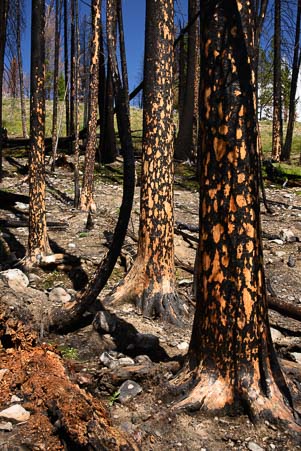
Bark falls off the trees from the Beaver Creek Fire in Idaho

Lace patterns on the tree trunks

Scorched logs lay scattered across the ground, each filled with the funny checkerboard patterns that develop as wood burns.

Hiking the Baker Lake Trail we see lupine blooming

A little lupine grows between the blackened tree roots

Scattered here and there between the singed roots and ravaged remains, little purple lupine flowers poked their heads through the cinders and basked in the sunshine.

A thicket of tiny purple flowers filled the spaces between a stand of black stick-like trunks, and a few yellow flowers smiled up at us from their hiding places amid the wreckage.

Life was returning.

RV Camping in the Sawtooth National Forest Idaho

Fire in the sky at sunset — flames of the gods!

Craters of the Moon National Monument

Craters of the Moon National Monument

We had been in Sun Valley for nearly a month, and we were ready to move on.  We packed up and made our way east from Ketchum, Idaho, through Craters of the Moon National Monument.  This monument is a vast sea of lava flows that is the result of a series of violent volcanic eruptions between Idaho and Wyoming.

Driving alongside this moonscape for many miles, there was nothing but black lava rock as far as we could see into the distance.

Ironically, here we were facing another cataclysm, one much bigger than a forest fire and dating from a much more distant time thousands of years ago.

Most of the hiking trails wound through crooked trees and craggy lava rock, but the best one climbed straight up along the lava cinders to the top of a cinder pile.

The more we explored the park, the more we felt its air of haunting melancholy.

Tree at Craters of the Moon National Monument in Idaho

Craters of the Moon has some wonderful landscapes

Placards along the trails told how, decades ago, in a misguided attempt to beautify the park, the National Park Service had poisoned all the trees that were afflicted with an ugly parasitic vine.

Only after all the parasitic vines had been successfully exterminated did the Park Service discover the delicate symbiosis between the vines and the now dead trees, one that is critical to the survival of the remaining trees.

Ancient volcanos in northern Idaho

An old volcano on the horizon in central idaho

We left the park pondering the immense forces of nature and the wisdom of tampering with their balance.  Can human knowledge control nature without disastrous consequences, or mastermind its energies without paying a price? An old volcano decorated with cell phone and radio towers slipped quietly past the car window.

High school class years on the hill in Arco Idaho

The hillside in Arco is covered with enormous white numbers.

Arco Idaho first atomic city in the world

Arco holds a unique distinction.

We arrived in the town of Arco, Idaho, and were immediately struck by the strange numbers that covered the hillside on the edge of town.  What the heck was that all about? Were there mines up there?

Looking a little closer, we soon realized these numbers were years — 2000, 89, 95 — and, asking around, we found out there’s been a long-standing tradition for the high school seniors to sneak up on the mountain and paint their school year on the rock.

That’s no small feat, as the numbers appeared to be 30′ or so tall!  Unfortunately, the Bureau of Land Management put an end to this practice about a decade ago.


ERB-1 Nuclear Power Plant control room_

The EBR-1 control room is right out of Star Trek.

We also learned that Craters of the Moon and the other vast barren landscapes in this region of the country are remote enough to have become the site of lots of weapons testing and nuclear power development over the years.

The little town of Arco stands out in history as the first city in the world to be lit by atomic power, and the nuclear power plant responsible, named EBR-1, is just down the road.

We took a tour, marveling at the 1950’s switches and dials in the control room. They seemed to come right out of Star Trek!

Storm clouds swirl above our RV

A fast moving storm swirls above our buggy.
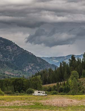
RV parked under storm clouds

Storm clouds threaten…

Leaving Arco and EBR-1 behind, we traveled on to the shores of beautiful Palisades Reservoir. Just as we pulled the rig around to set up, nature unleashed her fury with a cataclysmic thunder and lightning storm.  I was so taken by the sky, as I “helped” Mark get the rig parked, that I began snapping photos of it with the buggy in the foreground.

Mud and rain out our window

It poured pitchforks for four days!

Mark, of course, was struggling to get the rig parked and set up before the deluge hit while I leaped around singing, “Wow, this is AMAZING, it’s so BEAUTIFUL!” as I took more photos.

Just in the nick of time, I got the camera put away and we got our little home set up.  For the next four days we hunkered down as the rain fell in relentless torrents.

Muddy tracks outside our door

Will we ever be able to leave?

At one point, a knock on our door summoned us to the aid of four teenage boys whose muddy joyride in their Rubicon had left them stranded, hubcap deep, in lakeside muck.

Luckily, the Mighty Dodge (with the help of Mark’s skillful driving and four eager boys pushing) was able to pull the Rubicon back to solid ground.

Sunrise over our RV in Idaho

A beautiful sunrise heralds the (temporary) end of the storms…

At long last we awoke to a glorious sunrise, and the puddles around us soon began to dry. We looked around for Noah’s raven and dove to send out as scouts, but his little winged messengers were nowhere to be found. We had to don our boots and go outside for a look ourselves! After a day of drying out, we deemed it safe to hitch up and leave, and we slowly rolled on to Grand Teton National Park.


<– Previous Post: The Artsy Side of Sun Valley……………………………………..Wild Skies – Grand Teton WY  Next Post –>


See the following links for more info about:

For more from our RV travels to Sun Valley, ID, both past and present, see these links:


New to this site? Visit our Home page to read more about our full-time traveling lifestyle and find out where we keep all the good stuff. If you like what you see, we'd love for you to subscribe to receive our latest posts!

Hell’s Canyon – A Gorgeous Gorge!

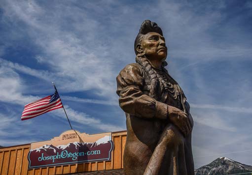
July 2014 – A wildfire in beautiful Hurricane Creek in Oregon’s Eagle Cap Wilderness just a few miles from Joesph, Oregon, spurred us to begin packing up and moving on. Looking at the statue of Chief Joseph, leader of the Nez Perce tribe, in the center of town, as thick smoke rose from behind the mountains at his back, I wondered what he would think of wildfires in his beloved Wallowa mountains.

Chief Joseph and wildfire near Joseph Oregon

What would Chief Joseph think of the white man’s land management today?

The discovery of gold on his tribe’s homeland in 1863 led to the forcible removal of his people from this gorgeous land. He argued with eloquence, grace and dignity before the American leaders of the day for equal treatment of all men under fair laws.

How tragic that Lincoln’s recently declared Emancipation Proclamation said the same thing but Chief Joseph’s impassioned pleas were ignored.

Red roofed church in Halfway Oregon

A pretty church in Halfway, Oregon.

Wholly consumed with thoughts of gold, cattle grazing and game hunting, no one of that time could possibly have anticipated just how massive and mechanized the American population would become or the kind of pressure all this humanity would put on the land.  Since that era just 150 years ago, America has grown by 750%.

Snake River Copperfield Oregon

The Snake River

In one of the country’s least populated areas, east of Joseph, Oregon, the Snake River has carved America’s deepest gorge: Hell’s Canyon.  Cliffs rise as high as 8,000 feet on either side.

The Snake River at Copperfield Oregon by Hell's Canyon

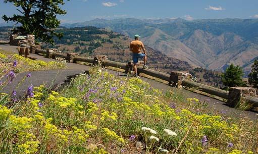
Wallowa Mountain Loop road (Route 39), a twisty National Forest road, runs from Joseph out to Hell’s Canyon Overlook where we got a peak at Idaho’s Seven Devils Mountains that line the gorge.


Hell's Canyon Overlook in Oregon

Hell’s Canyon Overlook – No river in sight!

This is a winding 45 mile drive, and although the views across the canyon were vast, it didn’t give us the perspective on the gorge we had expected.

The Snake River at Hell's Canyon Copperfield Idaho

Hell’s Canyon as seen from the shoreside road!

The Snake River in Hell's Canyon

Curvy road at Hell's Canyon Idaho

I just love a curvy road!

For those views, we had to take a 150 mile detour back through Baker City to avoid the Wallowa Loop Road construction with our buggy.

Beautiful curves and cliffs of Hell's Canyon Idaho

This one lies on the shores of Hell’s Canyon!

We stopped in the little town of Halfway and admired their very cute red church, and continued on to Copperfield at the base of Hell’s Canyon.

Us at Hell's Canyon National Recreation Area Idaho

A memorable visit to a beautiful place.

Unlike the Hell’s Canyon Overlook that peers across the top of canyon, the Hell’s Canyon National Recreation Area offers dramatic scenery and lots of adventure between the canyon walls.  We found loads of inspiring views to keep our cameras happy.

Tubing on the Snake River at Hell's Canyon

People were playing in boats and tubes and standup paddle-boards on the river.

There were boaters playing on the water, fisherman casting their lines, and we even found a tiny private sandy beach tucked along the shoreline.

From our first glimpse of Hell’s Canyon at Copperfield, we drove north along the Idaho side of the gorge to the end of the road at Hell’s Canyon Dam.

Beach on Hell's Canyon Snake River

Snooping around on the banks we discovered a tiny, private, sand beach!

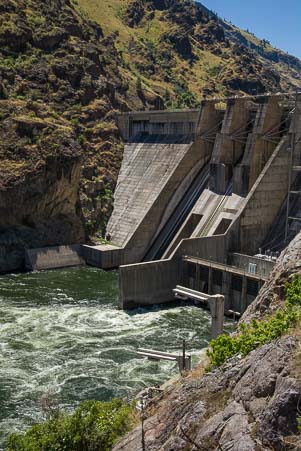
This is one of fifteen dams constructed for various purposes along the Snake River, and it is one of three dams in Hell’s Canyon that were built to produce electricity and control flooding.

Hell's Canyon Dam Idaho

Evidence of progress in the form of electricity and flood control, but the “dam thing” blocks the progress of salmon!

Like anything that interferes with the processes of nature, these dams have had unanticipated effects. The Snake River used to be a major salmon run for three different species of salmon that spawned far inland upriver but spent most of their lives in ocean. They’d wait until their last year of life to swim back upriver and spawn the next generation of fish.

Rose bushes at Hell's Canyon Idaho Wildflowers

Taking a photo of a mule deer

A deer looks up while Mark takes his photo.

Unfortunately, those aging salmon can no longer swim past the dams to spawn, so the ones that mistakenly swim up the Snake River this far end up trapped at the dam.

Skinny Mule deer

Hopefully all those grasses will fatten this guy up!

The National Forest Service rangers at the dam told us that because of this salmon roadblock, Hell’s Canyon Dam is an awesome place to go fishing.

They said that over Memorial Day weekend this year, the river was absolutely boiling with fish, and the banks were throbbing with fishermen!

What would Chief Joseph think of that?

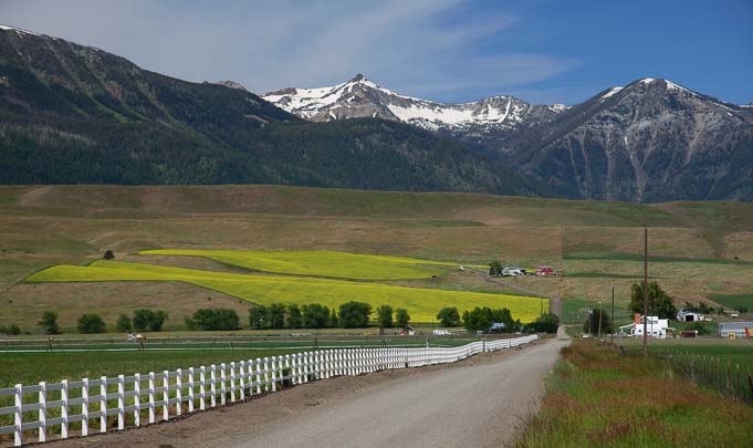
Farm and prairie in eastern Oregon

Farm land, prairie and the Wallowa mountains in eastern Oregon.

I don’t know, but after seeing this part of the world, I understand why he loved this land so dearly.

______________________

Here are some links for more information on Hell’s Canyon National Recreation Area  (more here), the Snake River and its dams as well as RV parking options in Copperfield, Oregon.

Subscribe
Never miss a post — it’s free!

<-Previous || Next->

More from our RV travels in Eastern Oregon:

Our most recent posts:

More of our Latest Posts are in the top MENU above.

Hurricane Creek Wildflowers – Enterprise OR

Trees at Wallowa Lake Oregon

Wallowa Lake

July, 2014 – For a tiny little village, Joseph, Oregon, had been keeping us very busy with a wonderful variety of activiites.

From the unusual bike ride on the old railroad tracks to the Wallowa Tramway to enjoying the scenery along Wallowa Lake, we had been enchanted by this corner of northeastern Oregon every day.

Sacajawea statue in Joseph Oregon

Indian guide Sacajawea

Everywhere around Joseph is incredibly photogenic. Mark got a beautiful shot of the red and green trees down at Wallowa Lake.

Bounding deer in Joseph Oregon

Weeeee!

In town, he got another beauty of the bronze sculpture of the multi-lingual Indian guide Sacajawea.

She helped Lewis and Clark on their 1805 expedition to the Pacific Ocean, not only with translations between two Indian languages, English and French, but with route-finding as well.

Hiking the Hurricane Treek Trail Eagle Cap Wilderness

Hiking into the Eagle Cap Wilderness at Hurricane Creek


Deer are abundant in and around Joseph, and one afternoon Mark miraculously caught one mid-flight as it bounded across the road.

Fording Hurricane Creek in the Eagle Cap Wilderness

Who knew acrobatics were part of this hike?!

Wildflowers on Hurricane Creek Trail Eagle Cap Wilderness

What a pretty field of flowers!

Hanging out in Joseph with our friends Dick and Katie made our time even more special.

When they suggested we all hike into the Eagle Cap Wilderness on the Hurricane Creek Trail, we were delighted.

Wildflower on the Hurricane Treek Trail Eagle Cap Wilderness

There were beautiful wildflowers everywhere.


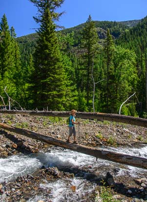
There hadn’t been any mention of fording rushing streams, but within the first half mile we had to make our way across a precarious log bridge!

Wildflowers on Hurricane Creek Hike Enterprise Oregon

And such pretty shapes!

Wildflowers in Wallowa-Whitman National Forest Oregon

Such delicate patterns!


After a lot of uphill hiking through the woods, the trail suddenly delivered us into the most spectacular meadow.

It was filled with wildflowers, and surrounded on two sides by snow-capped mountains.

We were in seventh heaven admiring all the gorgeous scenery!


Hurricane Creek Trail Oregon wildflowers

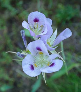
The wildflowers came in all shapes and sizes: pink ones and lavender ones,; big ones and small ones.  Each seemed to be basking in the brilliant sunshine.

Waterfall at Hurricane Creek Trail Enterprise Oregon

A refreshing waterfall

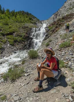
After communing with the spirits of the colorful flowers for a while, we finally followed the trail through the woods and eventually came to a huge crashing waterfall.

Resting on Hurricane Creek Trail Eagle Cap Wilderness Oregon

Ahhh!

Riverside at Hurricane Creek Enterprise Oregon

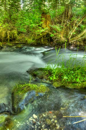
The stream was shallow, but oh so clear!

This was a great spot for a break, and we all enjoyed a snack while zephyrs of cool air wafted over us from the cascading water, caressing our sun-baked skin.

Terminal Gravity Brewing Enterprise Oregon

Yum!

In places, the creek alongside the trail was a vivid light blue and as clear as could be.

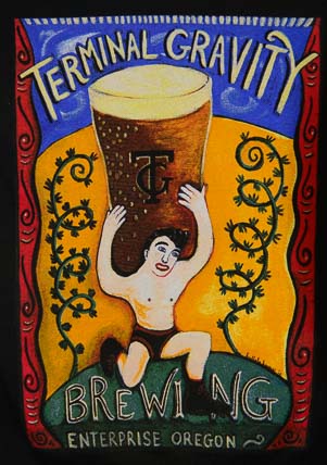
Back in Enterprise, we stopped at Terminal Gravity Brewing for a taste of their microbrew.

Sitting at picnic tables outside the brewpub under several huge shade trees, we enjoyed their outstanding Festiva ale, a yummy beer that can’t be found anywhere else!

Joseph Oregon Scenery

Joseph is incredibly photogenic!

Joseph captured our hearts in every way. It is scenic, quiet, relaxing and far from the rush and chaos of the real world, a perfect combination for a summer break.

Joseph Oregon Horese in a field

The fields were bright green and yellow when we arrived.

The languid days oozed from one to the next, and at one point we were convinced it was Thursday until we checked our wall clock and it told us it was Sunday. How did that happen? I don’t know, but we were loving the slow pace.

Mark gets lost amid the mustard flowers

Mark is in his element — lost in the wildflowers!

We stayed in Joseph, Oregon, so long that the daisies that had been approaching their peak when we arrived had begun to fade.

Sunset in the Wallowa-Whitman National Forest Oregon

A beautiful starburst in the trees at sunset!

The farm fields around town went from the bright greens and vivid yellows of the mustard flowers (planted to rejuvenate the soil) to the dull grey-greens of cut hay.

Hay bales began to dot the fields from horizon to horizon, and one day we noticed the clear air had become stained with the white haze of smoke from distant forest fires.

We still had one more hike we wanted to do, the Lostine River Trail hike that our friend Kim of the Joseph Branch Railriders had recommended very highly.

But we discovered the “distant” fires were actually very close and disturbing.  The Hurricane Creek Trail that we had just hiked was now closed.  A fire was burning in the wilderness we had just hiked.

This was the third time this season we had blazed a trail and left it blazing behind us, first at West Fork in Sedona and then in the Bend, Oregon, area and now here.

Reluctantly, we spread our maps out on the floor of the buggy and began to ponder our next move. North? East? South? We weren’t sure… However, after a few days of musings, inspiration finally struck!

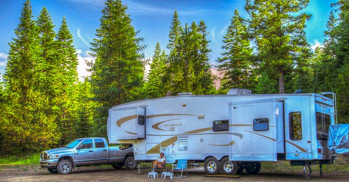
Camping in a Fifth wheel trailer

Picture perfect…this was a time of pure peace and summertime bliss!

Subscribe
Never miss a post — it’s free!

<-Previous || Next->

For more information about hiking in this wonderful area, here are links for the Hurricane Creek Trail and the Eagle Cap Wilderness.

For more info about RV camping in Joseph Oregon, visit these links:

More from our RV travels in Eastern Oregon:

Our most recent posts:

More of our Latest Posts are in the top MENU above.

Wallowa Lake Tramway – Into the Alps!

July 2014 – If riding the old railroad tracks on the cool tandem pedal-driven railcars of the Joseph Branch Railriders weren’t thrilling enough, we soon found ourselves whisked away on the Wallowa Lake Tramway for a gondola ride to the top of Mount Howard just a few miles from the town of Joseph, Oregon.

Wallowa Lake Tramway Ride Joseph Oregon

Up we go — 4000′ feet to the top of Mount Howard!

Mt. Howard Joseph Oregon

We get swept away to a day of adventure in the mountains with new friends.

For a few weeks, our Arizona cycling and RVing friends Dick and Katie had been parked next to RVers Mike and Jea, the owners of this wonderful gondola, and they had become friends.

By the happy luck of being friends-of-friends, we were invited to take the gondola ride up to their mountaintop restaurant and enjoy lunch on the deck with them at the Summit Grill.

Little did we know it would be lunch with a breathtaking view of the gondolas gliding up and down against a backdrop of snow-capped mountains and pretty Wallowa Lake in the distance.

Hiking at the top of the Wallowa Lake Tramway

Wow!

Holy smokes, what a spot! Lunch was delicious, and the view was magnificent!

Snow-capped peaks at the Wallowa Lake Tram Ride in Joseph Oregon

The mountain peaks had snow and the valleys had flowers!

Wild snapdragons in Wallowa-Whitman National Forest Oregon

Wild snapdragons were in bloom.

After lunch, Jea took us out on the hiking trails that circle and weave around the top of the mountain.

Everywhere we turned we saw alpine scenery that was right out of a picture book. The mountains were still decorated with snow and there were lots of wildflowers too.

Hiking amid snowy mountains at Wallowa Lake

Views, views and more views!

Wallowa Lake in Joseph Oregon 511

Wallowa Lake is THE place to go on a hot summer day.

The Wallowa Lake Tramway is at the far southern end of beautiful Wallowa Lake, and we visited the active town beach several times.

Kayaking at Wallowa Lake Oregon

There were lots of kayaks on the lake.

By the river at Wallowa Lake State Park Oregon

It’s a great place for photography!

On the weekends families played on the beach all day, bringing picnics, dabbling in the water and paddling around on kayaks.

I put a toe in the water but Mark ventured out waist deep and then dove in.

Enjoying the cold water at Wallowa Lake Oregon

Feet in the water, beer in hand, does it get any better?

He came running back to the beach shivering like crazy.

“How’s the water?” I asked.

“It’s like swimming in a cooler full of ice!”

Three kayaks at Wallowa Lake Oregon

What a backdrop for a swim or ride in a kayak!

Well, no wonder, since the water comes right from the snow melt on the surrounding mountains.

The air was toasty warm, though, and what better way to while away an afternoon in this kind of heat than to sit on beach chairs out in the water with an ice cold Oregon microbrew in hand?!

Driving the road that flanks the west side of the lake, we passed all kinds of mountain cabins and lakeside homes perched above the water.

This is steep mountain terrain and there were lots of staircases running up to the homes.


No Trespassing for deer at Wallowa Lake Oregon

Didn’t you read the sign?!

Out of the corner of his eye, Mark spotted a deer running up one of these staircases.

I leaned over him to get a shot of this little guy out the window.

Only later did I see that the deer had been standing next to a sign that said, “No Trespassing!”

Riverside in Joseph Oregon

Rushing water at the river.

Deer are really common around Joseph. They wander in and out of front yards and back yards, eating the flowers and looking very cute.

A deer and two fawns in Joseph Oregon

A little deer family shares dinner together.

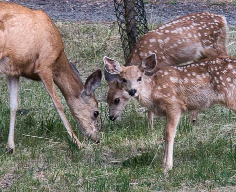
As we drove back from the lake one afternoon we saw a doe with her two spotted fawns.

How sweet!

A doe and her two fauns in Joseph Oregon 481

Mama didn’t mind us but one of the babies was curious!

They didn’t seem to be bothered by us stopping to photograph them.

The mom and one baby looked up, but mom decided we were okay and went back to grazing.

It’s these kinds of heartwarming encounters that were the hallmarks of our wonderful stay in Joseph.

Clouds over our fifth wheel trailer

Clouds streak the sky with some of Mark’s photography magic.

Subscribe
Never miss a post — it’s free!

<-Previous || Next->

For more info about RV camping in Joseph Oregon, visit these links:

More from our RV travels in Eastern Oregon:

For more information about this area, click these links for:

Our most recent posts:

More of our Latest Posts are in the top MENU above.

Joseph Branch Railriders – What a ride!

Rail riding bicycle for two

A Joseph Oregon “Rail Rider” — What a blast to ride!!

July 2014 – While roaming around the backside of the pretty town of Joseph, Oregon, we came across a guy working on the most unusual looking tandem bicycle.

It had two seats side by side and was sitting on the old railroad tracks of an unused railway line.

Continue reading

Joseph, Oregon – At Heaven’s Door!

July 2014 – Even though the cyclists at the Baker City Cycling Classic had seen rain and hail and all kinds of miserable cold weather on their first day of racing, a scorching heat wave was predicted for the upcoming week.  We decided it was time to get out of the valley.  We ventured east at first, checking out the new Oregon Trail Interpretive Center that stands proudly at the top of a hill with some pioneer wagons parked outside that look very authentic from the highway below.

Oregon Trail Wagon train ruts

Original ruts on the Oregon Trail

Most intriguing, however, were the original wagon train ruts of the old Oregon Trail that can be seen just a few feet from the highway.

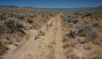
We tromped around for a while, not sure if these were a modern two track road or the real thing, but after a short walk we came across a Bureau of Land Management sign that confirmed these were the real deal.

Fifth wheel trailer on the road to Joseph Oregon

Heading down our Oregon Trail!

The original Oregon Trail was a wide, shallow ditch made by the horses and oxen that pulled the wagons.  Early motor cars used the old trail route too, though, and turned it into a two track road.

I was floored to learn that during the peak of the migration, diaries indicate that thousands of wagons could be seen from horizon to horizon at certain spots along the trail.

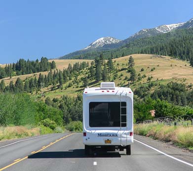
How easy we have it today, driving down the smooth, paved highway, towing our fifth wheel down the road with the Mighty Dodge.  What those pioneers would have given for a rig and road like this!

Wallowa Mountains in Joseph Oregon

The first glimpse of the scenery surrounding Joseph – WOW!

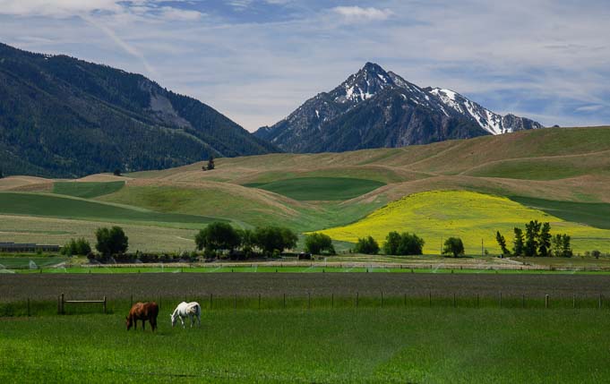
The tiny town of Joseph, tucked way up in the northeastern corner of Oregon (by Washington and Idaho), has been begging us to visit for years. It wasn’t an overt invitation, but Joseph beckoned me on the map because it sits at the end of a dead-end road right at the base of the Wallowa mountains.

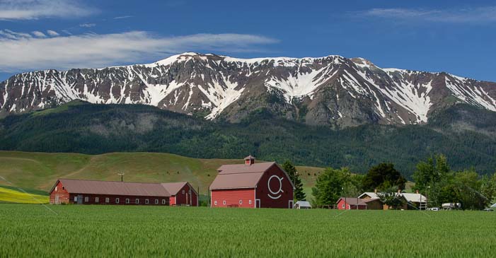
Red barns and Wallowa mountains in Joseph Oregon

Such pretty landscapes!

We needed to skirt the western and northern edges of those mountains to get there, but as the road finally turned south towards Joseph, our jaws dropped at the majestic views taking shape around us.

Joseph Oregon barn

I love those old red barns

The mountains were still snow-capped, and the rolling farm and ranch land stretched green and alive as far as the eye could see.

Snow-capped Wallowa mountains and red barn

The Wallowa mountains make such a beautiful backdrop!

Wonderful old barns filled the foregrounds of every view, each one seeming more picturesque than the last. We stared out the windows wide-eyed.

Main Street and mountains in Joseph Oregon 681

Main Street in Joseph

Lilacs and the Wallowa Mountains in Eastern Oregon

How’s that for a backyard garden?!

If this bucolic alpine scenery weren’t enough, as we pulled into town we were smitten with the quaintness of the place.

Just 1,000 people call Joseph home, and even though it swells a little with visitors in the summertime, it is remote enough that it is still very quiet.

Asking a fellow from Portland how long it had taken him to get here, he laughed and said, “Days!”

Red Horse Coffee Roasters cafe in Joseph Oregon

Red Horse Coffee Traders is a favorite gathering place.

The Red Horse Coffee Traders coffee shop soon became a second home for us, and we had lots of company there.

Rodeo sculpture in Joseph Oregon

Ride ’em cowboy!

The locals hang out there just like we were doing, not only because of the great coffee and unbelievably yummy muffins, but because it’s a fantastic spot to relax in the shade of the trees and mess around on the internet.

“You don’t have internet at your house?” I asked the guy next to me incredulously.

“Nah, I live ten miles out…”

Chief Joseph sculpture in Joseph Oregon

Chief Joseph watches over the town.

Joseph, Oregon, is home to a Valley Bronze, a foundry established in 1982. Bronze sculptors from all over the country cast their works here.

Indian sculpture at the Joseph Oregon post office

Even the post office has a beautiful bronze sculpture outside.

Each corner of Main Street in town is adorned with beautiful bronze sculptures, including one of Chief Joseph, the town’s namesake, that was purchased by Sam Walton’s daughter-in-law and given to the town to display.

A bronze rodeo rider, a soaring eagle, a cougar and Indian guide Sacajawea are all posed elegantly amid the flower boxes around town.

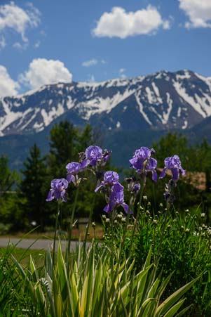
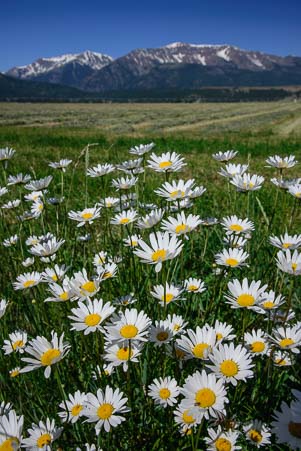
Garden flowers against snow-capped Wallowa Mountains

Daisies and the Wallowa Mountains in Oregon

Wild daisies were in bloom everywhere.

Even the tiny post office has a handsome bronze sculpture of an Indian warrior right outside the front door.

Still drawn in by those dramatic mountains at the back of town, we drove towards them until we came to breathtaking Wallowa Lake.

Kayakers and paddleboarders were out on the water while a few sunbathers laid out on blankets on the beach.

Wallowa Lake in Joseph Oregon

Wallowa Lake

What a place!!

We ran around with the cameras for days, composing photos of those gorgeous mountains with anything and everything we could find in the foreground: wild daisies, vivid pink flowers in a garden, trees, cows and barns…and more barns!

Sometimes we spotted deer as they wandered through gardens in town or bounded through the hay fields on the outskirts.

Deer in our yard

Deer wandered all over town!

Mark even saw a doe with two little spotted fauns when he was out on a run one morning.

Sunset behind our fifth wheel trailer

Happy camper!

As we hung around and chatted with people, we discovered there was a ton of stuff to do in the area besides take photos.

Going over our growing list of hikes and rides and places we wanted to visit, we soon realized we would be here in Joseph for a while!


Subscribe
Never miss a post — it’s free!

<-Previous || Next->

For more info about RV camping in Joseph Oregon, visit these links:

More from our RV travels in Eastern Oregon

Our most recent posts:

More of our Latest Posts are in the top MENU above.

Baker City Cycling Classic

June 2014 – Baker City Oregon is in the heart of some of the best road cycling in America. This is rolling farm country where ranchers own land by the section (that is, by the square mile!).

Rolling counryside for road cycling in northeastern Oregon

Cyclists roll by all the time in eastern Oregon.

Baker City Oregon Loves BIkes

Baker City is in the heart of cycling country.

The roads are well maintained, with generous shoulders, and there is nary a car to be seen once you get a few miles from town.

Touring cyclists in Oregon

We saw touring cyclists of all kinds between Bend and Baker City

On our way from Bend to Baker City, we played hopscotch with long-distance touring cyclists heading east with us (the prevailing winds are out of the west).

Bike racer's leg muscles

Eastern Oregon is a great place to develop legs like these!


Some were on shorter tours with local clubs while others were individuals traveling cross-country on their own with panniers on their bikes.

For a few days on these scenic roads we kept passing, and being passed by, the annual trans-America organized ride put on by America By Bike.

They were en route between Astoria, Oregon, and Portsmouth, New Hampshire, a 51 day trip.


Baker City Cycling Classic Road Race finish line

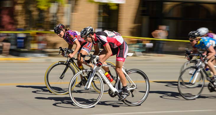
Hammering it out in the final sprint to the finish line.

When we got to Baker City, we saw posters for the Baker City Cycling Classic, a three day bike race with four race stages that attracts over 150 racers from Oregon and nearby states.

By some wonderful, sweet, unplanned, good fortune, we just happened to be in town on the weekend of the race!

With two road race stages out in the countryside that are 72 and 84 miles each, and an 11 mile downhill time trial, there was a lot of racing to see.


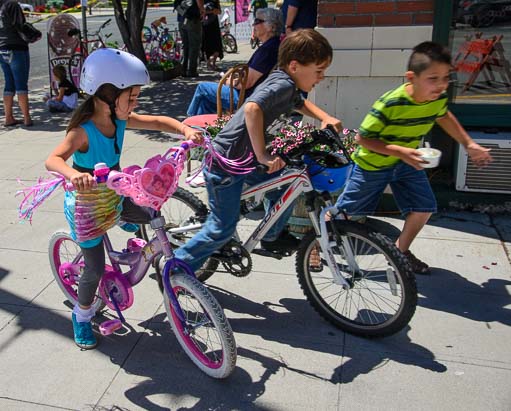
kids racing bikes

“Race ya to the corner!”

We went out to the finish line of the first road race and watched the cyclists descend the last mountain of the day and sprint to the finish line. What a rush!

Little girl bike racer

Going for the gold!

Cyclist warms up for the Baker City Cycling Classic

Warming up on a trainer…

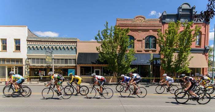
The third stage of the race is a wild Saturday afternoon criterium circuit race around the streets of Baker City, and it brings out the crowds.

As we waited for the race to begin, we noticed two little boys and a girl starting a race of their own on the sidewalk!

After they got to their turnaround point at the end of the block and headed back, the little girl roared by us, hell bent for the win!

Meanwhile, the streets had been blocked off and all the restaurants set up chairs outside for the fans to eat lunch and sip microbrews while watching the action.

Wandering around the empty streets, we saw cyclists warming up on trainers with their teams. A few rode a lap or two around the 1.1 kilometer course to check it out.

Then they were off!

Baker City Cycling Classic passes Geiser Grand Hotel

Bikes blur past the Geiser Grand Hotel downtown.

The racers were divided by the USA Cycling category divisions, and they were unleashed on the course one group at a time.  Each race lasted from 40 minutes to an hour, depending on the caliber of the racers.  The bikes just kept coming and coming, round and round.

Baker City Cycling Classic race downtown

The historic streets make a perfect backdrop for a bike race.

As I mentioned in my last post about Baker City, Oregon, this is a really pretty town full of historic Victorian buildings.  What a great way to show off the city — with colorful cyclists filling the streets!
Bike racers in Baker City Oregon

The race went on all afternoon, so we could walk around to different parts of the course.

Cyclists race in downtown Baker City Oregon_

Baker City’s historic Eltrym movie theater.

The night before the first road race, racers and fans gathered in the historic Eltrym movie theater to watch Half the Road a movie about professional women’s cycling.

This thought-provoking film is a must-see for anyone interested in professional sports, the lives of elite athletes and/or the empowerment of women.

I still find it incredible that in my own lifetime we have gone from Women’s Lib bra burning to being defended by female fighter pilots.

And in recent years, a woman has nearly made the men’s podium in long distance triathlons!
So what a surprise it is to learn from this film that the Union Cycliste Internationale, the  governing body of the sport, is deliberately inhibiting the growth of women’s professional cycling because they believe women aren’t physically up to the demands of the sport!

Pro Women Cyclists race all out

Do women have what it takes physically to race bikes?

Bicycle racers pass Baker City Oregon's St. Francis Cathedral

St. Francis Cathedral peaks out behind the charging pack.

What would they say if they saw the determined women cyclists here in Baker City racing through driving rain and pelted by marble sized hail as they negotiated the steep climbs and descents on the first day of this race weekend?

(We stayed home and drank hot chocolate for that part!)

Popular and funny cycling commentator Bob Roll presents the infuriating facts (including startling interviews with UCI’s top brass) with good humor, making me want to laugh and cry at the same time.

A blur of cyclists race the Baker City Cycling Class bike race in Oregon

With the current demand for a higher minimum wage, how shocking that professional women cyclists worldwide would be happy just to have a wage!

Out on the downtown race course, the fabulous Oregon microbrews kept coming while the cyclists kept rolling, and fans were all on the edges of our seats.

Baker City Cycling Classic race in Oregon 2014 771

What a thrill to watch!

Bike racers pass Eltrym Theater in Baker City Oregon_

Fans clocked the earlier and slower groups of riders at about one minute twenty-five seconds for each lap (about 29 mph).

When the fastest racers, the Pro / Category 1 men, took the course near the end of the day, we clocked them ticking off laps at one minute fifteen second intervals (about 33 mph).

Wow!

On the sidelines the crowd became more and more animated each time the racers zoomed by.

Cyclist looks back at fallen racer 511

Crash!

“You’d better get up there with your camera,” Mark suddenly said to me.  “You know someone’s gonna crash!”

The racing had definitely reached that level of intensity.  You couldn’t win this thing without taking risks, and the racers collectively threw all caution to the wind.  We fans were out of our seats!

Within seconds the pack came by and, sure enough, someone went down.

Racers fish-tailed around each other.  One guy did a cartwheel over another. Soon more bikes went down.


Ouch!

Ouch!

Oh my, when bikes pile up in a corner, they really pile up.

Miraculously, once the pack had scrambled through the mess, the fallen racers bounced back up and brushed themselves off!

Racing cyclist with bandaged arms and legs

Back on his feet.

A few rejoined the race.

But in the final laps it happened again, and one unfortunate fellow stayed on the ground after the race ended while the EMT’s patched him back together again.

They got him all bandaged up on one arm and both legs within minutes, and he was back on his feet and moving once again, although not with quite the same zip!

In all that excitement we lost track of who had won.

But it didn’t matter to us fans. It was the color and the speed and the whir of spinning wheels that had made the afternoon so exciting.

Rainbow

Rainbow after the hail storm that pelted the first road race.

We sure are glad that Baker City loves bikes! If you are here next June, grab a chair at a little bistro and kick back with a microbrew to watch this mini Tour de France from the front row!

Subscribe
Never miss a post — it’s free!

<-Previous || Next->

More from our RV travels in Eastern Oregon:

Our most recent posts:

More of our Latest Posts are in the top MENU above.

On the road to Baker City, Oregon

Big Money Bank Dayville Oregon

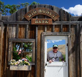
Mark greets patrons at the Big Money Bank

June 2014 – Leaving the John Day Fossil Beds National Monument behind and continuing our scenic drive to northeastern Oregon along Route 26, we passed through lots of small towns.  Each one celebrated the historic American West in its own way.

Still pondering the early 20th century sheep ranching lifestyle we had seen at the Monument, we came across a funny, fake old western town front in Dayville.

Rather than building a sheep ranching enterprise, perhaps the easiest way to make a fortune in the old west was to work at the Big Money Bank. Mark certainly thought so!

Miners' homes black and white

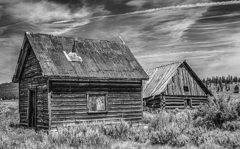
With the railway shut down, Whitney, Oregon, is now a ghost town.

Another community we passed, named Whitney, was once a railroad town for the logging industry. Now it is a ghost town.

Rails extended in all directions from Whitney so that an immense stand of yellow pine could be harvested and shipped out on rail cars.

From 1901 to 1947 as many as 150 people called Whitney home.  Today only a handful of crumbling buildings remain.

Sumpter Railroad Oregon

The Sumpter Valley Railroad between Sumpter
and McEwen is still alive and well!

Further east in Sumpter, Oregon, we found the lovingly restored remnants of the same logging railroad line that had put Whitney on the map: the Sumpter Valley Railroad

This railway now offers excursion rides. From the brake man to the conductor to the engineer, all the positions are held by dedicated volunteers.

Mark at the wheel of Sumpter Railroad Oregon

The engineer gave Mark a turn in the driver’s seat.

Volunteers work for a few years to learn all the skills necessary to be advanced to the level of train engineer, and that was the goal of several volunteers we met.


Meadow of Lupine Sumpter Oregon

We came across a vast field of wildflowers.

The train goes only a few miles between Sumpter and McEwen, but it is a popular ride for young and old alike.

The engineer invited Mark to have a seat in front of the engine. What an antiquated mechanical marvel that is!

The old mechanics who worked on these kinds of engines back when they were still in commercial use are now passing their skills on to younger mechanics who are learning how to restore them and keep them running.

Lupine in the woods

Lupine were blooming in the woods nearby too!

Back on the road again, we saw snowy mountains beginning to appear on the horizon.

When we passed a field full of purple and white lupine, we had to stop for photographs!

Hay bales in Baker Oregon

Baker City is smack in the middle of beautiful farm and ranch land.

While we were both knee deep in flowers, a fellow driving by stopped his truck and walked over to us, saying, “I was hoping someone would photograph those flowers!”

Welcome to Baker City Oregon

Baker City’s small town charm is infectious.

We ended up chatting with him for quite a while, right there on the side of the road. He wasn’t in a hurry and neither were we!

We had arrived on the quieter side of Oregon.

Baker City is the biggest city for hundreds of miles around. How big is big? 10,000 people live there.

How fast is it growing? The population has hovered around 10,000 since 1940!

Baker City Oregon city streets

Baker City Oregon

Baker Tower in Baker City Oregon

Baker Tower is STILL Oregon’s highest building
east of the Cascades!

What a contrast to other western cities like Phoenix that is 23 times the size it was in 1940, or Bend Oregon that has quadrupled in just a few decades.

City Hall in Baker City Oregen

The grand buildings like City Hall
belie the small size of the population.

When I asked at the fabulous Baker Heritage Museum in town why things haven’t changed much over the years, I was told it’s because a lot of old timers like the city just the way it is.

If it ain’t broke, don’t fix it!

Grand Geiser Hotel Baker City Oregon

This small historic city oozes charm.

The nearest Walmart is 45 miles away, and there are no big box stores.

What really makes it special, though, besides its quiet, down to earth and friendly nature, is the beautiful Victorian arcthitecture all around town.

The Geiser Grand Hotel presides over downtown, along with the Baker Tower, the tallest building east of the Cascades.

Five pound gold nugget Baker City Oregon

Baker City was known as the “Queen of the mines” for good reason…

Keeping a lid on growth and resisting change doesn’t mean there’s no money around, however.

Northeast Oregon is the richest part of the state for gold, and the US Bank branch in town has a glass enclosed exhibit of gold nuggets that includes a fist-sized “nugget” that was found nearby in June, 1913.

The day after unearthing it, the two men who discovered it hopped on the Sumpter Valley Railroad (which was carrying passengers as well as logs by then) to take it to Baker City to have it appraised.

At 80.4 ounces (over 5 lbs.), it is one of the largest pure gold nuggets still in existence today (most others were melted down).

Adler House Baker City Oregon

Not all money came from gold and timber…
Magazine distribution magnate Leo Adler lived here.

At the time it was found, gold was about $18 an ounce, making it worth about $1,500 to those two lucky men.

Today, 99 years later, gold is worth over $1,300 per ounce, but as a collectible, this nugget is probably even more valuable.

One of the town’s most successful residents is Leo Adler who created a magazine distribution empire in the mid-1900’s.


Deer crossing Adler Path Baker City Oregon

A deer and his buddy surprise us on the bike path in town.

He started out by walking around town at age 9 carrying the Saturday Evening Post and Ladies Home Journal!

Young buck Baker City Oregon

They call this a city?!!

He loved Baker City, and he left the city a substantial sum, part of which has been used to create a paved bike path through town.

Fifth wheel trailer under a rainbow

What a soul-satisfying town
to call home for a while.

While we were riding on his namesake path one day, Mark saw a young buck nibbling leaves on a tree.

He trotted right between us!

We followed him and his buddy to a big field where they started grazing, totally unconcerned with our presence.

Such is life — one of peace and tranquility — in Baker City, Oregon.


Subscribe
Never miss a post — it’s free!

Here is a little more info for you about Baker City, and the Sumpter Valley Railroad.

<-Previous || Next->

More from our RV travels in Eastern Oregon:

Our most recent posts:

More of our Latest Posts are in the top MENU above.

Smoked out by a Wildfire!

Two Bulls Wildfire Bend Oregon June 2014

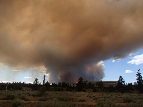
The Two Bulls fire created a mushroom cloud on Bend’s horizon

June, 2014 – We were having so much fun in Bend, Oregon,  that one night when we went to bed we joked that we’d probably stick around for another month.  Or maybe all summer!

The next afternoon the Two Bulls wildfire broke out about ten or so miles away.

Within 24 hours the smoke was choking our campsite.

Ironically, back at Crater Lake, we had stood in the snow on the rooftop of an overlook with some Oregon firefighters who told us they expected a very difficult fire season due to the scant snowfall over the winter. Continue reading

A Scenic Drive in Central Oregon

June, 2014 – Oregon is loaded with designated Scenic Drives, and a lot of these routes weave a web around central Oregon. During our stay in Bend, cruising friends of ours who were on a brief break from sailing the South Pacific on their boat Mazu invited us to visit. This was a perfect chance for us to check out the scenic roads along the McKenzie River that lie to the west of Bend.

Barn and mountain in Sisters Oregon

We got great scenery right away on our way to Sisters

As we approached the cute town of Sisters we were awarded with some spectacular views of snowcapped mountains hovering on the horizon. These mountains are the Three Sisters, bearing the names Faith, Hope and Charity.

They sit a tantalizing but frustrating distance away from the very lonely yet handsome Mount Bachelor who has been trying unsuccessfully to win their affections forever.

Our drive along the pretty McKenzie River took us first to Camp Sherman, a tiny and richly verdant village on the banks of the small Metolius River.

Camp Sherman Head of Metolius River Oregon

Camp Sherman is an evergreen riverside hideaway

Just a few miles from Camp Sherman we visited the headwaters of the Metolius River which spill forth from the side of a hill like a huge bubbler. The scientific debate about the origins of this water is intriguing in an academic kind of way, and we nodded with appropriate solemnity as we read the plaques about it all.

Chipmunk at the Head of the Metolius River

Well, hello there!

Chipmunk begging at Metolius River Oregon

These guys were professionals!

But what really captivated us at the viewing area were the chipmunks.

These cheeky little guys are very fond of people and they ran right up to us.

Suttle Lake Oregon

Come sit for a spell at Suttle Lake…

Well, “fond of people” isn’t quite accurate, as it is the snacks we people carry that they are after!

They sized us up in a heartbeat, and quickly wrote us off as being uselessly empty-handed and soon disappeared.

A little further west on our drive along Route 126 we stopped at Suttle Lake where we wandered among the flowers and took in the lake views.

The Lodge at Suttle Lake is a beautiful log structure with a huge and inviting great room that boasts a big stone hearth.

The Lodge at Suttle Lake Oregon

The lodge was spacious and airy yet cozy at the same time.

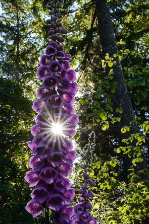
Starburst thru a purple flower

Starburst through a flower!

Lavender Wildflower at Suttle Lake Oregon

Mark found this beautiful wildflower.


The Lodge at Suttle Lake Oregon deck

View from the deck of The Lodge at Suttle Lake

Out on the raised lawn there is an elegant deck with patio seating that overlooks the lake.

Mark spent quite a bit of time among the flowers and came away with some magnificent photos.


Leaving Suttle Lake and carrying on our explorations further west, we came to Sahalie Falls.

Sahalie Falls Trail Oregon

A stream-side hike at Sahalie Falls brought us to this view.

Oregon is known for its stunning and varied waterfalls, but Sahalie Falls will always stand out in our memories as particularly majestic.

We heard the big cascade from the parking lot before we even saw it, and as we descended the stone stairs on the path, a blast of cold air swept across us.

Sahalie Falls Oregon

Sahalie Falls

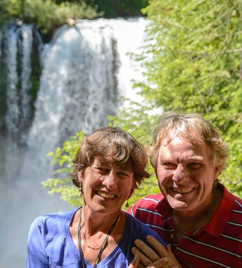
Sahalie Falls and Us Oregon

Happy campers

The stairs are lined with hewn log rails that are covered so thickly in moss and ivy that they are a rich, moist dark green that is alive to the touch.

At the bottom of the stairs a wonderful rainforest hiking trail winds over roots and between ferns along the river’s edge.

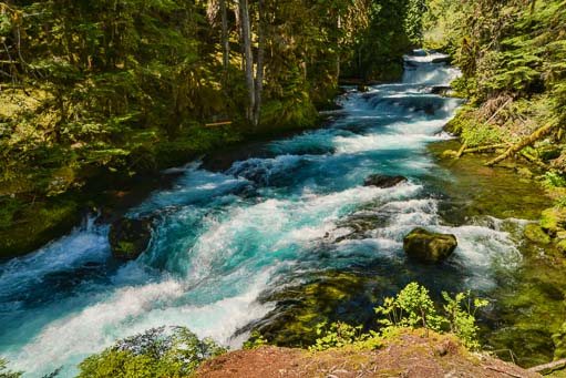
Here the falls rush along in splashy, noisy rapids that tumble and crash over the rocks in a big rush to get downstream.

Good Pasture Covered Bridge Oregon

Good Pasture Covered Bridge is the longest continually used covered bridge in Oregon!

Hopping back in the truck, Route 126 took us further west along the McKenzie River, passing by the historic Good Pasture Bridge.

This covered bridge is the second longest in Oregon, and the longest one that has been in continual use since it was built.

We learned that, back in the day, bridges were built with walls and a roof so horses would walk across without shying.


Good Pasture Covered Bridge and 1959 Corvette

And here comes a 1959 Corvette!

How fun to watch a pristine 1959 Corvette convertible come through the bridge towards us!


Our friends took us to the Leaburg fish hatchery where trout and other fish are raised to stock the area rivers and lakes.

Seeing the jumble of fish in the water was interesting, but the best part was when an osprey silently swooped down and grabbed a fish out of a tank in its talons.

Soaring osprey

There’s nothing like a free lunch!

He took his catch up in a tree to enjoy lunch with a view!

Two routes cross the Cascades west of Bend, the Santiam Pass (Route 126) we had just driven and the McKenzie Pass (Route 280) we had not yet seen.

For one month each spring the McKenzie Pass Scenic Byway is opened strictly to bicycle traffic. We hit it with our mountain bikes on the last day that bikes ruled the road.

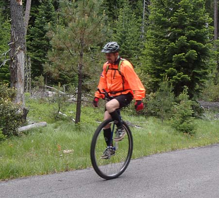
Unicycle on McKenzie Pass Oregon

Riding our bikes up steep McKenzie Pass we were humbled to
see a guy doing it on a unicycle!!

After a long grind to the top and a screaming descent back down to the bottom, we noticed a fellow doing the ride on a unicycle.

This wasn’t his first time either. He told us he’d ridden to the summit on his unicycle each weekend since the route opened to bikes four weeks earlier. What’s more, he was part of a unicycling mountain bike club.

And here we’d been patting ourselves on the back for conquering McKenzie Pass and romping around the area’s mountain biking trails on our two wheeled bikes.

Without a doubt, the area around Bend, Oregon, was continuing to impress us with its gorgeous rivers, streams and lakes and its vigorous and irreverent spirit!


<– Previous Post: Lakes & Rivers in Bend, Oregon………………………………..Smoked Out by a Wildfire! Next Post –>

New to this site? Visit our Home page to read more about our full-time traveling lifestyle and find out where we keep all the good stuff. If you like what you see, we'd love for you to subscribe to receive our latest posts!