This is the second part of our story of doing the Baja Bash. The first part is here: Baja Bash (1).
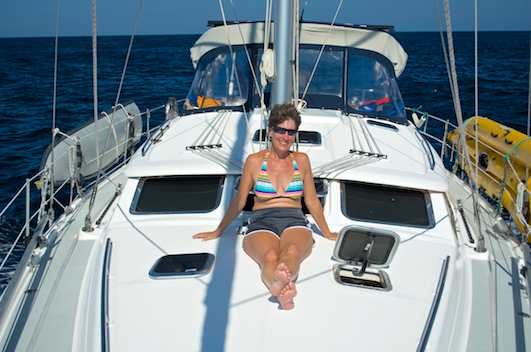
Early July, 2013 – I slowly became aware of my surroundings aboard our sailboat Groovy as I woke up after just two hours of sleep. For the past two days we had been sailing non-stop from Puerto Vallarta to Cabo San Lucas, and it felt luxurious to be lying in bed at anchor in Cabo without having to worry if we were still on course or if we were about to hit something in the dark.
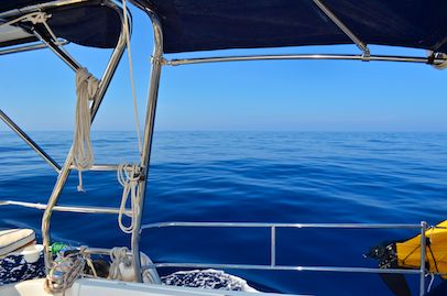
I was thinking dreamily of how beautiful and crystal clear the water had been in Cabo San Lucas when we had first arrived here in November 2010. It had been the clearest water we ever saw during our cruise of Mexico.

View from the Cabo San Lucas anchorage. Dozens of resorts line the bay.
The water had been a brisk 70 degrees then, however. In contrast, a few hours ago when we arrived in Cabo in the predawn light, the temperature gauge had said the water was 80 degrees. This wasn’t quite the 89 degrees we had left behind us in Puerto Vallarta, but I sure looked forward to relaxing for a few days and enjoying some swimming and snorkeling, not to mention catching up on much needed sleep.
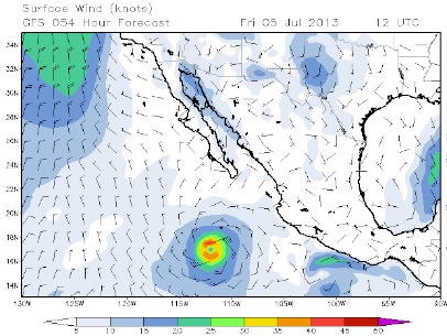
I rolled over and thought about how well the precursor to the Baja Bash had gone for us. I really liked this business of taking advantage of the hurricanes. Today was Friday, July 5th, and if we waited for the hurricane coming up behind us, we could catch it on Monday, and then ride its outer southerly winds right up the outside of Baja. How perfect!

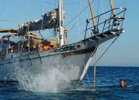
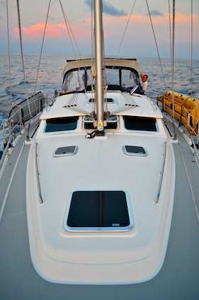
Groovy in Cabo when we first arrived three years prior.
Hang on… Say that again?? If we waited in an exposed anchorage until a hurricane arrived, we would do what??!! My eyes flew open. Was I nuts??
The image of the hurricane rolling off Mexico’s mainland coast that I’d seen on the weather charts the night before suddenly filled my mind. How close was it going to come to Cabo?
In one motion, I was out of bed and onto the computer, bringing up the latest weather data.
Rubbing the sleep out of my eyes, I stared in horror. It didn’t look anything like it did three hours ago. I thought the hurricane was supposed to approach Cabo and then veer off to the west like all the others before it had done. Now they were predicting it would head up into the Sea of Cortez. What??
Suddenly my heart was in my throat. I flipped back and forth between the weather charts, frantically trying to make sense of what was going on. The anchorage we were in was going to be blasted by high winds on Sunday if we stuck around, and even though it didn’t look like a great time to go up the coast, we had to get out of here. Now!!

The forecast for Sun Jul 7 at 12 Greenwich Mean Time (UTC),
downloaded when we first arrived in Cabo at 7:00 a.m.
Hurricane Erick will head west and bring a southerly flow to Baja on Monday and Tuesday.

3 hours later I downloaded a drastically different forecast for
that same time. Now Erick is predicted to head to Baja
and up the Sea of Cortez. Time to get out of Cabo!!
Who knows WHAT will happen there Monday and Tuesday!!

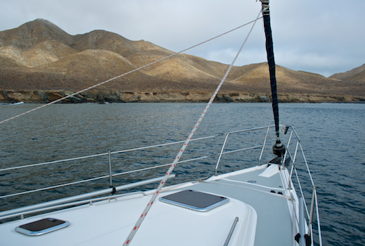
Cabo Falso is just an hour from the
Cabo San Lucas anchorage, but it is worlds away
in terms sea state and wind.
Problem was, the bottom west end of Baja California, called Cabo Falso, is a little cape with a big and terribly mean temper. It is one of the two most treacherous points in the whole 800 mile trip north from Cabo to San Diego. It was only an hour (6 miles) from where we were sitting right now, but for the next 30 miles after that (five to eight hours), we could face howling winds and snarling seas. Cabo Falso was a place where sailors were regularly crushed and sent packing back to Cabo San Lucas to lick their wounds.
The wise author of our guide book, Baja Bash II, said to try to reach Cabo Falso when the conditions were calmest, right at dawn, and never to attempt to get around it later in the day or if you could see white caps on the open ocean while still in the anchorage. Arghh. It was already nearly 10:00 in the morning. The sun had been up for hours. There were no whitecaps in the distance right now, but the wind was building.
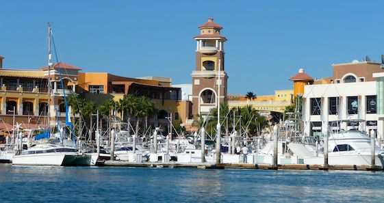
Cabo San Lucas Inner Harbor
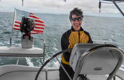
Mark appeared in the doorway, bleary eyed and squinting.
“We have to leave right now.” I said, my voice shaking.
“Now?” He said, scratching his head slowly. “I thought you wanted to stay…”
“I was wrong. We’ve gotta go. Right this minute.” I was already flipping on the instruments in the cabin and flying up into the cockpit and turning the key in the ignition. The engine roared to life.
As Mark climbed around me and out on deck to the anchor locker, I heard him mutter: “I was wondering why you wanted to stay. We should have tied up at the fuel dock when we came in…”
He was right. We needed fuel, and the prudent thing would have been to be at the fuel dock when it opened at 8:00 in the morning. At least then we could have been at Cabo Falso by 9:00. But we didn’t have time for regrets now! I shoved the throttle to its max and we charged over to the fuel dock, weaving between the traffic jam of boats at 7.5 knots.
The guy at the fuel dock confirmed that Hurricane Erick seemed to be headed towards Baja, and he got us fueled up in record time. He glanced at his watch and then shoved us off, saying, “It’s only 9:15, you have time…”

We bid goodbye to the arches at Cabo San Lucas
I did a double take and ducked my head into the cabin to look at our big clock on the wall. It said 10:15. Oh, that’s right, we had changed time zones! Our clocks were still on Puerto Vallarta time!
I heaved a huge sigh of relief. The witching hour of noon when the wind really begins to pick up was still three hours off.
The wind was already beginning to build in the bay, however, and we both stood anxiously in the cockpit as the boat barreled around the famous Los Arcos rock formations. We strained through the binoculars to see if there were white caps on the open water. It didn’t seem so. At least not yet.
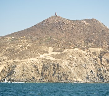
The Cabo Falso Lighthouse is waaaay up there!
Watching the magic of Cabo slip away behind us, my only consolation was that the entire bay was filled with red tide. We weren’t missing any snorkeling or swimming this time!
Ahead of us, the apparent wind, that is, the wind we felt on our faces, which was a combination of the wind in the air and the wind generated by our own forward motion, quickly increased to 15 knots, then 18, then 20. The water rippled and began peaking in little wavelets. Soon whitecaps surrounded us. But the waves were blessedly small.

Cabo Falso smiles on us!!
Suddenly the Cabo Falso lighthouse came into view, high up on a hillside.
We stared at each other in disbelief. “This is it? We’re rounding Cabo Falso and we’re not fighting for our lives?!”
So it seemed. It wasn’t like there was a sharp corner. It was an almost imperceptible turn. The lighthouse slipped by, and as we continued, the conditions remained the same. What a relief!! Could any two people be so lucky?
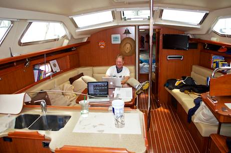
As a lark, I checked the laptop to see if we could get on the internet. We could!! I quickly jotted off a note on Facebook. How fabulous and bizarre to be rounding the dreaded Cabo Falso and reporting about it on Facebook in real time. What would the sailors of old think of that??
We settle down and do some ordinary things like laundry!
We settled down and began to relax into some routine activities. We did some laundry and hung it out to dry.
Brushing past the table in the cabin, I noticed Mark’s to do list intended for our time in Cabo. He had wanted to dive under the boat and check the prop, and also check the engine and transmission oil and the fuel filters, among other things. Oh well. Hopefully it was all okay!
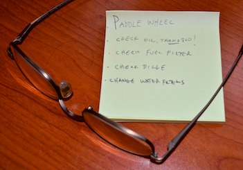
Mark had a list of things he wanted to do in Cabo…
At least we’d gotten two hours of sleep at anchor! Now we were in for another overnight 180 mile run before we would stop again, this time in Bahía Santa Maria. Hopefully we’d get a day of rest there.

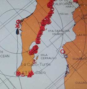
The plan for our major stops. There are
lots of hiding places in between¡
In the meantime, I studied our situation on the computer. I had written up all the possible scenarios for this coast, the distances between all the major and minor anchorages and notorious “bad spots” we’d encounter, how long it might take us to get between each one, and what times of the day were best for arriving at each location.
Our overall plan was to make two stops — one in Bahia Santa Maria and one in Turtle Bay — before ending in Ensenada, with each of the three legs taking 30-40+ hours. But who knew what the weather gods and boat gods might have in store for us.
Before we lost the internet for good, I downloaded the weather charts one last time and reviewed them yet again. Now that we were past Cabo Falso, everything looked good for getting to our first stop, Bahía Santa Maria in about 24 more hours.

Our atomic clock suddenly resets
itself to 5 days ago!
I glanced up at the atomic clock on the wall and did another double take. It said the date was July 1st. Huh? I looked at the computer. It said July 6th. What the heck? Goofy electronics. A satellite must have given out bad data when the clock beamed up. Good grief.
I went into the head and discovered the liquid hand soap had fallen over in the medicine chest and made a big mess. Oh well, those little shelves had needed to be cleaned and tidied up anyway. At least nothing big had gone wrong.

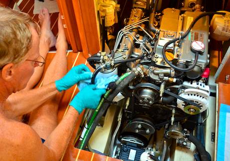
A fitting on the high pressure hose attached
to the watermaker pump suddenly started
spraying water everywhere.
Casting about for things to do to keep busy, Mark decided to make water for a while. He flipped the switch on our engine-driven watermaker, and suddenly we heard a horrible noise in the engine compartment. He instantly turned it off, pulled the stairs off the engine to see what was going on, and tried again. Yikes! Fountains of water were spraying everywhere all over our clean and sparkling engine. My heart stopped at the sight.
We had never had engine problems in 8,000 miles or so of cruising. And now we had 750 miles of motoring ahead of us! It is impossible to sail north on this coast because of the huge headwinds. And a hurricane was getting in position to block our passage to the south.
Mark flew through the cabin grabbing tools and a flashlight while I ran through scenarios in my head. If we turned around right now, we could sail downwind to Cabo in a few hours. Puerto Los Cabos Marina was 20 miles further downwind from there, and we could hide from Hurricane Erick there…
Suddenly the noise stopped, and Mark was grinning at me. I looked at him hopefully.
“No problem!” He said easily. “The fitting on the high pressure hose had worked its way loose from the vibration…”
Wow. My hero. Mark can fix anything. He is the ultimate troubleshooter. He knows how everything works. We moved the stairs back over the engine and I took a deep breath. One crisis averted!
We settled down again and took in our surroundings. The wind was a steady 15-18 knots on the nose as we barreled along at 6.5 knots, but the seas were flat. The water temperature had dropped to 75 degrees and it had become a vivid, rich green. What a startling contrast to the bright blue color of the water yesterday in the Sea of Cortez.
The water in the Sea of Cortez was brilliant blue

The much colder water outside Baja is suddenly a rich green

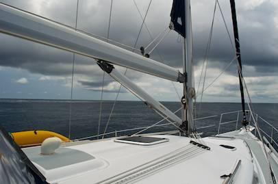
Swirling clouds, haze and towering mountains greet us
as we approach Bahía Santa Maria.
The afternoon slipped into evening. There was no sunset, but at 9:00 p.m. the wind suddenly picked up. The seas became steep and choppy and the wind blew a steady 20+ knots on the nose.
The boat began flying off the wave crests and crashing into the troughs, bringing the boat to an abrupt halt each time and threatening to shatter everything on board. We slowed the boat to 4 knots, climbing up and over each wave rather then leaping between them. Ahhh… much better.
No more bathing suit sailing. Now it’s jackets and pants!
When dawn finally came, it snuck in the back door surrounded by mist instead of announcing itself with a brilliant sunrise. The stark hills of Bahía Santa Maria appeared, and we saw fishermen out on their daily rounds.

Sea lions bark and play around us.
If the cooler water temps and changed color of the ocean weren’t enough to let us know we had left the tropics in our wake, the arrival of a group of sea lions confirmed it. They played and jumped around each other, barking non-stop.
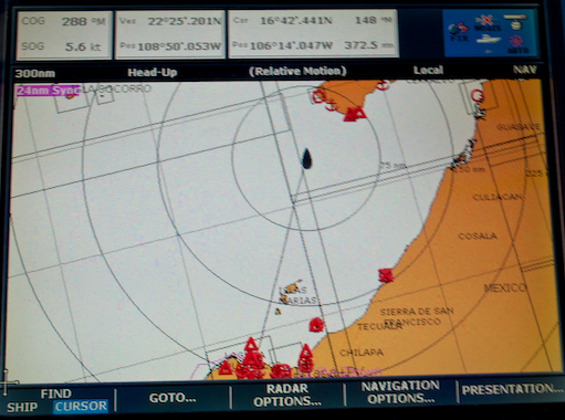
The dozens of anchorages in the Sea of Cortez are filled with cruisers trying to stay cool while we shiver on the Pacific side.
As we shivered in the damp, grey morning air in our jackets and pants, it was strange to know that on the opposite side of Baja California, in the Sea of Cortez, dozens of cruisers were sweltering in 100 degree heat. They were all swimming morning, noon and night to stay cool, and sailing between the crush of red waypoints we saw on our chartplotter.
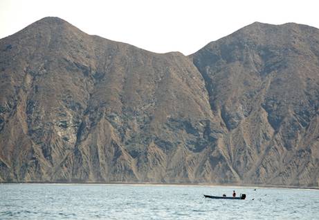
Fishermen work outside Magdalena Bay and Santa Maria Bay.
When we pulled into wide and sweeping Santa Maria Bay, it was noon on Saturday, and we got a fabulous internet signal on the laptop for a few minutes while we motored around.
We downloaded a weather update to get the whereabouts of Hurricane Erick and figure out our next move. A quick glance showed that Erick was weakening and still heading into the Sea of Cortez and that our best option for our next 40 hour jaunt to Turtle Bay would be to hang out here on Sunday and wait until Monday morning to leave.
The soft curves of the hills fill our view in Bahia Santa Maria.
We picked out a well protected spot in the corner behind the mountains, away from the half-dozen anchored shrimpers, and when we discovered we couldn’t get an internet signal from there, we didn’t care.
It was a heavenly place to rest our weary bones for a few days. Mark poured our 20 spare gallons of diesel into the fuel tanks, and all seemed right with the world until he came down below with a big frown on his face.
“The fuel didn’t look right.” He said. “It was grey. Normally the diesel we get in Mexico is pink or yellow.” I looked at him quizzically. He went on, “I think maybe there was stuff growing on the inside of our jerry jugs and it mixed into the fuel we got in La Cruz and turned it grey.”
He looked truly despondent. Diesel becomes contaminated with bacteria in the tropics so easily. “I didn’t check the insides of the jugs before we filled them.” He continued glumly. “Man, I always check things like that. Why didn’t I do it in La Cruz?”
He slumped on the settee, completely frustrated. How could I console him? It was an easy oversight. We wouldn’t know if we had bad fuel until the filters clogged and the engine quit running. And that could happen at any time.
I sighed heavily. We had two spare fuel filters. But if bad fuel clogged one, it would probably clog the second fairly soon too. Oh, if only we could have found another spare fuel filter or two in Puerto Vallarta!
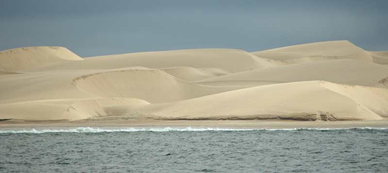
In the morning, we moved across the bay and anchored next to these beautiful sand dunes.
We tried to think happier thoughts and put this new wrinkle out of our minds while we enjoyed our time off in this wonderful bay. Bahia Santa Maria is like a huge lake. It is extremely well protected from the swell, and we slept like babies on a quiet boat. Ahhh… imagine if all of Mexico’s anchorages were like this!! The wind sang in the rigging, but it was a lullaby for our tired souls. We slept clear through from Saturday afternoon until Sunday morning.
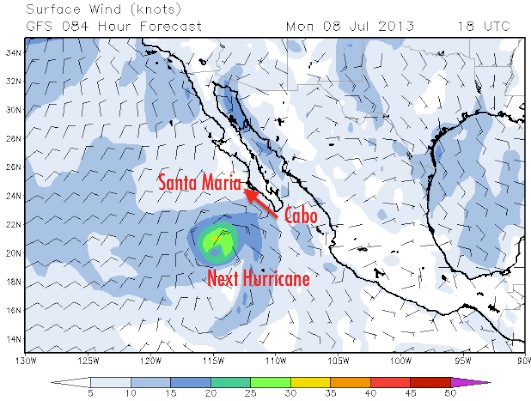
When we finally awoke, we were both eager to get another weather forecast. We motored across the bay closer to town and dropped the hook near some gorgeous sand dunes. After lazily taking some photos and watching the huge rollers breaking onto the beach, I eventually downloaded the weather. What I saw struck terror in my heart! No longer weakening and moving up the Sea of Cortez, Hurricane Erick was now predicted not only to remain strong but to hightail it straight up the outside of Baja, from Cabo to this very bay!
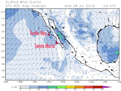
The first forecast we downloaded in Santa Maria showed
Erick going into the Sea on Mon Jul 8 at 3 GMT (UTC)

Downloaded 24 hours later: Now Erick heads to Baja
at that time and then up the outside!!
Oh NO!! Would my heart ever stop pounding on this voyage? That panicky knot of fear seemed permanently lodged in my stomach. We had been at this for five days now and still had six hundred miles of uphill battles to go.
We grimaced at each other. Our sweet plans to hang out by these sand dunes, play on the internet and relax for another 24 hours crashed on the beach along with the rolling waves. Under misty skies, we hauled the anchor and shot out of Bahia Santa Maria with our bow aimed at Turtle Bay 230 miles away. The forecast ahead was grim, with 6-9 foot seas predicted at 9 second intervals — meaning that we would be driving into walls of water stacked in front of us — but it beat the heck out of meeting up with Erick here.

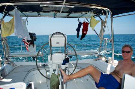
Mark catches a snooze while I make a meal. Note the rubber mat that keeps everything from sliding off the countertop!
As we were leaving, we saw another sailboat on the distant horizon. This was the first boat we had seen since leaving Cabo, and it was headed south! What the heck?
We hailed it on the radio. It was a 30 foot sailboat with a 13 hp outboard engine, and the couple on board had been beating their heads against a brick wall for two days trying to get to Turtle Bay.
They had made it only halfway across. The steep seas and high winds had finally defeated them and they were returning to protection at Magdalena bay around the corner from Bahia Santa Maria. “It was horrible out there,” the man said.

A young seagull flies alongside Groovy.
On this portion of the coast, the land pulls back from the sea. Cutting straight across the huge bay gets it over quicker, but you end up 50 miles from shore at one point.
We aimed straight for Turtle Bay and gritted our teeth, watching the winds and seas build all day long. Just as predicted, the walls of water were waiting for us. And just like all the other nights, at sunset the wind and waves picked up even more and remained elevated until 4:00 in the morning. Our ride eased until 2:00 pm the second afternoon, but then the gods of the sea put us back on the bucking bronco and left us there for another fourteen hours.
In the worst of it on the second day, we could travel at only 2.5 to 3 knots, or we would get launched off the top of each wave only to fall onto the next one with a resounding crash. By inching along, we were able to stop the violent slamming, but traveling at the pace of a window shopper was painfully slow. Here is a little video clip of what it was like in the late afternoon.

A beautiful sunset at sea between Bahia Santa Maria and Turtle Bay.
As darkness fell the second night, our fuel gauge was getting perilously close to empty. Whether or not the fuel was bad, we might not have enough anyway! I was way too wound up from all this to sleep, so I took a long night watch while Mark rested.
When I finally bedded down around 3:00 a.m., I had been asleep for just an hour when I felt his hand shaking my shoulder, “Sweety, I need you to look at something.” I sat up. “It looks like there’s land on our port side… It may be boats, but it looks like a row of houses…” I flew into the cockpit. Land? There should be nothing but open ocean on our port side!

I didn’t have my camera when Mark brought me on deck, but this sprinkling of shrimpers gives an idea…
Sure enough there was a scary looking string of lights off the port bow. I checked the chartplotter. We were on course, but there was a row of dots to our left. After studying the dots, we agreed it had to be a fleet of shrimpers. For all the world, though, through the binoculars it looked like a neighborhood of twinkling house lights.
You can never be too cautious in the strange world of the sea at night, and we were both glad to check out these lights together. I crawled back under the covers and fell into a restless slumber only to be woken again an hour later. “Sweety, I hate to get you up again…” I groaned and then heard him say, “The fuel gauge is now on E…”
Oh no. I tried to shut out the images that suddenly filled my mind of trying to get a tow in this forlorn, misty, cold, damp, remote place. What a horrible scenario. Maybe we should have spent that $50 to buy a spare 5 gallon plastic jug in Puerto Vallarta…
“We’re only 15 miles from Turtle Bay,” Mark went on, “I think there’s enough wind, and it’s at a good angle to sail.”
Really??!! I stepped into the cockpit and felt a light breeze coming over the beam. What luck! This was the first time we’d had a favorable wind since leaving Puerto Vallarta six days ago. What perfect timing. We put up the sails, and as we did, the breeze picked up even more. For the next two hours we sailed at 7 to 8 knots until we arrived in the heart of Turtle Bay. It was drizzling, but we didn’t care. We had just enough fumes in the tank to turn on the engine and putter the last few hundred yards to drop the hook.
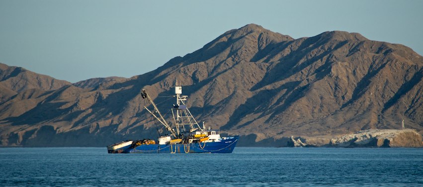
A shrimper anchored in Turtle Bay.
Oh my. Another leg completed, Bahia Santa Maria to Turtle Bay. 236 miles in 43.5 hours. We’d had a few scares and some discomfort, but everything was ticking along like clockwork. With any luck, the weather gods would let us stay in Turtle Bay for two nights to recover a bit and regain our sanity.
But what was Erick up to? In no time we had our answer: it was blasting Bahia Santa Maria, the bay we had just left. We wondered how the 30′ sailboat we had talked to on the radio was faring.
For us, rest was still a few chores away. Turtle Bay is not particularly yacht friendly, and the method for obtaining fuel there is always changing. On our trip south three years prior, a fuel boat had come out to Groovy and pumped fuel directly into our tanks.

Turtle Bay.
After trying to hail the old fuel provider Enrique a few times on the radio, one of the handful of sailboats that was anchored in Turtle Bay hailed us to explain that the method now was to take your boat to the fuel dock.
What a crazy setup this turned out to be! This ultra rickety “dock” was seemingly made of castoff wooden pallets that were strung together and stuffed with styrofoam. The surge was massive, and Groovy’s weight kept yanking the dock this way and that.
Playing on the computer and keeping busy on the Baja Bash.
After filling Groovy’s fuel tank, Mark lined up our fuel jugs on this makeshift dock to fill them too. A man handed him the fuel pump and went up the ramp to flip the switch.
Mark had just gotten one jug filled when the whole dock tipped, nearly throwing us both into the drink. He caught his balance just in time to save the four jerry jugs from sliding off into the water too. Good lord, what an absurd place.
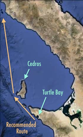
Back on the boat, we studied the weather charts once again. Our last 290 mile (45 hour) leg to Ensenada would begin with a major hurdle: rounding Cedros Island. The north end of Cedros Island and Cabo Falso down south are the two places on Baja that give sailors the most trouble.
The northeast end of Cedros Island can
be very treacherous. Giving it a wide berth
sometimes helps!
The north end of Cedros is 40 miles from Turtle Bay, and it is best to pass it well before the afternoon winds kick up. Our guide book recommended going outside the island, rather than taking the more popular route inside. Doing this avoids the worst of the nasty winds and waves that Cedros likes to whip sailors with at its northeast corner.
The forecast looked perfect for leaving twelve hours from now, that is, Tuesday night at midnight. The whole week after that looked truly miserable with big winds and big seas! So much for staying here and resting up for a few days!! When the weather gods offer to let you pass Cedros Island toll-free, you go for it!!
The boats anchored around us all filed out within the next hour, but we waited another twelve hours until midnight, and when we pulled out in the pitch black after a few hours of sleep, it seemed the predictions were right on target.
A brisk wind came directly over our starboard beam, and we flew along, motorsailing at 8 knots, listening to seals barking on the invisible pitch black shore nearby. The faster we got past the top of Cedros 40 miles away, the better.
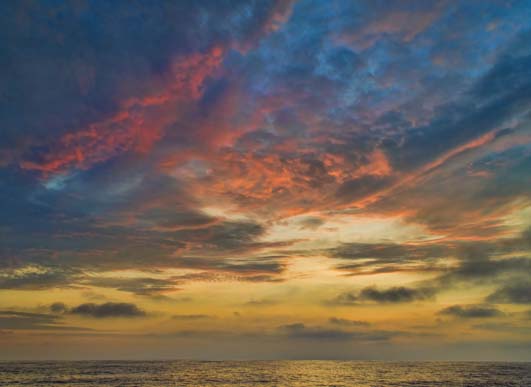
Our last night at sea we are given a brief but beautiful sunset.
As the sky lightened and we rounded the south end of Cedros, the winds died down. A few hours later, we passed the feared north end of Cedros Island without a hitch.
Unbelievably, the weather gods continued to give us their blessing, and for the next twenty-four hours the wind was virtually non-existent and the ocean swell was slow and languid. The motion of the boat was like being in a big old rocking chair.

We sail on an undulating sea that mirrors the grey skies.
As a parting gift, our final sunset at sea on this voyage was a stunner. After a peaceful night of long, easy, good-sleeping watches, the next morning we found ourselves living in a world of misty gray.
The water was like an undulating glass mirror, and the horizon was obscured where the water melted into the hazy sky.
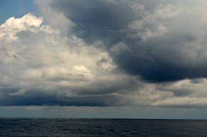
A few storms formed ahead of us, and they appeared on the radar as massive, ever-changing pink blobs. We sailed into them and found ourselves being spritzed with rain.

Rain squalls show up as big, constantly shifting pink blobs.
Checking the water temp gauge, it said the water was now 65 degrees. Ouch!
As we made our final turn into Ensenada Bay, a huge whale surfaced just meters from the boat.
Wow!! Minutes later, he surfaced a second time and then dove deep, showing us his tail before disappearing into the depths.
It was now Thursday afternoon, July 11th, and when we tied up at Cruiseport Village Marina, we were astonished to find that this last 291 mile passage from Turtle Bay had been our fastest ever at an average of 7 knots.

We aren’t bashing now!
We had made the 1,000 mile journey from Puerto Vallarta to Ensenada in just 8 days and 7 hours, stopping for a total of just over 41 hours and averaging our usual passage-making speed under power of 6.4 knots.
Never mind those statistics, though, what we really wanted was a happy walk on dry land, our first steps on terra firma (besides two fuel docks) in over a week.
Walking around the docks arm in arm, we were elated. We had actually done the Baja Bash! What a total thrill!

Mission accomplished! The sun sets off Groovy’s bow in Ensenada.
We had chased Hurricane Dalila across the Sea of Cortez and been chased by Hurricane Erick up Baja’s Pacific coast. Yowza!
We had dreaded and feared the Baja Bash for over a year. We had heard so many terrible tales about this frightening voyage, and now it was finally behind us. Phew!!!!
We were dizzy with excitement and with lack of sleep.
As the sun set in beautiful shades off our bow, we hugged each other. We felt a million emotions coursing through our souls, from total exhilaration to incredible relief. But more than anything else, we felt utterly triumphant. What a voyage!!
<- Previous Next->
Our beloved Groovy is For Sale