Horseshoe Bend Overlook – Page, Arizona – Stunning!

March 2016 – Horseshoe Bend is a jewel of spot just a few miles south of Page, Arizona, that’s easy to access and is a fabulous place to spend a few hours or more, especially for RVers headed through northeastern Arizona. As we brought our truck and trailer up from Sedona, Arizona, we stopped at Horseshoe Bend in the afternoon.

All smiles at Horseshoe Bend Arizona

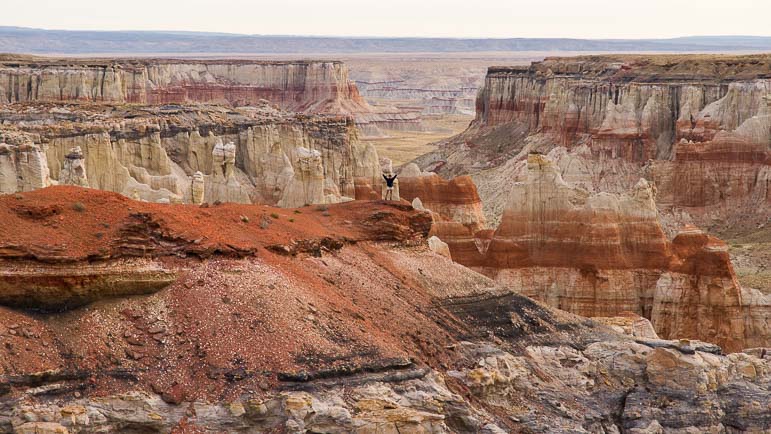
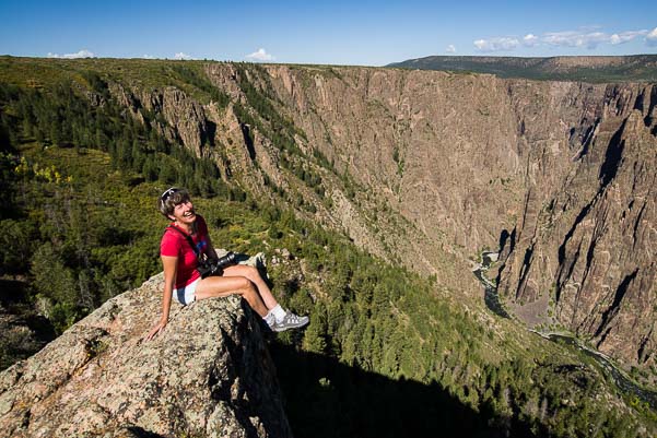
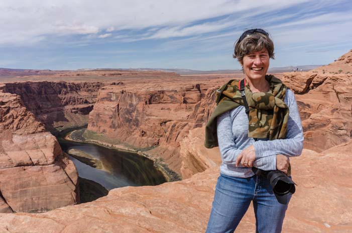
At the Horseshoe Bend overlook it’s easy to be all smiles!

From the parking lot there is a 3/4 mile walk up and over a rise to get to the Horseshoe Bend overlook. Hundreds of people were on this trail going in both directions.

As we crested the rise and began the descent on the other side, we could see people scattering like ants as they approached the Horseshoe Bend overlook.

Walking towards Horseshoe Bend Arizona

Horseshoe Bend is extraordinarily popular, and swarms of tourists roam along the rim all day long.

This is a Very Cool Place. Even though we were there with throngs of other people, we felt a rush of excitement as we neared the edge. Everyone else seemed to feel the same way, and the unprotected rim of the overlook was jammed with tourists peering over the edge.

People at Horseshoe Bend Arizona

Tourists were fearless at the edge.

Far down below, rafters were making their way along the Colorado River. The mighty Colorado has carved Horseshoe Bend over millenia, and it is staggering to think of the force necessary to dig this huge ditch through sandstone rock, especially with the river looking so meek and mild down there.

Colorado River rafters Horseshoe Bend Arizona

1,000 feet below, rafters were floating on the Colorado River

This is a great place for selfie shots too!

At the rim of Horseshoe Bend Arizona

I wasn’t the only one who wanted a pic of themselves at this overlook.

Selfie sticks were held high aloft all around us.

Taking selfies at Horseshoe Bend Arizona

Selfie sticks were everywhere!

Taking selfies at Horseshoe Bend Arizona

No selfie stick? Use a folded up tripod!

Some folks were pretty creative getting photos of themselves. Others just laid on their bellies to get a shot of the incredible bend in the river a thousand feet down below.

Taking selfies at Horseshoe Bend Arizona

Hmmm…. should I take a photo of me or a photo of that incredible view out there??

Some were brave and crept far out on a precipice for a very dramatic photo of themselves.

Horseshoe Bend Arizona Sitting on the RIm

The more daring the photo the better!

I’m not sure how many people had noticed the sign on the way in saying that the sandstone is crumbly and the overhanging edges have a tendency to break off…!

Photographer Horseshoe Bend Arizona

Everyone liked to be right on the edge.

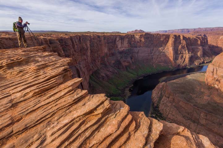
As the afternoon wore on, the crowd swelled as people came in to get a shot of the sun setting over the bend in the river.

Photographers at Horseshoe Bend Overlook Arizona

Photographers lined up on the rim with their tripods.

The rim was packed with photographers getting set up for this special moment. Finding a place to squeeze in along the rim wasn’t so easy!!

Photographers Horseshoe Bend Arizona

We waited patiently for the sun to go down.

The excited discussion between everyone standing on the rim alternated between what kind of photography gear they had and speculation about whether we’d all have a chance to go for a starburst shot at the moment the sun vanished from the sky on the far side of the canyon. One woman said she had gotten a doozy of a starburst photo two nights before. We all crossed our fingers.

But Mother Nature had other plans for us that afternoon, and the sun slipped behind the horizon with nary a wink.

It was still very special!

Horseshoe Bend Sunset Arizona

We didn’t get a starburst, but the sunset was beautiful.

I had an 18-35 mm lens, but the best images were a little wider. Mark whipped out his favorite trusty 14 mm lens and got a fabulous image.

Horseshoe Bend Arizona sunset photo

Mark was able to get a beautiful and slightly wider shot at 14 mm.

As we watched the clouds drift across the sky in shades of orange and yellow, suddenly the river down below began to reflect the color. How cool!

Sunset at Horseshoe Bend Arizona

For a split second, the river reflected pink and orange back at the sky.

We left Horseshoe Bend on a total high, absolutely exhilarated by Nature’s show. If the sunset could be that magical, we thought, then what might be in store at sunrise?

The next morning we were on the trail before dawn. There were three cars in the parking lot, including ours, and a young couple was just ahead of us on the trail, weighed down with some serious looking photography gear.

I got chatting with Brittany as we trudged along the trail in the dark, and I discovered that she and her companion, Justin, were professional videographers with their own video production company, Chiet Productions. They had just landed a gig for a regular show on PBS about a nightclub in Washington, DC, that will begin airing in April. It’s called “Live at 9:30.”

They were here at Horseshoe Bend for pleasure, however, and they were planning to shoot the sunrise using timelapse photography.

Timelapse photography Horseshoe Bend Overlook Arizona

A pair of professional videographers set up three cameras on the rim for a timelapse video of the sunrise.

Mark and I went for stills, however, since that was where our heads were at this morning. it was too early to think clearly enough to figure out everything we’d need to do to set up a timelapse, although I LOVED the idea!!

The sunrise was lovely.

The funny thing is that the sunrise wasn’t all that different than the sunset the night before. The sun had set over the horizon in the distance in front of us, but the sun rose behind us, so it would seem the canyon would look quite different. However, the colors we saw at sunrise filled the sky opposite the sun as it rose, casting a soft light across the horizon front of us.

Sunrise Horseshoe Bend Arizona

This morning’s sunrise was just as lovely as last evening’s sunset.

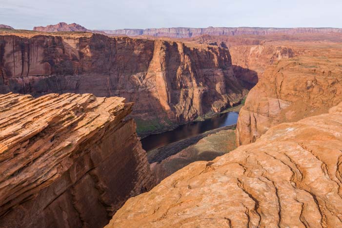
A little while later, the sun lit up the top of the peak in front of us. As the sun rose higher and higher, the shadow on the cliff slipped lower and lower.

Horseshoe Bend Arizona between the cliffs

As the sun rose it lit more and more of the cliffs across the canyon, while the shadow crept slowly downwards.

When the big show was over, we found Justin and Brittany where we had left them with all their gear on the edge of the canyon. They had done three timelapse videos, one on a GoPro, one on a Sony mirrorless camera and one on a cell phone. Brittany showed me the one she’d done on her cell phone. She had caught the sun lighting the top of the pinnacle in the canyon and had captured the shadow slipping down its front as the sun rose higher. Wonderful!!

Videographers at Horseshoe Bend Arizona

Brittany and Justin captured some great timelapse video of the sun rising in the canyon.

The morning wasn’t over yet, though. In fact, the day was just beginning. Where there had been just four of us on the rim at sunrise, we could now see a steady stream of people pouring down the trail, cameras and tripods in hand. The rim slowly became crowded with photographers and tourists once again!

Photographers with tripods at Horseshoe Bend Arizona

After sunrise, we were joined by lots of photographers at the rim.

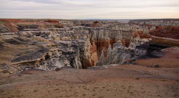
Curious about some rock formations nearby, we headed off to the right (north). Leaving behind the growing rush of visitors arriving at the rim, we walked out into these cool rocks.

Lines in the rocks Horseshoe Bend Arizona

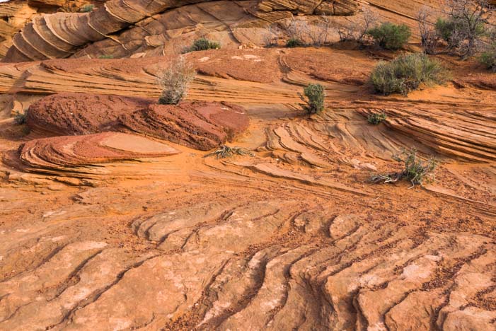
Away from the fray, to the north, we found some wonderful rock formations.

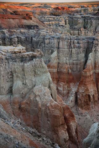
There were lots of curvy lines and ripples in the sandstone.

Patterns and Lines Horseshoe Bend Arizona

The curving lines and formations in the rocks were beautiful.

Rock crevices Horseshoe Bend Arizona

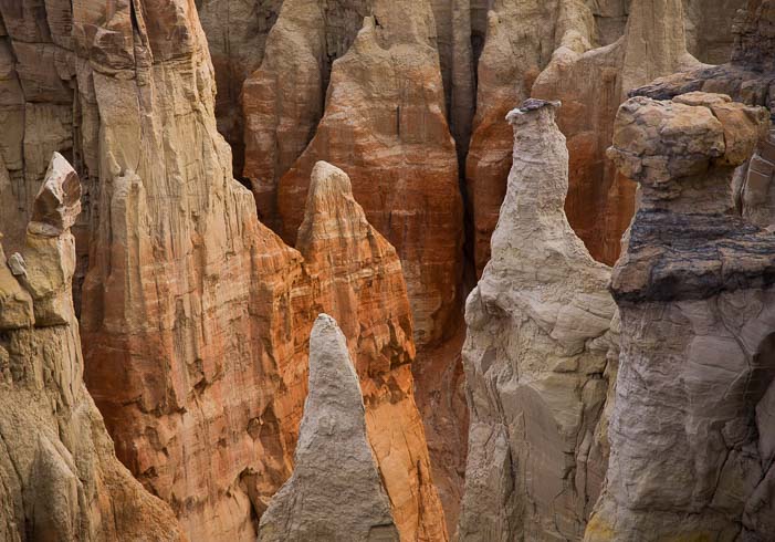
What magical shapes and formations!

We were both really intrigued by the contours of this fantastic land, and we roamed around this spot for quite some time.

Rock patterns Horseshoe Bend Arizona

The lines and patterns in the rocks drew us in.

If your RV travels take you to Page, Arizona, a stop at Horseshoe Bend is a must.

A few tips:

To avoid the crowds, the best time to get there is early in the morning.

If you are driving your RV, your best chance for finding a place to park it in the parking lot is early morning, not too long after dawn. There is turnaround room (big buses come and go regularly all day long), but it seemed to me that on weekends at peak season, especially holidays, this parking lot probably fills early and would be nearly impossible for an RV. We were there midweek in mid-March, and the number of tourists was mind boggling. The numbers intensify in the afternoon, especially near sunset.

Rock lines Horseshoe Bend Arizona

Horseshoe Bend is an overlook that deserves more than a fleeting glimpse over the edge

As you hit the walking trail to Horseshoe Bend, there’s a sign that says this is a Fee Area managed by the National Park Service. Interestingly, no money was being collected and no one asked to see our Federal Interagency Pass. The National Park Service could be making a small fortune here, as I’m sure several thousand people visit every day.

Subscribe
Never miss a post — it’s free!

More info about Horseshoe Bend:

National Park Service Website – Official description of Horseshoe Bend
Allstays – RV Parks near Page, AZ
Location of Horseshoe Bend – Google Maps (it is mis-labled “Houseshoe” and called a “chapel” – funny!)

Other blog posts from our RV travels in northeastern Arizona:

Our most recent posts:

More of our Latest Posts are in the MENU above.

<-Previous || Next->

A Glimpse of the Navajo (or “Diné” as they call themselves)

One of the biggest highlights of attending the photo workshop put on by Photography Life in Colorado this past fall was meeting pro photographer John “Verm” Sherman and, a few weeks later, his pro photographer girlfriend Dawn Kish.

Navajo Indian Dreamcatcher in Arizona

An Navajo dreamcatcher twists and turns in the wind

Dawn is a contributing photographer for Arizona Highways and she shoots for National Geographic as well. Her photography is so unique that one of her photos was selected by National Geographic Traveler as being among the Top 30 photos of the Last 30 Years.

Wow!!! Better yet, she is a vivacious and fun-loving woman who spends her leisure time rock climbing and mountain biking.

We were lucky enough to camp alongside her and Verm recently. When I told her we had just done some exploring in the Navajo Nation, she told me she had just finished an assignment making a video of the Navajo Nation Fair.

Suddenly, she plopped her laptop on our table, set up our two chairs to face it so we could watch, and brought up this incredible video.

I was spellbound.

I don’t know much about the Navajo (whose name for themselves is not Navajo but Diné). They are a very private people, and like indigenous people on every continent, they have been continually challenged to try and integrate into the society that enveloped them while hanging onto their traditions.

Dawn’s client asked her to make a video that honored the Navajo, and the result is both evocative and moving. She has captured their spirit and essence beautifully, and I had tears in my eyes as I watched a young Navajo girl dressed in full ceremonial splendor singing the American National Anthem — in Navajo.

Enjoy this beautiful glimpse into the lives of a special people whose roots in Arizona go back hundreds of years. It is ten minutes long and the link is below. Putting it in full screen is best!

If you are prompted for a password, it is Dine.

A few years ago, we watched a fabulous PBS “Independent Lens” documentary of a young Navajo girl who participated in the Miss Navajo Pageant, a competition that tests teenage Navajo girls’ mastery of women’s Navajo traditions, including slaughtering a sheep and speaking the language.

After seeing this PBS documentary, we traveled through Window Rock, Arizona, and saw their unique memorial to the Navajo Code Talkers. I picked up a fantastic book that gives a little insight into the Navajo, their patriotism to America and the unique (and arguably tide-turning) role they played in the Pacific theater of WWII: Search for the Navajo Code Talkers.

Just prior to that, while traveling in Mexico, we also had a special encounter with the little known indigenous Lacandon people of Chiapas who were “discovered” in 1948, a scant 66 years ago.  Like the the Navajo in America, they are working to find ways to integrate with mainstream Mexican society. You may enjoy this post about our trip there:

More related posts:

Click here for more Quick Pic posts!!

New to this site? Visit our Home page to read more about our full-time traveling lifestyle and our Intro for RVers to find out where we keep all the good stuff. If you like what you see, we'd love for you to subscribe to receive our latest posts!

Subscribe

Mysteries in the Navajo Nation, Arizona

October, 2014 – The snow in Ouray, Colorado, had transformed the surrounding national forest into a winter wonderland. Each night we looked up to see a dome of sparkling diamonds in the sky. This was a perfect chance to do some astro-photography, and one night Mark got out all his camera gear and his jacket, hat, boots and mittens before going to bed.

Night sky in Colorado with the Milky Way

Stars glitter in the heavens over Colorado

Back of the truck with snow

Even our water bottles were dusted with snow!

Sometime in the wee hours, while I was groping around for another blanket to pull over my head, he snuck outside and got some beautiful photos of the Milky Way and shimmering sky.

Another snowstorm delivered another dusting of the white stuff on everything, and we decided we had shivered enough.

As that night’s snow melted during the morning, we packed everything up, hitched up the buggy and started to pull out.

Snow capped mountains and a lake in Colorado

Our views on the Million Dollar Highway were spectacular.

Well, we TRIED to pull out!

The nice soft dirt that had been under the fifth wheel’s tires when we first set up camp had transformed into thick gooey mud.

Despite putting the truck in four wheel drive, the tires spun like crazy, flinging mud far and wide and splattering the whole front of the trailer. But the trailer didn’t budge! Mark grabbed our shovel and piled dry gravelly dirt in front of each of the truck and trailer tires.

Golden aspen and snow in Colorado

Nature was showing the last of her vibrant fall colors.

After a few groans from the hitch, the rig slowly began to move. We were on our way.

We drove up and over 11,000′ Red Mountain Pass into Silverton and then over two more passes before we dropped down into Durango.

The truck was working hard as it pulled our house along, but it made it through the three big climbs and descents just fine. Mark had recently installed a K&N air intake and an Edge Tuner, and these gave the truck a huge power boost on the many 10% grades.

The scenery was gorgeous, and it was bittersweet to leave the glowing aspens and snow-capped peaks behind.

But the red rocks of Arizona’s Indian country welcomed us.

Driving into Monument Valley Arizona

Monument Valley.

We were on a mission to get to Phoenix, Arizona, so we didn’t dawdle anywhere. However, when the turn-off for Monument Valley slipped by, we did a U-turn and circled back to drive a short ways out on spectacular Route 163 towards the valley.

Monument Valley Arizona

Classic Arizona skyline.

Dream catcher for sale near Monument Valley Arizona

A dream catcher blows in the wind
at a souvenir stand.

We hadn’t done that drive in many years, but it was just as dramatic as we remembered it being.

This is an iconic place, and lots of Hollywood movies have been filmed among these famous rock formations (see a list here).

Monument Valley Mitten formations Arizona

Monument Valley is famous for its mitten formations.

We had recently watched John Wayne’s black and white 1939 classic film Stagecoach and his 1956 film The Searchers which pretends this incredible landscape is in Texas!

5th wheel RV at sunset

A full moon appeared at sunset.

Seeing these monoliths for real on the horizon was breathtaking.

The road into Monument Valley is dotted with simple little structures where Navajo Indians sell their jewelry, pottery and other crafts.

A dreamcatcher fluttering in the wind at one of these open air booths caught my eye as it twisted and turned against the backdrop of the distant red rocks.

I got chatting with the very friendly woman who was selling these trinkets.

Cow silhouette_

Cows appear on a ridge.

Navajo Indian hand painted Christmas Ornament

Hand-painted Christmas ornament

I remarked that she had quite a spectacular view out her “office” window and she smiled and joked that her twenty mile commute along these roads wasn’t too bad either.

I soon found myself picking out a beautifully painted ceramic Christmas ornament.

“Those are painted by my friend,” she said. “She makes each one by hand, and each one depicts a different aspect of traditional Navajo society.”

On our hike we suddenly see a red rock canyon

Rainbow canyon in the Navajo Nation

I looked at the ornament in my hand.

It occurred to me that even though we have driven through the Navajo Nation many times — it takes up a good 15% of Arizona in the northeast corner of the state — we didn’t know much about the people or culture that reside here.

Outside the craft shop two old Indian women stood talking together — in Navajo.

I tip-toed past very slowly, trying to catch the sound of their language that flowed so easily and freely between them.

Guttural, staccato and clipped, it sounded like no other language I’ve ever heard.

“We really need to spend more time here,” I said under my breath to Mark as we got back in the truck, wishing we could stay and get to know these people a bit and learn a little more.

Before I knew it, he’d taken a turn off the main road, and we were bumping down some side road.

He had us on a crazy detour that was taking us far from the busy Route 160 that zips through the center of this land between Cortez, Colorado, and Flagstaff, Arizona.

We drove along a variety of back roads, watching unusual rock formations rise and fall around us as the traffic grew lighter and lighter.


Hiking with views on the Navajo Reservation

Suddenly, the land fell away in front of us.

Navajo Nation red rock canyon hike

We were standing on the edge of a rainbow canyon that stretched vast and wide before us.

We ran out to take a closer look and found ourselves staring out at a massive bowl of towering hoodoos made of pink and red and white striped sandstone.

The spires were a thousand feet tall and the canyon stretched to the horizon.

What a beautiful and mysterious place.

Red rock canyon lights up in the morning sun

From what I’ve read, the Navajo are reserved and private people, and they aren’t quick to reveal the secrets of their lives. How fitting that an exotic natural treasure like this lies hidden in the vast wide open plains on their land, unmarked and unfettered by the trappings of civilization. We watched in awe as the sunrise slowly lit the canyon with a gentle glow.

Hiking through red rock hoodoos and canyons in Arizona

Desert southwest hike through red rock canyon of hoodoo formations

I wrote this post over Thanksgiving weekend, and an observant reader reminded me that Thanksgiving was, of course, a celebration shared by the Indians and the pilgrims centuries ago. The celebration took place in the fall of 1621 in Massachusetts, likely at the end of September, and was attended by 90 Wampanoag Indians and 53 pilgrims. The Navajo were a far distant tribe in Arizona, but they shared a similar spirit and heritage with the Indians of the Atlantic coast.

Related posts from Indian Country:

Related posts from exotic canyons with red rock spires:

All our posts from Arizona: Here!

<-Previous || Next->

New to this site? Visit our Home page to read more about our full-time traveling lifestyle and our Intro for RVers to find out where we keep all the good stuff. If you like what you see, we'd love for you to subscribe to receive our latest posts!

Black Canyon of the Gunnison National Park, CO – Steep and Deep!

Bikes on Castle Creek Road in Colorado

Bicycles on scenic Castle Creek Road

September, 2014 – Maroon Bells may be the most photographed spot in Colorado’s Rocky Mountains, but nearby Castle Creek Road is also very scenic and not nearly as heavily visited.

We drove out one day and passed a steady stream of cyclists enjoying an exhilarating road ride. What a place for a morning workout!

A tiny historic ghost town named Ashcroft lies at the end of the road.

The old buildings were interesting, but we were more intrigued by a row of colorful rugs we saw hanging outside a shop very close by.

Teotitlan de Valle Oaxaca Rug Weavers

The rug weavers of Oaxaca come to Colorado!

Above the shop a sign read: “Welcome to the Catto Center at Toklat.”

We walked past the many rugs, admiring their designs, and then stepped inside.

We were suddenly surrounded by woven wool rugs that looked very similar to the ones we had seen near Oaxaca at Teotitlán de Valle in Mexico a few years ago.

A friendly looking woman was giving a demonstration to several tourists, showing them how the blue dyes were derived from indigo.

Views at Black Canyon of the Gunnison National Park Colorado

Black Canyon of the Gunnison

Our jaws dropped. That was exactly the same demonstration that we had seen in Teotitlán de Valle!

It turned out that this woman came from a family of rug weavers in that very same Mexican village.

I remembered vividly how our tour guide in Oaxaca had squished a bug in the palm of a girl’s hand to demonstrate how they made their red dyes (see my blog post about it here).

Apparently, the owner of this shop’s building had brought a few Oaxacan weavers to Colorado to promote their craft each summer. How fun!

Black Canyon of the Gunnison Colorado

The chasm is vast and deep

Where Maroon Bells and Castle Creek had shown us Colorado’s Rocky Mountains in the early stages of their fall glory, another land of stunning scenery — Black Canyon of the Gunnison — beckoned.

This canyon’s jagged cliffs are nothing like the soaring Rocky mountains.

Instead of craning our necks to look up at tall mountain peaks, the Black Canyon of the Gunnison is like a massive crack in the earth’s surface, with the sides parted to reveal sheer rock walls plunging nearly straight down to a thin ribbon of river far below.

Turkey vulture in flight

A turkey vulture soars past

The canyon wasn’t formed by the walls cracking apart, however. It was formed by the very fast moving Gunnison River cutting through the rock like knife.

The Gunnison River falls from great heights to great depths, dropping an average of 95 feet per mile. This keeps the water moving at quite a clip.

This raging water has cut through the black rock like a laser, deepening the canyon faster than other kinds of erosion can widen it.

Black Canyon National Park Colorado

The canyon is steep and deep!

At its narrowest point, it is just ¼ mile across, and the depths of the sheer walls range from 1,750 to 2,700 feet (by comparison, the Empire State Building is 1,454′ feet tall and would reach just partway up the walls!).

As we approached the rim at an overlook, we saw several turkey vultures circling right overhead. They played with the air currents and dove down into the canyon and rose back out again effortlessly.

What a thrill it would be to fly like that, letting the earth fall away from under you as you flew over the rim of the canyon!

The Black Canyon of the Gunnison fills a huge area along the Gunnison River, and there are two wonderful areas for exploring it: a National Park with an entrance on the south rim and a gorgeous scenic drive that snakes along Route 92 on the north rim.

Sitting on the edge of the Black Canyon of the Gunnison in Colorado

I got a kick out of crawling around on the ledges.


At the Visitors Center for the Black Canyon of the Gunnison National Park we noticed a bulletin board covered with little hand written notes.

“Happy Birthday, Wilderness!” a sign said, recognizing 2014 as the 50th anniversary of the Wilderness Act.

We learned that this 1964 Act set aside 110 million acres of land, created the National Wilderness Preservation System, and gave Congress the ability to designate official “Wilderness Areas.”


Craggy crevasse at Black Canyon National Park Colorado_

The “Painted Wall” is one of the most stunning overlooks.

Beneath the sign was a quote from Edward Abbey, novelist, environmentalist, and critic of public land policies.

“Wilderness is not a luxury but a necessity to the human spirit,” he was quoted as saying.

On this bulletin board, the rangers had posed the question, “What does Wilderness mean to you?” The notes tacked all over the board were full of thought-provoking answers:

“Free & Wild!” penned one person, adding a smiley face for emphasis.

Happy campers on the north rim of Black Canyon of the Gunnison Colorado

What a great place to explore!

“A place to discover who/what you are made of/for/by” responded another with a little red heart.

“It humbles me…puts me back in place,” someone had written. Next to that another had scrawled, “DITTO.”

I got a kick out of reading these notes.

In hindsight, it is especially interesting to read them now in light of the recent public outcry against restricting commercial filming in officially designated Wilderness Areas.

People treasure wild land.

Towering peaks at Black Canyon National Park Colorado

To get a feeling for the scale of the place, here’s our truck dwarfed by the peaks!

“Wilderness speaks…to my soul,” one card said.

Wildnerness is “one place in the world where man is insignificant and always will be,” another proclaimed.

The Black Canyon of the Gunnison is a National Park with the usual roads and overlooks. However, portions of it are officially designated “Wilderness.”

Yet, back in 1881-82, over 1,000 immigrants from Italy and Ireland worked in horrible conditions full of rock slides, avalanches, and unreliable explosives to push the Rio Grande narrow gauge railroad through this canyon.

At the base of the cliffs of Black Canyon Colorado

At the base of the cliffs of Black Canyon

It is hard to imagine the harsh working environment these men endured, sleeping and eating in wooden work cars and bedding down on wooden planks.

The Gunnison river at Black Canyon Colorado

We drove along the Gunnison River at the bottom of the canyon.

Staring down into the canyon from the overlooks that have been carefully designed and built by the National Park Service, it is even harder to imagine the raw triumph these men must have felt when the first train puffed its way through the canyon.

The trains and railroad had defeated the wilderness at last.

This railway was touted as the “Scenic Line of the World,” and the trains carried thousands of people and tons of goods and livestock through the canyon.


“Wilderness is my heaven,” says one of the cards at the Visitors Center.

“What a Creator we have! Praise His name!” says another.

Mirrored water in the Gunnison River at Black Canyon Colorado

The sun played on the leaves of the trees as they reflected in the water.

Down at the base of the canyon along the Gunnison River, the sun played with the green leaves of the trees and their reflections in the placid water.

Finding that delicate balance between our urge to conquer and make use of our most beautiful landscapes and our urge to protect them and leave them alone has challenged our leaders and thinkers for nearly two centuries.

Mark and I both read the Autobiography of Ansel Adams and were astonished to learn just how hotly the mission of the National Park Service and other public land agencies were debated in the early 1900’s.

Trees reflect in the Black Canyon's Gunnison River in Colorado

Mirror images in the Gunnison River.

We think of Adams as a photographer, but he was deeply involved in the early development of the Sierra Club, and he had very strong opinions about the National Park Service, most of them far from flattering.

He was fortunate to see these lands at their most untouched, and he felt that in many ways he was documenting a disappearing landscape.

Of course, he was not nearly as comfortable in his tent in the early decades of the 1900’s as we are running around in our luxury fifth wheel today. And that is the deepest irony of what “wilderness” really means.

River's edge Black Canyon of the Gunnison Colorado

At the river’s edge in the bottom of the canyon.

To make wild landscapes easily accessible requires roads, railways and other development. That gives us laymen a chance to get inside the scenery and enjoy the beauty.

But the very presence of those developments changes the landscape forever.

The “wild” in “wilderness” springs from its very inaccessibility. The more accessible it becomes, the less wild it can be, by definition.

Even though much of the Black Canyon of the Gunnison is officially a Wilderness Area, much of it has also been tamed.

Curecanti National Recreation Area

Curecanti National Recreation Area (Blue Mesa Reservoir) is at the east end of the Black Canyon of the Gunnison.

“Earth untouched by man,” is what ‘wilderness’ means to one person who answered the ranger’s query with a card on the wall at the Visitors Center.

Yet that very description is a dream and a fantasy for all but the most intrepid trekkers among us.

That kind of wilderness certainly isn’t a place you can drive by in a heated or air conditioned car, like the beautiful overlooks at the Black Canyon that are the only parts of it most of us will ever reach.

Perhaps the last card summed it up best:

Wilderness means “Hope — even if I never see those places that are truly wild.”

____________________


Although I wouldn’t drive a big RV on scenic Route 92 (where the views of the canyon are truly dramatic), this whole area can be enjoyed using Montrose, Gunnison or the Curecanti National Recreation Area as a home base. Lake Fork Campground is on the water’s edge at Blue Mesa Reservoir and was almost empty when we visited. Check out these links to learn more about:

More blog posts from our RV trips to Colorado:

<-Previous || Next->

Hell’s Canyon – A Gorgeous Gorge!

July 2014 – A wildfire in beautiful Hurricane Creek in Oregon’s Eagle Cap Wilderness just a few miles from Joesph, Oregon, spurred us to begin packing up and moving on. Looking at the statue of Chief Joseph, leader of the Nez Perce tribe, in the center of town, as thick smoke rose from behind the mountains at his back, I wondered what he would think of wildfires in his beloved Wallowa mountains.

Chief Joseph and wildfire near Joseph Oregon

What would Chief Joseph think of the white man’s land management today?

The discovery of gold on his tribe’s homeland in 1863 led to the forcible removal of his people from this gorgeous land. He argued with eloquence, grace and dignity before the American leaders of the day for equal treatment of all men under fair laws.

How tragic that Lincoln’s recently declared Emancipation Proclamation said the same thing but Chief Joseph’s impassioned pleas were ignored.

Red roofed church in Halfway Oregon

A pretty church in Halfway, Oregon.

Wholly consumed with thoughts of gold, cattle grazing and game hunting, no one of that time could possibly have anticipated just how massive and mechanized the American population would become or the kind of pressure all this humanity would put on the land.  Since that era just 150 years ago, America has grown by 750%.

Snake River Copperfield Oregon

The Snake River

In one of the country’s least populated areas, east of Joseph, Oregon, the Snake River has carved America’s deepest gorge: Hell’s Canyon.  Cliffs rise as high as 8,000 feet on either side.

The Snake River at Copperfield Oregon by Hell's Canyon

Wallowa Mountain Loop road (Route 39), a twisty National Forest road, runs from Joseph out to Hell’s Canyon Overlook where we got a peak at Idaho’s Seven Devils Mountains that line the gorge.


Hell's Canyon Overlook in Oregon

Hell’s Canyon Overlook – No river in sight!

This is a winding 45 mile drive, and although the views across the canyon were vast, it didn’t give us the perspective on the gorge we had expected.

The Snake River at Hell's Canyon Copperfield Idaho

Hell’s Canyon as seen from the shoreside road!

The Snake River in Hell's Canyon

Curvy road at Hell's Canyon Idaho

I just love a curvy road!

For those views, we had to take a 150 mile detour back through Baker City to avoid the Wallowa Loop Road construction with our buggy.

Beautiful curves and cliffs of Hell's Canyon Idaho

This one lies on the shores of Hell’s Canyon!

We stopped in the little town of Halfway and admired their very cute red church, and continued on to Copperfield at the base of Hell’s Canyon.

Us at Hell's Canyon National Recreation Area Idaho

A memorable visit to a beautiful place.

Unlike the Hell’s Canyon Overlook that peers across the top of canyon, the Hell’s Canyon National Recreation Area offers dramatic scenery and lots of adventure between the canyon walls.  We found loads of inspiring views to keep our cameras happy.

Tubing on the Snake River at Hell's Canyon

People were playing in boats and tubes and standup paddle-boards on the river.

There were boaters playing on the water, fisherman casting their lines, and we even found a tiny private sandy beach tucked along the shoreline.

From our first glimpse of Hell’s Canyon at Copperfield, we drove north along the Idaho side of the gorge to the end of the road at Hell’s Canyon Dam.

Beach on Hell's Canyon Snake River

Snooping around on the banks we discovered a tiny, private, sand beach!

This is one of fifteen dams constructed for various purposes along the Snake River, and it is one of three dams in Hell’s Canyon that were built to produce electricity and control flooding.

Hell's Canyon Dam Idaho

Evidence of progress in the form of electricity and flood control, but the “dam thing” blocks the progress of salmon!

Like anything that interferes with the processes of nature, these dams have had unanticipated effects. The Snake River used to be a major salmon run for three different species of salmon that spawned far inland upriver but spent most of their lives in ocean. They’d wait until their last year of life to swim back upriver and spawn the next generation of fish.

Rose bushes at Hell's Canyon Idaho Wildflowers

Taking a photo of a mule deer

A deer looks up while Mark takes his photo.

Unfortunately, those aging salmon can no longer swim past the dams to spawn, so the ones that mistakenly swim up the Snake River this far end up trapped at the dam.

Skinny Mule deer

Hopefully all those grasses will fatten this guy up!

The National Forest Service rangers at the dam told us that because of this salmon roadblock, Hell’s Canyon Dam is an awesome place to go fishing.

They said that over Memorial Day weekend this year, the river was absolutely boiling with fish, and the banks were throbbing with fishermen!

What would Chief Joseph think of that?

Farm and prairie in eastern Oregon

Farm land, prairie and the Wallowa mountains in eastern Oregon.

I don’t know, but after seeing this part of the world, I understand why he loved this land so dearly.

______________________

Here are some links for more information on Hell’s Canyon National Recreation Area  (more here), the Snake River and its dams as well as RV parking options in Copperfield, Oregon.

Subscribe
Never miss a post — it’s free!

<-Previous || Next->

More from our RV travels in Eastern Oregon:

Our most recent posts:

More of our Latest Posts are in the top MENU above.

From Salt to Snow in Nevada – Bonneville to Lamoille Canyon

May, 2014 – We were flying high as we left Ely, Nevada, where we had been thrilled by the Nevada Open Road Challenge car races. With car racing on our minds, the only direction we could head from there was north, up to the Bonneville Salt Flats just over the Nevada border in Utah.

The Bonneville Salt Flats are a massive, natural expanse of crusty old table salt that is layered thickly on a valley floor and extends for miles west of Utah’s Great Salt Lake. They have long been used for attempting and setting land speed records.

Traveler's Tree on Route 93 Nevada

We discover a Traveler’s Tree on the open roads of Nevada

The road from Ely to the town of Wendover on the edge of the salt flats is a narrow ribbon that winds through vast empty valleys. It soon hypnotized me as we drove.

So I was jolted back to reality when Mark suddenly hit the brakes and pulled over, saying, “We’ve gotta check this out!” Continue reading

Paria Rimrocks “Toadstools” Hike to A Hidden Canyon!

Fields of wildflowers in Southern Utah

OMG – When we’re not looking, we come across a gorgeous field
of wildflowers bursting with color!

May, 2014 – All spring we had deliberately searched for wildflowers in Arizona, using the excellent book Wild Arizona as a guide.

We had driven down crazy back roads and hiked into the hinterlands, stalking these colorful little beauties.

We had found lots of pretty flowers scattered here and there, but the vast fields of color we’d hoped for never materialized. Continue reading

Wire Pass Trail – Slot Canyon Hiking!

Wire Pass Slot Canyon view from outside

The slot canyon is barely visible from the outside.

May, 2014 – The beautiful red rocks and views of Sedona, Arizona, are utterly enchanting, but the exotic Vermillion Cliffs two hundred miles north lured us away.

We have driven past the fantastically colored rock walls along routes 89 and 89A between Page, Arizona, and Kanab, Utah, many times in the past.

However, this time we stopped for a while to explore the area in a little more depth. Continue reading

Flaming Gorge Utah – Fiery canyons, a cool river, and nearly tame bighorn sheep

Flaming Gorge Utah Rainbow over our RV

A rainbow frames the buggy

Early September, 2012 – Leaving the northern half of Flaming Gorge in Wyoming, we settled down near the heart of the gorge in Utah where it is a part of the National Park Service.

Flaming Gorge Utah RV Views

Mark gets a front row seat to the view.

The storms continued to march across the sky every afternoon, and one day, just as the sun was setting, the sky went black and a brilliant rainbow formed right over the buggy.

Flaming Gorge Utah Greendale Overlook

Kids monkey around for the camera

The overlooks and walking paths near the Visitors Center offer the most impressive views of the gorge, and we wandered out to the edge of the cliffs repeatedly to see the breathtaking scene from every possible vantage point.

Flaming Gorge Utah Canyon Rim Hike

The Canyon Rim hike goes through the woods too.

Brilliant mornings complemented the brooding afternoons.  As we paused one afternoon to enjoy the views from one overlook, a crowd of young families showed up.

Flaming Gorge is a perfect area for families, as there are all kinds of things to do, from hiking to biking to camping to visiting with herds of grass-eating animals to taking a tour of the dam.  This group of families was having a ball.  Half the parents were out on mountain bikes somewhere while the other half chilled at the overlook.  The kids romped all over the place in very high spirits, despite the gathering afternoon storm.

RV boondocking view of Flaming Gorge Utah meadow at sunrise

Meadow at sunrise.

They posed for their moms to take a photo, and they were all so cute I had to get one too.  Just minutes after that the skies opened up and we had a downpour that pelted everyone and everything and soaked us all to the bone.  The kids laughed it off, but we felt badly for the late returning dads who had to hurry in the driving rain to get all the mountain bikes back on their bike racks before they drove off in a blur of spray.

RVers coming to Flaming Gorge will find stunning views and camping

Breathtaking views at every turn.

Between storms we were gifted with glorious sunshine.  We hiked the Canyon Rim between the visitors center and the Canyon Rim Campground, taking two photos for every five steps.  What a place!  Rock outcroppings hang out over the edges of the cliffs all along the rim, making for dramatic views (and a little bit of stomach churning if you stand on the edge and look straight down).  Campers can set up in sites with marvelous views.

RV boondocking offers amazing views of Flaming Gorge

Now it’s my turn to perch on a cliff.

The big horn sheep are very much at home in this terrain, though, and a large herd was mingling with the campers in the Canyon Rim Campground.

Another woman watching them through the viewfinder of her camera (just like we were) told us they had been wandering between the campsites  all four days she had been there.

Bighorn sheep at Flaming Gorge's Canyon Rim Campground, an RVers delight

A herd of bighorn sheep hung out at the campground. Rangers track their movement by radio.

As we chatted, the group of sheep stood and stared at us, barely moving.  They formed something of a protective circle, facing outwards.  They stood there so long the young ones got bored, as we did, and eventually two of them laid down behind the shield of their parents’ legs.

Big horn sheep at the Flaming Gorge Canyon Rim Campground

We watched each other carefully.

These guys were very accustomed to humans, and they let us get close enough to see that the largest one had been outfitted with a radio collar.  A large antenna stuck out from the radio on his neck like a third antler behind his head.  Rangers told us they track the herd very closely.

Flaming Gorge Dam

Flaming Gorge Dam

Flaming Gorge used to be a free-flowing river, and one afternoon we took a tour of the Flaming Gorge Dam.  Built in the late 1950’s, it was one of the West’s many water reclamation projects of the mid-1900’s that tamed the west’s wild rivers and provided electrical power to nearby communities.

Flaming Gorge Dam turbine

An original turbine was replaced recently and is now on display.

The most amazing thing about these dams, I find, is that in order to build them the rivers had to be re-routed temporarily.  At Flaming Gorge, as at all the other major western dams, a huge tunnel was dug into the cliff so the water would bypass the dam construction area.  The concrete is so thick in Flaming Gorge dam that it will take 100 years to cure fully at its center.

Turkey vultures dry their wings on the scaffolding outside the Flaming Gorge dam.

When the sun came out, the whole flock dried off its wings.

That means the concrete at the core is only half cured now, and it puts the cure date sometime just before 2060!

A turkey vulture at Flaming Gorge Dam

Seeing an original turbine that had recently been replaced was interesting, but what really caught our attention was the huge flock of turkey vultures sitting on the scaffolding outside the dam.

Sweeping views from the Flaming Gorge Visitors Center in Utah

Flaming Gorge was an awe-inspiring place to visit.

When we started the tour raindrops were falling, and these guys were hunkered down waiting for the typical afternoon deluge.  But when we emerged from the bowels of the dam’s massive structure an hour later at the end of the tour, we discovered the sun had come out and all the turkey vultures were now sitting with wings outstretched, drying off their feathers!

Flaming Gorge is a magical place, and we dallied for a while.  But eventually the lure of dinosaurs drew us away and we drove further south to Vernal Utah and Dinosaur National Monument.

<- Previous                                                                                                                                                                                       Next ->

Canyon de Chelly, AZ – A Canyon of Indian Cliff Dwellings

RV blog post - We took the scenic route through Arizona's Navajo Nation to Window Rock and saw the stunning vistas and cliff dwellings of Canyon de Chelly.

Window Rock City Park.

Window Rock, Arizona.

The Window.

The Navajo Tribal Band practices for Oklahoma's Red Earth festival at Window Rock.

The Navajo Tribal Band practices

for Oklahoma's Red Earth festival.

The Navajo Tribal Band practices for Oklahoma's Red Earth festival at Window Rock. Navajo Code Talker statue at Window Rock, Arizona.

Navajo Code Talker.

Show of patriotism at a cemetery outside Window Rock on Indian Route 12, Arizona. Views along Indian Route 12, Arizona.

Scenic Indian Route 12.

Exotic rock formations and colors along Indian Route 12, Arizona.

Two toned rock formations.

Brilliant rock formations along Indian Route 12, Arizona.

A homeowner with a flair for color.

All kinds of colors in the rocks along Indian Route 12, Arizona.

The land was painted pink too!

Cliff views at Canyon de Chelly National Park, Arizona..

Looking down Canyon del Muerto.

Looking down Canyon del Muerto at Canyon de Chelly National Park, Arizona..

Sheer cliffs and lush valleys.

"Where two fell off."

Massacre Cave at Canyon de Chelly National Park, Arizona..

Massacre Cave.

Cave dwelling at Canyon de Chelly National Park, Arizona..

The little cave to the left.

Cliff dwelling at Canyon de Chelly National Park, Arizona.

There's a structure inside!

Expansive views at Chelly National Park, Arizona.

The immensity is hard to capture.

Looking across the canyon at Mummy Cave, Chelly National Park, Arizona.

Tim & Mary Lynn look across at Mummy Cave.

Mummy Cave, Chelly National Park, Arizona.

Mummy Cave housed a small community

in the shadows.

Building inside Mummy Cave, Chelly National Park, Arizona.

The structure inside Mummy Cave.

Navajo Fortress between Canyon del Muerto and Black Rock Canyon, Chelly National Park, Arizona.

The confluence of Canyon del Muerto

and Black Rock Canyon.

Antelope House, Chelly National Park, Arizona.

Antelope House is tucked into the

bottom of this massive cliff.

Close-up of Antelope House, Chelly National Park, Arizona.

Close-up of Antelope House ruins.

Hiking down to White House Ruin, Chelly National Park, Arizona.

Beginning our descent

into Canyon de Chelly.

We hike to White House Ruin, Chelly National Park, Arizona.

Looking down on the lush valley floor.

We hike past crazy swirling rock patterns on our way to White House Ruin, Chelly National Park, Arizona.

Crazy swirling rock patterns.

Rock swirls dwarf the trees on our hike to White House Ruin, Chelly National Park, Arizona.

The swirls dwarf the trees in the middle of the pattern.

Pause in our hike to White House ruin, Chelly National Park, Arizona.

We take a breather from hiking.

The lush valley floor of Canyon del Chelly.

The bottom of the canyon is flat and wide.

White House Ruin, two levels of dwellings, Chelly National Park, Arizona.

White House ruin has two levels:

a ground-level building & a cave dwelling above.

Dramatic pink and orange stripes decorate the front of White House Ruin, Chelly National Park, Arizona.

No architect today could design a

more dramatic front entrance!

Awe-inspiring drippy stripes on the cliffs surround White House Ruin, Chelly National Park, Arizona.

The drippy stripes down the walls

fascinated us.

Wildflowers, Chelly National Park, Arizona.

Flower or origamy?

Wildflowers, Chelly National Park, Arizona. Pictographs, Chelly National Park, Arizona: a person and a roadrunner.

Rock Art:  Roadrunner.

Pictographs at Chelly National Park, Arizona: a scorpion.

Rock Art:  Scorpion.

A hogan stands agains a dramatic backdrop of cliff walls on the lush valley floor of Chelly National Park, Arizona.

A Navajo hogan backed by dramatic cliff walls.

We hike through a tunnel on the White House Ruin hike in Chelly National Park, Arizona.

Canyon de Chelly National Park, Arizona

Early June, 2012 -- Leaving the Petrified Forest, we decided to head north by

Indian Route 12 which, to our surprise, was noted on our tourist map as a

scenic route.  As one-time Arizona residents we had no idea there was a

scenic road through the Navajo Nation way over in the northeastern corner of

the state.  We also wanted to see Window Rock, which lies on that road.  This

town is the Navajo tribal headquarters, and it always turns up in the Phoenix

TV weather forecasts with very cool temps.

We arrived on a warm day, however, and

were immediately drawn to the city park in

front of the big window in the rock.

The tribal band was practicing in

the park, and we watched and

listened for a while.  Chatting with

the band leader during a break,

we found out the band was

headed to Oklahoma City in a

few days for the big Red Earth

arts festival there.  Apparently

this is one of the largest

gatherings of Indian artists and

performers in the country, and

the group was very excited.

The park also features a large

sculpture of a WWII "code talker" in action on his radio.  A nearby plaque

explains how the US Military was struggling to find a way to keep the

Japanese from deciphering their communications in the South Pacific

Theater, and that 29 Navajo marines were recruited to devise a new

code using their native language.  By war's end there were over 400

Navajo Marines serving as code talkers, and the Marine Corps

commanders credited them with saving countless American lives.

Maj. Howard Conner, Signal Officer on Iwo Jima, is quoted as saying,

"Were it not for the Navajos, the Marines would not have taken Iwo Jima."

This impressive history is also the subject of a fictional 2002 movie,

Windtalkers.

Back on Route 12 we saw more patriotism in a cemetery festively filled

with American flags.

The scenery on our route became very dramatic as we drove north of

Window Rock.  Huge red rock cliffs lined the sides of the road.

Suddenly it seemed that God switched paints on his easel, and large

rock formations began to cover the landscape in shades of green as

well as red.

Someone with an artistic eye painted their house a vivid blue,

making a wonderful contrast to the green and red rocks in their

back yard

In one place the

sandstone even had a

pink hue.  It was a

beautiful drive.

Our destination was

Canyon de Chelly

National Park

(pronounced "d'Shay").

This park is at the confluence of three

snaking canyons that are like three fingers of

a hand spreading eastward from where they

all join in the town of Chinle ("pronounced

Chinley").

The stunning thing about Canyon de Chelly

is the immensity of the canyons.  Standing on

cliffs that are 1,000' above the canyon floor,

the walls are very sheer and the views curve

past narrow walls of stone.  At the bottom of

the canyon is a lush, fertile valley floor where

the Navajo developed corn fields and peach

orchards in the 18th and 19th centuries.

In the movies, landscapes like this are always accompanied by the piercing call of a

falcon echoing off the canyon walls.  But here the silence was so noticeable that our ears

hurt.  Scanning the horizon many miles distant, and looking deep into the valley below

us, the only sound was our own breathing.  Even the wind stood still.

In 1805 the Spanish tried to conquer the Navajos.  At the point where I was standing a woman

tried to fend off a Spanish soldier, and in their struggle the two fell off the cliff to their deaths.  In

the distance we could see "Massacre Cave" where the Navajos had hidden out.  In the end, the

Spanish claimed to have killed 90 men and 25 women and children, but the Navajo remember it

differently, saying that all the younger men were out hunting that day and the deaths were strictly

women, children and old men.

Either way, the cave looked tiny in

the distance.  Inside were some

structures that the Navajo hid in.

To the left of the main cave was a

much smaller one and, using the

long camera lens, we could see

another small structure inside there

as well.  It is hard to imagine living

on the edge of a cliff like that for any period of time,

especially with the Spanish after you.

At each viewpoint you get a slightly different view of these

lush canyons, and it was hard to capture the enormity of

the place in a little photograph.  Pan out or zoom in?  How

do you show it all??

At the Mummy Cave overlook we came across a

couple sitting behind a tripod. They were waiting

patiently for the afternoon light to provide its best

illumination of the cave ruins far below.  Waiting

for good light sounded like a great idea, so we hung out and

started chatting with them.  It turned out that they had spent the

last three years traveling the western states in their camper van, living

a lot like we do by boondocking on public lands.

Our eyebrows shot up when they told us they had just come back

from a sailboat charter in the Grenadines in the Caribbean ten days

earlier and were contemplating taking their travels to the sea.  What's

more, we found out Tim's mountain bike on the back of their van was

the same exact model as Mark's on the back of our trailer.  To top it

off, Mary Lynn enjoyed web design too.  What a crazy coincidence!!

Like us, too, they were using a Nikon camera to try to capture this cliff

dwelling in just the right light!

The good light never came, but we managed a few shots

anyways and hoped we'd run into these guys again somewhere.

Meanwhile, the mystery of the cliff dwellings lured us on.  The ancients built their homes in caves on these sheer

canyon cliffs between 700 and 1300 AD.  So these homes were first going up right after the peak of Mayan

remodeling down in Palenque in Chiapas, Mexico.  They may not be as majestic in terms of size or human

construction and engineering skills, but they are incredible for making fantastic use of the landscape.  What a

place to build a house!

Over at Antelope House we looked out across the canyon

at a beautifully striped, back-sloping wall.  Nestled at its

base was a small town made up of crumbling walls,

windows and towers.  You need binoculars or a long

telephoto lens to make out the tiny structures so far

below.  Even then they look like little toy buildings for wee

dolls.  They can't possibly be real.

Archaeologists call these ancient people the Anasazi,

which is derived from the Navajo language and is

variously translated as "Ancient Ones" and "Enemy

Ancestors," due to the subtle word "Zazi" which means

"Non-Navajo" or "enemy."  Also known as the Ancient Puebloans,

from the Spanish word for "townspeople," these long ago people

farmed the valley floor and disappeared around 1300, probably due

to drought.  The Navajo didn't arrive in this area until 1600, and by

then the ruins were long abandoned.

The Navajo flourished here for a while, but in 1864 US Col. Kit

Carson entered the canyon with a group of soldiers and

eventually cornered the Navajo at one end.  Few survived, and

those that did were forced to walk 300 miles to Fort Sumner in

New Mexico and stand trial.  They were allowed to return five

years later.

The most famous of the

ruins is "White House

Ruin," and we decided to

hike down into the

canyon to see it up close.

We hiked along with our

new RVing/sailing friends

who had ended up

camping alongside us overnight.  As with every overlook in the entire

park, the views from the top were so gorgeous I found myself running

and jumping over the rocks trying to get the best angles and trying to

fit it all into the camera frame.  Sigh.  Not possible!

The contours of the rocks are

wavy and rippled, swirling in

enormous and wild patterns.

You can almost feel the power of

the water that etched out its

course along these canyon walls

over the millennia, carving its

path ever deeper into the stone.

After snaking down the edge of the rock face,

we finally arrived at the canyon floor, crossed a

small foot bridge, and arrived face-to-face with

White House Ruin.

Two levels of dwellings were built into the base of the cliff -- one

on the ground level and another one up about 40' off the ground in

a cave.  An orange rainbow of stripes rains down the cliff wall,

painted by a divinely inspired hand -- or the result of a spilled paint

can way up on the top of the canyon.

At our feet we discovered unusual

flowers.  A young Navajo boy showed us

a lovely painting he was working on

featuring the White House ruin and some

of the rock art that we could barely make

out along the rock wall.

In no time at all we climbed back to the top, passing through a wonderful

tunnel on the way.  We would have stayed to see a few more of the

sights this mysterious canyon has to offer, but a massive heatwave was

spreading across the west and we wanted to get to higher, cooler

ground.  We seemed to be on an ancient ruin kick, something we had

started with the Zapotecs and Mayans in southern Mexico several

months back.  So we made our way to Mesa Verde National Park in

Colorado, possibly the best collection of cliff dwellings in the US.