March 2024 – The Salt River in eastern Arizona boasts some of the finest Sonoran Desert scenery in the state, and it’s one of our favorite places for exploring, hiking, biking, photography and relaxing in the lush desert!.
The river flows westward from Arizona’s White Mountains, and as it approaches Phoenix, a portion of it known as the Lower Salt River flows through a series of dams, creating Roosevelt Lake, Apache Lake, Canyon Lake and Saguaro Lake. The Apache Trail parallels the river on an impossibly winding and gorgeous route.
The contrast between the dry desert and these lakes makes for a unique landscape, and in the springtime it is bursting with flowers and wildlife.
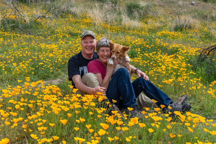
A little wildlife amid a lot of flowers!.
We had so much fun photographing the Arizona poppies along the Bush Highway last March that we just had to return this year.
Last year the poppies exploded in a fabulous super bloom. This year the fields of gold weren’t as extensive as before. However, it was still a magical experience to see the pretty flowers and walk between the thick patches of yellow and orange.
Buddy made himself at home and promptly laid down in a thicket of poppies.
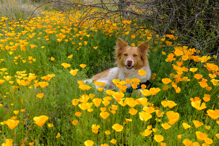
“This is nice here!”
People all around us strolled slowly in wonder, stopping now and then to get selfies amid the flowers. We were no exception!
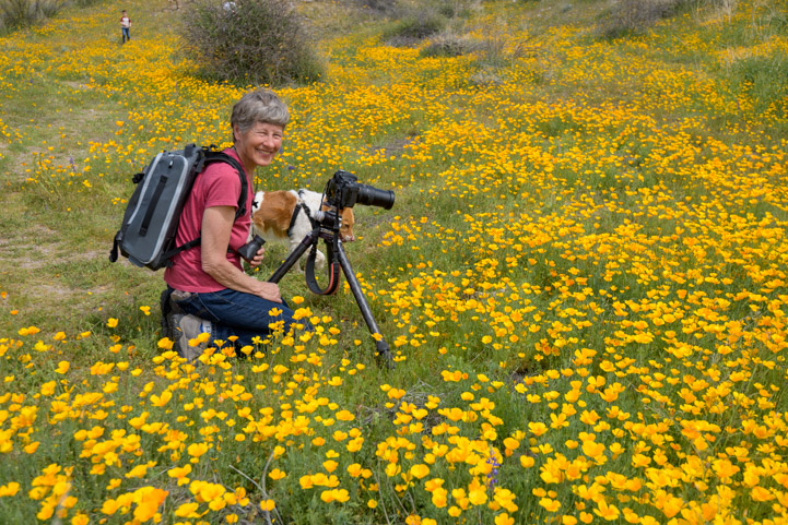
Right in the thick of it…
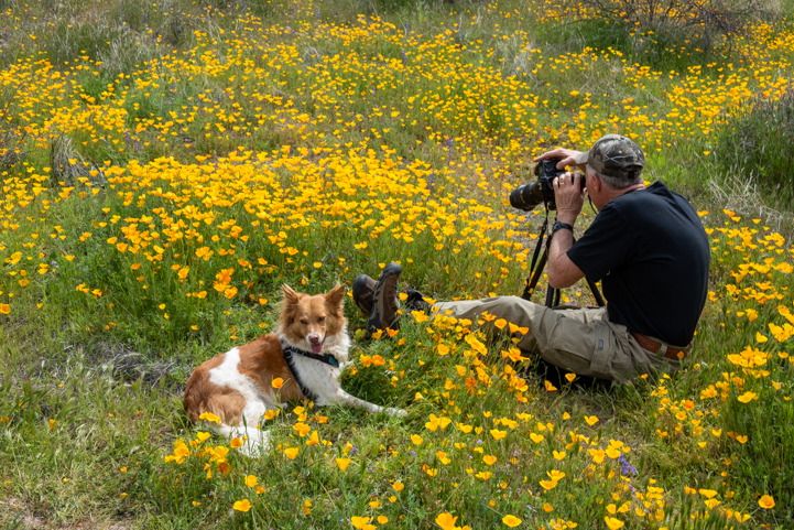
Getting down to business!
We use these two-way radios EVERYWHERE!. Hiking, biking, shopping and parking the rig! For more of our RVing tips, visit this page: RVing Tips & Tricks
These joyful flowers grow in abundance all around the Phoenix area. For some people whose yards are overrun with them each spring, they can actually be something of a nuisance. But to us, their happy faces smiling up at the sun are the very essence of Spring.
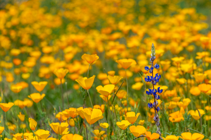
Poppies herald the arrival of Spring in the Sonoran Desert.
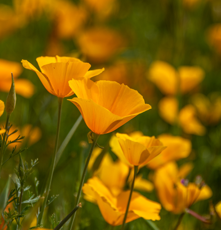
Smiling faces.
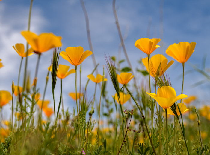
Poppies’ eye view of the sky!
A little further down the Bush Highway, we stopped at the Water User’s Recreation Area. This is a huge parking lot and river frontage area where people launch kayaks, standup paddle boards and let their dogs and kids play in the water. There’s a fantastic view of the Salt River from the edge of the parking lot.
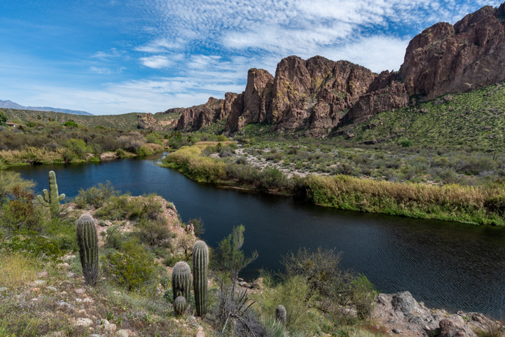
A natural river flows through the desert.
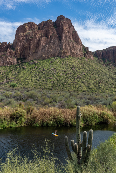
This is a great place to play in the water on a hot day.
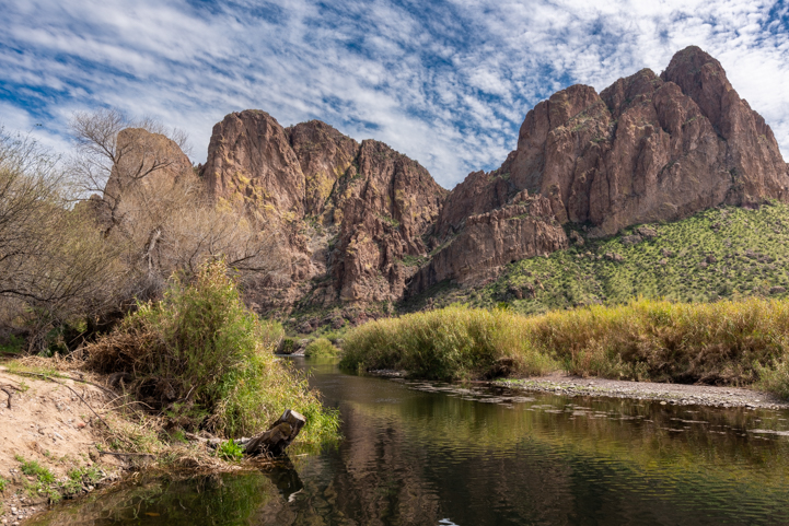
Just love those cliffs!
Sometimes when we’ve stopped at this spot we’ve seen the wild horses that are residents of the area. They come down to the water here for a drink. None were out on this particular day. However, Buddy waded in the water and took a long drink.
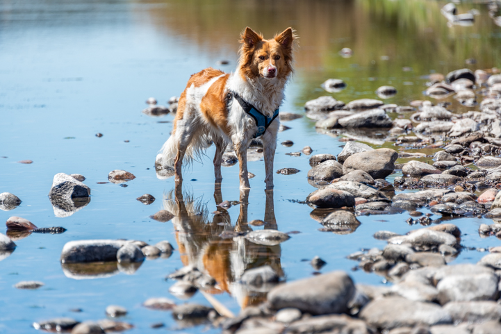
.
There are a lot of recreation areas along the Bush Highway, and each is a little different. There are cliffs and beaches and even some mesquite woods at the Coon Bluff Recreation Area.
We hiked on the short trail that parallels the Salt River and wanders between the lush green grass and mesquite trees.
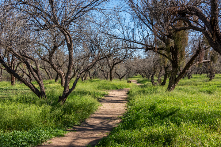
We watched a wedding shoot in this grove of trees a few years back!
Down on the riverbank we suddenly heard a loud chirping coming from a pile of boulders. Buddy quickly ran over and stared into a hole between the rocks, sniffing continuously. Sure enough, there was a ground squirrel in the hole. He came out into the sunshine for a split second and chirped for us and then darted back in the hole.
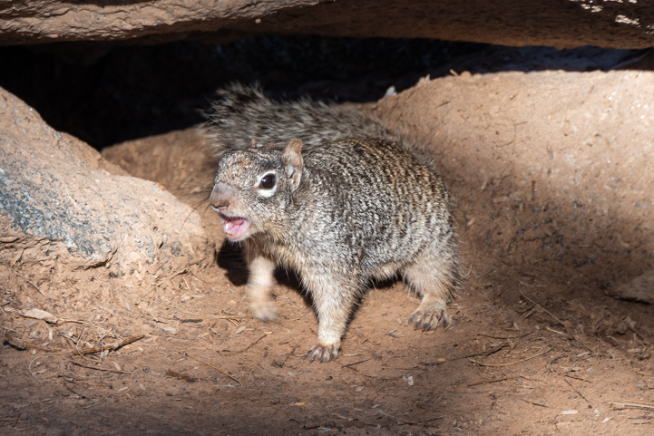
“Watcha doin’ ?”
Up in the sky, a pair of geese flew by. One was honking loudly. The wildlife around here had a lot to say!
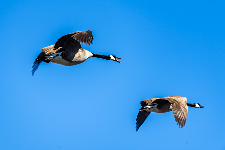
“Take a left!”
We drove on a short distance and stopped at the Phon D Sutton Recreation Area. This spot is at the confluence of the Salt River and the Verde River, and there’s not only wildlife all around but lots of human activity too. it’s a beautiful place to spend an afternoon.
We hiked a short trail that goes along the river’s edge, and Buddy suddenly stopped and laid down for a brief rest while he surveyed the pretty landscape from a nice spot in the shade.
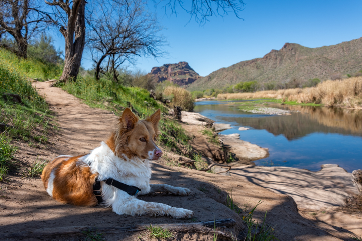
Buddy takes a breather in the shade by the Salt River.
Four Peaks appeared far out on the horizon. From this vantage point we were seeing the “front” of Four Peaks while when we RV camped at Roosevelt Lake further upstream on the Salt River a few weeks ago, we were looking at the “back” of Four Peaks.
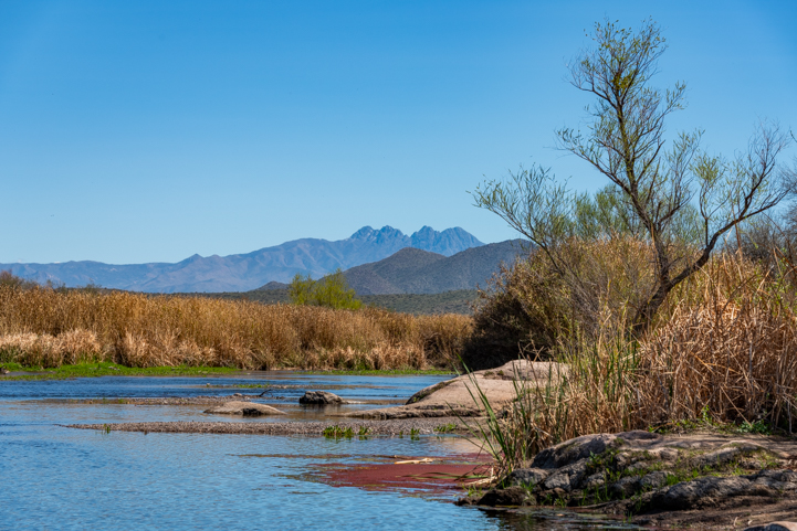
View of Four Peaks from Phon D Sutton Recreation Area.
In the opposite direction, Red Mountain cast a reflection in the glassy water.
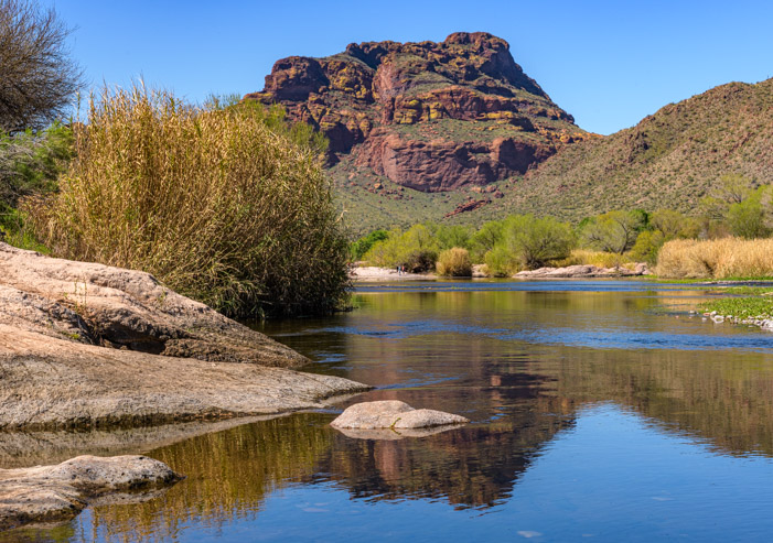
Red Mountain checks its reflection in the water.
As I mentioned, Phon D Sutton (along with all the other Recreation Areas on the Salt River) is a popular place for all kinds of outdoor activities. While we were there, a group of people began bringing inflatable kayaks down to the water’s edge. First it was two yellow kayaks. Then two yellows and a red. Then two yellows, a red and a green. In no time the shoreline was filled with a rainbow of kayaks.
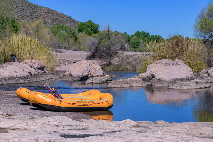
A group of kayakers brought a kaleidescope of kayaks to the shores of the Salt River.
A fly fisherman stood in the water casting his line, and a photographer grinned happily between shots.
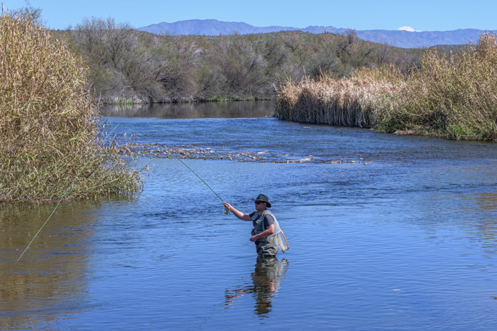
The Lower Salt River recreation areas along the Bush Highway are all about having fun in and near the water.
The Reese Goose Box was a GAME CHANGER for us. We got the bed of our truck back (yay!) and hitching/unhitching is easy.
Check out our review: HERE!
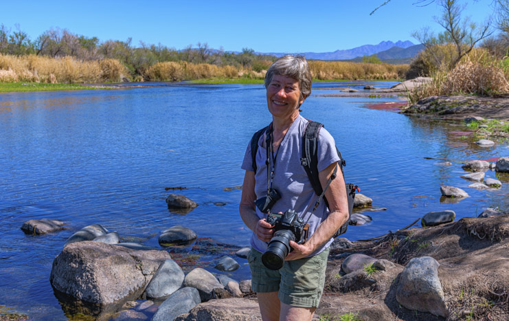
This is a great area to bring a camera.
The Bush Highway, Coon Bluff and Phon D Sutton are all near the city of Mesa. Further upstream on the Salt River, on the northeastern edge of the city of Apache Junction, lies one of Arizona’s most spectacular scenic drives: the Apache Trail (State Route 88).
This incredible winding road goes through some of the finest Sonoran Desert scenery in the state on a road that began as a trail used by the Apache Indians before the settlers arrived.
In 1903 road construction began to link the city of Mesa with the construction site for the Roosevelt Dam. In just a year, the first 64 miles of the road from Mesa to the Roosevelt Dam (which created Roosevelt Lake) was completed for a cost of $200,000. Two years later, in 1905, the entire 112 mile long road through this very treacherous terrain was completed for a total cost of $500,000.
The road builders were predominantly Apache Indians, and they built the road using pick axes and shovels along with dynamite. What an impressive feat!
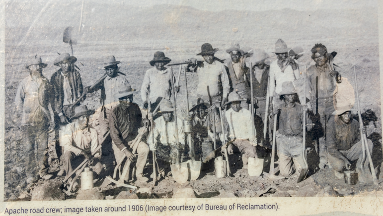
These guys built 112 miles of road through perilous terrain in 3 short years!
Today, the 37 miles of road through the most treacherous part of the original 112 mile long Apache Trail goes from Apache Junction to Roosevelt Lake and takes dozens of sweeping turns on a hilly run out towards the dam.
Only the first 15 miles are paved, however. And the 22 mile long dirt portion, which used to make for a very exciting ride, is currently washed out in a few places due to flooding in 2019, so it’s closed.
As we drove this beloved road, we reminisced about racing our bicycles on the paved portion after work on hot summer Wednesday evenings back in the day! It was a crazy race, but so much fun. It was typically 115 degrees, and we’d both put in a full work day already, but all our cares slipped away as we rode at top speed on this scenic route.
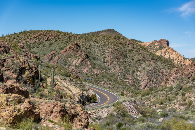
One of dozens of tight turns on the Apache Trail.
On our drive last week, we were alarmed when we saw a sheriff’s car and an ambulance parked by the side of a particularly tight turn, lights flashing.
People routinely drive this road way too fast, and a surprising number go over the edge. Seeing the car at the bottom of the cliff was a great reminder to take our time and drive slowly. After all, why rush on such a beautiful drive?!
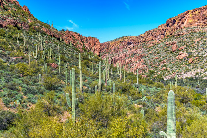
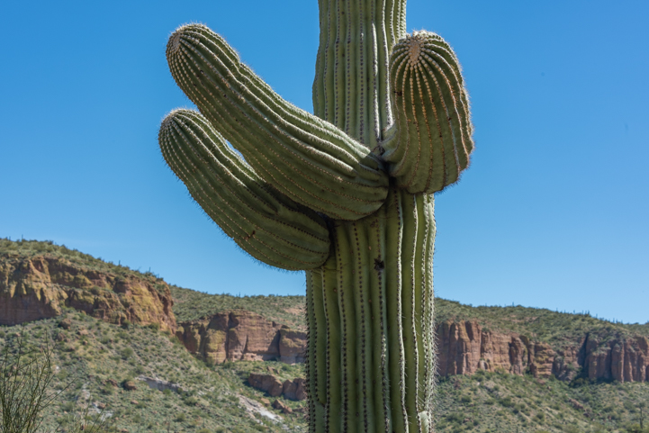
The Apache Trail is one of the best places to see gorgeous saguaro cactus stands.
.
Along the way, two trestle bridges cross tributary streams that flow into the river.
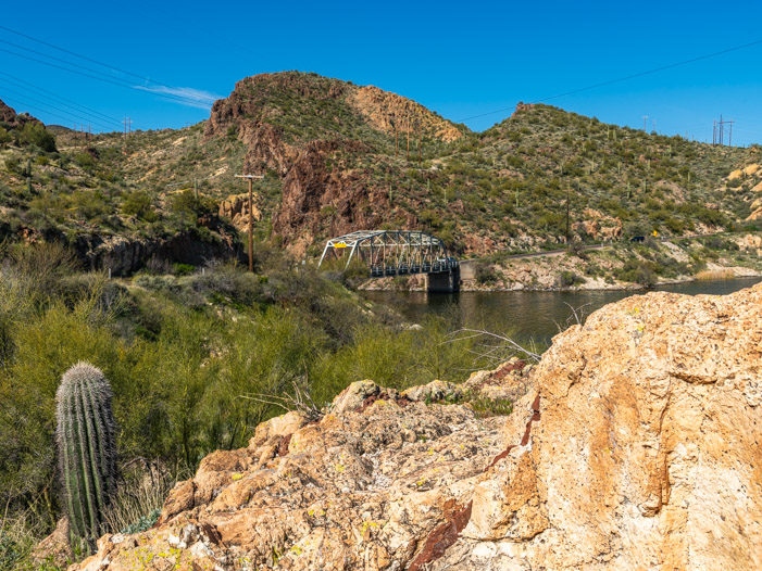
There are two trestle bridges on the Apache Trail.
The Apache Trail follows a portion of the Salt River that is dammed to form a series of lakes: Roosevelt Lake, Apache Lake, Canyon Lake and Saguaro Lake. As we turned a corner, we could see Canyon Lake in the distance.
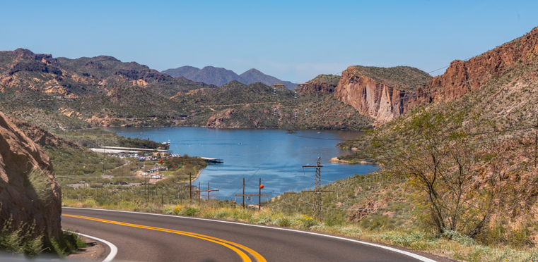
Canyon Lake appears in the distance.
A delightful way to see Canyon Lake is to take a ride on the Dolly Steamboat. We enjoyed that wonderful boat ride a few years ago when a crew from Camping World was filming us for a promotional video. It was a lot of fun to float through a Sonoran Desert canyon!
We’ve also taken the boat ride on Saguaro Lake aboard the Desert Belle. If you have a chance, either boat ride (or both) is well worth doing. Drifting through spectacular Sonoran Desert scenery is a captivating way to spend a few hours.
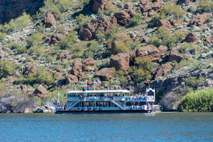
Dolly Steamboat cruises down Canyon Lake.
There are also several recreation areas near the Dolly Steamboat dock, and we stopped at Acacia Recreation Area to explore. This is a gorgeous spot with a beach, picnic tables, shade trees and stunning views of the canyon walls across the water.
A young family was enjoying a picnic on a blanket while a little girl and her dad fished at the water’s edge.
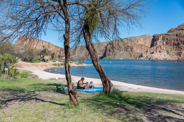
What a beautiful place to bring the family on a hot day.
We used two of these solar panels to upgrade our toy hauler's factory-installed 200 watt system to a 600 watt system.
See our DIY installation here:
RV Solar Power Upgrade
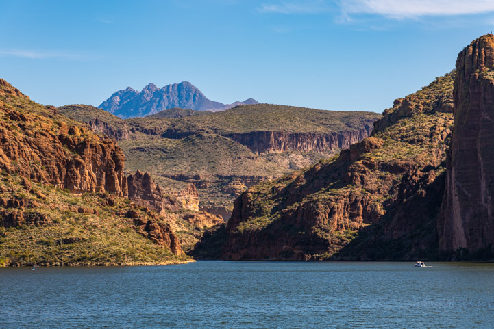
Far in the distance, the Dolly Steamboat is dwarfed by the canyon walls.
The paved portion of the Apache Trail ends just beyond Tortilla Flat, a small complex of historic buildings with a restaurant. This place is a magnet for convertible drivers and motorcyclists who love to ride the sweeping turns of the Apache Trail and then stop for lunch.
On our way back we saw an opening for a small trail that went down to a stream. Buddy cooled his paws in the water and Mark did too when he accidentally stepped into deep water that came in over the tops of his boots!
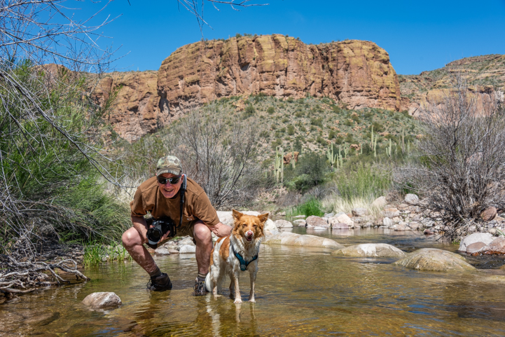
Buddy and Mark cool their paws in the water.
The whole Lower Salt River area from Roosevelt Lake to the Apache Trail to the river access points on the Bush Highway is a rich playground for outdoor lovers, and we keep going back and back again!
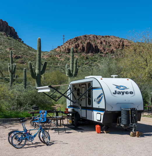
RV camping in the Sonoran Desert – fun fun fun!

Poppies, poppies, poppies!
Subscribe
Never miss a post — it’s free!

More info about the Lower Salt River recreation areas and the Apache Trail:
- Salt River Info – Tourism website
- Apache Trail Info – Tourism website
- Dolly Steamboat ride on Canyon Lake – Official website
- Desert Belle boat ride on Saguaro Lake – Official website
- Apache Trail – Google Maps
- Bush Highway – Google Maps
Other blog posts from our visits to the Salt River and Apache Trail:
- Arizona’s Stunning Apache Trail Scenic Drive
- Camping World Video Shoot — RVing is for Everyone!
- Dolly Steamboat – Gliding Through the Arizona Desert on Canyon Lake
More blog posts from our trips to central Arizona:
- Windy Hill Campground + Tonto National Monument
- We’re Alive and Well and Camping in Arizona!
- ViewPoint RV & Golf Resort – RVer’s and Golfer’s Delight!
- Tonto National Monument AZ – Workamping with the Ancients!
- Tonto National Monument AZ – Lower Cliff Dwellings
- To Catch a Hummingbird (on camera!)
- The Wind Cave Hike in Phoenix AZ – The Hills are Alive!
- Snow in the Arizona Desert – A Beautiful Fairy Dusting!
- Saguaros and Sunsets in Phoenix Arizona
- RV Camping with the Rock Art Petroglyphs in Gila Bend, AZ
- Roosevelt Lake, AZ – Desert Oasis
- Roosevelt Lake – Lakeside Camping in AZ
- Rivers of Phoenix – Oases in the Desert!
- Ranch Sorting Competition – Cowboy Adventures in Phoenix Arizona
- Phoenix Sonoran Preserve – A City Escape
- Phoenix Parks – Saguaros and Sisters
- Peach Faced Lovebirds in Phoenix, AZ – Parrots in Cactus!
- Monte Vista RV Resort in AZ – Arts, Crafts and Sports Fun!
- Merry Christmas – Arizona RV Style!
- McDowell Sonoran Preserve in Scottsdale AZ
- Magical Moments in the RV Life
- Lost Dutchman State Park: GORGEOUS scenery & RV campground!
- Lost Dutchman State Park Campground – Arizona Gold in the Superstitions
- Lake Pleasant & Canyon Lake – Waterfront Camping in Arizona’s Sonoran Desert
- Florence, AZ – Few Tourists & Lots of Soul!
- Fiery Sunsets and Interesting Folks in the Arizona Desert
- Fall Color in Arizona’s Sonoran Desert near Roosevelt Lake
- Dead Horse Ranch State Park + Tuzigoot and Clarkdale
- Copper Mines, NOT CAMPING, in Tonto National Forest – Why?
- Catalina State Park & Roosevelt Lake: RV Camping in AZ
- Castle Hot Springs and Other AZ Treasures near Lake Pleasant
- Burrowing owls in Gilbert, Arizona – They’re a Hoot!
- Arizona, Here We Come – Space Aliens of All Kinds!
- “RaVeS” Cafe for RVers in Mesa AZ
Our most recent posts:
- How to Install Starlink Gen 3 in an RV? Use the Speedmount! 08/07/25
- Escape to Paradise – Rocky Mountain Magic! 08/01/25
- Is Forest River a Good RV? Well Built? Here’s Our Experience 06/20/25
- Sunset Crater Nat’l Monument – Lava & Camels at Bonito CG! 06/06/25
- 2024 Alpha Wolf 17CB Trailer – Our Goldilocks RV! 04/25/25
More of our Latest Posts are in the MENU.
New to this site?
Visit RVers Start Here to find where we keep all the good stuff. Also check out our COOL NEW GEAR STORE!! *** CLICK HERE *** to see it!
<-Previous || Next->


Great subject matter and composition in your photographs, even without the inherent drama of dawn or dusk lighting!
It’s a gorgeous area at any time of day or night, and we loved trying to capture the essence on camera. Thank you very much for appreciating our efforts!
We are so fortunate to call this section of Arizona home! You did a wonderful job of describing the beauty of it!! 😊
It’s such a great part of the world, Annie. Lucky you to be living there!!
Happy Easter & Spring! Always enjoy reading your story to Rich. We are heading out Friday to Lost Dutchman State Park for our fourth Vintage Cruiser Rally. Colorado plans for June/July. Safe travels…take care❗️Hugs & love…Mary & Rich
Oh man, we just missed you! That’s where we stayed last week!! We would have loved to see you and all those vintage rigs!! Have a blast and enjoy that wonderful campground and state park. Hugs to Rich — thanks for reading my various posts aloud to him!!
Always fun when you refer to past adventures as you tool along memorable scenery….such beauty deserves repeats !
My neighbors in Paris mentioned enjoying this post…Love, Mom
We love discovering new places, but there’s something very special about returning to beloved old haunts…! Please tell your neighbors that I really appreciate their feedback. It’s heartwarming to know that our travel tales are enjoyed both here and abroad! xoxo
Seems we just missed you! We’ve been at Lost Dutchman for a week. I had wanted to camp on the other side but with Steve’s recent eye surgeries we can’t go up in elevation that far yet. We’re bummed with all the cold rainy weather this spring. The flowers are just starting to bloom. We had high hopes for peak season:
I’m sorry we missed you, Debbie! It sure has been a wet spring, and it was quite chilly AND wet for our last 3 days at Lost Dutchman. Oh well. Mother Nature has her own agenda and it’s impossible to know ahead of time when the flowers will bloom. The daffodils at our house bloomed on March 25th this year but on February 25th last year! Happy Trails and wildflower hunting to you and Steve, and stay warm!
We spent some time last spring at Lost Dutchman SP, and traveled the Apache trail as far as Tortilla Flat. Your posts remind me of what a glorious place it is!
No complaining about missing it now as we are currently at Zion NP, and going to Bryce next week.
Thanks for your amazing photos, as it inspires me to get smarter with my Canon 7D. Thanks for the inspiration!
I’m so glad you had a chance to drive the Apache Trail and stay at Lost Dutchman. But I’m envious of you being at Zion and Bryce right now! What an ideal time to visit those places. They’ll be so much quieter than at high season in mid-summer. Have fun with your Canon 7D. You can’t get a bad shot at those glorious National Parks!!
I finally got a chance to read this edition and look at the beautiful pictures. I’m glancing out at the remnants of 6 inches of snow we got 2 days ago, so your pictures really cheered me up!
Beautiful, now hopefully Spring will make its way East.
Spring will get to you eventually, and that snow will melt away. In the meantime, I’m glad the pics of the poppies and sunny skies lifted your spirits!