June 2015 – Maine’s Mt. Desert Island (pronounced “dessert” despite the spelling!) is home to several small harbor-front towns as well as lovely Acadia National Park. We made a beeline for the trendy and chic seaside town of Bar Harbor as soon as we got there.
Two old cannons face the water in the middle of town, aimed almost directly at a pretty schooner in the harbor. Mark decided to have a look down the barrel of one!

Boom!
It was early in the morning, well before the crowds of tourists began to fill the streets, and we enjoyed the quiet and peaceful feeling of the place. This is an upscale town loaded with high end galleries and boutique shops, and it was nice to walk the main street and window shop completely by ourselves for a while.

Shops on the main drag in Bar Harbor
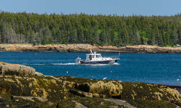
Another wonderful small waterfront town is Northeast Harbor (whose sister town, Southwest Harbor, lies across the bay). All of these towns made for fun excursions during our stay, and we spent many a happy hour walking along the docks and watching the boats in the harbor.
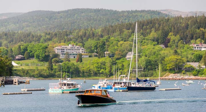
Scenic Northeast Harbor
A lot of Maine harbors are geered primarily towards the lobster boat fleet, but Northeast Harbor is also home to many beautiful sailboats — and some unusual looking ones too!

Northeast Harbor has sleek fancy yachts and cute antiques too
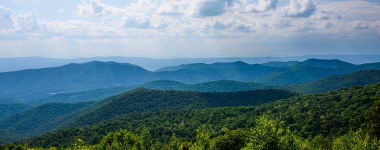
Mt. Desert Island is shaped something like a lobster claw with a pair of wide pincers hanging down. Acadia National Park takes up most of the eastern lobe and much of the western lobe too. In the eastern portion — the main part of the park — there is a Loop Road that passes the major sights.
The eastern 2/3 of this road is one way, and in our excitement to see it all on our first day in Acadia, we blew right by the visitors center, missed some key signs and wound up at the far end of the loop road facing the wrong way, trying to figure out how to see the park. Oops!

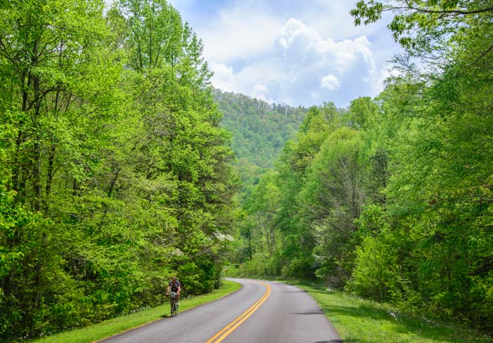
The drives around Mt. Desert Island are wonderful
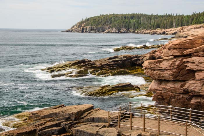
We got ourselves sorted out the next day and, map in hand, drove the loop clockwise as you are supposed to! Stopping at some of the viewpoints, we were quickly swept up in the beauty of the craggy shorline.

Crashing surf on Maine’s rugged coast.
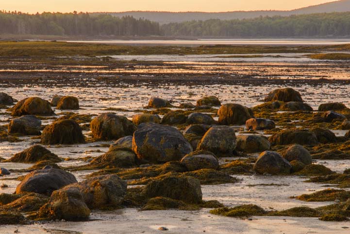
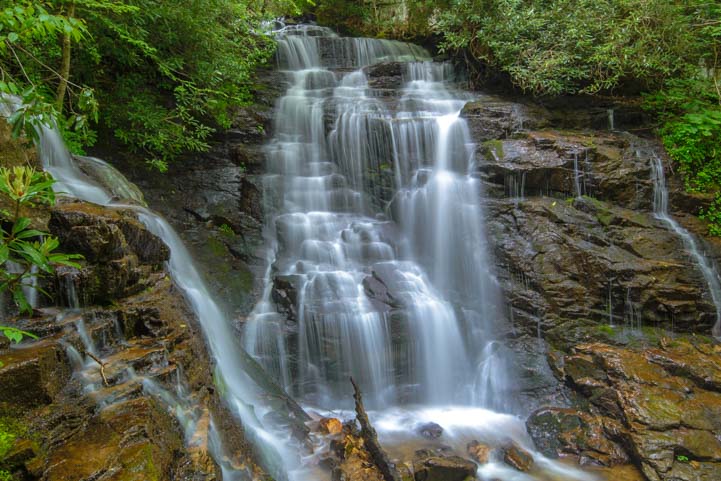
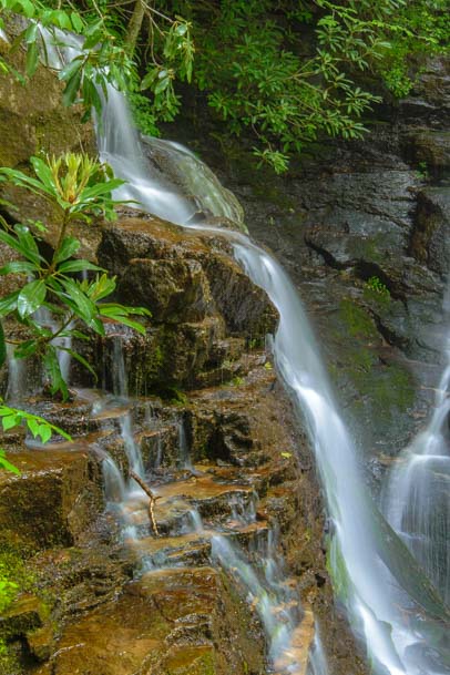
There were wonderful, huge granite boulders, and some of them even held tidepools. I love these northeast tidepools. There are whole ecosystems of algae, seaweed, periwinkels and limpets living in them, and many are lined with an ultra soft and rich red velvet that is some kind of algae.

We found lots of pretty tidepools

We LOVED the mix of pine trees and jagged granite boulders on the coast.
I wandered way off so I wouldn’t keep getting in Mark’s photos, and around the bend I saw a lobsterman busy hauling his traps. I took a bunch of photos of him and then noticed that he waved to me. I took my camera down from my face to wave back. When I raised it again, I saw through the telephoto lens that he hadn’t been waving — he’d been holding up a wriggling lobster for me!
Unfortunately, he dropped the lobster into his bucket before I realized what he was doing, and I missed the shot.
Darn! The one that got away…

I didn’t realize he was showing off a lobster for me to photograph until too late!
One of the most popular attractions at Acadia National Park is Thunder Hole, an opening in the rocks where the waves crash in and out, sending up a huge spray of water. To see the biggest spray, you have to catch it as the tide is coming in. The tide was going out when we swung by, but it was still neat to hear the gurgles, gulps and belches booming between the rocks far below as the waves washed in and out.

Thunder Hole – Booming sounds on an outgoing tide plus huge splashes on an incoming tide.
This shoreline is very alluring, and we had such fun scrambling over the rocks.

I swear, these kinds of big boulders bring out the kid in me.
What a coastline! If you don’t want to run and jump on the rocks, Thunder Hole has a solid railing…

A touch of drama in the sky.
Acadia National Park is a very popular place, and the park was very busy even though we had arrived ahead of the summer crowds (New England public schools were still in session because they’d had so many snow days during the endless winter blizzards). The roads are narrow and winding, and some crazy people like to bomb down them like they’re a racetrack.
One group of travelers, however, was enjoying every minute of slow driving on these roads — a Ford Model A club! They were so cute that none of the other drivers objected to their pace. Some 170+ Model A’s attended this rally, and everywhere we went we ran into little groups of them.
Seeing them out on the roads was lilke stepping back in time.

A Ford Model A rally took us back in time.
This group was having a ball, and the weather was perfect for them, so they drove around with the tops down and their beautiful leather suitcases strapped on the back bumpers.

Those guys were having too much fun!
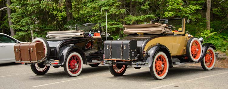
Enjoying a fabulous road trip!
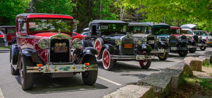
These guys were all over the park. What fun!
Another Acadia National Park favorite is to take a drive to the top of Cadillac Mountain, the highest point in the park. We zoomed up the mountain, watching the views grow ever larger around us. And who was waiting for us at the top? A bunch of those Model A’s!!
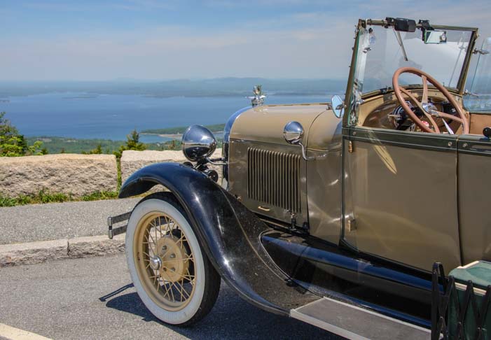
View from the Top
The views were truly beautiful — you can see the many islands of Frenchman Bay in the distance — but we got the biggest kick out of watching these cute Model A’s drive down these wonderful roads. They had come to Acadia National Park from all over the country, most making the trip on their own four wheels. One club member even hailed from Australia, although he’d left his Model A at home.

What a classic image descending Cadillac mountain!

.
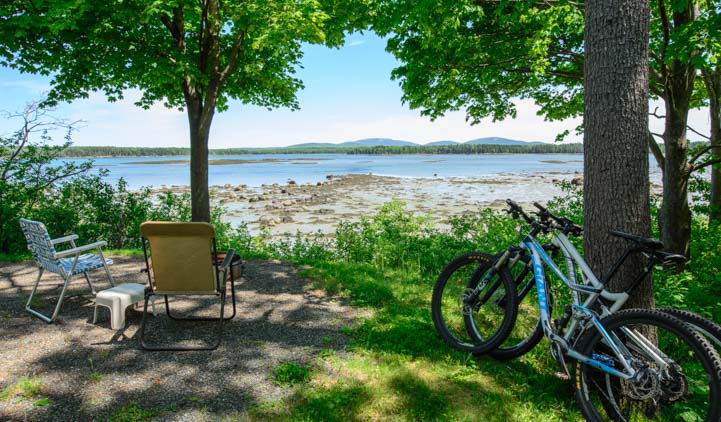
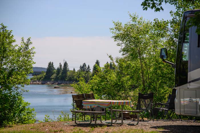
If you take your RV to Mt. Desert Island, unless it is fairly short in length and short in stature, you’ll be happiest leaving it behind as you tour the park. The scenic viewpoint parking is not RV friendly and there are bridges on the Loop Road as low as 11′ 8″. We enjoyed a fabulous stay at Narrows Too RV Resort, about 7 miles north of the north entrance to the park.
Subscribe
Never miss a post — it’s free!
Our most recent posts:
- Buckskin Mountain State Park – Fun on the Colorado River! 01/31/26
- How to Install Starlink Gen 3 in an RV? Use the Speedmount! 08/07/25
- Escape to Paradise – Rocky Mountain Magic! 08/01/25
- Is Forest River a Good RV? Well Built? Here’s Our Experience 06/20/25
- Sunset Crater Nat’l Monument – Lava & Camels at Bonito CG! 06/06/25
More of our Latest Posts are in the top MENU above.
For More Info:
- Acadia National Park – Official National Park Service Website. Click “View Map” for a map of the park.
- Where are these places? – Google Maps
Other blog posts from our RV travels in Downeast Maine
- Eastport and Bangor – Off the Beaten Path in Maine! 08/18/15
- Lubec & Campobello Island – Fantastic Lighthouses! 07/17/15
- Taking the Mail Boat Ferry to Maine’s Cranberry Islands 07/15/15
- Beauty in the Mist – Bass Harbor Head Lighthouse, Maine 07/10/15
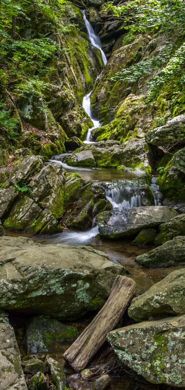
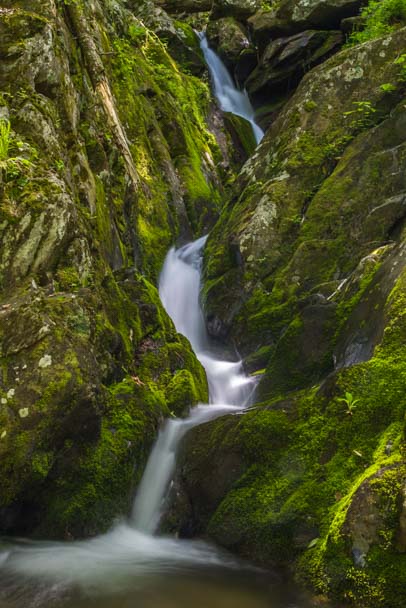
- Acadia National Park’s Carriage Roads in Maine – Thanks, Rockefeller! 07/07/15
- Schoodic National Scenic Byway – Downeast Maine at its best! 07/04/15
- Acadia National Park – Alluring Beauty on the Maine Coast 07/01/15
- Narrows Too RV Resort – A Great Acadia National Park Home Base 06/27/15
- Hinckley Yachts Factory Tour – Where Cruising Dreams Come True 06/16/15
Here are some of our blog posts with similar themes!
- San Diego’s Sunset Cliffs – A beautiful craggy shore in the far opposite corner of America
- Ensenada Mexico’s La Bufadora – A wonderful blow hole like Thunder Hole just south of San Diego
- Ely Nevada Open Road Challenege and Sun Valley Idaho Road Race – Two fun-filled events for car lovers
<-Previous || Next->