
April 2016 – Arches National Park lies just outside of Moab, Utah, and it has the highest density of natural stone arches in the world. Like all the National Parks, it deserves a week’s stay, at the least, but on this particular RV roadtrip we spun through in just a day.
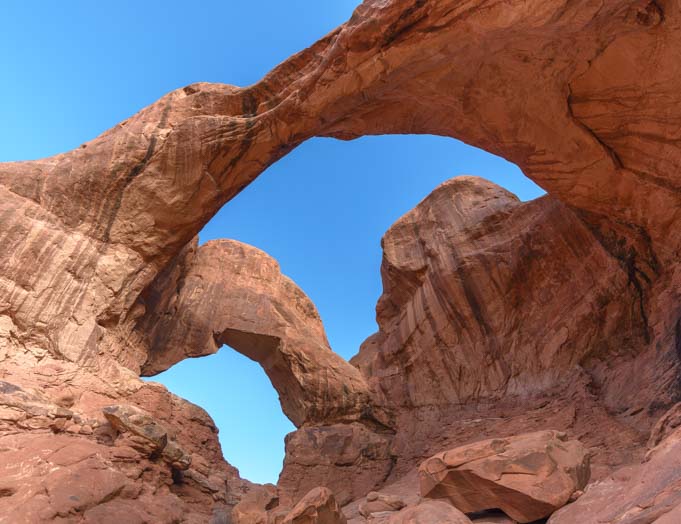
Double Arch in Arches National Park Utah
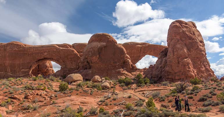
There are dozens of arches, each with its own name and personality. Our first stop was at Double Arch, so named because it is exactly that: two arches that are joined together at one end.
The thing that is impossible to grasp from photos of these magnificent sandstone sculptures that Nature has crafted by way of water, ice and wind, is the immense size. We crawled all around the interior of this beautiful pair of arches for quite some time and then got a selfie at their doorstep.

.
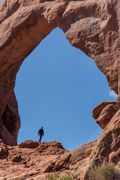
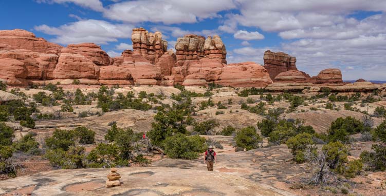
All of the arches at Arches National Park are gargantuan, and people exploring them disappear into mere specks.

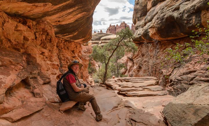
One of the most fun things at Arches National Park is crawling all around these beautiful arches.
Every arch has a different shape, and they all change shape as you hike towards them and through them.
There are arches of every imaginable size and shape.
Some have a long staircase leading up to them, courtesy of the National Park Service.
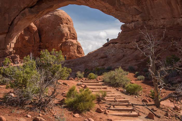
Stairs lead up to a beautiful arch.
And some offer a wonderful framed view when you stand beneath the peak of the arch and look out.
A peek at the world from inside Double Arch
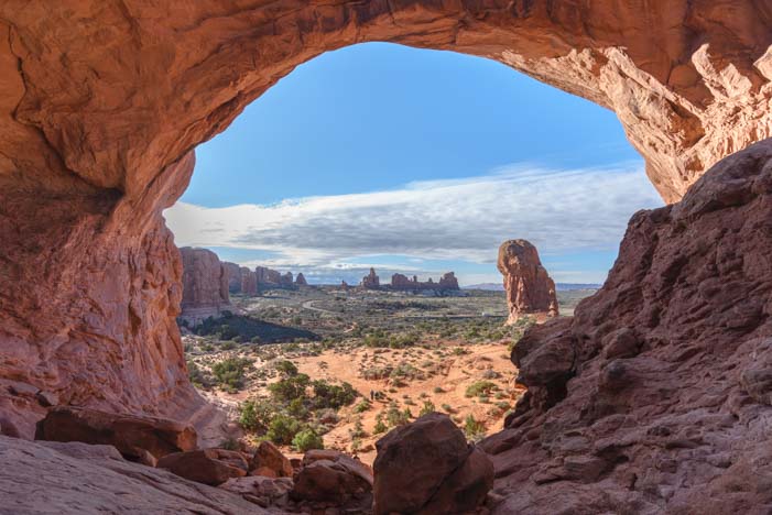
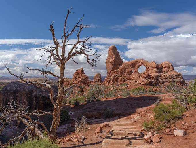
Sometimes, the view through the arch is sensational!

View of Turret Arch from the South Window
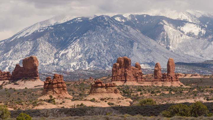
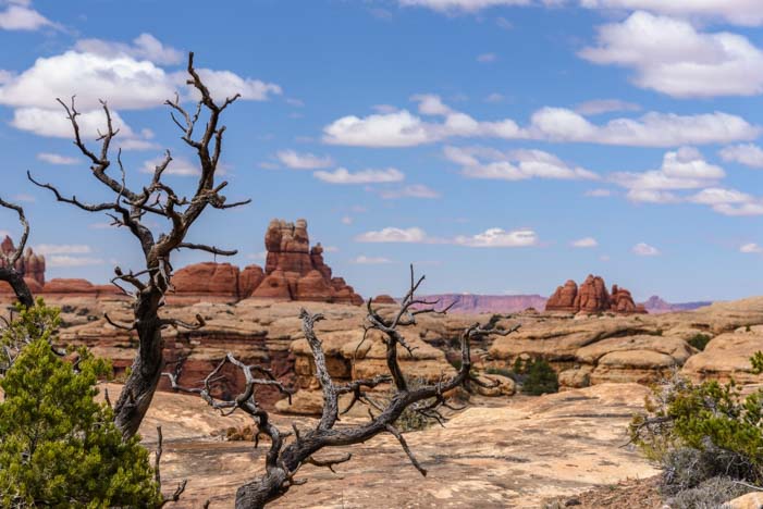
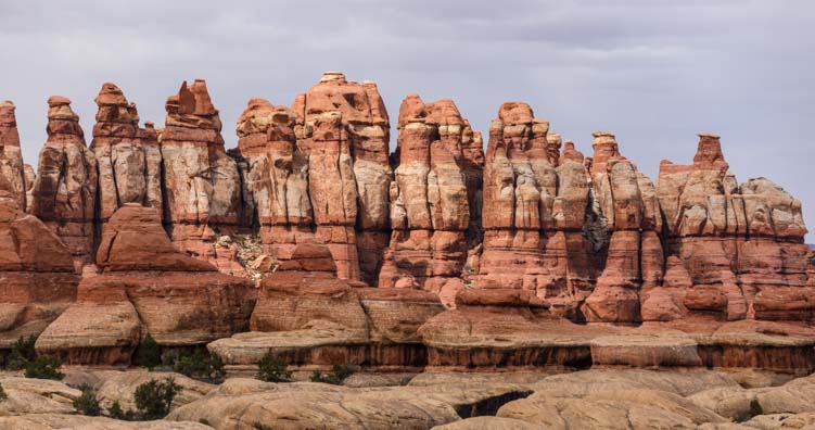
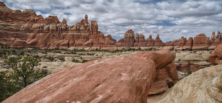
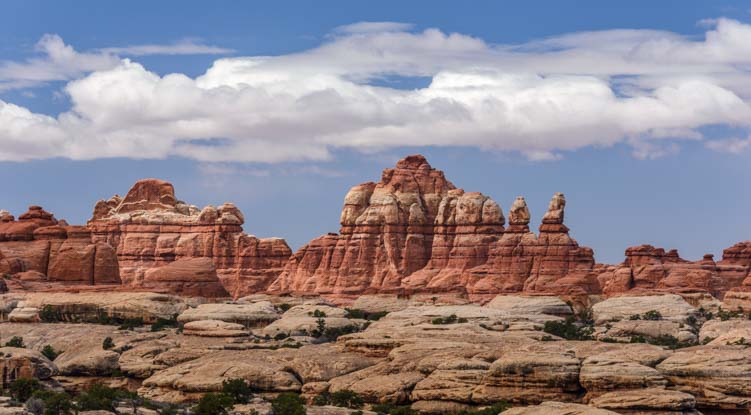
Arches aren’t all there is to see at Arches National Park, though. There are towers and cliffs of all kinds.

Arches National Park has wonderful pinnacles and red rock walls too.
The red rock sandstone is very sheer in places, forming immense walls and giant corridors.
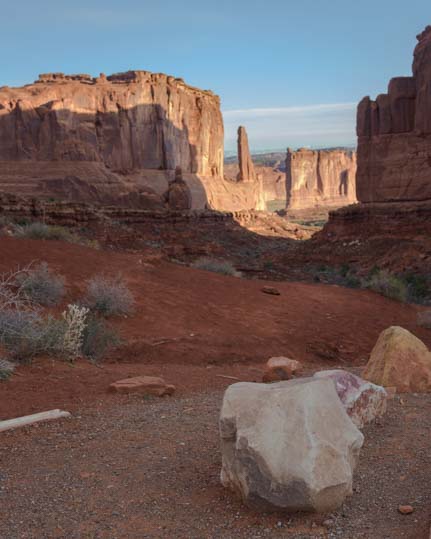
Park Avenue — Nature’s version!
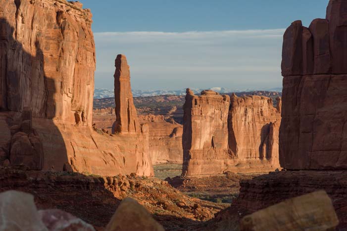
“Darling, I love you, but give me Park Avenue!” — Green Acres
Arches National Park is an ideal family destination, with room aplenty for the kids to run around. The tourists were thick — it was Spring Break while we were there — and people were having a blast climbing all over the rocks everywhere.

Arches National Park is a fabulous place for families with a little something for everyone.
Moms and dads were very busy with young kids who’d discovered that Arches is one enormous playground.

Two adorable girls kept dad busy in the mammoth “playground” that is Arches National Park.
The scenery is astonishing, and it is impossible to take more than a few steps without getting yet another photo.
We were blown away by the landscapes.

So many folks were taking photos, lots of pics became photos of photographers taking photos!
Like the Needles at Canyonlands and Valley of the Gods and Horseshoe Bend, we couldn’t help but join the crowd of selfie takers to get a shot of ourselves in this extraordinary setting.

What a great day and place!
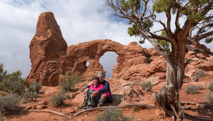
Aww, we had to take more than one. Turret Arch makes a wonderful backdrop!
The clouds rolled across the sky in thick battalions, and there was an intense threat of rain on the horizon.

.
As we watched one particularly menacing black cloud gathering steam in the distance, we decided to hustle back to the truck to avoid getting drenched.

Time to get moving!!!
We had had hopes of catching the arches at sunrise and sunset, playing with twinkling starbursts and the Milky Way.
The Spectacles!
But the weather didn’t cooperate, so we’ll have to return. Once again, rather than checking a destination off of our bucket list, all we did was whet our appetites to come back with our RV for more!
Arches National Park is awesome for an RV roadtrip.
If your RV travels take you to the Moab area, Arches National Park is stunning and a definite “do not miss” destination.
A word of caution: Arches National Park is extremely overrun with tourists. By noon everyday, the line of cars waiting at the entrance numbered at least 15 or more while we were in Moab. But it is for very good reason: Arches is fabulous!
If you can sneak into the park before sunrise (camping inside the park helps!) or shortly thereafter, you’ll have the first arch or two to yourself. After that, it’s a big old party. But what a great party it is!!

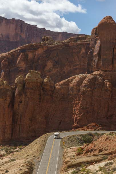
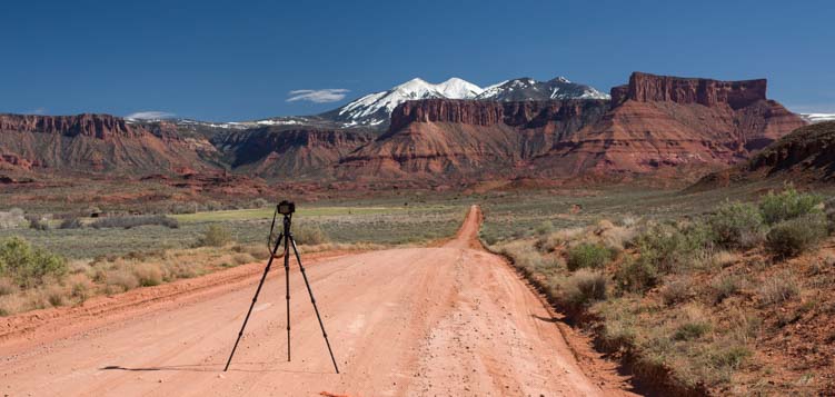
The roads near Arches National Park offer magnificent views.
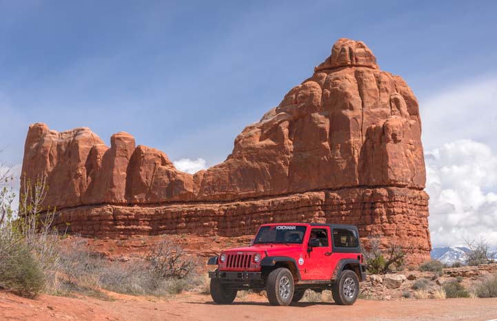
And if you go during Jeep Safari Week in Moab, the scenery in every direction will be decorated with colorful Jeeps!!

.
Love red rock bridges and arches? There are three true beauties at Natural Bridges National Monument in Utah, and more info and links for Arches National Park below.
Subscribe
Never miss a post — it’s free!
More info about Arches National Park:
- Arches National Park Official Website
- NPS Map of Arches National Park
- Allstays List of Campgrounds and RV Parks near Arches National Park
- Arches National Park official info for camping inside the park
- Location of Arches National Park (Google Maps)
Related posts from Utah’s Awesome Red Rock National Parks, State Parks & National Recreation Areas:
- Cedar Breaks National Monument in Utah – Better Than Bryce? 08/30/11
- Red Canyon Utah is an Overlooked Treasure 09/02/11
- Natural Bridges National Monument & Utah’s Bicentennial Highway 06/15/12
- Capitol Reef National Park Utah – Awe-inspiring! 06/25/12
- Flaming Gorge Utah – Fiery canyons, a cool river, and nearly tame bighorn sheep 10/02/12
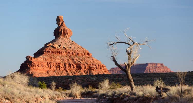
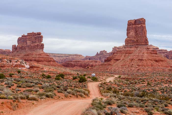
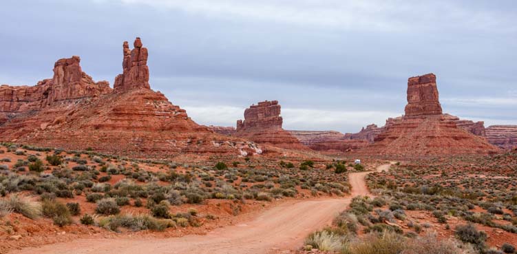
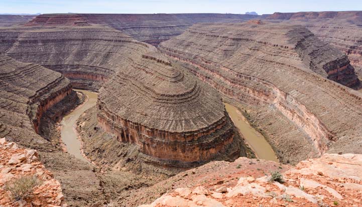
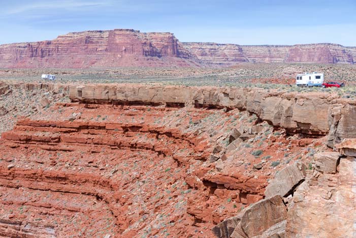
- Valley of the Gods & Goosenecks State Park, Utah – Beautiful! 04/04/16
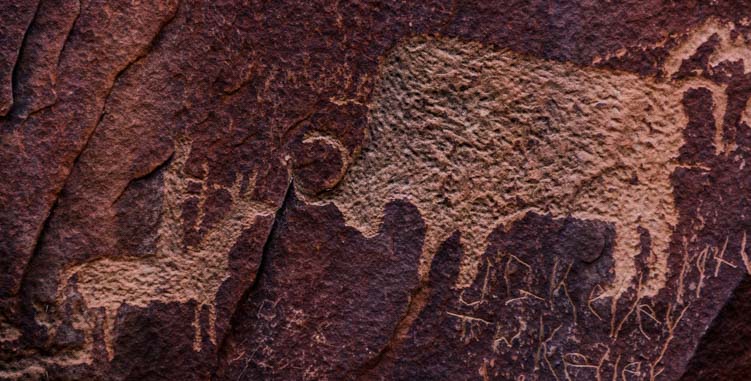
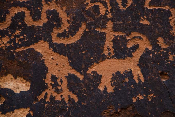
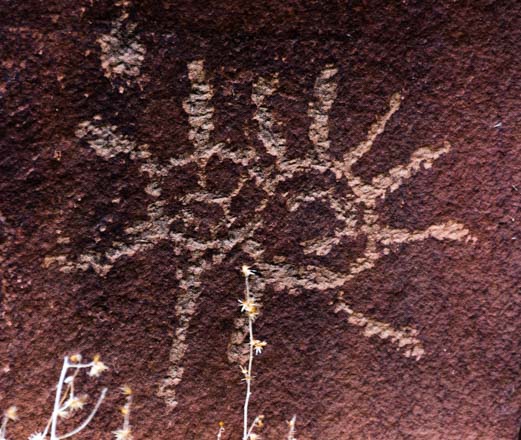
- Newspaper Rock Utah – Petroglyphs and Rock Art from the Ancients 04/06/16
- Canyonlands National Park Utah – Hiking in the Needles District! 04/12/16
- Moab Utah – Red Rocks and Snowcapped Mountains 04/14/16
- Arches National Park Utah – A Playground of Soaring Red Rock Bridges! 04/21/16
- Dead Horse Point State Park, Utah – Magical Sunrises! 04/23/16
- Canyonlands National Park UT – Island in the Sky (and Night Skies!) 04/28/16
- Bryce Canyon – Hiking The Rim & Navajo Loop + A Tourist Time-lapse! 09/29/16
- Sand Hollow State Park, Utah – An Oasis in the Desert! 11/21/17
- Utah Scenic Byway 24 RV Trip – Capitol Reef National Park 04/16/18
- Goblin Valley State Park Utah – One Gigantic Playground! 04/20/18
- Bryce Canyon in Winter – Snow and Lace on the Red Rock Spires! 01/25/19
- Cedar Breaks National Monument – Glorious Amphitheater of Red Rocks! 07/26/19
- Cedar Breaks National Monument – Wild Skies & Summer Storms 08/02/19
- Cedar Breaks Wildflowers + Stunning Brian Head Overlook 08/16/19
<-Previous || Next->
Our most recent posts:
- Buckskin Mountain State Park – Fun on the Colorado River! 01/31/26
- How to Install Starlink Gen 3 in an RV? Use the Speedmount! 08/07/25
- Escape to Paradise – Rocky Mountain Magic! 08/01/25
- Is Forest River a Good RV? Well Built? Here’s Our Experience 06/20/25
- Sunset Crater Nat’l Monument – Lava & Camels at Bonito CG! 06/06/25
More of our Latest Posts are in the MENU above.

.


 While visiting central Utah on a recent summer day, my husband and I drove the Fish Lake Scenic Byway, one of the state’s many beautiful highways and byways that are officially (and rightfully) designated as “scenic.” This road, Utah Route 25 between Loa and Fish Lake, weaves and curves through pine tree studded hills and into thick aspen groves. A bike trail runs alongside the lake and we quickly unloaded our bikes to ride this waterfront path. We soon found ourselves jumping on and off our bikes to take in the views, smell the fragrant air and check out the thick carpets of wildflowers that rolled down to the shore.
 rying a fishing pole or a tackle box. A large family huddled around one of the fish cleaning stations near the Lodge, and two men busily carved up the day’s catch. The kids watched in fascination as one of the men sliced open the belly of a fish and then explained it was a female as he pulled out a fistful of eggs. The little girl scrunched up her face and squealed, “Gross!” while the boy next to her grinned, “That’s cool, Dad!”