Blue Ridge Parkway (Virginia) – Waterfalls & Rhododendrons

May, 2015 – As we took our RV north through Virginia, hopping on and off the Blue Ridge Parkway, we followed the blooming of the rhododendrons as they blossomed first in the south and then in the north. In fact, we followed the rhododendron bloom all the way from the Smokies to northern Maine over the course of five weeks! We also decided to contine the travel theme we had begun in the southern part of the parkway in North Carolina: Waterfalls.

Rhododendron selife Crabtree Falls Blue Ridge Parkway Virginia

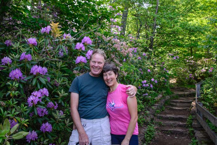
Lavender rhododendrons and stairs defined our Blue Ridge Parkway waterfall hikes in Virginia

Seeing waterfall pics is very inspiring, but actually getting to them on a hiking trail usually involves a lot of vertical hiking, either climbing up to the top of a waterfall or scrambling down to the bottom of one. We got some great stair-stepping workouts on our quest for beautiful waterfalls in the Virginia portion of the Blue Ridge Parkway!

APPLE ORCHARD FALLS

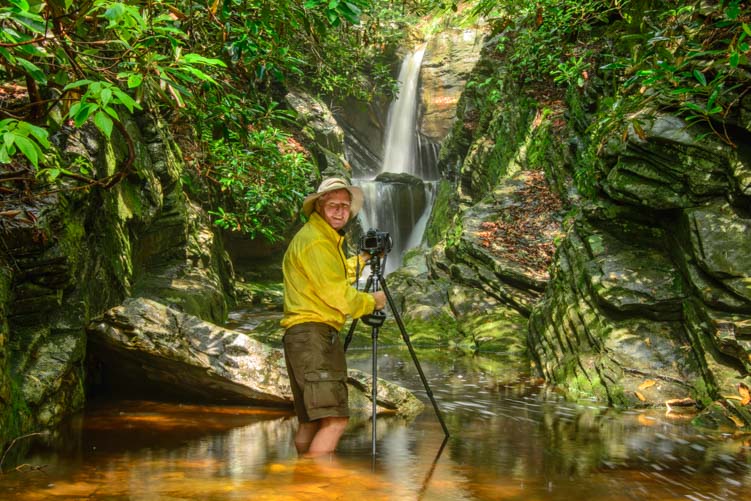
The first waterfall we went to was Apple Orchard Falls. This hiking trail crosses the Appalachian Trail, and we were astonished as we approached the intersection with the Appalachian Trail to meet a fellow who was spending his summer hiking from Georgia to Maine!

This hiker, Brian, was traveling light for a 4 month walk in the woods, but he said he was doing great. Unlike most of his fellow hikers, he hadn’t had to replace his hiking shoes yet, and he’d knocked out 770 miles of the trek with another 1,400 or so to go before he reached Mt. Katahdin in Maine.

Appalachian Trail Through Hiker Brian (Porkchop)

Brian is walking from Georgia to Maine this summer, and we met him 1/3 of the way into his trip.

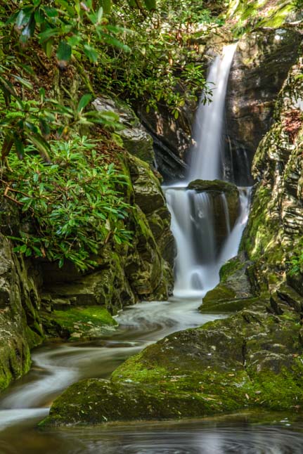
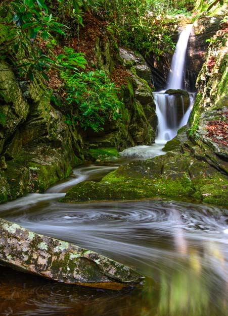
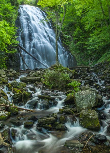
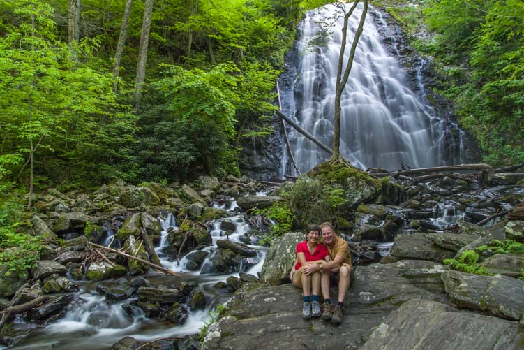
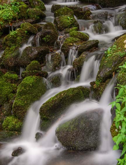
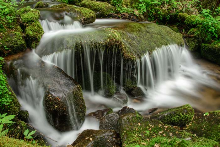
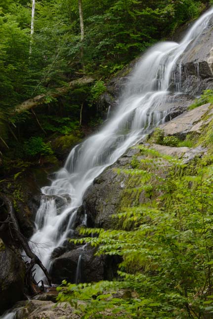
We bounded down the trail to the bottom of Apple Orchard Falls after that encounter, so excited to have met an Appalachian Trail through-hiker in the middle of his journey. At the bottom we found a pretty waterfall cascading over the rocks.

Apple Orchard Falls Blue Ridge Parkway Virginia

Apple Orchard Falls

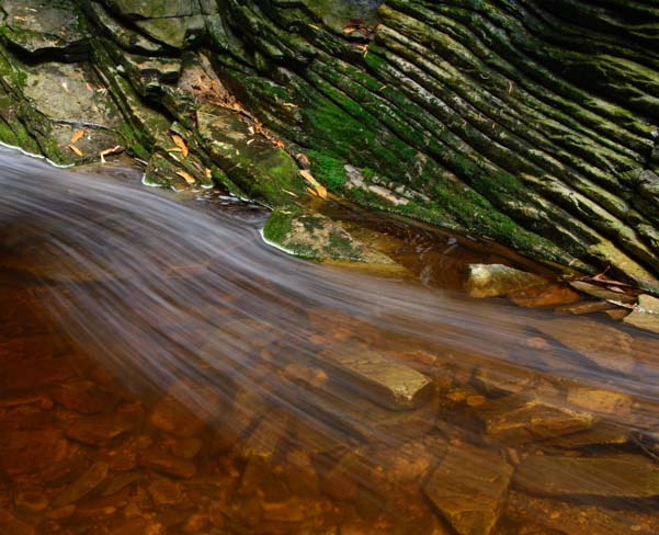
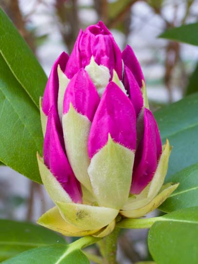
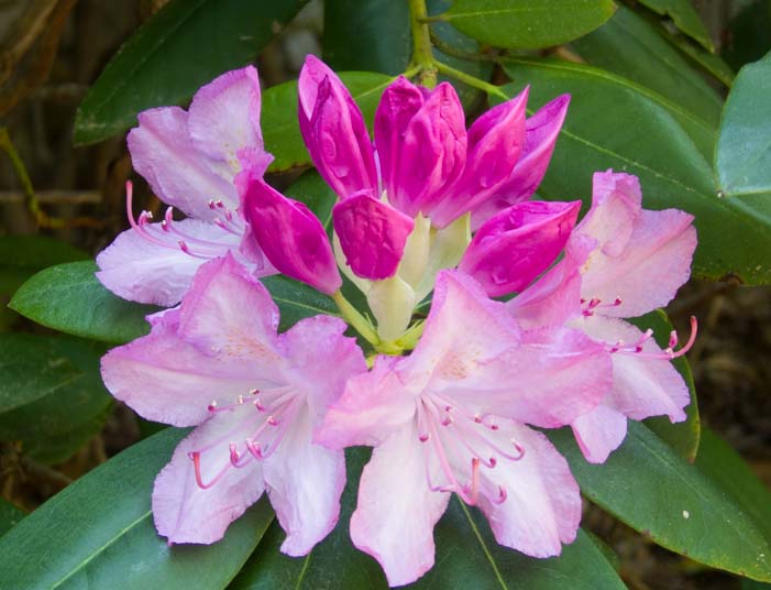
Better yet, there were rhododendrons blooming all around the lower part of the waterfall and even more along the stream that fell loosely over the rocks into the woods. We were in seventh heaven running around taking pics. In no time we were in our own worlds, totally separated. It was long after we were out of sight of each other that we realized we’d left our trusty two-way radios in the truck. I had no idea where Mark went, but I followed the rhododendrons!

Rhododendrons Apple Orchard Falls Blue Ridge Parkway Virginia

Rhododendrons were blooming all over the place

Rhododendrons are a magnificent flower, and I crouched and crawled and snuck under branches along the river banks to try to find places to get pics of them with flowing water. I couldn’t believe they grew wild in such abundance. Everywhere I looked, they were in all stages of bloom:

04 406 Rhododendron blooming 1

05 406 rhododendron blooming 2

Rhododendron blooming 5

.

Rhododendron blooming 6

.

When I’d had my fill of rhododendrons and waterfalls, I hiked back to where I’d last seen Mark at the bottom of the falls. I searched around there for a long time wondering where he’d disappeared to along the creek. I yelled his name, bunches of times, but there was no answer. Oh no!

The return hike to the truck was a one and a half miles or so straight uphill. This trail was STEEP, and I was torn. Should I stay at the bottom? Should I go back to the top?

I finally decided to take the chance that he had gone back to the top. It was late, after all, and if he couldn’t find me I figured he’d return to the truck up top. I hiked nervously straight uphill, sweat pouring down my back.

What if he wasn’t at the top? I wondered. Would it make sense to go back down to the bottom to look for him? And what if I couldn’t find him down at the bottom? Should I then hike back up again?

At exactly what point would I try to get help? And how many miles away would help be? And would those helpful people then hike to the bottom to look for him this late in the day or wait til tomorrow? What if he’d gotten injured and couldn’t move? My imagination ran wild.
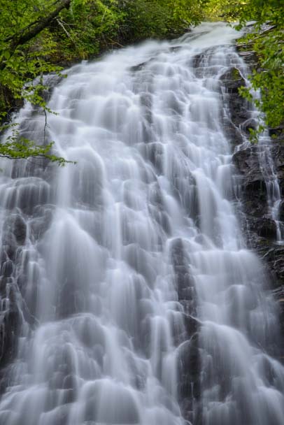
Apple Orchard Falls Blue Ridge Parkway VIrginia

Apple Orchard Falls

I continued yelling for him periodically, morosely envisioning the headlines, “Dead hiker found at waterfall, two-way radios found in truck.” How foolish of us!

As I hiked the last 100 yards straight uphill I craned my neck looking for the truck. When I finally caught a glimpse of it just beyond the last tree, I saw the door was open and Mark’s smiling face poked out from behind it and we both ran and gave each other a huge hug. What a relief!

Fallingwater Cascade Blue Ridge Parkway Virginia

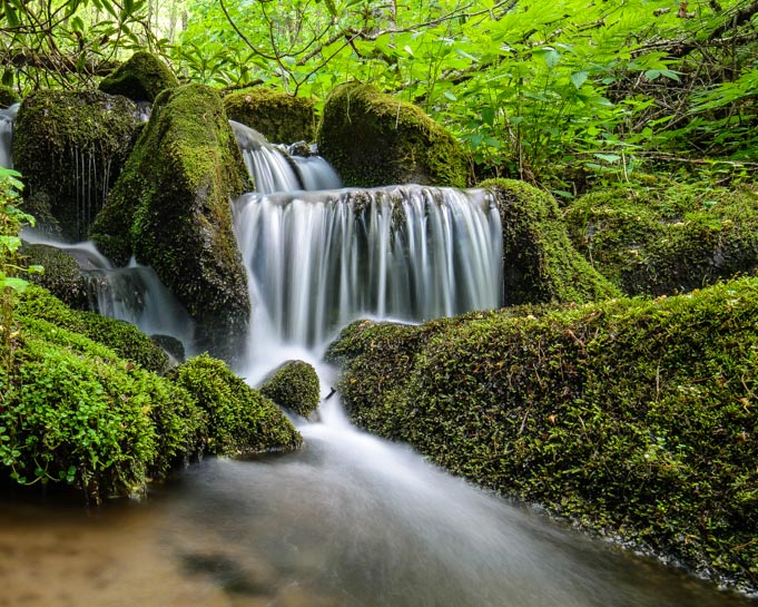
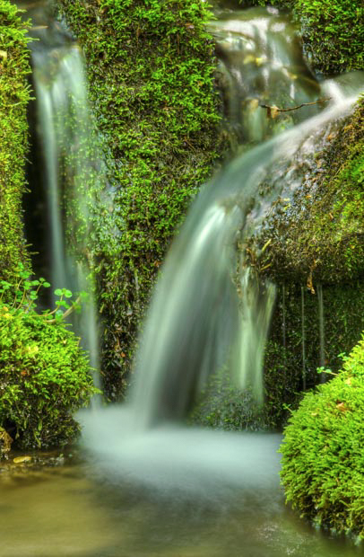
Fallingwater Cascades — with overhanging rhododendrons

FALLINGWATER CASCADES

The next hike proved much more straight forward. Fallingwater Cascades is just five miles away from Apple Orchard Falls, and is a much shorter and easier hike.

Fallingwater Falls rhododendrons Virginia

Fallingwater Cascades

The rhododendrons were blooming here too, but I stayed on the trail this time. The waterfalls were lovely.

Fallingwater Falls Virginia

Fallingwater Cascades

CRABTREE FALLS

Our final waterfall hike along the Blue Ridge Parkway in Virginia was Crabtree Falls. When we saw the name of this waterfall we did a doubletake because we had already hiked a Crabtree Falls in the North Carolina part of the Blue Ridge Parkway a week or so ago.

12 406 Fallingwater Waterfall Blue Ridge Parkway Virginia

So we were surprised when the gal at the visitors center who told us about Crabtree Falls in Virginia had never heard of the one in North Carolina. However, the Virginia falls is the tallest waterfall in the east, a claim to fame the North Carolina Crabtree Falls doesn’t have.

Crabtree Falls Blue Ridge Parkway Virginia lower waterfall

Crabtree Falls — Lower falls

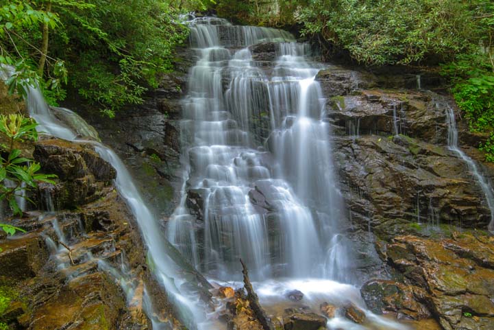
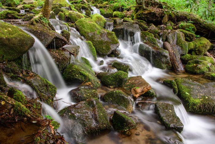
We found out that when you hike the tallest waterfall in the east, you are in for a LOT of stair climbing. Crabtree Falls consists of three waterfalls sections that are each unique, and between each section there are staircases and some steep trails.

Crabtree Falls hiking trail Blue Ridge Parkway Virginia

Not only is this hike steep, but there are a ton of stairs!

Each staircase brought us to more waterfalls.

Lower Crabtree Falls Blue Ridge Parkway Virginia

Crabtree Falls

And then we climbed more stairs!! Some stairs were built into the trail. Others were just plain old staircases!

Hiking trail stairs Crabtree Falls Blue Ridge Parkway Virginia

In some places the stairs look natural, and in some places they are just staircases.

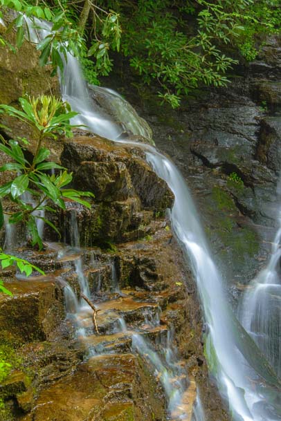
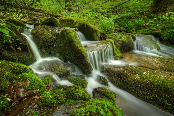
After the stairs we saw another bit of the waterfall. Different shape. Same falls!

Middle Crabtree Falls Blue Ridge Parkway Virginia

Crabtree Falls

As we climbed higher, we got more and more tired. And obviously the rangers did too, because up near the top they quit building stairs and just let the tree roots be the stair cases!

Root staircase Crabtree Falls Virginia

Nature’s Staircase!

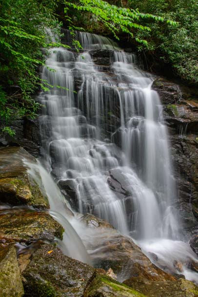
At the very top of the waterfall, the stream flowed between the rhododendron bushes and then fell right out in front of them. Just beautiful. And this time, since we had started the hike at the bottom and had climbed to the top, we gleefully ended our hike by descending down the stairs instead of trudging up!!

Top Crabtree Falls Blue Ridge Parkway Virginia

Crabtree Falls

If you take your RV along the Blue Ridge Parkway, the parkway itself is fine for driving except for two low bridges at the far south end in North Carolina.

No matter where you drive in this area, be prepared for steep hills. We were very grateful driving in these hills to have recently outfitted our truck with a diesel engine tuner to improve its towing power and to have outfitted our trailer with electric over hydraulic disc brakes.

Subscribe
Never miss a post — it’s free!

Our most recent posts:

More of our Latest Posts and Quick Pics are in the top MENU above.

More info for these waterfall hikes:

Related posts from North Carolina and Virginia:

<-Previous || Next->

Waterfalls of the Blue Ridge Parkway (North Carolina)

May, 2015 – The Blue Ridge Parkway is 469 miles long, and it creates a link between Great Smoky Mountains National Park down south in North Carolina with Shenandoah National Park up north in Virginia. It’s a very skinny road, and private land abuts it on both sides, so most of the attractions are just off of it to one side or the other.

There is so enormously much to see and do along this long stretch of road that we decided we’d shape our Blue Ridge Parkway adventures by having a theme: waterfalls.

We’d had a lot of fun exploring some of the waterfalls in Great Smoky Mountains National Park, so we started hunting for more waterfalls as we traveled northeast along the parkway. The first one we went to was Soco Falls. It’s fairly close to Cherokee, North Carolina, where we’d been staying for a while.

SOCO FALLS

Soco Falls Blue Ridge Parkway North Carolina

Soco Falls near the Blue Ridge Parkway in North Carolina

The hike down to Soco Falls is steep but quite short. There is a viewing platform partway down, but the real beauty of the falls lies well below that at the very bottom of the falls.

We had to scramble a little bit on the slick muddy trail to get down to the bottom. Luckily, there was a strong rope strung between some trees to give hikers a handhold in the steepest parts. Once we got down to the bottom, the view looking back up at the falls was spectacular.

Soco Falls Blue Ridge Parkway North Carolina

Soco Falls

Soco Falls Blue Ridge Parkway North Carolina

Hiking below the viewing platform takes you to the best views!

Soco Falls Blue Ridge Parkway North Carolina

Looking up at the falls from the bottom

A group of local kids was down at the bottom of the waterfall too, fishing. “Look, we’ve caught 8 fish!” one of them told Mark excitedly, holding up a small canvas bag in his grubby hand. Mark asked what they planned to do with them. “Eat them, of course!” the kid said, giving Mark a funny look.

The kid vanished lower down the falls, and then came back up again a little while later. “What are you doing?” he asked Mark as he stared at his camera and tripod. When Mark said he was taking pictures, the kid asked what for. “To look at, of course!” Mark said. This time he gave the kid a funny look!

Soco Falls Blue Ridge Parkway North Carolina

What a beautiful place…

Whether you come to these falls to fish or to take photos to look at later, they’re wonderful. The hike to the bottom is well worth the little bit of extra scrambling to get all the way down, even if it’s muddy.

DUGGERS CREEK FALLS

The next waterfalls we wanted to see were Linville Falls and Duggers Creek Falls which are both reached from the same trailhead parking area. At the Linville Falls Visitors Center, we saw a breathtaking photo of Duggers Creek Falls and decided to do that hike first.

The skies were getting dark, however, and we joked with the ranger that we really ought to buy two of the rain ponchos they had for sale, just in case. But we didn’t. In fact, Mark even left his rain jacket in the truck.

Linville Falls VIsitor Center Blue Ridge Parkway North Carolina

Mark feeds a raccoon on a painting at the Linville Falls Visitors Center.

The hike to Duggers Creek Falls isn’t very long, and we had just gotten to the bridge down near the waterfall when the skies opened up. We hid out under a rock outcropping for a little bit, but the rain went from simply pouring to coming down in torrents. In no time, we were drenched, especially Mark without his jacket. We decided to make a run for it back to the visitors center.

Linville Falls hike to Duggers Creek Falls

Duggers Creek Falls is beside that bridge

As soon as we walked in the door of the visitors center, Mark grabbed two rain ponchos off the shelf and slapped them down next to the cash register. Water was dripping from his soaking wet hair right down his nose as he handed the clerk his credit card. How funny!

Of course, after about half an hour or so the sun came out. So, down the trail we went once again. This time we were not only both wearing our rain jackets but we had our nifty new rain ponchos tucked into our packs too. Surely, that guaranteed the sun would stay out!

Duggers Creek Falls Blue Ridge Parkway North Carolina

A view of Duggers Creek Falls from the bridge

We took the shortcut hike from the far end of the parking lot this time, and when we got down to the bridge, the view of the waterfall was lovely. But the falls are set far back from the bridge, and they weren’t nearly as dramatic as the photos we’d seen.

Then we realized that the best spot to see these falls was from under the bridge! Mark waded out into the water with his tripod.

Duggers Creek Falls Linville Falls Blue Ridge Parkway North Carolina

The better view of the falls was from under the bridge — and out in the water!

He got some beautiful photos.

Duggers Creek Falls

Duggers Creek Falls

Suddenly, he jumped. “Ow!” He said. “I’m getting bitten!” He slapped something off his leg. It was a little lobster looking creature — a crayfish, or a crawdad thing with claws. It had crawled up his leg and nipped him! Yuck!! But the beautiful photos were worth it.

Duggers Creek Waterfall Blue Ridge Parkway North Carolina

Duggers Creek Falls

We were both playing with using long shutter speeds to make the water smooth, and soon we noticed that the foam and bubbles at the bottom of the waterfall were drifting downstream and making wonderful patterns on the surface of the water in our photos.

Waterfall foam streaks water at Duggers Falls

We got a kick out of playing with the foam patterns.

The foam streaked past us in all kinds of interesting lines and shapes. At one point it even flowed in a circle, and I just happened to catch that moment with my camera.

Duggers Creek Waterfall Swirling Water

I got a shot where the foam went in a circle. Cool!

We ended up enjoying Duggers Creek Falls so much — and for so long — that we never made it to Linville Falls. Oh well. Next time!

CRABTREE FALLS

The last waterfall we visited on the North Carolina end of the Blue Ridge Parkway was Crabtree Falls.

Crabtree Waterfall Blue Ridge Parkway North Carolina

Crabtree Falls – North Carolina

The hike down was pretty easy (although the return trip was a bit of a workout), and the waterfall was a fabulous and dramatically steep cascade over lots of big rocks.

Crabtree Falls Blue Ridge Parkway North Carolina

Crabtree Falls is a neat cascade that goes over lots of different rocks on its way down

A closeup of a tree in front of the falls made for a beautiful, mystical shot right out of a Tolkien fantasy.

Crabtree Falls Blue Ridge Parkway North Carolina

A world apart

While I had been busy getting my mystical closeup of the tree against the waterfall, I discovered that Mark had been busy taking photos of a cute blonde girl sitting on a rock with the waterfall as a backdrop. Hey! Granted, she’d asked him to take her pic, and sure, she was thrilled to get the photo for her facebook friends. But…

Soon she disappeared up the trail, and we posed ourselves on the same rock to get a nice selfie. How lucky we were to be enjoying another gorgeous waterfall!

Crabtree Falls Blue Ridge Parkway North Carolina

We were loving these waterfalls on the Blue Ridge Parkway!

There are dozens and dozens of waterfalls along the Blue Ridge Parkway, especially at the southern end. These three — Soco Falls, Duggers Creek Falls and Crabtree Falls — are all stunning waterfalls that are easy to reach.

If you take an RV roadtrip along the Blue Ridge Parkway — whether driving the RV directly on it or driving on the roads nearby — any one of these waterfalls makes for a really fun excursion.

Subscribe
Never miss a post — it’s free!

Our most recent posts:

More of our Latest Posts and Quick Pics are in the top MENU above.

Here’s a little more about each waterfall:

Other posts from this general area:

<-Previous || Next->

A Jewel of a Waterfall – Great Smoky Mountains National Park

For the last few days we have been enjoying the beauty of the Great Smoky Mountains National Park and the Blue Ridge Parkway in North Carolina. These two adjacent national parks are enormous, and it can be a little overwhelming to figure out how to see it all.

Falls at Smoky Mountains North Carolina

A spectacular waterfall we “discovered” in Great Smoky Mountains National Park

There are waterfalls and hikes and biking loops and all kinds of things to see and do — not to mention a bunch of visitors centers to help you get oriented! Just getting from one side of the park to the other can take a few hours of driving (especially if you stop to take pics all the time!).

great smoky mountains national park oconaluftee river

As usual, we gathered lots of reading material and went over it all with the folks at the Oconaluftee Visitors Center, trying to come up with a sightseeing strategy. How to get started?? Hmmm…

cascading waterfall in Great Smoky Mountain National Park North Carolina

We did a few drives and saw some lovely things, but these two sprawling parks didn’t really capture our hearts until one afternoon when we accidentally bumped into a true jewel by the side of the main road that scales the peaks of Great Smoky Mountains National Park.

Oconaluftee waterfall Great Smoky Mountains National Park

We were just driving along when out of the corner of our eyes we spotted a fabulous waterfall cascading down the vivid green hillside.

waterfall on oconaluftee river great smoky mountains national park

Mark did a quick U-turn, and we rushed back to find a place to park so we could run out and see this gorgeous waterfall up close.

North Carolina Oconaluftee River Waterfall

Before I jumped out, I scanned the maps, but there was no mention of this glorious waterfall anywhere. And there were no road signs marking this stunning gem either. There was barely room for a three or four cars to park!

Smoky Mountains National Park waterfall

We scampered up the steep, muddy trail alongside the waterfall. The stunning cascade went up and up and up, disappearing into the lush green woods high above the highway. We followed the lure of pretty arcs of water washing over moss covered rocks until we felt like we were in the treetop canopy.

waterfall Great Smoky Mountains National Park North Carolina

What a discovery!! We clambered around and took photos for hours, thoroughly enjoying this perfect, unnamed and unsung showpiece in this mammoth park.

closeup waterfall Oconaluftee River

We’ve been reading up on all the waterfalls there are in the Smokies and along the Blue Ridge Parkway — there are dozens — and we’ve checked the photos of them all. But this unknown one keeps calling us back. It is so beautifully balanced, with water tumbling down a magnificent pattern of rocks. There is no doubt that this was one designed by a divine hand.

So far we’ve visited three times!!

sitting by waterfall in smoky mountains north carolina

If you take your RV to Great Smoky Mountains National Park in North Carolina, I’m sure there are loads of beautiful waterfalls to see — we’ll be finding out in the coming days and weeks and reporting back about what we find. But be sure to check out this unmarked beauty.

From Cherokee, North Carolina, the waterfall is located 8.5 miles west of the Oconaluftee Visitors Center on Newfound Gap Road on the left hand (south) side. You won’t see it as you drive west from the visitors center, but if you drive out about 10 miles and then turn around and come back east (towards the visitors center) slowly, you’ll see it flowing oh-so-happily on the right.

Subscribe
Never miss a post — it’s free!

Our most recent posts:

More of our Latest Posts are in the top MENU above.

More info about the Smokies:

Related posts from our travels:

Agua Azul & Misol-Ha – Waterfall Adventures in Mexico

Sail blog post - traveling inland by bus from Marina Chiapas, we toured he incomparable waterfalls outside Palenque, Mexico: Misol-Ha and Agua Azul.

Misol-Ha waterfall, a thin, pure stream.

Behind the falls, Misol-Ha waterfalls, Chiapas, Mexico

Behind the falls.

Through the trees, Misol-Ha waterfalls, Chiapas, Mexico

Misol-Ha.

Four-year-old Amina.

Agua Azul waterfalls, Chiapas, Mexico

Agua Azul's falls are wide and fast.

Crashing water, Agua Azul waterfalls, Chiapas, Mexico

Agua Azul.

Tumbling into turquoise pools, Agua Azul waterfalls, Chiapas, Mexico Serene aquamarine pools, Agua Azul waterfalls, Chiapas, Mexico

Agua Azul's pools of turquoise.

Little Amina goes

swimming.

Visitors get photos of themeselves, Agua Azul waterfalls, Chiapas, Mexico

Everyone gets photos of themselves at the falls.

Vendors at Agua Azul waterfalls, Chiapas, Mexico

Vendors in palapas line the falls.

Eating mango-on-a-stick, Agua Azul waterfalls, Chiapas, Mexico

Mango-on-a-stick.

Agua Azul waterfalls, Chiapas, Mexico

The falls tumble down many layers of boulders.

Agua Azul waterfalls, Chiapas, Mexico Agua Azul waterfalls, Chiapas, Mexico Agua Azul waterfalls, Chiapas, Mexico Van tour, Agua Azul & Misol-Ha waterfalls, Chiapas, Mexico.

Our companions get into another van.

Comitán's Santo Domingo Church, late 16th century.

Comitán's Santo Domingo, built in the late 1500's.

Santo Domingo Church, Comitán, Chiapas, Mexico

Santo Domingo steeple.

Church steeple, Comitán, Chiapas, Mexico

Lots of church steeples in this town.

Church bells, Comitán, Chiapas, Mexico Lots of churches to visit in Comitán, Chiapas, Mexico Modern sculpture in the Zócalo, Comitán, Chiapas, Mexico

Modern sculpture in the Zócalo

Mayan woman, Comitán, Chiapas, Mexico Happy old vendor, Comitán, Chiapas, Mexico Lovers in the Zócalo, Comitán, Chiapas, Mexico Patio of wooden columns, Comitán, Chiapas, Mexico

Patio of wooden columns.

Flowering trees in spring, Comitán, Chiapas, Mexico

Spring is in the air.

Hilltop view from Comitán, Chiapas, Mexico

Hilly streets offer views into the surrounding

countryside.

Tenem Puente ruins & Spring Equinox celebration, Comitán, Chiapas, Mexico

Crowds take seats on the Mayan stadium stairs.

Tenem Puente Spring Equinox performance, Comitán, Chiapas, Mexico

Performers appear on the 1200-year-old ruins.

Spring Equinox at Tenem Puente, Comitán, Chiapas, Mexico Blowing a conch shell, spring equinox celebration, Tenem Puente, Comitán, Chiapas, Mexico

Blowing on a conch shell.

Dramatic headdresses, spring equinox performance, Tenem Puente ruins, Comitán, Chiapas, Mexico Mayan rituals for the deceased victim in a spring equinox celebration at Tenem Puente Mayan Ruins, Comitán, Chiapas, Mexico

Rituals for the dead victim.

Marina Chiapas at dawn.

(Photo courtesy of Capt. Andrés Reyes Prudente).

Agua Azul, Misol-Ha & Comitán, Mexico

March, 2012 - Besides the mysterious ruins of Yaxchilan & Bonampak, the Palenque

area is bursting with beautiful natural features as well.  We hopped on another van

tour, this time to see waterfalls.  We went with a no-name tour company, one of dozens

selling tours in town.  It was cheap, this was just a day trip, and all we really needed

was transportation to the falls.  We sat behind a very seasoned Central American

traveler from North Carolina named Tom who was just starting a four-month tour from

Mexico to Colombia.  His itinerary, unlike ours for some reason, included both the

waterfalls and the Palenque ruins.

"I never have any expectations

when I get on a bus in these

parts."  He said knowingly.  We

had had plenty of bus

adventures, so we nodded with

him, almost as knowingly.

Our first stop of the day, after

bouncing over the rough roads

out of town, was the magnificent

Misol-Ha waterfall.  A thin wisp

of water flowed in a steady

stream off a cliff into a cool, wide

pool.  We followed a short trail

down to the falls and discovered

we could crawl underneath a rock

outcropping behind them.  The fine

mist that sprayed us all was

refreshing.

Our group was in high spirits in the

early morning air as we piled back

into the van.  Young European

backpackers dominated our group,

including a pair of gorgeous, tall,

leggy, blonde Danish girls up front

and three boys from Switzerland, Austria and Germany speaking German together in the

rear.  A little four-year-old Mexican girl, Amina, from Playa del Carmen in the Yucatan, sat

next to me and asked to see our waterfall photos on our cameras.

A very comical and rudimentary conversation in Spanish ensued as our chatter wandered

to our granddaughters and she told us about her cousin.  There's nothing like having a

four-year-old native speaker show you just how poor your command of Spanish really is.

Her giggles and funny faces made it clear we sounded pretty goofy to her.  Luckily her

grandma bailed us (and her) out a

few times when our conversation

reached a total impasse of

incomprehension.  We were quite

humbled when she later talked up a

storm with the van driver!

Our next stop was Agua Azul, a

series of cascading waterfalls that

rushes over stair-stepping boulders

and lands in the most exquisite

turquoise pools.  Wooden viewing

platforms encourage tourists to take

their time soaking in the views and

posing for photos.  The water

thunders down the rocks from

several directions and then rests for

a bit in shades of aquamarine before

sliding on.

The tour vans line up outside the park

while visitors are granted anywhere from

an hour to an afternoon to enjoy the falls

and pools.  Lots of young travelers

eagerly donned their swimsuits and

jumped into the water.

Vendors selling all kinds of snacks and

trinkets under makeshift palapas line the

sides of the waterfalls at various levels beside the endless wooden stairs going up.  We climbed up

and up and up looking for the top of the falls.  The clan of young boys from our van rushed ahead

and later reported that there was a fantastic swimming hole

a mile or so away.  We never got that far.  Instead we

settled at a picnic table to enjoy eating mango on a stick (a

great way to eat mangos!) and watermelon slices in a cup.

After a few wonderful afternoon hours at these rushing

falls and placid pools, we all made our way back to the

van, a little damp, and rather tired at the end of a great

day.  The drive back should have taken just an hour, but

this was a budget van.  It turned out that not only had our

North Carolina friend, Tom, not been taken to the ruins in

Palenque as he expected, but the European travelers with

us were not returning to the town of Palenque at all.  They

were headed in the opposite direction to San Cristóbal de

las Casas, some 5 hours away.  Huh?

Apparently our van was supposed to meet another van on the

road somewhere and transfer the travelers over.  Problem

was, "where" and "when" were not well defined, and although

we all stood by the side of the road in the middle of nowhere

waiting for over an hour, the other van never showed up.  Tom

just nodded knowingly with a smirk on his face.

Luckily we all had lots to talk about, comparing notes about

what we'd seen in Mexico, and talking about what we missed

most from home.  The young German fellow said he missed

his wiener schnitzel terribly, and we all missed our favorite dark

beers from home.  Travel is wonderful, but homesickness for

familiar things steals over you once in a while.

Eventually the driver hailed a van labeled "San Cristóbal" and payed

for five tickets out of his own pocket so our companions could get to

their promised destination.  That van was already full, so I can only

imagine what everyone thought when five extra people and their

luggage were piled into and on top of it for five hours of travel on

twisty, miserable roads filled with speed bumps.  Tom said he'd just

catch a cheap combi van to the Palenque ruins on his own the next

day.  No problema!

We could have easily stayed in Palenque another week, but

disturbing news from family in the US began to take on a more and

more urgent tone, and we decided it was best to begin our trek out

of the jungle just in case we needed to fly back soon.  In the bus

station I saw a poster for a huge Spring Equinox celebration at the

Palenque ruins.  Oh my!  We were leaving the Mayan world on the

eve of the equinox!  You can't do that!!  Oh well.

The distance from Palenque to Puerto

Chiapas where Groovy was waiting for

us is only 550 miles, but it is two long

days of bus travel.  We decided to

break it up by stopping in Comitán, a

colonial city we had glimpsed from the

bus window on our way to San

Cristóbal and that had perked our

interest.

After spending several weeks plunk in

the middle of the touristy Gringo Trail,

surrounded by fellow travelers from

foreign countries, it was a delightful

change to walk the streets of Comitán.

It has all the colonial charm of other similar towns, but has

not been singled out for tourism development in the same

way.  Everyone on the streets was a local, or at least

Mexican, and all the happenings around town were put on

by the locals for the locals.

It is a hilly town, with a multitude of church spires piercing the sky.  The

Santo Domingo cathedral is the oldest, dating to the late 16th century,

some 50 years or so after Comitán was conquered by the Spanish.

Santo Domingo sits on the edge of the Zócalo, or town square, and while

we wandered among the beautiful shade trees and colorful flowers in the

late afternoon, we listened to the priest giving a sermon to his flock,

broadcast over speakers on the outside of the church.

The Zócalo is the heart of the town, and people hang out in the park doing all the fun

things that parks are made for: relaxing, people watching, selling stuff, buying stuff,

and, of course, enjoying each other's company in a romantic setting.

While wandering around I

looked up to see a huge

poster advertising -- a

celebration of the Spring

Equinox at the local

Mayan ruins of Tenem

Puente!  That afternoon!!

What luck!!!

We quickly jumped into a

local combi van and

headed out to the ruins a

few miles away.  This was

a hugely popular event

and the van was stuffed

to overflowing with

people.  It was full body

contact on all sides for

everyone.  Every

bare limb, thigh,

elbow, etc., was

pressed tightly

against those of fellow

passengers on each side.

We all breathed each

other's breath, except

those lucky enough to be

near an open window.

Dads stacked their kids

on their laps, oldest ones

on the bottom and

toddlers on top.

We learned that the

Mayan city of Tenem

Puente was at its peak

between 600 and 900

AD, although it was

occupied until 1200 AD.

It wasn't discovered by

archaeologists until 1925.

Unfortunately, when we

got there the ruins had

been closed off for the

celebration, so we saw

just the first building which stood opposite a hill of

staircases so common to Mayan sites.  Those stairs make

perfect stadium seating, and as they quickly filled with

hundreds of people I got a chill thinking of

how the ancient Mayans had probably sat

there just like we were now for their own

gatherings over a thousand years ago.

Suddenly a trumpet sounded and some

figures appeared on the building.  The men

wore enormous feather headdresses and

scrambled over the ruin.  An announcer

had talked for a while about the

performance before it began, but I couldn't

quite catch all the details.  The performance

depicted a battle, a killing, and some rituals

related to the death of the victim.  I think I

had expected something mystical involving

the alignment of the setting sun and the

buildings and some fascinating connection

to the Mayan calendar.  But this dance and music celebration had its own special

magic, especially as I scanned the crowd and realized that more than a few among

them may have had ancestors that lived inside these ruined walls when they were first built.

We took the overnight bus

to Tapachula that night, and returned to our sailboat Groovy in

the morning.  The boat, the marina and the world of cruising

suddenly seemed very foreign in those early dawn hours.  The

Tehuantepec had quieted down for a few days and boats

were arriving from Huatulco at the marina hourly.  As we

caught the dock lines for the incoming boats our groggy minds

were still far away, filled with the vibrant images of the jungle.

Soon, however, we would be immersed in reality and thrust

back into modern American life on a long road that eventually

led to northeastern Arizona.

Find Palenque and Comitán on Mexico Maps.