

Sweeping views at Cedar Breaks.


Fluffy clouds drifted above us.

Happy campers.


Red rock hoodoos with arches.

The trail winds through lush
greenery.

Columbines.

Indian paintbrush.

A chipmunk nibbles bluebells.


"Place where the rocks are sliding
down all the time."


Spectra Point.

1,600 year old bristlecone pine tree.

Gnarled old fellas.

A young fawn looks up as we pass.

Chessmen Overlook.

North View Lookout.

Cedar Breaks is known for
wildflowers.


Redrocks through the trees.

Millions of years old, the canyon weathers all.


Thick green carpet on the Alpine Pond
Loop Trail.

Alpine Pond.

Nature's graffiti.

The Upper Loop wanders through a meadow.

Colorful wildflowers.

Wild strawberry.

Last glimpse of the red rocks.

Reflections on the Alpine Pond Trail.
Cedar Breaks National Monument, Utah
Mid-August, 2011 - Visiting Cedar Breaks National
Monument was the main reason we came to Dixie National
Forest but, sidetracked by caves and canyons, it took us a
while to get there. Vastly overshadowed by nearby Zion,
Bryce Canyon and Grand Canyon National Parks, a lot of
folks are like us and only hear about it from a ranger or
other traveler once they get to this area. Years ago we had
stopped by for an hour on a quickie drive-by. This time we
wanted to hike the two hikes and see the canyon up close.
Perched nearly in the clouds at 10,350' elevation, the wildflower-lined
winding road seemed to climb forever before we got to the park.
Intrigued by the sign for the Spectra Point overlook in the parking lot,
we went straight up that path when we arrived, not knowing we were
venturing out on a 2-mile round-trip hike.
WIthin minutes we were staring at a wonderland of red rock spires
and hoodoos. The puffy clouds floated by above us, casting
shadows across the red rock "amphitheater." Red, pink, white and
orange rocks in crazy shapes filled the view in all directions, and
bristly pine trees speckled the distant cliffs
The trail wanders along the rim of
the canyon, weaving in and out of
lush greenery. There are no railings
or gates to obstruct the view, and
we felt as though we were
suspended above an orange
fairytale town.
Wildflowers bloomed alongside the
trail: white columbines and red
indian paintbrush flowers begged to
be photographed.
A little chipmunk
sat contentedly in
a thicket of
bluebells and ate
them for lunch.
We made very little forward progress as we kept stopping to take in the views,
admire the colorful wildflowers and chat with other people on the trail.
Many people were at the canyon that day somewhat by
accident, as it hadn't been on their original itinerary. One
fellow had had car trouble while visiting Zion and Bryce and
had asked the mechanic how to keep his family entertained
while waiting for the several-day repairs to be completed.
"Go to Cedar Breaks!" He was so happy to have discovered
this park; his kids were running ahead of him down the path,
excited to get to the overlook.
A 1,600 year old
bristlecone pine
tree stands near the
end of Spectra
Point, thriving in a barren, windwhipped and
hopelessly exposed spot. The wood is striated
beautiful shades of orange and brown, and a few
scraggly branches prove to the world that the
seemingly lifeless giant is truly alive and well.
The sun felt warm on our skin as we walked,
but the brisk wind that swept across the
canyon was a sharp reminder of just how
cold this area can be. A ranger told us that
the park usually gets 15' of snow each winter,
but last winter was buried 30 feet deep.
On our way back we noticed a doe eating the flowers, and then
behind her we saw her fawn.
As we drove out of the park we stopped at Chessmen overlook
and the North View Lookout. Stunning. Amazing. It's impossible to find words to
describe the vastness, the vivid color, the exotic contours and shapes of this beautiful
land.
Earlier residents of this area were the Paiute Indians, and they named the canyon, "Place
where the rocks are sliding down all the time." After that the Spanish explorers
misidentified the juniper trees as cedars (much as they did on Isla Cedros off of Mexico's
Baja Pacific coast). The word "breaks" refers to the steep, eroded landscape.
Cedar Breaks is known as much for its glorious wildflower
displays as it is for its majestic red rock amphitheater.
We returned on another day to hike
the Alpine Pond Loop Trail, and
found ourselves snapping shots of
the many brilliant wildflowers before
we even got to the trailhead.
Lupines and daisies and a myriad of
other flowers lay thickly on the green
brush surrounding the trail. The hum
of bees and mosquitos was very loud
too, and the lush land seemed to be
teeming with life.
Oddly, the forest of tall pine trees shading the
wildflowers is largely dead. In past years the
energetic National Forest Service extinguished all
wildfires within hours of them starting. The result was
an unhealthy forest dominated by one species of tree.
Those trees provided the most awesome feast for the
bark beetles that like to eat them, and in the past
decade the beetles have munched their way through
the woods, transforming the living pine
canopy into a pin-cushion of dead trunks and
branches.
Between the dead branches you can glimpse
the red rock canyon, however. The spires,
nooks and crannies of that spectacular
landscape are utterly impervious to the
comings and goings of trees upon the
surface.
Eventually we arrived at the alpine
pond. It wasn't the crystal clear kind
of lake we have seen at Yosemite
and other places, but it had its
charm.
Some of the dead tree
trunks had been carved
by Nature's graffiti
artists -- little worms
made all kinds of
patterns in the wood.
We had started on
the Lower Trail
which is lush and
green and closed-
in feeling. We
returned on the
Upper Trail which
takes the hiker out
across a wide
meadow filled with
flowers. The peak of the wildflower
season in Cedar Breaks is the final weeks
of July and perhaps the first week of
August. We were a little behind the peak,
so the blanket wasn't quite as thick with
color. But it was plenty
beautiful enough for me.
Mark has a green thumb
and cultivated strawberries
at one time, so he instantly
recognized the shape of
wild strawberry leaves
among the other greens.
"Strawberries!" He cried,
and then he spotted a beautiful tiny red ripe one, about a half inch
across. We left it for whatever bird or bunny might come that way.
The trail gave us one final glimpse of the red
rocks of Cedar Breaks and then we were
back at the truck.
Mark's parting shot was the reflection he saw
in my sunglasses. He came up to me really
close and said, "Oh, that looks really cool!" I
thought he was sweeping in for a kiss, but
suddenly he stopped, put his camera up and
snapped a picture. I made a face at him,
and then, being a romantic, he swooped in
for a real kiss.
Looking for more red rock adventure and a slightly lower altitude, we wandered 30 miles or so north along the incomparably
scenic Route 89 to the Red Canyon area.
Parowan UT, Las Vegas NV, Williams AZ & Sycamore Canyon AZ – Wow!

Wildflowers in Parowan, Utah.

Yankee Meadows Lake,
Parowan, UT

Antique Tractor Show

Miss Iron County
and her attendants.

Ukele singers.

Over the top Las Vegas glam.

Fancy racing bikes at Interbike.

Mark Cavendish's winning ride.

Mark meets George Hincapie.

A big horn sheep in the Las Vegas suburbs.

Time passes more
slowly in Williams, AZ.


One tourist came to town in style.

Cruiser's Cafe 66 has live music in the afternoon.

Route 66 memorabilia is
everywhere.

A cheery gas station from yesteryear.

A mannequin greets patrons at the Red
Garter Inn.

American Flyer is a coffee shop for cyclists.


The road to Sycamore Canyon.

After 20 miles of dirt roads, we find Sycamore Canyon.


White Horse Lake

A dam holds the water back from Williams.

Williams, Arizona
September, 2011 - While exploring the hiking trails at Red Canyon our legs were still
itching to run, so we decided to put them to the test a little further south at Parowan, Utah's
Labor Day Iron County Fair 5K. We had done this race three years prior, and we toed the
start line alongside the local speedsters from the high
school track team, hoping to match our old times.
By some miracle we both bettered our times, and Mark
left his peers in the dust. But it was the 80-year-old
Paul Flanagan who completed the 6500' altitude race in
a brisk 25 minutes that really got our attention. Heck,
he was older than most of the tractors at the fair's
antique tractor show, and he was a whole lot faster.
The Labor Day parade
was much as we
remembered it, showing
off both the young beauty
queens and older ukelele
singers. The arts and
crafts show was filled with
blue ribbons for Best in
Show of everything from
quilts to apple pies to giant
backyard pumpkins. And
the ferris wheel was
loaded with people swinging their legs and
eating cotton candy while taking in the
mountain views.
We continued down I-15 on our way to Las
Vegas for the annual bicycle industry trade
show, Interbike. The glitz and glam of this
crazy, over-the-top city greeted us warmly,
and we were soon immersed in the world of
bikes and cycling. Vendors showed off the
latest in their lineup of snazzy looking racing
bikes, and crowds formed around Mark
Cavendish's multiple stage winning Tour de
France bike.
Cavendish wasn't on hand himself, but Lance
Armstrong's legendary lieutenant George
Hincapie showed up to add a little star power to
the crowd.
Las Vegas is an enormous spread of urban
sprawl that reaches out into a vast desert, but
sometimes there is a little blurring of the two
worlds at the edges. As we passed through
one of the Las Vegas suburbs on the interstate
we saw two big horn sheep standing at the
edge of the highway watching the cars go by.
The cars, of course, wanted to watch the
sheep just as much, and a huge traffic jam
soon formed as we stared at each other.
Our final destination for this all-too-brief season of
RVing was Williams, Arizona, about 50 miles south
of the Grand Canyon on I-40. It is one of the
showcase towns along the old historic Route 66, and
there are fanciful nods to mid-twentieth century car
travel on every corner.
There is a fun, quirky and festive air to this town,
and every afternoon you can hear live music playing
on the patio at Cruiser's Cafe 66 where the local
Grand Canyon Brewery beers are served.
An antique gas
station features a
vintage car sitting at
old fashioned gas
pumps. Inside there
are all kinds of Route
66 souvenirs and
memorabilia.
The Red Garter Inn
is adorned with a
woman hanging out
of an upstairs window luring
people to pay a visit.
The American Flyer coffee
shop is a bike-and-bean
bistro with creatively
designed coffee tables and
shelves, all made with
bicycle parts.
Williams sits on the edge of
Kaibab National Forest,
and it harbors a special
secret that I suspect many
tourists miss. Somewhere
in the fine print of a
Williams tourist brochure I
found a tantalizing
description of Sycamore
Canyon, Arizona's second
largest canyon (after the
Grand one). We had
never heard of it before
and definitely had to go check it out.
Getting to it requires a long
drive on dirt roads through the
woods. The directions said to
allow 3.5 hours for the trip but I
figured that was only for
slowpokes. Four hours later,
as we emerged from our
adventure, I realized that being
a slowpoke is the only way to
get through these woods.
The road
wound up and
down and
around, finally
bringing us to a
plateau where
we drove right
out to the edge
of a huge cliff.
The canyon is
rimmed by
gnarly old trees, and it's basin is
lined with a light smattering of
greenery and bushes that soften
its sharp, jagged edges.
Wandering back along the dirt roads through the woods we came
across White Horse Lake and then returned to Williams past a dam
that protects the town from deluge.
Despite the proximity of the interstate I-40 and the town of Williams, the woods in
this part of Kaibab National Forest feel very remote. One night we heard loud
animal noises, and in our sleepy state we thought we were hearing coyotes. The
next night the sound was right outside the trailer and we opened the windows to
listen carefully. It was a nearby elk bugling. He couldn't have been more than a
few hundred feet from the trailer, but in the moonless pitch dark we couldn't see
him. Sometimes in the distance we could hear another elk answering. The next
morning a small elk harem ran past our campsite. Six females charged by us
followed by a solitary male
in the rear.
It was really hard to say
goodbye to the magic of
summertime in the
ponderosa pine woods, but
the temperatures were
dropping fast and Groovy
was waiting patiently in San
Carlos, Mexico. We had some chaotic logistics ahead of us to put the
trailer to bed and re-awaken the boat, but we wanted to catch the warm
water in the Sea of Cortez before winter's chilly fingers took it in its grasp.
Wupatki Nat’l Monument – Ancient Indian Ruins & Great Camping in AZ!

Flagstaff's San Francisco peaks seen across the meadow outside Bonito Campground.

Coconino Forest's ponderosa pine woods.

Wildflowers at Bonito.


San Francisco peaks.

Bonito Campground.


The meadow that used to be filled with
sunflowers is now parched and cracked.

Some sunflowers line the road.


Sunset Crater just before a downpour.

Looking down at Nalakihu from Citadel Pueblo.

Nalakihu Pueblo.

Lomaki Box Canyon dwellings.

View from inside Wupatki Pueblo.


Lomaki Box Canyon dwellings.

Lomaki Pueblo.

Lomaki Pueblo.

Looking out at the high desert plains from Citadel Pueblo.

Wupatki Pueblo and its round Kiva (gathering place).

Wupatki Pueblo, home for about 100 people.

Mark plays with the blow hole's breezes.

Our picnic is cut short by looming black skies.

Lightning!
Bonito Campground & Wupatki Nat'l Monument, Flagstaff, AZ
August, 2011 - We crossed the Sea of Cortez from just north of Bahía Concepción on the Baja side of Mexico to San Carlos on
the mainland side in late June, a 75 mile jaunt. It was the very best sailing day in our entire seven months spent cruising the
Mexican coast: bright sunny skies, flat seas, and a sprightly wind drawing us along on a close reach. Our arrival in San Carlos was
the first step of our re-entry into civilization and the US, and each stage of re-entry was a shock.
Perhaps the most jarring
moment in this process was our
first trip to a Super Frys
supermarket in Phoenix. What a
staggering abundance of
gorgeous produce, so beautifully
presented and in such perfect
condition! Mark and I stood and
stared in amazement, mouths
open in awe. "Where's my
camera?" I cried. Our friends
thought we were nuts.
Getting to Phoenix from San
Carlos required an 11 hour bus ride,
and we then returned to San Carlos by
truck (a mere eight hour drive) to deliver
some things to the boat and relieve the
boat of other things
we didn't need any
more (winter
clothing!).
Then over the next
six weeks we
skidded from being
merely bone tired to
being utterly
exhausted as we ticked off the endless items on our "to do" list of
chores. We lived as perennial house guests, bouncing between
generous friends' homes.
The madness culminated with finding new tenants for our
townhouse. Sleeping on an air mattress in our empty
townhouse during a frantic week of repainting the interior, we
realized we had come full circle. Four years of traveling, with
only the briefest visits to Phoenix, and here we were back in
our townhouse again, surrounded by the same smells, the
same noises, the same sensations that had been the essence
of our old home. What had the last four years meant? Had we
grown or just taken a big detour through life? There was no
time to think about that; there were chores to do!
Once our
responsibilities were
behind us, we grabbed
the trailer out of
storage and dashed up
to Flagstaff as fast as
we could go. We made
a beeline for Bonito
Campground, our all-
time favorite
campground. Despite
being die-hard
boondockers, we splurged on a weeklong stay there while we re-familiarized
ourselves with the RV lifestyle and restocked the trailer with everything we had
pillaged from it for the boat.
Here at 7000' elevation we finally began to take stock and get some perspective on all
that we'd been through. When we left Phoenix in 2007, real estate was peaking at
astronomical prices. Now, on our return, there was a sea of homes in various stages
of financial distress and foreclosure. Few real estate signs were visible, however. The
panic was largely on paper and online, and too often was manifested in midnight
moves. Some of our once-wealthy friends were now scrambling to pick up the pieces
of their lives, while other less well-heeled friends were suddenly able to afford
gorgeous homes.
The city's everpresent, massive
expansion into the outlying pristine
desert was temporarily on hold while it adjusted to the new economy. Our
memories of Phoenix as it once was were overlaid onto Phoenix as it is today,
and there were areas where the images meshed, and areas where they were
like two different places.
Some of the changes were within ourselves as well. Our souls were the same,
but all this traveling had expanded our knowledge of the lands around us, and
we had come to know ourselves better too. These thoughts swirled around us
as we rested and strolled about Bonito's pretty grounds. Life aboard Groovy in
Mexico felt like a far distant dream.
The land surrounding Bonito Campground has changed too. Last year this part
of Coconino National Forest was devastated by the Schultz wildfire which wiped out some
15,000 acres, mostly on the area's mountain slopes. Campers at Bonito were evacuated
twice, first to escape the fire and later to avoid the erosion-caused floods. As a ranger
explained to us, the floods altered the landscape forever and
even moved floodplains. Many nearby homes were damaged
or lost, a young girl drowned, and the water rose to about 8' in
the campground's amphitheater, leaving the place buried in
sludge.
Knowing some of this before we arrived, it was with trepidation
that we approached the campground. The meadow that is
usually teeming with bright yellow sunflowers at this time of
year was devoid of blooms and parched and cracked in
places. But what a thrill it was to see and smell our beloved
ponderosa pine woods. Bonito's soul is the same, just singed
a bit here and there. The wildflowers still line the edges of the
roads and promise to return to the meadows. The
hummingbirds still buzz the campers looking for easy
meals in feeders. Some ponderosas have blackened
trunks, but the tops are green.
However, the Schultz fire was
nothing compared to the volcano
that erupted at next-door Sunset
Crater around 1050 AD. Spewing
marble-to-football sized chunks of
rock into the air for a few months
(or possibly several years), the
evacuation of the local farmers
lasted for generations. The
volcano layered the land for many
miles around in a thick blanket of
cinder. In its last moments it spat
out a final burst of cinder that was oxidized to a rust color. This gives the mountain a distinctive
orange-red top to this day, and the sun and shadows spend their days playing with the color.
We took a drive through the
nearby Indian ruins at Wupatki
National Monument. These
were built 50-100 years after
the eruption by the so-called
Sinagua people who returned
to the area to find that the
blanket of volcanic ash now
helped keep rare moisture in
the soil. They somehow eked out a farm life, living essentially
"sin agua" or "without water."
The ruins are like tiny dots on vast open plains, each located
several miles apart. The San Francisco mountains line the
horizon, but there are few trees or other protection between the open lands and the sky.
We opted to start at the far end of the drive, visiting the more remote
ruins first. These were built above small box canyons that are
essentially ditches in the ground bounded on two or three sides by 100'
rock cliffs. The cliffs provide the only weather protection in the area.
The Sinagua people understood real estate: location location location.
It was early
morning and utterly
silent. The
crunching of my
feet on the gravel paths made the cottontail
bunnies run, and lizards of all shapes and
sizes scurried for cover under rocks along
the trail. We were the only visitors at each
ruin, lending a sense of magic to each
place.
At the biggest ruin, Wupatki Pueblo,
Mark played with the natural
"blow hole" air vent. The
National Park Service has built
a structure around it, but the
blow-hole itself is the real deal,
blowing air out or sucking it in
depending on ambient
temperatures and air pressures.
As we returned to the
campground the sky turned
black, thunder rolled and
lightning streaked the sky. For
seven months on the boat in
Mexico we hadn't seen a single
drop of rain. The deluge that came now was fantastic.
We drove through it
laughing, barely able to
see the road ahead, and
we jumped back in the
trailer, glad to have real
shelter. It was so great to
be back in our RV lifestyle
again. The rain pummeled
our roof all afternoon, and
we fell asleep to the plink
plink plink of raindrops
overhead. Little did we
know the downpours
would continue for several days. The sun finally returned in full blaze
as we took off to head north to Dixie National Forest in Utah.
Other great RV camping areas:
- Lost Dutchman State Park: GORGEOUS scenery & RV campground!
- Windy Hill Campground + Tonto National Monument
- Lynx Lake, Arizona – Great RV Camping Near Prescott!
- Dead Horse Ranch State Park + Tuzigoot and Clarkdale
- Catalina State Park & Roosevelt Lake: RV Camping in AZ
- Oliver Lee Memorial State Park, New Mexico – A Dog’s Eye View!
- Lost Dutchman State Park Campground – Arizona Gold in the Superstitions
- Lake Pleasant & Canyon Lake – Waterfront Camping in Arizona’s Sonoran Desert
- Sand Hollow State Park, Utah – An Oasis in the Desert!
- RV Camping with the Rock Art Petroglyphs in Gila Bend, AZ
- City of Rocks State Park, NM – RV Camping in the Hoodoos!
- Boondocking at Big Bend National Park – Cheap & Scenic RV Camping
- Roosevelt Lake – Lakeside Camping in AZ
- Wupatki Nat’l Monument – Ancient Indian Ruins & Great Camping in AZ!
- Valley of Fire, NV – A Cauldron Cooled
- Zion NP, Kodachrome Basin & Snow Canyon, UT – Great Red Rocks!
- Goblin Valley, UT – Where the Ghosts Are
Our most recent posts:
- Buckskin Mountain State Park – Fun on the Colorado River! 01/31/26
- How to Install Starlink Gen 3 in an RV? Use the Speedmount! 08/07/25
- Escape to Paradise – Rocky Mountain Magic! 08/01/25
- Is Forest River a Good RV? Well Built? Here’s Our Experience 06/20/25
- Sunset Crater Nat’l Monument – Lava & Camels at Bonito CG! 06/06/25
More of our Latest Posts are in the MENU.
New to this site? Visit RVers Start Here to find where we keep all the good stuff!!
Contact Us

Mark & Emily Fagan
Hurricane Ridge, Olympic National Park, Washington
Contact
We would love to hear from you. You can reach us at the following
email addresses:
Emily:
emilyfagan1 [at] gmail [dot] com
Mark:
masiman [at] hotmail [dot] com
To keep the automated email address snatchers at bay, these
addresses aren't shown in their conventional format. Just replace the
words in square brackets with the appropriate symbols...
SUBSCRIPTIONS
If you would like to receive an email message each time we update the
website, send Emily a message with the word "Subscribe" in the
Subject field. If you decide to unsubscribe later, simply send an email
with the word "Unscubscribe" in the subject field.
Follow us on Facebook, Google+, Twitter or our RSS FEED !!!

Bahía Concepción – From Fury to Fantasy in the Sea of Cortez

Isla Coronado on a calm day.

Bahía San Juanico at dusk.

Beach at San Juanico.

San Juanico.

Desert hills stretch to the interior of Baja.

San Juanico anchorage.

Desert cactus meets the sea.

Morning fog.

A diving duck fished under our
boat for hours.

Fog layer at Bahía San Juanico drifts out to sea.

Gringo beach homes line the shores at Playa El Burro.

The source of the SSB radio
Sonrisa Net's weather
forecasting.

Looking down at Playa El Burro from
the mountain hike.

Playa El Burro.

Playa El Burro is fringed with ex-pat beach houses.

The Ancients saw the same striped fish we have.

A sand ray?

Sea turtle.

Scarlet cardón cactus flowers
have started to open.


Mark tries the pole at
the infamous Estrella
del Mar pub.

Pretty homes between tall palms on Playa Coyote.

Chicken barbecue!

Playa Coyote.

Bays within bays: Playa El Burro within Bahía Coyote within Bahía Concepcion.


Easy living at Playa Santa Barbara.

Fancy beach palapa in
Playa Santa Barbara.

"Tents" for eco-tourists at Santa Barbara.

"Boondocking" on Playa Santa
Barbara.

Peace and tranquility at Isla Requesón in Bahía Concepción.

George greets us when we stop
for the world's best burger at
Playa Buenaventura.

Nature's mosaic: rock patterns on the mountain at
Isla Requesón.

Isla Requesón. Bahía Concepción's beaches and bays make the world slip away.
Bahía Concepción, Sea of Cortez, Mexico
June, 2011 - Two days before we left the Loreto area, at the very
end of May, we enjoyed a perfect evening in Isla Coronado,
drinking sundowners with a group of cruisers in a friend's cockpit on
flat calm water. The air was still as the sun slipped from the sky.
We chatted about the north winds due to arrive the next morning,
because we were all anchored in a cove that was totally exposed to
the north. Everyone agreed it was way too late in the season for a
real Norther where the wind would howl for several days, but no
one could make sense out of the forecasts which had ranged from
15 knots of breeze to 35 knots of wind, and from 12 hours to 24
hours duration, depending on the forecaster. We all decided to wait
until morning and see what happened. This anchorage was way
too pretty to leave, if we could avoid it.
On the opening pages of The Log of the Sea of Cortez John
Steinbeck writes: "The Sea of Cortez...is a long, narrow, highly
dangerous body of water. It is subject to sudden and vicious storms of great intensity." His description is right on target. After
a perfectly calm night, at 4:00 a.m. the boat turned and began to rock gently. At 5:00 a.m. a breeze began to blow. At 6:00
a.m. the rigging began to make noise and the wind was up to about 18 knots. We took a peak around the anchorage and all
but three of the boats had left for safety on the south side of the island, two miles away.
How much more would it blow? The weather sites we had relied on for 7 months both predicted nothing over 20 knots. No
problem. We stayed and began our customary wobble dance as Groovy began to roll and bounce. By 10:00 am the wind was
up to 28 knots and our gyrations were like the death throes of a rabid animal. Groovy pitched violently from side to side and
from front to back, and the waves poured into the anchorage relentlessly.
We were backed up to a lee shore whose white sand beach looked like a soft landing but whose crashing surf looked like it
could pummel anything to dust in minutes. We were confident that our ground tackle would hold us firm, but it was unnerving
to watch the fierce action on our the bow as Groovy yanked the anchor chain this way and that like a wild beast.
Finally we could take it no more, and at about noon we decided to make the two mile trek around to the south side of the
island where life might be equally blowy but a lot less jumpy. We hadn't traveled a half mile when the waves suddenly became
vertical walls of water. I have never seen such steep waves so close together. Groovy valiantly climbed and fell over each
one, alternately pointing her nose at the sky and then nearly burying it into the troughs of the waves. All around us the waves
curled over and broke like the tunnel waves you see on TV surfing shows.
A spray - not a wave - caught the kayak and bent the stainless steel racks supporting it like they were made of thin wire. That
was all it took to send us back into the anchorage. Bumping around for a while longer was better than risking life and limb to
get to smoother water. Once settled back on the hook we resumed our windy carnival ride under the mocking, blazing sun.
Who would ever guess this usually gorgeous anchorage could have such a mean streak? Such is the Sea of Cortez. As one
cruiser told us: "For every two days of paradise you get in the Sea of Cortez you have to pay with a third day of hell."
A fishing panga had crept ashore in the early hours as the wind was
coming up, and we watched two people huddle under a beach palapa all
day. They had overnight gear with them, and as the day ended and the
wind showed no signs of simmering down, they set up camp and spent
the night. By first light the next morning the wind had blown itself out
and the sea had flattened to a lilting roll with barely a ripple scuffing the
surface. Life was easy again and the little fishing panga disappeared
around the bend.
In the early days of June one online weather forecasting website wryly
noted: "Winter just refuses to let go of Baja." The winds which usually
turn south in the spring/summer continued to come out of the north until
mid-June. However, they were mostly light breezes that made for
pleasant sailing, and every night the wind and waves stopped all
together, letting us sleep in peace.
Except for its unpredictable bad temper, the Sea of Cortez is a dreamy place, and
as we settled into the pretty bay of San Juanico 20 miles or so north of Loreto, we
fell out of contact with civilization and the internet once again, and nature
overtook us.
Steinbeck noted in his Log, "One thing had impressed us deeply on this little
voyage: the great world dropped away very quickly... The matters of great
importance we had left were not important." And such were our days in the first
few weeks of June. Out of touch with everything but our immediate surroundings,
our world shrank to just the coves around us. Bahía San Juanico is a small bay
outlined by short beaches and punctuated by craggy rock towers. Osprey were
nesting in the peaks of several rock pinnacles, and their cries filled the air
mornings and evenings.
We took a hike up one of the mountains and were
rewarded with sweeping views. The anchorage lay
peacefully on one side of us and waves of brown,
scrubby, cactus covered mountains lay on the other
side. When not hiking or kayaking or snorkeling, we
rested, losing all track of time and days. Was it
Thursday or Monday? Was it noon or 4:00 pm?
Darkness didn't come until well after 9:00 pm, and we
woke only when the sun came in the windows and
forced our eyes open. Naps came easily.
Steinbeck also fell under this area's spell some 71 years before us, saying after a morning's snooze: "Sleeping late... has its
genuine therapeutic value," noting that with good rest he could work more effectively. Like us, however, he seemed to feel a
little bit of guilt as he melted into delicious lethargy: "We wish we could build as good a rationalization every time we are lazy."
Sailing another 35 miles or so north, we entered Bahía Concepción whose many charming anchorages swallowed us up for
the next ten days. This long slender bay runs along the Baja coast for 25 miles, and embraces several smaller bays along the
mainland shore. The region is cherished by nature loving gringos who drive down from the north to camp on its calm shores.
Palm thatched palapas offer shade for campers, RV parks offer hookups, and beach homes lie cheek-by-jowl along the sand.
Playa El Burro is the most popular among cruisers, and it is also home to Geary of
Single Side Band radio weather forecasting fame among sailors. His beachfront
home is the one covered with antennas. We later met Geary in October, 2011.
We enjoyed a terrific hike up a zig-zag route
that gave us stunning views of these
beaches. At the base of the hike is a large
collection of petroglyphs, cryptic notes from the
Ancients carved into the rocks. It seems they saw
many of the same things we've seen in this area:
striped fish, stingrays and sea turtles. A little
lizard kept a close eye on us as we passed.
A stop at the Estrella del Mar beach bar in Playa
Coyote saw Mark testing out their stripper's pole.
This is actually a very tame bar with a great group of
locals that we got to know over the ensuing days.
The community here is tightly knit, and we were
welcomed in as "los veleros," the sailboat people.
Playa Coyote boasts many lovely gringo homes
peaking out from beneath a canopy of tall palm trees, and we were
invited to a terrific chicken barbecue at one home. All our new friends
from the Estrella del Mar bar were there, and we felt like one of the bunch.
We enjoyed listening to them talk about the challenges of living and
running businesses on the beach without electricity, as we have lived
without electricity in the fifth wheel and boat for four years now. There is
electricity "in town" in Mulege 15 miles away, but the beach homes and
bars of Bahía Concepción operate on solar power and generators.
After a few days we slipped away from the crowd to see some of the less
visited places where the languor of Bahía Concepción overtook us
completely. Nature became our entertainment.
Five whale sharks, docile 25 foot long plankton eating fish that are neither
as imposing as a whale nor as fearsome as a shark, had taken up
residence in Bahía Concepción over the last few months. Cruisers and
shore visitors alike had enjoyed dinghying and snorkeling among them,
although we had not seen any yet.
As we pulled into the small, scenic cove of Playa Santa Barbara I kept seeing
radar returns on our chartplotter like that of a small boat in the middle of the bay.
Mark was on the bow and reassured me there was nothing there -- until he
spotted a whale shark. It must have surfaced a few times just high enough for
our radar to pick him up. We dropped the anchor and the whale shark reversed
direction and came over to check us out. What a thrill to see this enormous
spotted creature so close to the boat. Unfortunately he didn't stay long enough
for me to get a photo, and we never saw him again.
For several days there was just us, the desert and the sea in the tiny cove of
Playa Santa Barbara. Each morning we were awoken by the haunting calls of
quails and the shrill revving engine noise of cactus wrens in the thick grove of
cardón cactus on shore. The caws of crows and sing-song trills of cardinals
rounded out the sounds of the desert and brought a little bit of Arizona into our
cockpit. Mixed among these desert noises were the piercing cries of ospreys the
splashing water -- like kids at a pool -- from pelicans diving all around us.
We watched groups of creatures traveling together. Huge schools of tiny fish
swarmed Groovy, and when I jumped in to snorkel with them they were like a
thick dark cloud around me. Small jumping schools of fish pranced across the
water in leaps and bounds like steeplechase horses or skipping stones. Birds
commuted in well-formed lines, and for the first time I saw mixed flocks. A line
of boobies drafted off a pelican, like cyclists drafting off the lead rider, and
another time a single gull got an easy ride trailing at the end of a line of
pelicans. The days slowed down so much we noticed these things.
There was a single travel trailer parked
down by the beach and we kayaked
ashore to talk to the fellow living there.
His life was as simple as ours but more
permanently anchored to the beach. He was
bolstered by a huge cistern full of water and an
enormous propane tank. He turned out to be a
watchman for the owners of a resort that is being
built on the beach, and every Saturday he and
another fellow switch off spending a week in the
trailer overseeing the grounds.
The resort is currently comprised of several tent
houses that look like an ideal getaway place for
an eco-tourist vacation. There is a beautiful,
upscale beach palapa with an ornate thatched
roof, well crafted chairs on a large wooden deck,
and an enormous barbecue. Under a tree you
can pull a chain and get a fantastic fresh water shower. The resort's construction
supervisor arrived in a pickup and told us of plans to put a hotel on the hill and an 18 hole
golf course in place of the large stand of cardón cactus. So Baja California slowly
transforms, trading its wildness for gentrified beauty, one beach at a time.
A few miles south lies
Playa Buenaventura and Isla Requesón, a tiny island
hanging off the mainland on a sand spit. We tried to anchor
in this area twice but were blown out each time by
unexpectedly high afternoon winds. Sailing there at 2 knots
in a whisper of breeze the first time, Mark thought he saw
pelicans diving in the distance. It turned out to be a swatch
of whitecaps, and in a few minutes we were engulfed in 20
knot winds. The anchorages here are not protected, so we
ran back to hide at Playa Santa Barbara. We repeated this
exercise again two days later.
Finally the third time was
a charm, and we got the
hook down at Isla Requesón for
several days near its pretty, remote
beach. Giant angel fish outlined in
neon blue with brilliant yellow stripes
across their bodies came up to us as
we snorkeled, and the reef fish were
plentiful.
Camped on the white sand we found
a wonderfully friendly family from
Arizona who had set up their rugged
tent trailer just steps from the warm turquoise water. It was refreshing to
be with a family again, kids, parents and grandpa, and we shared a
pleasant afternoon together. But it also made us a bit homesick. All this
immersion in Arizona type desert and family campers made us long for
our trailer and family and friends back home.
Our days on the Groovy boat in the Sea of Cortez were drawing to a close, but our thoughts lay ahead of us in the crazy
logistics of transferring from 18 consecutive months on a sailboat to a brief summertime land-based life, while trying to tackle
the immense list of boat-related and living-related tasks that had mounted over the past few months. It wasn't until many
weeks later in our trailer at Bonito Campground / Wupatki National Monument in Flagstaff, Arizona, that we were finally
able to take a deep breath and ponder the impact on our lives of four years of traveling by RV and sailboat and the shock of
going home again.
Find Bahía Concepción, Playa El Burro, Playa Coyote, Playa Santa Barbara and Isla Requesón on Mexico Maps.
Loreto: Fun times in Puerto Escondido and Loreto

Mexico's Highway 1 slips past a golf course
at Nopolo, just south of Loreto.

A finch on our stern rail sings
us a welcome song.

The Tripuli RV park feels like it is set in Arizona.

Flowers bloom on a
cardon cactus.

A few homes have a spot for an RV too.

Headin' on down the road.

A lean, mean carbon fiber sailing machine.

Bridge to a broken dream.

A developer's hopes dashed.

Loreto's panga harbor.

A fishing panga on Loreto's shore.

This guy was fishing on the
beach every morning we
came ashore.

Loreto has many charming walking streets.

The Loreto town center.

There are lots of outdoor eateries
in Loreto.


At a taco stand I meet a little
girl who shares my name.

Trees carved into an arch over one of Loreto's
walking streets.

Almost Starbucks.


Misión de Nuestra Señora de
Loreto Conchó.

An inviting hotel gate...

Chacho Damianee sings
and strums.


Mark gets a haircut.

I get a cavity filled.

Loreto's Sunday farmer's market.

Vendors sell produce of all kinds.

Three brothers.

Veggies are not hard to find in the Sea of Cortez.

Mark rebuilds a solenoid for a head.

Little tykes in sailor suits head out for a boat ride on Día de la Marina (Navy Day).
Puerto Escondido & Loreto, Mexico
May, 2011 - We left Ensenada Blanca reluctantly, but we were getting low on
provisions so it was time to hit a big town. Puerto Escondido ("Hidden Port") is
just a few miles up the coast, and it offers both a well protected outer harbor
and a fully enclosed inner (or "hidden") harbor. John Steinbeck and his crew
stayed in the outer harbor when he did his six week tour of the Sea of Cortez in
1940. Cruisers now affectionately call that
outer harbor area "The Waiting Room." We
traversed the shallow entrance to the inner
harbor and found a spot to anchor near the
dinghy dock.
After anchoring, we got a surprise welcome
serenade from a little finch who landed on our
rail and sang his heart out for us.
Puerto Escondido doesn't have
much besides a small
government run marina and a
little "Modelorama" convenience
store half a mile down the road. Modelo brews Corona and
Negra Modelo among many other beers, and their convenience
stores are great places to buy many things. However rival
Tecate can't be found there.
There is an RV park near the
Modelorama, and we wandered
through, hoping to meet some
RVers. Fifteen years ago a
devastating fire raged through the park
and most owners now have homes built
on their sites instead of RVs. Several
homes had outdoor kitchens and bars
which looked very inviting.
There is one parking area available for
transient RVers, and we watched with a
funny feeling of nostalgia as two big fifth
wheel rigs pulled out and headed up the
road. The boating life is fulfilling, but
lately we have been missing the
trailer, especially as summer
approaches.
Back on the water, we got chatting with the captain of a 65 foot catamaran on a mooring
next to us. This stunning yacht, built entirely of carbon fiber with a Kevlar overlay on the
hulls, boasts a navigation station reminiscent of the Starship Enterprise. It had completed
its maiden voyage from California to Cabo San Lucas last year. That was to be the first
leg of a circumnavigation, but the thrill of crashing down the coast at 25 knots was a little
more than the owner had bargained for, and when he got off the boat he had just two
words for the captain: "sell it."
This is hardly the first boat that
we've come across where the
owner's plans changed once
the real cruising began. But at
just under $4 million, it is
definitely the most expensive.
Cruising is a challenging way to travel, much more so than any
other way we've tried. The difficulties are rarely discussed in the
magazines and books that drive the boating industry, as they prefer
to paint vivid pictures of an idealized life instead.
For most people a boat represents an aspect of a dream, and as one
boat broker once said to me, "I sell dreams." But for many, including
ourselves, the dream can be elusive. Defining exactly what the dream is
before setting out can often spell the difference between happiness and
unhappiness in the cruising life.
Resorts are dreams of another kind, and we had just spent several
dreamy days anchored in front of the spectacular Villa del Palmar resort
at Ensenada Blanca which is being constructed by a firm with immensely
deep pockets. Here in Puerto Escondido we discovered a different
developer's dream-turned-nightmare. Next to the dinghy dock there is
an intriguing canal that runs under a bridge. We jumped in the dink one
morning to see what was beyond the bridge. We found a maze of
canals that wander off in a spider web of possibilities, scooting under
several bridges and fanning out into a subdivision of lots and roads.
This was intended to be a cluster of lovely waterfront homes
and shops, all built along the edges of the canals. The first
group of buildings was partially constructed some years ago.
We could easily imagine colorful little shops in these buildings,
full of life and tourists. Instead they are half-built and
abandoned. Beyond the vacant buildings there are large two-
lane streets with big street lamps hanging over slowly
crumbling sidewalks. It could be such an awesome place if the
developer's dream had come true, but now it is disintegrating.
Cruisers use Puerto Escondido as a jumping off point to visit and
provision at Loreto some 15 miles north. Getting to Loreto is not
all that easy, however, as the bus service is infrequent and taxis
and rental cars are expensive. So we simply took the boat to
Loreto and anchored in front of the town. It is not a protected
anchorage, but at this season it was fine.
According to his Log of the Sea of Cortez, when Steinbeck
anchored in front of Loreto in the spring of 1940, his arrival was
a special occasion for the town because so few boats ever
stopped in. He and his crew entertained the port officials on
their boat for hours and gave them cigarettes and matches to
smooth the clearing in process.
When we dropped our anchor we
were one of four boats in front of
Loreto on that at particular afternoon,
and no one paid any attention to us
except our friends on the other boats.
After being in Mexico with a boat for
so long, we have had many
encounters with government and
Navy officials. We are used to the
crisp uniforms, unfailingly polite
demeanor and the automatic
weapons that can accompany
meeting them on our boat. We have also grown accustomed to the
long waits that can typify visits to their offices ashore.
So we laughed aloud at Steinbeck's description of the Mexican port
officials as "well dressed men...armed with the .45 caliber automatics
which everywhere in Mexico designate officials. And they were armed
also with the courtesy which is unique in official Mexico... One fine
thing about Mexican officials is that they greet a fishing boat with the
same serious ceremony they would afford the Queen Mary, and the
Queen Mary would have to wait just as long."
One of our missions in Loreto
was to renew our FM3 travel
visas. These visas allow tourists
to stay in Mexico for a year
rather than six months, and you
can renew the visa without
having to leave Mexico.
Obtaining an FM3 and renewing
it involves a delicate dance and
shuffle lead by the courteous,
uniformed officials at the
immigration office. You are
asked to do a lot of fancy
footwork, and once they are
satisfied you are granted a small
laminated ID card. One of the
more unusual parts of the
process this year was that we
were asked to buy manila
folders so our paperwork could be filed, and at the last
minute our cards were delayed by a day because the
laminating machine had run out of plastic.
The town of Loreto is utterly charming, and impressed us
immediately with its pretty layout, its casual walking
streets and its inviting town center.
It would be easy to laze away many days simply strolling
the streets and sipping morning coffees and afternoon
beers at the outdoor bistros. There is a friendliness and
relaxed air here that made us smile.
Starbucks hasn't quite
arrived, but a good
imitation has set up shop.
Loreto was
founded in 1697
by Father
Salvatierra, and is
considered the
birthplace of all the missions in both
Baja California and the state of
California. The mission church has a
quiet presence at one end of the town
center, having withstood many
hurricanes over the centuries.
Out on the waterfront a new resort, as
yet untested by hurricanes, sports an
ornate gate. We couldn't resist passing
through the gate, and inside we found
a large pool bar where we listened to
Chacho Damianee playing classic rock
n' roll favorites one afternoon.
We always enjoy getting haircuts in small towns, and at
the edge of Loreto we found a wonderful little shop where
two haircuts and some lively conversation in Spanish cost
us a grand total of 140 pesos, or about $12.
Dental work in Mexico is carried out with an efficiency and
simplicity to match a barber's, and we stopped at a
"dentista" for a quickie consultation. A pain-free filling by
the most gentle and sympathetic dentist's hands I've ever
experienced cost me 450 pesos, or about $40.
The last thing on our agenda for the "big city" of Loreto
was a trip to the Farmer's Market. Held every Sunday, this
is both a swap meet and a vegetable market.
Many of the veggies are imported
from the US, and the variety and
quality are excellent
This is a big weekly event for
everyone that lives in Loreto, both
Mexicans and gringos, because it
is the best place to stock up on
produce. The vendors start setting
up their stalls the night before, and
families come right at daybreak to get the best selection. Meats, goat
cheese, jewelry, clothing, electronics and DVDs can all be found along
with peppers and broccoli.
A toddler eating an apple caught Mark's eye and I snapped a photo of
him. His older brother noticed and wanted to be in the picture too.
But first he ran over to another stall to drag his other brother back with
him so all three could be in the picture. They laughed and pointed
when I showed them the photo in the back of the camera.
Before cruising the Sea of Cortez
we had heard that finding fresh
veggies would be very difficult.
Not so. Now I'm wondering what I
will ever do with all those cans of
veggies I stuffed into the bilge!
There are always little things that
need fixing or tweaking on a
boat, and Mark sat down one
afternoon to rebuild the solenoid
from one of the heads when the
head started running continually.
Little did he know as he smiled
for this photo that in a fit of
"repair me too!" jealousy the
other head would suddenly
refuse to flush two days later. He
wasn't smiling then!
One day we awoke to Mexico's "Día de la Marina" or "Navy Day" festivities. Last year we
were in Ensenada for this event and the Navy put on a huge show with tours of their ships,
a parade and lots of fanfare. Loreto is a much smaller town, and here the day was
celebrated by bringing all the school kids down to the docks for boat rides on the bay.
They were a happy, noisy bunch as they stood excitedly in their school uniforms on the
pier waiting for the boats to pick them up. And what a gleeful crew they were as they left
to go out into the bay.
That was our last morning in Loreto. We
had been in the area for three weeks,
and getting ready to leave felt like we
were starting a new chapter. After
waving off the kids in the pangas we
readied Groovy for our next destination:
San Juanico and Bahía Concepción.
Find Puerto Escondido and Loreto on
Loreto: Isla Coronado & Villa del Palmar – Taming the Sea of Cortez
Roads Less Traveled

Villa del Palmar resort in Ensenada Blanca (Bahía Candeleros).

Isla Carmen's "Painted Cliffs."

Isla Carmen's Punta Perico.

Isla Coronado.

Isla Coronado.

The turquoise water reflects off
the seagulls.

A turkey vulture looks for carion on the beach.

A seagull perches on a
desert cactus.


Buses wait in a dirt lot to take the resort
workers home.

Village church.

Jose holds up a cabrilla for us.

Jose fillets the cabrilla in his panga.

View from a Villa del Palmar 7th floor balcony.

The resort pools are creatively laid out.

A golf course is going in behind the resort.

A spa and restaurant will grace one end of the resort.

The pool bar overlooks the bay.

Dining in the desert by an open fire -- reminiscent of
the finest resorts in Scottsdale, Arizona.

Groovy sits quietly at the resort's front door.
Isla Coronado & Ensenada Blanca, outside Loreto, Mexico
May, 2011 - At Agua Verde we really began to
relax. All of a sudden the exertion of seven
months of cruising the Mexican coast had
caught up with us, and there in that little oasis
of tranquility we unwound until we became
blobs of jello. We went to bed before sundown,
got up after sunrise, and stretched out for naps
in between. For 17 days the Sea of Cortez
gave us a life without the distraction of the
internet. The world beyond our immediate
surroundings on the sea seemed very far away.
As we sailed north and turned the corner to pass inside Isla Danzante
our eyes popped out of our heads when a massive resort suddenly
rose out of the mountains, overshadowing a cove and filling our view.
"Holy mackerel, what is that?" Civilization. Land of plush vacations.
We could almost hear the air conditioners throbbing, the fresh water
pumping, the workers scurrying. We could almost see the elegant
meals being served by uniformed waiters on linen tablecloths while
patrons gazed at the expansive view of the Sea and its desert
islands. Our guidebooks called the bay "Bahía Candeleros," and
mentioned only that a resort was under construction there. Well, it's
open for business now!
We weren't ready for all that quite yet. We pressed on, weaving between
the islands and taking a detour around the eastern side of Isla Carmen.
Here the colorful towering cliffs and crying gulls took over once again. We
stopped at Punta Colorada, and again at a place the guidebook called
"Painted Cliffs" and finally at Punta Perico. Besides one other sailboat and
the hum of cruisers talking on the radio, humanity disappeared once again.
A few days later we arrived at Isla
Coronado, an ideal little aquamarine
cove where the water is such a bright
turquoise that it reflects off the gulls'
wings as they fly overhead. We relaxed
into jello once again. Between swims
and kayak rides I began reading John
Steinbeck's Log of the Sea of Cortez while Mark played guitar.
Visiting the Sea in 1940 on a personal quest to study life in the
coastal tidepools, Steinbeck gives hilarious descriptions of life afloat
on a chartered California sardine boat. Packed in with six other
guys, he took a six week voyage from California to Cabo, and then
along the inner coastline of the Sea of Cortez and back. Endless
jars of pickled specimens that the crew collected from tidepools
filled every available space on the boat: crabs, worms, sea
cucumbers, and much more.
I laughed out loud at his wry tales. They
were all the more poignant because
certain aspects of traveling the Mexican
coast by boat have not changed since
Steinbeck's time. His skiff's cranky outboard engine, which he derisively nicknamed the "Sea-Cow,"
quickly became an eighth grumpy personality in the mix, running only when it wasn't needed and
leaving the men to row their dinghy in the most challenging conditions. The crew bickered about
whose turn it was to wash dishes, harassing each other with practical jokes. And they got caught by
surprise in the La Paz Coromuel winds which "sprang upon us" and "seemed to grow out of the
evening." By the end of the trip they were all thickly encrusted in salt, as they had long since given up
using fresh water to wash their bodies or their clothes. In fact, from the start they found the quality of
the fresh water they were able to get for their tanks so dubious for drinking that they endeavored to
consume as little water as possible and live on beer instead.
As I read Steinbeck's Log I found myself pondering the many changes, both
subtle and dramatic, that have taken place in the last 71 years in this remote
part of the world. Cabo San Lucas, a raucous, pricey, resort-filled party
town today was, in Steinbeck's time, "a sad little town" whose road in from the
bay was "two wheel-ruts in the dust." At La Paz he bemoaned a new
"expensive looking" hotel going up, as it spelled the end of the town's unique
character and isolation. "Probably the airplanes will bring weekenders from
Los Angeles before long, and the beautiful bedraggled old town will bloom
with a Floridian ugliness."
In several different parts of the Sea he described seeing schools of leaping
swordfish. Swarming the boat in thick schools, they "jumped clear out of the
water" and "seemed to play in pure joy." In other places the schools were
tuna, and they too leaped around the boat with total abandon. The tuna
would shimmer silver in the sun as they rocketed out of the blue depths and wriggled in the air. On the Pacific side of Baja
between Magdalena Bay and Cabo San Lucas, he wrote: "We came upon hosts of...red rock-lobsters on the surface,
brilliant red and beautiful against the ultramarine of the water...The water seemed almost solid with the little red crustacea."
We haven't seen any of those things, and we haven't heard of anyone else seeing them either. However, the leaping manta
rays Steinbeck describes are still here, doing somersaults and slapping the water in loud belly smacks. We had first seen
them 500 miles south in Las Hadas in Manzanillo. They cruised Isla Coronado's cove in huge schools, fooling us when we
first arrived into thinking we had accidentally anchored next to a rock. Jumping in with masks and snorkels, we searched
everywhere for that rock only to realize it had been a school of rays floating past.
Steinbeck vividly describes
the Japanese shrimping factory ships that filled the Sea in 1940.
He and his crew spent time on one of these ships and watched in horror as the massive nets scraped
the bottom clean of all sea life. Fish from every level of the sea came up in the nets: sharks, turtles,
pompano, sea horses, sea fans and more. All were discarded overboard in a sea of death, except the
shrimp which were processed and packaged to be taken home to Japan. He bitterly lamented the
waste of a massive food source that could feed the Mexican people indefinitely. At the same time he
conceded that none of the dead fish were wasted, as the birds scooped up every morsel that had been
thrown over the side.
A Spanish speaking cruiser told us he had talked at length with some lobstermen on the Pacific side
of Baja as he sailed south from San Diego last January. He learned that these men work in
cooperatives for Japanese ships that wait in Ensenada and sail once the holds are filled. The
lobstermen have a quotas that the cooperative must meet -- some 20,000 tons of lobster
per month was a number he was given -- and all the lobstermen are paid equally if the
quota is met.
While Steinbeck and his crew got progressively grubbier, drinking warm beer and eating
spaghetti twice a week, they felt a stab of jealousy when a sleek black yacht sailed by. The
passengers, dressed in white, relaxed in chairs on the shaded back deck sipping tall cool
drinks. Today we see the enormous power megayachts and can only wonder what that life
is like. The upper crust passengers are usually hidden behind large tinted windows, and
the sliding glass doors are usually closed to keep the air conditioning in.
Eventually our curiosity about the resort we had sailed by earlier overtook us and we
doubled back. "Bahia Candeleros" seems to be the name that was assigned to this bay by
the earliest cruisers and nautical charts. But we soon learned that everyone in the nearby
village -- and even Google Earth -- refers to this bay as "Ensenada Blanca."
Whatever the name, it is a fascinating convergence of the old Sea and the new. At one end
of the cove stands a small fish camp where drying clothes hang out on clotheslines and
cisterns hold water on the roofs of rickety shacks that look like they would collapse in a
storm. A tiny village half a mile inland has a small church and store, reminiscent of Agua
Verde a few miles south. Pangas on the beach bring in small boatloads of fish.
A friendly fellow at this end of the beach named Jose sold us a
"cabrilla" (bass) that had been caught and laid on ice that morning. He
filleted it expertly on the seat of his panga and rinsed the flesh in the
seawater at his feet. The gulls and pelicans gathered in a noisy crowd
nearby and fought each other over scraps.
Jose explained to us
that the well built
fiberglass pangas we
have seen on every
part of the Mexican
coast are built in
Mexico using molds
made in the US. These
rugged boats have replaced the common
fishing boats that Steinbeck described as "double-ended canoes carved out of a single log of
light wood, braced inside with struts...seaworthy and fast." Today's pangas are driven by
powerful outboards whereas the canoes were "paddled by two men, one at either end."
The eldest Baja citizens, whom Steinbeck called "Indians," would have been small children
when he was here. He wrote: "When we think of La Paz it is always of the small boys that we
think first." They swarmed his boat, curious and eager to help him collect sea creatures when
he offered a few centavos per specimen. Those boys would be old men now, and they may
still be telling tales to their grandkids of gathering clams and worms and crabs for some crazy
gringos in exchange for a few centavos each. Not even a full lifetime has passed.
Wandering down to the other
end of the cove it seems like
centuries must have gone by.
The gargantuan resort is called
Villa del Palmar, and the guards
were happy to arrange a tour for
us. What a place. Only the
finest materials have been used,
the highest end appliances fill
each suite, and the layout of the pools and gardens, as viewed
from a seventh floor balcony, is an artful pattern in the shape of
a sea turtle. It is Scottsdale, Arizona on the Sea.
We learned that this resort is just the first of three similar hotels
planned for this small bay. "Villa de la Estancia" and "Villa del Arco"
will follow. A golf course will line the base of the mountains and
condos will be built in all of the nooks and crannies in between.
We looked out over the construction in awe. Backhoes clawed
the dirt while cement trucks flowed to and fro. Uniformed men
with clipboards checked the progress while workers nodded
confidently at them, wiping their sweaty brows with dusty
hands. The air was filled with purpose and excitement.
Our tour guide, Gabriel, lives in Loreto and he couldn't stop
smiling throughout the entire tour. He is thrilled to have this
job, working in a beautiful place in handsome clothes and with
what he believes is a fine future ahead. He told us the resort
employs 250 people. About 50 guests were there during its
second month of operation. We had seen the buses that the
company uses to bring the employees in from town. The road
to the resort is not yet paved and the buses park behind the
fish camp in a large dirt lot.
In the afternoon Mauricio, the music electronics whiz who sets up
the karaoke machines at the pool bar, told us he transferred in
from Mexico city. He is being housed in one of the beautiful
condos set back in the hillsides while he looks for a home so he
can transfer his family from the mainland. He likes the school
system in Loreto and is pleased there is a university there. His
wife, a bank manager, may find work at the hotel too, and he hopes
his kids will be able to continue the after-school activities they now
enjoy in Mexico City: horseback riding, swimming and soccer.
The entire resort pulsed with the feelings of opportunity, promise
and the future. This is the new Sea of Cortez that Steinbeck
knew was coming, tamed and gentrified for well-heeled tourists.
Along with the classy resort came an internet signal, and what a
surprise it was after so long adrift from world news to find out that
Osama bin Laden had been captured and killed. This mirrored
Steinbeck's experience too. He discovered that while he was in
the Sea, "Hitler marched into Denmark and into Norway, France
had fallen, the Maginot line was lost -- we didn't know it but we
knew the daily catch of every boat within 400 miles."
We stayed for several days, enjoying
placid, clear water and lovely views as
Groovy slowly swung at anchor. Finally a
need for provisions pushed us into the
busy ports of Puerto Escondido and
Find Isla Coronado, Ensenada Blance and Loreto on Mexico Maps
Loreto: Agua Verde – “The Best of the Sea of Cortez”

San Evaristo: a family visits to sell us
"langostas" (lobster).

"Gosta" said the toddler, eliciting proud smiles.

Puerto los Gatos is rimmed with smoothly rounded
red rocks. Utah on the ocean.

Sedona meets the Sea.

Vibrantly striated cliffs along the Sierra de La Giganta mountains lining the Sea of Cortez.

Punta Gavilán ("Oarlock Point").

Sea cave at Ensenada de la Ballena.

Inside the sea cave was a
complete ecosystem.

Brilliantly colored crab.

Cactus grows among the rocks on the beach at
Ensenada de la Ballena (Bahía Berrendo).

A whale's pelvic bone sits on the beach at aptly
named Ensenada de la Ballena ("Whale Cove").

Those guys are big!!

Groovy braces for the norther at
Bahía Santa Marta.

The results of a
savage wave.

Two days later Agua Verde
is the mirror of tranquility.

"Roca Solitaria" evokes the Grand Canyon's "Point Imperial."

The red rock cliffs tower above
the sailboats at anchor.

A sailboat disappears against Baja California's
spectacular mountains.

Cactus and pretty water
at Agua Verde.

Peace.

Agua Verde's picturesque bay.

Agua Verde village church.

Goats wander freely.

Everyone rests in the shade
at midday.

Maria's Tienda

Mini Market Miguelito with a solar panel out front.

No fancy gourmet goods, but the basics are all here.

Outdoor refrigerators contain chilled vegetables.

Agua Verde is all about fishing.

Sea kayakers travel
this area frequently.


Agua Verde's old cemetery dates from the mid-1900's.

Where's the beef? Free-range cattle
make a meager living out here.


Groovy is boarded by La Armada de
México (the Mexican Navy) once again.

Path from town to the beach.
Agua Verde, Baja California Sur, Mexico
Late April-Early May, 2011 - We left Isla San Francisco to head north knowing that a "Norther" (several days of big north
winds and seas) was due to arrive in a few days. So in the back of our minds at each anchorage we visited we asked
ourselves "would this be okay in northerly blow?"
Our first stop was San Evaristo, a small pair of coves on either
side of a fishing camp that houses a few families. As the sun was
setting a panga loaded with people came out to visit our boat. It
turned out to be a family, including a baby.
"Negocios!! Quieren langostas?" (Let's do business! Do you want
lobster?). I explained that we don't really like lobster but we love fish.
To my astonishment, the young driver told me they had no fish on the boat but he would be back in an hour with some for us.
When they came back, as promised, it was dark. A young girl held up the toddler. "Escucha!" (Listen!") she said, and then
prompted the toddler to say "langosta," the word for lobster. "Gosta" the little girl said hesitantly. The mom beamed at me
with pride and everyone in the boat laughed. There's nothing so cute as a baby struggling to say its first words, even when
they don't quite say them right. If only my feeble efforts at Spanish were met with such delight!
We decided to move further north and stopped at Puerto Los Gatos.
This is a stunning cove, just big enough for a few boats, where
beautiful, smoothly rounded red rocks roll down to the water.
Before we had a chance to explore ashore, we were suddenly
chased out of the anchorage by a horde of thirsty bees. They
buzzed all over Groovy looking for fresh water. There are so many
fresh water sources fit for a bee on our boat (faucets, shower
heads, sinks and toilets) that it was easier for us to leave the cove
than to persuade the bees to leave the boat.
The Baja coast along this
stretch pierces the sky in
enormous, jagged
mountains, cliffs and rock
formations. In many places
the carved rock faces are
striated in a rainbow of
whites, reds and browns.
We stopped briefly at Ensenada de la Ballena, also known as Bahía Berrendo, a
small gravel beach tucked into the south side of a craggy point. High up on the cliffs
is a perfectly round hole giving the point its name "Oarlock Point" or "Punta Gavilán."
There is a small sea cave in this bay as well,
and we snuck inside and listened to the waves
echoing off the back walls.
Lots of little bright red legged crabs crawled
around the inside of the cave.
It still amazes me to see this junction of the
desert and the sea. A large stand of cactus
filled a valley behind the beach and ran up the sides of two mountains.
Here and there, tucked into the beach rocks, we found baby cactus
taking root.
A little further on
we came across
a whale's pelvic
bone. It was very
well preserved,
with individual
vertebrae and
some very long
narrow bones
resting nearby.
There are three anchorages in this area
that offer north wind protection, and we
chose the prettiest one, Bahía Santa
Marta, to wait out the Norther. There was a beach with a
collection of palm trees at one end, and the red rocks
rising behind the beach were layered. In hindsight a
better choice would have been Bahía San Marcial (also
known as Bahía San Marte). But you don't necessarily
know these things ahead of time.
Once the wind started to blow it seemed like it would
never let up. We saw gusts over 30 mph, and later we
heard that a few miles north in Puerto Escondido where
"Loreto Fest" was taking place the gusts got into the 40's.
The last day of their activities had to be canceled as no
one wanted to leave their boat. Some boats broke off
their mooring lines and other boats dragged their anchors.
We had no such trouble, but the swell was merciless.
Groovy rocked and rolled and the two of us fell all over ourselves
and each other as we tried to move about the boat.
I snuck off in the porta-bote just to get a change of scenery during
each of the three days, but the conditions were downright scary in
the dink and I didn't go far. Our anchor chain got hung up under some
rocks and pinned the boat on a very short leash for a while. This made the
jerking motion even worse as the bow of the boat yanked at the chain like
a wild dog. At one point Mark came up into the cockpit asking if I'd seen
the kitchen knife. We use this knife many times every day, and it never
goes missing. "I left it on the counter..." I said. He found it stuck in the
floor like a javelin. The force of one of the boat's rolls had flung it off the
counter with such power it had landed point down and stuck in the floor
about a quarter inch. Thwang!!!
We were grateful when the norther finally blew itself out. Rounding the
point we finally made radio contact with the rest of the cruising fleet and
were relieved to hear human voices and stories once again. We
discovered this had been supposed to be a "mild late-season norther," and it caught everyone a
bit off guard. Everybody was amazed that a blow like this could hit with such ferocity as late as
early May.
When we arrived in idyllic Agua
Verde, where the water was
smooth and the wind just a
pleasant breeze, it occurred to
us that the Sea of Cortez has a
Jeckyll and Hyde soul. One
minute the Sea is a raging
terror, and the next minute it
is a tranquil paradise.
We took the dinghy out at
daybreak one morning and
slipped across mirrored water.
The rock pinnacle "Roca Solitaria"
stands sentinel at the mouth of
Agua Verde bay, and it stood out
in sharp relief against the striped
rock cliffs on the shore behind it. I
was reminded of "Point Imperial"
at the Grand Canyon's North
Rim. But the glassy water at the
foot of the cliffs planted this place
firmly in the Sea.
Agua Verde is very popular, offering
three unique and delightful spots to drop
the hook. The boats were dwarfed by
the rocky mountains rising behind them.
We took a hike up and over the hills that
rise behind the northern beach. The
views looking back down at the bay were
breathtaking.
Wandering into the village one morning,
we walked the dusty streets. The
nearest town, Loreto, is 60 miles away,
25 miles of which is a mountainous a dirt
road. This little fishing village is isolated
and close-knit.
Goats wander freely, their little bells tinkling as they walk. Spring
had been good to the goats, and almost all the goats we saw were
mothers with their babies.
Days are hot and still, and everyone takes shelter in any kind of shade
they can find. We passed a school and watched the children walking
home in their tidy little uniforms carrying their school papers and
backpacks.
We were in need of a few
supplies and had heard that
Maria's Tienda (Maria's Store)
had a few supplies. The only
thing that distinguished Maria's
Tienda from the surrounding
homes was a little bit of writing
outside the door on the front wall.
She had some staples, but not what we were looking for, so she sent us
on to the other village store, telling us to look for a red building. "Mini-
Market Miguelito" was much better marked and a group of moms was
hanging around inside chatting with each other. These village stores are
not supermarkets or even convenience stores, by any stretch of the
imagination, but the few shelves had a surprising variety of items.
When I asked about vegetables I was led outside to some
large top-loading refrigerators under the trees outside. I
peered in one and was astonished to find peppers, celery,
cucumbers and apples. What impressed me even more is
that these refrigerators -- as well as almost every building in
town -- were powered by a solar panel or two outside. A
simple wire ran from the panels to the charge controller, car battery and inverter.
Agua Verde lives and dies by fishing, and the dads went out in
their pangas twice a day six days a week to fish. Early in the
morning the men would suit up in bright orange foul weather
gear and cast off, waving goodbye to their wives on shore. In
the early afternoon they would return and a whole commercial
exchange would take place. Fish were unloaded from the boats
and carefully counted and loaded into coolers in pickup trucks.
One by one the trucks would take off, including one small
refrigerator truck. Another truck carrying gasoline tanks would
arrive and run a hose to fill the gas tanks on the fishing boats.
Then the beach would clear out for a few hours and return to the
possession of the gulls and pelicans. As the sun was setting the
whole process would repeat, with the wives and kids waving off
the fishermen as they left for the night's catch. Long after dark
we would hear the pangas return.
I was reminded of my great-grandfather who was a lobsterman on Massachusetts' north shore in the
early 1900's. He rowed his dory from lobster pot to lobster pot faithfully every day, hauling them by
hand. His village was small and tight-knit too, made up mostly of Scandinavian immigrants and
situated at the end of a long journey from Boston. Agua Verde lives in the early 21st century,
however, and the Honda outboards were big and powerful and the pickup trucks were late models
from Dodge and Chevy. One fisherman was putting in his iPod earbuds as he zipped past our boat,
and they all had VHF radios and antennas. The trade is the same, but it is a different era.
This part of the Sea is traveled by kayakers
as well as fishermen and cruisers, and we
met several who were kayaking and camping
en route to La Paz from Loreto.
One day we hiked over the hill past an old
cemetery. The tombstones were from the
1930's to the 1960's, and some still bore
adornments lovingly placed there by living family members.
The hiking trail
follows a wash
out to the
beach, and
the free-ranging cattle were
in abundance.
Laid out on the ground in
one spot we saw the
skeleton of what we thought
was a horse, complete with
skull, vertebrae and leg
bones. All the bones were
bleached white in the sun, and a jawbone laid off to one
side showing a full row of molars.
One afternoon a Mexican Navy boat entered the bay
and anchored. All the cruisers kept an eye on the boat,
waiting for the inevitable moment when we
would all get a visit. To our surprise the Navy
boarded several fishing pangas as the
fishermen headed out for the evening's catch.
This business of being boarded by the Mexican
Navy is an equal opportunity affair. A few
lagging pangas snuck out of the bay on the far
side to avoid being detained, but another went
straight to his buddy who had been waylaid and
waited for him to finish with the Navy so they
could go out to fish together.
The cruisers' turns came the next
morning, and as before it was an
easy process. This time it was
more like a US Coast Guard
boarding: along with the usual paperwork they wanted to see that our flares were up
to date, our fire extinguishers hadn't expired and that we had life preservers for
everyone on board. We have now been boarded three times in two months (the
second was so trivial I didn't mention it on these pages). Seasoned cruisers say it
was never this way in the past. It's just a sign of the times.
Agua Verde was a classic Sea of Cortez stop. Clear turquoise water, calm nights and
a dusty but vibrant fishing village, all set against the soaring jagged peaks of Baja
California's Sierra de la Giganta mountain range. By the time we left our sprits were
completely restored after the wild ride we'd been given during the late season
Norther, and we were ready for more Baja adventures in the Loreto area.
Find San Evaristo, Puerto Los Gatos and Agua Verde on Mexico Maps.
La Paz: Ensenada Grande & Isla San Francisco – Stunning Anchorages

Red rocks and cactus at
Ensenada Grande on Isla Partida

Cactus on the water's edge, at
Isla Partida's Enseanda Grande

This could be Sedona,
Arizona!

Unusual rock formations line the far edge of the bay.

These cliffs dwarf the huge
cactus rooted on them.

The calm, clear waters of
Ensenada Grande bring
charterboats of all sizes.

A campsite for dive charters on the beach at Enseanda Grande.

You can sleep in a tent or out under the stars.

These funny little buildings turned out to be
outhouses.

Not bad facilities for a beach camp
on a desert island.

Divers kick back here to contemplate all
they saw on their Sea of Cortez dives.

We wander up a wash and look back at the cove.

Cardón cactus, cousins of
Arizona's Saguaro cactus, grow
all over the canyon.


Bats pollinate these cactus at night.

As we hiked into the canyon
the heat and stillness erased
all thoughts of the ocean.

It is a bit of a stair-step hike.

Little whispy trees seem to thrive.

The hike ends at cliff's edge
overlooking the Sea.

Looking east from isla Partida.


On our way back the view of Ensenada Grande grows larger.

Beach living at its best.

Isla San Francisco just a few miles north of Isla Partida.

Vivid colors of Isla San Francisco

Isla San Francisco's popular "hook" anchorage.

The anchorage opposite the "hook."

Hiking trail on the ridge of Isla
San Francisco.

Moorings bareboat charter boat.

Spectacular views reward hikers after a long scramble.


Isla San Francisco.
Ensenada Grande & Isla San Francisco, Mexico
Late April, 2011 - Our first stop north of La Paz was at
Ensenada Grande located on the west side of Isla Partida.
This is one of the few anchorages in the area that is well
protected from the nasty nighttime south/southwesterly
Coromuel winds, and we tucked right up into a tiny cove
where we were well sheltered by red rock hillsides.
Looking at the scenic bay around us, it seemed we were
at the meeting place of the desert's most spectacular
cactus-adorned red rocks and the jade green sea.
We jumped in the kayak to see everything up close, and
moseyed along the base of the red rock cliffs. Cactus
grew out of crevices in the rock, somehow eking out a
living from those few morsels of dirt that had gotten
wedged into the cracks.
The deeper water undulated turquoise green, while the
shallower water revealed all the details of the rocks and
fish under the surface.
On the far side of the bay the rock
formations were intriguing. Carved
out underneath by the wind and
waves, the rock cliffs were smooth
and rounded, as if shaped by a divine
hand working in wet clay. On top of
the bluff the desert's crispy crust
seemed almost to drip over the sides
towards the water. The tall cactus
seem small compared to the cliffs.
Leading up to the main beach the
water runs shallow for 100 yards or
more, rising and falling in a billowing
veil over the sand. This is a popular spot for day and
weekend charters from La Paz, and during our stay we saw
several extraordinarily appointed megayachts stopping in for
an afternoon or an overnight in the bay.
We pulled the kayak up onto the beach and were very
surprised to find a little encampment perched on the water's
edge. A Mexican fellow was singing Queen tunes as he raked
the word "Welcome" into the sand. His name was Hernando,
and he told us this little oasis was a "campsite" for visiting dive
charters. Three large, rugged tents were set up with cots and
bedding. True nature lovers could take their cots out onto the
beach and sleep under the stars.
Off to one side stood several homemade little shacks with
doors. Peaking inside one I discovered it was a neat little
outhouse, complete with a marine pump toilet, toilet paper
and a colorfully woven wall covering.
Hernando started
working in the
little kitchen
building, and he explained that
this place was used by dive
charter companies and was open
every day from April to
November. Down on the beach
there were plastic lounge chairs
and some fantastic varnished
wood chairs and umbrella tables.
What a cool place to take a load off after a
reef dive in the Sea of Cortez.
Turning back towards the red rock canyons
behind the dive camp, we found a desert
wash running down from the mountains to
the beach. Lush vegetation grew all around
and beckoned to us to
walk in a little further.
Wandering into the wash,
we found ourselves
surrounded by healthy,
vigorous cactus. As we
got deeper into the
canyon, the sounds of
the bay began to vanish, replaced
by the buzz of heat bugs
alternating with the intense silence
of the hot desert rocks.
We have been away from the
desert for so long it felt like coming home. We happily
soaked up the dry heat, enjoying the feeling of the sun
prickling our arms. The cactus were amazingly thick,
and as we walked deeper into the canyon we were
suddenly immersed in utter silence.
We had come ashore just for a quick look around and
were wearing water shoes and bathing suits. This
place deserved a much closer look, and the next day
we came back dressed more appropriately for a
desert hike, armed with hats and hiking boots.
A few cardón cactus arms were trimmed
with flowers. Like their northern cousins,
the Saguaro cactus, these guys get
pollinated at night by bats, so their
flowers are timed for nighttime opening.
The hike is a scramble up a boulder filled
wash, and it was a good little workout
stair-stepping our way up. As the bay and
boats and beach receded behind us, we
became more and more certain that we were
deep in the Arizona desert, far from all
thoughts of oceans or water.
Little scraggly trees grew here and there, taking tiny sips
of water from the moisture that occasionally seeped down
the wash. Lizards crawled on the rocks at our feet.
Finally the boulders in the wash gave
way to a wide open pebbly expanse,
and we marched up and out of the
canyon onto a vast plateau. Sensing a
stunning view just over the rise, we
picked up the pace to a near run until
we stopped short at the edge of a cliff
that hung out over the water below.
The Sea of Cortez stretched for miles
of blueness into the distance, and we
could clearly see every rock and
contour of the water hundreds of feet
below us.
After inhaling a few
deep breaths of
success and
satisfaction we started
back down again,
watching the little cove
of Ensenada Grande
growing beyond the
desert rocks and
cactus. What a
fantastic combination of
desert and ocean.
As we walked the last few steps through the scrubby brush at the base of the wash, the dive
camp reappeared along the beach. The scene looked so inviting, like a little slice of heaven.
The Coromuel winds continued to howl at 20 knots all
night every night, making the boat swing and sway on the
anchor line. But we were close enough to the shore to
prevent any waves from reaching us, so we stayed flat and
slept well.
One morning we caught the tail end of the previous night's
Coromuel wind for a ride up to Isla San Francisco. With
the breeze at our backs we romped along steadily at 8
knots, exhilarated to feel the boat surge forward in
response to even the slightest puff.
Isla San Francisco has a picturesque anchorage that is shaped like a
huge circular hook and is lined with a thin white beach. We took our
position among the collection of anchored boats and then just stared
at the shore for a while, mesmerized by the colors and the view.
Bright blue sky, craggy reddish rock hills, blindingly white sand, and
smooth green water lay before us. The island begged to be explored,
and we immediately dashed ashore to scurry up the short hike to the
ridge trail that snakes along the hills at one end of the bay. What a
perfect perch to gaze down at the anchorage and out across the bay
to the Baja mountains on the horizon.
There is another anchorage on the other side of the
island, opposite the favored "hook" anchorage, and it is
easily visible from this ridge trail as well. We pranced
along the skinny footpath, meeting the crews from
several other cruising boats and charter boats along the
way. This place is "not to be missed" and few boats
coming up from La Paz ever miss it.
During our stay we connected with the crews from two
bareboat charters. One was a young couple form
Vancouver Island aboard a McGregor 26 for a week.
After seeing so many heavily outfitted 40' cruising
sailboats driven by grey haired retirees, it was refreshing
to see these two kids in a little boat arrive in the anchorage.
Their sailboat was outfitted with just a simple outboard
engine, tiny solar panel and mini-fridge, but what a blast
they were having. They swam and snorkeled with
abandon, and when we invited them aboard Groovy for
cocktails along with some other cruisers, it was soon
evident that even at their young age they were more
experienced sailors than many cruisers.
We saw several sleek
charter sailboats from
the Moorings too. The
one with the Swiss
family aboard was our favorite. They were celebrating their 20th anniversary and sharing
the moment with their four young teenage and pre-teen children. The mom and dad were in
and out of the water as much as the kids were. Sunbathing, reading, teasing each other,
and pushing each other over the sides, this family made the most of every day. They were
on the boat for just a week and they liked Isla San Francisco so much they stayed for four
nights. Like the other young charterers, they were seasoned sailors, and had chartered all
over the Mediterranean and Caribbean. We were impressed when they headed out for an
afternoon daysail and sailed off their anchor with ease, rather than using the engine.
Watching these exuberant vacationers was
inspiring. It is easy, after living this lifestyle for a
while, to forget just how special each day is. When
Mark stood on the swim platform for a very long
time one afternoon, debating whether or not to
brave the cold water, I reminded him, "Hey, those
folks on the charter boats wouldn't think twice..." With
a loud splash and a gurgled shriek, he hit the water
and bounced back to the surface
wearing a satisfied smile.
Isla San Francisco has another
hiking trail that leads up to a higher
peak. This trail is not used too often,
and after passing a few rock cairns
that marked the start of the trail, we
were soon scrambling up an
unmarked pebbly, slippery slope.
At the top we were rewarded with
marvelous views that were well worth
the dicey descent that followed.
We had heard news of an impending late season "Norther" that would
bring big north winds and stormy seas for a few days. Crews of boats
began strategizing which anchorage would offer the best protection,
and because of the huge cruising event called "Loreto Fest" going on
a bit north of us, we knew we would be challenged to find a good
anchorage that wasn't already loaded with other boats if we didn't get
going soon. Looking back with 20-20 hindsight we now realize we
should have stayed put at Isla San Francisco for another week, as it
offers the best north wind and wave protection in the area. But we
didn't, and we were soon in for a wild ride before we found paradise
again at Agua Verde.
Find Isla Partida (Ensenada Grande) and Isla San Francisco
on Mexico Maps.
La Paz: La Paz, Bahía San Gabriel & Puerto Balandra – Beauty & The Beast

Golf course near La Paz's Costa Baja Resort Marina.

Brand new buildings rise out of the desert in La Paz.

Future development plans are marked in the desert hills.

A mega waterslide.

Old and new: a renovated schooner cruises past a
brand new golf course.

Boats of all sizes enjoy La Paz harbor.

Marina de La Paz.

The La Paz malecón.

Inviting park benches line the malecón.
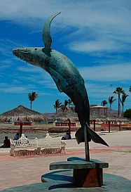
Humpback whale breaching.

Evocative statues enliven the malecón.


Dressy trash cans.

A turtle statue gives a mural a
3D twist.

Musical sea shells.

The malecón is a great place to sit a spell.


Carlos Slim's super yacht drops in for a few days.

The Mexican Navy kicks off the Semana Santa (Holy Week) celebrations in dress whites.

Mexican Navy ships behind us.


Embroidered and knitted items for sale.

Manual orange juicers in a kitchen shop.

Katty took our measurements and made fantastic
lycra snorkeling suits for us.

The La Paz eddy?

Puerto Balandra.

Lagoon entrance at Puerto Balandra.

Puerto Balandra.

Cardón cactus greet us.

A sunflower starfish (the
camera's flash made a bright
spot in the center).

Peace.

Happy afternoons in the cockpit.

Sunset in Puerto Balandra.
La Paz & Puerto Balandra, Baja California, Mexico
Mid-April, 2011 - After a few quiet days in Ensenada de
Los Muertos at the tip of the Baja peninsula we felt
sufficiently recovered from visiting Mazatlan and crossing
the Sea to make our way into another big city: La Paz.
Coupled with Mazatlan and Puerto Vallarta, La Paz
makes the third urban leg of the triangle joining the Sea
of Cortez and the Pacific Ocean (see Mexico Maps).
The beautiful marinas in each of these cities often keep cruisers
tied to the docks for weeks, as the deliciously comfortable resort
lifestyle makes it hard to untie the lines and move on. We had
been told repeatedly before we left for Mexico, "Don't spend too
long in Puerto Vallarta like we did," or "We got stuck in Mazatlan
way too long," or "We were trapped in the 'La Paz eddy' and ran
out of time." Staying out in the anchorages instead of the marinas
throughout our Mexico cruise has kept us mobile, and we planned
a brief visit to La Paz.
As we approached La Paz, motoring down the several mile long
entrance channel, the area seemed bursting with the thrill of new
resorts going up. A brilliant green golf course defied the brown
desert surroundings while stunning glass plated multi-story
buildings rose from the hills. Behind a huge unfinished building,
markings on the hillside revealed how the land will be carved up
for future development. It all pointed to a town flush with hopes
of hosting well-heeled tourists for many years to come.
A massive water slide made our jaws drop, and we could hear
the screams of the kids on one of the slides.
It was nearing the start of
"Semana Santa," or the
Holy Week surrounding
Easter that is Mexico's
major vacation week, and
boats of all shapes and
sizes were heading out of
the channel into the island
playground that is just
beyond the city's limits.
Marina de La Paz has
space at their dinghy dock
for boats that anchor in the bay. They
are also home to Club Cruceros, a
cruising club that offers a ready-made
community of knowledgeable fellow
cruisers for visiting sailors, complete
with morning coffee hour gatherings
and a very large book exchange.
The heart of La Paz is the malecón, or
seaside boardwalk, that extends for
several miles along the bay. This is a
wonderful place for both leisurely
strolls and energetic jogs. The
malecón is dotted with inviting
white wrought iron park benches
and charming sculptures.
A deep love of the sea and a
little bit of whimsy fill each statue,
reminiscent of San Diego's
Urban Trees. Even the trash
cans are dressed up as sea
creatures.
A huge mural of
the undersea world of the Sea of Cortez incorporates a
sculpture of sea turtles in an intriguing way, and we
found a band of shells strumming instruments a little
further on.
Despite being a
bustling city, you can't
help but slow down
along the malecón and take a breather while looking out at
the many cruising boats anchored in the harbor.
During our stay we had lots of things
on our "to do" list, and we scurried
around town gathering provisions both for the dinner table and the boat. This was the first
city where we had found a chandlery, Lopez Marine, that not only had all of the items we
needed but was run by a Canadian ex-pat who understood both our language and our
boat's fussy needs. We had struck out at boat-oriented stores in Manzanillo, Puerto
Vallarta and Mazatlan before this, so we were thrilled to stock up on all the items we had
neglected to bring with us from San Diego.
We also discovered we were definitely in Baja and not on the mainland anymore as we
shopped for the galley and stopped at street-side vendors for snacks. We had searched
high and low for fish tacos and grilled beef tacos on our travels on the southern mainland,
always coming up empty. Flour tortillas are nonexistent on menus south of Puerto Vallarta
and aren't available for purchase save for one brand in the supermarkets. Now we rejoiced in $1.50 grilled beef tacos with all
the fixings, we scarfed a few fish tacos, and grabbed a variety of brands of flour tortillas for the galley.
The richest guy in the world, Mexican communications
tycoon Carlos Slim, also seems to like La Paz. His
megayacht was in port getting a little window washing
during our stay.
We woke up the day before Good Friday to find the
Mexican Navy in celebration behind us.
Several small Navy ships were anchored just off our stern, flags
flying. A whole group of Sailors lined up on shore looking very
sharp in their dress whites.
La Paz is an older town, and it has hilly, narrow streets that give it a different, cozier kind of
feeling than other Mexican coastal cities we've visited. As in the US where so many towns
are beginning to look alike with matching big box stores, Mexico's chains and street vendors
give many of their towns a similar appearance. Familiar Mexican businesses like Coppel,
Elektra, Comex, Soriana, Comercial Mexicana, Bancomer, TelCel and Banamex show up in
every city, often accompanied by American counterparts like Walmart, Home Depot, KFC,
Office Max, Subway, McDonalds and others.
But the streets of La Paz go up and down,
rather than being wide and flat, and many
seem to be one-way. Even the street vendors
here seemed to be offering slightly different
wares, including one who was selling
embroidered and knitted goods.
We got a tip from friends that a seamstress in
town makes custom fitted snorkeling suits.
With long sleeves and long legs, these lycra
outfits offer a little bit of warmth
and a lot of abrasion protection.
We visited Katty's house for a
fitting and three days later had
two wonderful new body
suits for less than the
price of a bikini back
home.
As we made our way
back to the boat one
day, a small school of
fish was swarming in
circles under our
friends' boat.
Were they caught
in that infamous La
Paz eddy too?
Hmm... maybe it
was time to leave.
The anchorages in the first 100 miles north of La Paz are considered to be
some of the best in the Sea of Cortez. We wanted to visit every one, so
we started at Bahía San Gabriel at the southern end of Isla Espiritu Santo.
This pretty bay had us each sighing "ahhhh" all afternoon once the hook
was down. A noisy frigate bird nesting colony filled the trees along one
part of the shore, and the long white sand beach begged to be walked.
"Tomorrow..." we both said simultaneously, envisioning a quiet kayak ride
to shore and a slow walk-swim-walk together along the water's edge.
From the perfect stillness of the cockpit we watched the sun set in spectacular colors, anticipating a quiet night. So we were
quite surprised when the boat began to roll mysteriously. An ominous, low roar gradually filled the air around the boat.
Suddenly the wind began to pick up, sending us into the cabin to get out of the cold and then bringing us back on deck in
alarm as it quickly accelerated over 20 knots. The boat began to buck and roll, and we watched in awe as the one other boat
in the anchorage, a 65' Swiss flagged yacht, pitched wildly in the growing maelstrom. We struggled to keep our footing as we
scrambled down below again. What the heck?
For 15 straight hours the boat jerked violently and the wind bellowed and whistled through the rigging. We were wide awake
throughout the night, our only comfort being the knowledge that the seven people on the other boat were wide awake too. By
morning we had read every book on board about the La Paz Coromuel winds. Good grief. Who woulda thunk that a heavenly
little tropical anchorage could transform into a nightmarish haunted house and roller coaster ride so fast? Well, we learned
that it happens every night in the late spring and summer within 40 miles of La Paz. The word "Coromuel" is the Spanish
pronunciation of the name of British privateer Samuel Cromwell.
This odd, all night phenomenon of absolutely vicious south/southwest winds is caused by hot desert air rising from Baja's
southern tip near La Paz and sucking in the cold Pacific air across the low lands without any mountains to slow it down. By
11:00 each morning the show is over and the winds vanish, replacing the word "nightmarish" with the word "idyllic" in the
description of every southwest-facing anchorage in the area. With great optimism, many travel guides dismiss this horror as
"a cool evening breeze," which it may be if you are on a protected patio somewhere.
So the trick in spring and summer near La Paz is to stay only in
those anchorages that have south to southwest protection. We
found such a spot at Puerto Balandra.
Tucking up under the towering cliffs
to the south, we spent three stunning
days gazing at the white sand
beaches and jade green water, smug
in the knowledge that when the
ferocious winds came at night we would be completely
protected from the huge waves and modestly protected from
the howling wind.
It had been 16 months since we had spent any time in the
Sonoran desert, and it felt wonderful to be back again. The tall
cárdon cactus, close relatives of our beloved Arizona saguaro
cactus, seemed to reach their arms out to us in a big wave
"hello." In the distance we heard the familiar chortle of a cactus
wren. Our sinuses got all crackly again and every towel on the
boat dried out in an hour or so.
Slathered in sunscreen once more, we explored the pristine
beaches by foot and with mask and snorkel. We spotted a
sunflower starfish under the still, clear water. From the boat we
could hear the happy voices of kids playing on one of the white
beaches a mile away while the sun baked our bodies. It
reminded us both of our childhood days -- on Michigan lakes for
Mark and on New England beaches for me.
We hung out in the cockpit every
afternoon, and Mark got inspired to strum a few tunes.
This bay is a perfect weekend getaway for folks in La Paz. After
a few days of blissful vacation we zipped back into the city for
some final provisions before hitting the remote and largely
uninhabited islands to the north in the Sea of Cortez where our
first discoveries were Isla Partida's Ensenada Grande and then
Find La Paz and Puerto Balandra on Mexico Maps.