Sedona Reflections on the West Fork Trail

West Fork hike Sedona AZ

Beautiful reflections on the West Fork Trail

May, 2014 – Sedona, Arizona, is an outdoor lover’s paradise.  Not only were we thrilled (and challenged) by the wonderful mountain biking in the area, but the hiking was incredible too.

The only problem we had was figuring out which hikes to do! Continue reading

Sedona – Mountain biking in the red rocks!

Mountain bikes at Bell Rock Oak Creek AZ

Ready to Ride!!

May, 2014 – Sedona, Arizona, is a mountain biking mecca, and our friend Marcel, whom we met during our winter stay in Phoenix, and who inspired us to take up this sport, was eager to get us out on the trails.

The mountain biking in Sedona is scenic, dramatic and thrilling — but we soon found out that it is far from easy!

There is only one trail in the main system of in-town trails — the Bell Rock Pathway — that is truly for beginners, and we happily rode up and down that 3.5 mile path many times. Continue reading

The Wind Cave Hike in Phoenix AZ – The Hills are Alive!

Wind Cave Trail Arizona

An ocotillo greets us at the start of the hike.

Early March, 2014 – We had been enjoying the rivers and waterways and Saguaro Lake in Phoenix, Arizona, but the cactus filled desert was never far away.

Mark at the Wind Cave trail bottom

Ready for hiking!

Cactus looking down towards brittlebush

Usery Mountain Regional Park has a beautiful campground and some great hiking.

One hike in particular, the Wind Cave Trail, came highly recommended by our friends, Mike and Donna (FlyingTheKoop.com). They once called this area home and have hiked it many times.

Brittlebush blooming with cactus

The yellow brittlebush were in bloom all around us.

This is an uphill hike that climbs straight up for a mile and a half, making lots of switchbacks on the way.

The bright yellow brittlebush flowers had just started to bloom, and there were sprays of golden flowers everywhere.

Emily poses with brittlebush

There’s nothing like getting out on a warm, sunny, early spring day!

And the saguaros were standing around having their usual conversations too.

One cactus looked like it was whispering in the ear of another!

Two saguaros on Windy Cave hiking trail

“Psssst…can you keep a secret??”

Wind Cave is a popular hike, and we met a lot of other hikers on the trail.

A large group came up behind us, walking sticks and cameras in hand.  It was a beautiful day to be out.

Busy day on Usery Mountain Wind Cave Hiking Trail

We had lots of company on the trail.

What sets this hike apart is the lichen that covers the sides of the cliffs in a broad band along the top of the mountain.

The faces of the cliffs are shaded in the morning, though, so when we started up the switchbacks, the color on the cliff faces was muted at first.

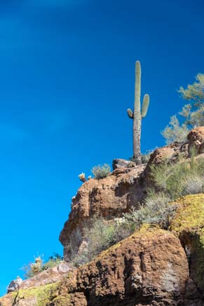
Saguaro cactus looks down from top

Waving “hi” to his buddy down below.

Saguaro cactus looks up the mountain

The rising sun lit up one saguaro

In the shadowed lighting, it seemed like a rather ordinary, though lovely, Sonoran desert hike.

Then the sun began to peek around the edges of the mountain.

Its warm rays lit up a solitary cactus that stood away from the cliffs.

This guy seemed to be looking up at his saguaro buddy who was staning on a little higher ground above him and waving.


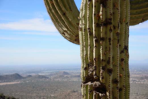
Saguaro cactus with valley below

An ancient, pock-marked cactus has enjoyed this view for over a century.

As we climbed higher and higher, the views across the valley begame bigger and bigger.

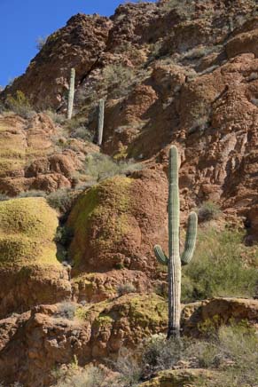
Saguaro cactus in the lichen

The sun and shadows played hide and seek with the cactus among the rocks.


Lizard on hiking path

A lizard scurried past…

At our feet, we saw lizards scampering across the trail.

We listened to the Gambel’s quails and cactus wrens calling all their friends.

The Phoenix area is known as the “Valley of the Sun,” but as you travel around town, it doesn’t feel like a traditional v-shaped valley. Instead, it is a vast, flat, desert floor that stretches to eternity in all directions, broken up here and there by little pyramid peaks.


Brittlebush and palo verde on hiking trail

We were hiking up a pretty tall peak, and the trail didn’t take a break anywhere — it was up, up, up. We progressed very slowly.  It was just too pretty to rush, and we ended up taking photos with every step.

People at the Wind Cave

There was a crowd waiting for us at the Wind Cave

When we finally reached the top, all the hikers who had passed us were taking a load off in the cool shade of the Wind Cave itself. It isn’t really a “cave” but is more of a sheltered spot that’s perfect for enjoying the views.

Chipmunk peeks around corner

A little chipmunk peeks over a rock at us.

The rocky cliff has an inward curving wall, providing welcome shade and inviting people to sit for a spell, eat a little something, and catch their breath.

Lots of chipmunks live up here, and they have learned that hikers carry yummy snacks like granola bars.

Chipmunk stops momentarily

The chipmunks kept us entertained as we ate a snack.

Lichen covered rocks on Windy Cave Hiking Trail

The beauty of the Wind Cave trail unfolds
as the sun rises.

These little guys were very brazen, and walked right up to all of us to see if we were had something to share.

Of course, who can resist a cute little furry face looking up at you hopefully? We all gave in and found a few crumbs to spare.

The chipmunks eagerly grabbed their snacks and ran off a few paces to nibble away, holding the treats in their little hands as they ate.

By the time we started down, the sun was hitting the lichen covered cliffs beautifully.

Lichen on cliffs Wind Cave Trail Arizona

The cliffs are clad in orange and yellow lichen.

Three saguaros and lichen on cliffs on Usery Wind Cave hiking trail

The craggy rock faces seemed to be showing off their bright yellow and orange wardrobe, and the vivid colors made a wonderful backdrop for the saguaro cactuses along the trail.

We wandered down the trail to the valley floor and noticed the clouds were moving very quickly across the sky.

Looking over valley on Wind Cave hiking trail

A hiker takes in the view of the valley, but the backdrop behind him is just as stunning.

Triplet saguaro cactuses

Fast moving clouds frame a trio of saguaros

Mark took out his neutral density filter and let the moving clouds create a kind of crown around a trio of saguaros.

While he was busy setting up the shot, he noticed a tiny hummingbird sitting on a wee little nest behind a thick veil of branches and leaves in a small tree.

He approached the hummer and she didn’t move.  She just sat tight, watching his every move.

He hurried away to find me, because I had a long lens with me, and I rushed back to see if I could catch the little bird.


Hummingbird on nest

A hummingbird sits on her nest deep inside a tree.

Gosh, she was buried way back deep inside those branches.  I moved closer and she flew off her nest.

Inside were two miniature little eggs.

They were so tiny, I was afraid they would get chilled really quickly while mom was off the nest. So I stepped away, and she returned and wiggled her tail end a bit as she settled back down on her eggs.

Yellow wildflower

An early sign of spring!


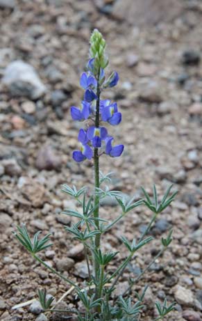
Purple wildflower

The wildflowers are starting!

Then more hikers came down the trail and she flew off again.

Her nest site was well protected, but lordy, she could have chosen a spot a little further from the trail!

Oh well.  I managed to fire off a few shots of her sitting on her soon-to-be family, and then left her in peace.

Spring was definitely in the air.

Not only were a few birds starting their families, but some wildflowers were beginning to show their colorful little faces too.

We were really excited by the early arrival of spring, and we were hopeful that soon the whole Sonoran desert would be alive with flowers.

<- Previous                                                                                                                                                                                       Next ->

Natural Bridges National Monument & Utah’s Bicentennial Highway

Early June, 2012 - We left Mesa Verde and drove the dramatic Bicentennial Highway to Utah's unique Natural Bridges National Monument.

At the top of Natural Bridges National Monument, Utah.

A wwoden ladder on the Sipapu Bridge trail.

Some folks were put off by the

trail's wooden ladders.

Looking down a wooden ladder on the Sipapu Bridge trail of Natural Bridges National Monument.

Looking down is a bit unnerving!

climbing a wooden ladder at Natural Bridges. On the trail at Natural Bridges NM.

The trail hugs a sheer canyon wall.

Hiking behind a barefoot person at Natural Bridges National Monument.

Barefoot tracks...

Exotic rock formations along the trail. Dramatic cliffs line the walls along the Sipapu Bridge Hike in Natural Bridges National Monument.

Dramatic cliffs and rock

formations everywhere

Down by Sipapu Bridge. Natural Bridge Nat'l Monument Natural Bridges National Monment

Full sized trees at the base of the cliffs.

Stiped cayon wall at Natural Bridges NM.

Massive leaning walls are painted in vivid stripes.

Sipapu Bridge, Natural Bridges National Monument

Sipapu Bridge

Ladders are central to the hike to Sipapu Brige.

Ladders...

The NPS has carved stairs in the sandstone on the trail at Natural Bridges National Monument.

…and carved stairs.

Cactus flower, Natural Bridges National Monument Striped cliff walls, Natural Bridges National Monument.

Striped cliff walls.

Kachina Bridge, Natural Bridges National Monument.

Kachina Bridge

Kachina Bridge at Natural Bridges National Monument.

Mark is dwarfed by Kachina Bridge.

More ladders and steep hiking at Natural Bridges National Monument. Owachomo Bridge at Natural Bridges National Monument.

Owachomo Bridge - delicate and soaring.

Owachomo Bridge at Natural Bridges National Monument.

Owachomo Bridge.

Owachomo Bridge at Natural Bridges National Monument.

The base of Owachomo Bridge.

"Bears Ears"

The Cheesebox, Bicentennial Highway, Utah.

The Cheesebox.

Jacob's Chair, Bicentennial Highway, Utah.

Jacob's Chair.

Scenic Bicentennial Highway.

Scenic Bicentennial Highway

Driving through Glen Canyon on the Bicentennial Highway, Route 95 Utah. Bridge over the Colorado River, Bicentennial Highway, Route 95 Utah.

Bridge over the Colorado.

Colorado River, Bicentennial Highway, Route 95 Utah.

Colorado River.

Bicentennial Highway, Route 95 Utah. Scenic overlook along the Bicentennial Highway, Route 95 Utah.

Scenic Overlook on the

Bicentennial Highway.

Ghost town Hite City was buried by Lake Powell.

Ghost town Hite City lies underwater here.

SR-95 Bicentennial Highway. Rock formations along State Route 95, the Bicentennial Highway, Utah.

The gods were messing with finger paints.

Scenic Route 24, Utah.

Fruita in Capitol Reef National Park, Utah.

Capitol Reef National Park, Utah.

Driving along Capitol Reef National Park, Utah.

Capitol Reef National Park, Utah.

Natural Bridges and Utah's Bicentennial Highway

Early June, 2012 - After leaving Mesa Verde National Park we were

totally enthralled by the scenery that surrounded us on Utah's

Bicentennial Highway.  This area is rich with exotic rock formations, and

three special ones are clustered at Natural Bridges National Monument.

While getting our hitch extension fabricated in Blanding we had learned

that our welder, Jack, had grown up playing among the bridge

formations before the modern park rules became so strict.  "It was in

our backyard and we could camp anywhere in those days.  I grew up

climbing all over those bridges."

Now it is a formal tourist attraction,

set aside and protected by the

government, with signs telling you all

the things you shouldn't do.

However, rather than having to scramble down scary drop-offs and wondering how the heck all

these formations got here, the National Park Service has built beautiful trails to the bridges and

offers all kinds of literature and books that explain everything about the geology, the wildlife, and

nature in general at their terrific visitors center.

Just like Canyon de Chelly where the canyons

are equally as stunning as the cliff dwellings, we

found the setting, the vistas and the hikes as

thrilling here as the bridges themselves.  There

are only three natural rock bridges, but there is

an infinite number of spectacular views.

All together it's just four miles of hiking, but you

can skip doing your stair stepping workout on

the day you go.  Each bridge hike is a nearly

vertical descent to the base of the bridge, and

then, after admiring it, you've gotta climb out.  We quizzed

everyone we passed whether each hike was worth the

effort.  Most said "Yes!"  But one couple was put off by the

rickety looking wooden ladders.  We found the ladders were

actually really fun!  They're rock solid and shiny smooth

from thousands of hands and feet using them.

The trail to Sipapu bridge is

sandy and hugs a sheer canyon

wall.  There are all kinds of

footprints from previous hikers,

but the ones that caught my eye

were the barefoot ones.  I felt like

I was following an Indian.  But it

was just someone wearing those

newfangled Vibram FiveFingers

shoes!

We scampered all over the place, soaking

up the towering cliffs and basking in the

silence.  It is hard to imagine that the

immense natural force of flowing water

created these formations.

Many of the rocks are beautifully striped,

carefully painted in vibrant hues by

mother nature.

The size and scale was hard to

capture with the cameras,

especially trying to draw into the

lens that sensation of being

embraced by soaring cliffs and very

hot sun.

Mark got to the

Sipapu bridge

first, and when

he called back

to me his voice

echoed

wonderfully

between the

rocks.  He let

out a few extra hoots

and whistles, enjoying

the effect.  I hooted

and whistled back and

marveled at hearing

the sound perfectly

duplicated.

Climbing back out we noticed

how the Park Service has not

only installed fantastic Navajo

looking wooden ladders, but

has carefully sculpted out lots

of stairs in the rocks as well.

And we learned these bridges

were first found by Cass Hite in

1884 when he was searching for gold.

Kachina Bridge was up next, and

again we descended on a nearly

vertical path into a vibrant green

wash filled with trees and refreshingly

cool shade.  The rocks here had

been painted in stripes too, and bird

songs echoed off the canyon walls as

they flitted from tree to tree.

We staggered around in the sandy wash at the base of the bridge, craning

our necks as we tried to take it all in.  This bridge is thick and squat, and the

underside is decorated with scraggly petroglyphs.  People have lived here

off-and-on for 9,000 years, including a few Mesa Verde cliff dwellers who

moved over here for a few generations around 1200 AD.  This must have

been a great spot to while away the hottest summer hours back in the days

when air conditioning was unavailable and people entertained themselves

by pecking out images on rock walls.

The steep climbs and descents began to blend together in a

haze of sweaty huffing and puffing as we put one foot in front of

the other and hiked up and down the canyons.

The last bridge in the trio is

Owachomo Bridge.  Where

Kachina Bridge had been thick

and massive, Owachomo was

thin and delicate.

Still mighty at its base, from a

distance the narrow stone

seemed almost wispy as it

soared across the expanse.

As we left Natural Bridges National

Monument we caught a glimpse of the

twin peaks the Indians called "Bears

Ears."   What a perfect name!

Many rock formations, cliffs and mesas

around here often beg to be named

because their shapes are just so

familiar.  The Bicentennial Highway

took us past the Cheesebox and

Jacob's Chair.

Back on the scenic Bicentennial Highway the views really got us excited as we

approached Glen Canyon and the Colorado River.  I was practically jumping up

and down in my seat with excitement as the truck swept around one gorgeous

curve after another.

Mark just puttered along, patiently driving, while I whirled around from side to

side snapping hundreds of photos out the windows.  I even climbed up to sit in

the truck window a few times to get pics over the roof.  It is just that gorgeous!

This section of the road must have

been a huge challenge to construct,

and I kept thinking of Ferd Johnson

from the visitors center back in

Blanding who described living out in

these canyons for over two years

while building the highway and the

bridges across the river.

What a place to work!

We stopped at a scenic overlook after

crossing the river and learned that

when the river was dammed back in the

1960's, the new Lake Powell flooded

not only countless ancient Indian

settlements complete with artifacts,

petroglyphs and other priceless

treasures of humankind, but it flooded

an old mining ghost town as well.  Hite

City had boomed when local miners got

"uranium on the cranium" and started

searching the area for "hot rocks."  Now

the entire town lies underwater.

Back in Blanding, both our welder, Jack, and highway builder Ferd

told us they remembered this canyon vividly from the days before it

was filled with water.  What an event it must have been when the

dam was completed to see the water rise against the cliffs and

transform the landscape.

Eventually the scenery along the Bicentennial Highway simmered

down to downright boring, and I settled down in my seat.  From

Route 95 we turned west onto Route 24, and then the views began

to build yet again.

Swirling patterns filled

the rock landscape.  It

seemed the gods had

gotten their hands

colorfully dirty, messing

around with finger

paints, and then had

smeared their prints

across the rocks.

We approached some

towering pale cliffs and

then found ourselves

deep in the heart of red

rock country.

We had arrived at Capitol Reef National Park.  What a

spot!  The bright green trees, burnt orange rocks and crisp

blue sky made a vivid feast for the eyes.  We happily

agreed to settle in here and explore the area for a while.


Subscribe
Never miss a post — it’s free!

Other fabulous scenic drives in Utah:

Other wonderful hikes:

Our most recent posts:

More of our Latest Posts are in the MENU.   New to this site? Visit RVers Start Here to find where we keep all the good stuff. Also check out our COOL NEW GEAR STORE!! *** CLICK HERE *** to see it!

Northern Idaho – Trail of the Coeur d’Alenes

Trail of the Coeur d'Alenes Idaho

The Trail passes lakes, streams, farmland and cute towns.

Trail of the Coeur d'Alenes Idaho

The Trail of the Coeur d'Alenes is 72 miles of paved

cycling bliss.

Rails-to-trails Trail of the Coeur d'Alenes Idaho

The Trail crosses old train bridges.

We started getting into cycling when we

arrived in Idaho.

Kellogg Idaho

Kellogg, Idaho is a special town that has an eclectic feeling.

St. George is popular in Kellogg, ID.

One of Kellogg's chalet homes.

Trail of the Coeur d'Alenes Idaho

It winds through the woods.

Trail of the Coeur d'Alenes Idaho

Plaques describe the ecology and history of the area.

Trail of the Coeur d'Alenes Idaho

Portions of the Trail flank a wide lake.

Moose tracks on the Trail of the Coeur d'Alenes Idaho

Muddy moose tracks!

Trail of the Coeur d'Alenes bike trail Idaho

Beautifully maintained by Union Pacific, there are rest areas

and restrooms along the trail.

Trail of the Coeur d'Alenes bicycle path Idaho

The scenery is stunning.

Riverview along the bike path Trail of the Coeur d'Alenes Idaho

The water is blue-green because of the high mineral

content.

Bicycle trail Trail of the Coeur d'Alenes Idaho

We will be back.

Northern Idaho

August 26-September 2, 2007 - Leaving the North Cascades, we visited Coeur

d'Alene briefly and headed east towards Montana.  In the town of Smelterville, 30

miles east of Coeur d'Alene we stopped overnight at Walmart.  We noticed a paved

bike path next to the

parking lot and took out

our bikes to explore.

We soon discovered

that we were in the

middle of the charming

72-mile-long Trail of the

Coeur d'Alenes rails-to-trails bike path.  We found a campground and

stayed a week so we could explore the bike path more fully.  Each day

we drove the truck to a trailhead, unloaded the bikes and rode a ten

mile segment, out and back.

The valley area 30 miles east of Coeur d'Alene is one of the

richest mineral deposits in the world, and the town of Kellogg is

the heart of this area.  In the 1940's it was poisoned by the toxic

silver mining process.  In the 1980's the mine closed, the

railroad shut down and everyone lost their jobs.  As one woman

put it, it looked like an atom bomb had gone off. A fellow who

grew up here in the 1940's said you could taste the sulphur

dioxide in your mouth all the time and the air was always hazy

blue from the smoke stacks and smelters. Rather than flee

when their world crashed in the 1980's, many townspeople

stayed.  Declared an EPA superfund site, Union Pacific cleaned

up their mess by burying their toxic waste along the tracks and creating the 72-mile long paved bike path.  The high school

students planted a million trees on the barren hills surrounding town in the 1980's, and today those hills are lush, the air is clear,

and the town is optimistic.

There is an artsy

flair to the town.

Someone in town

loves St. George

and the dragon: we

found them in a

sculpture and a

mural.  Several

homes had an

alpine look to them,

and nearby there is

a ski area complete

with gondola and chair lifts.  There is something upbeat and

offbeat about Kellogg that really appealed to us.

The Trail of the Coeur d'Alenes is a gem.  There are

trailheads along its length, each with display maps showing

the highlights.  It passes through the historic town of Wallace,

the simple mobile home town of Osburn, the former mining

towns of Smelterville and Kellogg, and through the lakeside

town of Harrison.  Some parts of the trail are busy and others

are very quiet.  Mostly alone on the trail, there were times

when we shared it with cyclists, dog walkers, and inline

skaters, but there was never any congestion.

In one lonely area, far from civilization, we discovered

some moose tracks.  I had been reading a book that talked

about how moose like to eat the roots of lilies, and this part

of the Trail passed a large lily pond.  Some workers

painting a train trestle further down told us a moose had

been in the area for several weeks.

After a week in this

charming part of the world

we ventured on eastwards

to northern Montana and

the stunning Glacier

National Park.