RV Trip on Colorado’s Million Dollar Highway – Ouray to Silverton

Red Mountain Pass near Ouray Colorado

The Million Dollar Highway

October, 2014 – We were loving our stay amid the golden aspen of Ouray, Colorado, where every view we saw in every direction we turned was a true jaw-dropper. Our cameras were going non-stop.

Ouray sits in a valley surrounded by mountains with a narrow ribbon of highway running through it.

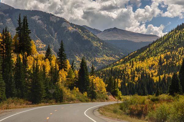
This highway, US Route 550, is a part of the San Juan Skyway, a breathtaking scenic loop drive that takes in some of the best mountain views that Colorado has to offer.


A fifth wheel RV starts over Red Mountain Pass in Colorado

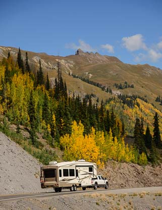
A fifth wheel takes in the views

Swinging through Telluride, Ridgway, Silverton and Durango, the San Juan Skyway winds all through the mountains, soaring over the peaks and dropping down into the valleys.

A motorcycle drives the Million Dollar Highway in Colorado

This is great motorcycle country!

When it gets to Ouray, drivers headed south are at the starting point of one of the most spectacular 25 miles stretches of road in America.

Nicknamed the Million Dollar Highway, the views are worth every penny (lol)!

The origin of this name is uncertain, but it may have come about because it was thought that a million dollars’ worth of gold dust was in the gravel and dirt that was used to build the road in the late 1800’s. Or, the name may have come from the cost of paving the highway in the 1930’s.

Million Dollar Highway Route 550 near Ouray Colorado

Million Dollar Views on the Million Dollar Highway

If those stories aren’t the real source of the name, there is also a joke that perhaps this gorgeous bit of road got its nickname from an early traveler who, wide-eyed with terror, exclaimed, “I wouldn’t go that way again if you paid me a million dollars!”

Really? Oh yes, indeed!

The views along this road are beyond stunning, but you’ve gotta steel your nerves when you drive it, especially if you are in the passenger seat heading south from Ouray to Silverton.

Nevermind the beauty. This road is one of the most hair raising and dangerous highways in America.

Fall Colors on the Million Dollar Highway near Silverton Colorado

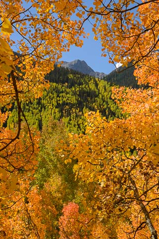
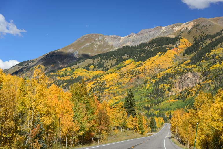
As we approached Silverton the aspens were ablaze!

As we drove it the first time, we both kept saying “WOW” the whole way.

Half of those “wows” were because the scenery was so incredible. But half of them were because of the utterly sheer and totally unprotected drop-offs that fell away from the truck’s right tires, falling hundreds of feet straight down to a chasm below my door!

We stopped a few times at various pullouts and peered over the edge.

OMG. At one spot we saw an upside down car way at the bottom of the gorge below us!

Scary drive on Million Dollar Highway Colorado

Some consider this road among the most dangerous of America’s highways.

Yikes! Lord knows if it was from a fatal crash or if kids had rolled a car off the highway to watch it fall.

Over the decades I’m sure both of those things have happened!

Yet, frightening as this drive can be for first-timers, semi-tractor trailers traverse it all the time, climbing up and over the three mountain passes that lie between Ouray and Durango, Colorado.

I’m not sure that we ever saw any trucks hauling super heavy loads, but Freightliners and their like made up a significant percentage of the traffic on this narrow twisty road.

Colorado Red Mountain Pass in the rain

It’s certainly intimidating when the weather gets ugly!!

This gave us heart, because we were planning, at the end of our stay, to take our fifth wheel over this road.

We ended up driving the Million Dollar Highway and its highest summit, Red Mountain Pass (at 11,000+ feet), many times during our two week stay, because the peak of the fall foliage color was happening all up and down its wild walls.

So we got to know the many twists and turns and scary parts of the road.

When the weather turned nasty for a few days, and the road got soaking wet, the clouds dropped into the canyon and filled it with fog, and the rain fell in blinding torrents on our truck. At least we knew what lay ahead!

Motorcycles riding from Silverton to Ouray Colorado

On a sunny fall day, this is motorcycle heaven!

But on beautiful sunny days this is a drive people come from miles around to enjoy.

We watched lines of touring motorcycles, groups of shiny new Ferraris, and even a caravan of rental RVs out for a scenic drive on this thrilling road.

After crossing over the summit of Red Mountain Pass, the road begins to descend towards Silverton, and the fall colors jumped out at us from all sides.

Then the valley opened up, and Silverton lay before us, a tiny town with a big mining history.

Silverton Colorado

Silverton is one super cute Colorado mountain town.

Durango to Silverton Narrow Gauge Railroad

The Durango and Silverton Narrow Gauge Railroad is a fun stream train ride.

Once home to 1,100 people (in the late 1880’s) when the nearby silver and gold mines were flourishing, Silverton houses just 500 or so hardy souls today.

Tourists love it, and it is a great spot to spend an afternoon or a few days.

The Durango and Silverton Narrow Gauge Railway is one of the biggest attractions, and we saw it in the distance, chugging up into the valley under a thick cloud of black smoke that trailed off behind it.


Western Photography in Silverton Colorado

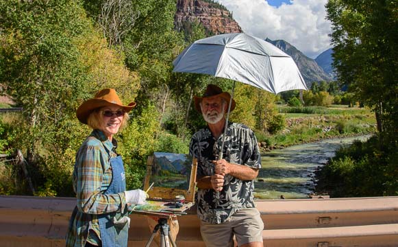
Not only is the town photogenic, but it’s a great place for western-themed portraits.

This railroad was built in 1882, and it carried both mining supplies and tourists right from the get-go.

Today it carries only tourists, and it is a major attraction in the area.

40+ years ago in the early 1970’s, one of the train’s brakemen had a younger brother that was an avid cyclist, and one day they challenged each other to a train/bike race up the mountain from Durango to Silverton.

The cyclist bested his brother on the train, and the Iron Horse Cycling Classic was born.


Family readies for western photo shoot

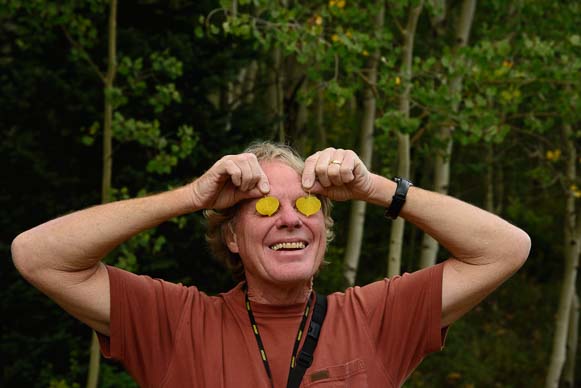
A family get ready for a western photo session.

Now the Iron Horse is a huge affair with pro cyclists, recreational riders, volunteers and sponsors of all kinds participating.

Their website gives the annual race results for each group of cyclists that competes, but the one thing I couldn’t figure out was: how did the train do?!

No matter how you get to Silverton, by car, train or bicycle, this town is a great stopover.

It’s very photogenic, with colorful old buildings lining the dirt streets that are set against a vivid mountain backdrop.

Photographers set up western-themed photo shoots for tourists too, and we watched a family getting set up for a fun photo.


Old mining houses on the Million Dollar Highway Colorado

There are old mining ruins and old homesteads all over the place.

Two little girls donned big flower hats and long dresses, and a little boy hugged a bottle of whiskey while his brothers brandished rifles. Mom had a pistol, and the baby wore chaps. What a hoot!

Of course, it’s one thing to dress up like old times and have a meal at one of the western themed restaurants in town.

It’s a whole different thing to have lived here in the mining camps 100+ years ago.

An RV descends Red Mountain Pass near Ouray Colorado

The Million Dollar Highway can be negotiated by the biggest rigs on the highway — if you dare!

The ruins of both the mines and the homes are scattered among these mountains, and it is startling to picture that life.

Living at 10,000 feet in remote mountains where snow comes in early October (and sometimes sooner) must have been an unbelievable challenge.

What’s worse, the mining companies didn’t care a lick about safety. Falling down a mine shaft or having the whole mine collapse on your head were accepted risks that were just part of the job.

In 1918, Silverton was brought to its knees by the influenza epidemic. A staggering 10% of the population died in a six week period.

More recently, a rock slide in January, 2014, brought the town to its knees once again. Route 550 was suddenly impassable, and the town was cut off from its main supply route to the north.

A motorhome on the San Juan Skyway in Colorado

Just keep your eyes on the road (hah!)

The few vehicles that made it to Silverton had to drive nearly 500 miles out of their way to get there.

But hardships of remote mountaintop living aside, it was the gold and silver of yesteryear and the majestic scenery of today that put and keeps this area on the map.

For all the grittiness of the mining life in these mountains, I imagine that when the miners found a spare moment to soak in the scenery, it was as precious to them in those days as it is to us today.

Red stone lined stream and Colorado autumn color

The scenery here inspired us for weeks.

Back out on the road heading back to Ouray, we saw lots of big RVs navigating the hairpin turns on the Million Dollar Highway.

I had looked for info on taking an RV on this road in some of the online RV forums, and lots of people had said there was no way they would ever take a big rig on this road.

But many people do it, and we never saw anyone having trouble. Driving it a few times in a smaller vehicle first definitely helps!


Prior to towing our 14,000 lb. trailer over these passes, we installed an Edge Evolution Diesel Tuner on our truck to give it a little more power, and it worked great! (Our installation of this engine tuner is described here).

Fall color at a lake near Ouray Colorado

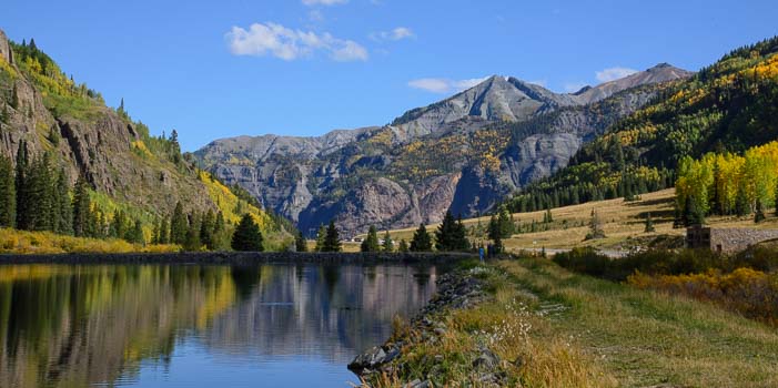
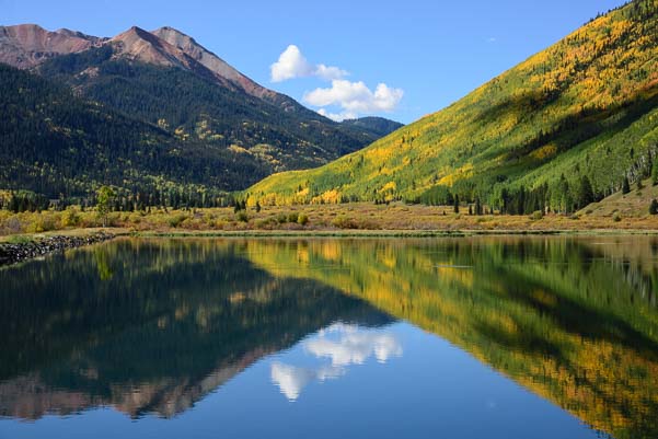
Fall color at Crystal Lake near Ouray.

For more info about this glorious drive and the Silverton area, check out these links:

Scenic Roads and Drives:

Silverton Area Attractions:

Subscribe
Never miss a post — it’s free!

Related posts about Colorado’s spectacular fall color and where to see it:

More blog posts from our RV trips to Colorado:

<-Previous || Next->

Our most recent posts:

More of our Latest Posts are in the MENU.
New to this site? Visit RVers Start Here to find where we keep all the good stuff!!

Ouray – Finding the COLOR in Colorado on an RV Trip!

Classic western store fronts in Ouray Colorado

Ouray, Colorado, is a classic western mountain town.

September, 2014 – Continuing our journey south through Colorado, we left the rugged Black Canyon of the Gunnison and traveled on to the classic Rocky Mountain town of Ouray (pronounced “you-ray”).

This tiny town of just 1,000 people is tucked into a valley that is nestled in the clouds at nearly 7,800 feet, and it is surrounded on all sides by mountain peaks that soar into the sky.

We first discovered Ouray fifteen years prior to this year’s visit on a tent camping trip long before we were RVers.  We promptly fell in love with the town and the entire area around it.

We hadn’t been back since that first visit, and we were delighted to find that not much has changed.


Ouray Colorado is a cute mountain town

Home to just 1,000 residents, Ouray is a charming mountain town.

Even the barista at the cute coffee shop and chocolatier called Mouse’s Chocolates & Coffee confirmed that in the dozen or so years she’d been in town things have remained pretty much as they were.

That’s a rare thing in the popular western states, and it’s a good thing there hasn’t been a huge press for growth, because there is absolutely no room for this town to grow.

Sheer mountains frame every view in every direction, and the streets on the edges of town turn sharply upward.


Victorian house in Ouray Colorado

Most of Ouray’s architecture dates to the turn of the last century.

The town fills the whole little valley, and the town’s dirt streets that are away from the main drag are wonderful proof that progress is taking its time here.

Settled as a base for miners working the thirty or so gold and silver mines in the nearby mountains, Ouray was home 1,000 residents way back in 1877 too.

An RV in the golden aspen of Colorado

What a place to go RVing!

From 1887 until 1930 the Denver & Rio Grande Railway brought people and goods to and from Ridgway 10 miles to the north.

Today the town boasts beautiful architecture on the main street with wonderful Victorians dotting the view.

Orange Aspen in autumn in Colorado

The aspen trees were a brilliant orange.

For us and for many fall visitors, the real draw to Ouray, which many call the “Switzerland of the Rockies,” is the stunning visual drama of the fall foliage season.

Two years ago we attended a photography workshop in the Ridgway/Telluride area put on by the incomparable Nasim Mansurov of PhotographyLife.com, a massively popular website.

At the workshop we were blown away by the brightly colored aspen that blanketed the mountainsides beneath the gray craggy peaks on the Dallas Divide.

Nasim is a very unusual person.  Born and raised in Uzbekistan, he is gifted with that special kind of charisma and leadership ability that have ensured him a massive following (in the hundreds of thousands), not just for his photography blog but in past years when he led an online forum dedicated to Central Asian students studying abroad. To see just how unique he is, read his inspiring essay on why he traded a hugely successful corporate career for a simpler life doing what he loves. As you enjoy his eloquent writing, note that English is his second language!.

When we discovered he was offering his fall foliage workshop in the Ouray area again this year, we rearranged our travel plans to get us there in plenty of time.

Mother Nature did not disappoint.

Bright orange aspen trees in Colorado

Driving these mountain roads was sheer delight.

When we arrived in Ouray, the mountains were on fire — not with smoky wildfires but ablaze with the brilliant reds and golds and oranges that transform Colorado’s aspen trees in autumn.

Arriving a few days ahead of time, we eagerly explored the spectacular scenic drive that heads south from town on Route 550.

After negotiating a series of incredibly steep 180 degree switchbacks that made us feel like we were driving skyward into a kaleidoscope of yellow and orange, the road skirted some very sheer cliffs and delivered us to Crystal Lake.

Reflections at Crystal Lake near Ouray Colorado_

Crystal Lake reflects the puffy clouds and vivid colors of the mountains

This small lake was as still as glass in the morning hours, and we circled around the entire body of water, checking out the awe-inspiring views from every vantage point.

I’ve become very fond of photographing reflected images in mirrored water, and I’ve made the most of the scenes we found in Grand Teton National Park Wyoming and Maroon Bells Colorado.

Crystal Lake gave us the same kinds of fun photo ops and totally delighted us both.


A hint of autumn at Crystal Lake near Ouray CO

A few wildflowers were still in bloom at Crystal Lake.

The mirror images of the white clouds hovered on the surface of the water while the rocks that were totally visible on the bottom showed their faces through the crystal clear water too.

The golden aspens had just started to color the shoreline, and as the weeks went on during our stay, all the hillsides around the lake soon took on a bright yellow and rich orange hue.

A few straggling wildflowers were still blooming at the water’s edge.  I’m sure if we’d been there a few weeks earlier they would have been even thicker.

Crystal Lake and Adams Mountain

There is beautiful scenery every way you turn!

Mirrored water at Crystal Lake near Ouray Colorado

I got a kick out of getting reflection shots at this lake.

The spectacular fall foliage season in Colorado is hardly an unknown phenomenon, and we found ourselves in plenty of company as we repeatedly drove this jaw-dropping drive over the coming weeks.

From iPhones held out car windows to photographers with huge cameras and tripods, everyone was out and about taking photos in the abundant sunshine and even more abundant color.

As the road climbs into the mountains, taking one tight switchback turn after another, the views into the valleys become ever grander.

The Million Dollar Highway Route 550 neary Ouray Colorado

Is this a “scenic” drive? I think I would call it a “Knock Your Socks Off” drive!!

An artist and her husband with an umbrella

What a gentleman – he shaded his wife with his umbrella while she painted!

Not far from town we came across a couple standing on a bridge.

I did a double take as we passed because the guy was holding an umbrella.

Looking closer, I saw he was holding it over his wife’s head as she painted the river scene in front of her with oil paints and canvas on an easel.

It is crazy, but this is something like the fourth or fifth time we have run into “plein aire” artists painting out in nature this year.


Golden aspen in autumn

Mark captured this beautiful reverse silhouette of an aspen in autumn.

From Phoenix, Arizona to Sun Valley, Idaho, to the Tetons we keep stumbling upon artists happily recreating beautiful landscapes on their easels in nature.

I joked with the woman that she had found herself a very special husband if he would willingly stand next to her and hold an umbrella over her for hours on end, keeping her shaded while she painted.

“Isn’t he lovely?” She agreed. “I’m very lucky!”

Indeed!!

And he didn’t seem to mind one bit.

Autumn still-life in Colorado

A perfect still-life was all set up for me here.

The fall colors in Colorado can easily awaken the most artistic feelings in even the least sensitive soul, and we got caught up in the excitement of Nature’s vivid display along with everyone else.

Cars were pulled over at one hundred yard intervals for miles along the highway, and we scampered around the meadows with all the others, scoping out one magical scene after another.

Mark created a beautiful image of an aspen reverse-silhouetted against blackness, and I found the most amazing ready-made still-life with colorful leaves lying on a log.


Mark has stars in his eyes!

Starry-eyed with aspen leaves!

I didn’t put any of it in place there, honest!

The scenery was so majestic it was intoxicating.

Caught up in the thrill, Mark suddenly grabbed two aspen leaves and held them over his eyes.

“Take my picture!” He said.

I laughed as I got his pic. What a goof-ball.

But that’s the kind of silliness and joy this place inspires at this time of year!

A motorhome at the peak of fall foliage season near Ouray Colorado

Ouray is a gorgeous place to visit in late September and early October.

Colorful aspen in autumn

Sometimes we took pictures, but a lot of times we just stood and stared…

The host “hotel” for the PhotographyLife.com fall foliage photography workshop this year was the KOA campground in Ouray.

Nasim and his wife Lola are enthusiastic RVers, and they set up camp with their young family in their beautiful new 38′ Cougar fifth wheel trailer.

Other attendees came in assorted RVs, and many stayed in the KOA camping cabins as well.

The campground common room was quickly transformed into a lecture and seminar room, and people loaded down with eye popping photography gear of all kinds began to assemble.

Colorful view of golden aspen from our RV window

What a view to wake up to!

The weather in the mountains at this time of year is very unpredictable, and Nasim deftly got everyone out onto the spectacular forest roads in the area when the sun was shining and brought the group back indoors for lectures when it rained.

The mottled skies made for some beautiful photo ops, and no matter how many times we drove in and out of town or up and down the forest roads, our eyes were riveted on the gorgeous scenes all around us.

The trees seemed to change even as you looked at them, fading from lime green to the lemon yellow and darkening from yellow to a rich orange hue as the hours and days passed.

___________________________

This is an incredible area for an autumn RV road trip from late September through early October. There are several RV parks in Ouray in addition to the KOA. Just 14 miles away, lovely Ridgway State Park has hookups and sites for bigger rigs. For more information, visit these links:

Subscribe
Never miss a post — it’s free!

Related posts about Colorado’s spectacular fall color and where to see it:

More blog posts from our RV trips to Colorado:

<-Previous || Next->

Our most recent posts:

More of our Latest Posts are in the MENU.
New to this site? Visit RVers Start Here to find where we keep all the good stuff!!

<-Previous || Next->

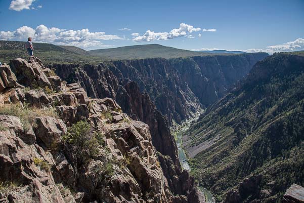
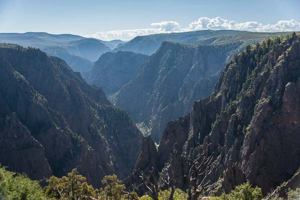
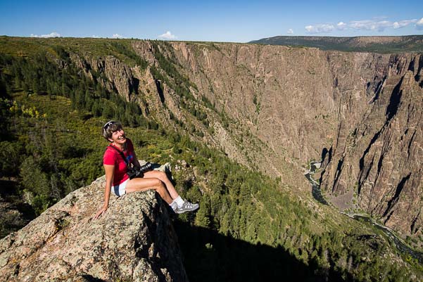
Black Canyon of the Gunnison National Park, CO – Steep and Deep!

Bikes on Castle Creek Road in Colorado

Bicycles on scenic Castle Creek Road

September, 2014 – Maroon Bells may be the most photographed spot in Colorado’s Rocky Mountains, but nearby Castle Creek Road is also very scenic and not nearly as heavily visited.

We drove out one day and passed a steady stream of cyclists enjoying an exhilarating road ride. What a place for a morning workout!

A tiny historic ghost town named Ashcroft lies at the end of the road.

The old buildings were interesting, but we were more intrigued by a row of colorful rugs we saw hanging outside a shop very close by.

Teotitlan de Valle Oaxaca Rug Weavers

The rug weavers of Oaxaca come to Colorado!

Above the shop a sign read: “Welcome to the Catto Center at Toklat.”

We walked past the many rugs, admiring their designs, and then stepped inside.

We were suddenly surrounded by woven wool rugs that looked very similar to the ones we had seen near Oaxaca at Teotitlán de Valle in Mexico a few years ago.

A friendly looking woman was giving a demonstration to several tourists, showing them how the blue dyes were derived from indigo.

Views at Black Canyon of the Gunnison National Park Colorado

Black Canyon of the Gunnison

Our jaws dropped. That was exactly the same demonstration that we had seen in Teotitlán de Valle!

It turned out that this woman came from a family of rug weavers in that very same Mexican village.

I remembered vividly how our tour guide in Oaxaca had squished a bug in the palm of a girl’s hand to demonstrate how they made their red dyes (see my blog post about it here).

Apparently, the owner of this shop’s building had brought a few Oaxacan weavers to Colorado to promote their craft each summer. How fun!

Black Canyon of the Gunnison Colorado

The chasm is vast and deep

Where Maroon Bells and Castle Creek had shown us Colorado’s Rocky Mountains in the early stages of their fall glory, another land of stunning scenery — Black Canyon of the Gunnison — beckoned.

This canyon’s jagged cliffs are nothing like the soaring Rocky mountains.

Instead of craning our necks to look up at tall mountain peaks, the Black Canyon of the Gunnison is like a massive crack in the earth’s surface, with the sides parted to reveal sheer rock walls plunging nearly straight down to a thin ribbon of river far below.

Turkey vulture in flight

A turkey vulture soars past

The canyon wasn’t formed by the walls cracking apart, however. It was formed by the very fast moving Gunnison River cutting through the rock like knife.

The Gunnison River falls from great heights to great depths, dropping an average of 95 feet per mile. This keeps the water moving at quite a clip.

This raging water has cut through the black rock like a laser, deepening the canyon faster than other kinds of erosion can widen it.

Black Canyon National Park Colorado

The canyon is steep and deep!

At its narrowest point, it is just ¼ mile across, and the depths of the sheer walls range from 1,750 to 2,700 feet (by comparison, the Empire State Building is 1,454′ feet tall and would reach just partway up the walls!).

As we approached the rim at an overlook, we saw several turkey vultures circling right overhead. They played with the air currents and dove down into the canyon and rose back out again effortlessly.

What a thrill it would be to fly like that, letting the earth fall away from under you as you flew over the rim of the canyon!

The Black Canyon of the Gunnison fills a huge area along the Gunnison River, and there are two wonderful areas for exploring it: a National Park with an entrance on the south rim and a gorgeous scenic drive that snakes along Route 92 on the north rim.

Sitting on the edge of the Black Canyon of the Gunnison in Colorado

I got a kick out of crawling around on the ledges.


At the Visitors Center for the Black Canyon of the Gunnison National Park we noticed a bulletin board covered with little hand written notes.

“Happy Birthday, Wilderness!” a sign said, recognizing 2014 as the 50th anniversary of the Wilderness Act.

We learned that this 1964 Act set aside 110 million acres of land, created the National Wilderness Preservation System, and gave Congress the ability to designate official “Wilderness Areas.”


Craggy crevasse at Black Canyon National Park Colorado_

The “Painted Wall” is one of the most stunning overlooks.

Beneath the sign was a quote from Edward Abbey, novelist, environmentalist, and critic of public land policies.

“Wilderness is not a luxury but a necessity to the human spirit,” he was quoted as saying.

On this bulletin board, the rangers had posed the question, “What does Wilderness mean to you?” The notes tacked all over the board were full of thought-provoking answers:

“Free & Wild!” penned one person, adding a smiley face for emphasis.

Happy campers on the north rim of Black Canyon of the Gunnison Colorado

What a great place to explore!

“A place to discover who/what you are made of/for/by” responded another with a little red heart.

“It humbles me…puts me back in place,” someone had written. Next to that another had scrawled, “DITTO.”

I got a kick out of reading these notes.

In hindsight, it is especially interesting to read them now in light of the recent public outcry against restricting commercial filming in officially designated Wilderness Areas.

People treasure wild land.

Towering peaks at Black Canyon National Park Colorado

To get a feeling for the scale of the place, here’s our truck dwarfed by the peaks!

“Wilderness speaks…to my soul,” one card said.

Wildnerness is “one place in the world where man is insignificant and always will be,” another proclaimed.

The Black Canyon of the Gunnison is a National Park with the usual roads and overlooks. However, portions of it are officially designated “Wilderness.”

Yet, back in 1881-82, over 1,000 immigrants from Italy and Ireland worked in horrible conditions full of rock slides, avalanches, and unreliable explosives to push the Rio Grande narrow gauge railroad through this canyon.

At the base of the cliffs of Black Canyon Colorado

At the base of the cliffs of Black Canyon

It is hard to imagine the harsh working environment these men endured, sleeping and eating in wooden work cars and bedding down on wooden planks.

The Gunnison river at Black Canyon Colorado

We drove along the Gunnison River at the bottom of the canyon.

Staring down into the canyon from the overlooks that have been carefully designed and built by the National Park Service, it is even harder to imagine the raw triumph these men must have felt when the first train puffed its way through the canyon.

The trains and railroad had defeated the wilderness at last.

This railway was touted as the “Scenic Line of the World,” and the trains carried thousands of people and tons of goods and livestock through the canyon.


“Wilderness is my heaven,” says one of the cards at the Visitors Center.

“What a Creator we have! Praise His name!” says another.

Mirrored water in the Gunnison River at Black Canyon Colorado

The sun played on the leaves of the trees as they reflected in the water.

Down at the base of the canyon along the Gunnison River, the sun played with the green leaves of the trees and their reflections in the placid water.

Finding that delicate balance between our urge to conquer and make use of our most beautiful landscapes and our urge to protect them and leave them alone has challenged our leaders and thinkers for nearly two centuries.

Mark and I both read the Autobiography of Ansel Adams and were astonished to learn just how hotly the mission of the National Park Service and other public land agencies were debated in the early 1900’s.

Trees reflect in the Black Canyon's Gunnison River in Colorado

Mirror images in the Gunnison River.

We think of Adams as a photographer, but he was deeply involved in the early development of the Sierra Club, and he had very strong opinions about the National Park Service, most of them far from flattering.

He was fortunate to see these lands at their most untouched, and he felt that in many ways he was documenting a disappearing landscape.

Of course, he was not nearly as comfortable in his tent in the early decades of the 1900’s as we are running around in our luxury fifth wheel today. And that is the deepest irony of what “wilderness” really means.

River's edge Black Canyon of the Gunnison Colorado

At the river’s edge in the bottom of the canyon.

To make wild landscapes easily accessible requires roads, railways and other development. That gives us laymen a chance to get inside the scenery and enjoy the beauty.

But the very presence of those developments changes the landscape forever.

The “wild” in “wilderness” springs from its very inaccessibility. The more accessible it becomes, the less wild it can be, by definition.

Even though much of the Black Canyon of the Gunnison is officially a Wilderness Area, much of it has also been tamed.

Curecanti National Recreation Area

Curecanti National Recreation Area (Blue Mesa Reservoir) is at the east end of the Black Canyon of the Gunnison.

“Earth untouched by man,” is what ‘wilderness’ means to one person who answered the ranger’s query with a card on the wall at the Visitors Center.

Yet that very description is a dream and a fantasy for all but the most intrepid trekkers among us.

That kind of wilderness certainly isn’t a place you can drive by in a heated or air conditioned car, like the beautiful overlooks at the Black Canyon that are the only parts of it most of us will ever reach.

Perhaps the last card summed it up best:

Wilderness means “Hope — even if I never see those places that are truly wild.”

____________________


Although I wouldn’t drive a big RV on scenic Route 92 (where the views of the canyon are truly dramatic), this whole area can be enjoyed using Montrose, Gunnison or the Curecanti National Recreation Area as a home base. Lake Fork Campground is on the water’s edge at Blue Mesa Reservoir and was almost empty when we visited. Check out these links to learn more about:

More blog posts from our RV trips to Colorado:

<-Previous || Next->

Romance at Maroon Bells Colorado!

Green River at Flaming Gorge National Recreation Area

We waved “Hello” and “Goodbye” to the vivid Green River at Flaming Gorge.

Grand Teton National Park turned out to be our northernmost stop in our RV travels this summer, and at the end of our second week a cold spell swept through.

It was time to move on — and move south.

We traveled down through Jackson and Pinedale Wyoming and continued onwards south past the stunning Flaming Gorge National Recreation Area that straddles Wyoming and Utah.

We have spent a lot of time there in the past, so we just waved at the brilliant Green River, scooted by, and kept on going.

Read More…

Colorado GOLD – A Fall Foliage Photography Workshop

Telluride Colorado Dallas Divide Photography Workshop

Photo workshop students line up for the sunrise shot.

Late September, 2012 – We went to Ridgway, Colorado, for a landscape photography workshop, and the Colorado Rockies were bursting with fall foliage colors when we arrived.

Dallas Creek Road Colorado Fall Foliage Ridgway Telluride Golden Aspen

The rising sun lights up our view.

Our group of 20 or so photography enthusiasts gathered at Ridgway Lodge the night before the big shoot to review our camera equipment and basic photography techniques.  My, oh my, I have never seen so many top-of-the-line Nikon cameras in one room.

The next morning, before dawn, we all piled into four cars and set off for our first shooting locale.  A scenic overlook along Route 62 heading to Telluride is a favorite among photographers, and we all lined up in front of a fence to get shots of the rising sun as it cast its pink and golden light across the colorful foothills leading to the San Juan mountains.

Dallas Divide Colorado Fall Foliage Photography Workshop

Sunrise at the San Juan mountains.


Our instructor, Nasim Mansurov, gave marching orders for how to set up our cameras for this shot.  He wanted us to shoot in manual mode, something Mark understands but that I’d never done before.  His instructions were spot on, and as the landscape before us came to life, the images on our cameras miraculously did too.  How funny it was, though, to stand shoulder to shoulder with other photography buffs in the pre-dawn light, waiting for the magic to happen in front of us!!

Telluride Colorado Dallas Divide Photography Workshop

Golden aspens and evergreens.


As we progressed from one shooting location to the next, Nasim explained the importance of using “leading lines” in our photos to draw our viewers’ eyes into our pictures.  “If you go to Rome or Egypt you’ll see that the ancient architects used leading lines everywhere,” he told us.

At a small pond along Dallas Creek Road, he explained that the pier could be used to create a leading line coming in from the lower left corner of the photo.  Suddenly all the cameras pointed that way to try to get the shot he described.

Dallas Creek Road Colorado Ridgway Telluride Autumn Colors

We learned about using “leading lines” in our photos.


We stopped again, trying this time to incorporate an old, crooked, wooden fence into our images.  Nasim explained that the fence in the foreground would lead to the golden aspen in the mid-ground and then to the craggy mountains in the background.  Neither Mark nor I were happy with our results, but an elk hunter who was watching all of us crazy photographers crawling all over the wooden fence got a chuckle out of the scene.

Telluride Colorado Elk Hunter Dallas Divide

A hunter tells me of a celebrity wedding on Ralph Lauren’s property.


The hunter and I began chatting and he told me that at this time last year Jeb Bush’s son and Ralph Lauren’s daughter had gotten married on Lauren’s massive estate (he owns most of the stunning land in this area).  What an event that must have been, with Secret Service protecting two former presidents, and helicopters bringing in celebrities from all over.  Apparently all the national forest roads were blocked off for several days, annoying more than a few hunters and campers who were stuck on one side or the other!   Isn’t it ancient wisdom that if you’re gonna throw a big noisy party you gotta invite all your neighbors??!!

Dallas Divide Colorado Aspen Grove Last Dollar Road Photography Workshop

The aspen get paparazzi treatment!

When we came to an unusual canopy of aspen trees shrouding a section of Last Dollar Road, Nasim asked us all to hold back before we walked in among the trees so we wouldn’t get in each other’s photos.  This made for a funny paparazzi crowd at the entrance to the aspen grove.  Those aspens were getting celebrity treatment worthy of Ralph Lauren himself!!

Telluride Colorado Last Dollar Road Dallas Divide Aspen Grove Photography Workshop

Photography students roam around under the canopy of aspen.


After a few moments we all wandered into the stand of aspens and let our cameras loose.  What a blast!

Last Dollar Road Colorado Aspen in the Dallas Divide

Last Dollar Road Colorado Dallas Divie Aspen Grove

True love.

Mark and I were lucky enough to be passengers in Nasim’s station wagon for the entire workshop, so we were privy to some lively exchanges between him and the other very knowledgeable folks in the car about the merits of all kinds of gear and various photography techniques and tricks.

Telluride and Ridgway Colorado Fall Foliage on the Dallas Divide


Colorado Fall Foliage Photography Workshop - what's in your bag?

A mascot comes along for the ride.

We heard about polarizing filters, graduated neutral density filters, and the quality of this lens versus that.  We chatted about figuring out an image’s hyperfocal length and dividing an image’s composition into thirds.  The discussions were fast and furious.  For us, it was an intense immersion into a new, exciting world.

As we piled in and out of the car all day, camera bags got loaded on and off laps at every stop.  And although each pocket of every camera bag was stuffed to the gills with the latest and greatest gear, Mark found one pocket that had been reserved for a special companion…

Dallas Divide Colorado between Ridgway and Telluride Fall Foliage Colors in the San Juan mountains

Inspiring Colorado views!


When the day began to wind down, we stopped for a sunset shot looking back across fields of hay bales towards the mountains.  Unfortunately, the sky didn’t cooperate with magical colors, and many of us had worn out our shutter fingers by then and reached the point of saying, “No more!!”  But Mark was still going strong, and he took one of my favorites shots for the whole day of a fence tucked snugly into a field of wildflowers.

Colorado wildflowers

Folks had flown in from all over the country, and some didn’t have to leave for another day or two, so an impromptu group gathered to take more photos the next day.  But the weather was deteriorating rapidly, and the crisp blue skies gave way to clouds and rain.  When we finally left the area, a heavy rain had fallen overnight, which blessed us with a sprinkling of snow on mountains.

Telluride Colorado Dallas Divide Fall Colors snow on mountains

What a glorious drive from Telluride towards Dolores!

Our drive from Telluride southwest to Dolores was among the most beautiful I have ever seen.  The aspens were rich in color and heavy with moisture, and the skies seemed to be brooding about the coming winter.

Telluride Colorado Dallas Divide Snowcapped Mountains and fall colors

Majestic scenery in every direction.

The aspens filled in the valleys with a vivid tapestry of green and yellow, and when I caught Mark smiling beside the edge of the road at one point, it seemed like he was standing in front of a painting.

Telluride Colorado Fall Foliage at the Dallas Divide

Is that backdrop real??

Route 62 Telluride Colorado Dallas Divide Aspens

The views continued to inspire us as our buggy sashayed along the twisting mountain roads through the mountains.  We stopped briefly at Lizard Head Pass and again in the tiny hamlet of Rico, shivering in the growing cold and sharing the exquisite views with all the other lookie-loos who’d gathered in the scenic pullouts alongside us, cameras and grins flashing.

Telluride Colorado San Juan Mountains fall foliage

The misty mountains got a little blue sky.

San Juan Mountains Colorado fall foliage

Nature’s tapestry.

Lizard Head Colorado Rocky Mountains

Colorful mountains beside Trout Lake


Finally, and sadly, the postcard landscape eventually came to an end.  We had been treated to a glorious stay in this gorgeous part of Colorado at the most colorful time of year.  As we dropped south out of the mountains into more mundane scenery, the brilliant images we had left behind became a blur in our memories.

Dallas Divide Telluride Colorado Autumn Colors aspen

Fields of gold.


What a place.  If you haven’t seen the fall colors in Colorado, it really deserves a spot on your lifetime bucket list!!!  The magic happens sometime around the third week of September…

Rico Colorado fall foliage

Rico, Colorado – near the end of this magical drive.


Of course, our next stop in New Mexico’s Bisti Badlands was pretty exotic too, and it capped off one of our best summers in our trailer!

<- Previous                                                                                                                                                                                      Next ->

Subscribe
Never miss a post — it’s free!

Related posts about Colorado’s spectacular fall color and where to see it:

More blog posts from our RV trips to Colorado:

Our most recent posts:

More of our Latest Posts are in the MENU.
New to this site? Visit RVers Start Here to find where we keep all the good stuff!!

Ridgway, CO – Peak fall foliage on the Dallas Divide – WOW!!

Ridgway Colorado Fall Colors - Owl Creek Pass Chimney Rock Dallas Divide San Juan Mountains

Chimney Rock, Owl Creek Pass

Late September, 2012 – Over the summer, while I busied myself converting our website to WordPress, Mark delved into a passionate study of photography.  Pouring over books and websites for days at a stretch, his photography skills soared.  Mine improved a bit too, since he had a tendency to read every favorite passage (which was pretty much everything) out loud.

Ridgway Colorado Autmn Foliage Yellow Aspens Owl Creek Pass Dallas Divide San Juan Mountains

Owl Creek Pass

In his studies he found a photographer who was offering a one day Fall Foliage Landscape workshop in Ridgway, Colorado, at the end of September.  We signed up immediately.  For over a month, getting to Ridgway by September 22nd  shaped our travels.

We left Fruita, Colorado, behind, and trucked down to Ridgway a few days before the workshop so we could begin the hunt for a spot to boondock.  We drove the dirt road that goes up and over Owl Creek Pass, and were thrilled to find one absolutely jaw-dropping vista after another.  The aspens were at the peak of color and the air was crisp and cool.  Our camera shutters clicked like mad all day.

Ridgway Colorado True Grit Shootout Location Owl Creek Pass

Gotta truck camper? What a boondocking spot! It’s also where the shootout took place in John Wayne’s “True Grit.”

We found an ideal boondocking spot, but there was no way we could ever get the trailer to it on that skinny, steep dirt road.  After admiring the spot for a while — and imagining how we’d set up camp and orient the rig to maximize the view — a couple showed up.  The husband walked over to me.

“Are you a True Grit fan?”  He asked.  “Did you know this is the location of the big shootout near the end?”

True Grit?” I said dumbly.  “Is that a movie?” Mark smirked and the guy raised an eyebrow.

“It’s one of John Wayne’s best ones!  A lot of it was shot right here on Owl Creek Pass!”

Ridgway Colorado True Grit John Wayne Drunk Scene Owl Creek Pass

Mark channels John Wayne.

We drove on and Mark filled me in on John Wayne.  I confess that I didn’t know a whole lot about his movies, so Mark had a lot to say since he had been a big fan as a kid.

Ridgway Colorado True Grit John Wayne Drunk Scene Owl Creek Pass

The Duke gets drunk on Owl Creek Pass

Up around the corner we came to another gorgeous clearing in the woods with a peek-out view of the colorful mountains.  That guy we’d just talked to and his wife pulled up at the same time.

“This is where John Wayne got drunk!” He said, plopping down on a rock and posing as if taking a swig.  His wife took a few photos of him, lining up the mountains in the background. Then he hopped up and motioned for Mark to sit down and for me to get a similar picture.  I had no idea how the shot was lined up in the movie, but I took a guess while Mark pretended to tip back a bottle.

Ridgway Colorado Fall Foliage Dallas Creek Road San Juan Mountains Dallas Divide

Dallas Creek Road

A few days later,  we located a copy of the movie and  waited eagerly for the drunk scene on the mountain — and then there it was!  We had gotten the shot pretty darn close!

Ridgway Colorado Autumn Colors West Dallas Creek Road Dallas Divide

This spot always has photographers in it.

The next day we met up with our workshop instructor, Nasim Mansurov of PhotographyLife.com, and we piled into his car along with some other students to scout out locations for the workshop the next day.  What fun!  We started at the fence where we would take our morning sunrise shot.  This is a very popular place for photographers, and sure enough a few were there with cameras set up on tripods.

Ridgway Colorado Fall Colors West Dallas Creek Dallas Divide San Juan Mountains

West Dallas Creek Road

Ridgway Colorado Autumn Foliage Dallas Creek Dallas Divide San Juan Mountains

Dallas Creek Road

We drove out on Dallas Creek Road where the colors ran from yellow to vivid reds and oranges.  One of the key pieces of equipment for this workshop was a polarizing filter that would enhance the fall colors.  I had inadvertently left the one for my wide angle lens on our boat back in March. Arrghh!!

However, I did have the one for my 55-300 mm lens.  So here I was looking at these wide open, vast, colorful panoramas with a telephoto zoom lens. Oh well! I focused on finding patterns in the landscape.

Ridgway Colorado Fall Foliage Dallas Creek Road Dallas Divide San Juan Mountains

Dallas Creek Road

Ridgway Colorado Fall Colors West Dallas Creek Road Dallas Divide San Juan Mountains

West Dallas Creek Road

Telluride Colorado Autumn Colors Last Dollar Road Dallas Divide San Juan Mountains

Last Dollar Road


Ridgway Colorado Fall Foliage West Dallas Creek Road Dallas Divide San Juan Mountains

We drove on a washboard dirt road…(smile)

Mark tried some wonderful artistic techniques he’d read about, and got some cool effects.

Ridgway and Telluride Colorado Coyote

A coyote poses for an instant.

On our way down out of the mountains on Last Dollar Road we passed a coyote who posed just long enough for us all to hang our cameras out the car window and take some shots.

Coming into Telluride, the afternoon sun lit the entire town in brilliant colors.  We had fallen in love with Telluride years ago when we visited in a car with a tent.  But that had been in July when the town’s colors were grey and green from the mountains and trees.  Now it was a kaleidoscope of colors and was truly sensational.

Telluride Colorado Fall Colors

Telluride’s red rocks and golden aspen

We were both ecstatic to find ourselves surrounded by such beauty.  Colorado is challenging for our style of RVing, since the roads are steep and narrow and there are rules and regulations preventing RVs from parking just about anywhere.  So we had decided against it as a destination — until this workshop.  Sure enough, we never did find a place to boondock.  After four months of never paying a dime to camp, we suddenly found ourselves paying $29 a night for a site at Ridgway State Park.  Ouch, that hurt!!  But the thrill of taking photos in this incredible location was worth ever penny.

Telluride Colorado Autumn Foliage

Telluride – one of America’s prettiest towns!

That night we oohed and ahhed over each other’s pictures as we downloaded them on our computers.  We could hardly wait for the workshop to begin on the Dallas Divide the next morning with the sunrise shot at oh-dark-thirty.

Last Dollar Road Colorado Fall Foliage

Last Dollar Road on the way down to Telluride

<- Previous                                                                                                                                                                                       Next ->

Subscribe
Never miss a post — it’s free!

Related posts about Colorado’s spectacular fall color and where to see it:

More blog posts from our RV trips to Colorado:

<-Previous || Next->

Our most recent posts:

More of our Latest Posts are in the MENU.
New to this site? Visit RVers Start Here to find where we keep all the good stuff!!

Colorado National Monument & Fruita CO – Red Rocks, Cycling & Wine!

Fruita Colorado National Monument Mountain Biker

Fruita is cycling heaven!

Mid-September, 2012 – We dropped south from Dinosaur National Monument to Fuita, Colorado, where we found a huge billboard of a mountain biker catching air on the side of an industrial building. How cool! We had heard from friends that this area was mountain biking and road cycling heaven, and so it was!

WTF - Welcome to Fruita

Besides a vibrant mountain biking culture — or maybe because of it — this town seems to enjoy being a little bit irreverent. Stickers and patches emblazoned with “WTF” were for sale everywhere. It’s short for “Welcome to Fruita.”

Fruita lies to the west of its much bigger neighbor, Grand Junction. Paved bike paths weave along the edge of the Colorado River, which flows alongside by these towns, and we enjoyed several rides in the area.


Fruita Colorado Paved River Bike Path

Paved bike paths weave along the river.

Colorado National Monument - Scenic Rim Rock Drive

Scenic Rim Rock Drive

However, most serious road cyclists here head into Colorado National Monument to take on the challenging climbs and sweeping descents of Scenic Rim Rock Drive. We decided to tackle it with the truck instead, so we could bring spare lenses and tripods, and were told at the gate, “You can do the drive in about 45 minutes…”

Colorado National Monument a great place to take your RV!

Beautiful views!

Four hours later we’d made it through only half of the park! What a stunningly beautiful drive. It is loaded with gorgeous viewpoints and short hikes, and we found it impossible to drive straight through without stopping every few minutes. We came back the next day to try to see the rest of it, and after another four hours still hadn’t seen it all.

Colorado National Monument - Window Rock

Window Rock

The road twists and turns along the edges of the canyon, poking out onto peninsula-like points and winding back around valleys, offering ever-changing views of red rock formations. One of the most impressive pinnacles is Independence Monument, a 450 foot tall monolith that dominates the center of the valley.

Fruita Colorado National Monument - Independence Monument

Independence Monument

As we scrambled along the wonderful flat rock shelves that make up the Canyon Rim and Window Rock hiking trails, we kept hearing voices from the valley below us.

Rock climbers on Independence Monument at Colorado National Monument

Watch this!!

We couldn’t tell exactly where they were coming from for the longest time, but then suddenly a group of people appeared on the top of the spire. Independence Monument is a tall skinny rock, and the tiny figures ambled around on top, peering over the edges.

Suddenly they threw a rope over the side and started rappelling down. Now this is not just a straight sided cliff. There is a huge rock overhang at the peak, and each climber dangled for a few moments on the rope, bumping his way down until he got his footing on the rock below. Yikes. We were glad to have lots of solid footing all around us on all sides!

Monument Canyon at Colorado National Monument

Monument Canyon

We learned later that every Fourth of July local climbers scale this peak and plant a huge American flag on the summit of the spire.

The first climber to scramble up that sheer rock wall was John Otto, and today’s most popular route to the top is the one he took in the early 1900’s. He loved this canyon and wanted it to be preserved for future generations, and he campaigned tirelessly for the creation of the Colorado National Monument.


Devils Kitchen - Colorado National Monument

Devils Kitchen – for scale, see my red shirt!!

It was finally established in 1911. Not only did he oversee construction of Rim Rock Drive, which was initially called the Serpents Trail with 52 switchbacks in just four miles, but while he was the park’s first custodian he created many of the hiking trails that are still enjoyed in the park today.

Fruita Colorado National Monument Cold Shivers Point

Cold Shivers Point

Even more intriguing than the official park history, however, was the bizarre history we found engraved in the stones at Cold Shivers Point. As we walked towards the edge of this spectacular overlook, stepping across nature’s broad, unevenly spaced patio stones, we looked down and saw each one was etched with all kinds of names, initials, and dates. The dates ranged as far back as the early 1930’s, and included every decade to the current year.

Fruita Colorado National Monument Cold Shivers Point graffiti

Engraved initials date back to the 1930’s

Some names were big, some small, some were in pairs with a plus sign, and others were surrounded by hearts.

Fruita Colorado National Monument Cold Shivers Point graffiti

The Wongs were here 70+ years ago

The Wongs had included a Chinese character, and “R.A.S” had pecked his/her initials out like a woodpecker in 1938.

Fruita Colorado National Monument Cold Shivers Point graffiti

This guy used a woodpecker technique

This was a lover’s lane of sorts, and we found out later it has also been used as something of a lover’s leap too.

Back down in the valley of Fruita we discovered this area is rich farmland. The farmer’s market had some of the most wonderful fruits and vegetables we have sampled anywhere. The apples were tiny but crisp and bursting with flavor, the cucumbers tasted heavenly — who would think a cucumber could taste heavenly? — and the melon stand had a line of people around it slurping noisily. “We don’t have to go to Green River to get good melons,” an old fellow said to me, wiping his chin. We knew what he meant. We’d been to Utah’s Green River during the melon festival years ago, but these melons were every bit as delicious.

Fruita Colorado Farmers Market band

A band was playing at the farmer’s market

A lady selling alpacas and their wool kept the kids occupied for hours. These friendly, gentle animals made sweet humming noises as the kids hung over the fence and petted their thick fur. They are relatives of camels, she told us, but they’re so much cuter!

Fruita Colorado Farmers Market Alpacas for sale

Alpaca

This is also wine country, and on the other side of Grand Junction the small town of Palisade is home to lots of vintners. We drove the wine route and sampled some delicious wines. The port wine from Graystone Winery  was my favorite, while Mark fell for a white wine early on in our tour. But by the end neither of us could remember which one it was!!

Fruita Colorado Palisade Colorado Wineries and Wine Country

Palisade boasts lots of wineries

In late September we often go to the Interbike trade show in Las Vegas to check out the latest bicycles and cycling gear.  This year, however, we opted to attend a photography workshop in Colorado instead.

Fruita Colorado Palisade Colorado Wineries

We had fun on a wine tour

We did get a tiny whiff of bike stuff, though.  A friend of ours builds bicycle wheels at DT Swiss in Grand Junction, and we got a peek at the shop. Spokes were flying off the production line and the truing stands were whirring at this small, high end bicycle wheel manufacturer.

Grand Junction Colorado DT Swiss Wheel Building Factory

DT Swiss bicycle wheel builders

Soon the photo workshop day arrived, and we made our way to Ridgway, Colorado, where the leaves were in the absolute peak of color. What a majestic place that turned out to be!!

More blog posts from our RV trips to Colorado:

<- Previous                                                                                                                                                                                       Next ->


Mesa Verde National Park, CO – Life on the Edge with the Ancients

Great pics and stories from our trip to Mesa Verde National Park. Also includes our visit to Blanding, Utah and Utah's Bicentennial Highway.

Unusual rock formations line the road.

A deer says

A deer says "hello" at Mesa Verde.

We peer out over The Tower House, Mesa Verde Nat'l Park

The Tower House, Mesa Verde Nat'l Park

We take a closer look at The Tower House, Mesa Verde Nat'l Park

Stone masonry from sandstone bricks.

The Ansazi built round walls as well as straight ones at The Tower House, Mesa Verde Nat'l Park

They were as good at round walls as straight ones.

Communities are tucked under overhanging cliff walls.

Communities are tucked under overhanging cliff walls.

Looking closer in at Balcony House.

Looking closer in.

Mesa Verde was scarred by wildfilres but the cliff dwellings survived unharmed.

Above the cliffs is flat land -- some has

been burned by wildfires.

You'll need a telephoto lens or binoculars to see the cliff dwellings across the canyon at Mesa Verde.

A closer look at the buildings below.

The Ancestral Puebloans built split-level homes in caves along the canyon walls at Mesa Verde.

Split-level living with some buildings on a higher ledge

and others on a lower one.

The Cliff Palace is the biggest Anasazi ruin at Mesa Verde Nat'l Park.

Cliff Palace.

Here are a few of the rooms at Cliff Palace.

A closer look at Cliff Palace.

A tour group walks through the Cliff Palace ruins.

A tour group walks through the Cliff Palace ruins.

An above-ground structure at Sun Temple.

An above-ground structure at Sun Temple.

The Far View Sites.

Don't Touch!!!

No climbing -- unless you're a

ranger.

There are beautiful fields and farm country between Colorado and Utah.

Landscapes as we leave Colorado and enter Utah.

We met a young, hard-working cowboy in Blanding.

The real deal.

Winter wheat at twilight in Blanding, Utah.

Winter wheat at twilight.

An old truck out back behind JM Welding.

An old truck out back behind Jack's shop.

Twilight in the fields around Blanding Utah.

What else to do while waiting for work

on the trailer - take photos!

The round plastic handle was becoming square.

An excellent welding shop that does awesome metal fabrication:  JM Welding in Blanding, Utah. What our hitch extension will look like.

The design.

Jack brings us the finished product.

Jack and the finished product.

Here's how our hitch extension works and what it does.

How it works and what it does.

Finished product.

Ta da!!

Photos from the Bicentennial Highway, Scenic Route 95 in Utah.

The Bicentennial Highway, Route 95 in Utah.

These are typical rock formations seen along the Bicentennial Highway, Scenic Route 95 in Utah.

Typical sights along the "Bicentennial Highway"

Here's one of many spectacular views along the Bicentennial Highway, Scenic Route 95 in Utah.

Scenic Route 95.

We spot a perfect boondocking spot.

"Oh oh oh oh -- it's perfect!!"

We're happily camped alongside the Bicentennial Highway, Scenic Route 95 in Utah. Views out our window from our boondocking spot on the Bicentennial Highway, Scenic Route 95 in Utah.

View out the window.

We have found one of the most amazing camping spots ever, on Scenic Route 95 in Utah.

No one for five miles in any direction.

Here's why we love RVing in Utah.

Why we love RVing in Utah.

Mesa Verde National Park & Eastern Utah.

Early June, 2012 - The mysterious cliff dwellings of Canyon de Chelly

National Park in Arizona had inspired us, so now we pointed our buggy

in the direction of Colorado's Mesa Verde National Park where another

massive cluster of cave homes lines the canyon walls.

We passed many

dramatic rock

formations on our

way, and we were

greeted by a deer

when we first

entered the park.

Mesa Verde is a vast park that requires a lot of driving on hilly twisty roads to

see all the sights.  We were surprised by the huge number of tourists crammed

into the Visitors Center, especially compared to the quiet and laid back nature

of Canyon de Chelly.  This is a park where you could easily stay a week or

more.  The place is packed with different cliff dwelling structures as well as

above-ground ancient Indian ruins.

We tried to get our bearings quickly and headed out to the

Square Tower house.  After driving some 10 miles or so

through the park winding along hill crests on curvy roads, it

was quite a surprise to walk down a short trail, turn a

corner, and find ourselves staring down at a beautiful intact

ruin.

The little community stood tightly pressed against a back-sweeping cliff

wall.  The tower building was four  stories tall with a large window on each

floor.  But it all looked like a miniature doll house compound down there, far below our feet.

The buildings are made of sandstone bricks, each one about the size of a

loaf of bread, and they are mortared with a mixture of dirt and water.  The

Ancestral Puebloans - or Anasazi - built these structures around 1100 to

1300 AD, but sadly left no written documentation behind.

At the Mayan ruins of southern Mexico we had been shocked to discover

that entire dynastic histories are known in detail today, right down to kings'

birthdays, city-state conquests and squabbles for power.  However, at

these Indian ruins in Colorado we learned that very little is known with

certainty about the people who built and lived in them.

As we wound along the tops of the canyon walls, we were amazed to look

out across the narrow ditch and see all the tiny dwellings tucked into the

opposite canyon wall.  At first all we could see was the faces of the cliffs,

but as our eyes adjusted to spotting the cave homes across the way,

suddenly they become obvious in every nook and cranny.

The park offers inexpensive tours of most of the ruins, but we contented ourselves

with getting an overview of it all from the top rather than climbing down in.

When we finally reached the Sun Temple overlook, the best place

to view the magnificent Cliff Palace ruins, we were amazed by the

complexity and density of the buildings.  It was a complete town

nestled into a cave midway up a rock wall.

A tour group was passing through the ruin, and the tiny, brightly

colored people walking among the buildings gave us an interesting

perspective on this place.  This canyon and its massive rock

formations is immense and timeless.  But the people who built their

homes here stayed for just a few generations and filed through this

ageless place rather quickly.  Fortunately for us today, they left a

most unusual signature behind: uneven, jam-packed housing.

We learned that the

first people to settle

this region were the

Basketmakers who wove very fine

basketry and built pole-and-adobe

houses above ground starting

around 750 AD.  By 1,000 AD, just

before the Norman conquests of

England, they began building their

homes using stone masonry.

Interestingly, archaeologists say

their basketmaking skills showed

a marked decline once they

began to specialize in masonry.

It's intriguing to me that one skill rose while another

fell.  And isn't it still so true today.  We are all expert

at moving over ground at 60 mph but most of us

would balk at killing, plucking and carving up a

chicken for dinner, something our great-

grandparentss happily did years ago.  We have all

become so adroit with electronic and keyboard

technology, but gosh darn if we aren't all forgetting

how to spell.

We wandered among the above-ground dwellings

and hiked around the Sun Temple and Megalithic

house.  Like the Mayans at Bonampak who had

created an elaborate series of murals inside one

of their ruins but abandoned the building before

it was finished, here at Mesa Verde the Anasazi

had also abandoned their property before it was

totally completed.  It is baffling to ponder how a

society can reach such heights of sophistication

and then vanish.

Unlike the Mayan ruins, however, where today's

visitors can scamper all over every building at

will, we saw signs posted everywhere telling us

not to touch or climb on anything.

Rangers, of course, are excepted…

Somewhere in our meanderings through Mesa

Verde we realized that we had reached total saturation with seeing the ancient

dwellings of antique cultures.  We had seen some of the best of the best in the

last six months, and we were ready for a change of pace.

We left the Indians and Colorado behind and

crossed over into Utah, stopping at a gas station

to fill the truck.  From somewhere in the distance

we heard the clank-clank-clank of spurs coming

towards us, and suddenly we found ourselves

face to face with a cowboy.  Not a cowboy-hatted

urbanite donning the clothes and stance of his

country idol, but the real deal: a young,

hardworking cowboy who had just finished a dirty

week of cattle work.

When he started gassing up his truck, Mark struck up a conversation.  It turned out he'd been

ranching all his life and now commuted every other week between Ogden at the north end of Utah

and Blanding a few hundred miles south at the other end of the state, to work on a ranch.  He beamed

as he told us he had just found a house in the Blanding area so he could move his family down this

way.  "Heidi is real happy," he drawled slowly, his bright blue eyes twinkling.

We asked him if our planned drive along Route 95 would be okay with our big truck and trailer (we

had read something about 8% grades).  "Oh yeah," he said very slowly.  "It's a real pretty drive.

That's how I go back and forth to Ogden."  What a life: outdoors all day in some of the country's most

dramatic landscapes, and commuting to work on a National Scenic Highway.

Reassured that we would't be facing any gnarly

driving, we left the gas station and promptly

bottomed out the back end of the trailer on the

lip of the driveway.  Our brand new bike rack that

we both just love scraped the pavement loudly

and the truck ground almost to a complete stop.

Mark made a face at me, and we leaped out of

the truck to check the damage.  "We gotta fix

that!" He said nervously.  But we were both

relieved that there was no damage worse than a few scratches.  Our fantastic

new bike rack has been such a great addition to our travels this season, but it

hangs way out from the back of the trailer.  This was the fourth time we'd

scraped it hard on the ground, and the once-round plastic knob on the back

was becoming rather square.

We drove over to the Visitors Center and found an old fellow deep in conversation with

the lady behind the desk.  We asked if there was a good welder in town who could

fabricate something for a trailer hitch.  They told us that JM Welding just on the edge of

town by the airport would do a great job for us.

Still uneasy about the Scenic Route 95 ahead of us that was known to

be so beautiful but scurried diagonally across the Utah map as if it

were a cat chasing a butterfly, I asked the pair if that route was okay

for a big truck and trailer.  "Route 95?" the man said, "Why, I built that

road."  Turns out that the construction of this road, known as the

Bicentennial Highway, had spanned from the 1930's to 1976 when it

finally got paved, and this man, Ferd Johnson, had been part of the

team that built it.

"We all lived out in the canyons for two and a half years while we built

that road."  He said, telling us how rugged and wild and beautiful the

land was.  "There are three bridges crossing the Colorado river, and

those were tough…" he trailed off.  The lady behind the desk piped

up.  "I did the drive once with him," she said nodding in his direction,

"and he talked the whole way.  He had a story about

every mile of that road."

We left really excited to see this

scenic highway for ourselves.  But our

first stop was at JM Welding.  Jack,

the owner, understood exactly what

we wanted and said he could order

something like that and have it for us

tomorrow.  "Or I can build one for you

right now that would be better quality

for about the same cost."  Go for it!!

He grabbed a piece of chalk from his

pocket and drew an outline of a z-shaped

hitch extension on the shop's concrete

floor.  Within moments his son had cut the

pieces and welded them.  Jack powdered

coated it and cooked it for an hour while we chatted with Jed,

one of Jack's long-time customers who had just showed up.

"I'm really looking forward to driving that famous scenic Route

95 tomorrow," I said, making idle conversation.  Jed looked at

me blankly.  "Scenic road?  There's a scenic road out

here?"  I did a double-take.  "You know, that Scenic Route

95.  You take a right just a mile south of here…"  He

scratched his head.  "Oh, right…of course…oh yeah.  I

drive that road all the time.  It's pretty."

As we drove this magnificent road over the next two days,

our jaws dropping repeatedly at the stunning beauty around

us, we had to laugh.  Utahans live in some of the most

spectacular scenery America has to offer, but I guess after

a while it becomes an ordinary backdrop for their lives.

In no time Jack had finished our hitch extension

and Mark mounted it on our trailer.  Suddenly all

our fears of grinding our new bike rack into the

dust while boondocking down rough dirt roads

vanished.

Next morning, after a peaceful

night parked out behind Jack's

shop where fields of winter wheat

waved softly in the twilight and

dawn, we struck out on scenic

Route 95.

From red rock cliffs to exotic

pink-and-white striped swirling

rock formations to dramatic

descents into vivid green valleys,

we drove with our heads turning

constantly.

I literally hung

my whole

upper body out

the window a

few times to

snap photos at

55 mph.

The road swerved here and

there, curving deliciously

between cliffs and canyons.

Suddenly I saw a dirt road

scooting off to a wide flat

plateau.  "Oh oh oh!!!"  I

cried, not quite getting any

words out.  "It's perfect!"

Mark skidded to a stop,

squeaked out a u-turn and

drove back.  What a

sweetie!

Down the dirt road we went, bumping along to the most fabulous

and dramatic boondocking spot.  There wasn't anyone around

us for at least five miles in any direction, and we had the

canyon, the cliffs and the sky to ourselves.  That is the magic of

RVing in Utah.  50% of the state is public land, and you can

camp anywhere you dare to take your rig.  It was so beautiful we

stayed for a few more days before exploring Natural Bridges

National Monument.


More blog posts from our RV trips to Colorado:

Our most recent posts:

More of our Latest Posts are in the MENU.   New to this site? Visit RVers Start Here to find where we keep all the good stuff. Also check out our COOL NEW GEAR STORE!! *** CLICK HERE *** to see it!