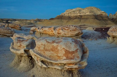
Beehive Trail in Arizona – A “Mini Wave” hike by Lake Powell

May 2024 — On our recent RV trip to Lake Powell we came across a fun little hike that is near Lake Powell, just over the Glen Canyon Dam from town of Page, Arizona. It’s called the Beehive Trail, and it’s pretty obvious why: the predominant rock formation resembles a beehive!

Beehive Trail Arizona - hiking in the red rocks by Lake Powel

Hiking the Beehive Trail is lots of fun!

The whole area is a wide expanse of relatively flat boulders, and you can head in any direction from the trailhead. However, if you like to follow a real trail, the National Park Service (managers of Glen Canyon Recreation Area where Beehive Ttrail is located) has outlined a path across the boulders using two lines of small rocks to show their suggested route.

Our Trail Scout (our beloved pup, Buddy) promptly hopped on the trail and showed us the way.

The Trail Scout leads us to the Bee Hive

Buddy, our Trail Scout, bounded ahead of us on the Beehive Trail.

What makes this rock formation very “beehive-like” is the thin layers of rocks that lie like shingles overlapping each other very slightly.

The side of the namesake Bee hive on Beehive Trail Arizona

Narrow “shingles” adorn the sides of the beehive.

The thin lines curve this way and that, making wonderful patterns everywhere.

Swirling patters in the rocks on the Beehive Trail near Page Arizona

Curvy layers.

Beehive Traile rock patterns Page Arizona

Straight layers.

Pup on the Beehive Trail in northern Arizona

A mix of layers leading up to Buddy!

People compare these layered undulations to The Wave, a nearby sandstone formation that resembles a fabulous curling ocean wave. Both formations were undoubtedly created by similar forces: small trickles of water rolling downhill followed by extended periods of very high wind.

The hike was super easy, but we kept getting waylaid by the fantastic shapes and contours that begged to be photographed.

Beehive hike rock patterns Arizona

Creases and layers on the side of the beehive.

Beehive Traile rock patterns in Arizona

Such great patterns!

Beehive Trail near Lake Powell Arizona

.

We ended up doing the hike several times at various times of the day, and each time it was a completely different hike.

The spring flowers were blooming, but we discovered that some of them liked to sleep in in the morning! So, if we got out on the trail too early they were all closed up! Later in the day, though, they blossomed to their fullest.

There were a few magenta cactus flowers in bloom here and there, and late one afternoon we noticed one that was backlit. So pretty!

Cactus flower

These humble cacti burst with color each spring!

Backlit cactus flower on the Bee Hives hike near Page Arizona

The cactus flower wore a halo when the sun shone through its petals.

Early in the morning, we found evening primroses that were still opened up. Once the sun had ascended into the heavens, these delicate flowers quietly closed, saving their beauty for the next evening.

Primroses blooming on the Bee Hives Hike in Arizona

Evening primroses were still open in the earliest morning light.

The whole hike is about 45 minutes if you follow the loop trail and circle around the beehive rock formation in the middle without stopping too much, but we just couldn’t go that fast. This was a special moonscape that was worth savoring, even sitting down!

Photography in the rocks on the Beehive Trail near Page Arizona

.

Our favorite time was late in the afternoon. Not so late that the sun was setting, because by then all the shadows were gone and the landscape flattened out. But a bit before sunset when the sun cast a burnt orange glow across the red rocks.

Guiding rocks on the Beehive Trail near Page Arizona

The beehives beckon at the end of the day.

Buddy loved being out there, and we always conferred with him about which direction we’d go.

Conferring on the hiking trail at Bee hive Arizona

“Which way?”

He liked posing amid the rock formations too. He’d run ahead and then pose as he waited for us slowpokes to come along.

Happy pup on the Beehive Trail in Arizona

Buddy waits patiently for us, his colors blending in with the surroundings.

Like a true model, he took different poses and faced in different directions.

Happy pup on the Beehive Trail near Lake Powell Arizona

“Do you like my front side?”.

Happy pup doing the Beehive Trail

“Or my left side?”

The trail scout leads the way on the Beehive Trail in Arizona

“Or my back side?”

There were some fabulous rock pinnacles at the furthest point in the hike. You can clamber up to the base of these pinnacles or even scramble up the sides. Peering into the crack between two of these pinnacles we found a little oasis of scrub brush and small trees in a huge sandstone bowl.

Golden hour on the Beehive Trail near Glen Canyon Dam Arizona

We spotted a hiker between the pinnacles in the distance.

We saw other hikers each time we hit the trail, but it is the kind of place that is so expansive you never feel crowded.

Beehive Trail near Page and Lake Powell Arizona

.

We highly recommend giving the Beehive Trail a try. It is located just west of Glen Canyon Dam on US-89.

Beehive Trail Glen Canyon Recreation Area Arizona by Lake Powell

What a lovely surprise this hike turned out to be.

If you’re looking for a spot to camp, there’s a tiny campground right there opposite the trailheadl. There are only six sites and it is an extremely exposed and dusty place, especially when the wind howls in the afternoon. But it works if you don’t mind hiding inside when the dust flies. It is first-come-first-serve, and it fills up quickly during the peak spring and fall seasons.

Subscribe
Never miss a post -- it's free!

More info about Beehive Trail and the surrounding area:

Other blog posts from northeastern Arizona:

Our most recent posts:

More of our Latest Posts are in the MENU.   New to this site? Visit RVers Start Here to find where we keep all the good stuff. Also check out our COOL NEW GEAR STORE!! *** CLICK HERE *** to see it!

<-Previous || Next->

Capitol Reef NP – Cathedral Valley – A Stunning Backcountry Drive in Utah!

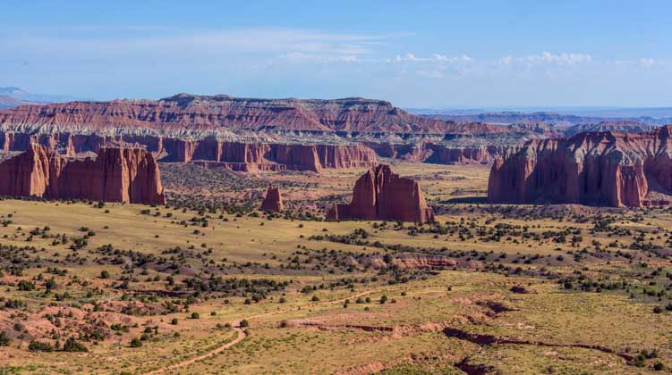
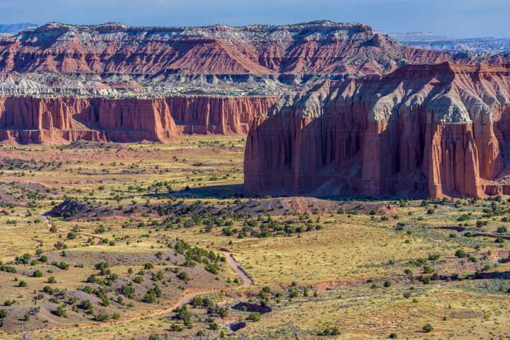
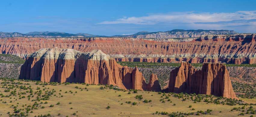
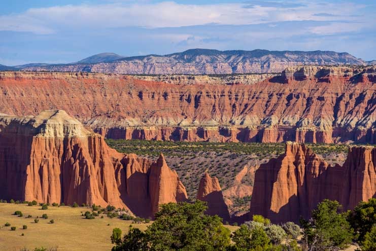
September 2019 – One day, while enjoying the beautiful lakes and woods of central Utah, we took our RZR up and over a mountain and found ourselves staring down into a world of stunning red rocks: Capitol Reef National Park’s spectacular Cathedral Valley.

Cathedral Valley Capitol Reef National Park Utah

We took our RZR for a ride in sensational Cathedral Valley — WOW!

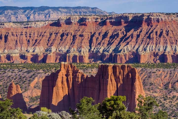
The road wound around through the mountain woods and passed a few small ponds and meadows and then branched off on a spur to an overlook. What a fabulous view!

View from a RZR Cathedral Valley Capitol Reef National Park Utah-min

The red rock towers of Cathedral Valley beckoned from a distance.

Lookout at Cathedral Valley Capitol Reef National Park Utah-min

Buddy looks out at the astonishing view.

Cathedral Valley Capitol Reef National Park Utah-min

Cathedral Valley lay far below us.

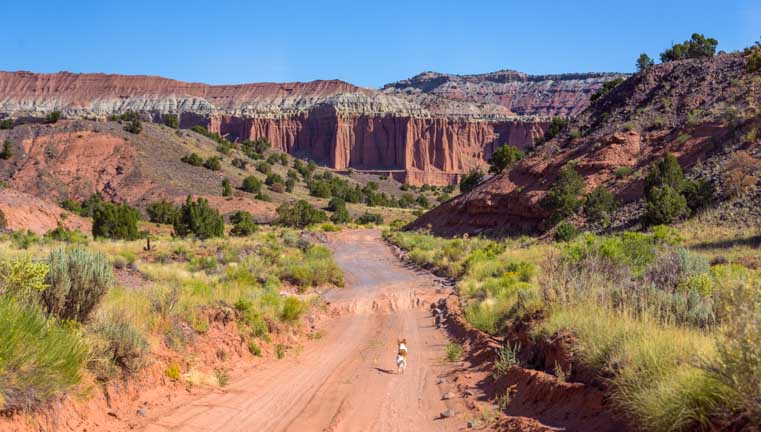
In the distance we could see a dirt road crossing the valley floor heading off towards the towering red rock cathedrals.

Road to Cathedral Valley Capitol Reef National Park Utah-min

A road through Cathedral Valley wound towards the pinnacles.

Towers in Cathedral Valley Capitol Reef National Park Utah-min

.

The road descended quickly and made some sharp switch-back turns.

First glimpse Cathedral Valley Capitol Reef National Park Utah-min

We got down towards the level of the valley floor.

We stopped on a little promontory and wandered around on a narrow sandy trail. Such views!

View of Cathedral Valley Capitol Reef National Park Utah-min

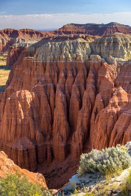
Exotic stone towers seemed to jut up from the desert floor.

Cathedral Valley Capitol Reef National Park Utah views-min

.

We rounded one final hairpin switchback turn and then the view widened. The towering cathedral pinnacles seemed within arm’s reach.

Cathedral Valley Capitol Reef National Park Utah view-min

“Cathedral Valley” is the perfect name for this place.

Cathedral Valley Capitol Reef National Park Utah pinnacle framed by tree-min

View through the branches of an old dead tree.

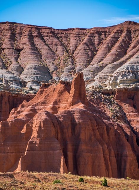
Some of the rock formations were sharp and jagged, while others had a more rounded and softer appearance.

Sandstone towers Cathedral Valley Capitol Reef National Park Utah-min

Some rock towers had knife-like edges. Others were softly rounded.

Striped sandstone formations Cathedral Valley Capitol Reef National Park Utah-min

Horizontal stripes and undulations

Pinnacles Cathedral Valley Capitol Reef National Park Utah-min

Varying shapes and layers.

Once we got down to the valley floor, our little canine trail scout, Buddy, insisted on showing us the way.

Puppy runs in Cathedral Valley Capitol Reef National Park Utah-min

The views made Buddy want to run run run!

Puppy runs in Cathedral Valley Capitol Reef National Park Utah-min

What a place!

We were all alone in a fantastic and desolate land. The sun was warm on our skin and there were exotic red rock cliffs and pinnacles in every direction around us.

RZR side-by-side ride in Cathedral Valley Capitol Reef National Park Utah-min

Moon unit in a moonscape!

We hopped out of the RZR onto the sandy trail, and down at our feet we noticed that even though we felt like we were alone, there were lots of other creatures enjoying this beautiful place along with us.

Footprints in the desert sand-min

We were not alone out here!

Further down the road a thin wall of pinnacles rose up on one side of us.

Cathedral Valley Capitol Reef National Park Utah-min

Some pinnacle walls were very sheer.

Cathedral Valley Capitol Reef National Park Utah-min

.

At one spot there was a a U-shaped window in the thin wall.

Cathedral Valley Capitol Reef National Park Utah-min

The razor’s edge of the cliff wall can be seen in this unique window

Window Cathedral Valley Capitol Reef National Park Utah-min

.

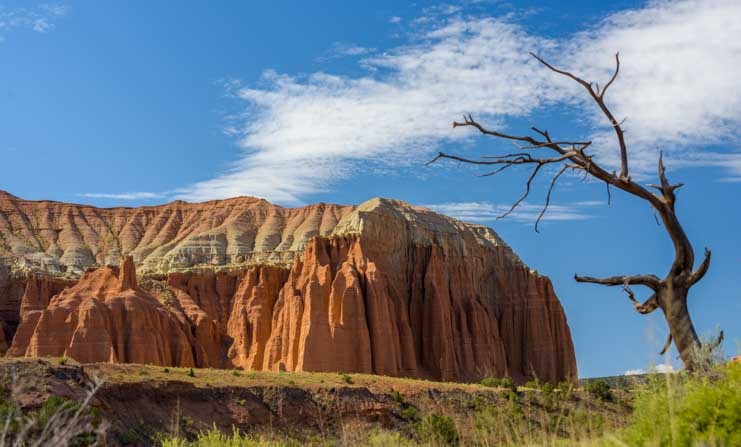
A little further down the road we saw an old dead tree permanently arched as if blown by a persistent wind.

Old tree in Cathedral Valley Capitol Reef National Park Utah-min

.

As we progressed down the road we had to stop every 100 yards or so to get a closer look. Such beauty absolutely everywhere — it was breathtaking!

RZR side-by-side ride in Cathedral Valley Capitol Reef National Park Utah-min

We hopped in and out of the RZR a lot. There was just so much to see up close on foot!

Pinnacle peaks Cathedral Valley Capitol Reef National Park Utah-min

.

The name “Cathedral Valley” is perfect for this area. One formation in particular seemed to have buttresses along the flanks of the cathedral and a steeply pitched roof.

Cathedral buttresses and roofline Cathedral Valley Capitol Reef National Park Utah-min

All it needed was a tall steeple at the far left end!

While Nature has created these fabulous rock formations, ranchers have put their imprint on the land as well. We came across a small wooden building that was used by the cowboys of yesteryear when they brought their cattle to this valley for summer grazing.

There was a hitching post out front and a small corral for their horses off to the side. Inside was a table and set of shelves that held many of the relics that have been found around the property: rusty cans and utensils, bits of pottery, cookware and some leather straps and buckles.

There was a row of hooks on the wall for coats and cowboy hats.

Old cabin and hitching post Cathedral Valley Capitol Reef National Park Utah-min

We found an old cabin cowboys used to use in the summertime.

Window view old cabin Cathedral Valley Capitol Reef National Park Utah-min

It was ultra-simple living out here in this remote land, but I’m sure the cowboys loved it.

Back on the road we savored the views in every direction. While we snapped endless photos, Buddy pranced along on his own four paws.

Pinnacle in Cathedral Valley Capitol Reef National Park Utah-min

.

Puppy runs in Cathedral Valley Capitol Reef National Park Utah-min

These glorious open spaces make some people want to grab their cameras and other people want to run!

Cathedral Valley Capitol Reef National Park Utah puppy on the trail-min

Working up a thirst!

Water break

Ahhh! A cool water break in the shade!

The back roads through Capitol Reef National Park are open to highway licensed vehicles, bikes, horses and hikers, and they are drivable with a 4×4 passenger vehicle if you take it slowly.

Some parts are narrow, steep, twisty and washboarded, and in a few places the road was covered with fairly deep sand, but we did see a pickup go by. We loved driving in our “little tank” because it is open air, it floats over the bumps and is so easy to hop in and out of.

Side-by-side RZR ride Cathedral Valley Capitol Reef National Park Utah

.

This remote back side of Capitol Reef National Park is gorgeous. As with all the National Parks, though, we recommend that first time visitors check out the sights by the front door of the Park at the outset.

After all, visitors centers and major overlooks are always located at the most spectacular spots, and there is much to see along the truly eye-popping Highway 24 “All American Scenic Drive” as it goes through the main part of Capitol Reef National Park before venturing into the Park via this more rough hewn back door!

Subscribe
Never miss a post — it’s free!

More info about Capitol Reef National Park:

More from Capitol Reef National Park:

Related articles from our RV travels:

Our most recent posts:

More of our Latest Posts are in the MENU.   New to this site? Visit RVers Start Here to find where we keep all the good stuff. Also check out our COOL NEW GEAR STORE!! *** CLICK HERE *** to see it!

<-Previous || Next->

Cedar Breaks National Monument – Wild Skies & Summer Storms

July 2019 – Cedar Breaks National Monument is a stunning landscape of red rock pinnacles and hoodoos in any kind of weather, but when clouds form and rain starts to fall in the distance, it is truly breathtaking.

Cedar Breaks National Monument Summer Storms

Cedar Breaks National Monument is spectacular when summer storms sweep through

As storm clouds began to gather, we made our way out to the main overlook at Point Supreme. What a fabulous drama in the sky was unfolding! Black clouds were dumping torrential rain in the far distance, but our little spot at the overlook remained dry for the moment.

Storm clouds at Cedar Breaks National Monument Utah-min

Storm clouds with rain in the distance at Cedar Breaks National Monument

Rain at Cedar Breaks National Monument Utah-min

What a spectacular sight!

Once in a while the sun peeked out from behind the storm clouds, casting shafts of light across the red rocks. Then the clouds would close ranks around the sun once again, sealing off all but a thin ray from the heavens.

Cedar Breaks National Monument Utah storm clouds-min

.

Light shafts Cedar Breaks National Monument Utah-min

A shaft of light broke through

As we set ourselves up to take pics, a gal scurrying back towards her car laughed as she ran by. “This kind of weather is when the photographers come out and when everyone else leaves!” Sure enough, we were soon alone at the overlook as the storm clouds rushed to surround us.

Even Buddy wasn’t so sure about the wisdom of being here in this kind of weather. He took shelter in Mark’s arms and advised him of the best techniques for taking photos of the incoming storm.

Photography at Cedar Breaks National Monument Utah-min

Mark sets up a shot as Buddy looks on

Wild skies Cedar Breaks National Monument Utah-min

Wild skies

Shafts of light at Cedar Breaks National Monument Utah-min

Heavenly light.

Finally, the rain hit us with full force, and we bolted back to the truck. The downpour as we drove through the woods was a deluge!

Pouring rain in the woods in Utah-min

The rain came down in buckets

Even though most mornings were sunny, storm clouds returned to Cedar Breaks with punctual regularity every afternoon. It didn’t always rain, but the bright blue skies of early morning were filled with puffy clouds by noon and were buried under heavy dark clouds filled with heavy raindrops by afternoon.

Cedar Breaks National Monument Utah clouds parting-min

The sky was slightly more tame after the deluge.

Cedar Breaks National Monument colors-min

.

Visiting the overlooks at the golden hour late in the afternoon, we watched the red rocks take on a brilliant glow. The sun pierced the clouds and bathed Cedar Breaks in a rich orange light.

Golden hour storm clouds Cedar Breaks National Monument Utah-min

The colors were incredibly rich at the golden hour before sunset

Chessmen Overlook Cedar Breaks National Monument Utah-min

One of the “chess men” at Chessmen Overlook

Cedar Breaks National Monument Utah Golden Hour-min

.

Red rocks Cedar Breaks National Monument Utah Golden Hour-min

.

One evening, as we walked out onto Point Supreme overlook at sunset, we found a group of tourists huddled along the fence watching the show. One brave person was even standing on a fence post!

Standing at Point Supreme overlook Cedar Breaks National Monument Utah-min

At sunset a small crowd formed along the fence — and on top of it!

We explored the other overlooks too: Sunset View, Chessmen Ridge and the North View. Each one offered a unique view of unusual shapes and colors.

Colorful Cedar Breaks National Monument Utah-min

.

Beautiful Cedar Breaks National Monument Utah-min

.

Cedar Breaks National Monument Utah pink orange and white cliffs-min

.

Inner light Cedar Breaks National Monument Utah pink orange and white cliffs-min

.

Pink and orange Cedar Breaks National Monument Utah-min

.

Because the road along Cedar Breaks National Monument is a fairly busy highway, we took our truck on each visit. The Polaris RZR side-by-side wasn’t getting much use at all. One day when we called Buddy over to get in the truck, he ran over to the RZR instead and sat next to it, as if to say, “Why can’t we take the RZR this time?”

Puppy wants a Polaris RZR ride-min

Buddy wanted to take the RZR instead of the truck!

We did get out into the woods a bit wih the RZR, and Buddy was our little trail scout, as he always loves to be.

Puppy runs down a dirt road in the woods-min

He got his wish and had fun running through the woods

Cedar Breaks and the surrounding area lies at 10,000 feet elevation. That is, it lies 4,000 feet higher than the peak of famous Mt. Washington in New Hampshire!

Being so high, it is cold and is prone to all kinds of crazy weather. As I mentioned in our last post, we’d seen patches of snow in our wanderings, even during the last few days of July, right in the middle of a heatwave that had engulfed the whole country!

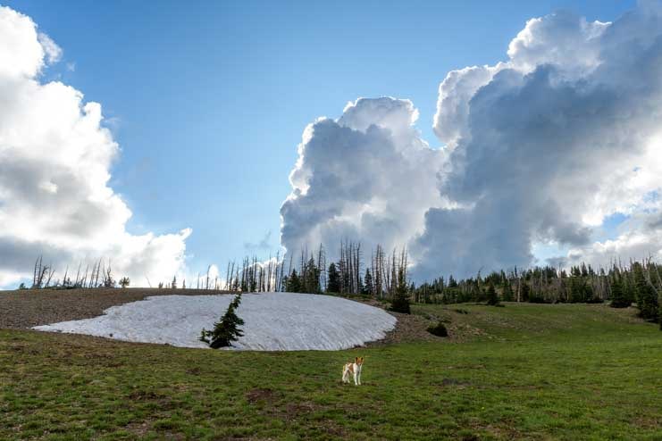
One day while we were out exploring we turned a corner and found a particularly enormous patch of snow.

Snow in Utah in mid-summer-min

A big patch of winter snow that’s still left at the end of July

Snow in late July in Utah-min

.

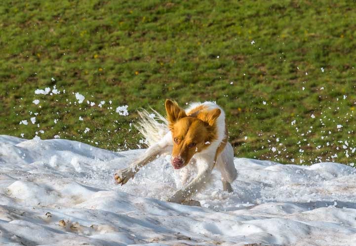
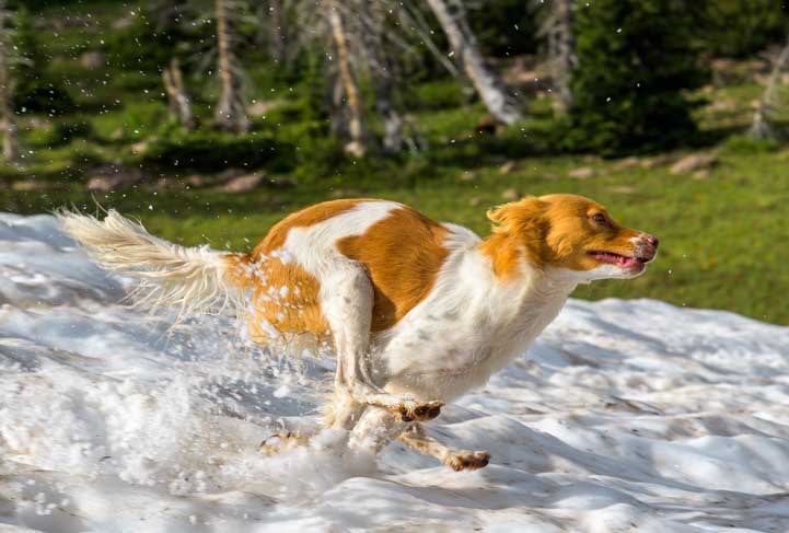
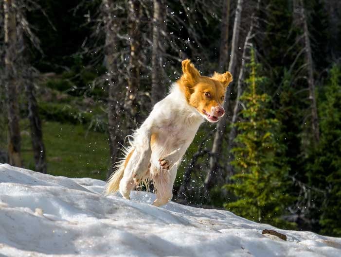
Buddy loves snow, so we decided to let him play in it for a while.

Puppy plays in Utah mid-summer snow-min

A happy little puppy in a big field of snow!

Oh my, was he in heaven once he figured out what he was standing on! He went wild, running in crazy circles, throwing up snow and ice all around him as he took hairpin turns at top speed and dove into the show head first. He galloped at full speed in sheer joy.

Puppy plays in the snow-min

“Weeeeeee!!!”

Galloping through summer snow-min

.

Diving into summer snow-min

.

Puppy plays in the summer snow-min

.

Puppy plays in the summer snow-min

.

After he had gleefully burned off enough energy for all three of us, we finally told him it was time to go. He was soooo disappointed.

He stood by the edge of the snow and forlornly watched us walking away, making no move to follow. He could have happily stayed at his private summer snow park for a few hours more!

Puppy love the summer snow in Utah-min

“Do we have to go??!!”

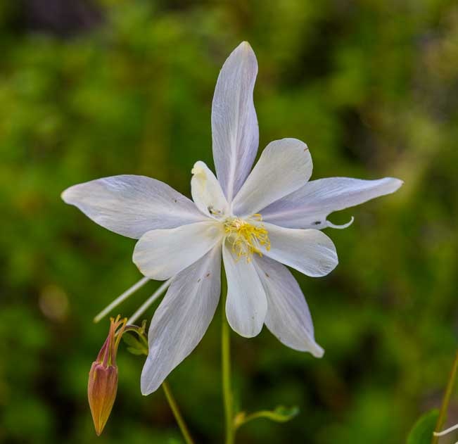
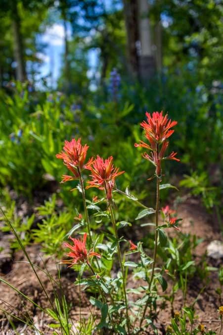
Not far away from the patch of snow we found some beautiful wildflowers in full bloom. The bees were busy gathering pollen in the bell shaped flowers, and despite the nearby snow, the flowers reminded us that it was indeed summertime, even here in Utah’s higher elevations.

Columbine wildflower-min

Columbine

Bee in wildflower-min

Busy bee

Indian paintbrush wildflowers in the Utah woods-min

Indian Paintbrush

Most of southern Utah is in the 4,000 to 7,500 foot range of elevation and is quite warm or even blazingly hot in mid-summer. But for those who love blustery weather and snow, there’s a bit of that waiting for you atop the plateau at Cedar Breaks National Monument.

Subscribe
Never miss a post — it’s free!

More info about Cedar Breaks National Monument:

Other blog posts from Utah’s Red Rock Parks:

-> All of our National Parks Travels in N. America and SE Asia <-

Our most recent posts:

More of our Latest Posts are in the MENU.   New to this site? Visit RVers Start Here to find where we keep all the good stuff. Also check out our COOL NEW GEAR STORE!! *** CLICK HERE *** to see it!

<-Previous || Next->

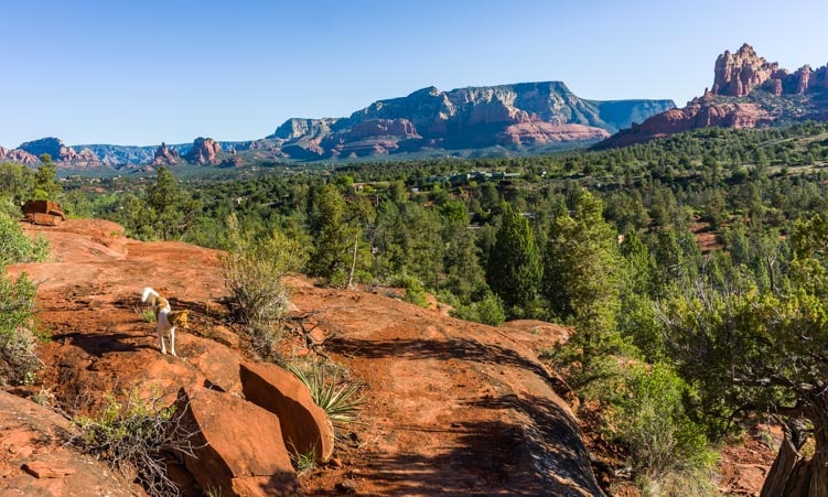
Hiking the “Pig Trails” in Sedona, AZ – Breathtaking! (oink oink!)

May 2019 – The hiking trails in the area around Sedona, Arizona, are so spectacular that they are worth many return visits. The thing is, the trails never look the same because the views and the air and the feeling change as the weather changes.

Sedona Arizona Pig Trail Hikes in red rocks on an RV trip-min

The hikes in Sedona’s red rocks are glorious in any weather.
Here dark clouds loom over the views from the “Pig Trails” hikes.

We decided to explore the trail system that is known collectively as the Broken Arrow system, and specifically within that system we wanted to see what could be seen from the various Pig Trails.

The what?

Well, whoever named these hikes must have seen a lot of javelina rooting around here, because quite a few hikes have pig-related names.

Javelina (pronounced “have-a-leena” despite being spelled a bit like the Greek throwing spear) are not pigs at all, but they have a piggish look about them from snout to tail.

They eat prickly pear cactus pads (ouch!) and leave very fibrous poops behind.

Dead tree and red rocks in Sedona Arizona-min

A dead tree and dark skies — what a delicious morning on the trail in Sedona!

So, the trails we wandered around on had names like “Pig Tail Trail,” “Hog Wash,” “Peccary,” and “Hog Heaven.” How funny!

We got started on our hike a little before 6:00 in the morning on a blustery and overcast day, and the trail was damp from rainfall the night before. We breathed deeply in the crisp fresh air.

I especially loved the smell of the wet creosote bushes. It is a pungent smell that somehow evokes the essence of the southwestern desert for me. That unique creosote smell is especially thick in the Phoenix area during “Monsoon Season” in the summertime.

Buddy didn’t say anything about the smell of the wet creosote leaves, but he barreled around the corners in sheer delight.

Puppy runs on hiking trail-min

Buddy flies around a corner to tell me what’s up ahead!

There was a little archway between the trees on the trail, and we took some fun pics of each other with the red rock spires in the distance.

On the hiking trail in Sedona Arizona-min

Two Happy hikers.

Another happy hiker!

The gloomy clouds made the views particularly dramatic, and with each turn in the trail we got a different glimpse of the distant spires in a natural frame.

Sedona Arizona red rock pinnacles with storm clouds-min

Distant red rock spires framed by dark clouds and darker hills.

As an aside, we just saw the article I wrote that offers a few of our photography tips in the June 2019 issue of Trailer Life Magazine, and it is truly eye-popping.

The editors kindly set aside six full pages for the article — all without ads — and called it, “Shoot to Thrill.” How perfect!

Some of our favorite pics appear in the article along with some notes about things we think about when we take photos in our travels.

I don’t know if they’ll eventually post the article on their website or not, but for those who subscribe to the magazine, please keep an eye out for it! The article talks about framing, among many other things that are all very straight forwar, even with a smartphone camera, and we used an example of the framing technique from Arches National Park since we hadn’t yet taken these photos in Sedona!

Red rock pinnacles with storm clouds Sedona Arizona-min

We kept seeing these cool framed images as we hiked.

Sedona Arizona red rock spire-min

.

As we rounded a bend, the trees that had been partially blocking our view disappeared and our jaws dropped as we looked out at the fabulous stormy sky hovering over the red rock peaks.

Sedona Arizona red rock view with stormy sky and puppy-min

Wow!

Sedona Arizona red rock view-min

Will the storm clouds break?

Suddenly, we heard a clap of thunder in the distance. Uh oh! That was it for hiking! We hightailed it outta there and ran for the safety of a coffee shop in town where we enjoyed a latte and a muffin while it rained.

Storm clouds over Sedona Arizona-min

The storm clouds got darker and then thunder sent us scurrying off the trail!

Storm clouds continued to swirl around the Sedona area and dump rain now and then for a few days. One afternoon we saw the most amazing cloud form over our rig.

Fifth wheel RV under storm clouds in Arizona-min

What a cloud!

Then the sun set in brilliant color right over some blooming cactus flowers.

Cactus flowers at sunset-min

.

Sunset with cactus flowers Sedona Arizona-min

Cactus flowers give the sunset a nod.

While the skies did the wild thing above us, we spotted some spring wildflowers blooming at our feet. Beautiful!

Pretty wildflowers Sedona Arizona-min

More pretty wildflowers.

Red cactus flowers-min

.

When we were out and about around town we saw some gorgeous views as the skies slowly cleared. That’s the unusual thing about this area: even driving around town you’ll see awe-inspiring views!

Red rock views Courthouse Butte Sedona Arizona-min

As the storms began to give way, we saw some gorgeous view around town.

We decided to check out the pig-related hiking trails once again on another morning, and this time, as day dawned out on the trail, there was sun in the sky.

What a difference that made. The subtle coloration on the distant peaks became washed out and the sky was a beautiful blue but not too exciting, so our focus shifted a bit.

We quickly teached the point where we had turned around before and kept going to see what was ahead.

Puppy playing in the red rocks-min

We hit the Pig Trails on a sunny day and the features that captivated us were completely different!

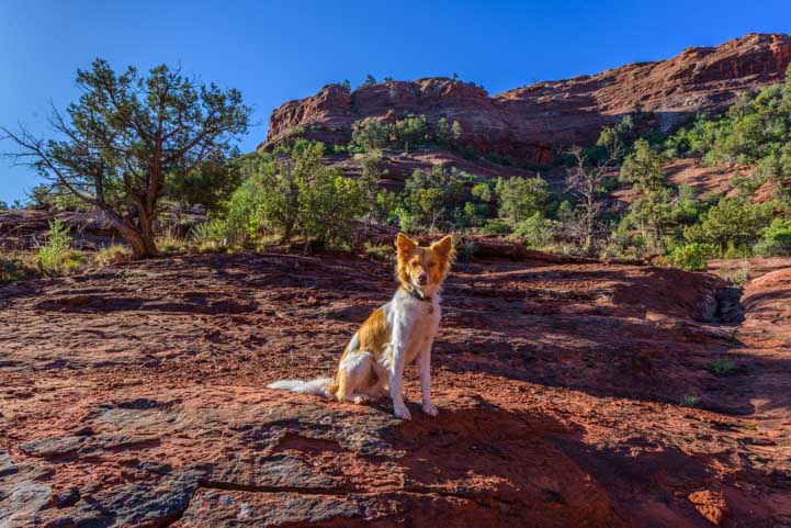
We came to an open area in the trail where we could prowl around on huge wide flat rocks. Buddy sat down to take it all in and wait to find out what was next on our hiking agenda.

Puppy in the red rocks of Sedona Arizona-min

Buddy takes a break and enjoys the view.

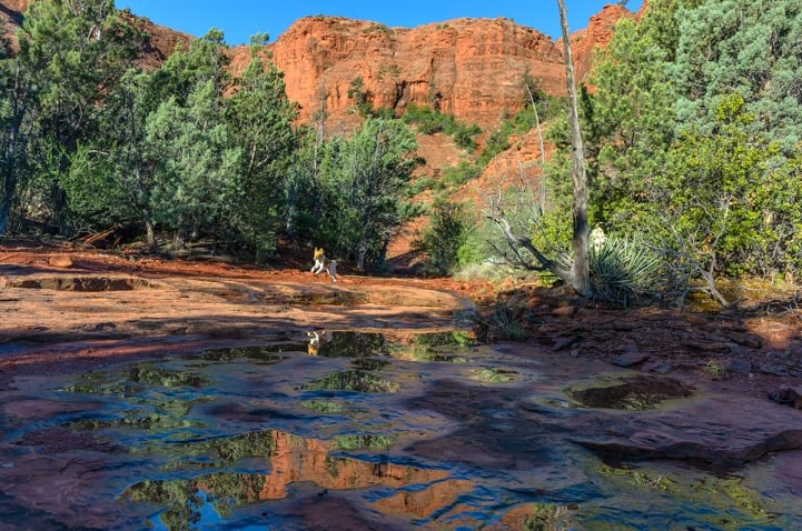
The rain had created puddles in places where there probably aren’t any most of the time. There was a narrow ribbon of a stream flowing along a crevice in the rocks.

Sedona Arizona hikes are great for photography-min

Our focus shifted from the distant views to the trickle of water and puddles near our feet!

Mark spotted me with my reflection, and after yelling to me to stand still so he could get a pic, we both started to look around for reflection images. You have to get low for these. Buddy is already low, so he helped out in the search.

Red rock reflections in Sedona Arizona hike-min

Seeing my reflection, Mark gave us both an idea to look for other reflections in a cluster of small puddles!

Photo op in Sedona Arizona on Hog Heaven trail-min

Buddy kept an eye out for lizards while we scouted for reflection images!

Wow, what fantastic reflections we found! For my birthday a few months ago, Mark had given me a Nikon 12-24mm wide angle lens, and this jewel of a lens creates jewel-like images!

Red rock reflections Hog Heaven hiking trail Sedona Arizona-min

.

Reflected Red Rocks in Sedona Arizona on Hog Heaven hike-min

.

Of course, sometimes just as I get a cool shot lined up it gets photo-bombed by our four-legged friend.

Red Rocks in Sedona Arizona on Hog Heaven hike-min

Oops! Photo bomb!

The little puddles made some beautiful images and an hour quickly passed while we crawled around on our hands and knees peering at the distant red rocks with our faces and cameras just above the water.

Puppy leaps across the red rocks-min

We loved crawling around these shallow puddles, and so did our furry friend.

Puddle reflections in Sedona Arizona on Hog Heaven trail-min

.

Interestingly, we ended up on this trail a few days later and the puddles were all but gone!

Mountain bikers love riding the trails in the Broken Arrow system, no doubt because they are very challenging! In some sections you ride on an exposed sandstone ledge — not for the faint of heart!

Fortunately, we had hit the trail so early in the morning that we didn’t see a soul until the final few hundred yards when a mountain biker approached.

Mountain biker in Sedona Arizona-min

At the very end of our hike we saw the first person on the trail — a mountain biker!

We’ve begun to realize that if you are lucky enough to get to Sedona, Arizona, whether with an RV or without one, you can’t go wrong on any of the hiking trails.

Some trails have funny piggy names while others are named for features in the landscape, but either way, they are all fabulous and they are all worth doing!

Subscribe
Never miss a post — it’s free!

More info:

Related articles:

Photography – Cameras, Gear, Tips and Resources for Learning!

Our most recent posts:

More of our Latest Posts are in the MENU.   New to this site? Visit RVers Start Here to find where we keep all the good stuff. Also check out our COOL NEW GEAR STORE!! *** CLICK HERE *** to see it!

<-Previous || Next->
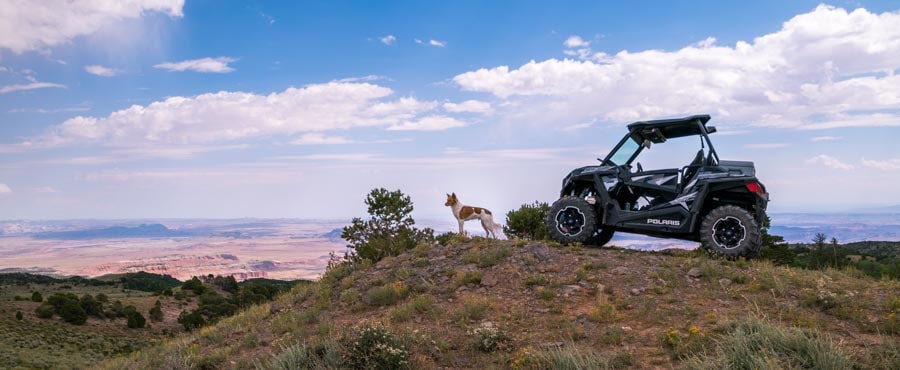
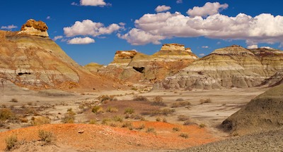
Bisti Badlands NM – Mysterious rocks and an alien egg factory!

Bisti Badlands hiking in the wash

Hiking into the remote and mysterious Bisti Badlands.

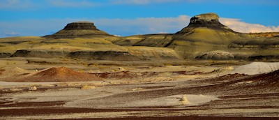
Late September, 2012 – One of the great things about hanging out with the photography pros at Nasim Mansurov’s Colorado Landscape Photography Workshop was that they knew where the cool places were to take pictures.  Nasim suggested we check out the Bisti Badlands in New Mexico where there are all kinds of rock formations, hoodoos and some mysterious alien looking “eggs.”

Bisti Badlands New Mexico Hiking through the rock formations

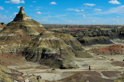
We hiked on ridges and in valleys

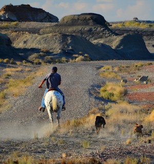
This is a very remote place, 36 miles south of Farmington, New Mexico, and when you get here after miles and miles of boring flat land, it is a wonder to behold.  Even more startling for us, though, was having an Indian on a spotted Appaloosa horse ride up to our campsite to chat with us.  His name was Nelson, and I suspect his first language was Navajo, as he spoke English with an unusual accent.  He had been out rounding up a miscreant brahma bull that had wandered away when his nephew accidentally left the paddock gate open.

Bisti Badlands New Mexico lots of colors in the rocks and Teepees

The colors vary from one neighborhood to the next.

Tourists from all over the world make their way to Bisti Badlands, and Nelson has met folks from Europe, Asia, and all the states.  It is a wilderness area, so there are no signs and no trail markers, and too often hese tourists wind up on his ranch, quite lost.  The rather baffling maps from the BLM office make it look easy to find your way, but they quickly prove almost useless once you start hiking.

Bisti Badlands New Mexico Indian on an Appaloosa Horse

An Indian visits our campsite on his spotted Appaloosa horse “Oreo”

Just last week Nelson had rescued a Japanese family that saw the light on in his house near midnight.  They knocked on his door seeking refuge from the cold, scary desert night.  He brought them back to their car in the morning.  “Don’t they see the movement of the sun, or watch the moon?” He asked us, shaking his head in disbelief.  Then he spurred his horse and cantered down the road in a cloud of dust, his faithful dogs following.

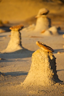
Bisti Badlands New Mexico hoodoos

Exotic hoodoos surrounded us.

Wow.  That was right out of the movies!!

Bisti Badlands Alice in Wonderland furniture

Mark finds himself a little table.


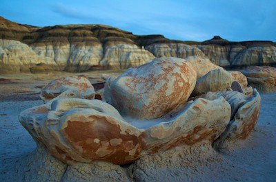
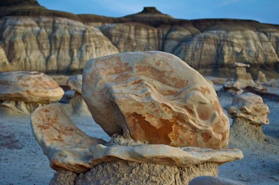
We ventured into the badlands armed with a compass, binoculars, a good sense of the sun’s path, a bunch of food and water, and our cameras.  The “egg factory” is a collection of rocks that look like aliens hatching out of their eggs, and finding it was our ultimate goal (as it is for most travelers here).  But the rock formations and desert colors we saw on the way were just as inspiring.

Bisti Badlands New Mexico Alice in Wonderland hoodoos

Obama and Romney should pontificate a bit out here!!

We hiked for hours, following first one wash and then another, climbing up and over tall pyramid shaped rocks and skirting around the bottoms.  Over the years visitors have given the different groups of rock formations names:  The Wings, Alice in Wonderland, The Teepees, etc.  Spread out over several square miles, you only know you’ve arrived in a particular neighborhood when the rock formations look like the names they’ve been granted.

Bisti Badlands New Mexico searching for the cracked eggs

Mark scans the horizon for the eggs

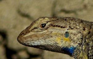
Bisti Badlands New Mexico Collared Lizard

This lizard wasn’t lost!

We came across a group of rock formations that looked like furniture.  A perfect little table and a podium were fun to pose with.


But where in the world were those crazy eggs?  They were supposed to be about two miles into the badlands area, along a wash that branched southeast.  Well, there were lots of washes, and they branched all over the place.  We saw lizards scampering along the desert floor.  Surely they knew exactly how things were laid out in this vast barren place.

Bisti Badlands Rock Formations

Well, the eggs aren’t here, but this is cool!

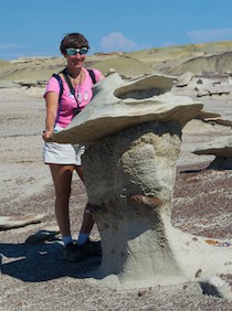
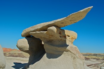
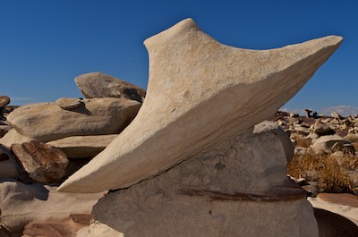
Bisti Badlands New Mexico Wings

Winged things.

Bisti Badlands New Mexico Flying Saucer

A flying saucer!


We found ourselves in another area of formations that had flat roofs, or wings.  These hoodoos were otherworldly.  One even looked like a flying saucer.  Some of the flat tops were detachable and could be lifted off.

Bisti Badlands New Mexico Pyramids

Mark stands at the base of a pyramid

Continuing on, we wandered between tall pyramid shaped formations that were decorated with fantastic horizontal stripes.  They stood just a hundred feet or so high, and were easy to scramble up onto for a birds-eye view.

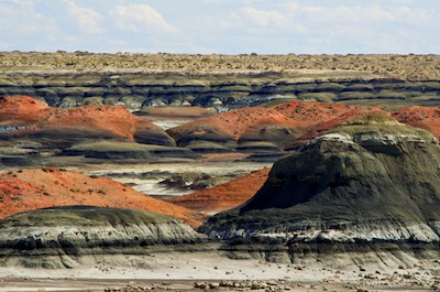
Bisti Badlands New Mexico colorful black and red pyramids

The colors change to black and red

The landscape changed from shades of white and yellow to shades of red and black.  It was all quite beautiful and exotic.  But the eggs were nowhere to be found.

Bisti Badlands bird

Bisti Badlands New Mexico searching for the egg factory

“North is that way!”

We returned to our campsite and studied the BLM map once again.  Maybe they would turn up on a second day’s quest.  We headed out again the next day and this time recognized many of the landmarks and had a much better sense of where we were.  “North is that way,” Mark said at one point.  He had a photo of the eggs from the BLM and now we knew what they would look like if we found them:  small egg-like rocks backed by white eroded cliffs.

Bisti Badlands New Mexico cracked eggs

Two of the elusive alien eggs

Finally we found them and whooped and hollered in triumph.

Bisti Badlands New Mexico the black boobs

The black boobs – important landmarks!

In the end, they are actually very easy to find.  There are GPS coordinates available on the web, but here is an easy landmark-based way to get there:


Follow the fence on the left side of the parking lot into the badlands.  When the fence takes its second sharp 90 degree turn to the left, look straight ahead in the direction you’ve been walking, and look for two black “boobs.”

Bisti Badlands New Mexico the egg factory

Mark sits among the eggs

Walk towards them.  As you approach them, walk around the leftmost one (the further one), leaving it on your right, and continue on to the black topped white cliffs in the distance.  The little collection of eggs is right there in front of the cliffs.

Bisti Badlands New Mexico egg factory

The best light for these guys is dawn and dusk

Bisti Badlands New Mexico cracked eggs

Bisti Badlands New Mexico egg factory

We had arrived at the eggs in the glare of midday, but who cares?

Bisti Badlands New Mexico the egg factory

In a softer light at dusk

Bisti Badlands New Mexico the eggs

An alien rises up out of its shell!

Bisti Badlands New Mexico the eggs at dusk


We felt like successful Explorers!  The following afternoon we returned to the eggs a second time to capture them in the softer light of sunset.

Bisti Badlands New Mexico egg factory light painting

A full moon rises behind the eggs

There were a few other photographers with us, and we all had very a funny moment when we suddenly noticed the full moon rising opposite the setting sun.  All the cameras and tripods turned around in one motion!

Bisti Badlands New Mexico Cracked Eggs light painting

Light painting on the eggs

We hung out as the sky darkened, and we played with a new photography technique Mark had learned:  light painting.  Using a flashlight, we “painted” the eggs with light and used long exposures to get a wonderfully eerie effect.

This was the last of our RV travels before we returned to Phoenix to visit friends and family. Then it was time to store the trailer and board a plane to Mexico where our sailboat Groovy waited for us in a slip down south in Marina Chiapas.

<- Previous                                                                                                                                                                                      Next ->

We returned to Bisti Badlands in the spring of 2017:

Alien Eggs in Bisti/De-Na-Zin Wilderness (Bisti Badlands) New Mexico

Subscribe
Never miss a post — it’s free!

Other exotic landscapes we have loved:

Our most recent posts:

More of our Latest Posts are in the MENU.
New to this site? Visit RVers Start Here to find where we keep all the good stuff!!

Cedar Breaks National Monument in Utah – Better Than Bryce?

RV blog post - at Cedar Breaks National Monument  we found the sweeping views, soaring red rock pinnacles and spectacular wildflowers truly awe-inspiring.

Sweeping views at Cedar Breaks.

Stunning views at Cedar Breaks National Monument, Utah Fluffy clouds at Cedar Breaks National Monument, Utah

Fluffy clouds drifted above us.

Beautiful vistas at Cedar Breaks National Monument, Utah

Happy campers.

Red rock views at Cedar Breaks National Monument, Utah Red rock hoodoos and arches at Cedar Breaks National Monument, Utah

Red rock hoodoos with arches.

Spectra Point Trail, Cedar Breaks National Monument, Utah

The trail winds through lush

greenery.

Columbine at Cedar Breaks National Monument, Utah

Columbines.

Red indian paintbrush wildflowers at Cedar Breaks National Monument, Utah

Indian paintbrush.

Chipmunk eating bluebells at Cedar Breaks National Monument, Utah

A chipmunk nibbles bluebells.

Indian paintbrush wildflowers wave at the view at Cedar Breaks National Monument, Utah Cedar Breaks National Monument, Utah Cedar Breaks National Monument, Utah,

"Place where the rocks are sliding

down all the time."

Wildflowers and red rock views, Cedar Breaks National Monument, Utah Spectra Point, Cedar Breaks National Monument, Utah

Spectra Point.

1,600 year old bristlecone pine tree, Cedar Breaks National Monument, Utah

1,600 year old bristlecone pine tree.

gnarled old bristlecone pine tree, Cedar Breaks National Monument, Utah

Gnarled old fellas.

Young fawn at Cedar Breaks National Monument, Utah

A young fawn looks up as we pass.

Chessmen overlook, Cedar Breaks National Monument, Utah

Chessmen Overlook.

North View Overlook, Cedar Breaks National Monument, Utah

North View Lookout.

Wildflowers, Cedar Breaks National Monument, Utah

Cedar Breaks is known for

wildflowers.

Wild lavender daisies at Cedar Breaks National Monument, Utah Bluebells, Cedar Breaks National Monument, Utah Lupine, Cedar Breaks National Monument, Utah Columbine, Cedar Breaks National Monument, Utah Lupines, Cedar Breaks National Monument, Utah Red Indian Paintbrush at Cedar Breaks National Monument, Utah Purple daisies and pine cones at Cedar Breaks National Monument, Utah Wildflowers, Cedar Breaks National Monument, Utah Redrock views through dead trees at Cedar Breaks National Monument, Utah

Redrocks through the trees.

Red rock vistas, Cedar Breaks National Monument, Utah

Millions of years old, the canyon weathers all.

Stunning views at Cedar Breaks National Monument, Utah Alpine Pond Loop Trail goes through thick lush green vegetation in Cedar Breaks National Monument, Utah

Thick green carpet on the Alpine Pond

Loop Trail.

Alpine Pond, Cedar Breaks National Monument, Utah

Alpine Pond.

Nature's graffiti - worm-eaten wood - Cedar Breaks National Monument, Utah

Nature's graffiti.

The Upper Loop of the Alpine Pond Trail, Cedar Breaks National Monument, Utah

The Upper Loop wanders through a meadow.

Colorful wildflowers, Cedar Breaks National Monument, Utah

Colorful wildflowers.

Wild strawberry at Cedar Breaks National Monument, Utah

Wild strawberry.

Chessmen at Cedar Breaks National Monument, Utah

Last glimpse of the red rocks.

Reflections on the Alpine Pond Loop Trail at Cedar Breaks National Monument, Utah

Reflections on the Alpine Pond Trail.

Cedar Breaks National Monument, Utah

Mid-August, 2011 - Visiting Cedar Breaks National

Monument was the main reason we came to Dixie National

Forest but, sidetracked by caves and canyons, it took us a

while to get there.  Vastly overshadowed by nearby Zion,

Bryce Canyon and Grand Canyon National Parks, a lot of

folks are like us and only hear about it from a ranger or

other traveler once they get to this area.  Years ago we had

stopped by for an hour on a quickie drive-by.  This time we

wanted to hike the two hikes and see the canyon up close.

Perched nearly in the clouds at 10,350' elevation, the wildflower-lined

winding road seemed to climb forever before we got to the park.

Intrigued by the sign for the Spectra Point overlook in the parking lot,

we went straight up that path when we arrived, not knowing we were

venturing out on a 2-mile round-trip hike.

WIthin minutes we were staring at a wonderland of red rock spires

and hoodoos.  The puffy clouds floated by above us, casting

shadows across the red rock "amphitheater."  Red, pink, white and

orange rocks in crazy shapes filled the view in all directions, and

bristly pine trees speckled the distant cliffs

The trail wanders along the rim of

the canyon, weaving in and out of

lush greenery.  There are no railings

or gates to obstruct the view, and

we felt as though we were

suspended above an orange

fairytale town.

Wildflowers bloomed alongside the

trail:  white columbines and red

indian paintbrush flowers begged to

be photographed.

A little chipmunk

sat contentedly in

a thicket of

bluebells and ate

them for lunch.

We made very little forward progress as we kept stopping to take in the views,

admire the colorful wildflowers and chat with other people on the trail.

Many people were at the canyon that day somewhat by

accident, as it hadn't been on their original itinerary.  One

fellow had had car trouble while visiting Zion and Bryce and

had asked the mechanic how to keep his family entertained

while waiting for the several-day repairs to be completed.

"Go to Cedar Breaks!"  He was so happy to have discovered

this park; his kids were running ahead of him down the path,

excited to get to the overlook.

A 1,600 year old

bristlecone pine

tree stands near the

end of Spectra

Point, thriving in a barren, windwhipped and

hopelessly exposed spot.  The wood is striated

beautiful shades of orange and brown, and a few

scraggly branches prove to the world that the

seemingly lifeless giant is truly alive and well.

The sun felt warm on our skin as we walked,

but the brisk wind that swept across the

canyon was a sharp reminder of just how

cold this area can be.  A ranger told us that

the park usually gets 15' of snow each winter,

but last winter was buried 30 feet deep.

On our way back we noticed a doe eating the flowers, and then

behind her we saw her fawn.

As we drove out of the park we stopped at Chessmen overlook

and the North View Lookout.  Stunning.  Amazing.  It's impossible to find words to

describe the vastness, the vivid color, the exotic contours and shapes of this beautiful

land.

Earlier residents of this area were the Paiute Indians, and they named the canyon, "Place

where the rocks are sliding down all the time."  After that the Spanish explorers

misidentified the juniper trees as cedars (much as they did on Isla Cedros off of Mexico's

Baja Pacific coast).  The word "breaks" refers to the steep, eroded landscape.

Cedar Breaks is known as much for its glorious wildflower

displays as it is for its majestic red rock amphitheater.

We returned on another day to hike

the Alpine Pond Loop Trail, and

found ourselves snapping shots of

the many brilliant wildflowers before

we even got to the trailhead.

Lupines and daisies and a myriad of

other flowers lay thickly on the green

brush surrounding the trail.  The hum

of bees and mosquitos was very loud

too, and the lush land seemed to be

teeming with life.

Oddly, the forest of tall pine trees shading the

wildflowers is largely dead.  In past years the

energetic National Forest Service extinguished all

wildfires within hours of them starting.  The result was

an unhealthy forest dominated by one species of tree.

Those trees provided the most awesome feast for the

bark beetles that like to eat them, and in the past

decade the beetles have munched their way through

the woods, transforming the living pine

canopy into a pin-cushion of dead trunks and

branches.

Between the dead branches you can glimpse

the red rock canyon, however.  The spires,

nooks and crannies of that spectacular

landscape are utterly impervious to the

comings and goings of trees upon the

surface.

Eventually we arrived at the alpine

pond.  It wasn't the crystal clear kind

of lake we have seen at Yosemite

and other places, but it had its

charm.

Some of the dead tree

trunks had been carved

by Nature's graffiti

artists -- little worms

made all kinds of

patterns in the wood.

We had started on

the Lower Trail

which is lush and

green and closed-

in feeling.  We

returned on the

Upper Trail which

takes the hiker out

across a wide

meadow filled with

flowers.  The peak of the wildflower

season in Cedar Breaks is the final weeks

of July and perhaps the first week of

August.  We were a little behind the peak,

so the blanket wasn't quite as thick with

color.  But it was plenty

beautiful enough for me.

Mark has a green thumb

and cultivated strawberries

at one time, so he instantly

recognized the shape of

wild strawberry leaves

among the other greens.

"Strawberries!"  He cried,

and then he spotted a beautiful tiny red ripe one, about a half inch

across.  We left it for whatever bird or bunny might come that way.

The trail gave us one final glimpse of the red

rocks of Cedar Breaks and then we were

back at the truck.

Mark's parting shot was the reflection he saw

in my sunglasses.  He came up to me really

close and said, "Oh, that looks really cool!"  I

thought he was sweeping in for a kiss, but

suddenly he stopped, put his camera up and

snapped a picture.  I made a face at him,

and then, being a romantic, he swooped in

for a real kiss.

Looking for more red rock adventure and a slightly lower altitude, we wandered 30 miles or so north along the incomparably

scenic Route 89 to the Red Canyon area.


Bryce Canyon, UT – Fairyland of Pink Turrets

Inspiration Point overlooking Bryce Ampitheater

Inspiration Point overlooking Bryce Ampitheater

Bryce Canyon Point

Bryce Canyon Point

Smiles everywhere at Bryce Canyon

Smiles everywhere

Stunning views at Bryce Canyon, Utah Stunning views at Bryce Canyon, Utah

Natural symmetry

Stunning views at Bryce Canyon, Utah

The regularity and precision of

these formations can be dizzying.

Trees cling to the rim at Bryce Canyon, Utah

Trees cling to the rim

Bryce Canyon Ampitheater

Bryce Ampitheater

Rim views, Bryce Canyon, Utah Beginning of Queen's Garden hike Bryce Canyon, Utah

Beginning of Queen's Garden hike

The spires give way to a smooth, orange and red moonscape at Bryce Canyon, Utah

The spires give way to a smooth, orange and red

moonscape

Bryce Canyon, Utah

Trees from another planet

Queen's Garden Bryce Canyon, Utah

End of the trail -- at Queen's

Garden

Nature's Wall Street at Bryce Canyon, Utah

Nature's Wall Street

Looking down from the top of the Wall Street switchbacks at Bryce Canyon, Utah

The top of the Wall Street switch backs

Bryce Canyon, Utah Bryce Lodge has many cute cabins for guests

Bryce Lodge has many cute cabins for guests

The Peek-a-boo hike at Bryce Canyon defies nature's laws and seems to ascend for the entire loop.

The Peek-a-boo hike defies nature's laws and seems

to ascend for the entire loop.

Serenity along the hiking trails at Bryce Canyon

Serenity

Spires and spikey trees surrounded us at Bryce Canyon, Utah

Spires and spikey trees surrounded

us

Peek-a-boo, the namesake of the Peek-a-boo trail at Bryce Canyon

Peek-a-boo

Seeming chess pieces at Bryce Canyon

At times it seemed as though we were wandering

among towering chess pieces.

Stunning view at Bryce Canyon, Utah

A promontory hangs into the canyon for an awe

inspiring view.  A good place to take a breather!

Tunnels and arches at Bryce Canyon, Utah

Little tunnels and hobbit doorways invite the hiker to

vast views on the other side.

Bryce Canyon National Park, Utah

July 20-August 20, 2008 - We had

arrived in the lower elevations of

Kanab, UT and visited Best

Friends Animal Sanctuary,

during a peak week of monsoon

activity.  Monsoons are a

southwest phenomenon that give

the desert's much needed

moisture and relief from the heat

in mid-summer.  I had learned

about them living in Arizona, but

had never known that they could

spread their salve as far north as

southern Utah and even over into

southern Colorado.  It is magic to

watch the sky cloud over promptly

at noon every day, and there is a

lusciousness to being drenched

by brief downpours every

afternoon.  These storms leave

the air crisp and clear, and they

keep the ferocious heat to a minimum.  Once the monsoons abated, we

found ourselves in an oven, baking by noon, and burnt to a crisp by

evening.  Full of energy at the break of day, we were lethargic sloths by

nightfall.  It was time to get back to the higher elevations.  We left Kanab

for Ruby's Inn, a settlement just outside of Bryce Canyon National Park at

7,500 feet.

Bryce Canyon

is a wonderland of pink and white

spires, laid out with amazing

symmetry.  The open bowl of

crystalline formations carved from

the surrounding flat plains

resembles an ampitheater.  The

man who first ranched the area

around Rubys Inn in the 1800's

had no idea the canyon was just

beyond his land.  Imagine the

look on his face when, at the

suggestion of a knowledgeable

neighbor, he took his family on an

excursion to the rim!  It is a place that evokes smiles

in everyone, and as we rode the shuttle bus to the

view points and walked the many trails that lead

along the edge and down into the canyon, I was

struck by how happy everyone was.  Children love

this place.

We walked along the Rim, from

Bryce Point to Inspiration Point,

and watched a fantastic summer

thunderstorm creep over the

valley until we had to run for

cover ourselves.  This land was

carved by a divine hand using the

tools of wind and rain to erode the

rock into fantastic formations.  I

was awed by the regularity of the

carvings.  Rows upon rows of

spires stand in perfect military

formation.

At the top the

trees cling to the rim for dear life,

their roots clawing at the

crumbling gravel as their

branches wave ominously in the

breeze, threatening to rip the

trees from the edge.  At the

bottom the trees pierce the air

above them, the dark green

spikes contrasting with the

orange and white striped spears

of rock.

We hiked down into the canyon to

the Queen's Garden.  As you descend on this hike,

the land becomes otherworldly.  Between the spires,

the land forms smooth, rounded slopes and the

trees are short and twisted.  The noise of the

tourists at the rim fades away behind you and the

solitude and odd surroundings seem like a

moonscape.  The emotional

anchor of the ordinary looking

grassy fields and ranches that

surround Bryce Canyon

disappear from view, and you

find yourself on the moon, or

mars, looking up at the red rock

spires, repeating the mantra:

"Wow!"

The gravel path winds in and out

of the spires, abandoning one

spectacular sight as it takes a

sharp turn around a bend

towards another.  We walked

through several doorways and

tunnels, emerging from each to

find ourselves staring at yet

another splendid work of art by

Nature.  People linger on these

trails. Llittle groups and pairs line

themselves up for photos, posing

all over this spectacular setting.

Cameras are handed around

trustingly between strangers in

order to get everyone in each

group into the pictures.  "I'll take

one for you if you'll take one for

me," is the phrase of the day,

sometimes said in broken English,

and often accompanied with gestures and sign language.  Cameras are all

shapes and sizes.  "Just press the button."  Lots of nodding and pointing.

Everyone is grinning.  None of us can wait to show these pictures to our

friends back home.  All the photos turn out great.

At the very bottom we came to a plaque that showed us

Queen Victoria.  This was the Queen's Garden.  She is

at the tippy top of a spire.  She looks very regal, and

very wee.  In time she will erode away and be replaced

by other shapes.  Looking around at the other hoodoo

rock formations, we made out a medieval friar and a

great horned owl to accompany the queen.

We had descended about a thousand feet and had to

climb back up again to the rim.  We chose the route that

goes through Wall Street, where the red rock walls

close around you like skyscrapers but much closer.  A

switchback trail takes you up until you look way down

on the tiny pine trees at the base.  Then you climb

higher til the people seem mere specks.  Your heart

pounds from the exertion of climbing

straight up, and when you reach the

top the view takes your breath away

yet again.

We wandered along the rim and met

a little girl holding a camera that was

as big as she was.  What a smile she

had as that camera clicked away.

The Bryce Canyon Lodge is the

oldest original National Park lodge still

standing; the others at Yellowstone,

Grand Canyon and the rest all

succombed to fire at one time or

another and were rebuilt.  Bryce isn't immune to

wildfires, however, and there were many "prescribed

burns" in action while we were there as the Park Service

attempted to keep the woods thinned so they wouldn't

be prone to future fires.

We spent a few days riding our bikes and hiking in the

areas away from Bryce Canyon and then returned to do

the Peek-a-boo hike.  We were both surprised at how

the grins came back to our faces and the "wow" formed

on our lips again as soon as we walked up to the rim.

What a place.

We had no idea why the Peek-a-boo hike has its name,

and we descended into the canyon away from the

crowds wondering what laid

ahead.

Once again, as we walked down

into the canyon, we felt an

almost physical sensation cloak

our bodies as the immense quiet and peace of this place enveloped us.

Suddenly, we looked up at a wall of spires and saw one hole, and then

another.  "So that's why it's called Peek-a-boo!"  Mark said, mugging for

the camera.  We walked with our heads up and our eyes on the peaks,

tripping occasionally.  But you can't look down on this hike, even as you

stumble.

The trail

twisted and turned and double-backed on itself between formations.  I

felt like a rat in a maze, or a child stomping around on an enormous

chessboard.

We did a lot of climbing on this hike, more than seemed physically

possible for a loop hike.  Mark walked faster than I did (he didn't

bring his camera and mine kept slowing me down!), and I turned a

corner and looked up to see him happily surveying the view from

an ideal vantage point.  Once I caught up to him we sat together

for a moment.

When we turned to continue on, we were facing a little doorway.  As we passed through the door

to the glittering view on the other side, I felt like Dorothy as she steps out of her Kansas house

into the colorful Land of OZ.

After a few weeks at our "ranch

house" outside of Bryce Canyon,

among the cattle, ponderosa pines

and pronghorn, overlooking grazing

lands that stretched to the horizon,

we felt like it was home.  Our TV got

great NBC reception, so we stayed to

watch most of the Beijing Olympics.  It

was very hard to tear ourselves away,

but eventually the day came, and

once we hit the road, the excitement

of discovering new places propelled us forward and made us eager to

leave.  We bumped into the sweet village of Alton and gradually made

our way over the mountains to Parowan and Cedar City.


Subscribe
Never miss a post — it’s free!

More info about Bryce Canyon National Park:

More blog posts from our RV trips to Bryce Canyon

Related posts from our RV travels:

Our most recent posts:

More of our Latest Posts are in the MENU.
New to this site? Visit RVers Start Here to find where we keep all the good stuff!!